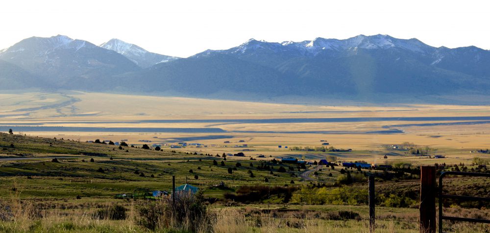
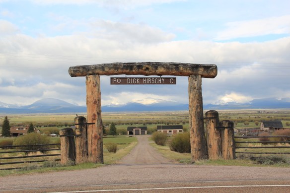
 Here is a property category that could be, probably should be, a blog of its own–the ranching landscape of Big Sky Country. Historic family ranches are everywhere in the state, and being of rural roots myself, and a Tennessee Century Farm owner, the ways families have crafted their lives and livelihood out of the land and its resources is always of interest.

Wibaux ranch house, 1985.
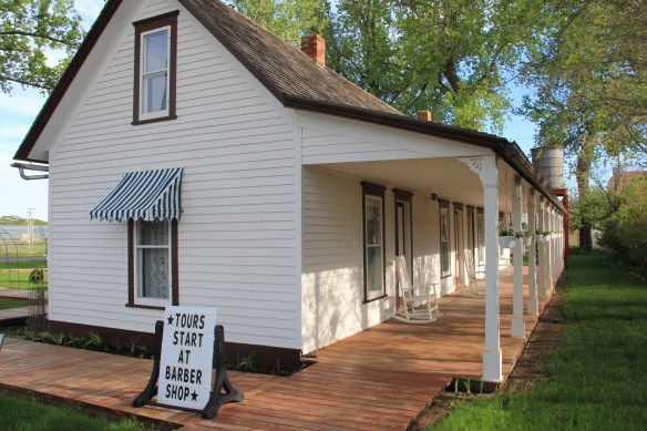
When I carried out the 1984-1985 fieldwork for the Montana state historic preservation plan, a handful of ranches had been preserved as museums. On the eastern end of the state in Wibaux was the preserved ranch house of Pierre Wibaux, one of the 1880s cattle barons of eastern Montana and western North Dakota. The ranch house today remains as a historic site, and a state welcome center for interstate travelers–although you wish someone in charge would remove the rather silly awning from the gable end window.
 Preserving merely the ranch house, and adding other period buildings, is one thing. The massive preserved landscape of hundreds of acres of the Grant-Kohrs Ranch in the western end of Montana is a totally different experience. This National Park Service site


not only preserves one of the earliest settlement landscapes in the state it also shows how successful ranches change over time. John Grant began the place before the Civil War: he was as much an Indian trader than ranch man. Grant Kohrs however looked at the rich land, the railroad line that ran through the place, and saw the potential for becoming a cattle baron in the late 19th century. To reflect his prestige and for his family’s comfort, the old ranch house was even updated with a stylish Victorian brick addition. The layers of history within this landscape are everywhere–not surprisingly. There is a mix of 19th and 20th century buildings here that you often find at any historic ranch.


When I was working with the Montana Historical Society in 1984-1985 there were two additional grand ranches that we thought could be added to the earlier preservation achievements. Both are now landmarks, important achievements of the last 30 years.
 The Bitter Root Stock Farm, established in 1886 by soon-to-be copper magnate Marcus Daly outside of Hamilton, came first. I can recall early site visits in 1985–that started the ball rolling but the deal wasn’t finalized for several years. All of the work was worth it.


Here was one of the grand showplace ranches of the American West, with its own layers of a grand Queen Anne ranch house (still marked by the Shingle-style laundry house) of Daly’s time that was transformed into an even greater Classical Revival mansion by his Margaret Daly after her husband’s death. It is with us today largely due to the efforts of a determined local group, with support from local, state, and federal governments, a group of preservation non-profits, and the timely partnership of the University of Montana.


The second possibility was also of the grand scale but from more recent times–the Bair Ranch in Martinsdale, almost in the center of the state. Charles Bair had made his money in sheep and wise investments. His daughters traveled the world and brought treasures home to their Colonial Revival styled ranch house. To get a chance to visit with Alberta Bair here in the mid-1980s was a treat indeed.


Once again, local initiative preserved the ranch house and surrounding buildings and a local board operates both a house museum and a museum that highlights items from the family’s collections.


The success of the Bitter Root Stock Farm and the Bair Ranch was long in the making, and you hope that both can weather the many challenges faced by our public historic sites and museums today. We praise our past but far too often we don’t want to pay for it.
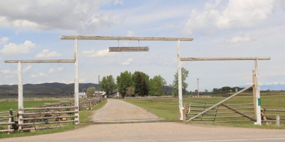
That is why family stewardship of the landscape is so important. Here are two examples from Beayerhead County. The Tash Ranch (above and below) is just outside of Dillon and is listed in the National Register of Historic Places. But is also still a thriving family ranch.


The same is true for the Bremmer Ranch, on the way to Lemhi Pass. Here is a family still using the past to forge their future and their own stories of how to use the land and its resources to maintain a life and a culture.


One family ranch that I highlighted in my book, A Traveler’s Companion to Montana History (1986), was the Simms-Garfield Ranch, located along the Musselshell River Valley in Golden Valley County, along U.S. Highway 12. This National Register-property was not, at
 first glance, architecturally magnificent as the properties above. But in its use of local materials–the timber, the rocks from the river bluffs–and its setting along a historic road, this ranch is far more typical of the Montana experience.


Similar traditions are expressed in another way at a more recent National Register-listed ranch, the Vogt-Nunberg Ranch south of Wibaux on Montana Highway 7. Actively farmed from 1911 to 1995, the property documents the changes large and small that happened in Montana agriculture throughout the 20th century.


The stories of these ranches are only a beginning. The Montana Preservation Alliance has done an admirable job of documenting the state’s historic barns, and the state historic preservation office has listed many other ranches to the National Register. But still the rural landscape of the Big Sky Country awaits more exploration and understanding.



 The Montana State Capitol was my first heritage project in the state–the Montana Department of General Services worked with the Montana Historical Society to have me prepare an interpretive guide to the capitol, and then set up the interpretation program, following an excellent historic structures report prepared by the firm of Jim McDonald, a preservation architect based in Missoula.


 When I worked at the capitol, of course I passed daily by other state government buildings, and rarely gave those “modern” buildings another thought, except perhaps for the museum exhibits and archival collections at the Montana Historical Society. Years later, however, what seemed unbearably recent in the early 1980s were now clearly historic. One of my MTSU graduate assistants, Sarah Jane Murray, spent part of a summer last decade helping develop a inventory of the buildings and then, finally, in 2016 the Montana State Capitol Campus historic district was listed in the National Register of Historic Places.


 The Capitol Annex (1910) was the first building added to the capitol campus, and its restrained classicism came from the firm of Link and Haire.
 The nearby Livestock Building (1918) is like the annex, complimentary of the capitol’s classicism but also distinguished in its own Renaissance Revival skin. Link and Haire were the architects.
 The mammoth Sam W. Mitchell Building (1948-50) reflected the post-World War II interpretation of institutional modernism and its mammoth scale challenged the capitol itself, especially once a large addition was completed at the rear of the building in 1977. The architect was Vincent H. Walsh of Helena.
 Another Link and Haire building on the campus is the Board of Health Building (1919-1920), which continues the pattern of more restrained architectural embellishment that shaped the look of the government buildings in the middle decades of the century.
 The Cogswell Building (1954-55, 1981) is another Vincent H. Walsh design, again reflecting the stripped classicism institution style often found in Cold War era public buildings.
 While the capitol campus took form on a hill about a mile east of Last Chance Gulch, the state’s governor still lived downtown, in the Queen Anne-style “mansion” originally built by miner and entrepreneur William Chessman and designed by the St. Paul firm of Hodgson, Stem and Welter. The state acquired the house in 1913 to serve as the residence for the governor and his family, and it remained the governor’s “mansion” until 1959.
 It was the opportunity to be the curator of this house museum that attracted my newlywed wife Mary Hoffschwelle that led me to come with her to Montana. She was born in Billings; I had never been west of Dallas. But then over 25,000 miles of driving, visiting, and looking in Montana transformed me, and led not only to the 1986 book A Traveler’s Companion to Montana History but now this Montana historic landscape blog. Fate, perhaps. Luck–I will take it any day.
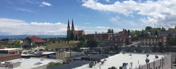 Helena, the capitol city of Montana, was where I made my home from 1981 to 1985, and served as my base for travels far and wide across the state during my work for the Montana State Historic Preservation Office’s preservation plan in 1984-1985. I started the project at the 1950s modernist Montana Historical Society building next door to the state capitol.


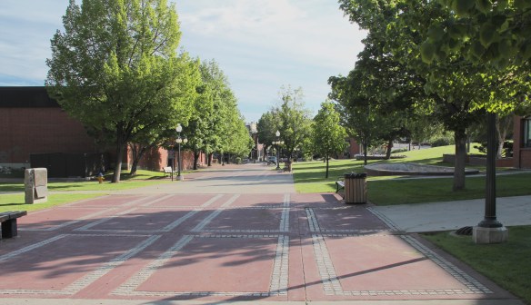
 Helena then was a small town but a big urban environment, and I used to enjoy exploring its two sided urban landscape: the 1970s “Last Chance Mall” where planners and designers closed the street for a few blocks and inserted a pedestrian mall, thinking that a “walking mall” experience would keep businesses downtown, and then the rest of the downtown before urban planners decided to change it into something it never was.


 The impetus behind the urban renewal of the 1970s was not only federal dollars through the Model Cities program but also federal presence. Officials wished to anchor the new Last Chance Gulch Urban Renewal project with a Park Avenue section that


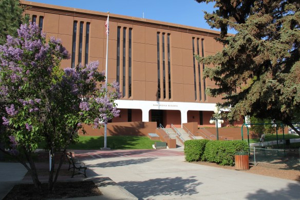
 The pedestrian mall on its west side ends at the imposing Richardsonian Romanesque styled T.C. Power Block, one of my favorite commercial buildings not just in Helena but in all of Montana.


 This downtown has several architectural landmarks, as you see below with the Art Deco-styled First National Bank building, and then a short block away, a magnificent statement of power and influence, the Montana Club, designed by noted architect Cass Gilbert.


 Once you cross Neill Avenue, you enter a new downtown of 21st century Helena, created by the demolition of the historic Great Northern Railway passenger station in the 1990s and the construction of a new Federal Reserve Bank. Here suddenly was a new downtown
 anchor, similar to that of the 1977 Federal Building on the opposite end of Last Chance Gulch. And the name given to this? the Great Northern Center, where not only the


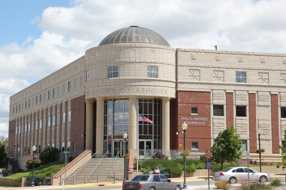 Federal Reserve lived but also a huge new Federal Courthouse, the Paul G. Hatfield Courthouse (2001-2002), a neoclassical monument of a scale that Helena had not seen since the construction of the State Capitol more than a century earlier, along with its more
 modern styled neighbor, the Senator Max Baucus Federal Building. In less than 40 years, the federal presence not only moved from one end of the gulch to another, it had become much larger and architecturally distinct.


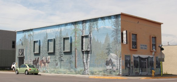
 City as one large tourism funnel. After spending a good part of 2006-2007 working with local residents and the Great Smoky Mountains National Park about the heritage and preservation of Gatlinburg, Tennessee–one of the most notorious gateways into any national park–I learned to look deeper than the highway landscape and find some real jewels in each of these Glacier National Park gateway communities.


 At Hungry Horse, however, I did leave the highway and explored the marvelous landscape created by the Hungry Horse Dam and Reservoir, a mid-20th century project by the U.S. Bureau of Reclamation. The agency justified the dam as a hydroelectric power project for a growing Flathead County and as a boost to local irrigation. The irrigation side of the project–the real reason the agency exists–never happened and Hungry Horse today is an electric power and recreational project.

 I appreciated the vastness of the concrete arch dam–the 11th largest concrete dam in the United States–as well as the beauty of Hungry Horse Reservoir, an under-appreciated tourism asset as anyone in Flathead County will tell you. But again, I let just the size and impact of the dam distract me from some of the details of its construction that, today, are so striking.


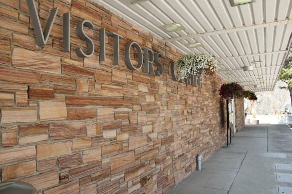

 I am concerned, however, about news in September 2015 that Reclamation has contracted for updates and renovation at the Visitor Center–let’s hope that the classic 1950s look of the property is not sacrificed.


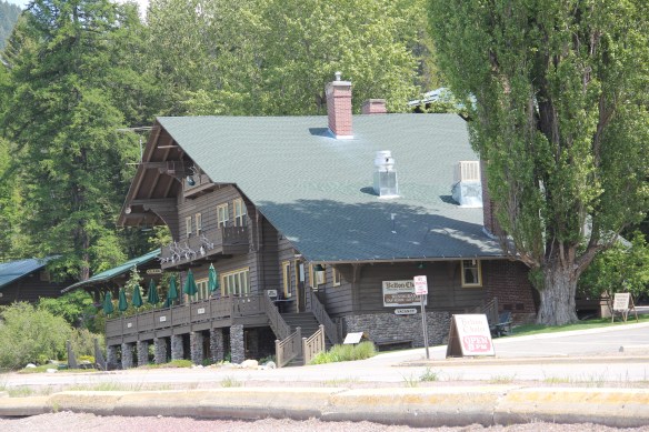 Architect Kirtland Cutter of Spokane was the architect and the chalet design was actually just a smaller scale and less adorned version of the Idaho State Exhibition Building that he had designed for the 1893 World’s Fair in Chicago. Cutter is one of the major figures of the Arts and Crafts Movement in the American Northwest and we will look at another of his buildings for the railroad and Glacier in the next post about Lake McDonald Lodge.




 Kalispell’s Main Street–the stem of the T-plan that dates to the town’s very beginning as a stop on the Great Northern Railway–has a different mix of businesses today than 30 years ago when I visited during my state historic preservation plan survey. It also now is a historic district within National Register of Historic Places, noted for its mix of one-story and two-story Western Commercial style businesses along with large historic hotels and an opera house for entertainment.
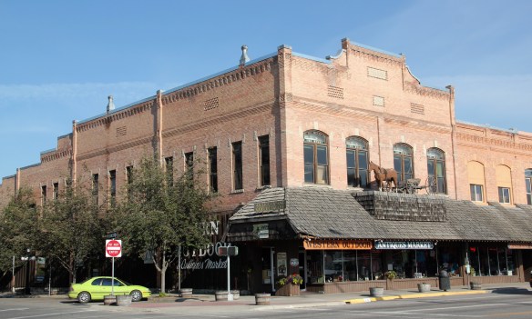 The Opera House, and I’m sorry you have to love the horse and buggy sign added to the front some years ago, dates to 1896 as the dream of merchant John MacIntosh to give the fledging community everything it needed. On the first floor was his store, which over the years sold all sorts of items, from thimbles to Studebakers. The second floor was a community space, for meetings, a gymnasium, and even from a brief period from 1905 to 1906 a skating rink. In this way, MacIntosh followed the ten-year-old model of a much larger building in a much larger city, the famous Auditorium Building in Chicago, providing Kalispell with a major indoor recreation space and landmark. Allegedly over 1000 people attended a performance of Uncle Tom’s Cabin soon after the opening.


 The Alpine Lighting Center dates to 1929 when local architect Fred Brinkman designed the store for Montgomery Ward, the famous Chicago-based catalog merchant. Its eye-catching facade distinguished it from many of the other more unadorned two-part commercial blocks on Main Street.




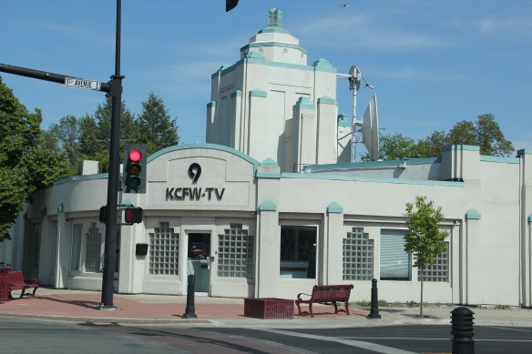

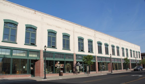

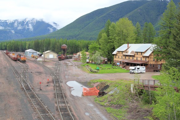
 As I would come to find out, on two return trips here in 1984, the town was much more than that, it was a true bordertown between two nations and two cultures. The two trips came about from, first, a question about a public building’s eligibility for the National Register, and, second, the fieldwork for the state historic preservation plan, where such obvious landmarks as the National Hotel and Eureka passenger depot were noted. Thirty

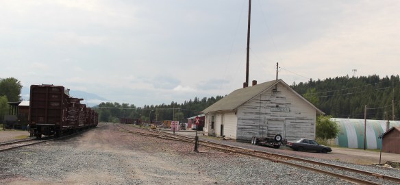 years later I was pleased to see the National Hotel in much better condition but dismayed to see the Great Northern passenger station–a classic example of its early 20th century standardized designs–is far worse condition that it had been in 1984.
 Otherwise, Eureka has done an impressive job of holding together its historic core of downtown one and two-story commercial buildings. In 1995, owners had the Farmers and Merchants State Bank, built in 1907, placed in the National Register. Walking the town, however, you see the potential of a historic district of this turn of the 20th century place.


 Located on a hill perched over the town, the building was obviously a landmark–but in 1984 it also was just 42 years old, and that meant it needed to have exceptional significance to the local community to merit listing in the National Register of Historic Places. Eureka had been a logging community, and the depression hit hard. The new building not only reflected community pride but also local craftsmanship, and it became a
 foundation for community resurgence in the decades to come. The building was listed in 1985, and was the first to have my name attached to it, working with Sally Steward of the local historical society. But credit has to go to Pat Bick and especially Marcella Sherfy of the State Historic Preservation Office for urging me to take it on, and to guide me through the maze of the National Register process. Today, it has experienced an adaptive reuse and serves as a rustic log furniture store.
 During those visits in 1984 I also held a public meeting in Eureka for the state historic preservation plan, where I learned about the Tobacco Valley Historical Society and its efforts to preserve buildings destined for the chopping block through its museum village on the southern edge of town. Here the community gathered the Great Northern depot (1903) of Rexford, the same town’s 1926 Catholic Church, the Mt. Roberts lookout tower, the Fewkes Store, and a U.S. Forest Service big Creek Cabin from 1926.


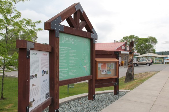


 The two railroads and the river that shaped Missoula also carved the landscape to the northwest. Following the Clark’s Fork River to the northwest, the Milwaukee Road passes through Mineral County, adding to a transportation corridor that, earlier, included the Mullan Road, and then later U.S. Highway 10. It is now the route of Interstate Highway I-90 as i heads west to Idaho and then Washington State.


 As the interstate crosses the Clark’s Fork River near Tarkio it bypasses the earlier transportation network. A particular marvel is the Scenic Bridge, listed in the National Register in 2010, especially how the bridge of U.S. 10, built in 1928, was designed in dialogue with the earlier high-steel bridge of the Milwaukee Road.
 The Scenic Bridge has been closed to traffic but is safe to walk across, creating great views of both bridges and the Clark’s Fork River–travel here has always been challenging.


 Twenty years historic preservationists stepped up to add numerous properties to the National Register throughout the county. In addition to the passenger depot, the Montana Valley Book Store, above, was listed. This two-story false front building, with attached one-story building, was once the town’s commercial heart and known as Bestwick’s Market–it has been close to the heart of book lovers for years now. Montana Valley Book Store was a relatively new business when I first visited in 1984 but now it is one of the region’s cultural institutions, especially when a visit is combined with a quick stop at the adjacent Trax Bar.
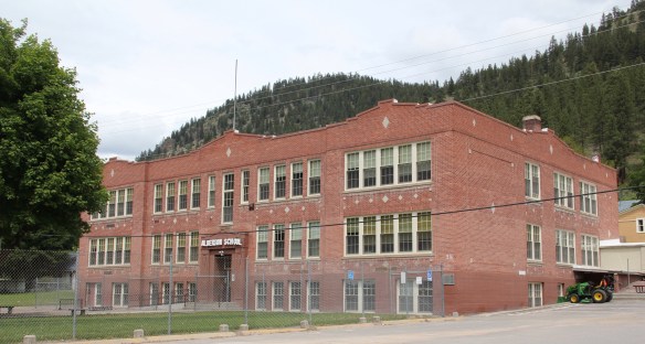
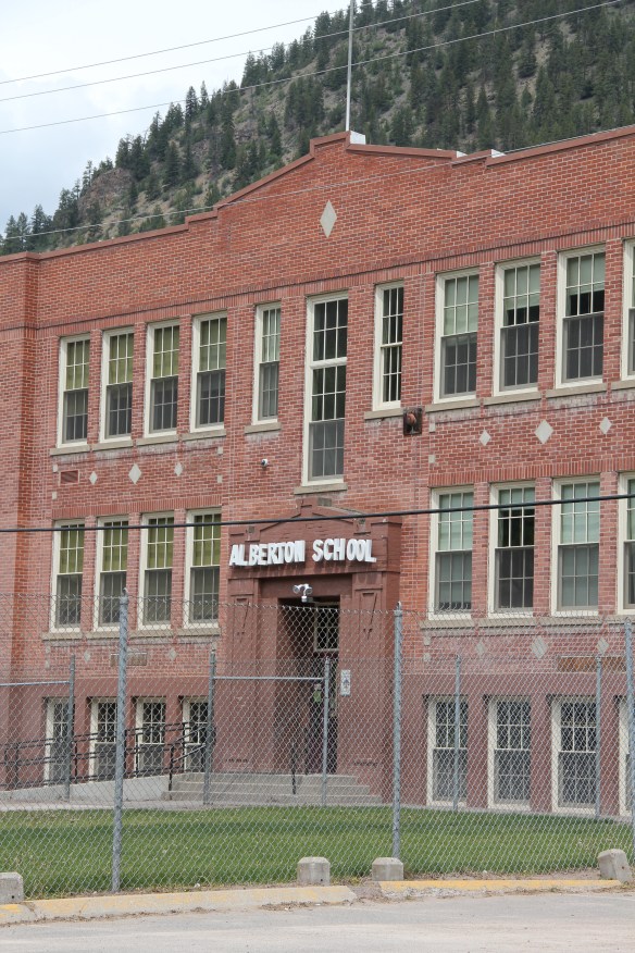 The historic three-story brick Alberton High School (now the Alberton School) operated from 1919 to 1960 as the only high school facility within miles of the railroad corridor. It too is listed in the National Register and was one of the community landmarks I noted in the 1984-1985 state historic preservation plan work.
 I gave no notice to the replacement school, the modern Alberton High School, c. 1960. That was a mistake–this building too reflects school design ideas of its time–the Space Age of the late 1950s and 1960s, when open classrooms, circular designs, and a space-age aesthetic were all the rage. Alberton High School is one of my favorite small-town examples of Montana modernism.
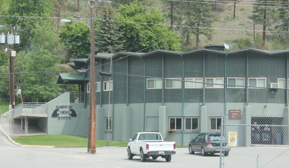 The school is a modern marvel just as the high school football field and track are reminders of how central the schools are to rural community and identity in Montana. Alberton has held its own in population in the decades since the closing of the Milwaukee Road, largely due to its proximity to Missoula and the dramatic gorges created by the Clark’s Fork River. Change is probably coming, and hopefully these landmarks will remain in service for years to come.

 To wrap up this multi-post look at Missoula and Missoula County, let’s take a brief look at the city’s historic neighborhoods. With seven historic districts, Missoula is rich in domestic architecture, and not only the homes built during its rise and boom from the early 1880s to the 1920s–there also are strong architectural traditions from the post-World War II era. This post, however, will focus on the early period, using the South Side and East Pine historic districts as examples.
 Listed in the National Register of Historic Places 25 years ago, the south side district was platted in 1890, with development especially booming after the turn of the century and the arrival of the Milwaukee Road depot by 1910. Within that 20 year period, an impressive grouping of domestic architecture, shaped by such leading architects as A. J. Gibson, was constructed, and much of it remains today. When the state historic preservation office designated the district in 1991, there were over 200 contributing buildings.
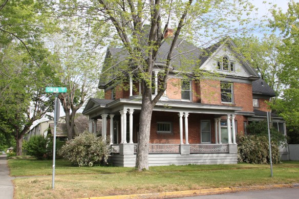 The neighborhood contains some of the city’s best examples of Queen Anne style, as seen above but also has many different examples of other popular domestic styles of the era, such as the American Four-square and variations on the various commonplace turn of the century types as the bungalow.


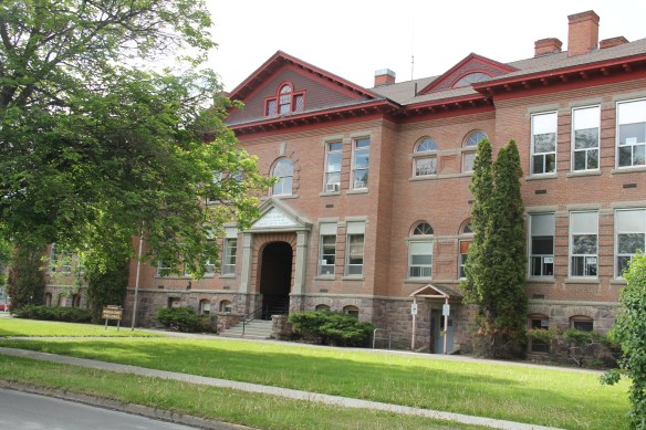 Apartment blocks and duplexes from the turn of the century also are important contributing buildings to the neighborhood. They reflect the demand for housing in a rapidly growing early 20th century western city.


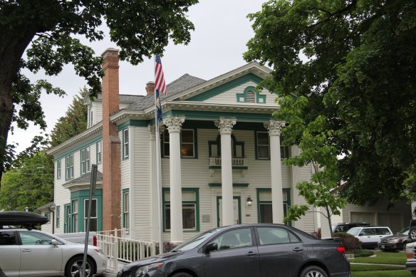


 Before we leave Missoula, I want to also briefly consider its historic 1884 cemetery, an often forgotten place as it is located on the northside of the Northern Pacific Railroad corridor, and a property, like so many in 1984-1985, I gave no consideration to as I carried out the fieldwork for the state historic preservation plan.
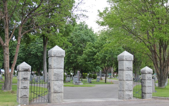
 A large concrete cross and adjacent river rock stone lined marker pay homage to the cemetery’s earliest burials as well as the many first citizens interred here.


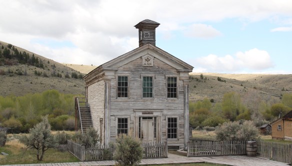
 My first trip to Beaverhead County in 1981 had two primary goals–and the first was to explore Bannack, the roots of Montana Territory, and one of its best connections to Civil War America. As this simple wooden sign below remarks, here in 1862 the first gold strike in what became Montana Territory occurred.
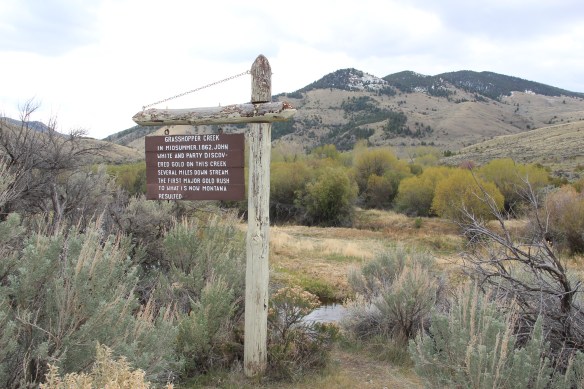
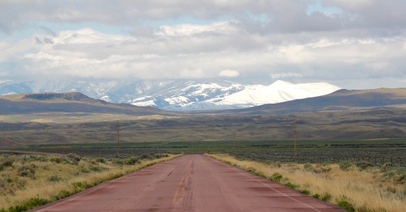 a path because the glistening bits of metal loose in the sands of the creek had never interested the Native Americans but news of the find was enough to drive easterners, many of them southerners, away from the landscape of war and into a wholly different place, crested by beautiful mountains.
 Grasshopper Creek was not much of place then, and even now, but this stream of water became the source of a boom that eventually reshaped the boundaries of the northern Rockies and nearby its banks grew the town of Bannack, a name taken in part from the Bannock Indians who had used this landscape in far different ways for many years.
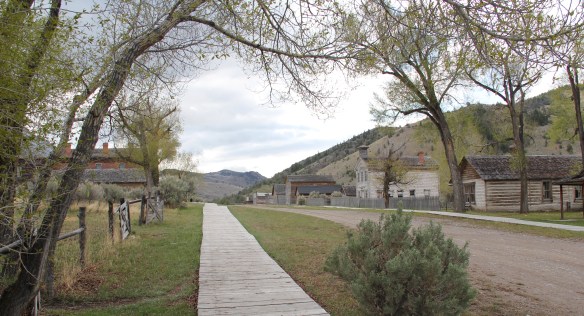 The story of the preservation of Bannock begins with local land owners, who protected the site, and kept most of the buildings from being scattered across the region. There was little official interest in the place at first. The state Daughters of American Revolution
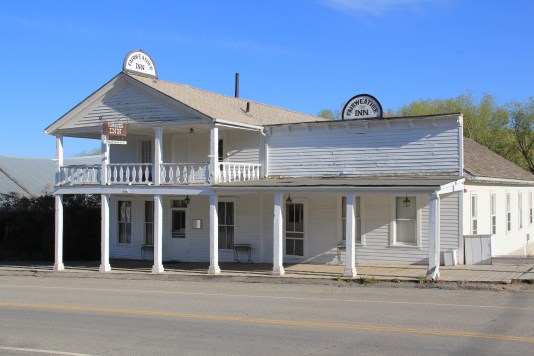
 marked it in 1925, otherwise the buildings remained, some in use as residences or for public purposes, others melting away in the demanding climate. The Boveys moved the Goodrich Hotel to their preservation project at Virginia City and transformed it into the Fairweather Inn, which is still in use as lodging.
 In 1954, the Beaverhead County Historical Society transferred about 1/3 of the present property to the state for protection and development as a state park. Not until 1961 did the National Park Service recognize the town as a National Historic Landmark.


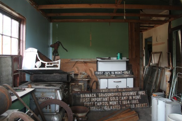 Gritty, dusty, forlorn: yes, Bannack is the real deal for anyone wanting to explore ground zero of the gold rush era in Montana, and to think about how in the midst of the great Civil War, federal officials found time to support adventurous citizens to launch a new territory in forgotten expanses of the northern Rockies.
 I thought that 30 years ago I “got” Bannack–there wasn’t much that I missed here. I was wrong. Probably like thousands of other visitors who fly into the town, and leave just as quickly, I missed what is still called the “new” town cemetery. Almost hidden in the sagebrush along Bannack Road, the “new” cemetery is not Boot Hill–where is Plummer
 buried people still want to know–but it is a remarkable place of hand-carved tombstones, others rich with Victorian imagery, and a few that are poignant reminders of the Civil War veterans who came here and stayed.


