By the late 1980s there was little doubt that a substantial development boom was underway in Flathead County. In the town near the Flathead Lake, like Bigfork, above, the boom dramatically altered both the density and look of the town. In the northern half of the county Whitefish suddenly became a sky resort center. In 1988, during a return visit to Montana, I did not like what I encountered in Flathead County–and thus I stayed away for the next 27 years years, until the early summer of 2015.


Bigfork had changed the most, and was almost unrecognizable to me, only the town plan having some semblance of historic feeling. Its population had jumped by 200% between 2000 and 2010, and what I recalled as a lakeside village of several hundred was now a large Montana town of over 4,000 residents.


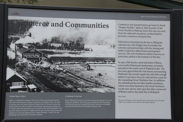
On the other hand, Somers (1901) is not as changed and older buildings both in use and abandoned speak to its history. Located on the northwest corner of the lake, it began as a railroad town, a link on the Great Northern Railway spur to Kalispell. The railroad also supported a large sawmill here, which drove the local economy for decades. Its closure at the mid-20th century brought change to Somers, one that continues today with the general patterns of growth and development in the lakeside area. One of the largest changes in Somers is the 2015 creation of its railroad heritage center, which also serves as the gateway to a rails to trails project that connects different areas, and railroad corridors, in Flathead County. The heritage center effectively interprets the town’s logging history.


Dell’s Bar is another Somers’ landmark, the type of community tavern/cafe that characterizes small town life in Montana. Retaining these types of community centers will be crucial to the region’s sense of place and identity in a rapidly changing demographic reality.

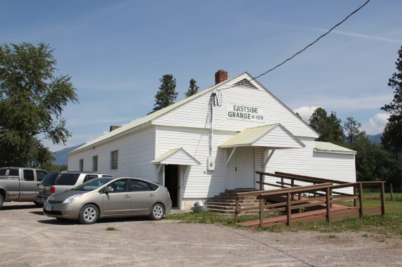
This southern part of Flathead County, between the lake and the sprawl of Kalispell, still has numerous ranches, beautiful working landscapes that deserve special consideration for agriculture was the heart of the Flathead Valley’s history. Emblematic of that are historic rural institutions, such as the school at Creston and the nearby Eastside Grange.

 I love Montana town signs, and Troy, deep in the state’s logging country, has one of the best. The sign lures to a city park nestled along the Kootenai River. The focus point is a


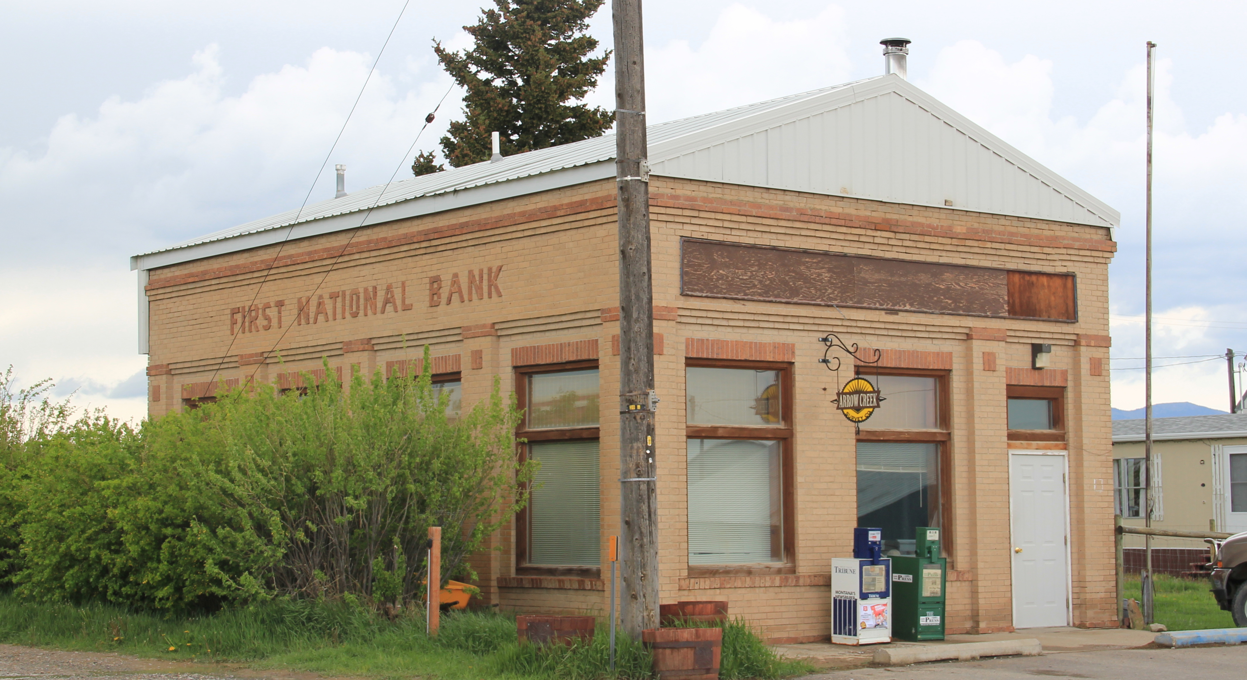
 the Great Northern’s main line, and I documented the few historic buildings left facing the railroad tracks today. The Home Bar (c. 1914) and the Club Bar were institutions then, and remain so today. The Kootenai State Bank building still stands but has experienced a major change to its facade–made better in part by the American flag painted over some of the frame addition.
 The Troy Jail, above, was listed in the National Register of Historic Places in 2006 and it remains the only building so listed in the town today. D.E. Crissey, a local contractor, built it out of concrete in 1924 during Troy’s boom from 1916 to 1926 when its population jumped from 300 to 1300. The Snowstorm mine, which produced lead, zinc, and silver, started to serve the demand for raw materials during World War I. The mine soon turned what had been a small railroad town into a mining camp best known for its brothels and bars. Then in the early 1920s the Great Northern decided to build a division point here, further booming the town. The Sandpoint Pole and Lumber Company began its logging business in 1923, and Troy suddenly was the largest town in the county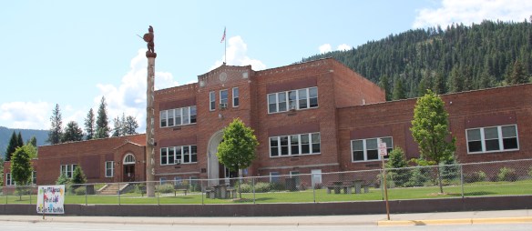


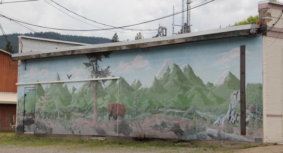


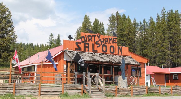


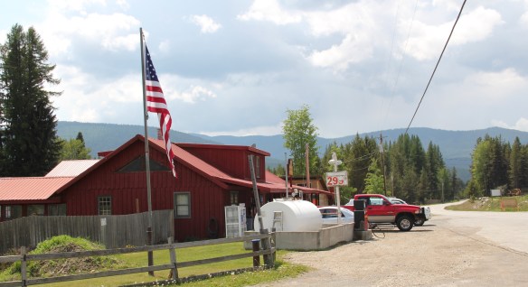

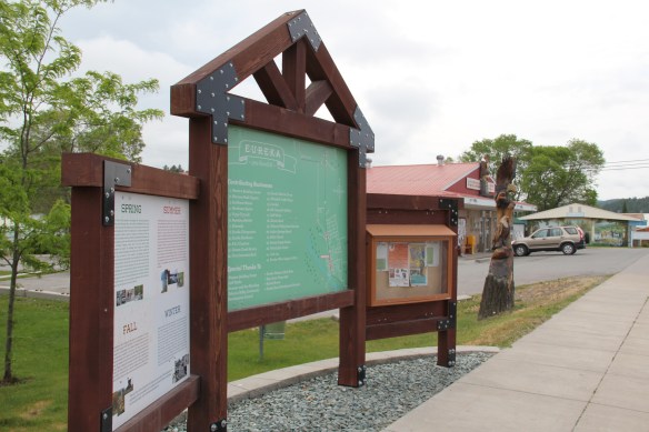
 As I would come to find out, on two return trips here in 1984, the town was much more than that, it was a true bordertown between two nations and two cultures. The two trips came about from, first, a question about a public building’s eligibility for the National Register, and, second, the fieldwork for the state historic preservation plan, where such obvious landmarks as the National Hotel and Eureka passenger depot were noted. Thirty
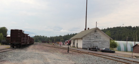 years later I was pleased to see the National Hotel in much better condition but dismayed to see the Great Northern passenger station–a classic example of its early 20th century standardized designs–is far worse condition that it had been in 1984.
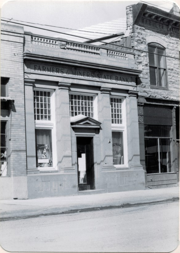
 Otherwise, Eureka has done an impressive job of holding together its historic core of downtown one and two-story commercial buildings. In 1995, owners had the Farmers and Merchants State Bank, built in 1907, placed in the National Register. Walking the town, however, you see the potential of a historic district of this turn of the 20th century place.


 Located on a hill perched over the town, the building was obviously a landmark–but in 1984 it also was just 42 years old, and that meant it needed to have exceptional significance to the local community to merit listing in the National Register of Historic Places. Eureka had been a logging community, and the depression hit hard. The new building not only reflected community pride but also local craftsmanship, and it became a
 foundation for community resurgence in the decades to come. The building was listed in 1985, and was the first to have my name attached to it, working with Sally Steward of the local historical society. But credit has to go to Pat Bick and especially Marcella Sherfy of the State Historic Preservation Office for urging me to take it on, and to guide me through the maze of the National Register process. Today, it has experienced an adaptive reuse and serves as a rustic log furniture store.
 During those visits in 1984 I also held a public meeting in Eureka for the state historic preservation plan, where I learned about the Tobacco Valley Historical Society and its efforts to preserve buildings destined for the chopping block through its museum village on the southern edge of town. Here the community gathered the Great Northern depot (1903) of Rexford, the same town’s 1926 Catholic Church, the Mt. Roberts lookout tower, the Fewkes Store, and a U.S. Forest Service big Creek Cabin from 1926.




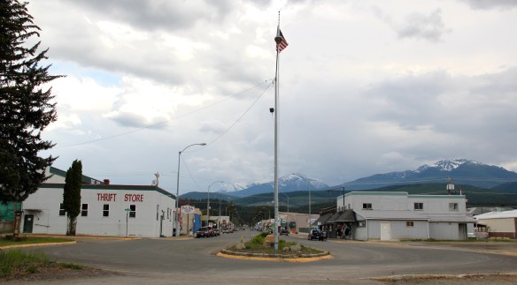 Libby is the seat of Lincoln County, a typical railroad town along the historic Great Northern Railway corridor. The image above is from the town’s railroad depot, the symbolic beginning of town, from which runs a long main street of businesses, reflecting the T-plan town design, where the long railroad corridor defines the top of the T and the main street forms the stem of the T.


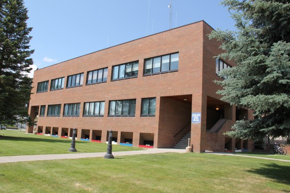
 courthouse received a totally new front, in a contemporary style, in the 1970s as the town and county expanded in the wake of the federal spending in constructing Libby Dam. The rectangular blockiness, flat roof, and band of windows set within a symmetrical facade makes the courthouse one of the state’s best designs for a rural public building in the late 20th century.
 I liked all of those things about Libby in 1984. Imagine my shock and disappointment to learn, as everyone else did, that Libby was one of the poisoned places in the west. In 1919, vermiculite, a natural material that contains asbestos, had been discovered outside of town, and the mines were still operating, producing 80 percent of the vermiculite in the world, under the control of the W.R. Grace company. Residue from the mines had been used in local yards and buildings for decades, a fact that was not known when I visited the town for the state historic preservation plan. When the discovery of the danger became public, and the federal Environmental Protection Agency entered into the fray in 1999, it was already too late for many residents. A federal Superfund project began, and did not conclude its work until 2015, spending some $425 million. Then in 2009 the Environmental Protection Agency announced a public health emergency, spending another $130 million to help residents and to leave a new health infrastructure in place. In a generation, Libby had been turned inside out. EPA announced in 2016 that the cleanup would continue to 2018, and that the project was the longest in the agency’s history.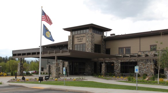
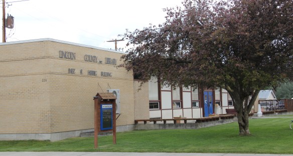
 Despite the disaster, I saw many signs that Libby residents were determined to remain and rebuild their community. One of the most powerful examples is the conversion of one of the town’s historic schools into a new community arts center as well as school administration offices.


 The asbestos crisis was a terrible disaster for Libby–yet residents refused to let it define their future. There are past accomplishments to acknowledge, an active railroad depot to cherish, a beautiful river and lake, the mountains all around, as celebrated in this public art mural on a downtown building. This place is here to stay, and the historic built environment is a large part of it.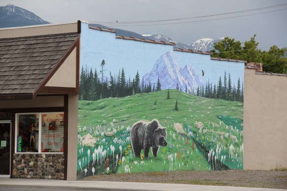
 U.S. Highway 2 enters northwest Montana in Lincoln County and from there the federal highway stretches eastward through the towns of Troy and Libby with vast rural stretches along the way to Kalispell. Paralleling the highway is the historic route of the Great Northern Railway, which brought timber and mining industries to this corner of Montana.
 Before you encounter the towns, however, there is a spot that is among my favorite in the state, and a place that I discussed in some depth in the book A Traveler’s Companion to Montana History: Kootenai Falls.


 The falls is spectacular, no matter what time of the year you visit. But do stop and consider the mountains and bluffs that surround it. The entire landscape is what mattered to the Native Americans as they navigated through the area, or took vision quests at isolated places, or stopped to fish along the banks or hunt the wild game who also came to the falls for nourishment.
 There are few less untouched places than Kootenai Falls. The county park provides access and information. It is then up to you to explore, stop, and think about how humans have interacted with this places, taking aways thoughts and messages that we can only guess at, for thousands of years.
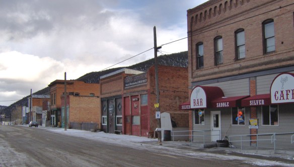 When I carried out the Montana State Historic Preservation Plan field work in 1984-1985 I passed through Basin Street in the heart of “downtown” Basin quite frequently, not because of the Silver Saddle Bar–fine place it is–but because I had no choice if headed
 The glory days of Basin had long since passed, although some locals and visitors would go to the Merry Widow Mine for a dose of radon, thinking it could cure their ills (of course radon exposure is actually dangerous). Led by the Butte capitalist Augustus Heinze, the town from the mid-1890s to mid-1920s had been a quite thriving place, served as both the Great Northern and Northern Pacific Railroads with its Basin Street becoming the route for U.S. Highway 91. The numerous two-story brick commercial buildings reflected that era of prominence while a decaying c. 1930 garage on the town’s outskirts documents the impact of the federal highway.
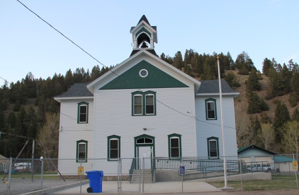
 Several key community landmarks remain. The most impressive is the two-story frame Basin School, built in 1895 and still in use as a school today. Here is another great Montana rural school building–the state is so rich in this type of public architecture.
 Nearby is the Community Church, another late Victorian-era styled building, with its tall bell tower and distinctive corner entrance.


 Many heritage areas in the eastern United States emphasize the relationship between rivers, railroads, and industrial development and how those resources contributed to national economic growth and wartime mobilization. Great Falls can do that too. Situated on the Missouri River and designed by its founders to be a northwest industrial center, entrepreneurs counted on the falls to be a source of power and then on the railroads coming from Minnesota, especially the promising Manitoba Road headed by James J. Hill, to provide the transportation.
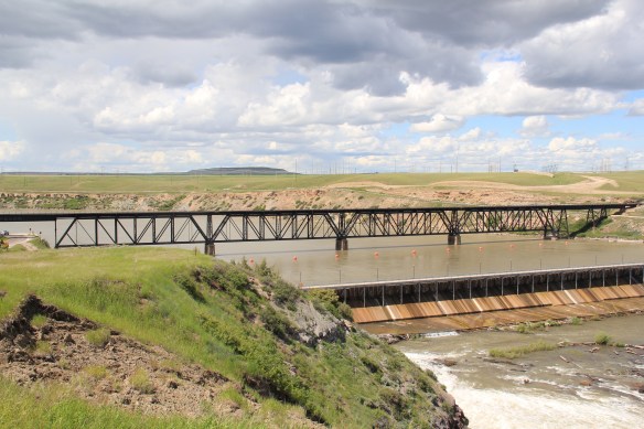 Paris Gibson, the promoter of the Electric City, allied his interests to two of most powerful capitalists of the region: Marcus Daly, the baron of the Anaconda Copper Company interests and James J. Hill, the future rail king of the northwest. Their alliance is embodied in several different properties in the city but the most significant place was where the Anaconda Copper Company smelter operated at Black Eagle until the last decades of the 20th century. When I surveyed Great Falls for the state

 decade of the 20th century and soon erected its tall tower depot right on the Missouri River. But wherever you go along the river you find significant buildings associated with the Great Northern and its allied branch the Montana Central Railroad, especially the downtown warehouses. Some are still fulfilling their original function but others


 Along the Missouri River is Paris Gibson Park, deep in the heart of Great Falls, Montana. Gibson was one of the classic civic capitalists of the late 19th century who understood that as the community prospered he too would achieve this dream of building a great western empire, with his town of Great Falls as the center. Almost 100 years after his death, in 2015, residents, preservationists, historians, and economic developers began discussions on establishing a heritage area, centered on Great Falls, but encompassing the Missouri River as the thread between the plains and mountains, that has shaped the region, and the nation, for hundreds of years. I strongly endorse the discussion and will spend the next several posts exploring key resources in Cascade County that could serve as the foundation for a larger regional story.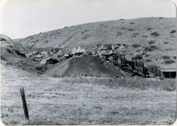
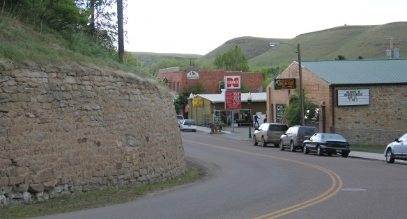
 Thirty years later, Belt’s population had bottomed out, declining to under 600 by the time of the 2010 census. But both times I have stopped by, in 2013 and 2015, the town has a sense of life about it, and hope. The town’s two historic taverns, the Harvest Moon Tavern and the Belt Creek Brew Pub, as well as the Black Diamond Bar and Supper Club attract visitors from nearby Great Falls and elsewhere, giving the place a sense of life at evenings and weekends.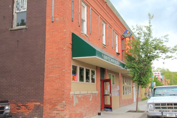
 When planners talk about heritage areas, they often focus on the contributions of local entrepreneurs who take historic buildings, like the Pioneer above, and breathe new life into them. Throughout small town Montana and urban commercial districts, new breweries and distilleries are creating such opportunities.
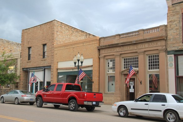
 Belt has a range of historic buildings, mostly of vernacular two-part commercial style that speak strongly to the boom of 1900 to 1920. The Victorian-styled cornice of the Belt Hardware Store (1896) speaks to the town’s origins. The Knights of Pythias Lodge of 1916 has been restored as a community theater, another reason for visitors to stop and explore.
 The result is a living cultural experience, since nothing in Belt is over-restored or phony feeling. It is still a gritty, no frills place. That feel is complemented by the Belt museum, which is housed in a historic jail on road down into town and within sight on a railroad trestle, a reminder of what literally drove the town’s development, coal for the railroads.
 During the 1984 survey, I gave the jail a good bit of attention since this stone building spoke to the craftsmanship of the era, the centrality of local government as the town developed, and the reality that this building was the only thing in Belt listed in the National Register of Historic Places. But in 2004 the state historic preservation office approved the Belt commercial historic district, and that designation has done much to drive the town’s recent revival. Belt is just the first place that speaks to the promise of the Great Falls heritage area concept.