 Montana history has many episodes that involve rich eastern and foreign capitalists who rolled the dice on Montana’s resources. Typically everyone thinks of the mining and railroad corporations of the late 19th century. But in several places across the Big Sky Country, investors looked to the land itself and dreamed of agricultural bonanzas.
 Such is the case of Amsterdam and Church Hill (now Churchill), two rural communities in today’s rapidly suburbanizing Gallatin County. The Manhattan Malting Company was mostly a New York City venture which in the early 1890s, before the terrible depression of 1893-1896, established an industrial base on the Northern Pacific Railroad, changing the name of the town from Moreland to Manhattan. The company purchased 13,000 acres,and acquired the best in agricultural technology, the Jacob Price Field Locomotive steam plow, to till the soil. They also convinced hundred of Dutch farmers to come to Gallatin County and work the land. Even with the hard times, or perhaps because of them, people still wanted good beer, and the company prospered. By 1905 the company decided to shed itself of the land and focus on malting barley.
 The new land company focused on getting farmers on its land, and to secure a railroad spur line. The railroad came in 1911, and the community name of Amsterdam reflected the ethnic origins of the surrounding farmers and ranchers. Even when the Malting Company failed during Prohibition, the farmers kept going, developing some of the still most productive farmland in the state.
 When I visited Amsterdam in 1984 the railroad line still operated but the spur closed the next year, leaving today only a faint corridor to mark its route. Look close and you can still see the outline of the T-plan town that was once “downtown Amsterdam” by the remaining historic commercial buildings, with the Danhof automobile dealership still in business today, with a newer showroom just east of the old railroad tracks.


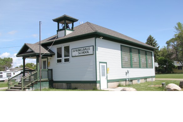
The Amsterdam school is also thriving today, serving both the Amsterdam and Churchill communities, as well as the expanding suburban enclaves of this part of the county. The school is not a frame building but a decidedly mid-20th century modern design in concrete.


Churchill had changed markedly since my last visit 30 years ago. The constant was the landmark Manhattan Christian Reformed Church: after all that is how the name Church Hill came about–the congregation located their Gothic-styled landmark on the highest point in the area. The church is even larger today, and the adjacent Manhattan Christian Academy has built new facilities since my last visit.


The second landmark church is the Bethel Christian Reformed Church, and between the two churches along the road early to mid-20th residences remain much as they were 30

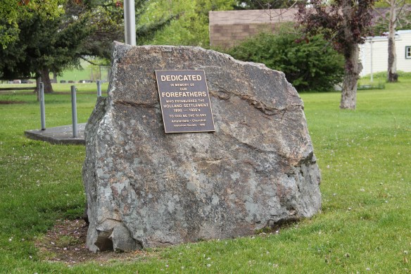
years ago. But suburbs are everywhere, and the demographics and culture of the area are changing. Perhaps that helps to explain why residents placed at the park at Manhattan Christian Reformed Church a monument to the “Holland Settlement,” to those “forefathers” who first settled this area over 100 years ago. There was no need for this monument in 1985. But in the 21st century times and people had changed. This boulder monument will be hard to displace, no matter what happens to the land around it.
 U.S. Highway 89 enters the Blackfeet Indian Reservation on its southern border, heading for its junction with U.S. Highway 2 and the reservation center of Browning. Before the junction, you cross the historic Two Medicine River, a historic corridor for the Blackfeet. To the west of the river crossing is a highway historical marker for Coldfeet School, a one-
 room school (not extant) built for Blackfeet children in 1933 during the New Deal. To the east of the highway river crossing, however, was one of the earliest schools (1889) on the reservation, the Holy Family Catholic
")


 This panorama of the mission site today shows that neither of the dormitories remain, although the historic frame barn and mill still stand (to the left) while the chapel is still a dominating element, and has been incorporated into present-day Blackfeet culture. It is in excellent shape.
 Another change is that the Blackfeet provide public interpretation of the site, through their own historical markers, which is extended into the adjacent historic cemetery, one of the most somber places in the region. The old mission is now part of the reservation’s heritage tourism effort.
 Returning to U.S. 89 and heading northwest, you head to the junction of U.S. Highway 2 and the town of Browning. The town is a center for reservation education, as shown by the new campus for the Blackfeet Community College.
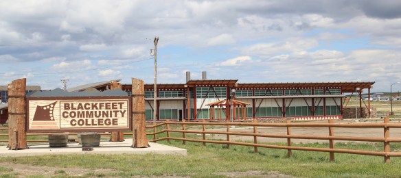 Here too is another historic Catholic Church, the Little Flower Catholic Church, built in 1931, from locally available stone in a Gothic Revival style. The congregation supports a small Catholic school next door.
 The Browning fairgrounds is an important Blackfeet recreation and cultural center, with this recent installation again providing public interpretation of Blackfeet culture.
 and U.S. 89, heading north. It created an appropriate, respectful way for the increasing number of auto tourists headed to Glacier National Park to learn about the Blackfeet in particular and Plains Indian culture in general. The famous mid-20th century anthropologist, John Ewers, had worked tribes to create the museum’s initial exhibits and collections. In the 21st century, the Blackfeet have developed additional institutions to take advantage of tourism through the nearby Glacier Peaks casino and hotel, a complex that has developed from 2011 to 2015.
 These new buildings are part of a long-term continuum of tourism in Browning, starting with this old concrete tipi, built originally as a gas station in 1934 and now converted into a coffee shop. And the Blackfeet
 Trading Post is a business found in all sorts of national park gateways–the classic place to get cheap souvenirs and t-shirts of all types, not to mention moccasins and all of the stereotypical material culture of Native American tourism in our country.
 the primary voice on what the park means, and how visitors can think about it today. The Native American presence on U.S. Highway 89 today is much more evident, with much more public interpretation, than in my travels 30 years ago.
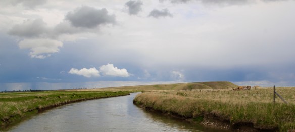
 The two lanes of U.S. Highway 89 as it winds northwest from Choteau to the southern boundary of the Blackfeet Indian Reservation, cross a stark yet compelling landscape, a jaunt that has never ceased to amaze me. To those only with the mountains of Glacier National Park in their minds will see merely open land, irrigated fields, scattered ranches.
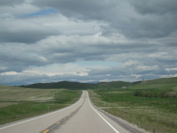 But there’s a deeper landscape here, some embodied in the tiny towns along the way, others in places just ignored, certainly not recognized. In the first post of 2016, and the 200th of this series of explorations of the Montana landscape, let’s once again look a bit harder.
 For one, this is a landscape shaped by Cold War America. Nuclear missile silos were installed throughout the region with some easily accessible from the roadway. You wonder how many tourists realize that.
 The federal imprint has lingered on this land for almost 150 years. Today north of Choteau this highway historical marker, and a lonely boulder set square in the adjacent field, mark the first federal intrusion, the creation of the Teton River Agency, where in 1868-69 the federal government established its reservation headquarters for the Blackfeet Indians. The agency was only here for about 7 years but this spot was where the first white-administered schools for Blackfeet children began, in 1872.
 Irrigation systems would be a third federal imprint on the landscape and it came early to this region–through the Reclamation Service’s Valier Irrigation Project–but to find that place you need to venture a bit east of U.S. 89 to the town of Valier, on the banks of Lake Frances, which was created as a reservoir for the irrigation project.
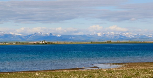 Valier has never been a very big place, but its investors in 1908, including William S. Cargill of the powerful Cargill family of Wisconsin (today’s Cargill Industries), had high hopes that the engineered landscape could create a ranching and farming wonderland.

 Listed in the National Register of Historic Places, the school remains in use today, as a bed and breakfast establishment. Even though Valier never reached the dreams of the Cargills and other outside investors, it has been a stable agricultural community for 100 years–the population today is only 100 less than what the census takers marked in 1920. Valier has that


 Heritage tourism also remains alive along U.S. Highway 89, and for those travelers who slow just a bit there is now the Two Medicine Dinosaur Center at Bynum.
 One of my favorite county seats is Choteau, where U.S. Highways 89 and 287 meet. Both of those roads were and are among my favorite to take in the state, and Choteau I quickly found had one of my favorite local dives the Wagon Wheel. Back in the day, however, I did not appreciate how the town’s history and built environment was shaped by the Sun River Irrigation project and the overall growth in the county during the first two decades of the 20th century and later a second boom in the 1940s.
 Choteau has a different look than most towns from this era of Montana history. The centerpiece of the towns plan is not a railroad depot but the magnificent Teton County Courthouse (1906), which occupies a spot where the two federal highways junction. Designed by architects Joseph B. Gibson and George H. Shanley, the National Register-listed courthouse is made of locally quarried stone in a late interpretation of Richardsonian Romanesque style, similar to, but to a much lesser scale and detail, than H. H. Richardson’s own Allegheny County Courthouse (c. 1886) in Pittsburgh.

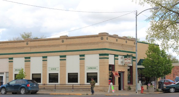 This historic neoclassical-styled bank building is now home to a coffee shop but other commercial buildings have changed very little, except for the mix of retail business. This is not a dying business district but one with a good bit of jump, of vitality.


 where the historic Bella Vista Motel–a perfect example of a 1950s motel with separate units like tiny Ranch-styled houses–has given way to a c. 2015 conversion into apartments.


 We just finished an exploration of U.S. Highway south from Great Falls to Livingston, the gateway to Yellowstone National Park. Now let’s head in the opposite direction, north of Great Falls to Glacier National Park. In the first half of this trek, one great man-made landscape dominates either side of the road–the Sun River Irrigation Project, established by the U.S. Bureau of Reclamation in 1906 but not completed until the late 1920s.

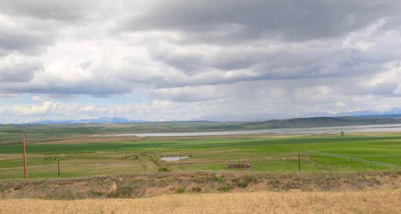
 Feeding in and out of Fairfield are multiple canals and ditches, with the great bulk of land devoted to the production of malting barley, under

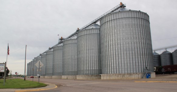 Fairfield itself is a classic T-plan railroad town. The barley granaries dominate the trackside, where also is located the headquarters for the Greenfields Irrigation District, so designated in 1926.
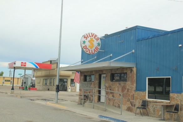
 Along the stem of the “T” plan are all of the primary commercial buildings of the town, from an unassuming log visitor center to various one-story commercial buildings, and, naturally, a classic bar, the Silver Dollar.


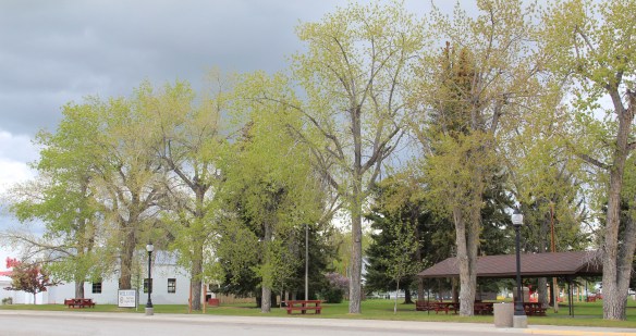
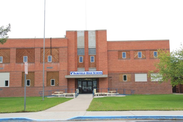
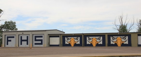
 Public spaces and institutions are located at the bottom of the “T,” including a community park and swimming pool, a c. 1960 community hall, and an Art-Deco styled Fairfield High School. The park, pool, and high school were all part of the second period of federal improvement at Fairfield during the New Deal era.


 Livingston’s town plan from 1882 was all about the railroad, with the adjacent Yellowstone River an afterthought, at best an impediment since it defined the south end of town. So far from the tracks to be of little worth to anyone, few paid it any attention. 100 years later when I am considering the town for the state historic preservation, I too was all about the railroad and the metropolitan corridor of which it was part. I paid no attention to the river. The town’s schools were on this end, but they were “modern” so did not capture my attention.
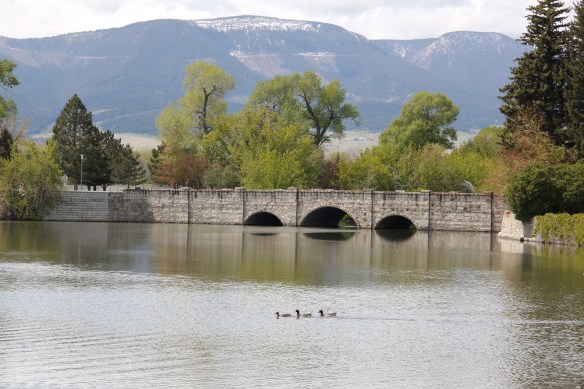
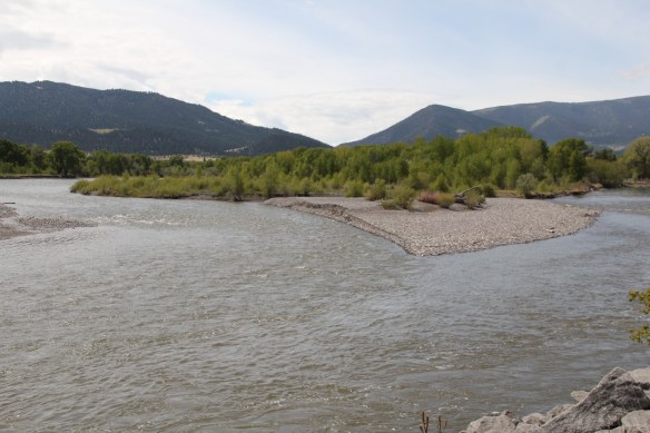 Consequently I missed a bit part of the town’s story, the effort to reform the landscape and create public space during the New Deal era. The Works Progress Administration (WPA) transformed this part of town from 1935 to 1938 expanding an earlier public park into today’s Sacajawea Park.


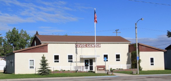
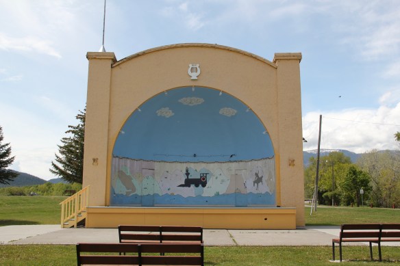 The major addition, however, was the large combination Civic Center and National Guard Armory, an Art Deco-styled building that cost an estimated $100,000 in 1938. It too survives and is in active use by the community.
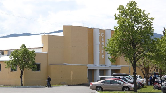 Tourists now come to this area more often than in the past due to additions made during the Lewis and Clark Bicentennial in the early 21st century. The park is part of the Lewis and Clark National Historic Trail.
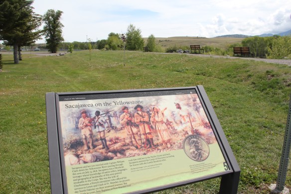


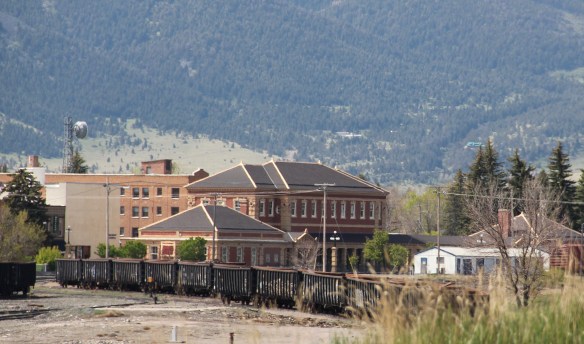 Livingston was one of the Northern Pacific Railroad’s most important division points. Not only did the massive and architecturally ornate passenger station, discussed in the previous blog, serve as a gateway to Yellowstone National Park, it contained various company offices, serving as a nerve center for the thousands of miles of railroad line. If you do the typical tourist thing in Livingston, you pay attention to the depot and the many late 19th and early 20th century buildings south of the tracks.
 But to find where the real work of the railroad took place, you have to locate the underpass that takes you to the north side of the tracks, and the extensive Northern Pacific railroad shops. This area is not as busy as it once was, but enough buildings remain and enough activity takes place 24-7 that you quickly grasp that here is the heartbeat of the line. In the photo above, one early shop building, the lighter color brick building to the right center, still stands. Most others date to the line’s diesel conversion in the mid-20th century.
 With the mountains to the south, and the outlines of the town visible as well, the shops are impressive statements of corporate power and determination, and how railroads gave an industrial cast to the landscape.
 The north side, in many ways, was a separate world. Here the homes may date to the Victorian era too, but they are not the stylish period interpretations found in numbers on the south side. Rather they are vernacular styled cottages, or unadorned homes typical of America’s turn-of-the-century working class.

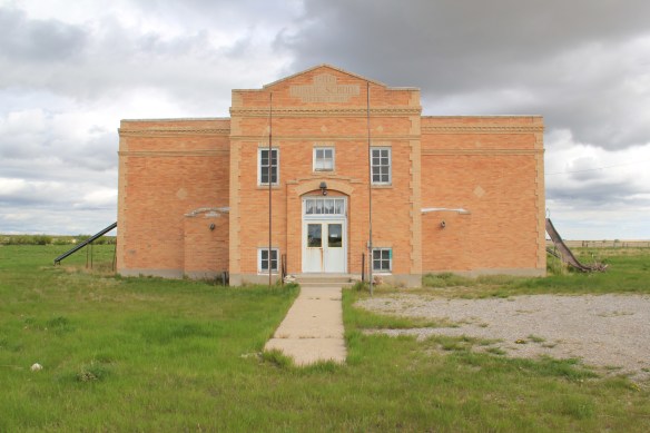
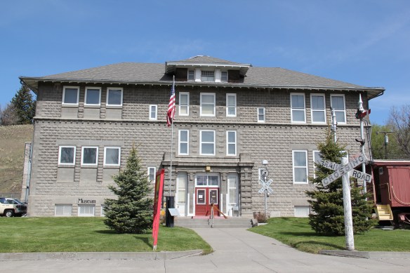 The school was converted into a community museum some 30 years ago, and if you visit the grand passenger station, you also need to stop at the school, to get a fuller picture of Livingston, the railroad town.

 The above block of commercial businesses was once better known as the Montana Hotel while the block below, called the Hiatt Hotel in more recent years, was the Park Hotel, opened in 1904 to take advantage of increased tourist business due to the new Northern Pacific depot. Noted Montana architect C.S. Haire was the designer.
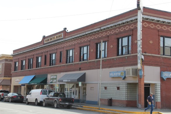 These buildings served tourists in the summer months but throughout the years they relied on the “drummer” trade. Drummers were a word used to describe traveling businessmen, who rode the rails constantly, stopping at towns large and small, to drum up business for their companies. They too, like the machine shop workers on the south side, were a constant presence on the railroad lines of 100 years ago, and helped to make the lines hum with their travel and their stories.
 Continuing west you soon encounter post-World War II service stations and motels, some updated, some much like they were, on the outskirts of town and then, boom, you are in the heart of Livingston, facing the commanding presence of the Northern Pacific depot complex with warehouses–some now converted to new uses–coming first and then
 massive passenger station itself. Opened in 1902, the passenger station was an architectural marvel for the new state, designed by Reed and Stem, who would continue on to great fame as the architects of Grand Central Station in New York City. The station, interestingly, is not Classical Revival in style–certainly the choice of most architects for their grand gateways along the nation’s rail line–but a more restrained interpretation of Renaissance Revival style, completed in red brick.
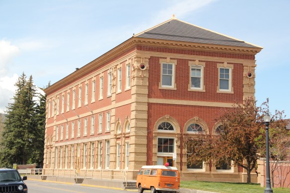 The building is not particularly inviting for locals coming from the business district to the depot–that was not its primary audience. Rather the grand entrance is track side, where passengers headed to Yellowstone National Park could depart for food, fun, frivolity, whatever they needed before the journey into the wildness of Yellowstone.
 Travelers were welcome to use the grand covered walkways to enter the depot proper, or to take a side visit to the railroad’s cafe, Martin’s as I
 knew it back in the day, a place that rarely slept and always had good pie. The cafe changed its orientation from the railroad to the road as automobile travelers on U.S. 10 began to dominate the tourist market. Now it has been restored as a local brew pub.


 Directly facing the center of the passenger station was the mammoth Murray Hotel–a flea bag operation in the 1980s but now recently restored as a hipster place to be, especially its signature bar.

 Imagine my pleasant surprise last year when I found that Gil’s still existed but now had been converted into a decidedly up-scale establishment, far removed from the 1980s.
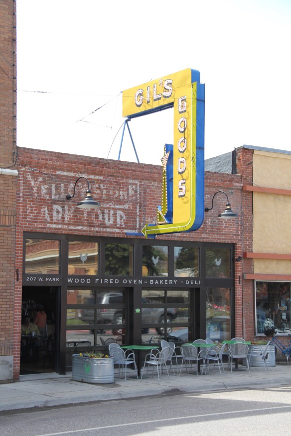 I don’t know if I have encountered a more fundamentally changed place–cheap trinkets gone, let the wood-fired pizzas come on.
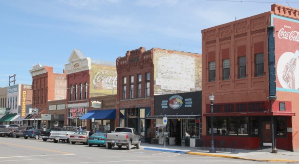 I was not so blinded in 1984 by the concept of the “metropolitan corridor” that I ignored the distinctive Victorian storefronts of Livingston–how could I since they all, in a way, fed into the tracks. But when I got to the end of that distinctive business district and watched the town, in my
 mind, fade into the Rockies, I had captured the obvious but had missed the bigger picture–that’s the next story.
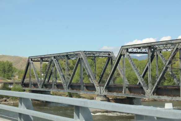
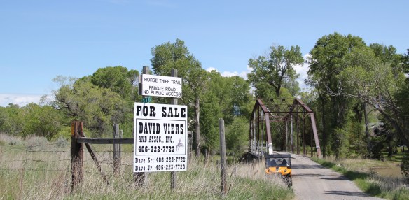 Traveling south of Clyde Park on U.S. 89, you pass by the turn-off for Horse Thief Trail, where a historic steel bridge still allows for one-lane traffic over the Shields River; this bridge and snippet of road is part of the original route of U.S 89. That means you are nearing the confluence of the Yellowstone and Shields rivers, and where U.S. Highway 89 crosses the Yellowstone River and takes you into the heart of Park County. Paralleling the modern concrete bridge is a c. 1897 steel Pratt through truss bridge, to serve the Northern Pacific Railroad spur that runs north to Clyde Park then Wilsall. The Northern Pacific called this the Third Crossing of the Yellowstone bridge; the Phoenix Bridge Company constructed it.
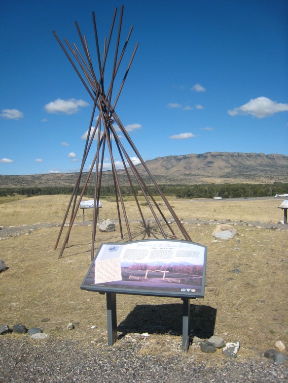
 Before jogging slightly to the west to head to Livingston, the county seat, two places east of the Shields River confluence are worth a look. First is the site of Fort Parker, established as the first Crow Agency in 1869 or the first federal facility in the valley. It operated from this location until 1875.
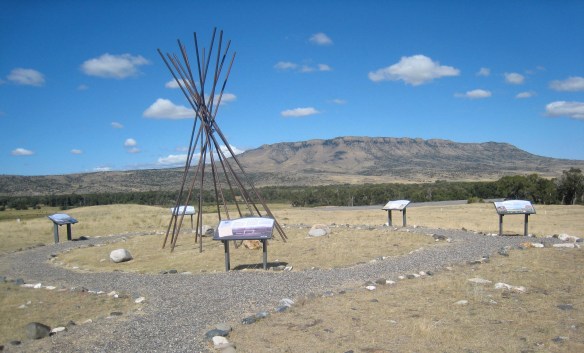 Gladly all of that changed in the 21st century. As a result of another innovative state partnership with land owners, there is an interpretive center for the Fort Parker story, easily accessible from the interstate, which also does not intrude into the potentially rich archaeological remains of the fort. The story told by the historical markers is accurate and comprehensive, from the agency’s beginnings to the land today.
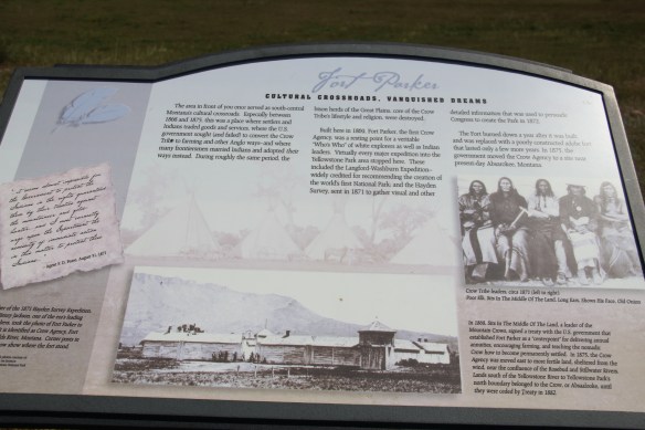
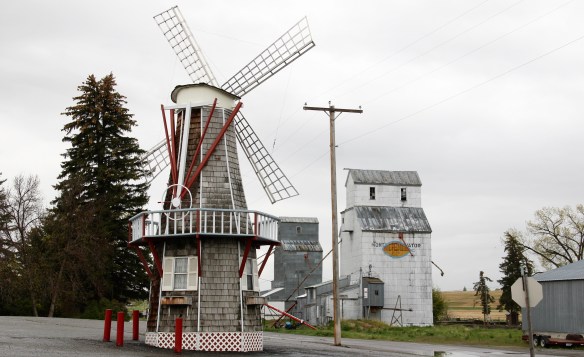
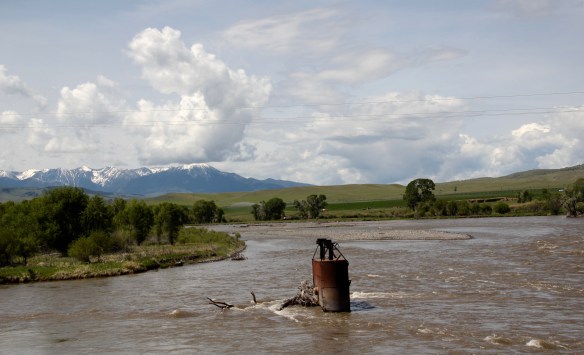
 Few remnants of that early white settlement remain today; you can find some just north of Springdale, at Park County’s eastern border, on the north side of the Yellowstone River. Hunter’s Hot Springs was the first attraction, established by Andrew Jackson Hunter in the 1870s, and receiving its last update in the early years of automobile tourism in the 1920s, as shown below in this postcard from my collection. Today, as the Google image below also shows, there are just scattered stones and fences from what had been a showplace for the valley.

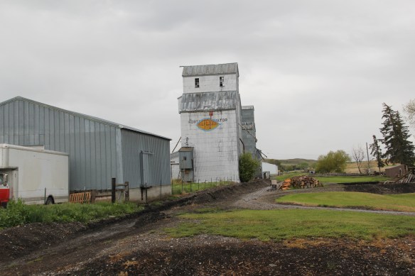
 Commercial businesses once lined the town side of the Northern Pacific tracks. Nothing is open today although trains rumbled down this historic main line every day. What does survive is impressive and worthy of