Gallatin County is one of the oldest white settlement landscapes in Montana. The Bozeman Trail to the western gold fields introduced settlers from the 1860s to 1880 to the potentially rich land of the Gallatin Valley. Then the Northern Pacific Railroad opened the heart of the valley to development as the tracks crossed the Bozeman Pass in the early 1880s.
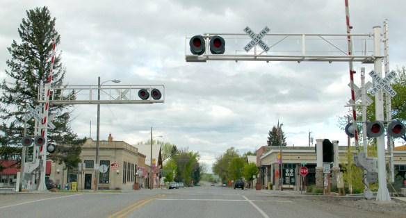
 Manhattan was not originally Manhattan, but named Moreland, as discussed in an earlier blog about the effort to build a barley empire in this part of Gallatin County at the turn of the century by the Manhattan Malting Company and its industrial works here and in Bozeman. But the existing railroad corridor, along with the surviving one- and two-

story commercial buildings facing the tracks (and old U.S. Highway 10), always made a drive through Manhattan a pleasant diversion as I crisscrossed Montana in 1984-1985. The town has a strong 1920s feel, in large part because of an earthquake that destroyed a good bit of the town’s original buildings in 1925.


Manhattan has changed significantly over 30 years–as the storefronts above suggest–just not to the degree of Belgrade. But you wonder if its time is not coming. From 1980 to 1990–the years which I visited the town the most–its population barely ticked up from 988 to 1032. In the 25 years since the population has expanded to an estimated 1600.
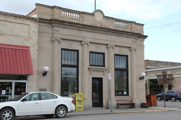
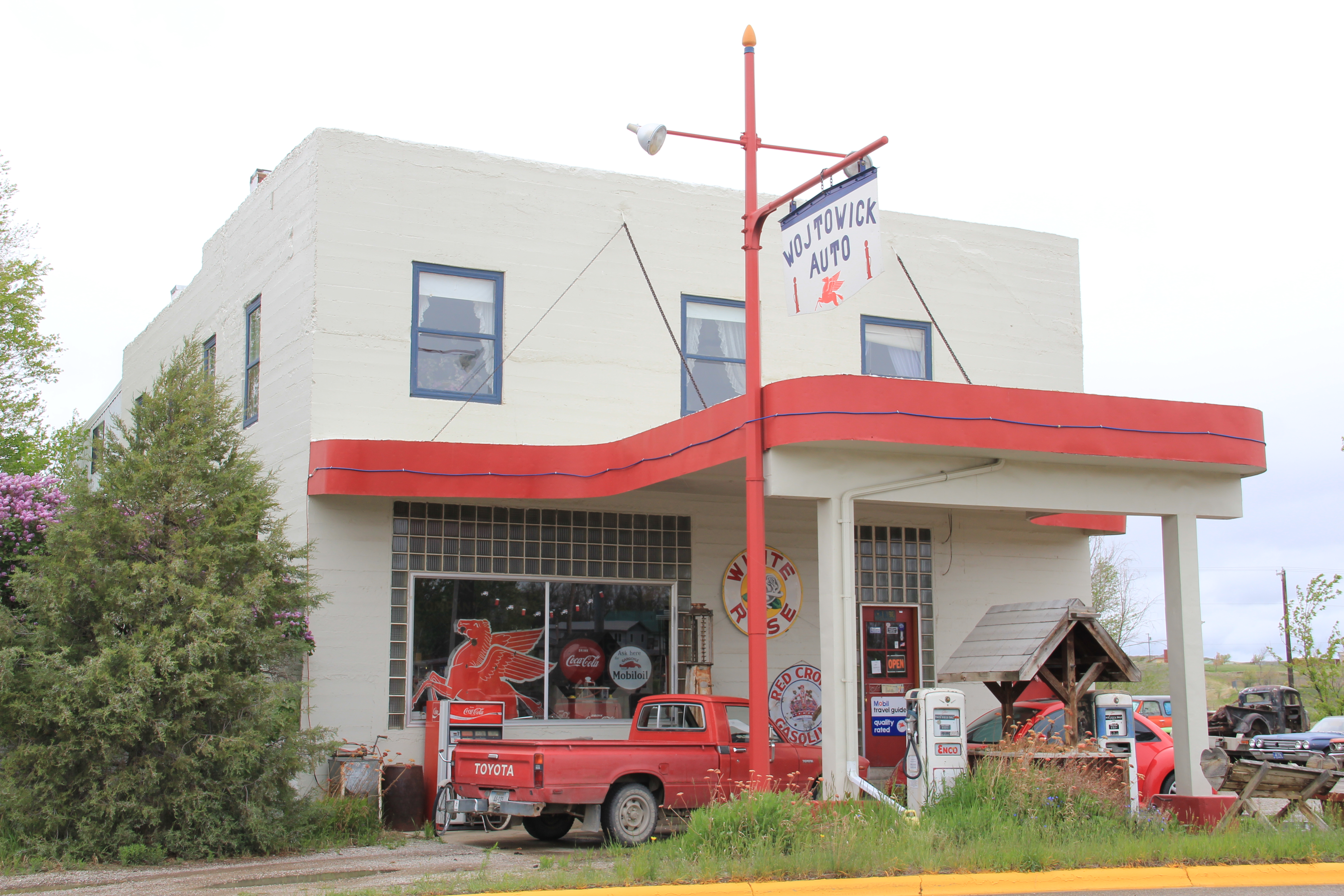
 The historic auto garage from c. 1920 above is one of the most significant landmarks left upon old U.S. 10, and I am glad it is still used for its original function in the 21st century.


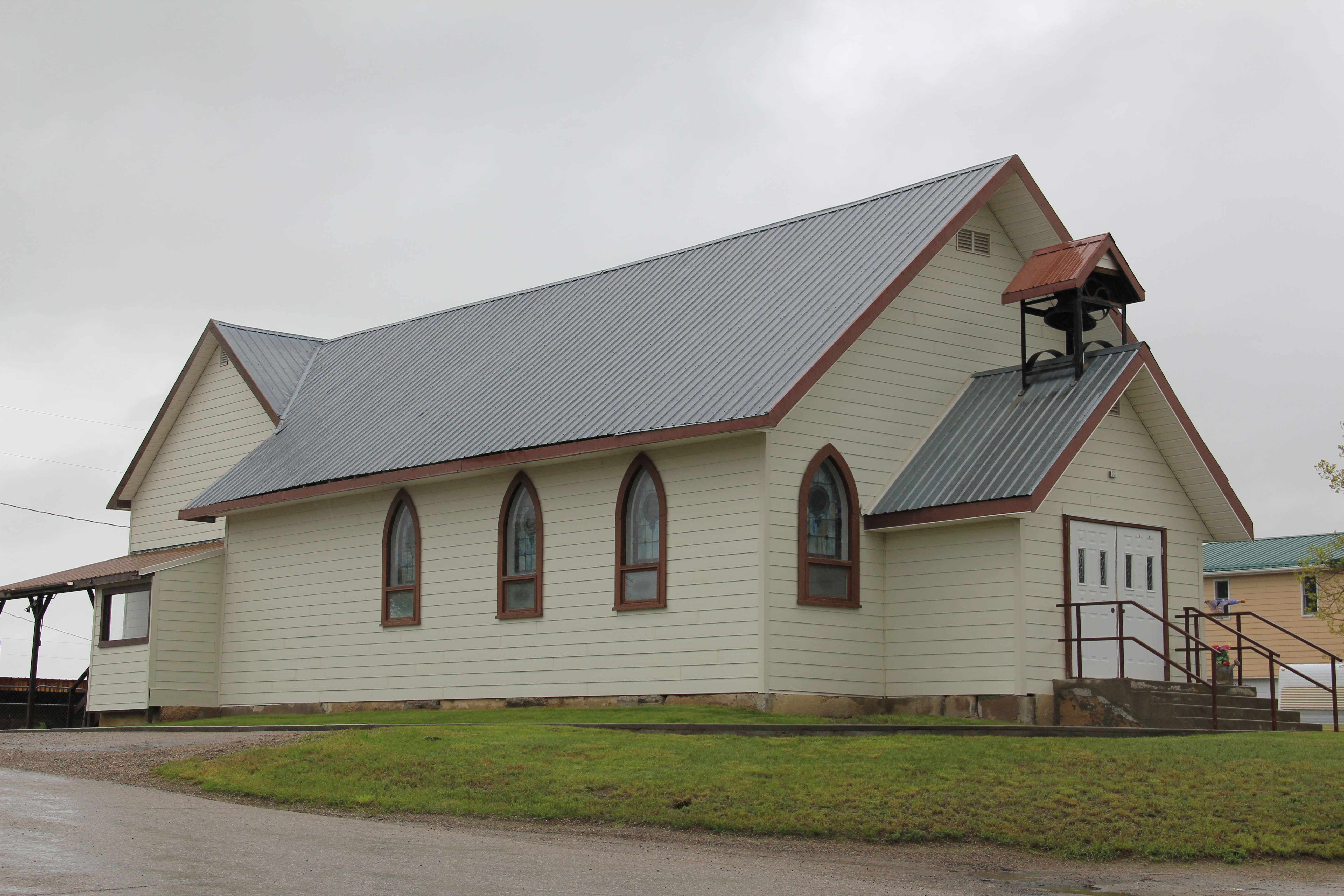
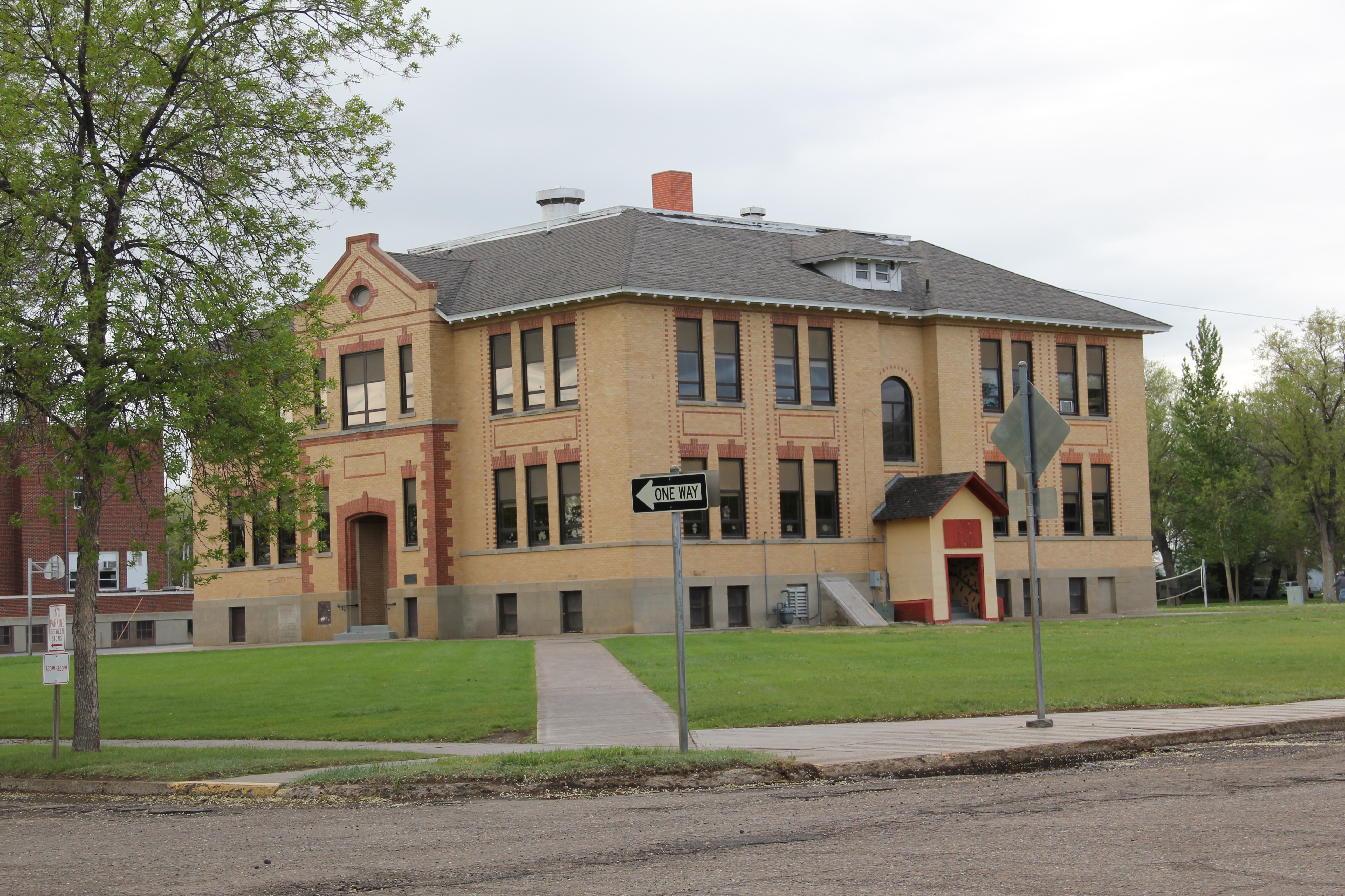
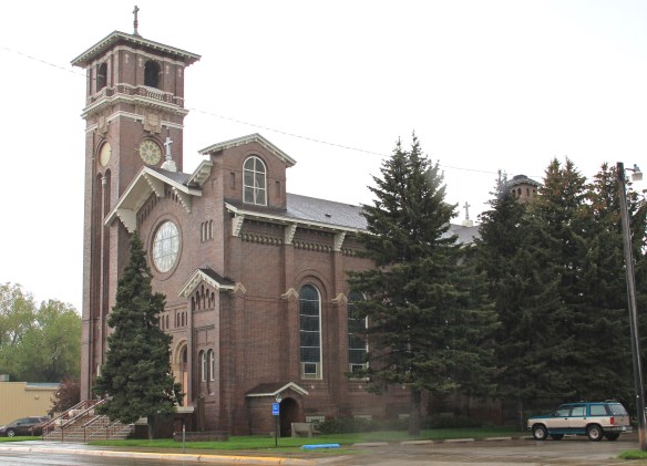
Community landmarks-fraternal lodges, the wonderful 1960s modernism of the Manhattan public school, and historic church buildings add character and a sense of stability to Manhattan.


Different variations on the Bungalow style characterize the town’s historic neighborhood. Buildings, like along old U.S. 10, have changed but still that sense of the early 20th century comes strongly across as you walk along Manhattan’s sidewalks.


At the same time, the new face of Manhattan is appearing in developments just south of the railroad corridor and in new construction facing the tracks. Both buildings “fit” into the town but stylistically and in materials belong more to the 21st century American suburb, especially when compared to the remaining vernacular commercial buildings.


Is Manhattan at a crossroads between its long history as a minor symmetrical-plan town along the Northern Pacific Railroad and its new place as one of the surrounding rural suburbs of the Bozeman area? Probably.
 But it has many positives in place to keep its character yet change with the times. Many residents are using historic buildings for their businesses and trades. Others are clearly committed to the historic residential area–you can’t help but be impressed by the town’s well-kept historic homes and well-maintained yards and public areas.


Like at Belgrade, historic preservation needs to have a greater focus here. Nothing in the town is listed in the National Register but as these photos suggest, certainly there is National Register potential in this town.
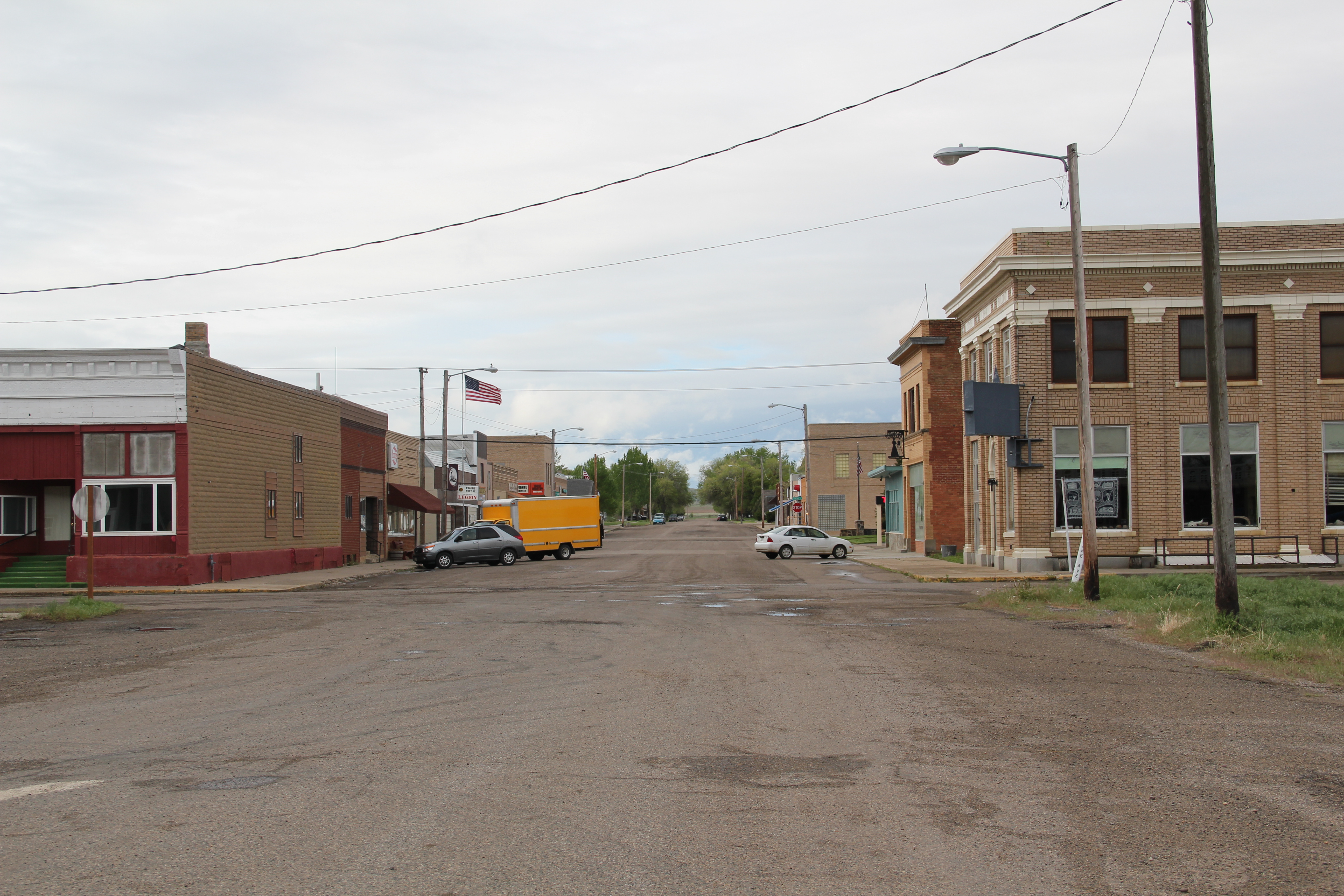
 From 1983-85 Belgrade became one of my favorite Northern Pacific railroad towns. Often I would leave the interstate here, stop at truly one of the great small town bars/cafes along the town’s railroad corridors, and then travel on old U.S. 10 (the town’s Main Street) on to Manhattan, Logan, and Three Forks before popping up on US 287 and continuing to home in Helena.
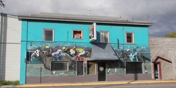

 Despite the boom, several landmarks remain. The Belgrade Community Church, built in 1904 as the town’s Presbyterian church, served in the 1980s as a joint church building for both the town’s Presbyterians and Baptists. This impressive Gothic Revival building had received several updates and additions in the mid-1970s. It became the Community Church in 1992 as the Presbyterians left and the American Baptist Church took over sole control of this historic church building.


 U.S. Highway 89 enters the Blackfeet Indian Reservation on its southern border, heading for its junction with U.S. Highway 2 and the reservation center of Browning. Before the junction, you cross the historic Two Medicine River, a historic corridor for the Blackfeet. To the west of the river crossing is a highway historical marker for Coldfeet School, a one-
 room school (not extant) built for Blackfeet children in 1933 during the New Deal. To the east of the highway river crossing, however, was one of the earliest schools (1889) on the reservation, the Holy Family Catholic
")


 This panorama of the mission site today shows that neither of the dormitories remain, although the historic frame barn and mill still stand (to the left) while the chapel is still a dominating element, and has been incorporated into present-day Blackfeet culture. It is in excellent shape.
 Another change is that the Blackfeet provide public interpretation of the site, through their own historical markers, which is extended into the adjacent historic cemetery, one of the most somber places in the region. The old mission is now part of the reservation’s heritage tourism effort.
 Returning to U.S. 89 and heading northwest, you head to the junction of U.S. Highway 2 and the town of Browning. The town is a center for reservation education, as shown by the new campus for the Blackfeet Community College.
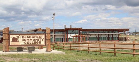 Here too is another historic Catholic Church, the Little Flower Catholic Church, built in 1931, from locally available stone in a Gothic Revival style. The congregation supports a small Catholic school next door.
 The Browning fairgrounds is an important Blackfeet recreation and cultural center, with this recent installation again providing public interpretation of Blackfeet culture.
 and U.S. 89, heading north. It created an appropriate, respectful way for the increasing number of auto tourists headed to Glacier National Park to learn about the Blackfeet in particular and Plains Indian culture in general. The famous mid-20th century anthropologist, John Ewers, had worked tribes to create the museum’s initial exhibits and collections. In the 21st century, the Blackfeet have developed additional institutions to take advantage of tourism through the nearby Glacier Peaks casino and hotel, a complex that has developed from 2011 to 2015.
 These new buildings are part of a long-term continuum of tourism in Browning, starting with this old concrete tipi, built originally as a gas station in 1934 and now converted into a coffee shop. And the Blackfeet
 Trading Post is a business found in all sorts of national park gateways–the classic place to get cheap souvenirs and t-shirts of all types, not to mention moccasins and all of the stereotypical material culture of Native American tourism in our country.
 the primary voice on what the park means, and how visitors can think about it today. The Native American presence on U.S. Highway 89 today is much more evident, with much more public interpretation, than in my travels 30 years ago.

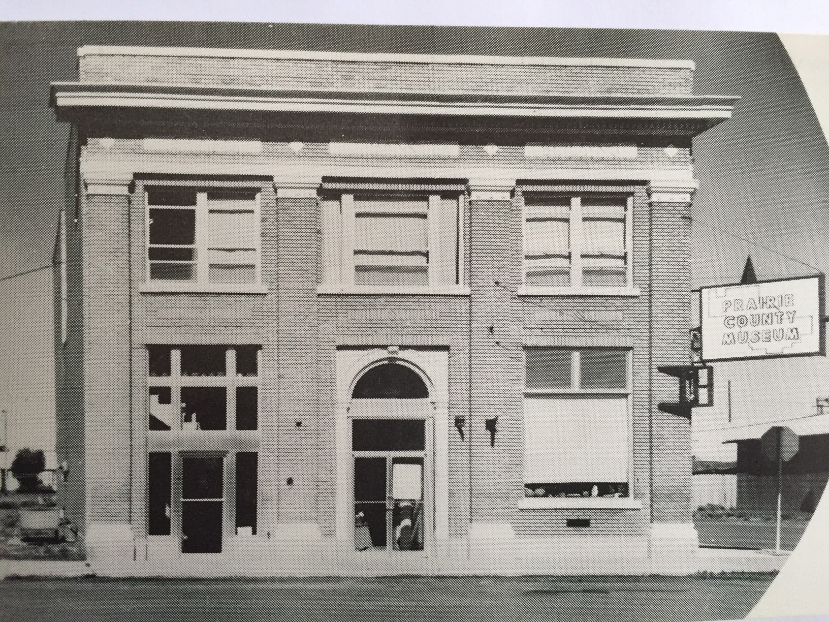
 Even the local museum was at the beginning stage, sharing quarters with the chamber of commerce in a Ranch-style building, like the park, on the outskirts of town.
 How times changed over 30 years. The museum is still at its location but adjacent is now a new facility, replicating a huge barn, expanded exhibits and artifacts about the region’s history.
 Markers about National Register-listed properties and districts exist throughout town, courtesy of the exemplary interpretive marker program of the Montana Historical Society.
 What happens within town is supported by recent interpretive marker installations at the highway rest stop as you enter Lewistown. From this spot there is an excellent view of the historic Lewistown airfield, listed in the National Register of Historic Places, for its significance in World War II aerial supply lines and defense.
 Not only can you see the historic district, you also can learn about its significance through an interpretive marker developed by Montana Department of Transportation.
 Steps away is another interpretive kiosk, related to an earlier, sadder military story, that of Chief Joseph of the Nez Perce Indians and their attempted flight to freedom in Canada in the 1870s. Both markers also emphasized the overall theme of transportation and how Lewistown has been crisscrossed by important historical events for centuries.
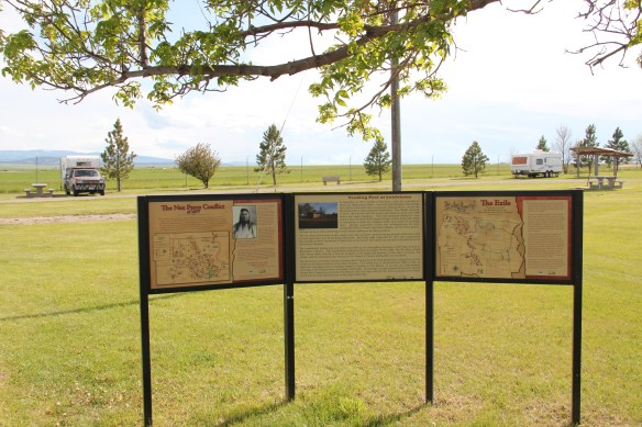
 Renaissance revival style from the prominent Montana firm of Link and Haire, and the historic early 20th century domestic architecture in the downtown neighborhoods.
 The town’s historic districts serve as anchors within the commendable trail system developed in Lewistown over the last 20 years. Local officials and representatives, working with the state government and abandoned railroad property and corridors, have established a series of trail loops that not only provide excellent recreational opportunities, as signified in this trail head near the Yogo Inn, but also paths for heritage tourists and
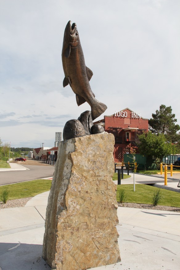 residents alike to explore the landscape, and how history in the 19th and 20th centuries created the place where they live and play today.
 As we will see later in western Montana, like in Butte and Kalispell, trail systems can be the best of heritage development because they take advantage of the state’s greatest asset–its landscape and sense of the Big Sky Country–and combine it with explanations of the layers of history you encounter wherever you go, creating an asset that visitors will like but that residents will cherish, because they can use it on a daily basis.
 Of course recreation, to my mind, is never complete unless there are nearby watering holes where one can relax and replenish, and Lewistown is rich in those too, being they the various classic roadside establishments along the highways entering and leaving town or the can’t miss taverns downtown, such as The Mint and the Montana Tavern, where the signs speak to the good times to come. Those properties are crucial for heritage development because they are important in themselves but they also are the places that get people to stop, and hopefully explore.
 Using multiple pasts to create new opportunities for communities: Lewistown has it going, and it’s far different world today than in 1984.