
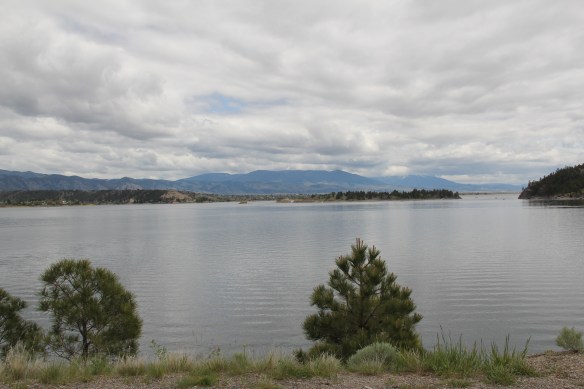
Canyon Ferry Lake is the third largest in Montana. A good part of it lies just east of Helena, the state capitol, while the bulk of the lake stretches southward into Broadwater County. Living in Helena during the 1984-85 state historic preservation plan survey, and often driving U.S. 287/12 which parallels the lake, you would think that the lake and its history would have played a major role in that initial plan. Such was not the case–rarely did I or anyone else give it much of a thought. Canyon Ferry Lake in 1984 was just 30 years old–it was not “historic.”

But its historic impact can’t be ignored. As part of the massive federal plan to conquer the Missouri River, the Pick-Sloan Flood Control Act of 1944 was justified by wartime conditions–it would create new sources of hydroelectric power–but actual construction did not get underway until the later 1940s and 1950s. Historians have studied the act’s disastrous impact on Native American tribal lands in the west, and the environmental consequences of building some 50 dams on the Missouri and its various tributaries.
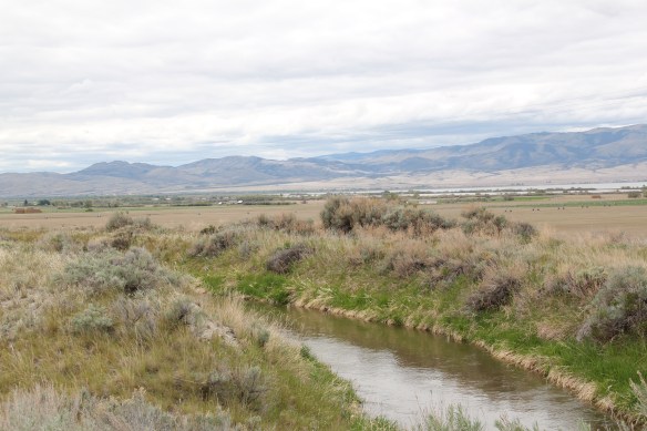
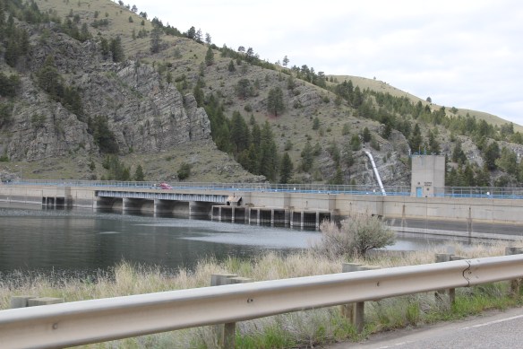
For Lewis and Clark County and Broadwater County, you can see the relationship between the dammed Missouri and irrigation, as shown above along Montana Highway 284, and you can find remnants of how the project displaced towns, landmarks, and people along the length of the river. No longer was the Missouri the river that the Corps of Discovery had traversed at the beginning of the 19th century.
 St. Joseph Catholic Church, perched now on a barren bluff facing the lake, was moved about 2.5 miles east to its present location in 1954. Originally near the river in what was then known as the Canton Valley settlement, the church building is one of the state’s oldest, dating to 1874-1875 and is listed in the National Register of Historic Places. The proud Gothic styled church is the remnant of one of the valley’s earliest settlements.

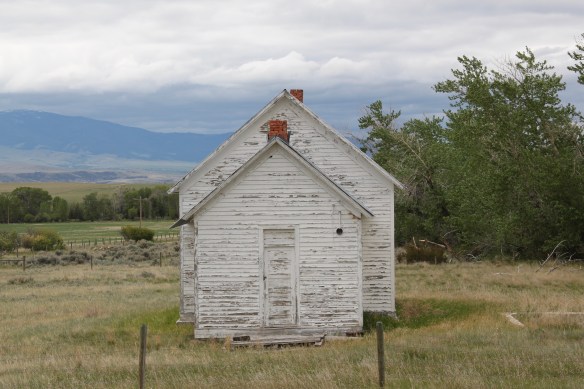
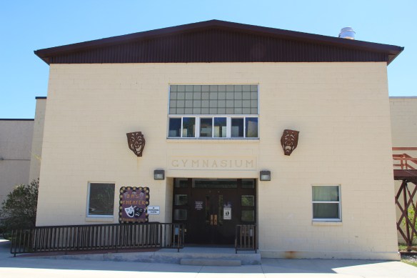
Not far from the church is another remnant of the early 20th century settlement boom during the early 20th century homesteading era after the creation of the county in 1897. Located along Montana Highway 284 this one-room school is typical of the type found throughout the state from 100 years ago, as adaptive by communities and school boards with the small gable-end extension creating storage space and a barrier between the cold winds of the outside and the inside of the classroom itself.


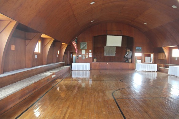
These vernacular buildings and landscapes compare starkly with what the U.S. Corps of Engineers built at Canyon Ferry in the 1950s. It is a Colonial Revival styled federal village–an architectural choice wildly out of step with regional traditions, and a reminder to anyone that here was the federal government, in the midst of the Cold War, placing its imprint on the land.


In 1984-1985 I ignored this new public landscape of a school, administrative building, work buildings, and village. Thirty years later, of course I see Canyon Ferry as a very distinct historic district, symbolic of the entire Pick-Sloan project and a significant example of an architectural aesthetic from the U.S. Corps of Engineers.
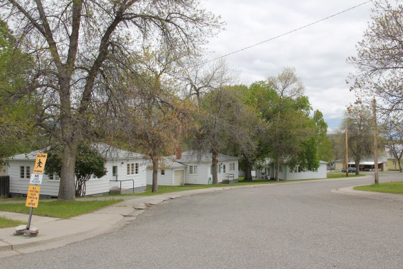


The Canyon Ferry headquarters of the mid-1950s is not listed in the National Register but it could be–an evocative grouping of buildings that helps to document that 60 years we were assured and more than a bit arrogant in our power and mastery of technology. We were convinced hat as we controlled the world, we could also control nature.


 In the early posts of this exploration of Montana’s historic landscape I spoke of the transformation that I encountered when I revisited Glendive, the seat of Dawson County, for the first time in about 25 years, of how local preservation efforts had kept most of the town’s railroad era landscapes alive while leading to the revitalization of its amazing number of historic residences from 1900 to 1950.
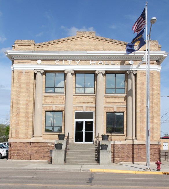 Let’s now turn our attention to public landmarks, old and more recent, that also deserve notice, starting with the magnificent Classical Revival-styled City Hall, one of the anchors of the Merrill Avenue historic district, which is listed in the National Register of Historic Places. Built in 1914, this all-in-one municipal building is an impressive architectural
 statement by the second generation of Glendale’s leaders that the town would grow and prosper during the homesteading boom of the first two decades of the 20th century. The architect was Brynjulf Rivenes of Miles City. His firm had so many commissions coming from eastern Montana and Yellowstone Valley patrons that by this time Rivenes operated offices in both Glendive and Miles City.
 Rivenes had earlier marked Glendive’s new emerging townscape with his Gothic design for the First Methodist Church, in 1909. Fifteen years later, he added another landmark church design with the Romanesque styled Sacred Heart Catholic Church (1924-1925).

 With recovery and the arrival of more and more automobile traffic from the late 1930s to the 1950s, many of the older buildings received mid-century updates. The remodels could
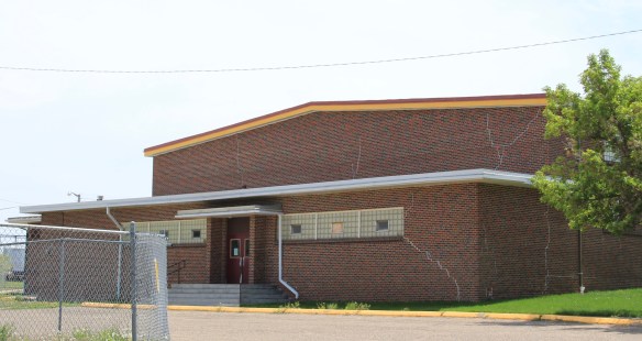
 The 1950s and 1960s brought many changes to Glendive. Post World War Ii growth both in the town and the many surrounding ranches led to expansion and remodeling at the historic Glendive Milling Company in 1955. When the historic districts for Glendive were designated in the late 1980s, preservationists questioned the inclusion of this important industrial/agricultural complex due to the changes of the 1950s. Viewed today, however, the mill complex is clearly a very significant historic site.
 More contemporary styled church buildings were also dedicated in the mid-century, such as the classic “contemporary” styling of the Assembly of God building, with classrooms at
 at the front rather than the rear, or the modified A-frame style of the First Congregational Church, which I shared in an earlier post on Glendive.
 Glendive is very much a blending of different 20th century architectural styles, reaching back into the region’s deep, deep past, as at Makoshika State Park, where the visitor
 center/museum is an excellent example of late 20th century modern style–clearly a building of the present but one that complements, not overwhelms, the beauty of the park itself.


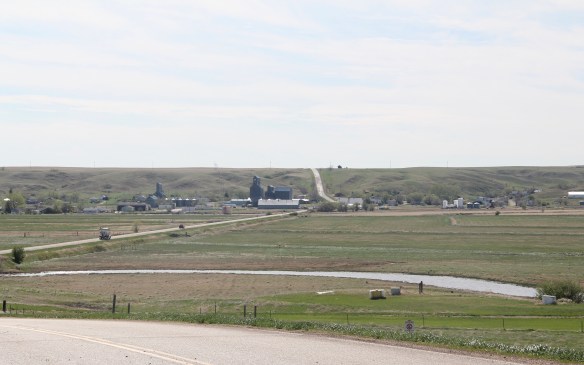
 The town’s grain elevators really are its landmark–the town is along the railroad spur and sits off Montana Highway 16–without the elevators you might not even notice it.
 Agriculture defines the use of the largest buildings of the town, and while it is a tiny place Reserve serves a much larger region of ranches located between Plentywood, the county seat, to the north and Medicine Lake, to the south.
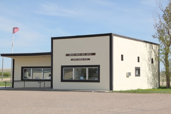 This larger audience for services in Reserve helps to explain the survival of the Reserve Post Office–so many tiny Montana towns have lost the one federal institution that had been there since the town’s beginning.
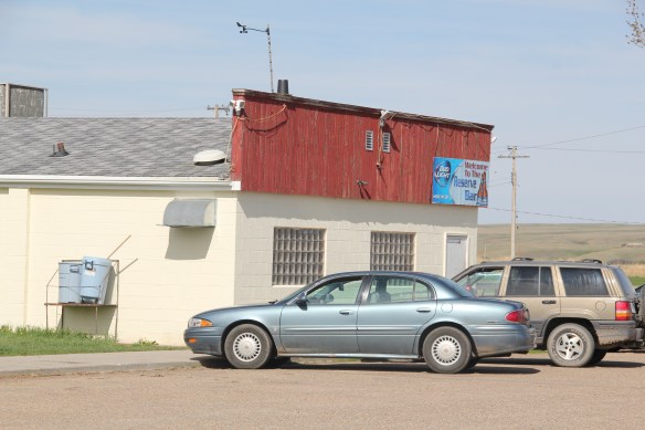 But naturally I will urge you to make a stop, however brief, at the Reserve Bar. This concrete block building, with its period glass block windows, is a friendly place, and a great way to talk with both residents and surrounding farmers.


 On the northwestern outskirts of Livingston is Mountain View Cemetery, another of the historic properties that certainly existed when I carried out the 1984-1985 fieldwork for the Montana state historic preservation plan, but since it was a cemetery, we as a field gave it, or any cemetery for that matter, little consideration thirty years ago.


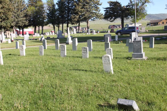


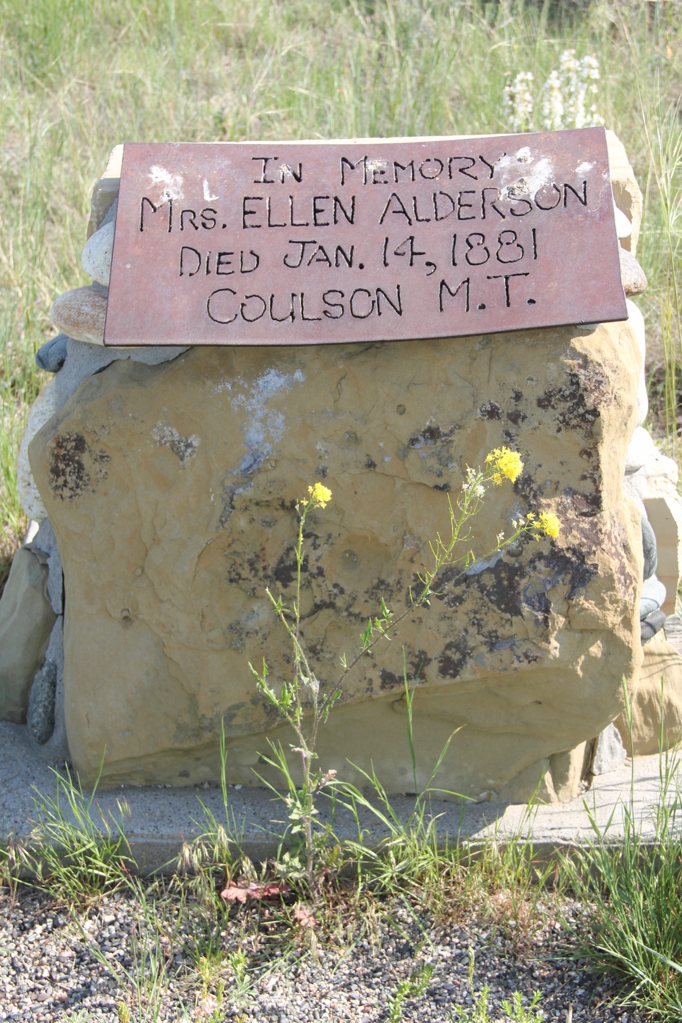
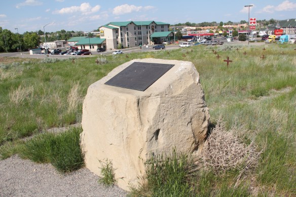
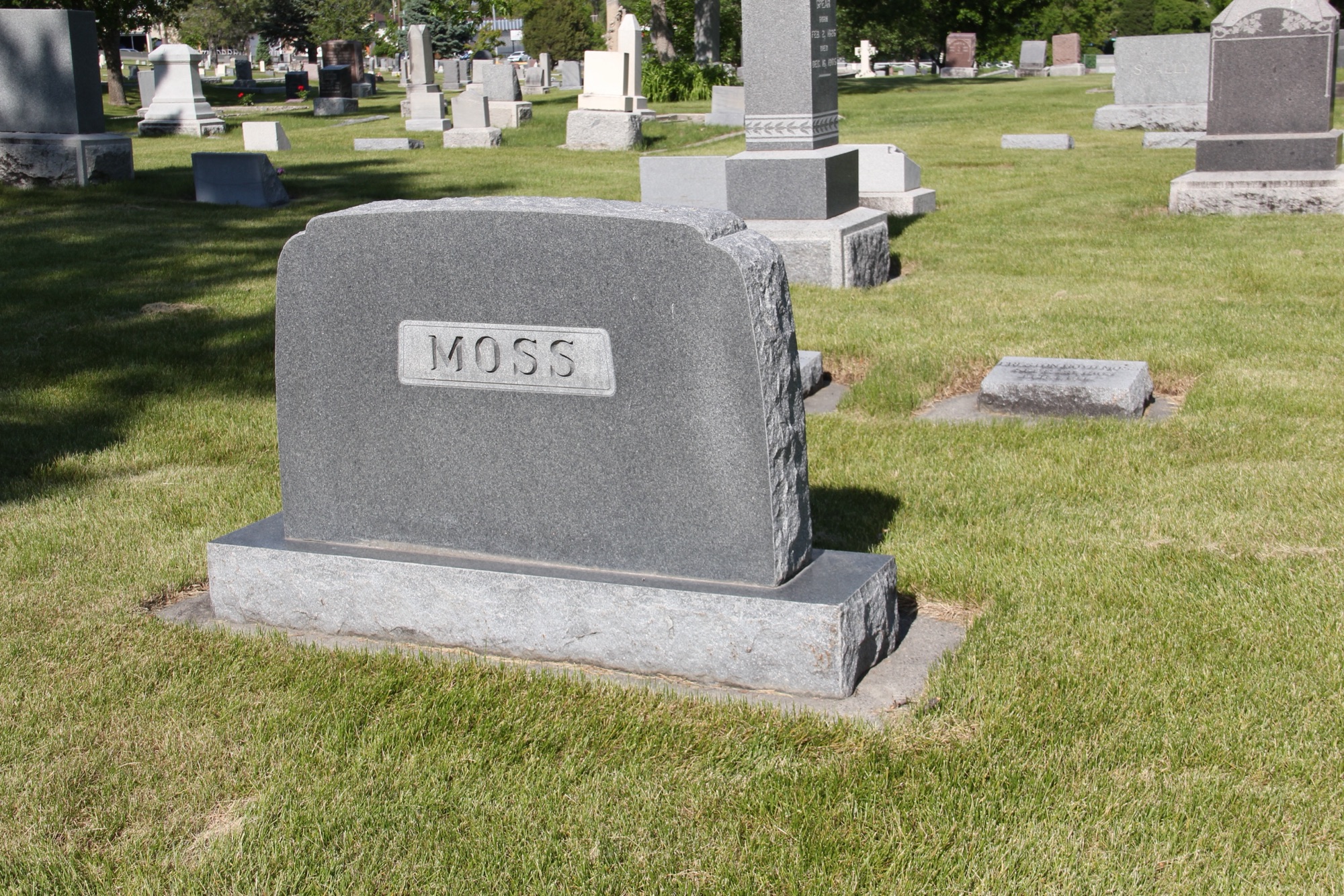
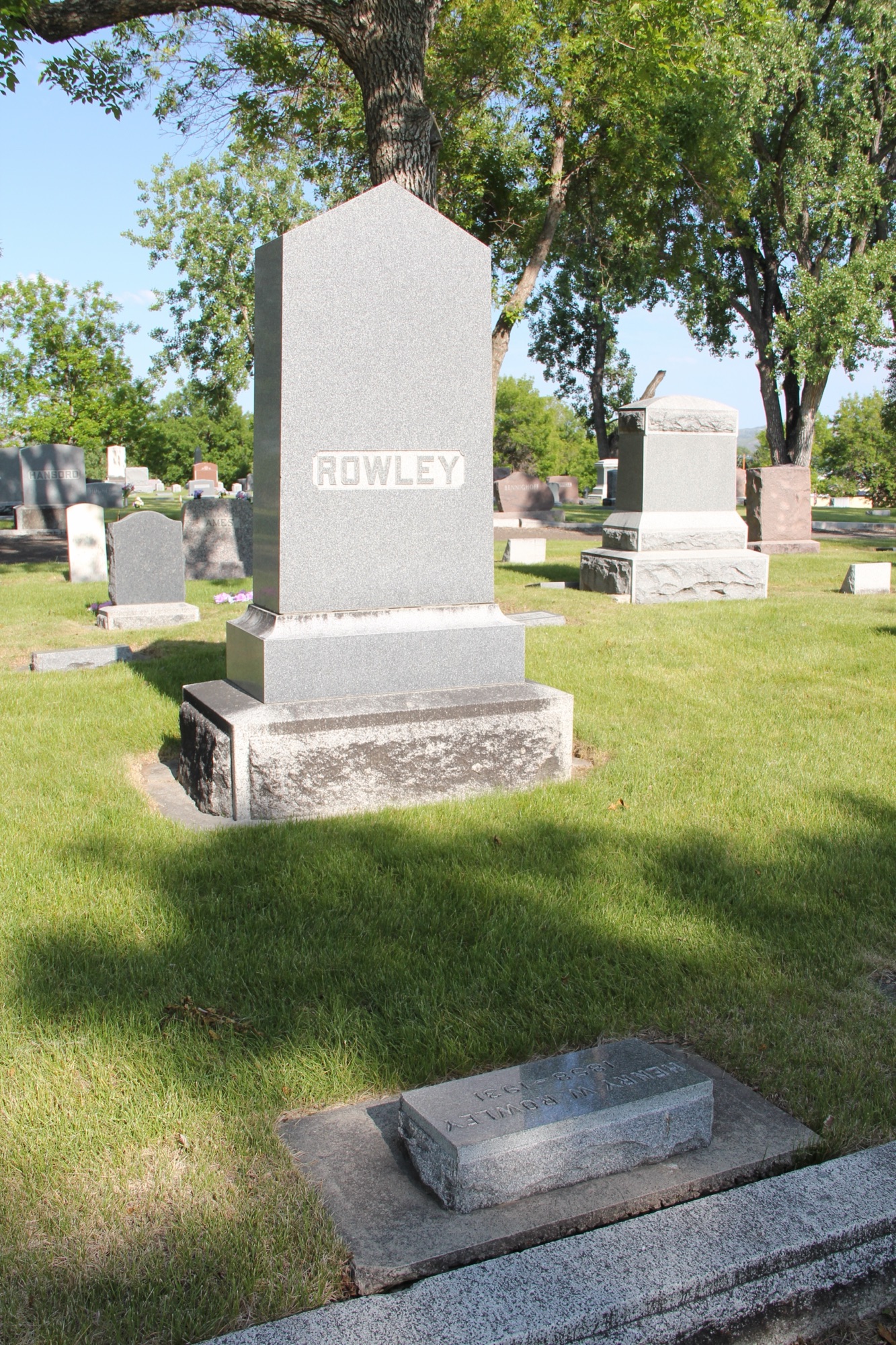

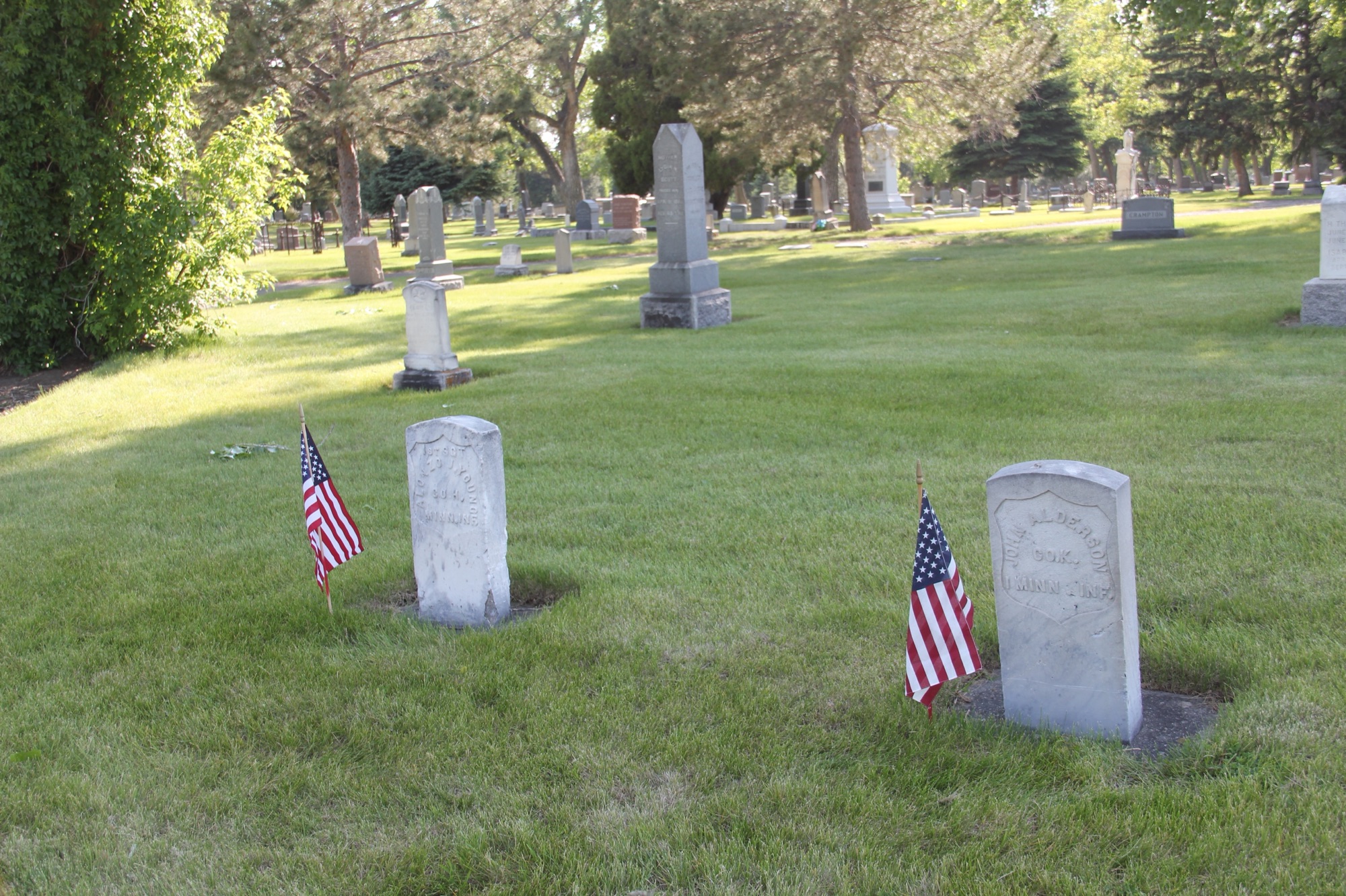
 This brief overview does not do justice to the city’s historic cemeteries. Certainly I gave Boothill consideration in the 1984-1985 and even wrote about it in both of my books on Billings history. But Mountview is a historic landscape that only now I recognize–and I hope to do more exploration in the future.
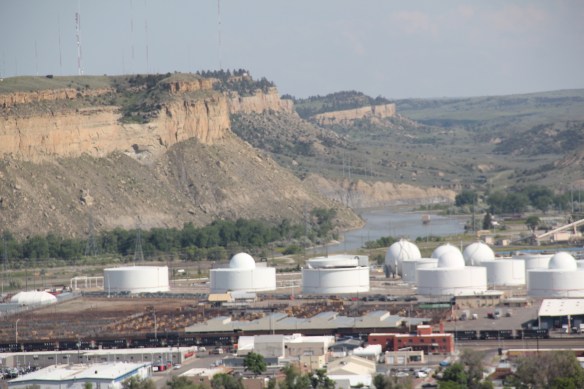
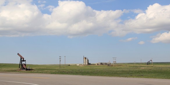
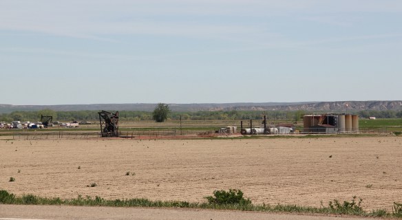
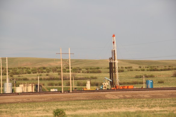
 The last post addressed Montana’s famous ranching landscape. Intermixed with the ranches, especially in the eastern third of the state, is a very different landscape of technology, one of pumps, storage facilities, pipelines, and refineries–the oil landscape of 20th and 21st century Montana.


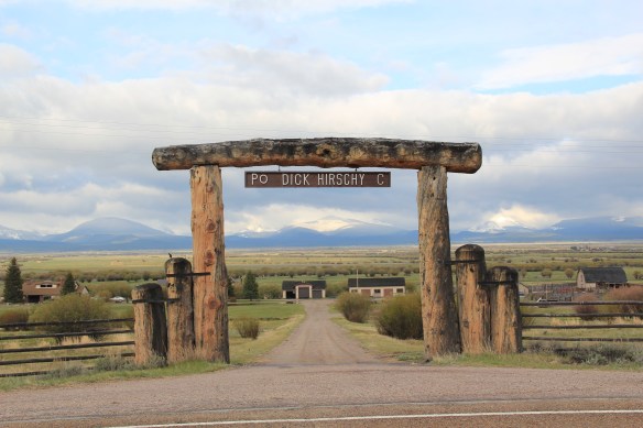 Here is a property category that could be, probably should be, a blog of its own–the ranching landscape of Big Sky Country. Historic family ranches are everywhere in the state, and being of rural roots myself, and a Tennessee Century Farm owner, the ways families have crafted their lives and livelihood out of the land and its resources is always of interest.
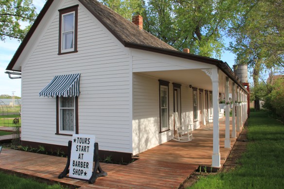 Preserving merely the ranch house, and adding other period buildings, is one thing. The massive preserved landscape of hundreds of acres of the Grant-Kohrs Ranch in the western end of Montana is a totally different experience. This National Park Service site


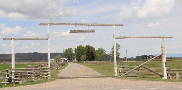
 The Bitter Root Stock Farm, established in 1886 by soon-to-be copper magnate Marcus Daly outside of Hamilton, came first. I can recall early site visits in 1985–that started the ball rolling but the deal wasn’t finalized for several years. All of the work was worth it.


 first glance, architecturally magnificent as the properties above. But in its use of local materials–the timber, the rocks from the river bluffs–and its setting along a historic road, this ranch is far more typical of the Montana experience.


