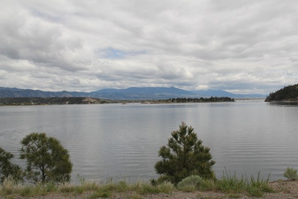
Canyon Ferry Lake is the third largest in Montana. A good part of it lies just east of Helena, the state capitol, while the bulk of the lake stretches southward into Broadwater County. Living in Helena during the 1984-85 state historic preservation plan survey, and often driving U.S. 287/12 which parallels the lake, you would think that the lake and its history would have played a major role in that initial plan. Such was not the case–rarely did I or anyone else give it much of a thought. Canyon Ferry Lake in 1984 was just 30 years old–it was not “historic.”

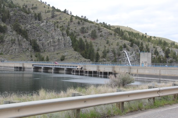
But its historic impact can’t be ignored. As part of the massive federal plan to conquer the Missouri River, the Pick-Sloan Flood Control Act of 1944 was justified by wartime conditions–it would create new sources of hydroelectric power–but actual construction did not get underway until the later 1940s and 1950s. Historians have studied the act’s disastrous impact on Native American tribal lands in the west, and the environmental consequences of building some 50 dams on the Missouri and its various tributaries.
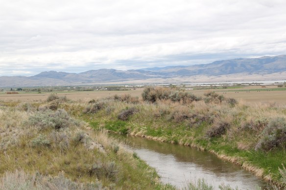
For Lewis and Clark County and Broadwater County, you can see the relationship between the dammed Missouri and irrigation, as shown above along Montana Highway 284, and you can find remnants of how the project displaced towns, landmarks, and people along the length of the river. No longer was the Missouri the river that the Corps of Discovery had traversed at the beginning of the 19th century.
 St. Joseph Catholic Church, perched now on a barren bluff facing the lake, was moved about 2.5 miles east to its present location in 1954. Originally near the river in what was then known as the Canton Valley settlement, the church building is one of the state’s oldest, dating to 1874-1875 and is listed in the National Register of Historic Places. The proud Gothic styled church is the remnant of one of the valley’s earliest settlements.

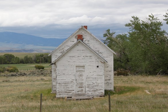
Not far from the church is another remnant of the early 20th century settlement boom during the early 20th century homesteading era after the creation of the county in 1897. Located along Montana Highway 284 this one-room school is typical of the type found throughout the state from 100 years ago, as adaptive by communities and school boards with the small gable-end extension creating storage space and a barrier between the cold winds of the outside and the inside of the classroom itself.


These vernacular buildings and landscapes compare starkly with what the U.S. Corps of Engineers built at Canyon Ferry in the 1950s. It is a Colonial Revival styled federal village–an architectural choice wildly out of step with regional traditions, and a reminder to anyone that here was the federal government, in the midst of the Cold War, placing its imprint on the land.


In 1984-1985 I ignored this new public landscape of a school, administrative building, work buildings, and village. Thirty years later, of course I see Canyon Ferry as a very distinct historic district, symbolic of the entire Pick-Sloan project and a significant example of an architectural aesthetic from the U.S. Corps of Engineers.
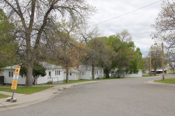


The Canyon Ferry headquarters of the mid-1950s is not listed in the National Register but it could be–an evocative grouping of buildings that helps to document that 60 years we were assured and more than a bit arrogant in our power and mastery of technology. We were convinced hat as we controlled the world, we could also control nature.