
 Since my earlier work on the state historic preservation plan in 1984-1985, few places in Montana had experienced such rapid population growth as Stevensville. The place had just over 1200 residents in the 1980s, and that increased to a mere 1221 in 1990. But now Stevensville is close to 2,000 in population.
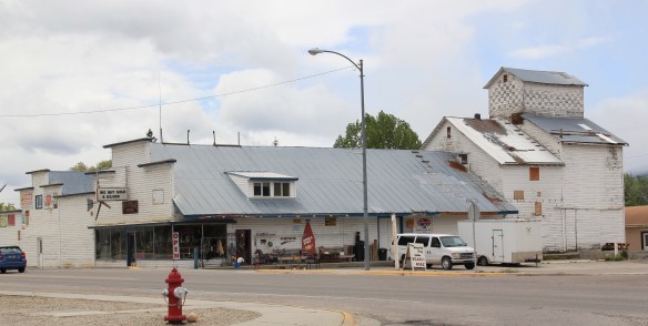 But enough is still here–like the historic mill complex above–that even as the business changes there is still the feel of an agricultural town at Stevensville. A major reason for the sense of continuity is the Stevensville Commercial Historic District, which has helped to protect the core of the town.
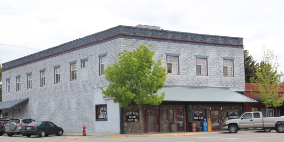
 Also, buildings such as the two-story Old Fellows Hall (1912) have been individually listed in the National Register, adding prominence to the historic district. The district has a range of one-story and two-story brick buildings, most from the agricultural boom of the first two decades of the 20th century. A notable exception is a two-story concrete block


Classical Revival-styled bank building, where the blocks are shaped to resemble masonry. You can find this architectural treatment across the state, most often in residential architecture. The Stevensville bank is an important commercial example.
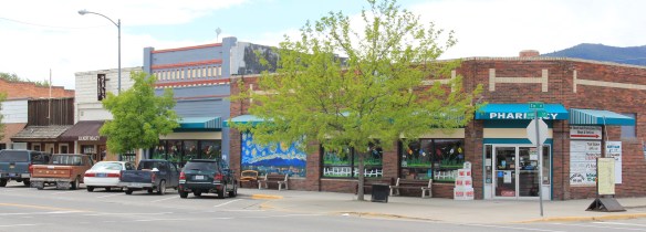 One major trend of Stevensville over 30 years is how buildings have been adapted to new uses. You expect that in a commercial area with a rising population, but here it has happened to such landmarks as the historic turn of the 20th century school building,
 which is now the United Methodist Church, while the two-story brick American Four-Square house below is the historic Thornton Hospital (1910), but now serves as the Stevensville Hotel. Both buildings are listed in the National Register.
 One area that I really failed to consider in the 1984-1985 work was the diversity and cohesiveness of the historic residential neighborhood. It too has been documented by a National Register historic district, but some dwellings, such as the impressive Classical Revival-styled Bass House have been individually listed.
 Another favorite dates to the 1930s and the impact of the International Style on Montana domestic architecture: the Gavin House, with its flat roof, its boxy two-story shape and bands of windows at the corners.
 Between these two extremes of early 20th century domestic design, Stevensville has an array of architectural styles, from the Folk Victorian to the more austere late 19th century vernacular to bungalows to revival styles.


Stevensville residents have used the National Register as an effective tool to commemorate their pasts but also to lay the foundation for a 21st century future in the midst of the some of the most rapid growth in the state.


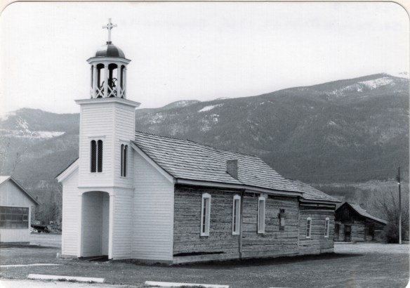

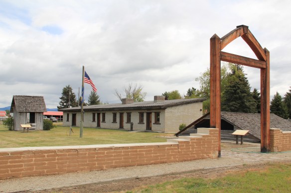 Much to my surprise I found a “pocket” park, set almost like you will find historic sites within major cities, except here the site is next to a working ranch. Not what I expected.
 But no complaints either. We are lucky that the ranchers shared a bit of the ranch and preserved some of the site’s history, especially the one remaining adobe barracks since this type of building and method of construction is so rare to find today. Most western forts are nothing more than archaeological sites.
 The barracks has much to say but public interpretation here has not improved to the degree found at several other state parks in Montana like at First Nations in Cascade County. We get enough of the story to tantalize the average visitor and perhaps confound the scholar who wants more context.
 The turn of the 20th century historic photo above shows how much was still here about 100 years ago but a storm ripped the roof off one of the barracks, and after all the construction Owen used here over 150 years ago was never meant to last for long. Traders wished to make an outpost impressive–why would anyone trade with a business that lacked substance?–but it made no business sense to build anything grandiose.


 that the open views to the greater landscape which remain as they were in the past might not last in the rapidly suburbanizing upper Bitterroot Valley. The Fort Owen park is still an invaluable national story set within a working ranch–but what if it becomes a pocket park surrounded by a 21st century suburb? The chance for meaningful archaeology–not to
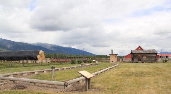 rebuild the fort as what has happened at its cousins in Fort Benton and Fort Union–but to understand much more about the formative period of Montana history: that could be lost forever.
 Luckily at St. Mary’s Mission enough land has been secured that even as Stevensville expands (its population has jumped over 50% since 1984), perhaps the historic site’s future will not be that of a pocket park.


 Let’s hope that future development in and around the historic mission keep these vistas as they are–for it is here that the modern story of the Bitterroot–meaning the last 175 years–begins.


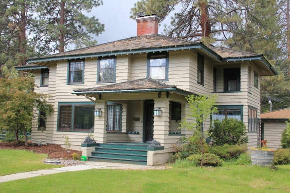 South 3rd Street also has a strong set of bungalows, Montana style, which means that they take all sorts of forms and use all sorts of building materials.


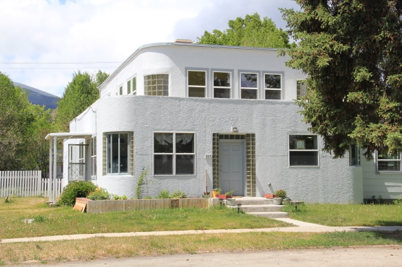
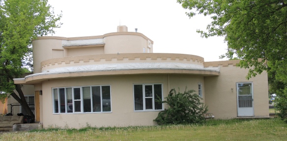


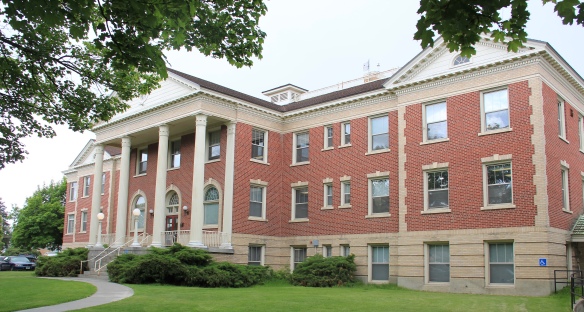 My favorite set of public buildings in Hamilton got back to the theme of town and ranch and how community institutions can link both. The Ravalli County Fairgrounds began on
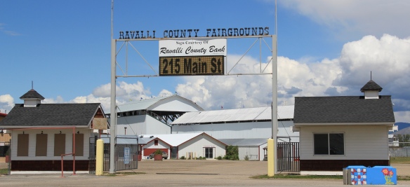 40 acres located south of downtown on the original road to Corvallis in 1913. Its remarkable set of buildings date from those early years into the present, and the Labor Day Rodeo is still one of the region’s best.


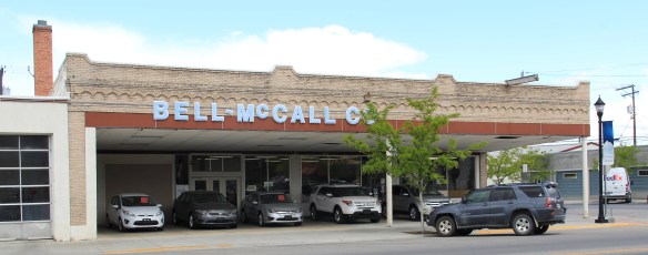


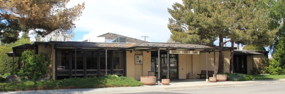 contemporary styling of the Ravalli County Bank or the “new” county courthouse of 1976, a building that I totally dismissed in 1984 but now that it has reached the 40 year mark the design seems so much of its time, and a very interesting local reaction by the firm of Howland and Associates to the ne0-Colonial Revival that gripped so much of the nation during the American bicentennial.

 Adaptive reuse had put some buildings back into use, such as the historic Creamery, once such an important link between town and ranch in the county. Other landmarks didn’t


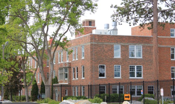
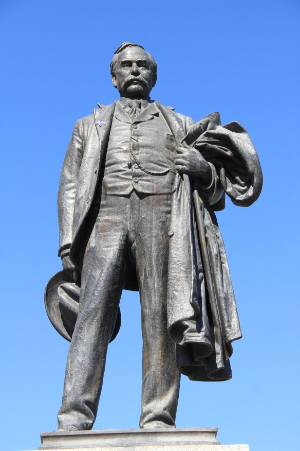 Marcus Daly, the copper magnate of Butte and Anaconda, certainly put his stamp on the landscape of Silver Bow and Deer Lodge counties. But not until the early 1980s did most Montanans understand that Daly too had shaped the landscape of the Bitterroot Valley with the creation and expansion of his Bitterroot Stock Farm, starting in 1886 and continuing even beyond his death in 1900.


 to have a place, on the other side of the divide from his dark, dank, smelly mining towns, where he and his family could escape and enjoy Montana’s open lands and skies. The ranch began with the purchase of the Chaffin family homestead in 1886. Daly immediately set forth to remodel and expand the older ranchhouse yet those changes only lasted three years when Daly replaced the first house with a rather grand and flamboyant Queen Anne-styled mansion and named it Riverside. Daly died in 1900 and Riverside’s last grand remodeling was guided by his wife, who looked to architect A. J. Gibson of Missoula to design a Colonial Revival-on-steroids mansion, which referenced the recent Roosevelt family mansion on the Hudson River in New York State.
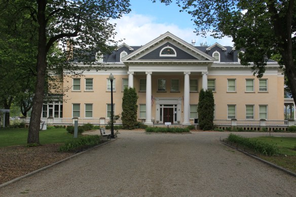 There is really nothing in the world of domestic architecture in Montana to compare to the Daly family’s Riverside estate. As we made our plans for the state historic preservation survey in 1984, I never imagined gaining access to this mysterious place. Then, suddenly, the owners decided to offer the property to someone–the state preferably but locals if necessary–who could transform it into a historic house museum and still working farm.

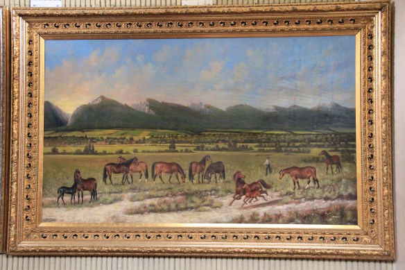


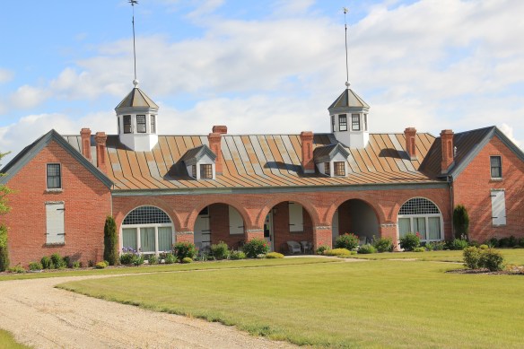 Indeed not far away is a 21st century sign of the super-rich and their imprint on the Montana landscape: the Stock Farm Club, a private, gated community for those who can afford it–and probably 99% cannot.
 As the historic promotional image above conveys, the Bitterroot Valley is an agricultural wonderland, but one dependent on irrigation and agricultural science. This image is on display at the Ravalli County Museum, which is located in the historic county courthouse from the turn of the 20th century.
 Local ranchers and boosters understood the economic potential of the valley if the land was properly nurtured. Some of the best evidence today is along the Eastside Highway,


 railroad spur through the valley. With its Four-Square style dwelling, the Bailey Ranch, immediately above, is a good example of the places of the 1910s-1920s. The Popham Ranch, seen below, is one of the oldest, dating to 1882.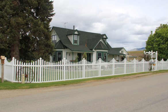
 One major change in the Bitterroot over 30 years is the fruit industry has diminished and how many more small ranches and suburban-like developments crowd the once expansive agricultural wonderlands of the Bitterroot. The dwindling number that remain deserve careful attention for their future conservation before the working landscape disappears.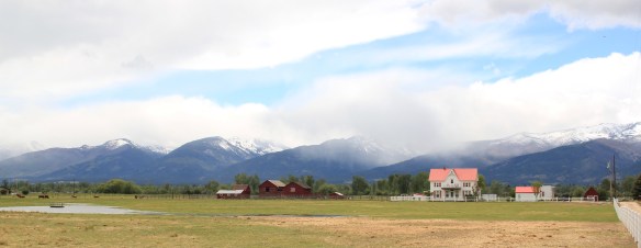
 When most people think of Ravalli County they think of the ever suburbanizing northern half, as you take U.S. Highway 93 south–a four lane highway–from Missoula and encounter the new suburbs of Florence. But if you use U.S. Highway 93 from the southern end, you find a very different place, one that starts with Ross’ Hole.
 There are few more beautiful places in the state, even on this cloudy day in 2012, the hole beckoned, as it has for centuries. In western American history, its importance has multiple layers, from ancient Native American uses to the peaceful encounter between Flathead Indians and the Lewis and Clark Expedition in 1805. Without the horses the expedition acquired from the Flathead, its journey would have been much more difficult, if not impossible.
 Montana “cowboy” artist Charles M. Russell painted the scene as a prominent historical mural in the House of Representatives chamber at the Montana State Capitol in 1912. His composition, as I used to like to point out when I gave state capitol tours in 1982, emphasized the centrality of the Native Americans in the region–the expedition were minor characters, in the background of the painting’s right side. The place name Ross’s Hole refers to Hudson Bay Company trader Alexander Ross who traded there in 1824. Hole was a trader and trapper term for mountain valley.
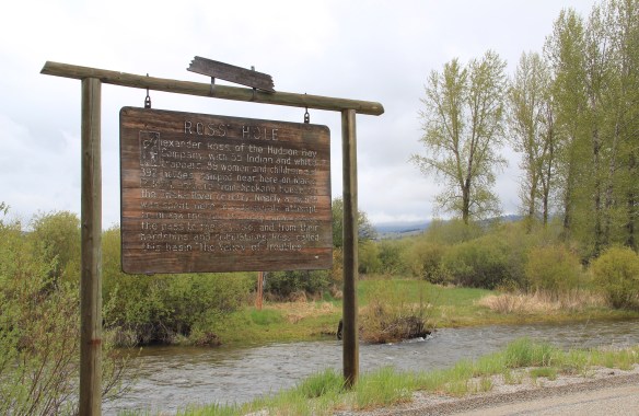 At the time of the 1984 survey, Ross’ Hole was interpreted by this single wooden sign, now much worse for the wear of the decades. But like many important landscapes in the state, today you find a rather full public interpretation in a series of markers sponsored by the Montana Department of Transportation, the U.S. Forest Service, and the Lewis and Clark National Historic Trail.


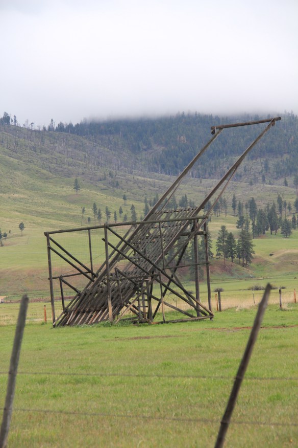 Any trip to Ross’ Hole would not be complete with a stop, however brief, at the roadside architecture-a log bungalow–home to the Sula Community Store, which can basically provide you with about anything you might need while traveling on U.S. Highway 93.
 And the coffee is always hot, and strong.
 Beaverhead County’s history has deep roots, perhaps never deeper than at the high mountain passes that divide it from neighboring Idaho. We have already taken a look at Monida Pass, but now let’s shift to the western border and consider Lemhi Pass (Lemhi Road is the image above) and Bannock Pass, both at well over 7000 feet in elevation.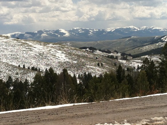
 Lemhi Pass is a magnificent place, reached by a wide dirt road that climbs up to 7300 feet. The roadbed is modern, and lies over a path worn by centuries of Native Americans who traveled this path between mountain valleys in present-day Montana and Idaho. That deep past is why the more famous Lewis and Clark Expedition took this route over the Bitterroot–and the Corps of Discovery connection is why the pass has been protected in the 20th century. The pass is also connected with Sacajawea, since her tribe, the Shoshone, often used it to cross the mountains.

 This kiosk by the U.S. Forest Service is part of the new public interpretation of the property, both at the start of the pass to the top of the mountain itself at the Sacajawea Memorial Area.
 Bannock Pass, comparatively has received little in public interpretation. Unlike Lemhi, it is not a National Historic Landmark associated with Lewis and Clark. For today’s travelers, however, it is a much more frequently used way to cross the Rockies despite its 300 foot higher elevation. A historic site directional sign leads to one interpretive


 It was a snowy Memorial Day when I crossed Lost Trail and Chief Joseph passes on my way to Big Hole Battlefield. Once again I was impressed by the recent efforts of the U.S. Forest Service to interpret the epic yet tragic journey of Chief Joseph and the Nez Perce in 1877, especially the Trail Creek Road that parallels Montana Highway 43.


 Canada was underway. Today the Nez Perce National Historic Trail and Park mark that journey into history. The park today is frankly an amazing transformation, from a preserved battlefield in the early 1980s that only hinted at the true facts of history to a modern of battlefield interpretation, one that does justice to history and to the Nez Perce story. One only wishes that more western battlefields received similar treatment.
 Dillon is not a large county seat but here you find public buildings from the first third of the 20th century that document the town’s past aspirations to grow into a large, prosperous western city. It is a pattern found in several Montana towns–impressive public buildings designed to prove to outsiders, and perhaps mostly to themselves, that a new town out in the wilds of Montana could evolve into a prosperous, settled place like those county seats of government back east.


 The Dillon City Hall also belongs to those turn-of-the-20th century public landmarks but it is a bit more of a blending of Victorian and Classical styling for a multi-purpose building that was city hall, police headquarters, and the fire station all rolled into one.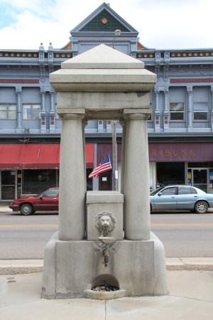
 A New Deal era post office introduced a restrained version of Colonial Revival style to Dillon’s downtown. The central entrance gave no hint to the marvel inside, one of the
 state’s six post office murals, commissioned and executed between 1937 and 1942. The Dillon work is titled “News from the States” painted by Elizabeth Lochrie in 1938. It is a rarity among the murals executed across the country in those years because it directly addressed the mail and communication in early Beaverhead County. Ironically, few of the post office murals actually took the mail as a central theme.
 The New Deal also introduced a public modernism to Dillon through the Art Deco styling of the Beaverhead County High School, a building still in use today as the county high school.
 A generation later, modernism again was the theme for the Dillon Middle School and Elementary school–with the low one-story profile suggestive of the contemporary style then the rage for both public and commercial buildings in the 1950s-60s, into the 1970s.
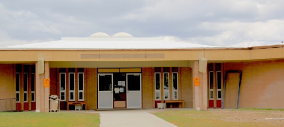
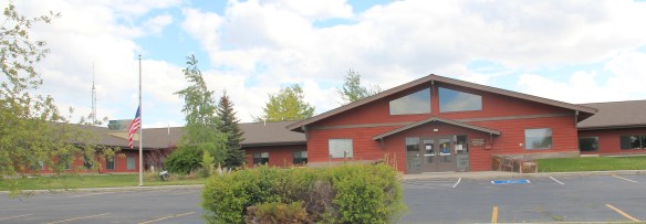
 The contemporary style also made its mark on other public buildings, from the mid-century county office building to the much more recent neo-Rustic style of the Beaverhead National Forest headquarters.


 This birds-eye view of the town is at the Beaverhead County Museum at the railroad depot. It shows the symmetrical plan well, with two-story commercial blocks facing the tracks and depot, which was then just a frame building. To the opposite side of the tracks with more laborer cottages and one outstanding landmark, the Second Empire-style Hotel Metlen. The Metlen, listed in the National Register of Historic Places, remains today, one
 of the state’s best examples of a railroad hotel. I recognized the building as such in the 1984 state historic preservation plan and my book, A Traveler’s Companion to Montana History, included the image below of the hotel.
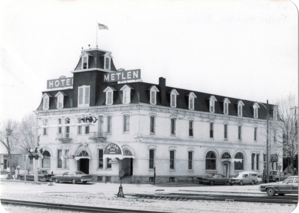 This three-story hotel served not only tourists but especially traveling businessmen–called drummers because they were out “drumming up” business for their companies. The interior has received some restoration work in the last 30 years but little has changed in the facade, as they two images, one from 1990 and the other from 2012, indicate.


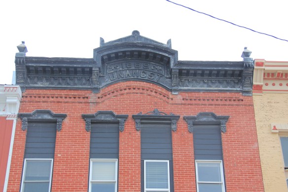
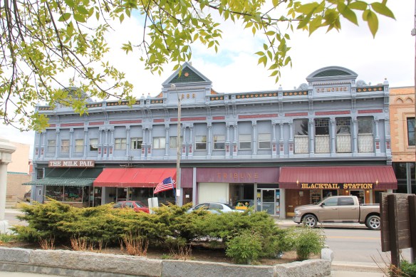
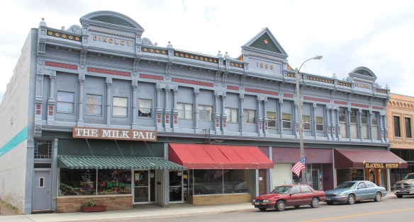
 built environment has many stories to tell.
