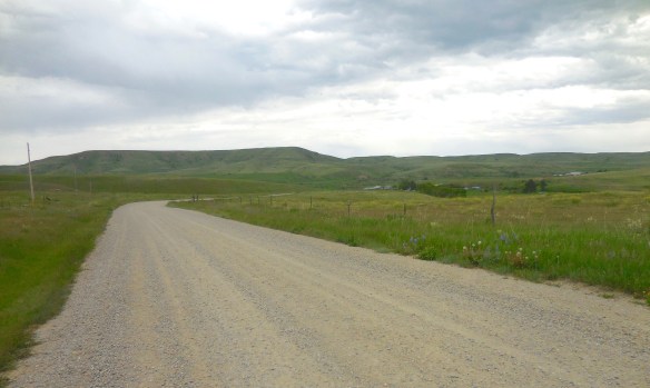
When I began my fieldwork for the state historic preservation plan in 1984, there was one spot I was particularly eager to visit: Gold Creek and Pioneer on the west side of Powell County. Granville Stuart and Conrad Kohrs both loomed large in the history of Montana; they were associated, respectively, with the two mines. Stuart was been among the party who first struck gold there in 1858; Kohrs later owned the Pioneer mines. Plus the two mining areas were counted among the state’s earliest. Then one winter in 1982 traveling along Interstate Highway I-90 I had looked to the west and saw the faded wooden signs marking what they called the first gold strike in Montana–one of 1858 even before the Mullan Road had been blazed through the area. Not far away was
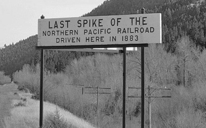
another nondescript sign–this one about the last spike of the Northern Pacific Railroad–it too was visible from the interstate. I had to know more.

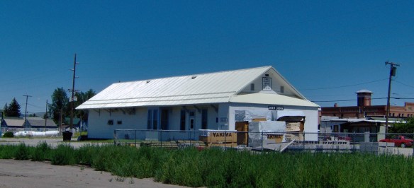
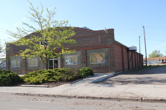
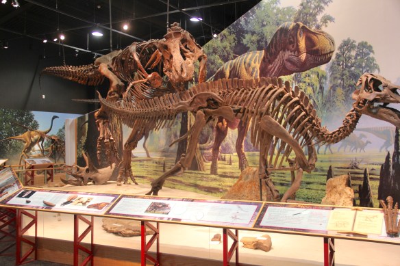
Gold Creek store and post office, 1984.
What I found was not much, at least anything much that could become part of public interpretation. The folks at the general store and post office, where exterior signs proudly noted that it began in 1866, told me that the granite marker for the Gold Creek strike was on private property–well maintained but something no one was interested in doing more with. The last spike for the Northern Pacific Railroad was a similar story. Once that spot was all in the national news. Now it was a place on the railroad right-of-way and Burlington Northern wasn’t interested in visitors being on such a heavily traveled section.
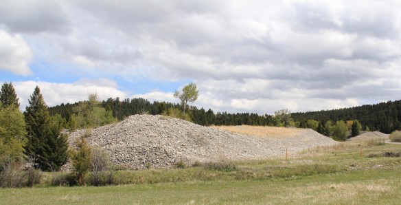
The road west of Gold Creek led into the later placer mining of the Pioneer Mining District (established 1866)–with the high mounds of tailings coming from much later efforts to dredge every bit of precious metal from the property.
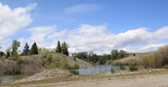 Ranchers had taken bits of older buildings from Pioneer and incorporated them into later structures between the mining district and Gold Creek. Pioneer as a ghost town barely existed then and little marks its past except for the scars of mining.


Gold Creek has existed since the dawn of Montana Territory but it has rarely caught a break–its monument about mining is landlocked on private property. The interpretive markers about the Northern Pacific’s last spike are on the interstate at the Gold Creek Rest Area. Much of what is there today dates to its last “boom” when the Milwaukee Road built through here c. 1908, but as regular readers of this blog know, the success of the Milwaukee and short lived and by 1980 it was bankrupt. Today little is left except the roadbed, as is the case, almost, in Gold Creek.
I say almost because the Milwaukee Road located one of its electric transmission buildings in the middle of Gold Creek, along the electrified line. Abandoned when I surveyed the town in 1984, the building has been restored and put back into business.

Milwaukee Road Electric Station facing the Northern Pacific line.
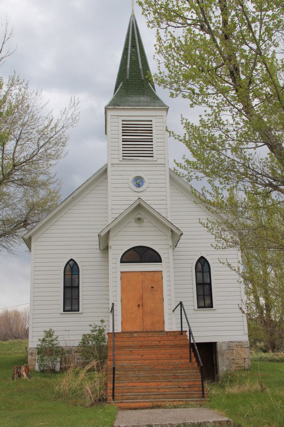
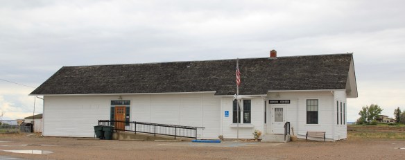
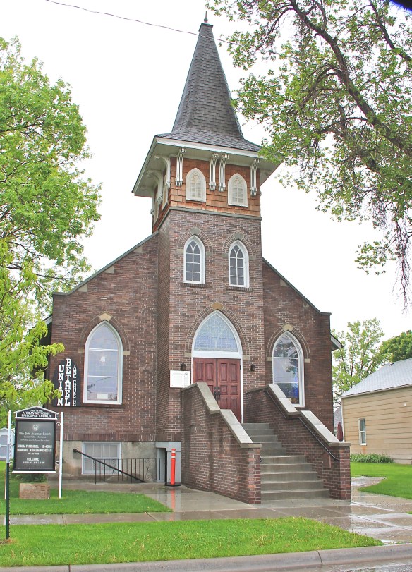
Two community institutions still shape Gold Creek. On the “far” end of town is the St. Mary’s Mission Catholic Church, built c. 1910, with its original Gothic design still intact.
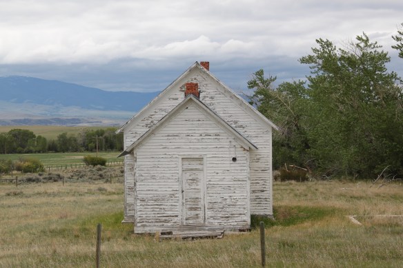
 But the most important community institution (yes, the Dinner Bell Restaurant out on the interstate exit is important but it is a new business) is the Gold Creek School, a rather remarkable building in that residents took two standard homestead era one-room schools and connected them by way of a low roof “hyphen” between the front doors.
 Adaptation and survival–the story of many buildings at Gold Creek and Pioneer. Historical markers are scarce there but the history in the landscape can still be read and explored.


 deteriorating in the mid-1980s but a determined effort to save the building and use it as an anchor for the Montana Avenue historic district has proven to be a great success in the 21st century.
 Milwaukee Road depot there, since Harlowtown was such an important place in the railroad’s history as an electric line.


 Fort Kipp Cemetery, above, is one of those place, nestled on the river bluffs overlooking the Missouri River. On a larger scale but still intimate, personal, and compelling is the city cemetery of Red Lodge, hundreds of miles away. Here surrounded by the mountains


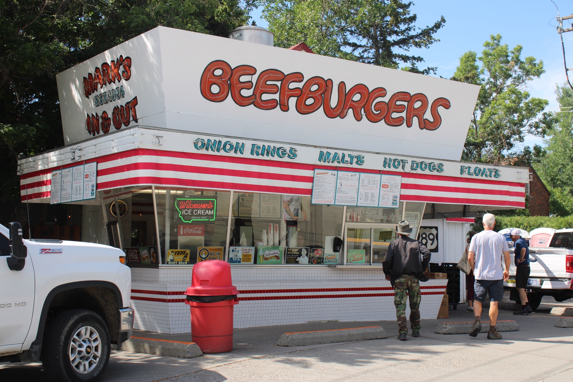
 The Main Drive-In in Conrad is located on the historic federal hi way (U.S. 91) and still draws in customers despite competition from chains and the diversion of most traffic to Interstate Highway I-15.
 At Scobey, Shu Mei’s Kitchen converted an earlier drive-in into a family restaurant on Montana Highway 13 in northeast Montana.

 It’s not surprising that Lewistown, in the middle of the state faraway from the interstate system, has several still operating roadside establishments from the mid-20th century, such as the Wagon Wheel Drive-In (above–and being a southerner I loved the sign that bragged “we have MT Dew”) and the Dash Inn (below), which opened in 1952.
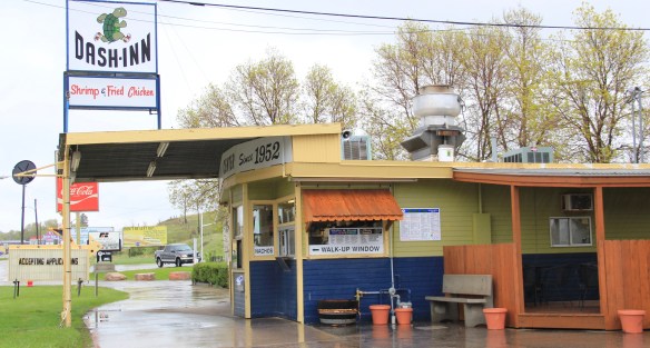


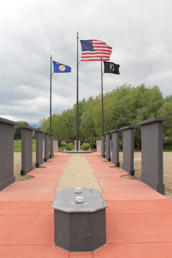
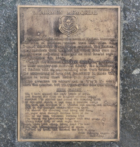
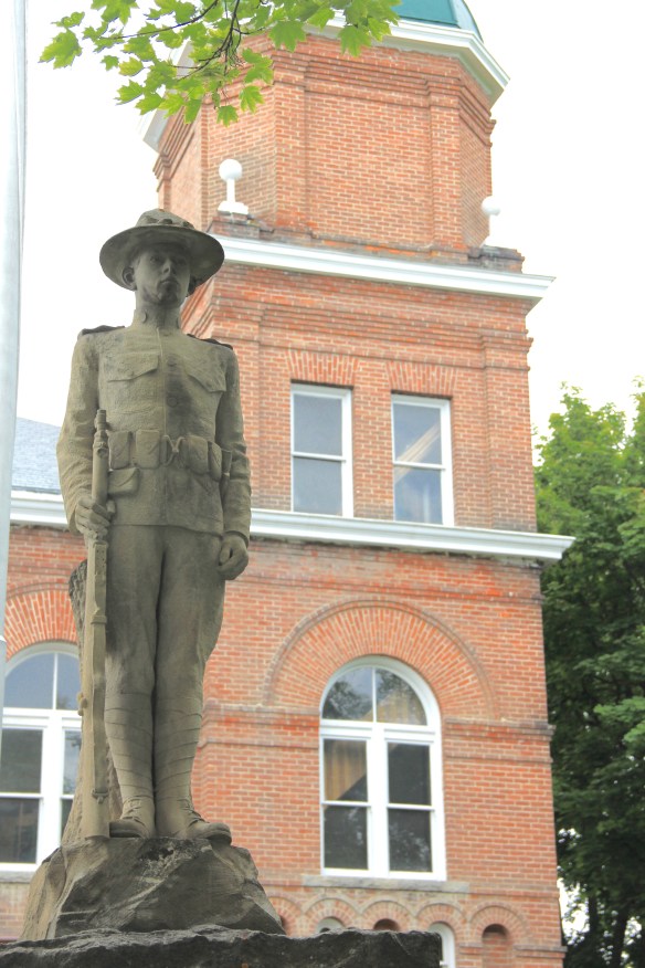
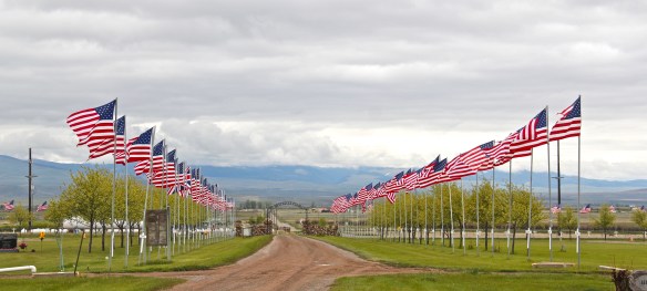 On this Memorial Day 2017 it is appropriate to celebrate the many memorials created by Montanans to recognize and commemorate the citizen soldiers who have served the armed forces of the United States. I am not adding much commentary because the memorials, both large and small, speak powerfully for themselves, and reflect the best of our values as a nation.
 Another compelling new memorial, at least it was installed after my historic preservation plan survey of 1984-1985, are these granite slabs, framed by the mountains, at Arlee.


 Dillon had significantly expanded its earlier veterans memorial (on the left) along the federal highway into an impressive new city park, the Southwest Montana Veterans Memorial.
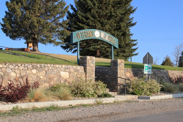 Even with the many changes in Ennis, the town has maintained its Veterans Memorial Park as a beautiful public park.
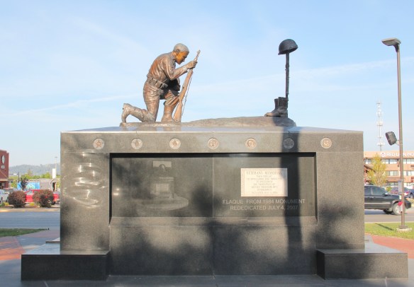


 Hamilton’s veterans memorial along U.S. Highway 93 will be a landmark for generations.
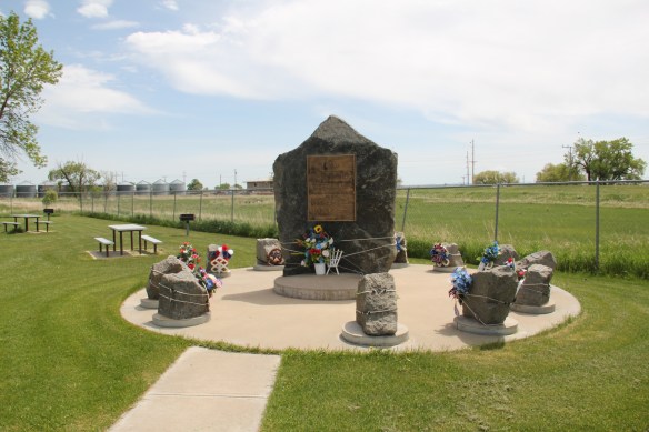
 In the 1984-1985 fieldwork for the state historic preservation plan, the impact of lodging chains in Montana was pretty limited to the larger towns, and gateways to the national parks. Many what I called “mom and pop” motels, largely from the pre-interstate highway era of the 1940s and 1950s, still operated. I was working with the state employee lodging rate of $24 a night (remember it was 1984!) and I found that the per diem eliminated the chains and I was left with the local establishments. During those months of intense travel I came to respect and really like the Moms and Pops. Several of the places I stayed in 1984-1985 are long gone–but ones like the Lazy J Motel in Big Timber remain. In this post I am merely sharing a range of historic motels from across Big Sky Country.
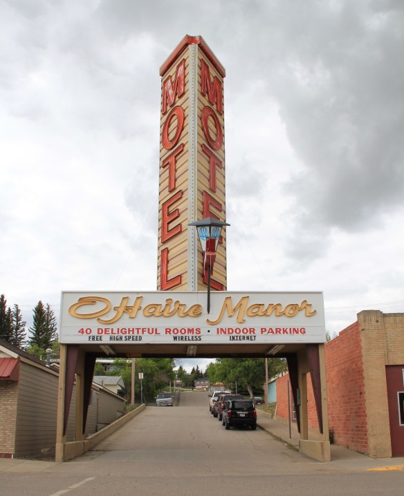 I began the fieldwork in February 1984 and the first stop was a public meeting at the Toole County Courthouse in Shelby. My first overnight was just as memorable–for good reasons–at the O’Haire Manor Motel. Its huge neon sign on the town’s main street, which was U.S. Highway 2, could not be missed, and actually the sign replaced a building that once stood along the commercial district, knocking it down so travelers would have a clear shot to the motel itself.
 Cut Bank’s Glacier Gateway, on the other hand, reminded visitors that it was that “coldest place” in the United States that they had heard about in weather forecasts.


 Another example from the old Yellowstone Trail and U.S. Highway 10 is the Shade Tree Inn Motel in Forsyth–although coal and railroad workers help somewhat to keep it going in the 21st century.
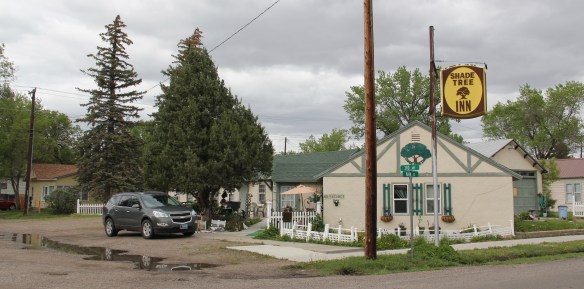 Just a block west of another historic section of U.S. Highway 10 in Deer Lodge is the Downtowner Motel, with its sloping roof and extended rafters representing the best in “contemporary” style from the 1960s. This place too was clean, cheap, and well located for a day of walking the town back in 1984.

 Not only have the changes in traffic patterns been important, the present generation’s preference for chain motels–and the proliferation of chains across the state–have shaped the future of the mid-20th century motel. A good example is the challenges facing the continuation of the Cherry Hill Motel in Polson, located along U.S. Highway 93. Here was a favorite spot in 1984–near a killer drive-in–a bit out of the noise of the town, and sorta fun surroundings with a great view of Flathead Lake.
 The place was up for sale in 2015–and the internet today tells me that it is “permanently closed.” I hope it can find a new owner and is still there when I next return to Polson but with the general boom in the Flathead Lake region, one assumes its days are numbered.
 The bear might be hugging the tree but does anyone else care enough–or want this type of lodging, complete with the “picture window” of the 1950s and 1960s, in the comfort obsessed 21st century?

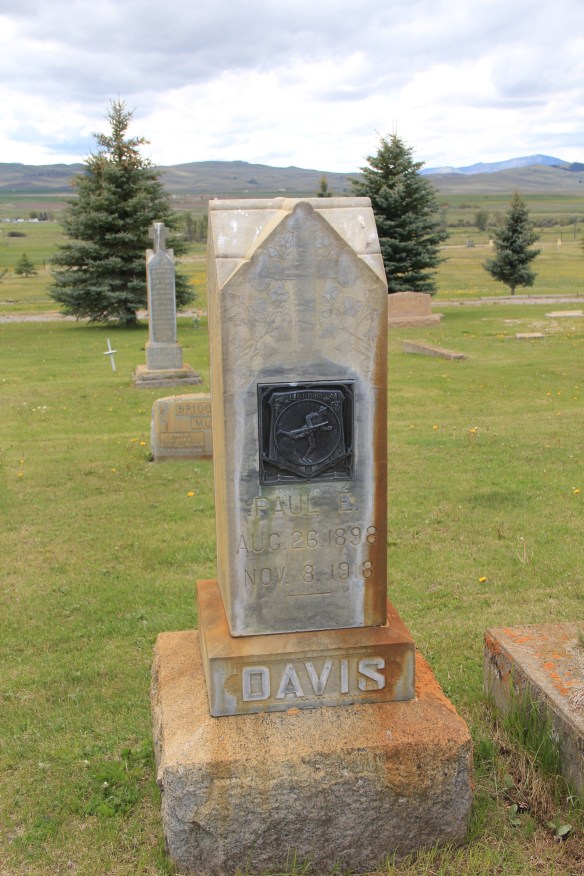 Paul E. Davis’ gravemarker at Valley Cemetery, along the historic Mullan Road, in Powell County is an early example of the WWI doughboy bronzed and rooted in Montana soil. The plaque says “America Over the Top,” a reference to the courage it took to jump out of the trenches and charge the enemy but also a reference to how the world war literally put America in a new position of world leadership.


 Community Center Bowl in Hardin, Big Horn County, is a wonderful recreational space, with its bays defined by c. 1960 styled “picture windows” framed in glass blocks. The owners have refurbished the lanes two years ago–this institution still has years left in it.
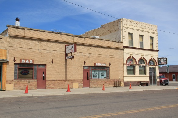
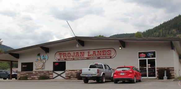 From the southeast corner of the state to its northwest corner–the Trojan Lanes (so named for the school mascot) in Troy, Montana. Here you find the type of alley that is common throughout the small towns of Big Sky Country. Not only do you have a recreational center but you often have the best family restaurant in town. That’s the
 case where at Troy’s Trojan as well as–returning to the southeast corner–the Powder River Lanes in Broadus. This tiny county seat has lost several of its classic cafes from the 1980s–the Montana Bar and Cafe on the opposite side of the town square being my favorite in 1984–but Powder River Lanes makes up for it.
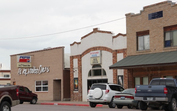 I am sorta partial to the small-town lanes, like the Lucky Strike above in Ronan, Lake County. Located next door to “Entertainer Theatre,” this corner of the town is clearly its center for pop culture experience.
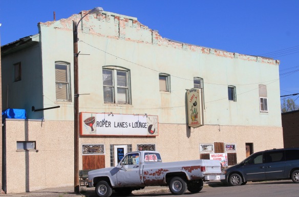 Another fav–admittedly in a beat-up turn of the 20th century building–is Roper Lanes and Lounge in Whitehall, Jefferson county, in the southwest corner of the state. Gotta love the painted sign over the entrance–emojis before they were called emojis.


 First came efforts to better interpret the Corps of Discovery and their travels through this section of the Missouri River 15-20 years ago. The theme was Lewis & Clark in the Missouri River Country, but by the 2010s the region’s demanding weather had taken its toll on the installation.
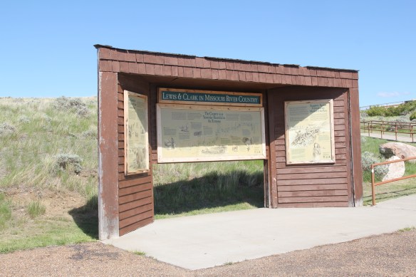


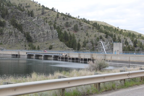
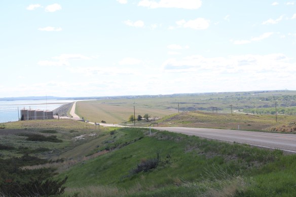
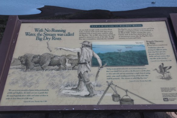 At the lake’s edge are additional markers encouraging visitors to imagine the time before the lake when the Big Dry River often meant exactly what it said–the reservoir keeps it full now.
 New interpretive markers combine with a well-defined pull-off to encourage travelers to stop and think about the loss of life that occurred in building the dam. Many of the massive infrastructure projects of the New Deal have similarly sad stories to tell–but few of them do.
 You can explore the landscape with the assistance of the highway markers to a far greater degree than in the past. Even if today it is difficult to “see” the transformation brought about by the massive earthen dam, there are informative markers to help you.


 St. Joseph Catholic Church, perched now on a barren bluff facing the lake, was moved about 2.5 miles east to its present location in 1954. Originally near the river in what was then known as the Canton Valley settlement, the church building is one of the state’s oldest, dating to 1874-1875 and is listed in the National Register of Historic Places. The proud Gothic styled church is the remnant of one of the valley’s earliest settlements.