In my original post about Circle, the seat of McCone County, I focused on the fate of the Gladstone Hotel, a place that I had stayed at in 1984 and a property listed in the National Register of Historic Places as one of the few homesteading era hotels left in the region. I also spoke about public institutions, the fairgrounds, schools, and the excellent McCone County Museum. In the years since I visited and talked about Circle in 2013, I have fielded several inquiries, and people wishing to see more.

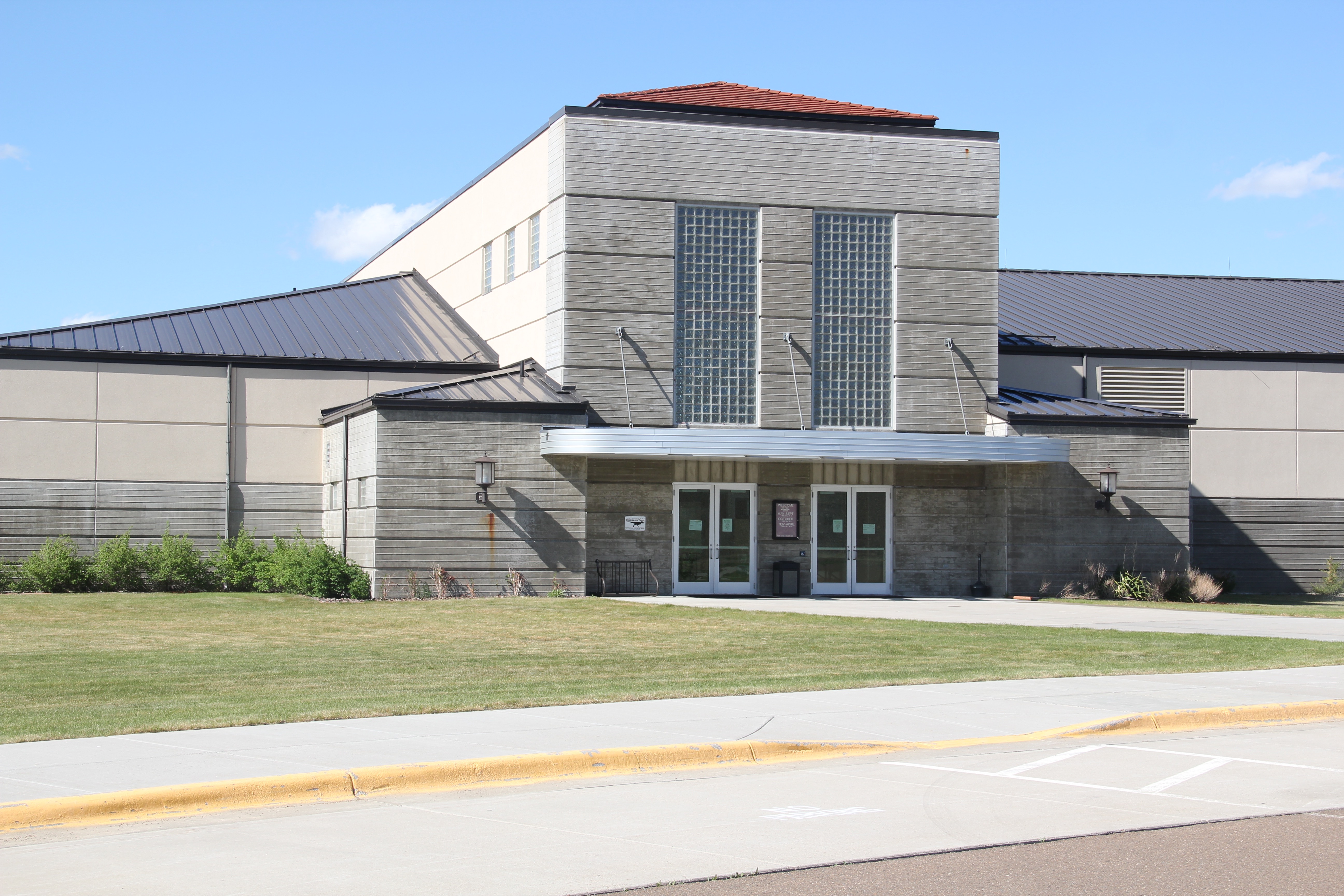
Sometimes you wonder how you neglected to speak about obvious landmarks, such as St. Francis Xavier Catholic Church, which is among the town’s most impressive architectural statements. It blends the more traditional late 19th century bell tower found at other Catholic churches will mid-twentieth century brick work and large glass block windows.
At least I had an excuse for the landmark across the street, the George McCone Memorial County Library, which in 2013 I could only get a decent side view (image on right) due to a public gathering taking place–one that I do not want to interrupt just to get a photo so the image on the left is from library’s website. I have another reason to return to Circle is the next couple of years! Public libraries are so important, period, but especially so in small towns.


Nearby the public library, naturally, is the large school complex area, with most of the buildings dating to the second half of the twentieth century, including the “spaceship” era of school building from the 1960s and 1970s (immediately above). With this building type educators decided to move away from the standard rectangular classroom and build more flexible circle-designs to encourage innovation and flexibility from teachers.


Just as I could/ should have said more about the schools, I needed to do the same with the McCone County Fairgrounds, a comparatively huge public property on the town’s outskirts. The county fair is almost as old as the county itself, which celebrates its 100th anniversary this year. That’s right, McCone County was established in 1919.
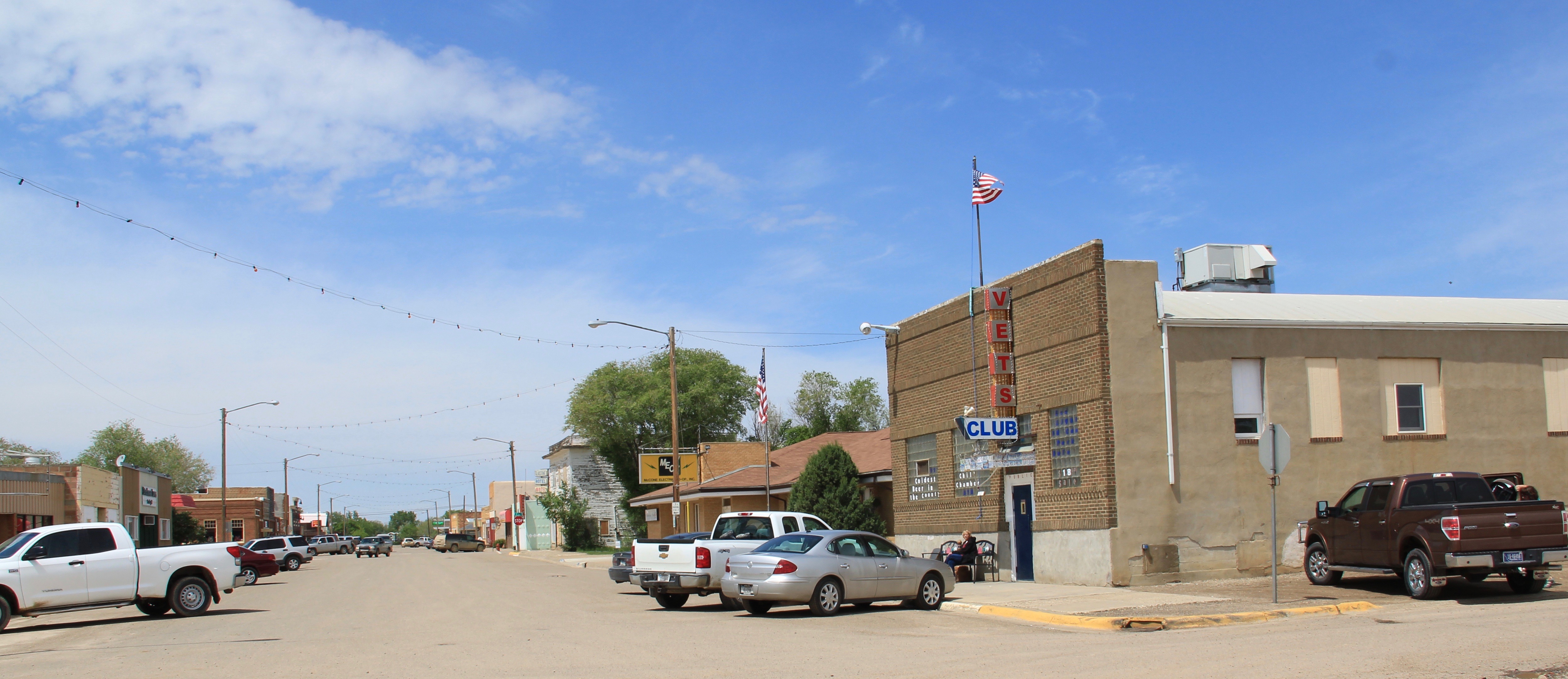
The fairgrounds, schools, and libraries–I discussed bars in an earlier post– are vital community centers in Circle, as its Vets Club, with that building occupying a strategic corner in town and its glass block windows distinguishing its entrance. As it is true with so many small western towns, regular movie showings are rare to non-existent. The Claret Theater was closed in 2013 and does not appears to have re-opened.

A word about banks. During the homesteading era, local banks competed for the patronage of the homesteaders. When the boom went to bust, the banks closed up business but their buildings, typically well located in the town, remain and ever since different owners have converted these buildings into new uses. A boutique had opened in one of the old Circle banks, seen below.

Since I had visited Circle last some 30 years ago, Wells Fargo has located a new bank, again at a prominent street corner, and contributes significantly to the town’s financial services.
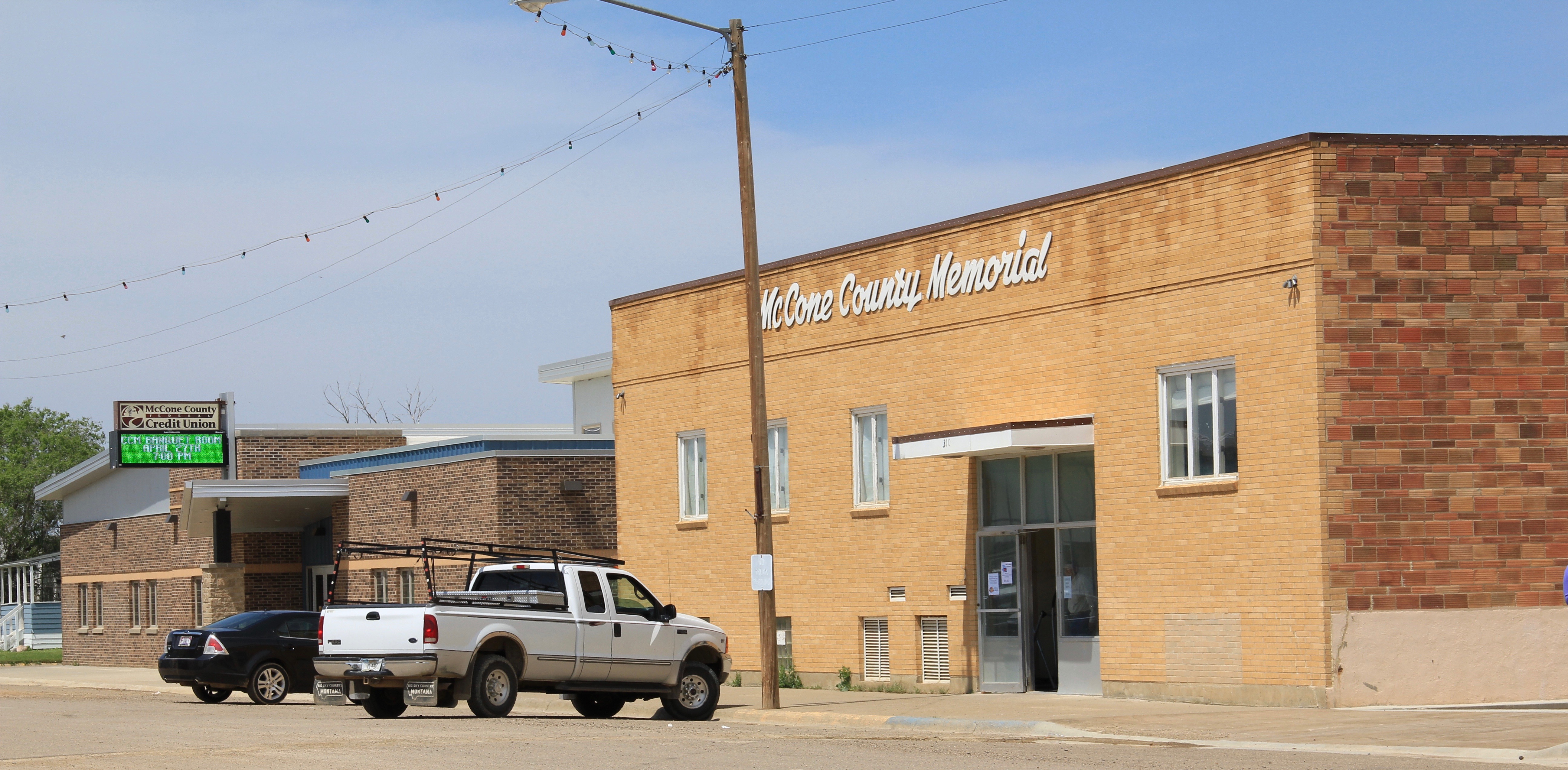
 Another new financial services building since my 1980s visit to Circle is the McCone County Credit Union building, shown below to the left of the landmark McCone County Memorial building.
These images are among those I took of Circle in 2013–it was a rather quick stop and I look forward having more time to explore in the next year.


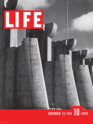
 First came efforts to better interpret the Corps of Discovery and their travels through this section of the Missouri River 15-20 years ago. The theme was Lewis & Clark in the Missouri River Country, but by the 2010s the region’s demanding weather had taken its toll on the installation.
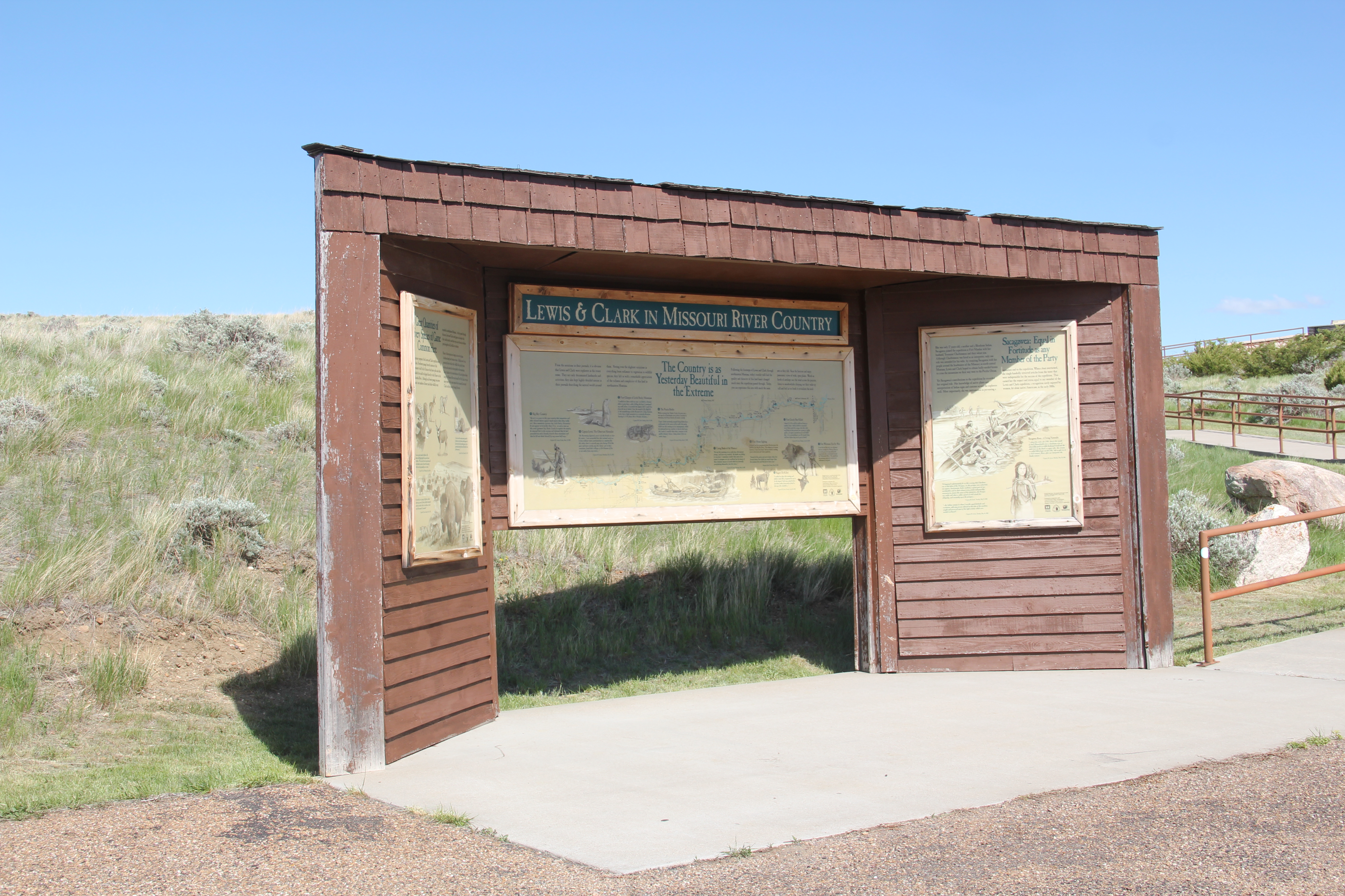


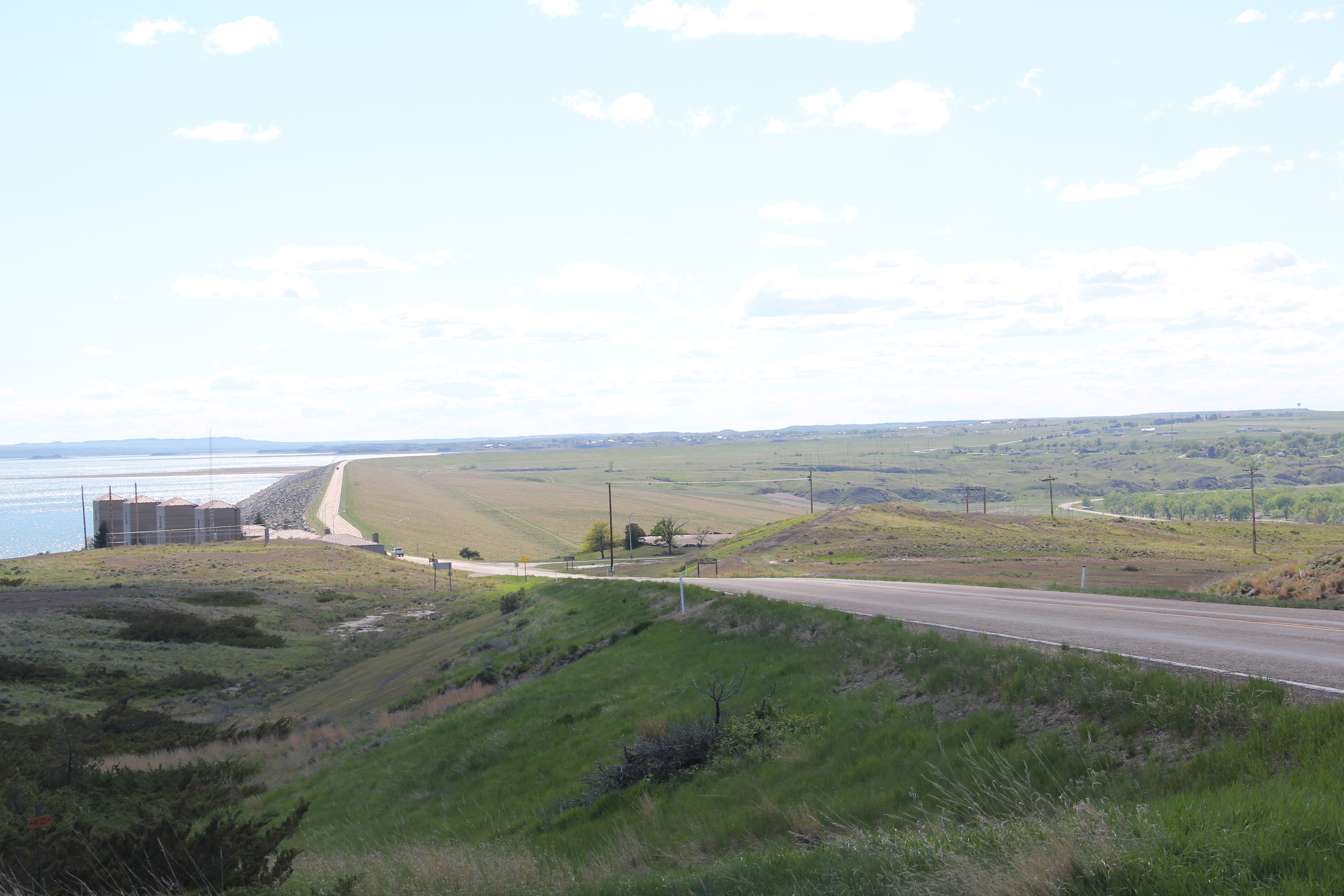
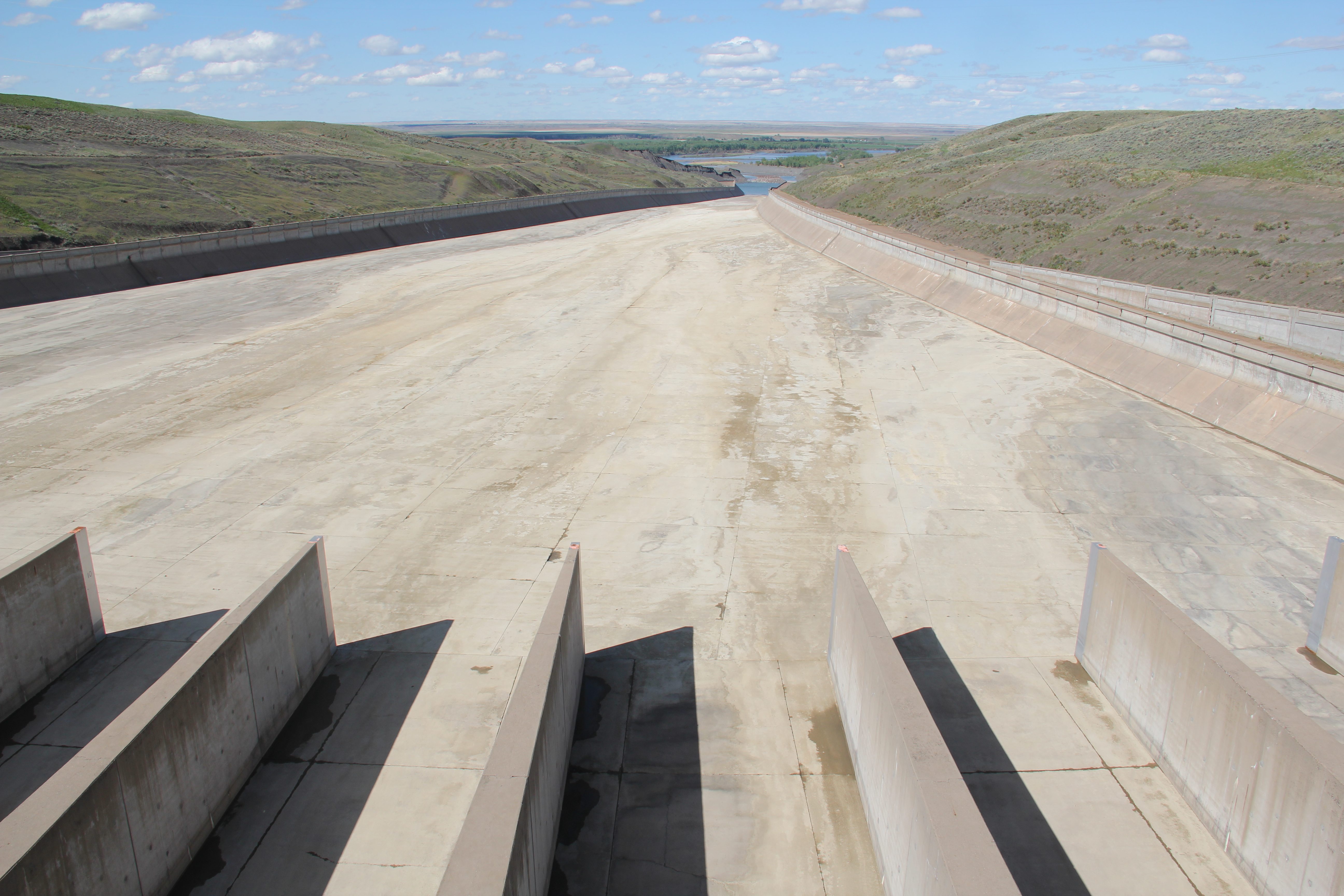
 At the lake’s edge are additional markers encouraging visitors to imagine the time before the lake when the Big Dry River often meant exactly what it said–the reservoir keeps it full now.
 New interpretive markers combine with a well-defined pull-off to encourage travelers to stop and think about the loss of life that occurred in building the dam. Many of the massive infrastructure projects of the New Deal have similarly sad stories to tell–but few of them do.
 You can explore the landscape with the assistance of the highway markers to a far greater degree than in the past. Even if today it is difficult to “see” the transformation brought about by the massive earthen dam, there are informative markers to help you.