
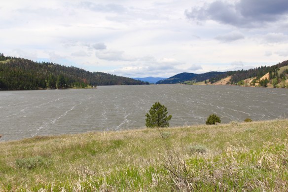
 Montana Highway 141 cuts north from Avon On U. S. Highway 12 to halfway between the towns of Ovando and Lincoln on Montana Highway 200. Its is high mountains prairie travel at its best, although the height of ranching along this route disappeared a while back. About 12-13 miles north of Avon you cross into the Nevada Creek drainage, which has long watered the land, enhanced after the New Deal added the Nevada Creek earthen dam that created Nevada Creek Reservoir in 1938.

Nevada Creek Dam Spillway.
 Along the east banks of the lake are remnants of the Fitzpatrick Ranch, which is listed in the National Register of Historic Places. I highlighted the property in my book A Traveler’s Companion to Montana History (1986). Jimmy Isbel established the property in 1872,
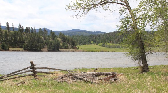
Fitzgerald Ranch facing Nevada Creek Reservoir.
building a log cabin. But he did little to develop it and c. 1885 he sold it to J.F. Fitzpatrick. His family patented his homesteading claim in 1890 and in the next decade, they built a two-story log home, a wooden-frame barn, and other outbuildings before adding a Queen Anne-influenced frame wing to the house, totally transforming the look of the ranch.
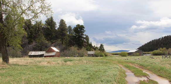 Thirty years ago, this significant collection of vernacular buildings was in good condition, but the years since have been hard on the property, and the complex now needs serious preservation attention. The loss of the roof on the log barn, and the general poor condition of the roofs of the outbuildings are major concerns.


 Between the Fitzpatrick Ranch and Helmville is the Barger Ranch, also from the late 19th century judging from the more polished example of Queen Anne style in the ranch house. It is living proof that not all of the Nevada Creek ranches have passed away. The Nevada Creek Water Users Association at Helmville still operates to distribute the invaluable water from the reservoir.
  Helmville was another topic in my 1986 book. Throughout the Nevada Creek drainage, you could help but be impressed with the log construction, and the various types of notching used for the buildings. Helmville had a particular interesting grouping of wood frame and log buildings, which were highlighted by a 1984 photograph in the book. That exact view could not be replicated 30 years later but several of the old buildings still stood.

 Helmville has a good bit of continuity. Along with the row of buildings on Montana 271 there is a turn of the 20th century gable-front cottage and a two-story lodge building that has been turned into a garage.


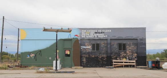
 Trixie’s was the same fun dive that I always recalled, but the village’s historic buildings had been restored, looking good. Business appeared to be brisk. A new community church has been opened, and a major interpretive place for the “Lewis Minus Clark” expedition had been installed. Kudos to both the U.S. Forest Service and the Lewis and Clark National Historic Trail for allowing a bit of humor in this marker.


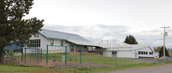 The school had also expanded from its New Deal core of the 1930s, courtesy of the Works Progress Administration. But the most noticeable change was the town’s street signs–first the fact that a small place had street signs but then the nostalgic backpacker theme of these cast iron marvels.
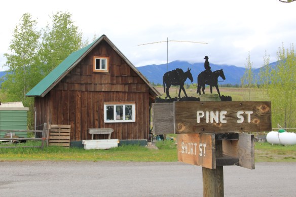 Ovando is a good location on the Blackfoot River for sportsmen, anglers, and hikers headed into the Bob Marshall Wilderness–its recent change demonstrates the influence on those groups on the 21st century Montana landscape.
 Between Garrison Junction, where U.S. Highway 12 and Interstate I-90 meet, to Elliston, at near the Mullan Pass over the continental divide, is a beautiful, historic valley carved by the Little Blackfoot River. It is a part of Powell County that hundreds whiz through daily as they drive between Missoula and Helena, and it is worth slowing down a bit and taking in the settlement landscape along the way.
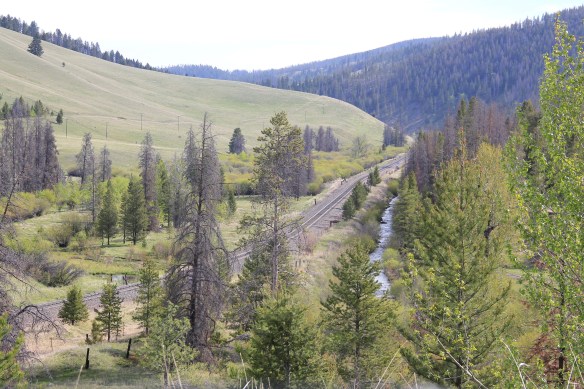
 Captain John Mullan came this way shortly before the Civil War as he built a military road between Fort Benton and Walla Walla, Washington. A generation later, in the early 1880s, the tracks of the Northern Pacific Road used the Mullan Pass to cross the divide and then followed the Little Blackfoot River west towards Missoula.


 The oldest federal imprint in Elliston comes from the ranger’s headquarters for the Helena National Forest in its combination of a frame early 20th century cottage and then the Rustic-styled log headquarters.
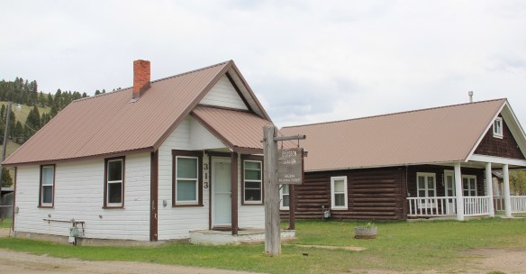 The next railroad town west is Avon, which is also at the junction of U.S. Highway 12 and Montana Highway 141 that takes travelers northwest toward the Blackfoot River. Like Elliston, Avon has several buildings to note, although the National Register-listed property is the historic steel truss bridge that crosses the Little Blackfoot River and then heads into ranch territory.
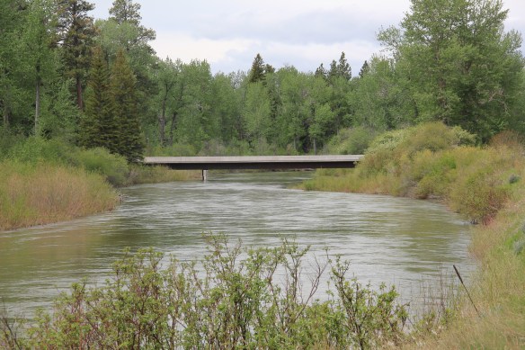
 The bridge is a Pratt pony truss, constructed in 1914 by contractor O.E. Peppard of Missoula, and little altered in the last 100 years. As the National Register nomination notes, the bridge’s camelback trusses are unusual and have not been documented in other Montana bridges from the early 20th century.
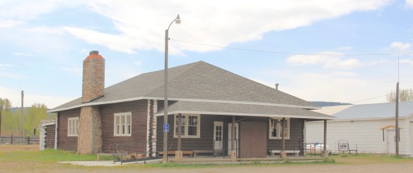
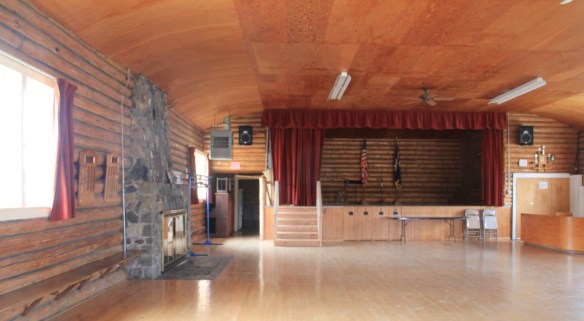
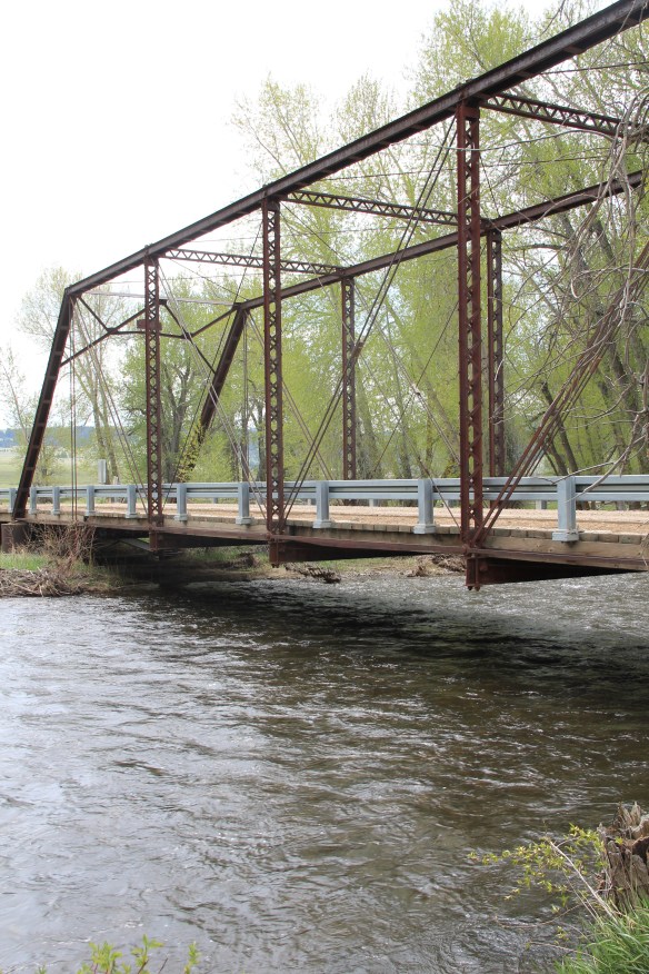 Avon has another clearly National Register-worthy building in its 1941 community hall, a late New Deal era building, which has served the community in multiple ways, as a meeting place for the Avon Grange, a polling place, and a place for celebrations of all sorts, including stage presentations and bands.
 The Avon School also has a New Deal era affiliation, with the Works Progress Administration. Although remodeled in the decades since, the school still conveys its early 20th century history.
 Avon even has its early 20th century passenger station for the Northern Pacific Railroad, although it has been moved off the tracks and repurposed for new uses.
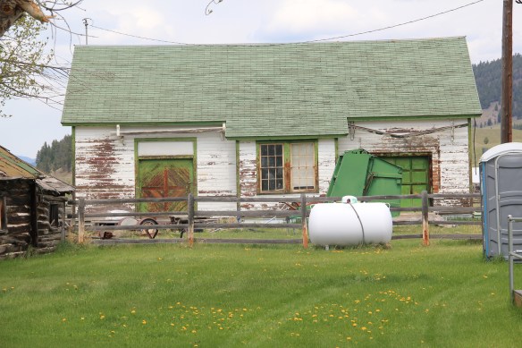 In front of the depot is the turn of the 20th century St. Theodore’s Catholic Church. The historic Avon Community Church incorporates what appears to be a moved one-room school building as a wing to the original sanctuary.


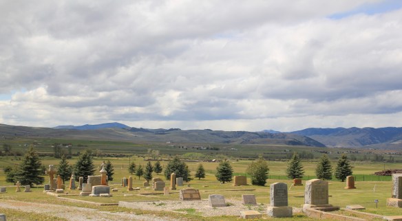
 Another important property in Avon, but one I ignored in 1984-85, is the town cemetery, which also helps to document the community’s long history from the 1880s to today.
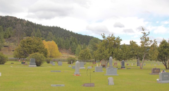
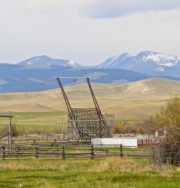
 Heading west from Avon on U.S. Highway 12 there are various places to stop and enjoy the river valley as it narrows as you approach Garrison. I always recalled this part fondly, for the beaverslide hay stackers–the first I encountered in Montana in 1981–and they are still there today, connecting the early livestock industry of the valley to the present.


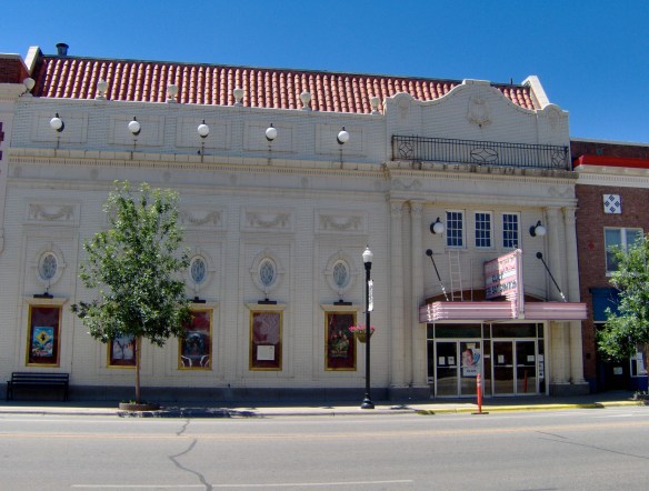
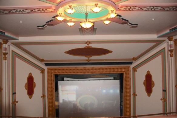
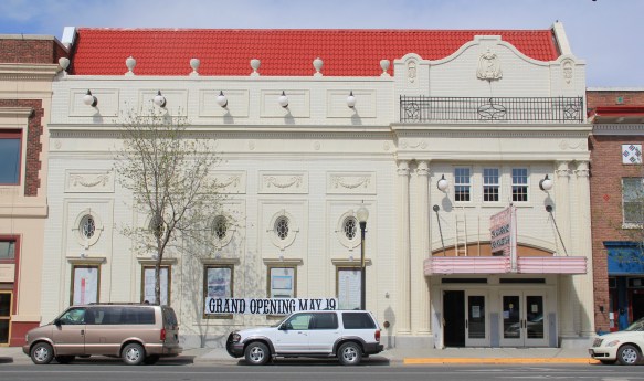 Imagine my pleasure to be there for the theatre’s grand opening May 19, 2012. Not only had the community raised the funds to repair and reopen the business, they also took great pains to restore it to its earlier architectural glory. Such an achievement for a town of just over 3,000 residents–when you consider that the next city south on Interstate I-90 is Anaconda with its monument Washoe Theatre, I immediately began to think of future “movie palace” trips. What a treat, both for the experience and architecture.


 In that same trip to Deer Lodge, I noted how the community had recently enhanced the National Register-listed W. K. Kohrs Memorial Library (1902), one of the region’s great Classical Revival buildings by the Butte architectural firm of Link and Carter (J.G. Link would soon become one of the state’s most renowned classicists), by expanding the library
 with an addition to the side and behind the commanding entrance portico. Although it has proven to be difficult for such a small town to keep the library professionally staffed, the care they have shown the exterior and interior indicate they understand the value of this monument from the past.

 Then add in the impressive examples of turn of the 20th century church architecture, represented by the Cotswold Gothic stone work of St. James Episcopal Church, the more former Tudor Revival of the 1st Presbyterian Church, and the more vernacular yet


 Powell County’s Deer Lodge Valley is another favorite western Montana landscape. I visited there often during the 1980s, and in the years since I found myself often back in places like Deer Lodge, the county seat, if for nothing else to stop at the R&B Drive-In.
 Let’s start with the town of Deer Lodge, a place that has changed much in the last 30 years, a process that was underway in the early 1980s after the Milwaukee Road closed its division point and declared the entire line bankrupt. Besides Miles City, it is difficult to find a town more impacted by the Milwaukee’s failure than Deer Lodge.


 Yet, Deer Lodge was not a typical small town base for the Milwaukee Road; railroads typically wanted to create their own place. But Deer Lodge was one of the oldest places in the state, where ranchers in the 1850s first arrived–the early site is now interpreted at the Grant-Kohrs National Historic Site of the National Park Service–soon followed by Capt. John Mullan as he and his soldiers built the Mullan Road through this valley.

 The Northern Pacific passenger depot exists across the tracks from the Milwaukee Road station. It too has a new use: the Northern Pacific depot is now the senior citizens center.
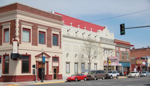

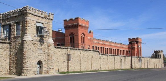 Before Deer Lodge was a railroad town, it was a prison town, the location for the Territorial Prison, and later the state prison. Most of the buildings you can visit today are from the state prison era. It operated here until 1980 when it moved to a facility outside of town.

 Deer Lodge also was an early center for education, represented by Trask Hall (1870s), which, like the territorial prison, is listed in the National Register. So with the themes of settlement, ranching, railroads, education, prisons, and the beauty of the valley why has Deer Lodge struggled to be recognized as one of Montana’s premier heritage designations? As the next post will discuss, citizens are taking steps to remedy the situation.
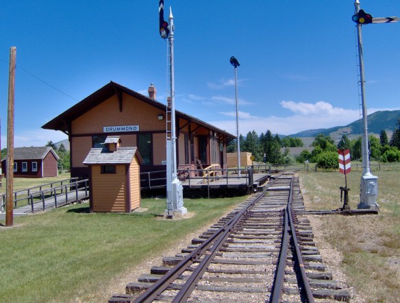
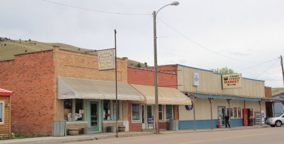 Drummond is the north entrance of the Pintler Scenic Route. The first ranchers settled here in the 1870s but a proper town, designed in symmetrical fashion facing the railroad tracks, was not established until 1883-1884 as the Northern Pacific Railroad built through here following the Clark’s Fork River to Missoula.


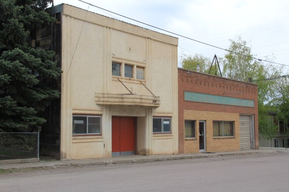
 There is a faintly classically influenced two-story brick commercial block, a Masonic Lodge made of concrete block, various bars and cafes, a railroad water tank, and a slightly Art Deco movie theater, which was open in the 1980s but is now closed.
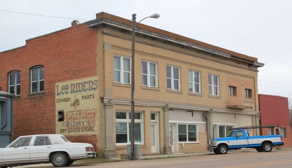


 Due to the federal highway and the later Interstate I-90 exit built at Drummond, the town even has a good bit of motel roadside architecture from c. 1970 to 1990.
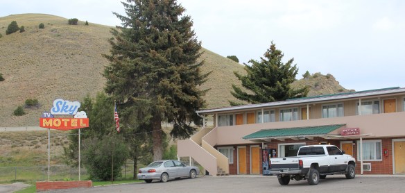
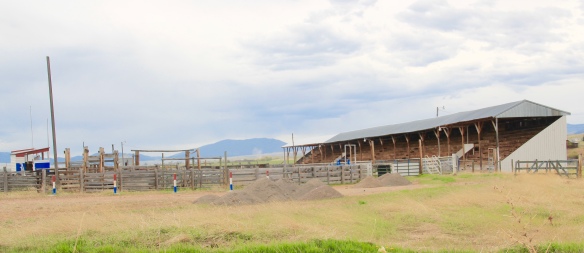
 Between the Northern Pacific corridor and old U.S. 10 is the town’s most famous contemporary business, its “Used Cow” corrals, and now far away, on the other side of the
 tracks are rodeo grounds named in honor of Frank G. Ramberg and James A. Morse, maintained by the local American Legion chapter.
 The rodeo grounds are not the only cultural properties in Drummond. The Mullan Road monument along the old highway is the oldest landmark. The local heritage museum is at the New Chicago School (1874), an frame one-story school moved from the Flint River Valley to its location near the interstate and turned into a museum.

 Another local museum emphasizes contemporary sculpture and painting by Bill Ohrmann. A latter day “cowboy artist” Ohrmann grew up in the Flint River Valley but by the 12960s he was producing sculpture and painting on a regular basis. The museum is also a gallery and his works are for sale, although the huge sculptures might not be going anywhere.


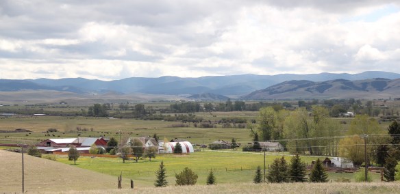 Montana Highway 1, the Pintler Scenic Route as I knew it during the 1984-85 state historic preservation plan survey, provides travelers with two distinct experiences. The southern half is a mining landscape, centered on the urban places of Anaconda and Philipsburg. The northern half is very agricultural, a place where cowboys and cowgirls still roam. It is one of my favorite parts of the state. Fret not, I won’t explore every nook and cranny but I will talk about three favorite places.
 First up is the village of Hall, which is north of Phillipsburg. The Northern Pacific Railroad ran its spur line from Drummond to Philipsburg through the middle of the valley, leaving Hall as the halfway stop between the larger towns. Just as in 1984, the old town bank still served as the post office. Hogan’s Store still stood near the railroad tracks and a lone grain elevator stood along the old railroad corridor.
 So too was the historic school at Hall still standing–in fact this c. 1920 brick building continues to serve local children as it has for decades. The same was true for the Stockman
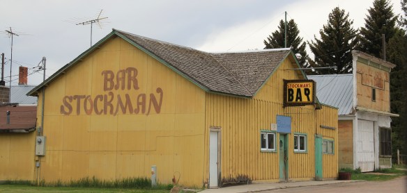 Bar–maybe not as old as the school building but not far behind and still in business despite the proximity to Drummond and Philipsburg. Then there is a wonderful piece of yard art in Hall–leaving no doubt about the primary agricultural product here.
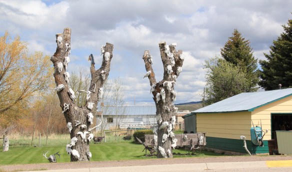
 As you travel north on Montana Highway 1 you next, unexpectedly, cross the historic Mullan Road, one of the oldest roads in the northwest. Parts of the road are graveled and graded, others are paved, but whatever the condition the road takes you to 19th century log
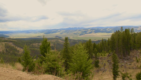
 buildings, even a dog-trot type log dwelling as well as the spectacular Valley Cemetery. I call it spectacular not for its cemetery art–although there is more than you would expect–but for its setting in the Flint Valley.

 Wherever you look the vista is jaw dropping and can’t be that different than what Capt. Mullan and crew experienced in the late 1850s as they trekked this way. The Annie Milroy grave marker and statue (1912) speaks to the sadness that many homesteaders experienced as they tried to make a go of it in this demanding land.


 The nearby elaborate carving of the Bergman family marker is just another indication that this cemetery deserves additional, full research. (Not far away from Hall is the lone obelisk marker for the historic Emmitsburg Cemetery, another early settlement site.) My next post will finish the Pintler Scenic Route with a deep look at Drummond.


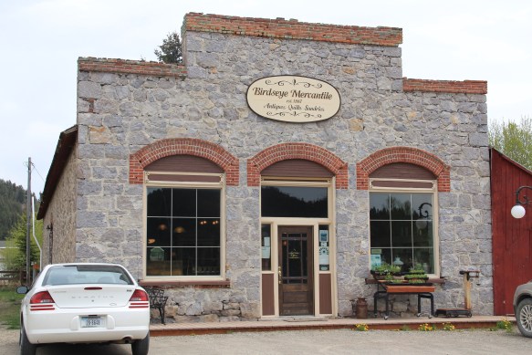
 Are we truly at a point in our culture that we can’t take the past and build a stronger community–this blog has pointed out countless examples of how that has happened across Montana–and we rather tear down and waste as we bow to the inevitability of Big box retail? The entrepreneurial spirit of Montana needs its landmarks–and the adaptive reuse of the Mercantile would be a great place to say here we make our stand, and build a better Missoula.
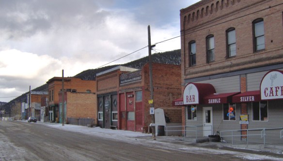 When I carried out the Montana State Historic Preservation Plan field work in 1984-1985 I passed through Basin Street in the heart of “downtown” Basin quite frequently, not because of the Silver Saddle Bar–fine place it is–but because I had no choice if headed
 The glory days of Basin had long since passed, although some locals and visitors would go to the Merry Widow Mine for a dose of radon, thinking it could cure their ills (of course radon exposure is actually dangerous). Led by the Butte capitalist Augustus Heinze, the town from the mid-1890s to mid-1920s had been a quite thriving place, served as both the Great Northern and Northern Pacific Railroads with its Basin Street becoming the route for U.S. Highway 91. The numerous two-story brick commercial buildings reflected that era of prominence while a decaying c. 1930 garage on the town’s outskirts documents the impact of the federal highway.
 Several key community landmarks remain. The most impressive is the two-story frame Basin School, built in 1895 and still in use as a school today. Here is another great Montana rural school building–the state is so rich in this type of public architecture.
 Nearby is the Community Church, another late Victorian-era styled building, with its tall bell tower and distinctive corner entrance.


 Miners first began to gather at what is now Philipsburg in the late 1860s; the town was later named for Philip Deidesheimer, who operated the Bi-Metallic Mine works. As the Bi-Metallic Mine and Mill expanded operations in the 1880s, a rapid boom in building


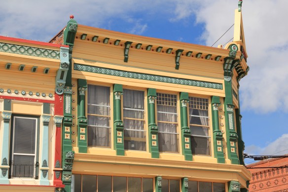 The quality of the Victorian commercial architecture still extant in Phillipsburg, such as the 1888 Sayrs Block above, astounded me during the 1984-85 preservation work. So much was intact but so much needed help. Residents, local officials, and the state preservation office understood that and by 1986 the Philipsburg Commercial historic district had been added to the National Register of Historic Places.
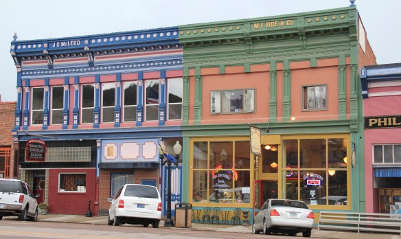 What is exciting is that in this decade, entrepreneurs are building upon early successful renovations and adaptive reuse project to launch new businesses and create new jobs. The town’s population is growing, after 30 years of decline.


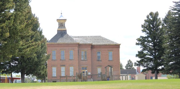
 The new developments in Philipsburg are interesting and invaluable changes since 1984-1985. At the same time, I am happy that residents have still embraced their historic public buildings in a similar fashion. The photograph I used in my book about the town in 1985
 was the Philipsburg School, with its soaring tower symbolizing the hopes that residents had for Philipsburg’s future in the 1890s. The historic school, which is listed in the National Register, remains although the community built a new building adjacent to the historic one in 1987. (you can see a corner of the new building at the lower left).
 When I first visited in 1984 the only building in Philipsburg listed in the National Register was the Queen Anne-styled Granite County Jail of 1902. It also remains in use.
 But now the Classical Revival-styled Granite County Courthouse (1913) is also listed in the National Register. Designed by the important Montana architectural firm of Link and Haire, this small town county courthouse also speaks to the county’s early 20th century ambitions, with its stately classical columned portico and its central classical cupola.


 By climbing the hill above the courthouse you also gain a great overview look of the town, reminding you that these rather imposing public buildings are within what is truly a modest urban setting that is connected to the wider world by Montana Highway 1.


 The Philipsburg Cemetery, which like so many that I ignored in 1984-1985, was a revelation, reflecting the quality of Victorian period architecture found in the town.
 The beauty and serenity of its setting were impressive enough, but then some of the family plots and individual markers reflected Victorian era mortuary art at its best.
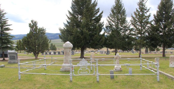 This cast-iron gate, completed with urns on each post and the music lyre gate, is among the most impressive I have encountered in any small town across America. And this cemetery has two separate ones.
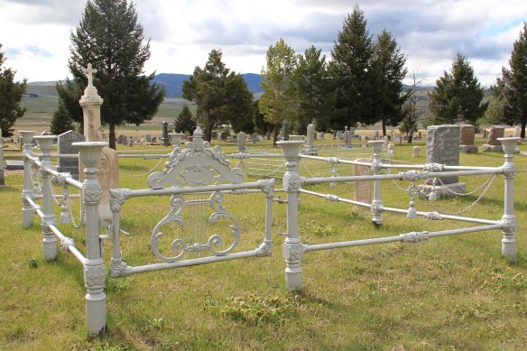 Many grave markers came from local or nearby masons but others, like these for the Schuh and Jennings families, were cast in metal, imitating stone, and shipped by railroad to Philipsburg.

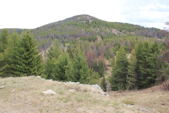
 The late 19th century discovery and development of silver mines high in the Granite Mountains changed the course of this part of the Pintler route. The Granite Mountain mines yielded one of the biggest silver strikes in all of Montana, creating both the mountain mining town of Granite and a bit farther down on the mountain’s edge the town of Philipsburg, which by 1893 served as the seat for the new county of Granite.
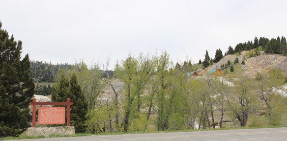
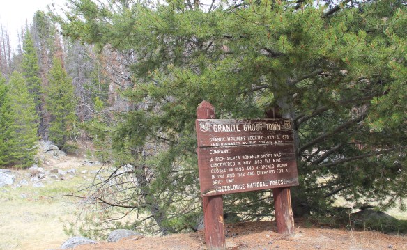 The U.S. Forest Service’s rather weathered and beat-up sign marks the historic entrance to the mining town of Granite, located at over 7,000 feet in elevation above the town of Philipsburg. During the 1984-85 state historic preservation plan work Granite was the focal point. The office knew of the latest collapse of Miners Union Hall (1890) turning what had been an impressive Victorian landmark into a place with three walls and lots of rubble–it remains that way today.


 Connecting the Granite road to the town of Philipsburg, today as in the past, is the site of the Bi-Metallic Mill, which is still in limited use today compared to the mining hey-day.


