U.S. Highway 2 east of Kalispell has grown into a four-lane highway (mostly–topography thus far has kept it as a two-lane stretch west of Hungry Horse) designed to move travelers back and forth from Kalispell to Glacier National Park. In my 1984-85 state historic preservation plan work, I thought of Columbia Falls, Hungry Horse, and Martin
 City as one large tourism funnel. After spending a good part of 2006-2007 working with local residents and the Great Smoky Mountains National Park about the heritage and preservation of Gatlinburg, Tennessee–one of the most notorious gateways into any national park–I learned to look deeper than the highway landscape and find some real jewels in each of these Glacier National Park gateway communities.
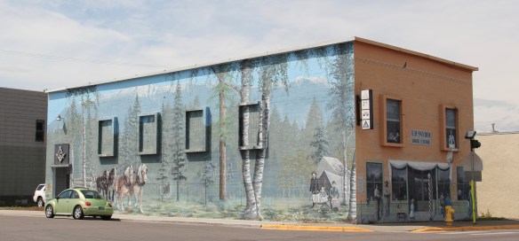
There is much more than the highway to Columbia Falls, as the three building blocks above indicate, not to mention the lead image of this blog, the town’s Masonic Lodge which has been turned into one huge public art mural about the town’s history as well as its surrounding landscape. Go to the red brick Bandit’s Bar above, and you soon discover that Columbia Falls has a good sense of itself, and even confidence that it can survive new challenges as its population has soared by over 2,000 residents since the 1980s, totaling over 5,000 today.
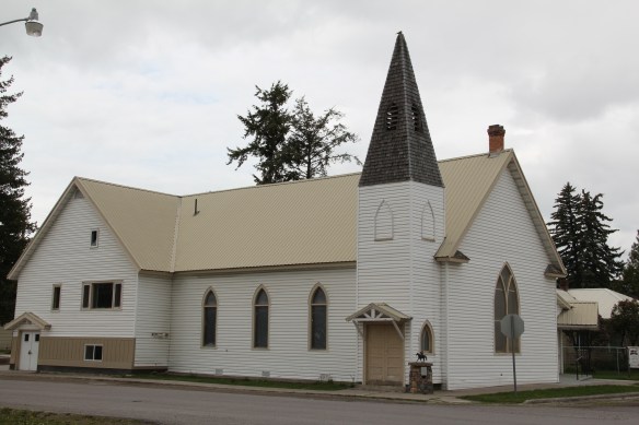
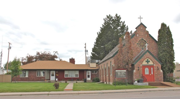
Once solely dependent on the Montana Veterans’ Home (1896), which is now a historic district, and then relying on the Weyerhaeuser sawmill for year round employment, Columbia Falls faces a different future now once the mill closed in the summer of 2016, taking away 200 jobs. As the historic business buildings above indicate, historic preservation could be part of that future, as the downtown’s mix of classic Western Commercial blocks mesh with modern takes on Rustic and Contemporary design and are complemented, in turn, by historic churches and the Art Deco-influenced school.
Once you leave the highway, in other words, real jewels of turn of the 20th century to mid-20th century design are in the offing. In 1984–I never looked that deep.
 At Hungry Horse, however, I did leave the highway and explored the marvelous landscape created by the Hungry Horse Dam and Reservoir, a mid-20th century project by the U.S. Bureau of Reclamation. The agency justified the dam as a hydroelectric power project for a growing Flathead County and as a boost to local irrigation. The irrigation side of the project–the real reason the agency exists–never happened and Hungry Horse today is an electric power and recreational project.

 I appreciated the vastness of the concrete arch dam–the 11th largest concrete dam in the United States–as well as the beauty of Hungry Horse Reservoir, an under-appreciated tourism asset as anyone in Flathead County will tell you. But again, I let just the size and impact of the dam distract me from some of the details of its construction that, today, are so striking.
Here I am thinking primarily of the contemporary design of the Visitors Center–its stone facade suggesting its connection to the now covered river bluffs but the openness of its interior conveying the ideas of space associated with 1950s design.
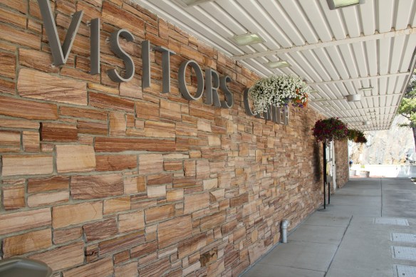

 I am concerned, however, about news in September 2015 that Reclamation has contracted for updates and renovation at the Visitor Center–let’s hope that the classic 1950s look of the property is not sacrificed.

Martin City is just enough off of U.S. Highway 2–it is situated more on the historic Great Northern Railroad corridor–to miss out on the gateway boom of the last 30 years, although with both the Southfork Saloon and the Deer Lick Saloon it retains its old reputation as a rough-edged place for locals.
For railroad travelers in the first half of the 20th century, West Glacier was THE west gateway into Glacier National Park. The Great Northern Railway developed both the classic Rustic-styled passenger station and the adjacent Arts and Crafts/Chalet styled Belton Chalet Hotel in 1909-1910, a year before Congress created Glacier National Park.
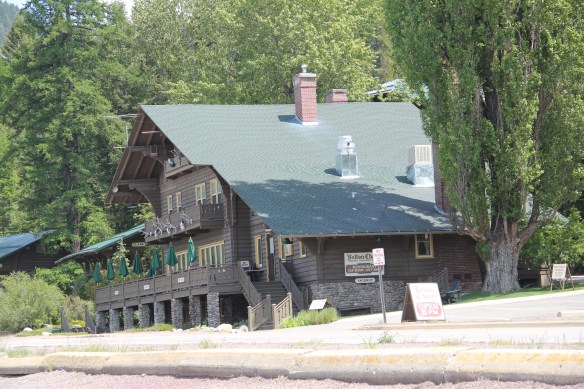 Architect Kirtland Cutter of Spokane was the architect and the chalet design was actually just a smaller scale and less adorned version of the Idaho State Exhibition Building that he had designed for the 1893 World’s Fair in Chicago. Cutter is one of the major figures of the Arts and Crafts Movement in the American Northwest and we will look at another of his buildings for the railroad and Glacier in the next post about Lake McDonald Lodge.
The Cutter buildings for the railroad between 1909-1913 set a design standard for West Glacier to follow, be it through a modern-day visitor center and a post office to the earlier mid-20th century era of the local school and then gas stations and general stores for tourists entering the national park by automobile.
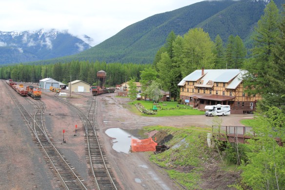
This blog has never hidden the fact, however, that my favorite Glacier gateway in Flathead County is miles to the east along U.S. Highway 2 at the old railroad town of Essex, where the railroad still maintains facilities to help push freight trains over the Continental Divide. The Izaak Walton Inn was one of the first National Register assignments given to

me by State Historic Preservation Officer Marcella Sherfy–find the facts, she asked, to show that this three story bunk house, railroad offices, and local post merited exceptional significance for the National Register. Luckily I did find those facts and shaped that argument–the owners then converted a forgotten building into a memorable historical experience. Rarely do I miss a chance to spend even a few minutes here, to watch and hear the noise of the passing trains coming from the east or from the west and to catch a sunset high in the mountains of Flathead County.


 At first glance, Dutton is like many northern plains railroad towns, located on the Great Northern Railway spur line between Shelby and Great Falls. The false front of Mike’s Tavern, then other plain, functional one-story buildings–we have seen hundreds of similar scenes across the Big Sky Country.
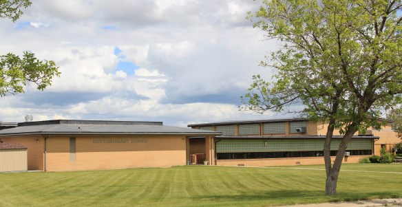 Then, suddenly, there is the cool mid-century modernism of the Dutton-Brady School (Brady is another neighboring railroad town), a style also embraced by the Bethany Lutheran Church.
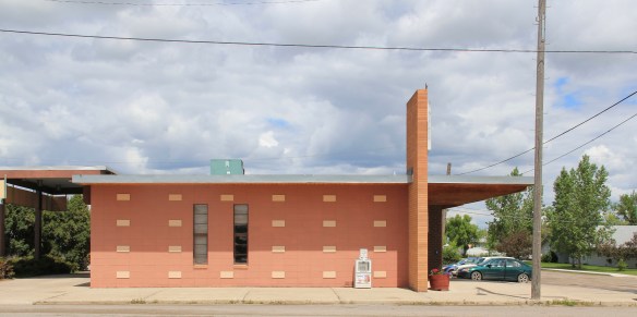


 By the late 1980s there was little doubt that a substantial development boom was underway in Flathead County. In the town near the Flathead Lake, like Bigfork, above, the boom dramatically altered both the density and look of the town. In the northern half of the county Whitefish suddenly became a sky resort center. In 1988, during a return visit to Montana, I did not like what I encountered in Flathead County–and thus I stayed away for the next 27 years years, until the early summer of 2015.


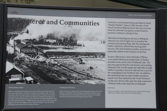


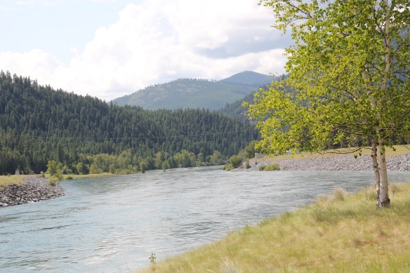
 The dam is 422 feet tall and stretches across the river for 3,055 feet–well over a 1/2 mile. It creates a huge reservoir, extending 90 miles to the north and into British Columbia, among the ten largest reservoirs in the nation. And like that, a historic river valley became a recreational lake in a joint project between the United States and Canada.


 The Lake Koocanusa Bridge, which provides access to a Mennonite community and a backroad way to Yaak, is the state’s longest, and in many ways, its most spectacular multi-truss bridge. The bridge is 2,437 feet long, and stands, depending on water level, some 270 feet above the lake.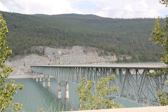


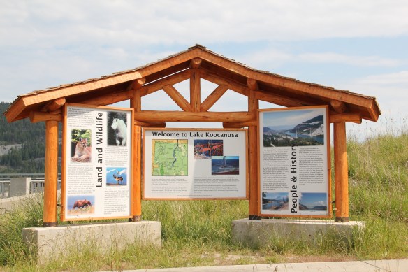 There was no interpretation at this bridge in 1984, but the scenic highway designation has led to the placement of overlooks and interpretive markers at some places along the lake. One wishes for the same at the Montana town that the lake displaced, Rexford. This once
 small river town had to move, or be inundated. And since the move took place in the mid to late 1960s, the town embodies the mid-century modern aesthetic, both in the design of many buildings but also in the town plan itself as the federal government finished relocating Rexford in the early 1970s.


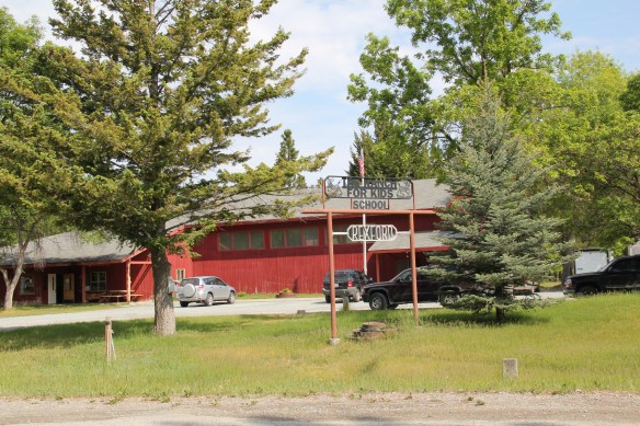
 school by itself is a fascinating statement of both design but also a community’s determination to stay, no matter what the federal government threw their way. Needless to say, in 1984 I paid Rexford no attention–nothing historic was there, it was all new. But now it is clear what a important place in Lincoln County’s 20th century history Rexford came to be.


 Moiese is best known, by far, as the entrance to the National Bison Range, where a general store stands nearby the refuge gate. Created by Congress in 1908, the refuge took
 additional land–almost 19,000 acres- from the tribes, without their consent, to create a safe haven for the remaining bison in the region. A few hundred bison live within its boundaries today. In 2016 the National Park Service began discussions with the Consolidated Kootenai and Salish Tribe to transfer management of the refuge to the tribe.
 Eight miles north of Moiese along the railroad line is the town of Charlo, named in honor of Chief Charlo of the Bitterroot Salish, who was forced from the Bitterroot Valley to move to the reservation in 1891. Charlo served as head chief of the Bitterroot Salish from 1870-
 1910. As a railroad town, Charlo is like many along the Northern Pacific, with a brief strip of businesses facing the railroad tracks, marked by the town’s sole grain elevator. It has a classic rural bar, Tiny’s Tavern, with its brightly painted exterior of concrete block, with brick accents. Built in 1946 by Tiny Browne, it was both a motel and a tavern, and a local museum of items that Tiny thought were interesting. Browne died in 1977 and his sister, Celeste Fagan, next owned the tavern, managed by Edna Easterly who recalled in a story in the Missoulian of April 20, 2007 that Tiny “was known as the bank of Charlo. Tiny always carried a lot of money in his pocket and if you needed to cash a check, you went to Tiny.”
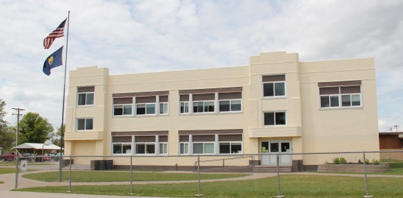
 Most important for its architecture, however, is the town’s public school, a wonderful example of Art Deco style from the New Deal decade of the 1930s.
 Ronan is a third town along the railroad corridor, named for a former white superintendent of the reservation. The town’s demographics today are mostly white, with a little more than a quarter Native American population. Ronan proudly proclaims its existence not only with a gate sign, connecting the business district to the sprawl along U.S. Highway 93 but also a log visitor center and interpretive park on the highway.


 The facade expresses a confident future, which is needed in today’s uncertain economic climate for rural hospitals across the state. But my favorite building in Ronan speaks to my love for adaptive reuse and mid-20th century modern design. The town library is an
 exquisite example of mid-century modern, and was once a local bank before being converted into the library.


 There is a new school and a really different lakefront of businesses, homes, and parks. The town’s population was over 1600 in 2010; it’s now 2700 and counting.


 To get the full meaning of Flathead Lake, however, you have to consider the lake’s deep time, and its long history with the Salish and Kootenai peoples. When I surveyed the county in 1984-1985, you came away impressed with the different vision that the tribes had for the region, and what was already happened at Pablo. In 2014, however, I left Lake County was a deeper impression on what the tribes have meant to the lake and vice versa.
 The People’s Center at Pablo is part of that lesson as it affords a powerful, lasting introduction to both the history and continuation of tribal traditions.
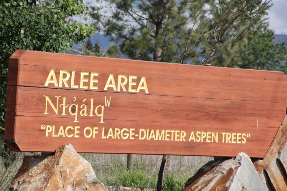
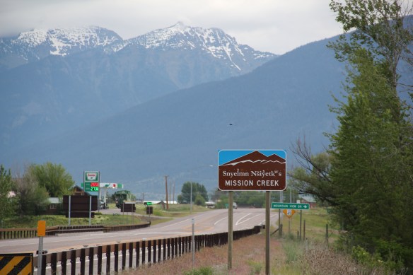


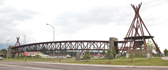
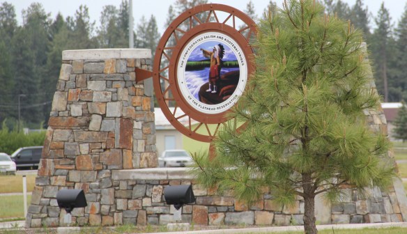
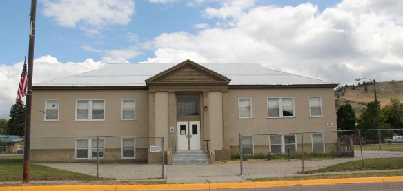 Plains is the second largest town in Sanders County, noted as the home of the county fairgrounds, the center of the local agricultural economy, and like Thompson Falls a significant place along the Clark’s Fork River and the Montana Highway 200 corridor.
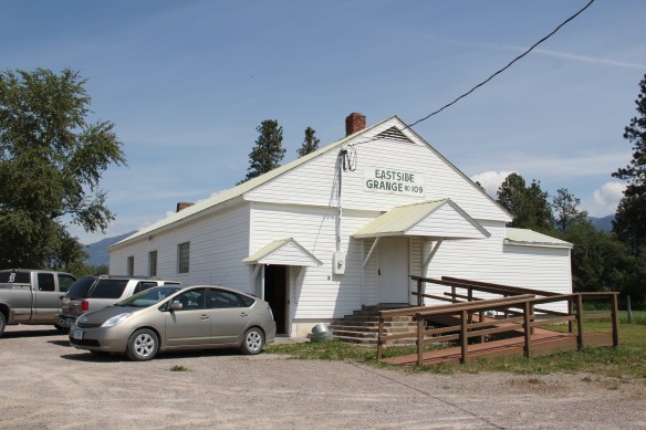
 century feel, be it in institutions, such as the local Grange above, or the continuation of the local VFW hall and bowling alley, below.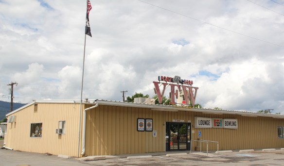


 The Noxon Dam was finished in 1959. It is a mile in length, 260 feet in height and 700 feet wide at its base. Its generators can power approximately 365,000 homes, making it the second-largest capacity hydroelectric facility in Montana.
 Today visitors can view the dam from various parking areas and short walking trails, one of which passes over the historic line of the Northern Pacific Railroad. The property has interpretive signs about the history of the project as well as about the engineering of hydroelectric power.
 Along the banks of the river/reservoir, a much more recent public park has opened–with public sculpture reminding everyone of the Native Americans who once camped along the
 river at this place. By bringing the deep past of the region in view of the modern, this site is a new favorite place–wherever you are in Montana, and there are many modern engineering marvels–the Indians were always there first, using those same natural resources in far different ways.
 Sanders County, like many of the places that are on the western side of the Rocky Mountains, has boomed in the last 25 years, from a population over 8,000 to the current estimated population of 11,300. It is close to Missoula, the eastern side is not far from Flathead Lake, Montana Highway 200 runs from Dixon to the end of the county at Heron. With wide valleys and narrow gorges created by both the Flathead and Clark’s Fork Rivers, which meet outside the town of Paradise, Sanders County is frankly a spectacular landscape, with dramatic mountain views framing open plains, such as the image above and the awesome gorge of Clark’s Fork River, below at Thompson Falls.
 The eastern side of the county is just as dramatic just in a far different way. For centuries First Peoples hunted game and dug the camas root in the broad upland prairie that became known as Camas Prairie, crossed now by Montana Highway 28.
 Then, leading from the county’s southeastern edge there is the beautiful Flathead River Valley, followed by Montana Highway 200, from Dixon to Paradise, and most importantly,
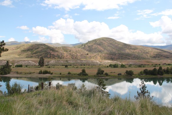 a transportation route initially carved as a trail by the First Peoples who became the nucleus of today’s Confederated Salish and Kootenai Tribe and much later engineered into a major corridor by the tracks of the Northern Pacific Railroad, as it stretched westward from Missoula to the west coast.
 In its wake, the Northern Pacific created most of the county’s townsites by locating sidings along the track. Substantial settlement arrived once the federal government opened lands for the homesteading boom in the early 20th century.
 Dixon, named for the former Montana governor Joseph Dixon, is one of the remaining railroad/homesteading towns along the Flathead River. The fate of the community bar, above, is symbolic of the recent history of the town, one of population decline.


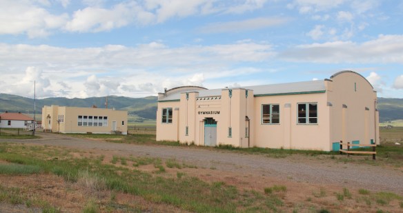
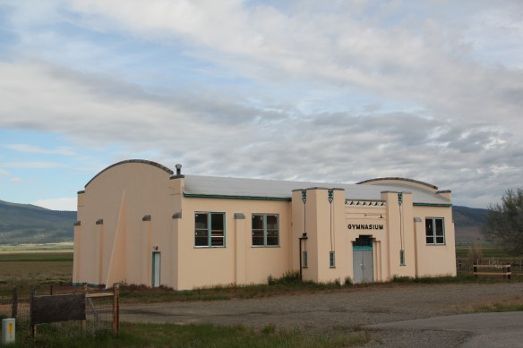
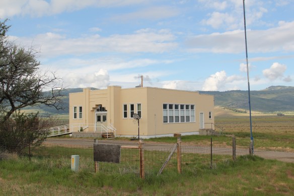 Local residents are being excellent stewards of this captivating property–certainly one of my favorite spots in the state combining landscape with architecture with history. The architect was the Missoula designer H. E. Kirkemo, and the school was completed in 1940, near the end of the New Deal school building programs.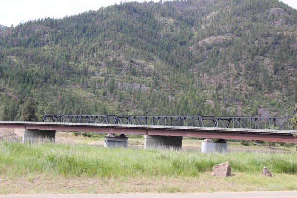

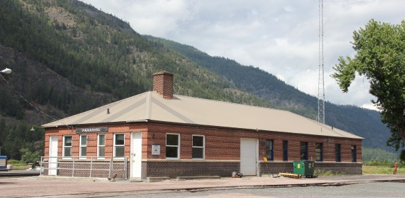

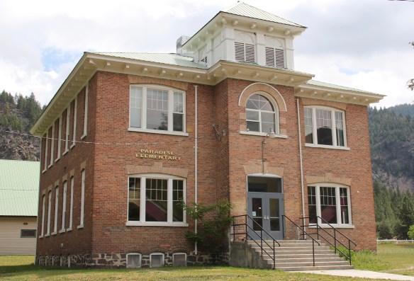 The school had just closed its doors for good when I lasted visited but the restoration planning has been underway ever since. I look forward to my next visit to Paradise to experience the final results. Near the school is another historic community property, the Paradise Cemetery, where tombstones mark the names of those who worked so long for the railroad and for the creation of this place within the Clark’s Fork River Valley.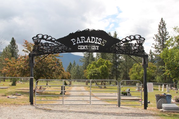
 The two railroads and the river that shaped Missoula also carved the landscape to the northwest. Following the Clark’s Fork River to the northwest, the Milwaukee Road passes through Mineral County, adding to a transportation corridor that, earlier, included the Mullan Road, and then later U.S. Highway 10. It is now the route of Interstate Highway I-90 as i heads west to Idaho and then Washington State.


 As the interstate crosses the Clark’s Fork River near Tarkio it bypasses the earlier transportation network. A particular marvel is the Scenic Bridge, listed in the National Register in 2010, especially how the bridge of U.S. 10, built in 1928, was designed in dialogue with the earlier high-steel bridge of the Milwaukee Road.
 The Scenic Bridge has been closed to traffic but is safe to walk across, creating great views of both bridges and the Clark’s Fork River–travel here has always been challenging.


 Twenty years historic preservationists stepped up to add numerous properties to the National Register throughout the county. In addition to the passenger depot, the Montana Valley Book Store, above, was listed. This two-story false front building, with attached one-story building, was once the town’s commercial heart and known as Bestwick’s Market–it has been close to the heart of book lovers for years now. Montana Valley Book Store was a relatively new business when I first visited in 1984 but now it is one of the region’s cultural institutions, especially when a visit is combined with a quick stop at the adjacent Trax Bar.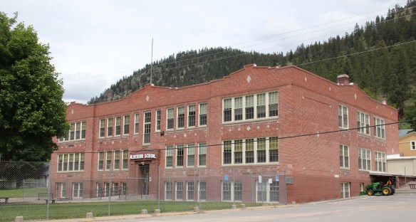
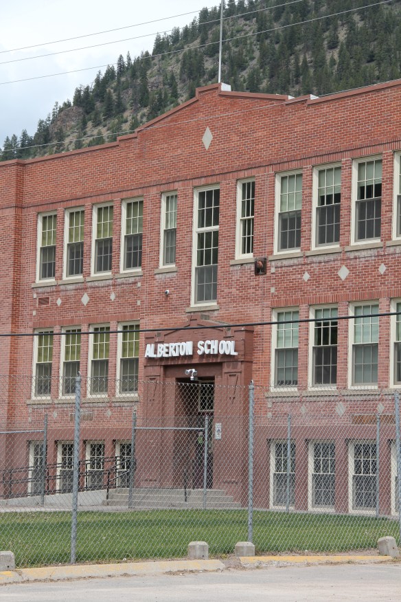 The historic three-story brick Alberton High School (now the Alberton School) operated from 1919 to 1960 as the only high school facility within miles of the railroad corridor. It too is listed in the National Register and was one of the community landmarks I noted in the 1984-1985 state historic preservation plan work.
 I gave no notice to the replacement school, the modern Alberton High School, c. 1960. That was a mistake–this building too reflects school design ideas of its time–the Space Age of the late 1950s and 1960s, when open classrooms, circular designs, and a space-age aesthetic were all the rage. Alberton High School is one of my favorite small-town examples of Montana modernism.
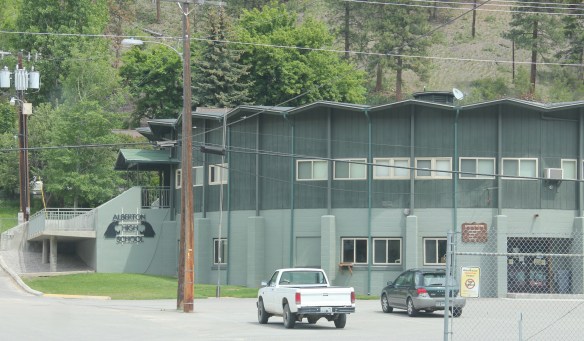 The school is a modern marvel just as the high school football field and track are reminders of how central the schools are to rural community and identity in Montana. Alberton has held its own in population in the decades since the closing of the Milwaukee Road, largely due to its proximity to Missoula and the dramatic gorges created by the Clark’s Fork River. Change is probably coming, and hopefully these landmarks will remain in service for years to come.
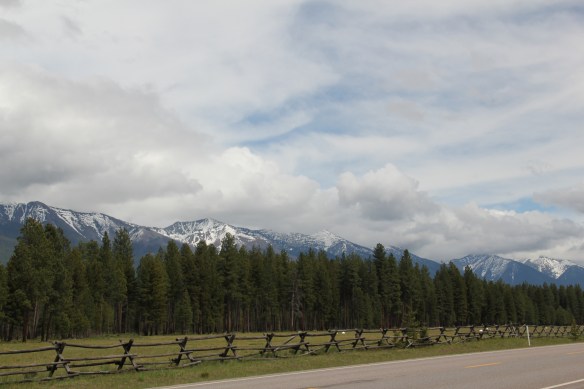 Missoula County has grown, a lot, since my state historic preservation plan work in 1984-1985, especially in the county seat of Missoula and surrounding suburbs. Yet Missoula County still has several spectacular rural drives, like Montana Highway 83 above at Condon, along with distinctive country towns. This post will share some of my favorites.


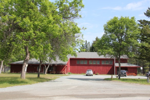
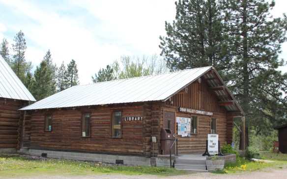 The Condon Community Center and adjacent Swan Valley Community Library serve as additional hubs for those living along the lakes and mountains of northeast Missoula County. Both buildings are excellent examples of mid-20th century Rustic style–a look that, in different variations, dominates the Highway 35 corridor.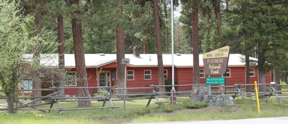
 Condon is also the base for the Condon Work Center, home to the Great Northern Fire Crew, of the Flathead National Forest. Here you can take a mile-long Swan Ecosystem Trail and learn of the diversity of life in this national forest region.
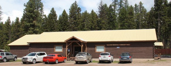
 South of Condon on Montana Highway 83 is Seeley Lake–a place that certainly has boomed in the last 30 years–witness the improved highway, new businesses, and population that has increased over 60 percent since my last visit in 1992. Yet it still had places rooted in the community’s earlier history such as the Sullivan Memorial Community Hall–a good example of mid-20th century Rustic style.
 And it had added one of my favorite bits of roadside architecture in this part of Montana: the Chicken Coop Restaurant as well as opening a new Seeley Lake Historical Museum and Chamber of Commerce office at a spectacular highway location just outside of town.


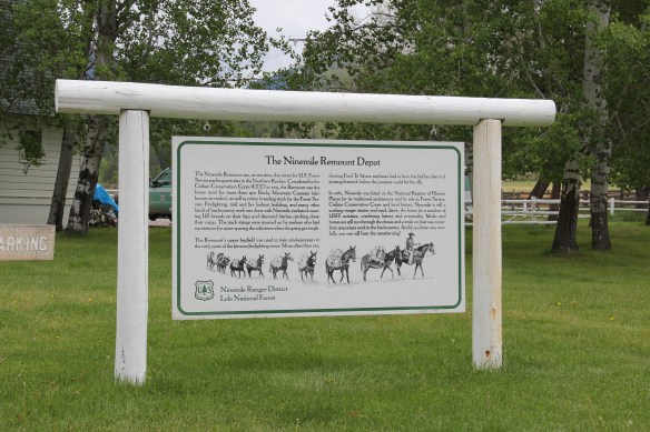
 I don’t recall even thinking about the forest service facility, but here was an entire complex devoted to the forest service’s use of mules and horses before the days of the ATV that was built by the Civilian Conservation Corps. The remount depot is an interesting


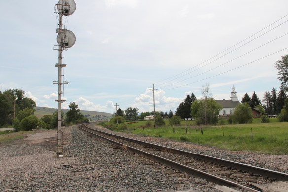
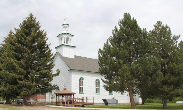
 The name Frenchtown dates to 1868 and is a reference to a number of French Canadians who moved here in the early settlement period. A National Register-listed church, the St. John the Baptist Catholic Church (1884) marks that first generation of settlers. Its classical-tinged cupola has long been the town’s most famous landmark.
 The Milwaukee Road built through here in 1907-1908 and there remains a handful of historic business buildings from the time of the Milwaukee boom. There is one landmark
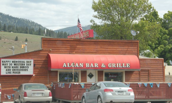
 another roadside landmark–the Bucksnort Bar, just further evidence to add to the Chicken Coop and the Alcan that you won’t go hungry if you explore the small towns of Missoula County.


