

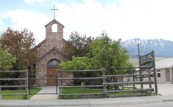
June means it is drive-in time in Big Sky Country. The next three months are not only when most visitors come to Montana. It is the time when Montanans get out and travel to festivals, rodeos, and their own family vacations. In my years of traveling and documenting historic places in Montana, I have not forgotten the drive-in restaurant and its role in the roadside landscape of the state. I paid some attention to this property type during the original work on the state historic preservation plan in 1984-1985. Most drive-ins (and here I am focusing on independent operators not fast food chains) dated between 1950 and 1970 and the best examples were located along stretches of early federal highways. When I returned in 2012-2016 to revisit the state’s historic landscape, scholarship told me to be on the look for drive-ins of all sorts and shapes. Some already had shuttered–like Zandy’s in Great Falls–but others were still vibrant, and great places for road food. The following are some of my favorites:
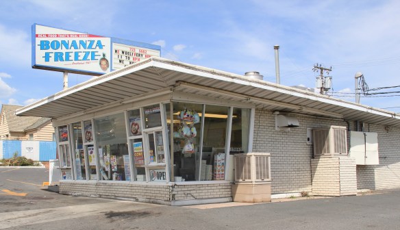
Bonanza Freeze in Butte is a walk-up and drive–thru. Gotta love the plate glass wall.


The Big K in Baker is along U.S. Highway 12–it too works as a walk-up–in southeast Montana.
 The Main Drive-In in Conrad is located on the historic federal hi way (U.S. 91) and still draws in customers despite competition from chains and the diversion of most traffic to Interstate Highway I-15.
 At Scobey, Shu Mei’s Kitchen converted an earlier drive-in into a family restaurant on Montana Highway 13 in northeast Montana.
This former drive-in at the forks of the Yellowstone Trail in Three Forks has been converted to a coffee shop.
But my favorite coffee drive-in, by far, is the Percolator, in Poplar along U.S. Highway 2 in northeast Montana.

Frosty’s In and Out is another classic drive-in along the historic Yellowstone Trail, this time in Glendive.
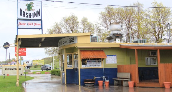
 It’s not surprising that Lewistown, in the middle of the state faraway from the interstate system, has several still operating roadside establishments from the mid-20th century, such as the Wagon Wheel Drive-In (above–and being a southerner I loved the sign that bragged “we have MT Dew”) and the Dash Inn (below), which opened in 1952.
The next three may well be my favorites of all of the different drive-ins. Ford’s Drive-In in Great Falls is so eye-catching with its Art Deco-influenced design and neon. Burgerville in Polson is just, well, eye-catching with all of its signs and towers–how could you ever miss it along U.S. Highway 93?
Near the downtown commercial district (on the old route of US 89).
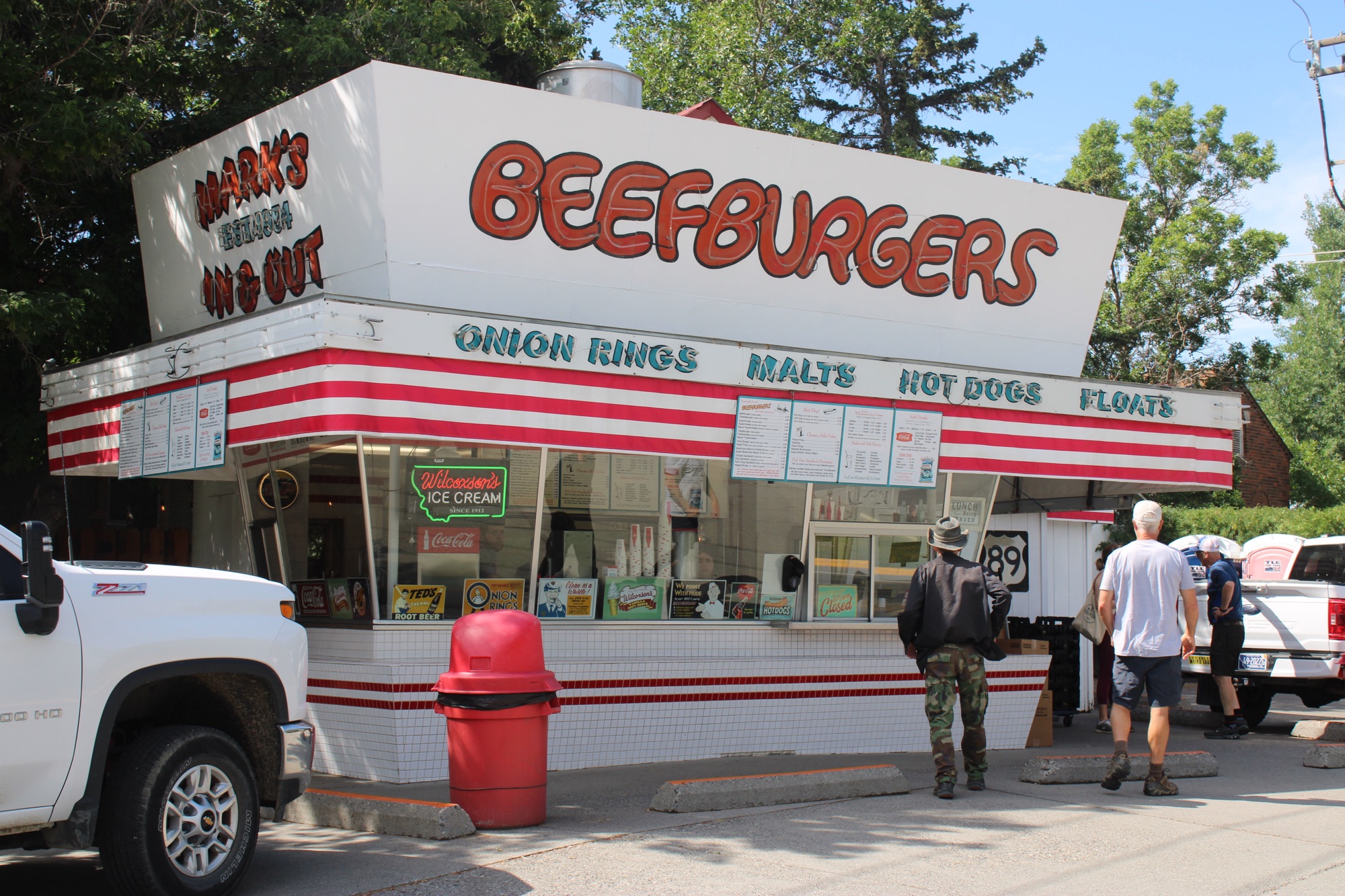
in Livingston is another favorite of many, Mark’s In & Out and its wonderful shakes.
Then there is Matt’s Drive-In in Butte. This place was awarded the prestigious 2016 America’s Classic Award from the James Beard Foundation. The foundation’s press release stated: “The whitewashed cottage with sky-blue trim opened in 1930 as a drive-in. The staff still deliver some meals curbside to this day, and they remain cheerful curators of community, working the soda-fountain counter in a room lined with midcentury-style wood paneling. The food does the roadside genre proud.” Yes, indeed. And you haven’t been to Montana if you have not tried a nut burger from Matt’s. Always add a shake and onion rings here too.


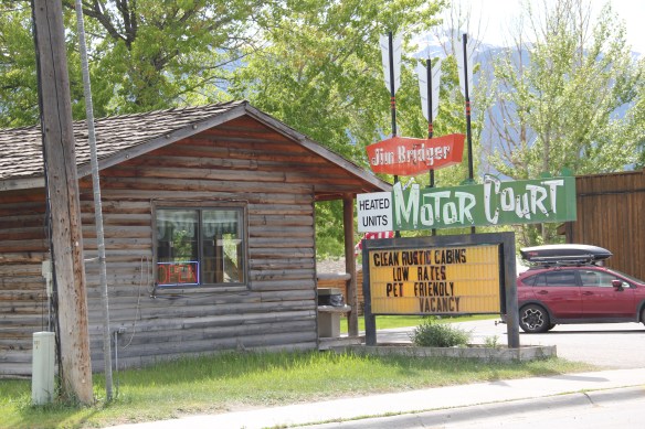
 In the 1984-1985 fieldwork for the state historic preservation plan, the impact of lodging chains in Montana was pretty limited to the larger towns, and gateways to the national parks. Many what I called “mom and pop” motels, largely from the pre-interstate highway era of the 1940s and 1950s, still operated. I was working with the state employee lodging rate of $24 a night (remember it was 1984!) and I found that the per diem eliminated the chains and I was left with the local establishments. During those months of intense travel I came to respect and really like the Moms and Pops. Several of the places I stayed in 1984-1985 are long gone–but ones like the Lazy J Motel in Big Timber remain. In this post I am merely sharing a range of historic motels from across Big Sky Country.
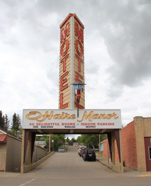 I began the fieldwork in February 1984 and the first stop was a public meeting at the Toole County Courthouse in Shelby. My first overnight was just as memorable–for good reasons–at the O’Haire Manor Motel. Its huge neon sign on the town’s main street, which was U.S. Highway 2, could not be missed, and actually the sign replaced a building that once stood along the commercial district, knocking it down so travelers would have a clear shot to the motel itself.
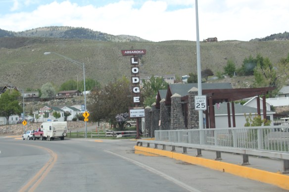
 Cut Bank’s Glacier Gateway, on the other hand, reminded visitors that it was that “coldest place” in the United States that they had heard about in weather forecasts.


 Another example from the old Yellowstone Trail and U.S. Highway 10 is the Shade Tree Inn Motel in Forsyth–although coal and railroad workers help somewhat to keep it going in the 21st century.
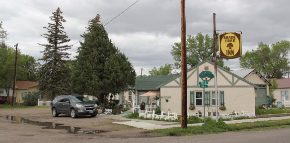 Just a block west of another historic section of U.S. Highway 10 in Deer Lodge is the Downtowner Motel, with its sloping roof and extended rafters representing the best in “contemporary” style from the 1960s. This place too was clean, cheap, and well located for a day of walking the town back in 1984.

 Not only have the changes in traffic patterns been important, the present generation’s preference for chain motels–and the proliferation of chains across the state–have shaped the future of the mid-20th century motel. A good example is the challenges facing the continuation of the Cherry Hill Motel in Polson, located along U.S. Highway 93. Here was a favorite spot in 1984–near a killer drive-in–a bit out of the noise of the town, and sorta fun surroundings with a great view of Flathead Lake.
 The place was up for sale in 2015–and the internet today tells me that it is “permanently closed.” I hope it can find a new owner and is still there when I next return to Polson but with the general boom in the Flathead Lake region, one assumes its days are numbered.
 The bear might be hugging the tree but does anyone else care enough–or want this type of lodging, complete with the “picture window” of the 1950s and 1960s, in the comfort obsessed 21st century?

 One of my favorite weekend drives, when I lived in Helena over 30 years ago, was to head north, via the Flesher Pass (above) and Montana Highway 279, and hit the very different landscape of Montana Highway 200 (below) and eastern end of the Blackfoot Valley.
 The destination was breakfast, often at Lambkin’s, a family business that, to my delight, still operates when I visited in 2015. Lambkin’s is one of those classic small town Montana eateries, great for breakfast, and not bad for a burger and pie later in the day. The town is


 The most popular Montana gateway into Yellowstone National Park is at Gardiner, in the southern tip of Park County. Here is where the Northern Pacific Railway stopped its trains, at a Rustic styled passenger station long ago demolished, and travelers passed through the gate above–designed by architect Robert Reamer–and started their journey into the park.
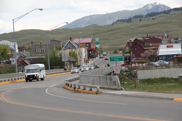 By the mid-20th century, Gardiner had become a highway town, the place in-between the beautiful drive through the Paradise Valley on U.S. Highway 89 (now a local paved road)


 The plan to develop a new Gardiner library at the old Northern Pacific depot site at part of the Gardiner Gateway Project is particularly promising, giving the town a new community anchor but also reconnecting it to the railroad landscape it was once part of. Something indeed to look for when I next visit this Yellowstone Gateway.
 My friends in the environs of Helena have been surprised that after 300 something posts I had yet to say anything about Augusta, a crossroads town in northern Lewis and Clark County along U.S. Highway 287, during my revisit of the 1984-1985 state historic preservation plan. They knew that I loved the open range drive to Augusta, whether approaching from U.S. 287 or U.S. Highway 89.
 Then, the various businesses and bars along Main Street represented not just a favorite place in rural Lewis and Clark County, but also document a classic western town with great roadside architecture such as the Wagon Wheel Motel.


 Augusta began as a crossroads town for neighboring ranches; the later extension of a railroad spur to nearby Gilman spurred competition between the two towns. But Augusta
  won that battle–today not much outside of the Montana Highway Historical marker, a steel bridge, and a disappearing railroad corridor remains of Gilman.

 But I like the football field almost as much as the historic school–could a more neighborhood setting even be imagined?
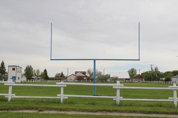 Then there are historic commercial buildings from the early 20th century–several with National Register qualities, especially the F. M. Mack General Merchandise store–a frame building with paired bracketed cornice.


 Over 300 people call Augusta home today, a slight increase since my work 30 years ago. The community not only has kept the historic buildings noted above, residents also have opened the Augusta Area Museum–heritage is clearly part of the town’s future.
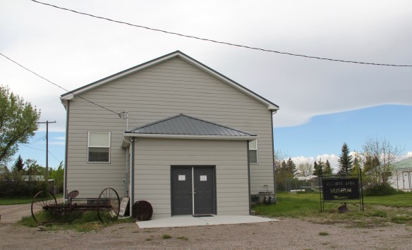


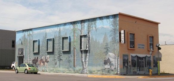
 I am speaking instead of the wide range of images and themes that visually interpret the town’s and county’s history. Finding public art murals about the open landscape once dominated by the Blackfeet Indians and the buffalo is not surprising–communities often embrace the deep history of their land.
 That Cut Bank also has a large expressive mural about the Lewis and Clark Expedition is not surprising–murals about Lewis and Clark were installed across several towns during the bicentennial of the expedition in the first decade of this century. East of Cut Bank is Camp Disappointment, one of the more important sites associated with the Corps of Discovery.
 Nor is it surprising to see communities commemorate their homesteading roots, and the importance of agriculture and cattle ranching.
 But I was surprised, pleasantly, by the number of murals that also documented the town’s twentieth century history, whether it is the magnificent steel trestle of the Great Northern Railway just west of the commercial core, or a mural that reminded everyone of the days when the railroad dominated all traffic here.

 It is this first half of the 20th century feel that the murals interpret–the era that actually built most of the historic buildings you find there today–that I find so impressive and memorable about Cut Bank, be it people on bicycles or what an old service station was like.
 Space matters when you interpret the built environment, and these various murals reflect not only a sense of town pride and identity they also give meaning to buildings and stories long forgotten.
 City as one large tourism funnel. After spending a good part of 2006-2007 working with local residents and the Great Smoky Mountains National Park about the heritage and preservation of Gatlinburg, Tennessee–one of the most notorious gateways into any national park–I learned to look deeper than the highway landscape and find some real jewels in each of these Glacier National Park gateway communities.


 At Hungry Horse, however, I did leave the highway and explored the marvelous landscape created by the Hungry Horse Dam and Reservoir, a mid-20th century project by the U.S. Bureau of Reclamation. The agency justified the dam as a hydroelectric power project for a growing Flathead County and as a boost to local irrigation. The irrigation side of the project–the real reason the agency exists–never happened and Hungry Horse today is an electric power and recreational project.
 I appreciated the vastness of the concrete arch dam–the 11th largest concrete dam in the United States–as well as the beauty of Hungry Horse Reservoir, an under-appreciated tourism asset as anyone in Flathead County will tell you. But again, I let just the size and impact of the dam distract me from some of the details of its construction that, today, are so striking.


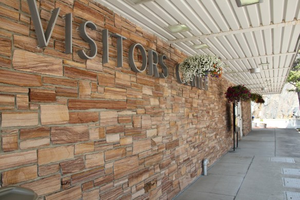

 I am concerned, however, about news in September 2015 that Reclamation has contracted for updates and renovation at the Visitor Center–let’s hope that the classic 1950s look of the property is not sacrificed.


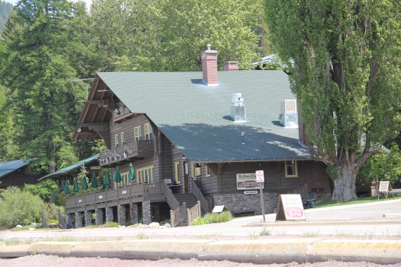 Architect Kirtland Cutter of Spokane was the architect and the chalet design was actually just a smaller scale and less adorned version of the Idaho State Exhibition Building that he had designed for the 1893 World’s Fair in Chicago. Cutter is one of the major figures of the Arts and Crafts Movement in the American Northwest and we will look at another of his buildings for the railroad and Glacier in the next post about Lake McDonald Lodge.


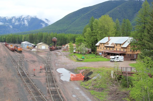


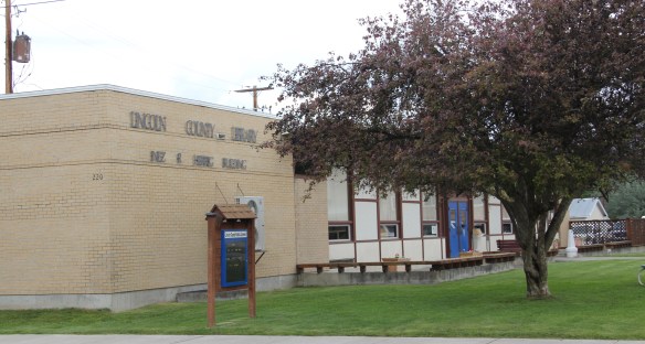
 Libby is the seat of Lincoln County, a typical railroad town along the historic Great Northern Railway corridor. The image above is from the town’s railroad depot, the symbolic beginning of town, from which runs a long main street of businesses, reflecting the T-plan town design, where the long railroad corridor defines the top of the T and the main street forms the stem of the T.


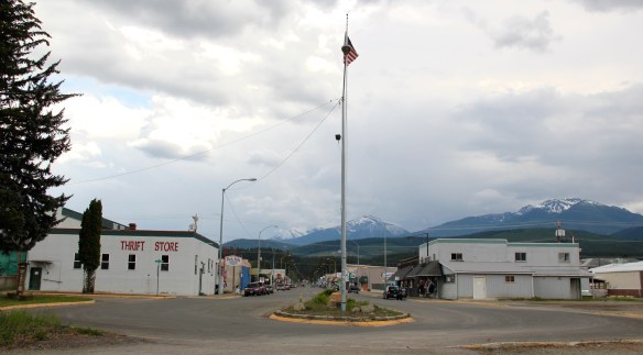
 courthouse received a totally new front, in a contemporary style, in the 1970s as the town and county expanded in the wake of the federal spending in constructing Libby Dam. The rectangular blockiness, flat roof, and band of windows set within a symmetrical facade makes the courthouse one of the state’s best designs for a rural public building in the late 20th century.
 I liked all of those things about Libby in 1984. Imagine my shock and disappointment to learn, as everyone else did, that Libby was one of the poisoned places in the west. In 1919, vermiculite, a natural material that contains asbestos, had been discovered outside of town, and the mines were still operating, producing 80 percent of the vermiculite in the world, under the control of the W.R. Grace company. Residue from the mines had been used in local yards and buildings for decades, a fact that was not known when I visited the town for the state historic preservation plan. When the discovery of the danger became public, and the federal Environmental Protection Agency entered into the fray in 1999, it was already too late for many residents. A federal Superfund project began, and did not conclude its work until 2015, spending some $425 million. Then in 2009 the Environmental Protection Agency announced a public health emergency, spending another $130 million to help residents and to leave a new health infrastructure in place. In a generation, Libby had been turned inside out. EPA announced in 2016 that the cleanup would continue to 2018, and that the project was the longest in the agency’s history.
 Despite the disaster, I saw many signs that Libby residents were determined to remain and rebuild their community. One of the most powerful examples is the conversion of one of the town’s historic schools into a new community arts center as well as school administration offices.


 The asbestos crisis was a terrible disaster for Libby–yet residents refused to let it define their future. There are past accomplishments to acknowledge, an active railroad depot to cherish, a beautiful river and lake, the mountains all around, as celebrated in this public art mural on a downtown building. This place is here to stay, and the historic built environment is a large part of it.
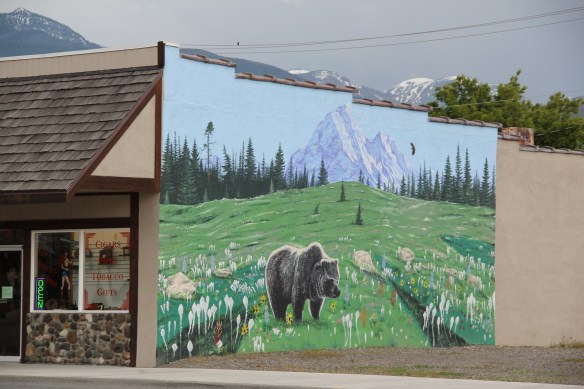
 Flathead Lake is a beautiful body of water and my favorite way to explore it by automobile is to take Montana Highway 35 north from Polson to Bigfork in neighboring Flathead County. Why is this winding, often slow, somewhat dangerous two-lane route my fav?
 Because it takes you by one of Montana’s most unique roadside landscapes–the orchard stands that sell Flathead cherries during the summer months. There isn’t really a Flathead cherry–the name comes from the lake region, especially this east side of the lake that has proven perfect for growing the sweet treat once Harry Chapman started the first orchard here around the turn of the 20th century.


