Country Towns in Beaverhead County, Part II

Jackson MT, MT 278Jackson, Montana, is another favorite place of mine in Beaverhead County.  Located on Montana Highway 278, far away from any neighborhoods, the town dates to the 1880s, as

Jackson Mercantile, MT 278, L&C sign on side
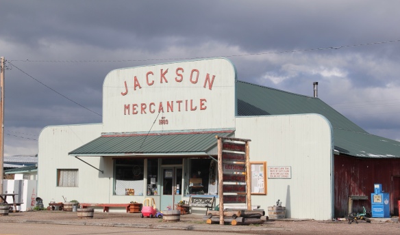
this area of the Big Hole Valley opened up to ranching. Its name came from Anton Jackson, the first postmaster; the town still has a historic post office building even though its

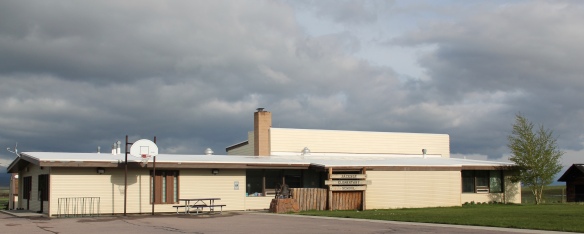
population barely tops 50.  That is enough, once kids from surrounding ranches are added, to support the Jackson elementary school–a key to the town’s survival over the years.

Jackson School, MT 278
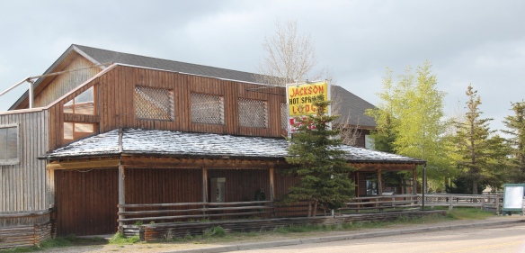
Jackson grows significantly during the winter, as it is an increasingly popular winter get-away destination, centered on the historic Jackson Hot Springs, which had been upgraded and significantly expanded since my last visit in 1984.

Jackson MT Hot Springs
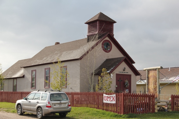
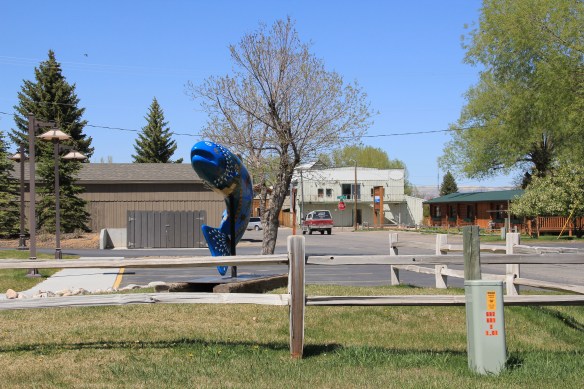
But my real reason to tout the wonders of Jackson, Montana, lie with a simple but rather unique adaptive reuse project.  A turn of the 20th century church building has been converted into a hat manufacturer business, the Buffalo Gal Hat Shop–and I like hats!

IMG_2995
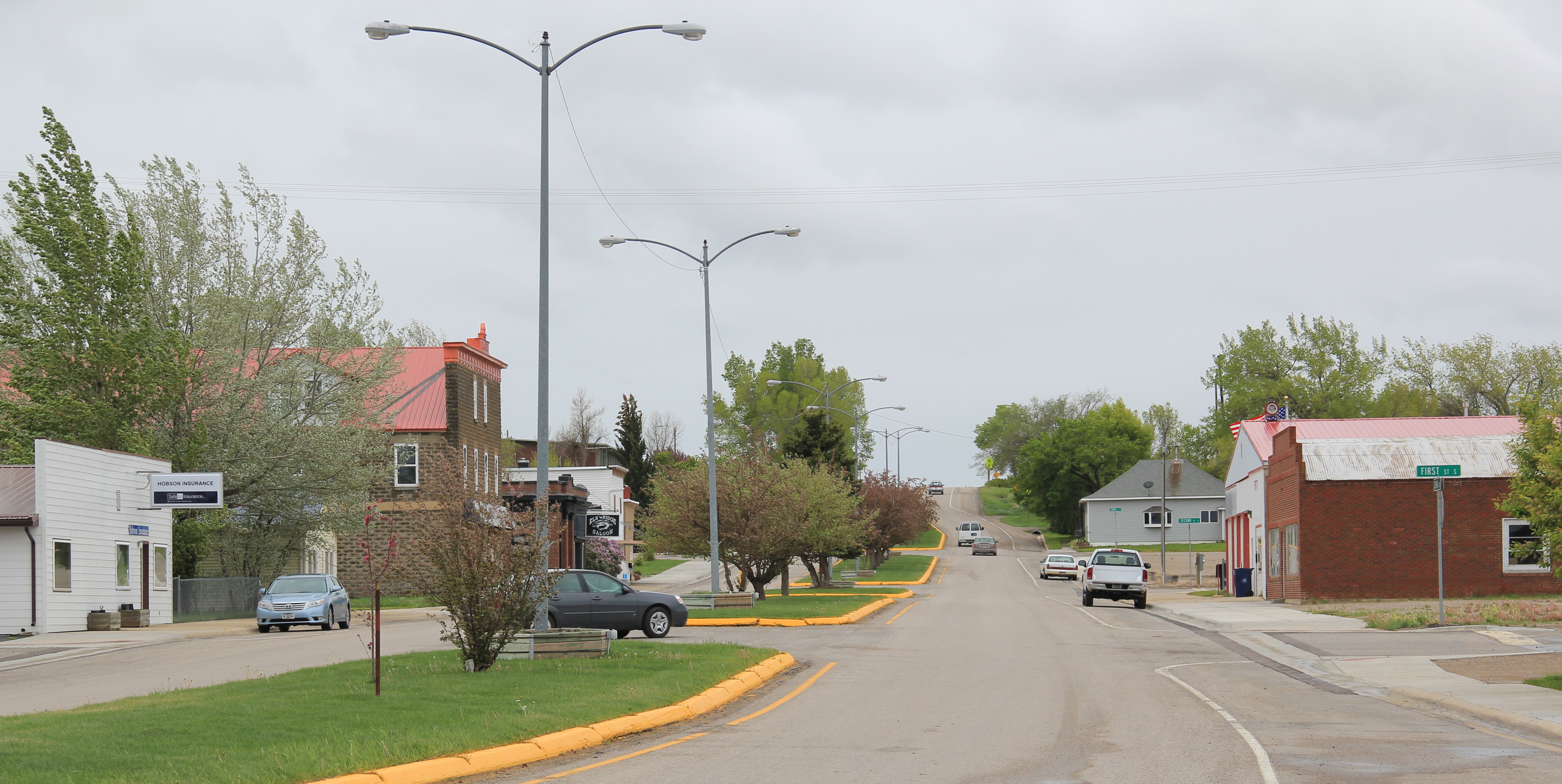
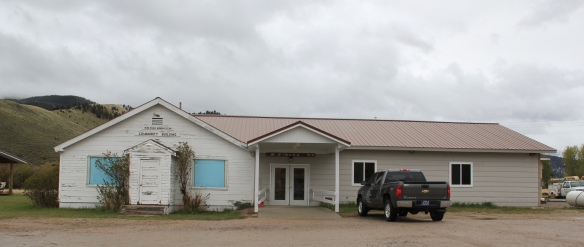
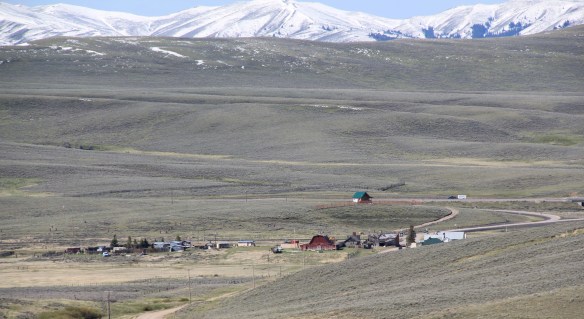
Grant is another ranching town along a Montana secondary highway, this time Montana Highway 324.  Like Jackson, it too has enough year-round residents and children from nearby ranches to support a school, a tiny modernist style building while an older early 20th century school building has become a community center.

Grant only attracts the more hardy traveler, mostly hunters.  The Horse Prairie Stage Stop is combination restaurant, bar, and hotel–a throwback to isolated outposts of the late 19th century where exhausted travelers would bunk for a night.

Grant bar and lodge
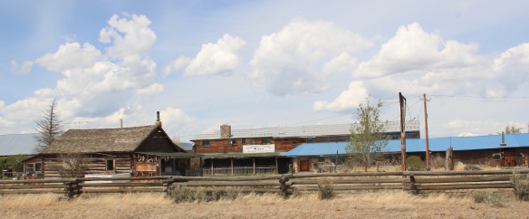
Back when I visited in 1984, Monte Elliott (only the third owner of the property he claimed) showed off his recent improvements made within the context of a business location that dated to the Civil War era.  The lodge still keeps records from those early days that they share with interested visitors.  In the 21st century, new owner Jason Vose additionally upgraded the facilities,  but kept the business’s pride in its past as he further expanded its offerings to hunters and travelers.

IMG_3499
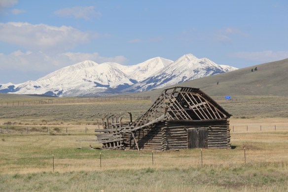
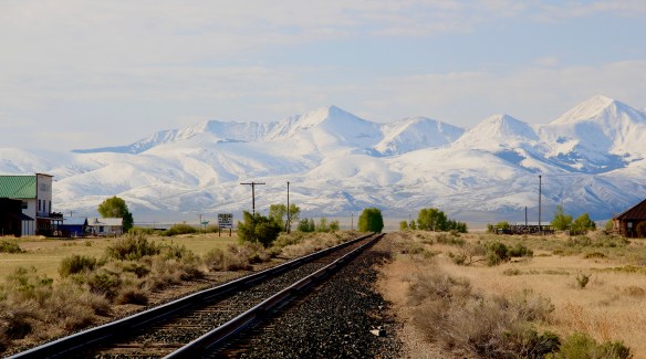
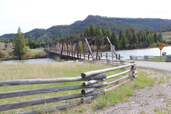
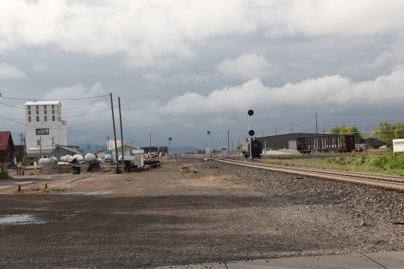
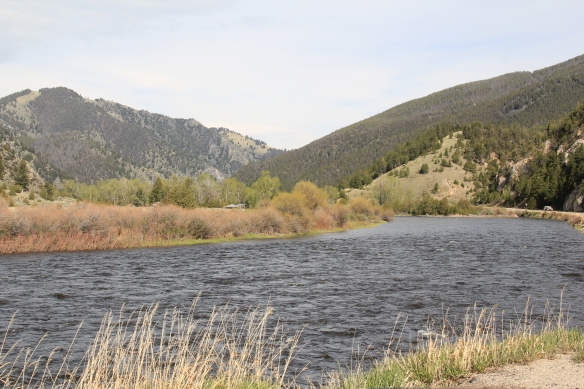
Far to the north along Montana Highway 43 is the Big Horn River Canyon, a spectacular but little known landscape within the state.  Certainly anglers and hunters visited here, but the two towns along the river in this northern end of Beaverhead County are tiny places, best known perhaps for their bars as any thing else.


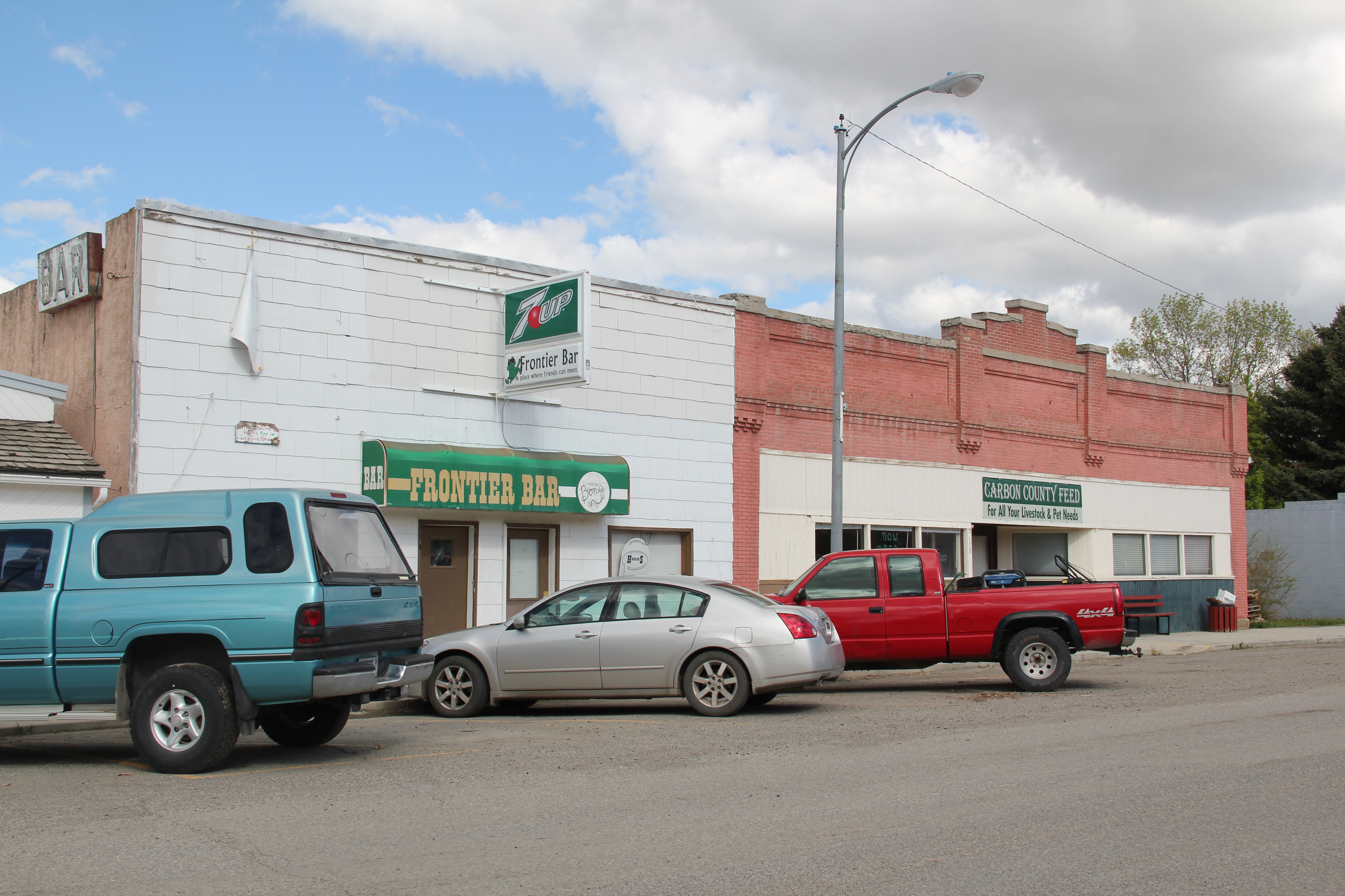
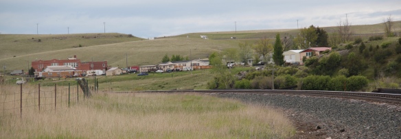
Certainly that is the case at Dewey, where the Dewey Bar attracts all sorts of patrons, even the four-legged kind.  The early 20th century false-front general store that still operated in 1984 is now closed, but the town has protected two log barns that still front Montana Highway 43.

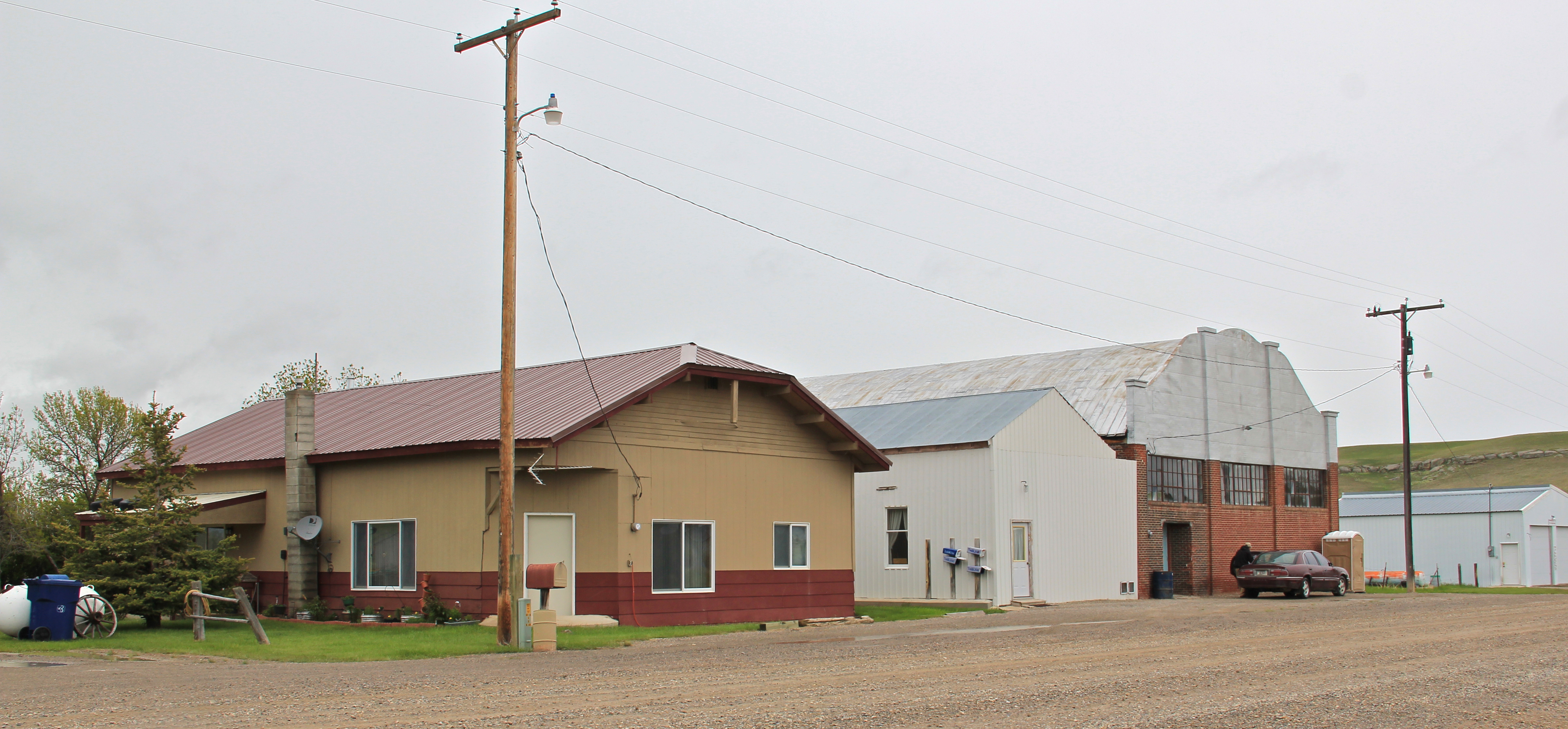
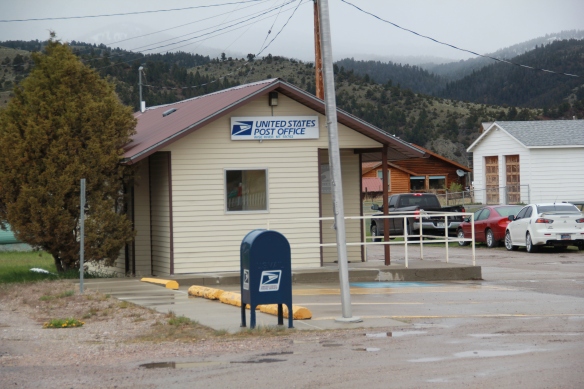
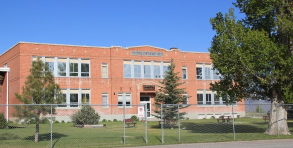
Wise River still has four primary components that can characterize a isolated western town:  a post office, a school, a bar/cafe, and a community center.  It is also the location for one of the ranger stations of the Beaverhead National Forest.

The station has a new modernist style administrative building but it also retains its early twentieth century work buildings and ranger residence, a Bungalow design out of logs.

The forest service station has provided Wise River with a degree of stability over the decades, aided by the town’s tiny post office and its early 20th century public school.

IMG_2965

IMG_2967
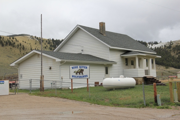
Just as important as a town anchor is the Wise River Community Center, which began in the gable-front frame building as the Wise River Woman’s Club but has expanded over the last 30 years into the larger building you find today.

Wise River Woman's Club with extension

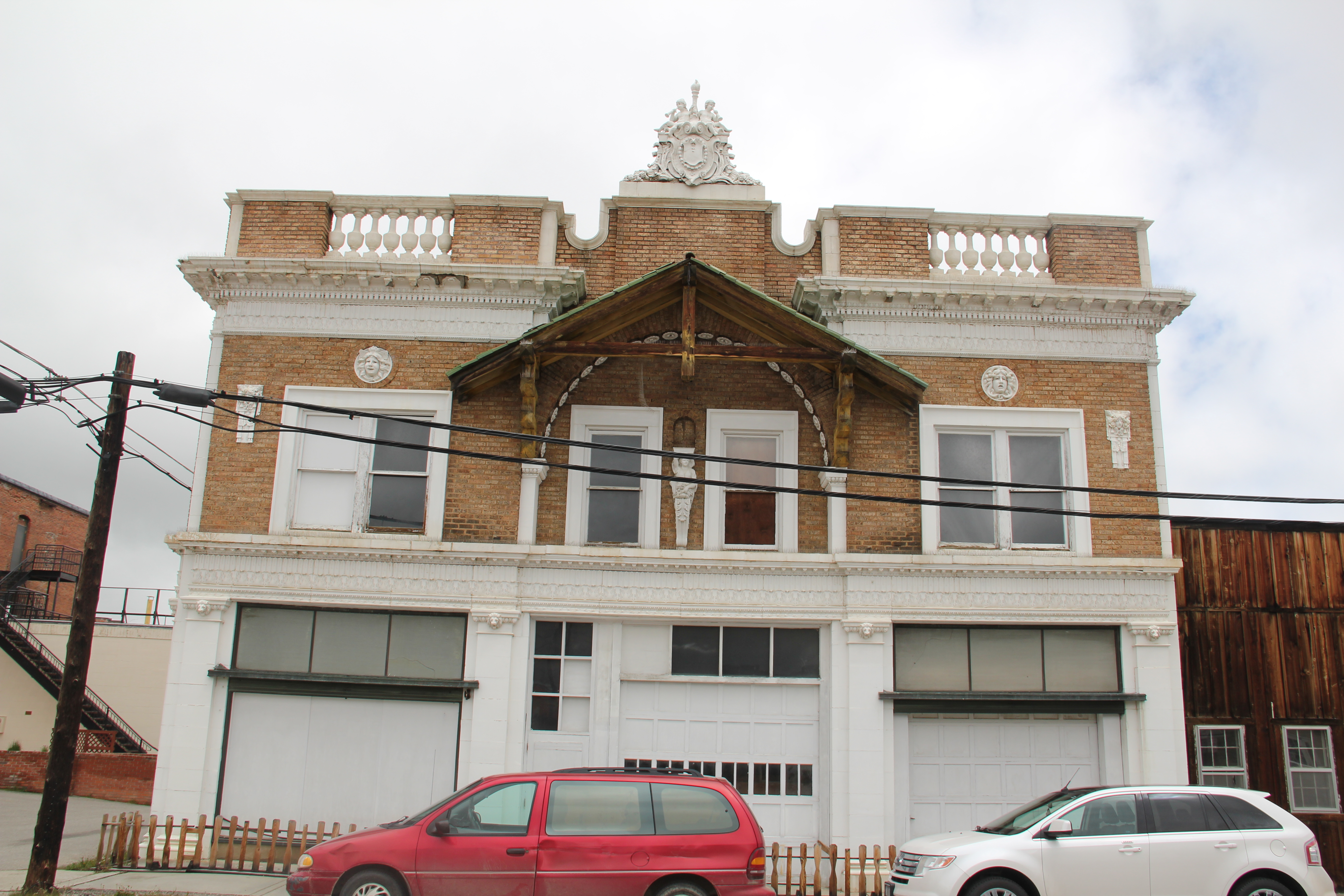
But to my eye the most important institution, especially for a traveler like me, is one of the state’s most interesting bits of roadside architecture, the Wise River Club.  I have already written about this building, from my 1984 travels.

Wise River Beaverhead Co. MT
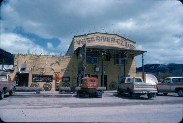
The liveliness of that 1984 exterior–note the mini-totem pole, the log benches, wagon wheels, and yes the many antlers defining the front wall–is muted in today’s building.

IMG_1660
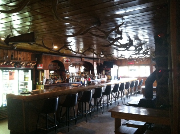
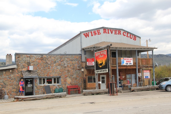
But the place is still there, serving locals and travelers, and a good number of the antlers now grace the main room of the bar.

IMG_0549
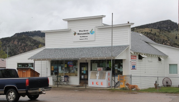
Wise River, unlike Dewey but similar to Jackson, has been able to keep its historic general store in business.  The post office moved out in the 1990s to the new separate building but the flag pole remains outside to mark how this building also served both private and public functions.

Wise River Mercantile, Wise RiverThe country towns of Beaverhead County help to landmark the agricultural history of this place, and how such a huge county as this one could still nurture tiny urban oases.  Next I will leave the rural landscape and look at Beayerhead’s one true urban landscape–the county seat of Dillon.

Country Towns of Beaverhead County, Part One

Monida from MT 508, 2

Monida, at the Idaho-Montana border, on Interstate I-15.

Country towns of Beaverhead County–wait,  you cry out: isn’t every town in Beaverhead County a country town?  Well yes, since Dillon, the county seat, has a single stop light, you can say that.  But Dillon is very much an urban oasis compared to the county’s tiny villages and towns scattered all about Beaverhead’s 5,572 square miles, making it the largest county in Montana.

IMG_3387Let’s start this theme with the railroad/ federal highway towns.  Monida, at the state border with Idaho, is a good place to start, first established as a place on the Utah and Northern Railroad line as it moved north toward the mines at Butte in 1881.  Monica had a second life as a highway stop on the old U.S. Highway 91 that paralleled the tracks, as evident in the old garages left behind.

The next town north on the corridor created by the railroad/highway/interstate is Lima, IMG_3369
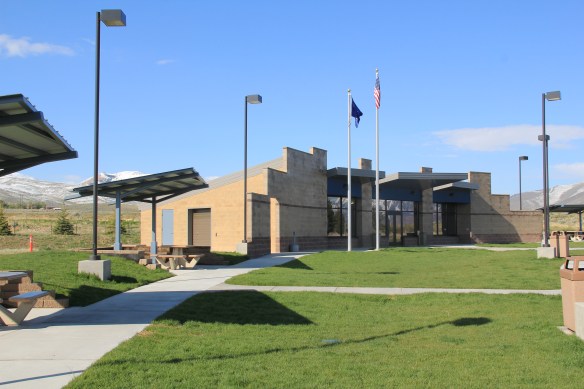
which possesses a Montana welcome center and rest stop.  That’s important because at this stop you also can find one of the state’s mid-20th century examples of a tourist welcome center, which has been moved to this stop and then interpreted as part of the state’s evolving roadside architecture.

Lima is a classic symmetrical-plan railroad town, the plan favored by the engineers of the Utah and Northern as the railroad moved into Montana.  The west side of the tracks, where the two-lane U.S. Highway 91 passed, was the primary commercial district, with several brick and frame two-story buildings ranging from the 1880s to the 1910s.

Lima west of tracks Peat Hotel and bar

Lima west of tracks 2 Peat Hotel and bar

The east side, opposite old U.S. Highway 91, was a secondary area; the Lima Historical Society is trying to keep an old 1880s building intact for the 21st century.

The town’s comparative vitality is shown by its metal Butler Building-like municipal building, and historic churches, ranging from a early 20th century shingle style to a 1960s contemporary style Gothic church of the Latter Day Saints.

The town’s pride naturally is its school, which developed from the early 20th century two-story brick schoolhouse to become the town’s center of community.

Lima school

Eight miles to the north is a very different historic schoolhouse, the one-story brick Dell school (1903), which had been converted into a wonderful cafe when I stopped in 1984.  It is still a great place–if you don’t stop here for pie or a caramel roll (or both), you goofed.

IMG_3391

The Calf-A is not the only place worth a look at Dell, a tiny railroad town along the historic Utah and Northern line, with the Tendroy Mountains in the background.  Dell still has its UPRR line at Dell

post office, within its one store, its community hall, and a good steakhouse dive, the false-front Stockyard Inn.  But most importantly, for an understanding of the impact of World

War II on Montana, Dell has an air-strip, which still contains its 1940s B-17 Radar base, complete with storehouse–marked by the orange band around the building–and radar tower.  Kate Hampton of the Montana State Historic Preservation Office in 2012 told me to be of the lookout for these properties.  Once found throughout Montana, and part of the guidance system sending planes northward, many have disappeared over the years.  Let’s hope the installation at Dell remains for sometime to come.

B-17 base landscape, Dell

There are no more towns between Dell and Dillon but about halfway there is the Clark Canyon Reservoir, part of the reshaping of the northwest landscape by the U.S. Bureau of Reclamation in the 1960s.  The bureau in 1961-1964 built the earthen dam and created the

reservoir, which inundated the small railroad town of Armstead, and led to the re-routing of U.S. Highway 91 (now incorporated into the interstate at this point).

Clark Canyon Reservoir, reclamationThe reclamation project, which stored water for irrigation, also covered the site of Camp Fortunate, a very important place within the larger narrative of the Lewis and Clark Expedition and its relationships and negotiations with the Shoshone Indians.  An early


effort to mark and interpret the site came from the Daughters of the American Revolution, who not surprisingly focused on the Sacajawea story.  Reclamation officials added other markers after the construction of the dam and reservoir.

In this century the Lewis and Clark National Historic Trail has added yet another layer of public interpretation in its attempt to tell the whole story of the expedition and its complicated relations with the Native Americans of the region.

North of Dillon along the old route of U.S. Highway 91 and overlooking the corridor of the Utah and Northern Railroad is another significant Lewis and Clark site, known as Clark’s Lookout, which was opened to the public during the Lewis and Clark Bicentennial of the early 21st century.

The lookout is one of the exciting historic sites that have been established in Montana in the 30 years since my initial survey for the state historic preservation plan.  Not only does the property interpret an important moment in the expedition’s history–from this vantage point William Clark tried to understand the countryside before him and the best direction to take–it also allows visitors to literally walk in his footsteps and imagine the same perspective.

Of course what Clark viewed, and what you might see, are vastly different–the tracks of the Utah and Northern, then route of old U.S. 91 are right up front, while the town of Dillon creeps northward toward the lookout.

IMG_3173

Our last stop for part one of Beaverhead’s country towns is Glen, a village best accessed by old U. S. Highway 91.  A tiny post office marks the old town. Not far away are two historic IMG_3164

North of Glen you cross the river along old U.S. Highway 91 and encounter a great steel tress bridge, a reminder of the nature of travel along the federal highways of the mid-20th century.

IMG_3161


Ennis, a Madison County Gateway

IMG_0336
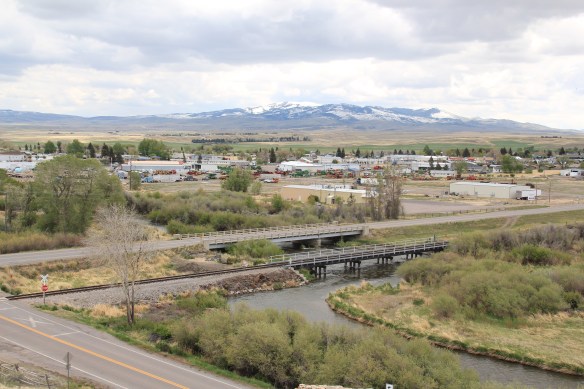
Nestled where Montana Highway 287 encounters U.S. Highway 287 in the southern end of Madison County, Ennis has changed in significant ways in the last 30 years. Its earlier dependence on automobile tourism to Yellowstone National Park has shifted into the favor of population growth and development in this portion of the county.

IMG_0328The iconic Ennis Cafe, always a favorite place back in the day of the statewide work, remains, with a new false front emphasizing the wildlife and open spaces of this area.   That place, along with several classic watering holes, served not only locals but the

motoring public headed to Yellowstone.  The Riverside Motel is a classic piece of roadside architecture from the 1950s, and the place where I stayed in 2012 during the Ennis work.

Another great bit of contemporary style design comes in the mid-20th century U.S. Forest Service headquarters building at Ennis–Rustic style with a Ranch-style House look.

Madison Ranger Station, Beaverhead and Deer Lodge Ntl Forests, Ennis

But now Ennis abounds with signs of more recent prosperity.  A town of 660 residents in 1980 now has 838 and counting in 2015.  New, more architecturally distinctive buildings potmark the town.  The First Madison Valley Bank is a blending of Prairie and Rustic styles, with exposed log walls, updated for the 21st century.

While the local city hall may have only a recent faux paneling update to its exterior, the Madison Valley Public Library is another 21st century interpretation of Rustic style.

Most interesting is the amount of public sculpture found throughout the town.  Designed to delight the visitor, and to convey a sense of the long standing traditions of recreation and ranching in the community, the sculptures comes from such talented artists as Jim Dolan, Dave Clarke, and E.C. Lyon, among others.


IMG_0326

New bars, restaurants, and medical center have been established, again more architecturally distinct for the Yellowstone visitor, and fly fishing devotee, of today.


South of Ennis Jeffers, once a cross roads town for traffic to the park.  It is now just off of the highway, and it retains several worthy historic buildings, centered around the turn of the 20th century Trinity Episcopal Church and the Jeffers Inn. But the crossroads village

also has captivating Queen Anne-style houses, false front stores, enough of a physical history left to suggest that it was bubbling with activity over 100 years ago.

U.S. Highway 287 is the modern two-lane road that runs along the Madison River and it heads into the national park.  The route also passes along some of the finest fly fishing of the Madison River Valley.  The Old Kirby Place fishing lodge (c. 1885) was once a toll gate, lodge, and dwelling.  Adjacent is the historic Hutchins Bridge (1902), a steel truss bridge

that was once the primary river crossing for the increasing number of tourists coming down the valley to reach Yellowstone National Park.  It is listed in the National Register of Historic Places.  Not only is the bridge a major landmark for those who fish, it is also part

IMG_0079 of a section of the highway where you will encounter magnificent views of the Madison River Valley and open ranch lands.

IMG_0072


Butte’s Uptown Funk

IMG_1134.JPGIn thinking about returning to Montana in 2012 and carrying out a huge “re-survey” of the places I had explored for the state historic preservation plan process 30 years earlier, Butte was high on my list of priorities.  Not that the city and its surroundings had been given little attention in the early 1980s–the Copper City was already recognized as a National Historic Landmark, and a team of historians, architects, and engineers had just finished a large study of its built environment for the Historic American Building Survey and the Historic American Engineering Record.  No, I wanted to go back because by 1985 many people counted Butte down and out, yet it had survived and started to reinvent itself.  Not

2011 MT Silver Bow County Butte 064
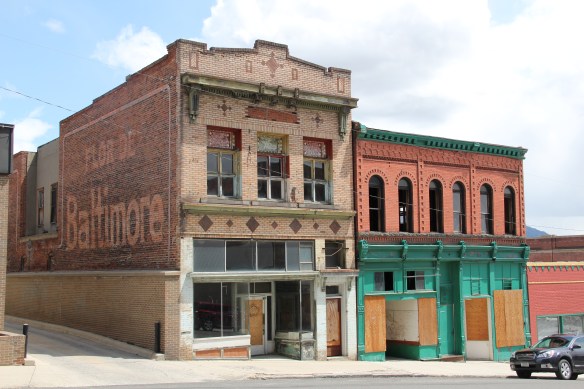
as a ghost town or the skeleton of a great mining city but as a revitalized place, both economically and culturally, centered in a strong core community, even though the challenges in front of it remain daunting, even overwhelming at times.

Mountain Con Mine E
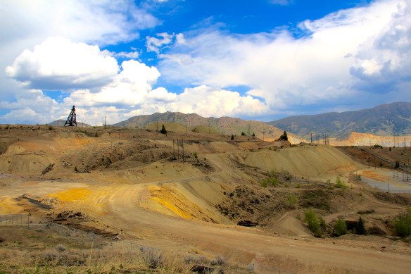
The environmental degradation left when the hard rock mines shut down is one burden that Butte has shouldered, with the help of the federal superfund program.  Still, no matter how scientifically this landscape has been “cleaned up,” it remained scarred, and it is a far different challenge to build back hope into a place stripped of its life.  Yet high over the city is a sign of the change to come in the Mountain Con Mine site.

Mountain Con Mine 6Still labeled as a Mile High and a Mile Deep place, the mine property is stunning, not only for its technological assertion–imagine working that high, and going that deep–but for its conversion into the walking/hiking/biking trails that encircle the city and present it with such potential as a recreational landscape.

Transformation, that it is what strikes me as I wander down the trail and into Butte’s famous, or is it infamous, “Uptown” district.  Butte is far from the place it was 30 years

2011 MT Silver Bow County Butte 030ago, with all sorts of signs of new investment, new pride, and community identity.  It may have lost a step, or two, and its swagger may not be quite as exaggerated as it was in the mid-20th century, but it remains a place with its own feel, its own funk.  For me, the reopening of the M&M Bar on Main Street–a legendary dive once shuttered, reopened, and shuttered again–gives me hope for Butte in the 21st century.  Around the corner is

another institution, Gamer’s Cafe, which is situated within the marvelous Victorian eclecticism of the Curtis Music Hall of 1892.

Both establishments are for locals but visitors are tolerated, even welcomed.  Indeed a degree of openness and acceptance have grown in Butte, a marked change from when the city’s Chinese residents lived and operated businesses on the edge of Uptown, along

IMG_0842Mercury Street; at the same time the sex trade was alive and well to the east of that same street in a series of boarding houses and hotels.  The Dumas Brothel, discussed in an earlier post, is listed in the National Register and its future as an adaptive reuse project and place for public interpretation is promising but not yet realized.  African Americans in

early 20th century Butte lived even farther down the hill from Uptown, in a small neighborhood around Idaho Street and the Shaffers African Methodist Episcopal Church, now a pentecostal meeting house.

Idaho St at Shaffers AME

Uptown today is more a place for everyone, and has become the center of the community’s identity.  It is easy to see why:  massive, soaring buildings like the Metals Bank and Trust Tower and Hotel Finlen lend architectural dignity to the surroundings.  Early 20th century classicism gives character and substance to Metals Bank whereas the Finlen has a classy

Renaissance Revival-style skin but then it has a spectacular contemporary Colonial Revival interior design, reminding us of Butte’s resurgence during the heyday of the Berkeley Pit boom from the mid-1950s through the turbulent 1960s.

The Hennessy Block is another commercial landmark, from the city’s founding generation, that has looked for a long-term solution for decades now.  Built in 1898 with support from mine magnate Marcus Daly, the building housed what most consider to be the state’s first full-fledged department store, headed by and named for Daniel Hennessy.  Minneapolis architect Frederick Kees designed it in a Renaissance Revival style.  In 1901 the Anaconda Copper Company moved its executive offices to the top of the building, making it perhaps the leading corporate landmark in the city.

2011 MT Silver Bow County Butte 040

2011 MT Silver Bow County Butte 038
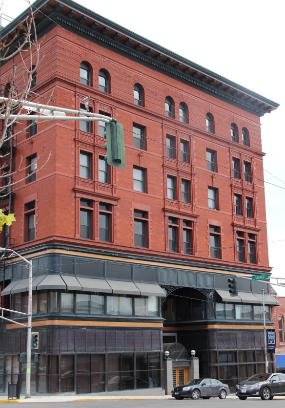
The massive building still dominates the Uptown building, making its closure in Butte in 1980 that more disturbing for residents.  When I did my preservation plan work in 1984-1985 the issue of what to do with the Hennessy was at the forefront.  By the end of the decade, ENTECH renovated the building and reopened it fully for business.  In 2010 came the popular Hennessy Market–giving the growing number of Uptown residents a grocery store once again.

IMG_0790
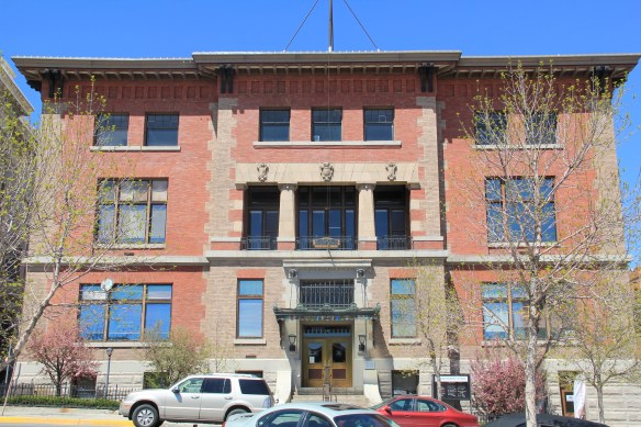
The Sliver Bow Club building (1906-7) also has shifted its purpose, from being the stately and eloquent clubhouse of the city’s elite to becoming a place for public offices and meetings in its once exclusive spaces.  Originally conceived by the same Spokane architects who designed the Lake McDonald Lodge in Glacier National Park, according to recent research by museum curator and preservationist Patty Dean, the building’s architects ended up being Link and Haire, the noted Montana architectural firm.

The interior design came yet from another important firm, William A. French and Company of St. Paul, Minnesota.  Here you find one of the state’s best “Arts and Crafts Movement” themed interiors–and one of the best in the entire West.

The interior design speaks loudly to the gender and class focus of the social club. Its success set there table for Link and Haire’s next Butte masterpiece, the Beaux Arts-styled Silver Bow County Courthouse (1910-1912).  Few public spaces in the state, save, perhaps the State Capitol, rival the Butte courthouse for its ornate exterior and interior, representing an overstatement of public authority and power in a city where a handful of mining interests made so many of the decisions.

Two years after it opened, the courthouse was not a refuge for those in need but a barracks for the state militia during the violence of 1914.  Today, however, it is most definitely the people’s house, and was duly celebrated during its 100th birthday in 2012.  It is part of the city’s distinguished public landscape, including the Victorian City Hall and the Beaux Arts classicism of the Police Department.

Of course, there is much more to see and say about Uptown Butte, but hopefully this is enough to show community pride at work, the value of historic preservation, and a proud city on the upswing, despite the obstacles before it.

Logan: A forgotten railroad junction in Gallatin County

Gallatin Co Logan Gallatin RiverLocated between the Gallatin River and Interstate I-90, Logan is a forgotten yet still historically significant railroad junction on the Northern Pacific Railroad.  Established c.

IMG_6627

IMG_6637

1890 the place was first known as Canyon House, for early settlers, and then named Logan in honor of a family who owned land there.

Gallatin Co Logan store

The original Canyon House name has reappeared in Logan since my last visit in 1985 with the name given to this conversion of an old store/hotel to apartments

Logan became the place where Northern Pacific trains went one of two ways:  crossing the river and heading to the recently established state capitol of Helena or staying south of the river and heading to the copper mines at Butte.

In time the railroad company developed Logan as a mini-division point with a roundhouse, other railroad support buildings, and offices.  Today none of that remains–the roundhouse burned during the depression and was not replaced–but the tracks still dominate all views of the town.

One key community building that documents the early 20th century prominence of Logan is the two-story brick school.  It has been closed since my last visit in the 1980s but was converted into private use, and was for sale when I stopped in 1985.  Its size, brick construction, and classic progressive school architecture design speaks to the


Gallatin Co Logan 7

The school (far left) dominates the town’s built environment as you approach on old U.S. 10 from the west

promise that residents held for the town c. 1920. A historic church building also exists from the founding decades of Logan.  It too is now closed and faces an uncertain future.

As the various images of the railroad corridor indicates, Logan is still a busy place for train traffic but its population never rebounded after the depression decade.  Train traffic during World War II boosted local fortunes a bit–and the town’s large depot served hundreds of customers a day into the late 1940s. But once the Northern Pacific switched to diesel, coal stops like Logan was no longer necessary.  When I visited in 2015 I expected to find little to nothing but the tracks–or much more than I ever expected if the boom that had overwhelmed Belgrade and was consuming Manhattan had reached Logan.  A bit of whimsy instead has come into Logan, along with one of the best bar/steakhouses in this region:  the aptly named Land of Magic Dinner Club–the type of Montana oasis you cannot get enough of.

Belgrade and transformation in Gallatin County

IMG_7066From 1983-85 Belgrade became one of my favorite Northern Pacific railroad towns.  Often I would leave the interstate here, stop at truly one of the great small town bars/cafes along the town’s railroad corridors, and then travel on old U.S. 10 (the town’s Main Street) on to Manhattan, Logan, and Three Forks before popping up on US 287 and continuing to home in Helena.

Gallatin Co Belgrade 8

The building for my favorite cafe/bar in Belgrade still stands; it has been converted into a sports bar/casino, and additions have been made to either end of the building.

Belgrade has changed so much in the last 30 years:  it is the largest Montana town that is not a county seat, and it is larger than many existing county seats in the state.  As the new adjacent Bozeman airport takes off, growth will continue in this part of Gallatin

Screen Shot 2016-01-24 at 10.20.19 AM

County, and Belgrade is probably not many months from 10,000 in population.  It had about 2300 residents when I surveyed the town in the early 1980s.

Gallatin Co Belgrade
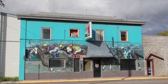
Despite the boom, several landmarks remain.  The Belgrade Community Church, built in 1904 as the town’s Presbyterian church, served in the 1980s as a joint church building for both the town’s Presbyterians and Baptists.  This impressive Gothic Revival building had received several updates and additions in the mid-1970s.  It became the Community Church in 1992 as the Presbyterians left and the American Baptist Church took over sole control of this historic church building.

A similar story is told by the Belgrade Mercantile Company block, a turn-of-the-20th-century two-story brick building, that defined the town’s primary commercial corner and faced the tracks of the Northern Pacific.  Thirty years ago, you saw the potential of the building but several storefronts then were shuttered.  In the early 21st century the landmark received a complete renovation and is a busy place today.

Gallatin Co Belgrade 5

The town’s historic mission-style gas station still stands along the U.S. 10 corridor but was not in use in May 2015.  The Mint Bar–another old fav–had just closed its doors when I visited last.  The town’s downtown blocks retain the historic look of the Northern Pacific symmetrical-plan town from 1881-1882, and many of the building blocks date c. 1900 to 1930.  it is time for Belgrade to take advantage of historic preservation as a tool for downtown revitalization.  In a county where so much is listed in the National Register, Belgrade has never taken full advantage of the program even as the town’s pride and stewardship of its early landmarks remain evident today.


Plains Country Towns in Montana’s Judith Basin

Created with GIMP

Milwaukee Road Corridor, Moore, 1984.

In my work with the State Historic Preservation Office in 1984-1985, my colleagues put up with many of my own peculiar interests and views of the Montana historic landscape, especially the focus on public buildings and the state’s railroad corridors.  My interests, however, in the country towns of the Judith Basin was probably always a puzzler; staff always wished I would press on to Lewistown, where some of the best preservation work in the state was taking place in the mid-1980s (much more on Lewistown a bit later).  But I must admit that the maze of small towns–never numbering more than 200 or so souls in any given place–created by the railroads as they fought for market dominance in the rich agricultural region of the Judith Basin some 100 years ago was just fascinating.

Moore Elevators Fergus Co

Grain elevators at Moore, 1984

And they remain so today.  The geographer John Hudson had provided basic insights on the creation, distribution, and purpose of the country towns in the larger development of the northern plains–he coined the phrase “plains country towns.” The constant elements that they all shared–oriented to the tracks, the dominance of grain elevators, the prominence of depots–underscore the railroad era origins.  But the towns all had their own individual places and statements, be it a woman’s club, a library, the school, and the bars and taverns.  Thirty years later, much was missing from what I experienced in 1984–every place lost population between 1980-2010–but much still remained, and residents seemed determined to keep it that way.

IMG_9782

IMG_9783

Moore still has its grain elevators but the Milwaukee depot is long gone, creating an empty space along the corridor.  Moore has the look of so many Milwaukee Road towns with a T-plan design apparent today even as the town decline from its height of 575 residents in 1920 to the 193 of today.

IMG_9790But the town, which compared to many I visited in 1984 had declined to a lesser degree (229 residents in 1980 to 193 in 2010), still has its public institutions.  The Moore Woman’s Club is celebrating its centennial in 2015 while the town’s public library is another key community center while the continued operation of the unassuming Moore public school

IMG_9787

IMG_9785_2is undoubtedly the major reason that the town is still here today.

IMG_9788

The Great Northern Railway spur line that snaked north from the Yellowstone Valley at Laurel through the Judith Gap then the basin was always a corridor of great interest to me, although the towns created along the way were small, seemingly inconsequential compared to the linking of Great Falls and Billings.

IMG_9770Traveling north out of the Yellowstone then Musselshell valleys, the Great Northern line entered the basin at Judith Gap, and the homesteaders who followed built a grand two-story brick school that spoke of their ambitions.

IMG_9769

The corridor then left in its wake places forgotten today.  Travelers along U.S. 191 may notice the old brick state bank building and elevators at Garneill, but they may not.

IMG_9779

The highway veers away from the railroad line at Garneill, meaning that the old state bank at Buffalo was a forgotten place in 1984–and the town remains so today.

Buffalo, Judith Basin Co (p84 35-15)

First State Bank, Buffalo, 1984.

Hobson, on U.S. 87/Montana 200, has experienced a much brighter history. Its brick bank building houses a local bar.  While no depot remains, the town’s railroad line remains a IMG_9797

IMG_9792point of focus, although most traffic, commercial and otherwise, relies on the highway.  Hobson’s population when I visited in 1984 was at its height, 261 people in 1980, and it still tops over 200 today.  Another defining characteristic is Hobson’s rather unique (for a plains country town) boulevard plan.

IMG_9794On either side lie business and public buildings and the street ends at the high school, where the six-man football field is a central element of the community’s public landscape.

IMG_9801The Murray Block, 1910, dominates the business district today as it much have done one hundred years ago–it is rare to see a false-front concrete block building.  The Masonic

IMG_9795Lodge probably helps to identify some of the builders of Hobson’s historic structures located on the boulevard.  But whoever the builders were, here is a very interesting place

IMG_9802

IMG_9798

IMG_9799and just as importantly the properties are in use, be they a cafe, a store, or a library. A long two-lane road, Montana 239, stretches east from Hobson along the Judith River and headed into Little Belt Mountains.  The paved road ends at the earlier settlement of the

IMG_9419basin, the cowboy town of Utica, made famous by the paintings and writings of Charles M. Russell, the state’s most famous artist.  Utica has a strong sense of itself, although it is justa tiny place today.  A large part of that sense of the past is maintained and enhanced by the work of the Utica museum, the local historical society, and the town rod and gun club.  Utica has a level of public interpretation that was certainly not in place in 1984 and that today is rarely matched in a small Montana town.

IMG_9425

IMG_9429

IMG_9422Utica also has done a commendable job of maintaining and preserving key community buildings, such as the early 20th century school and community hall, both properties associated with the homesteading boom of that time.  The town’s historic store is a little

IMG_9426

IMG_9427worse for the wear of 100 years of use, but it is still here, and the stone construction speaks strongly to the vernacular quality of the area’s built environment.

IMG_9428History and preservation are not the only reasons for Utica’s survival.  In true Montana fashion, most people who take the long drive here come for the food, drink, and good

IMG_9430times at the Oxen Yoke Inn–why else would you locate the town’s primary interpretive sign next to the bar’s parking lot.

IMG_9431For most travelers the highway from Hobson at the eastern end of Judith Basin County to Stanford, the county seat, in the center of the county, is just open road.  But between those two towns three Great Northern hamlets still have significant remnants of their past.  Moccasin was such a favorite in 1984 that the resulting book from the survey work,  A Traveler’s Companion to Montana History, had two images from the place–the New Deal school, with its totally out of place but flashy Art Deco design, and the two-story Classical Revival styled bank building. Moccasin MT JB CoMoccasin, Judith Basin Co (p84 85-1)Those landmarks remain in Moccasin, but much worse for the wear.  The school is clearly among those threatened landmarks highlighted by the National Trust for Historic Preservation in 2012.  The bank is hanging on, barely.

IMG_9818

IMG_9821Moccasin still has other historic buildings worthy of note, such as a church, its town pump, even a telephone booth (a real disappearing part of the landscape from 1984 to 2014).

IMG_9812

IMG_9810

IMG_9822More importantly, its historic Great Northern combination depot, although battered, still is along the tracks nearby the elevators, reminding anyone looking closely enough of the railroad roots of the place.

IMG_9809The next two towns of Benchland and Windham also retain their historic depots.  The Benchland station has deteriorated in the last generation as documented in a comparison of a 1984 image with one from 2014.

IMG_4054

IMG_9834The Windham depot has been moved slightly off the tracks–but still within a stone’s throw of the rails.  The station, along with the historic commercial strip of the T-town plan, and historic elevators, still give meaning to the “W” of the town sign.

IMG_9840

IMG_9838

IMG_9841

IMG_9839The curve of the tracks headed to Stanford is a good place to rest with this post–more on the plains country towns of the Judith Basin in the next post.

A last look at Carbon County, and a visit into the Crow Nation

In the northern reaches of Carbon County are two additional towns on U.S. 212 I would like to review before I turn into a far different landscape in neighboring Big Horn County.  I looked earlier at the Boyd store, and its changes over 30 years, briefly in passing on to other railroad towns in the Clark’s Fork Valley.

IMG_5916But Boyd is worth a second look if for nothing more than its rambling vernacular design post office since so many of those buildings have been replaced in the last 30 years by standardized USPS designs.  The same can be said of the Boyd School, a frame building now encased in vinyl that has layers of history in it as the community made additions as necessary over the decades.IMG_5917Continuing north on U.S. Highway 212 is the much larger, prosperous town of Joliet. Joliet is an anomaly–its population now is larger than it has ever been since census data has been recorded.  So many eastern Montana towns steadily lost population to where they are mere skeletons of themselves today.  Joliet has avoided that fate; in fact its population in 2010 was slightly more than when I first visited in 1984.

IMG_5928

The Joliet Community Center symbolizes the town’s stability and sense of itself.

The Rock Creek State Bank, now the Rebakah Lodge Building, anchors one of the town’s most prominent commercial corners.  It is one of several buildings in Joliet listed in the National Register of Historic Places, including a large historic residential district, in the last 30 years.  Joliet had nothing designated in the National Register when I visited in 1984.

IMG_5923While there is a bright new sheen to a good bit of Joliet, the downtown still has that classic mix of vernacular frame and brick one-story commercial buildings typical of the turn of the century railroad/homestead boom towns.  And like most, a tavern, in this case the Frontier Bar, is a permanent fixture in the town.

IMG_5920Outside of town is a wonderful array of roadside public sculpture, courtesy of long-time Joliet resident Charles Ringer.  Ringer moved to town, purchasing an old junk yard and part of a WPA granary, in 1971.  His works have become landmarks for travelers along U.S. Highway 212.  Ringer runs a studio shop out of an old ranch-style house.

IMG_5932Known to many winter travelers as “The Snow God” but named “The Creature” by its creator Charles Ringer, this huge metal sculpture is roadside art at its best in Montana.

IMG_5930

Ringer is also known for his various kinetic sculptures, and the entire property becomes a way for travelers to interact with, or just enjoy, the general wackiness of his creations.

IMG_5931

From Joliet you can strike out east on an improved gravel road, passing through the town of Edgar, and then climbing up out of the Clark’s Fork Valley and into the land of the Apsaalooke, or the Crow Indian Tribe.  Traveling west in the Crow reservation, you encounter two instant landmarks, one much more recent than the other but both are tightly intertwined.  A compelling metal sculpture of a warrior announces the entrance to the Plenty Coups High School, shrouded on the morning I went there in 2015 by an early morning fog.

BH Co Plenty Coups HS - Version 2

Across the road is the Plenty Coups State Park, a fascinating memorial to the former Crow chief Plenty Coups, who the Crow Indian Tribe has designated as its last traditional tribal

IMG_5544 IMG_5575

chief.  Plenty Coups had been among the first Crow Indians to take up a homestead, 320 acres along Pryor Creek, in 1884.  His succession of dwellings, using locally available

IMG_5564materials to build a log house, help to tell his story as well as how some Crows became ranchers.  The park has erected a modern tipi to show earlier Crow dwelling types; the rambling nature of the log house, is both typical and spectacular.  Typical in that

IMG_5549

IMG_5559

IMG_5551it is a three-bay house with a centered front door, but actually quite spectacular in its interior feel of open space, and that its very size would have spoken to the family’s prominence and achievements. The park also interprets a traditional sweat lodge, adding to the understanding of tradition and new ways that blended to create the homestead.

IMG_5561

IMG_5578When Plenty Coups died in 1932 he was 84.  He and his wife Strikes the Iron left 195 acres of their property to be a public park.  Later the National Park Service designated the site as a National Historic Landmark. Since my first visit in 1982 a new museum building had been added to the park, significantly enhancing the public interpretation of the site; you left with the feeling that this was just not a static installation and memorial (as it was in the 1980s) but a true museum and park which will continue to grow and adapt to the needs of the Crown Indian Tribe and the park’s visitors.

IMG_5572

To the east of Pryor, on Pryor Creek Road, was another historical place associated with the Apsaalooke–the Pryor Creek Battlefield.  Where in the low creek bluffs and the narrow

IMG_5533

valley created by the water, a major battle between the Apsaalooke and their enemies the Lakota, Cheyenne, and Arapaho took place c. 1861–just at the time the Civil War was beginning in the United States far to the east.

IMG_5536

The Crows had worked with federal officials to build a road turn-off and place interpretive markers about this key battle for the control of the Yellowstone Country c. 1861, just before the time that the first permanent white settlers entered what would become Montana Territory.  Thirty years ago, I knew from Crow historian Joe Medicine Crow that this famous battle, where the Apsaalooke secured control of the region in what Medicine Crow called a “glorious victory,” took place along Pryor Creek Road. But the markers now pinpoint the battlefield and interpret what happened plus the significance of the fight.

IMG_5538

Here was suddenly a place that I had truly never “seen” before–and an indication of how good interpretive markers can make a desolate place come alive with historical meaning.  Kudos to all for bringing forth this forgotten battlefield and a site of a famous Crow victory.

IMG_5539

Red Lodge: Preservation Maybes and Maybe Nots

It’s no secret that I have long admired the towns of the Yellowstone Valley.  Thirty plus years ago, the attitude across much of Montana was dismissive of this region:  I even was told by someone who should have known better that “outside of Custer, there’s really isn’t much history there.”  Not only was their history in spades–chronologically deep, thematically rich–there was this tremendous built environment that I began to explore in 1982, and haven’t stopped since.

Snag Bar (1901) Red Lodge Carbon Co  IMG_5715

Admittedly I take an old school approach to the preservation of this landscape.  Red Lodge has many exemplary preservation achievements but in the 21st century success may be leading to the community losing that edge, admittedly rough edge, that once characterized this region of Montana.  Case in point:  the Snag Bar.  The image on the left is from the 1980s–on the right is an image from this summer.  I was happy that the Snag was still with us–always a cozy watering hole in the past.  But now its entrance spoke to a different audience, and the place had taken on the “Main Street Preservation” look that you can find across the country–and a bit of distinctiveness was gone.

IMG_5725

IMG_5716

Red Lodge was not tipped into that preservation fantasy land right out of Disney’s “Main Street U.S.A.” But new infill of modern false-fronts and even a heavy mountain-like Rustic feel doesn’t help, not to mention the northern California wine bar with its set-backs and sidewalk seating.  It is just worrisome.  As is the future of this once grand movie theater,

IMG_5799which has been hanging on, seemingly by a thread, for decades.  The theater has one of the great Classical Revival facades found in the state, full of whimsy and wonderful detail.

IMG_5782

IMG_5785   IMG_5783

Its conversion into a garage was kept it alive but a conversion into a new public use:  well it is a huge building, that needs work, and Red Lodge is already blessed with a brilliant historic movie theater, the Roman.  Multiple theaters in the early 20th century made sense: today not so much.

IMG_5797

Red Lodge also has gotten it right in its residential historic districts.  The “Hi-Bug” neighborhood–a designation 100 years ago that spoke to the merchant class that lived in the town’s most affluent neighborhood–has made a remarkable recovery in the last 30 years, and looks great as these few images attest.

IMG_5751

IMG_5812

IMG_5815

Throughout town there are similar preservation success stories, ranging from a historic service station (that has a nifty exhibit about Yellowstone tour buses and their preservation lurking inside) and one of my new favorites, the Regis Grocery, now a neighborhood (meaning off the tourists’ beaten path of US 212) cafe worth a stop.

IMG_5737

IMG_5804Red Lodge does have challenges–growth that can overwhelm historic character, too many tourism focused businesses–but the changes here over 30 years are impressive achievements, sure signs of how the 1966 National Historic Preservation Act has helped to change the face of Montana.

Red Lodge: Coal Town of the Clark’s Fork Valley

Clark's Fork River, off U.S. 212, Carbon County, MT Clark’s Fork River, off U.S. 212, Carbon County, MT

When the Northern Pacific Railroad entered the Yellowstone Valley in the 1880s, officials and investors immediately began the search to find and acquire locally available deposits of coal.  First there came the Klein mines north of Billings and then by the end of the decade, the first move toward mines to the south, in the Clark’s Fork Valley, at what would become Carbon County with its major town of Red Lodge on Rock Creek. Development began slowly, with the Depression of 1893 intervening, but as the era’s financial and railroad magnates combined the Great Northern, the Burlington Route, and the Northern Pacific into one huge co-operative venture, they selected a new place in the Yellowstone Valley, a town called Laurel at the confluence of the Clark’s Fork and Yellowstone rivers, to connect the three railroads. In short order, a Northern Pacific Railroad spur line was built down the Clark’s Fork Valley to the place called Red Lodge–U.S. Highway 212 follows this route–and the boom was on.

IMG_5759Entering Red Lodge from the north via U.S. 212 you encounter immediately the town’s roots as a railroad town, as the historic Northern Pacific depot remains rooted at the head of the town.  Here is where my long-interest with the Red Lodge story began in 1984 when

IMG_5760I met with a small group of local historians, preservationists, and civic leaders determined to keep Red Lodge and its still intact historic environment together. The group’s vision for the depot was for it to be a visitor center, an arts center, but more than anything a community center, a visible sign of the turnaround that could happen.  Already, at the head of town artist Peter Toth had begun the new tradition with his mammoth wood sculpture, “In Honor of a Proud and Noble People,” installed in 1979, a theme of the region’s

IMG_5764Native American history and proximity to the Crow Indian Reservation that also was captured in a much more commercial way by the neon sign of the Red Lodge Cafe then, and still to my mind, the best place in town.  The neon, like Toth’s sculpture, was designed

IMG_5723

to attention of the one course of heritage tourism income that locals recognized:  that summer traffic coming out of Billings and off the interstate heading to Yellowstone National Park via U.S. 212 and the Beartooth Pass, one of the true highway wonders of the United States.  How to get people to stop, and how to restore pride and hope for the town itself: those motivated the group I met in 1984 moreso than any well meaning goal of merely preserving history and pretty buildings.

IMG_5758To say that the initial depot project was successful would be an understatement.  Thirty years later the depot is a public space that includes a gazebo, outdoor art, and a setting of history and culture rarely rivaled in the region.  As you move south from the depot, you also immediately encounter several of the dreams the groups discussed in 1984:  a National Register of Historic Places historic district (there are now more than one); restored and treasured public buildings such as the Carnegie Library and Carbon County Courthouse;

IMG_5746

IMG_5734

and their biggest goal of all in 1984, the acquisition, preservation, and transformation of iconic Labor Temple into a history museum and heritage center for the Carbon County Historical Society.

IMG_5740

The group understood the power of the Labor Temple:  they could tell a story not just of railroad magnates and economic development but could look at this history from those who came and labored in the mines, and built the town.  The building dated to the decade of Red Lodge’s height, 1910-1920, when the town’s population reached 5,000 but especially once the Northern Pacfic opened new mines at Colstrip to the east in the 1920s,  the town had been in a decades long period of population decline, where less than 2,000 people lived in 1980.  Many had given up, obviously, but those who stayed saw the bones of a possible community renaissance–and preservation was a big part of that.  That more recent story comes next.