 Jefferson County, nestled as it is between the much larger population centers of Helena (Lewis and Clark County) and Butte (Silver Bow County), has often been neglected in any overview or study of Montana. But within the county’s historical landscape are places and stories that convey so much about Montana history and the historic properties that reflect its culture and identity.
 Let’s begin with the place so often in the news lately, the Montana Development Center, the location of the historic Montana Deaf and Dumb Asylum (1897-1898), a stately red brick Renaissance Revival-style building listed in the National Register of Historic Places in 1985. Since the building was being considered for listing, it was a top priority for the state historic preservation plan work in 1984. It remains in need of a new future 30-plus

A photo of the asylum from 2007
years later. The architect was John C. Paulsen, who then served as the State Architect. The building represents an early effort by the state to provide for its citizens, and the presence of the institution in Boulder shaped that town’s history for the next 120 years.
Boulder is a place of impressive public buildings. The Jefferson County Courthouse (1888-89) is another piece of Victorian architecture, in the Dichardsonian Romanesque style, again by John K. Paulsen. It was listed in the National Register in 1980.
 Another public institution once found in numbers across Montana but now found only in a few places is the high school dormitory, for students who spent the week in town rather than attempting to travel the distances between home and the high school on a daily basis. Boulder still has its high school dormitory from the 1920s, converted long ago into apartments.

Indeed the importance of schools to not only the state’s history of education but the mere survival of communities has been pinpointed by various state preservation groups and the National Trust for Historic Preservation. Jefferson County still has many significant surviving school buildings from the early 20th century, none of which have been listed yet in the National Register.

Carter School, 1916, Montana City
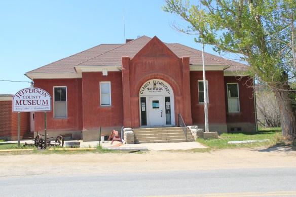
Clancy School, now the Jefferson County Museum
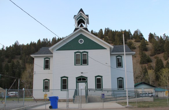
Basin school, still in use

Caldwell school, one of the few buildings left in this old railroad town
Whitehall still has its impressive Gothic style gymnasium from the 1920s while the school itself shows how this part of the county has gained in population since 1985.
 Community halls represent another theme found in the Montana landscape; Jefferson County has an excellent example in its 1911 community hall in Clancy, which now serves as the local library. Likewise, fraternal lodges played a major role as community centers in early Montana history–the stone masonry of the two-story Boulder Basin Masonic Lodge makes an impressive Main Street statement.
Irrigation and sugar beet cultivation are key 20th century agricultural themes, typically associated with eastern and central Montana. Jefferson County tells that story too, in a different way, at Whitehall. The irrigation ditches are everywhere and the tall concrete stack of the sugar refinery plant still looms over the town.
In 1917 Amalgamated Sugar Company, based in Utah, formed the Jefferson Valley Sugar Company and began to construct but did not finish a refinery at Whitehall. The venture did not begin well, and the works were later sold to the Utah-Idaho Sugar Company in 1920, which never finished the plant but left the stack standing. Nearby is Sugar Beet

Row, where hipped roof duplex residences typical of c. 1920 company towns are still lined up, and in use, although their exteriors have changed over the decades.

Through many posts in this blog, I have identified those informal yet very important community centers found in urban neighborhoods and rural outposts across the state–bars and taverns. Jefferson County has plenty of famous classic watering holes, such as Ting’s Bar in Jefferson City, the Windsor Bar in Boulder, or the Two Bit Bar in Whitehall, not forgetting Roper Lanes and Lounge in Whitehall.

Speaking of recreation, Jefferson County also has one of my favorite hot springs in all of the west, the Boulder Hot Springs along Montana Highway 69. Here is a classic oasis of the early 20th century, complete in Spanish Revival style, and listed in the National Register of Historic Places. Its rough worn exterior only hints at the marvel of its pool and experience of this place.

Mining always has been part of Jefferson County’s livelihood with still active mines near Whitehall and at Wickes. The county also has significant early remnants of the state’s

The coke ovens above are from Wickes (L) and Alhambra (R) while the image directly above is of 21st century mining continuing at Wickes.
mining era, with still extant (but still threatened as well) charcoal kilns at Wickes (1881) and at Alhambra. Naturally with the mining came railroads early to Jefferson County. As you travel Interstate I-15 between Butte and Helena, you are generally following the route of the Montana Central, which connected the mines in Butte to the smelter in Great Falls, and a part of the abandoned roadbed can still be followed.
 Another good example of the early railroad development is at Corbin, where a major ore concentrator operated by the Helena Mining and Reduction Company was located in the 1880s. The concentrator handled 125 tons of ore every day. The concentrator is long gone but the foundations, while crumbling steadily, remain to convey its size and location. The tall steel train trestle overlooks the town, a powerful reminder of the connection between the rails and mines. It is part of the historic Montana Central line, first built as a wood trestle in 1888 and then replaced with the steel structure found today in 1902.

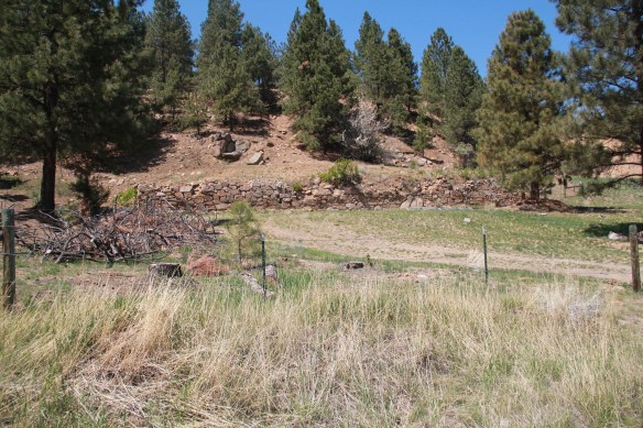
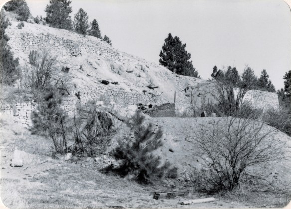
Corbin concentrator site, 1984

The Northern Pacific Railroad and the Milwaukee Road were both active in the southern end of the county. Along one stretch of the Jefferson River, which is followed by Montana Highway 2 (old U.S. Highway 10), you are actually traversing an ancient transportation route, created by the river, the railroads, and the federal highway. The Northern Pacific tracks are immediately next to the highway between the road and the Jefferson River; the Milwaukee corridor is on the opposite side of the river.
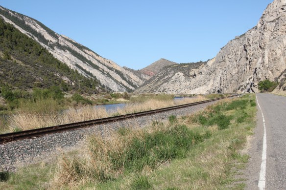
The most famous remnant of Montana’s mining era is the ghost town at Elkhorn. Of course the phrase ghost town is a brand name, not reality. People still live in Elkhorn–indeed more now than when I last visited 25 years ago. Another change is that the two primary landmarks of the town, Fraternity Hall and Gilliam Hall, have become a pocket state park, and are in better preservation shape than in the past.
 Fraternity Hall was famous at the time of the state historic preservation plan survey as one of the best architectural examples of false front, Italianate style-influenced commercial buildings in the northern Rockies. The two photos below, one from 1985 and the other from 2013, show how its preservation has been enhanced under state guardianship. Its projecting bay and balcony are outstanding examples of the craftsmanship found in the vernacular architecture of the boom towns.
The adjacent Gillian Hall is also an important building, not as architecturally ornate as Fraternity Hall, but typical of mining town entertainment houses with bars and food on the first floor, and a dance hall on the second floor.

While the state park properties dominate what remains at Elkhorn, it is the general unplanned, ramshackle appearance and arrangement of the town that conveys a bit of what these bustling places were like over 130 years ago–residences and businesses alike thrown up quickly because everyone wanted to make their pile and then move on.
Elkhorn is not the only place of compelling vernacular architecture. Visible along Interstate I-15 is a remarkable set of log ranch buildings near Elk Park, once a major dairy center serving Butte during the 1st half of the twentieth century. John and Rudy Parini constructed the gambrel-roof log barn, to expand production available from an earlier log barn by their father, in c. 1929. The Parini ranch ever since has been a landmark for travelers between Butte and Helena.
Nearby is another frame dairy barn from the 1920s, constructed and operated by brothers George and William Francine. The barns are powerful artifacts of the interplay between urban development and agricultural innovation in Jefferson County in the 20th century.
 The historic barn at the Jefferson Valley Museum is the Brooke Barn from 1914, another example of the dairy production then taking place in this part of Montana as the same time that the mines were booming in nearby Butte.
 The adjacent rodeo grounds at Whitehall host in late July the Whitehall Bucking Horse Futurity competition and fair.
 The bucking horse competition is not the only major summer event in the county. Along the old federal highway and the Jefferson River at Cardwell, music promoters took a historic highway truss bridge, converted it into a stage, and have been hosting the Headwaters Country Jam, the state’s biggest country music festival–a bit of Nashville every June in Montana: I have to love it.
 Here is adaptive reuse at perhaps its ingenious best, and successful adaptive reuse projects are another constant theme found across Montana. Whitehall itself has a second example in the conversion of a 1920s Craftsman-style building on Legion Avenue (old U.S. Highway 10). Indeed, although travelers do not use the older federal highway much since the construction of the interstate, Whitehall has several good examples of roadside architecture–yes, another blog theme–along Legion Avenue, such as a Art Moderne-styled automobile dealership and a classic 1950s motel, complete with flashing neon sign.
West of Whitehall is another 20th century roadside attraction, Lewis and Clark Caverns, a property with one of the most interesting conservation histories in the nation. It began as a privately developed site and then between 1908 and 1911 it became the Lewis and Clark Cavern National Monument during the administration of President William Howard Taft. Federal authorities believed that the caverns had a direct connection to the Lewis and Clark Expedition. The Corps of Discovery camped nearby on July 31, 1805, but had no direct association with the caverns. A portion of their route is within the park’s boundaries.
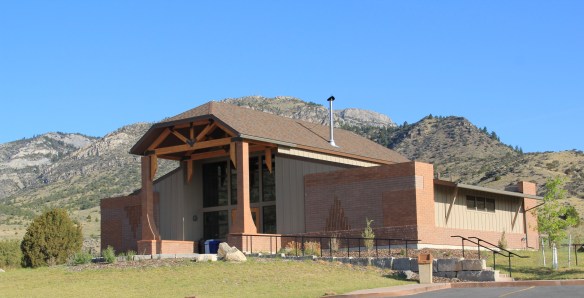 During the mid-1930s the Civilian Conservation Corps developed the park with new trails in the caverns; state and local authorities wanted more site development since the park stood along U.S. Highway 10, with potential tourism growth. In 1937-38, the federal government transferred the national monument to state control and in 1938 state officials launched Lewis and Clark Caverns as Montana’s first state park. Since my work 30 years ago, the state has re-energized the park with a new visitor center and interpretive exhibits that better convey the caverns’ significance, especially to Native Americans who had used the place centuries before Lewis and Clark passed nearby.
Faith, and the persistence of early churches across rural Montana, is perhaps the most appropriate last theme to explore in Jefferson County. St. John the Evangelist (1880-1881) dominates the landscape of the Boulder Valley, along Montana Highway 69, like few other buildings. This straightforward statement of faith in a frame Gothic styled building, complete with a historic cemetery at the back, is a reminder of the early Catholic settlers of the valley, and how diversity is yet another reality of the Montana experience.

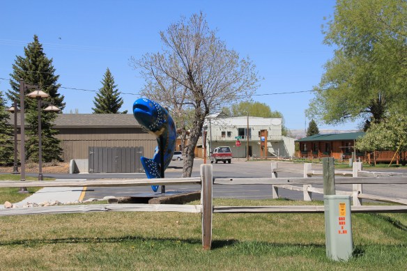
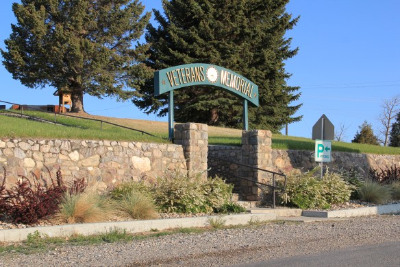 Nestled where Montana Highway 287 encounters U.S. Highway 287 in the southern end of Madison County, Ennis has changed in significant ways in the last 30 years. Its earlier dependence on automobile tourism to Yellowstone National Park has shifted into the favor of population growth and development in this portion of the county.
 The iconic Ennis Cafe, always a favorite place back in the day of the statewide work, remains, with a new false front emphasizing the wildlife and open spaces of this area. That place, along with several classic watering holes, served not only locals but the


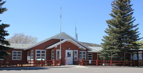




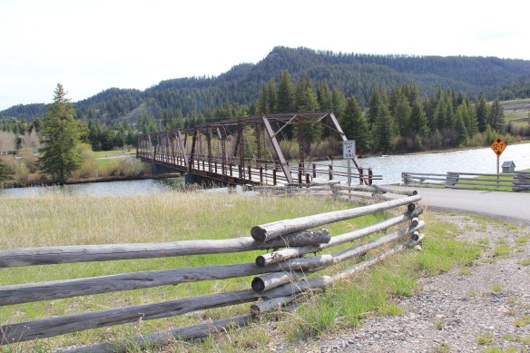 of a section of the highway where you will encounter magnificent views of the Madison River Valley and open ranch lands.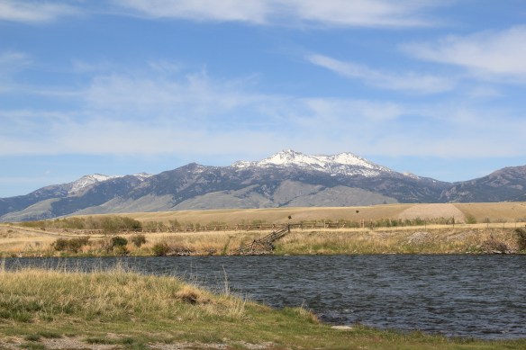
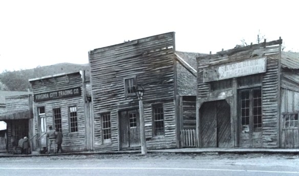 Virginia City was Montana’s first effort to protect a large district of buildings, and it took place through private initiative. In the late 1980s, out of the earlier fieldwork that decade, I was preparing an article on Montana’s preserved landscapes, and eventually the piece appeared in a book on historic preservation in the West published by the University of New Mexico Press. Virginia City had always intrigued me, because of how the Bovey family admitted to anyone who would listen that their encouragement came from the success of Colonial Williamsburg, in Virginia, where I had began my career.

 “The Bovey family lost interest in the project during the 1990s and at one time it appeared that many of the valuable collections would be sold and dispersed. The State of Montana and thousands of interested citizens stepped forward and raised the money to acquire the


 I am speaking instead of the very interesting historic city cemetery, just a bit to the north. It has a wide of grave markers, that show the confluence of folk burial practices of the mid to late 19th century with the more popular, and mass produced imagery of Victorian burial markers. There are, just as in southern cemeteries, family plots marked by Victorian cast-iron fences. Or those, in a commonly found variation, that have a low stone wall marking the family plots.


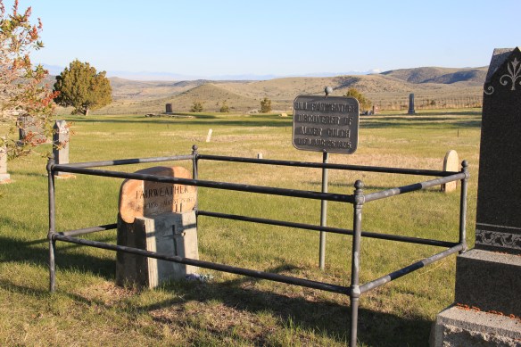
 Callaway’s grave is one of several of individuals significant in the territorial era. Thomas J. Dimsdale, the chronicler of the vigilante movement, is buried here as well as a more elaborate grave site for Bill Fair-weather, which includes a marker that describes him as the discoverer of Alder Gulch.


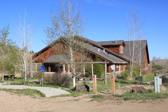 The impact on the buildings, and the constant efforts of repair and restoration, is very clear today. Virginia City is far from a sanitized outdoor museum environment. Residents still work and live here, but the historic built environment is in better shape than at any time in the early 1980s, as the images below attest.


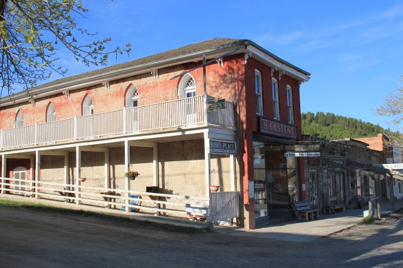 Save America’s Treasures funding has been leveraged with private donations and state funding to shore up the most significant properties. There is also a much greater, and more accurate, public interpretation found through the historic district. Visitors get much


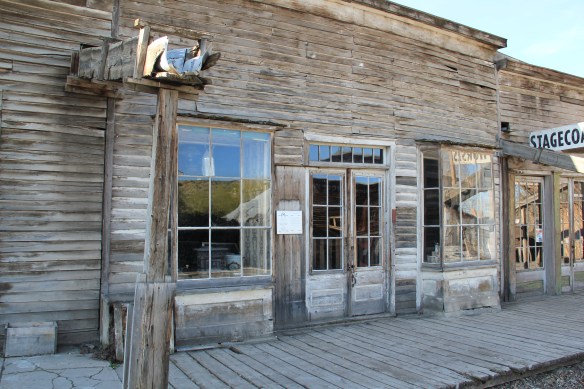 As the image above of the Smith Store attests, there is no need to paint too rosy of a picture about the future of Virginia City. This National Historic Landmark will always need a lot of care, attention, and funding if it is to survive another century. During the national hoopla of the Civil War sesquicentennial in the first half of this decade, the same sesquicentennial of the gold rush to the northern Rockies (Bannock, Virginia City, Helena, etc.) has passed by quietly. But both nation-shaping events happened at the same time, and both deserve serious attention, if we want to stay true to our roots as a nation.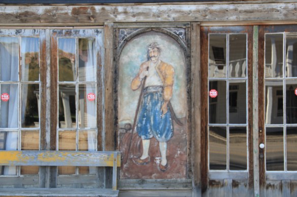


 For travelers along Montana Highway 287 the villages of Laurin and Alder are a mere diversion as you motor along from Sheridan to Virginia City. From those towns the Ruby River winds into the mountains, and they were the “end of the line” for the railroad spur that tied the southern part of Madison County to the state’s rail system. About two miles south of Sheridan is a former late 19th century Queen-Anne style ranch house that now houses the Ruby Valley Inn, a bed and breakfast establishment.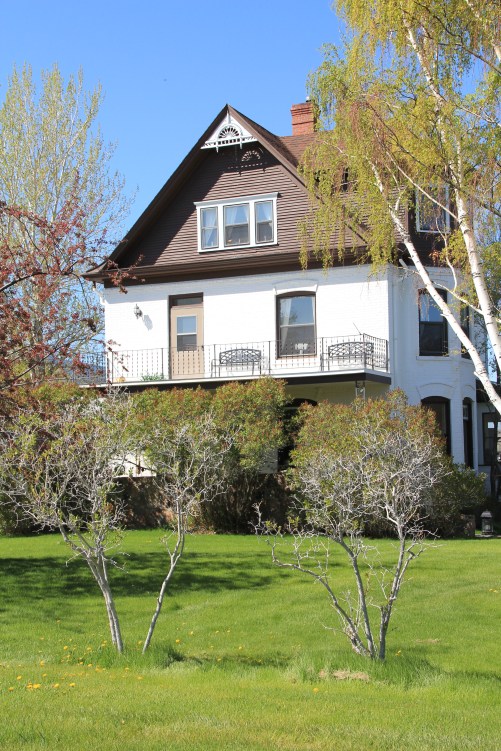
 At Laurin, St. Mary of the Assumption Catholic Church is a major Ruby River Valley landmark. It roots the settlement history of this place deep in the valley; John Batiste Laurin, for whom the village is named, established the place in July 1863. The church is listed in the National Register of Historic Places. Laurin was never large and a few repurposed commercial buildings indicate that. The historic Laurin School is now a private home, an excellent example of adaptive reuse of a historic rural school.
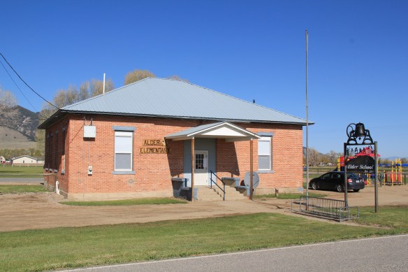
 While Laurin has a reserved, calm feel to it, Alder feels like the highway road-stop it has been for decades. Its historic brick school is not as architecturally elaborate as Laurin but in 2012 it was still open and serving local students.
 Other commercial buildings from the early 20th century were now abandoned, including the eye-popping, yellow-painted false front bar and steakhouse, which I understand has moved its business elsewhere since 2012.

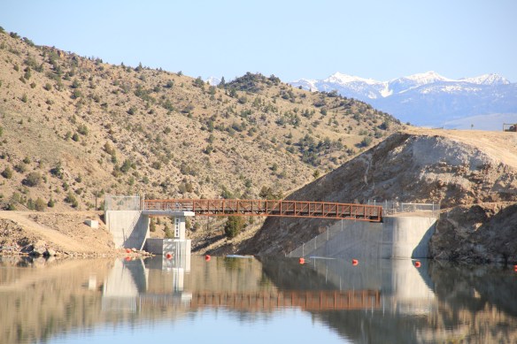
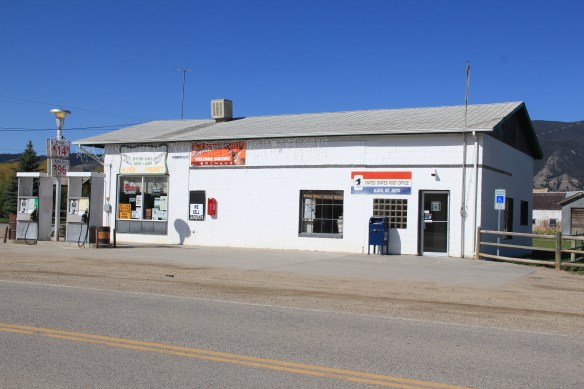 At Alder you can go south on Montana Highway 357 and follow a good, paved road to the Ruby Dam and Reservoir. Part of the New Deal’s contributions to reshaping rural Montana through new or expanded irrigation projects, the Ruby Dam is not an awe-inspiring engineering feat on par with Fort Peck Dam. But the views are striking and here is another engineered landscape created by mid-20th century irrigation projects from the Bureau of Reclamation.

 Back on Montana 287 is one of the first log buildings that I visited in Montana, known as Robber’s Roost. Listed in the National Register, this two-story log building dates to 1863, constructed by Pete Daly as a road house for travelers to the Virginia City mines. Tradition has it that it also became a hang-out for road agents who stole from travelers, thus the name. It is an important part of the vernacular log construction tradition of the territorial era in Montana history.
 Cutting through Montana’s southeast corner is state highway 287, not a particularly long route at a little over 40 miles in length, but a spectacular one nonetheless as it connects the Madison River Valley (seen above) with the Ruby River Valley, with the famous mining town of Virginia City in the mountains in between.
 We have already talked about the western gateway to the highway, the town of Twin Bridges. Now I wish to move from west to east, stopping first Sheridan and its Bethel United Methodist Church, a brick late 19th century Gothic Revival church, which is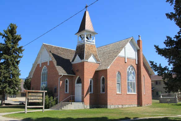
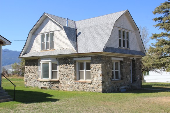 The O’Brien House is also listed in the National Register. Built in 1894, this two-story brick home is another example of Sheridan’s boom following railroad development. It is a rather late example of Italianate style (typically more popular in Montana in the 1870s).

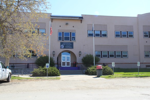 This Craftsman-style building dates c. 1920. Along the street are several interesting examples of domestic architecture from the early 20th century. You wonder if Mill Street might not be a possible National Register historic district.



 Montana Highway 41 and the western side of the county is where I start, with the town of Silver Star, nestled between a spur line of the Northern Pacific Railroad, Highway 41, and Jefferson River. Gold was discovered nearby in 1866 and the town is named for a mine, but growth came more from transportation, with Silver Star serving as an early transportation stop between Virginia City and Helena in the 1870s. Today the place is best known for a privately held massive collection of mining machines, tools, and artifacts established by Lloyd Harkins, and for its rural post office that is nestled within the town’s general store.

 valley and its irrigation systems helped to produce one of the most famous barns in the state: the Round Barn, just north of Twin Bridges. In 1882 Noah Armstrong, who had made a fortune in mining, built the barn as part of his Doncaster Stable and Stud Farm. In 1933
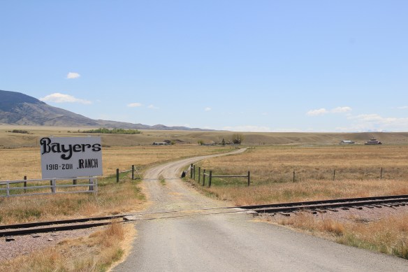 the Bayers family acquired the barn and incorporated it into their cattle business. When I visited in 1912 the barn was still an agricultural structure, with its wedding cake shape casting a distinct profile on the landscape. In 2015, the barn was restored to a new use: as a wedding and event reception space.


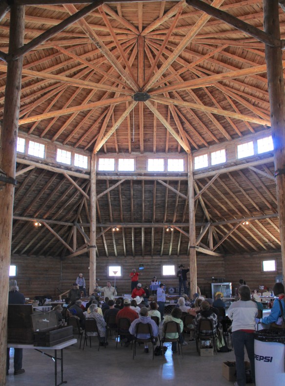 The result is spectacular, and with their restoration in the last 30 years, the buildings are not just landmarks but busy throughout the spring, summer, and fall.


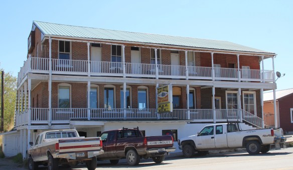
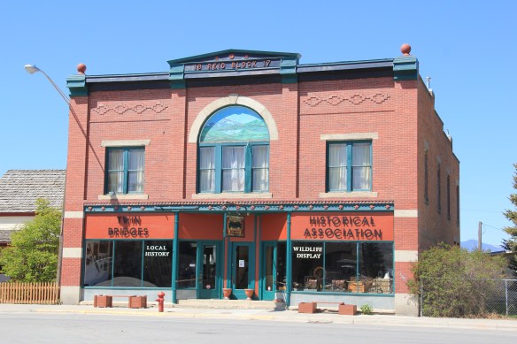 The Old Hotel, a brick two-story gable-front building, also marks the town’s ascent during the early 20th century when the town achieved its highest population, about 750 in 1920. Today about half of that number call Twin Bridges home.
 My personal favorite, and a frequent stop during the 1980s, is the Blue Anchor Bar, nestled on the first floor, with an Art Deco style redesign, in a two-story commercial block.
 Twin Bridges is a very important river junction, thus the name, where the Beaverhead, Big Hole, and Ruby rivers all meet to form the Jefferson River. A public park near the confluence just south of the Montana 41/287 helps to tell that story. Nearby is the Twin Bridges School and its amazing modernist styled gymnasium.


 When travelers, and most Montana residents even, speak of Silver Bow County, they think of Butte. Outside of the Copper City, however, are small towns and a very different way of life. To the west we have already discussed Ramsay and its beginnings as a munitions factory town during World War I. Let’s shift attention now to the southern tip of the county and two places along the historic Union Pacific spur line, the Utah Northern Railroad, into Butte.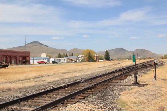


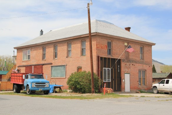 when Melrose was a substantial, busy place. This 1870s-1880s history is largely forgotten today as the town has evolved into a sportsmen’s stop off Interstate I-15 due to its great access to the Big Hole River and surrounding national forests as well as the quite marvy Melrose Bar and Cafe, a classic western watering hole.
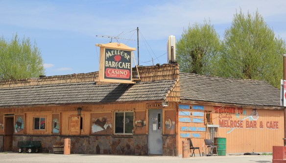 Community institutions help to keep Melrose’s sense of itself alive in the 21st century. Its school, local firehall, the historic stone St John the Apostle Catholic Mission and the modernist styled Community Presbyterian Church are statements of stability and purpose.


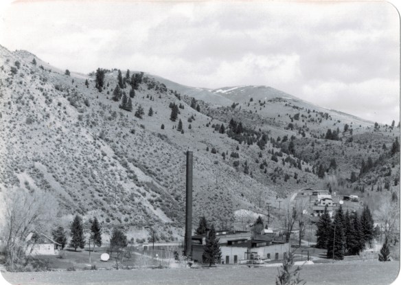 The photo above was published in A Traveler’s Companion to Montana History, in part because of the preservation excitement over this landmark but also because it documented how the boom in Butte helped to transform the historic landscape on the “other side of the divide.” The pump station took water from the Big Hole River and pumped it over the mountains to the Butte Water Company–without the pump station, expansion of the mines and the city would have been difficult perhaps impossible in the early 20th century.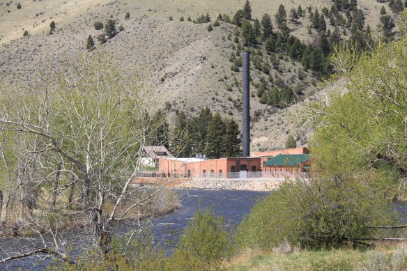
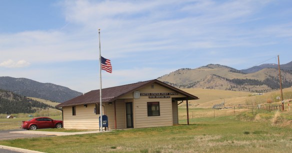 In 2014, in reaction to the listing of Montana rural schools as a threatened national treasure by the National Trust of Historic Preservation, CBS Sunday Morning visited Divide School for a feature story. Teacher Judy Boyle told the Montana Standard of May 16, 2014: “The town of Divide is pretty proud of its school and they want to keep it running. We have a Post Office, the Grange and the school — and if you close the school, you basically close the town.”
 Divide is one of many Montana towns where residents consider their schools to the foundation for their future–helping to explain why Montanans are so passionate about their local schools.
 In thinking about returning to Montana in 2012 and carrying out a huge “re-survey” of the places I had explored for the state historic preservation plan process 30 years earlier, Butte was high on my list of priorities. Not that the city and its surroundings had been given little attention in the early 1980s–the Copper City was already recognized as a National Historic Landmark, and a team of historians, architects, and engineers had just finished a large study of its built environment for the Historic American Building Survey and the Historic American Engineering Record. No, I wanted to go back because by 1985 many people counted Butte down and out, yet it had survived and started to reinvent itself. Not
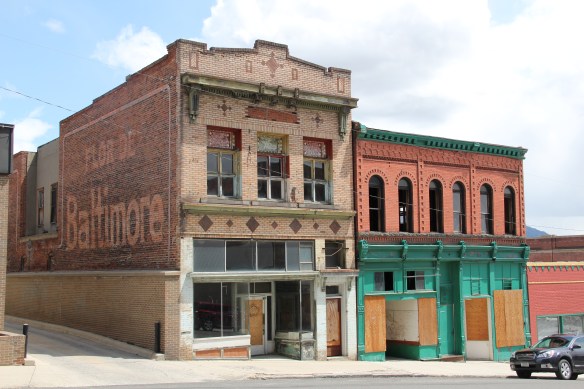 as a ghost town or the skeleton of a great mining city but as a revitalized place, both economically and culturally, centered in a strong core community, even though the challenges in front of it remain daunting, even overwhelming at times.
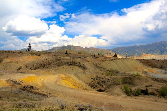 The environmental degradation left when the hard rock mines shut down is one burden that Butte has shouldered, with the help of the federal superfund program. Still, no matter how scientifically this landscape has been “cleaned up,” it remained scarred, and it is a far different challenge to build back hope into a place stripped of its life. Yet high over the city is a sign of the change to come in the Mountain Con Mine site.
 Still labeled as a Mile High and a Mile Deep place, the mine property is stunning, not only for its technological assertion–imagine working that high, and going that deep–but for its conversion into the walking/hiking/biking trails that encircle the city and present it with such potential as a recreational landscape.


 ago, with all sorts of signs of new investment, new pride, and community identity. It may have lost a step, or two, and its swagger may not be quite as exaggerated as it was in the mid-20th century, but it remains a place with its own feel, its own funk. For me, the reopening of the M&M Bar on Main Street–a legendary dive once shuttered, reopened, and shuttered again–gives me hope for Butte in the 21st century. Around the corner is


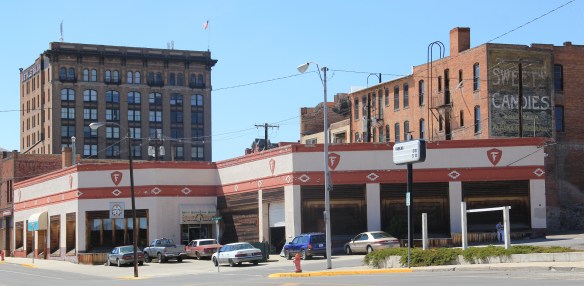
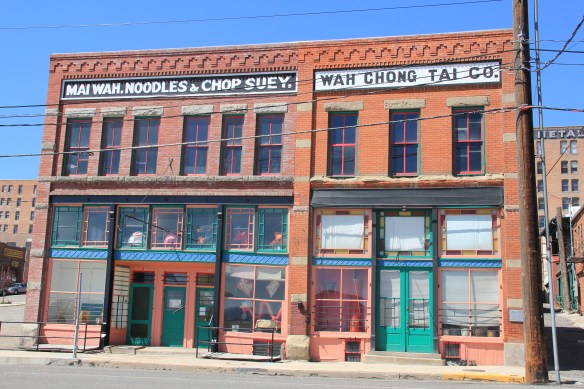 Mercury Street; at the same time the sex trade was alive and well to the east of that same street in a series of boarding houses and hotels. The Dumas Brothel, discussed in an earlier post, is listed in the National Register and its future as an adaptive reuse project and place for public interpretation is promising but not yet realized. African Americans in


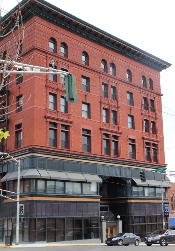
 The massive building still dominates the Uptown building, making its closure in Butte in 1980 that more disturbing for residents. When I did my preservation plan work in 1984-1985 the issue of what to do with the Hennessy was at the forefront. By the end of the decade, ENTECH renovated the building and reopened it fully for business. In 2010 came the popular Hennessy Market–giving the growing number of Uptown residents a grocery store once again.
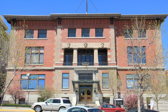 The Sliver Bow Club building (1906-7) also has shifted its purpose, from being the stately and eloquent clubhouse of the city’s elite to becoming a place for public offices and meetings in its once exclusive spaces. Originally conceived by the same Spokane architects who designed the Lake McDonald Lodge in Glacier National Park, according to recent research by museum curator and preservationist Patty Dean, the building’s architects ended up being Link and Haire, the noted Montana architectural firm.


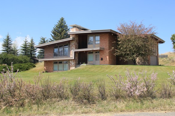 You don’t think Montana modernism when you think of Butte, but as this overview will demonstrate, you should think about it. I have already pinpointed contemporary homes on Ophir Street (above). The copper mines remained in high production during the Cold War era and many key resources remain to document that time in the city. For discussion sake, I will introduce some of my favorites.


 I looked at schools constantly across the state in 1984-1985 but did not give enough attention to the late 1930s Butte High School, a classic bit of New Deal design combining International and Deco styles in red brick. Nor did I pay attention to the modernist buildings associated with Butte Central (Catholic) High School.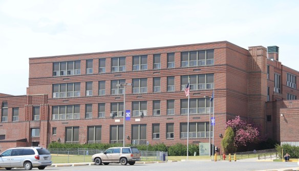


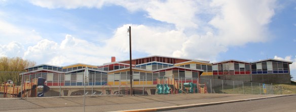


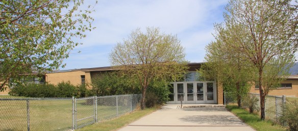

 You would think that I would have paid attention to the Walker-Garfield School since I stopped in at the nearby Bonanza Freeze, not once but twice in the Butte work of 1984. I
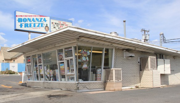 never gave a thought about recording this classic bit of roadside architecture either. Same too for Muzz and Stan’s Freeway Bar, although maybe I should not recount the number of stops at this classic liquor-to-go spot.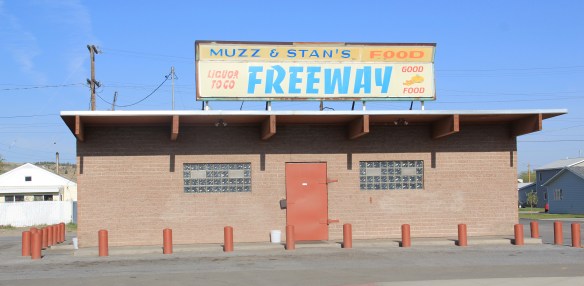


 for places to rest, relax, and enjoy the precious hours away from the workplace. So much has changed in Anaconda since the closing of the smelter in the early 1980s–but the town’s distinctive places for recreation and relaxation remain, a big part of the reason Anaconda is one of my favorite places in Montana.
 Let’s start with the magnificent Art Deco marvel of the Washoe Theater. Designed in 1930 by B. Marcus Priteca but not finished and opened until 1936, the theater has stayed in operation ever since. It is remarkably intact, especially when owners refused to follow the multi-screen craze of the 1970s and kept the lobby and massive screen


 A drink after the movie: still happens with regularity in Anaconda, due to the plethora of neighborhood bars, from the Anaconda Bar to the Thompson Bar. The range of sizes and styling speaks to the different experiences offered by these properties.


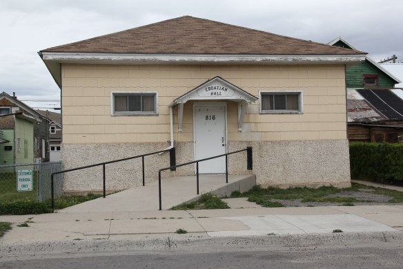 The Elks Club in the heart of downtown is a totally different statement, with its sleek 1960s modernist facade over an earlier turn of the century Victorian styled brick building reflecting a more prosperous and larger membership.

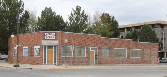 With its glass block entrances and windows, the American Legion lodge seems like another lounge, but the American Eagle mural says otherwise.

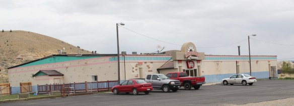 If not bowling, why not read a book. At least that was the motivation behind Progressive reformers and their initiative to create “free” (meaning no membership fees) public libraries at the turn of the 20th century. Anaconda has one of the state’s earliest and most architecturally distinctive libraries in the Hearst Free Library.

 Another Progressive-era institution is Washoe Park, established by the copper company and home to the first fish hatchery in the state. Washoe Park was a place for outdoor recreation, with ball fields, picnic areas, and amusement attractions. It also was home for the town’s baseball field and its historic grandstands and refreshment


 New renovations at the park have been underway, improving trails, the hatchery, and the outdoor experience plus adding public interpretation at appropriate places. The park is being re-energized but respect still shown its early elements, such as the historic Alexander Glover cabin, built c. 1865 and identified as the oldest residence in Anaconda, which was moved into the park as an interpretive site, early, c. 1920.
 Another outdoor recreational space that has been receiving renovation is the historic Mitchell Stadium complex, a New Deal project of the Works Progress Administration from 1938-1939. The stadium, designed to give the high school modern facilities for football and track and field, is quite the place, retaining so much of its original understated Art Deco styling.
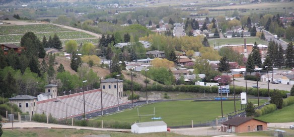 Unlike Washoe Park, here was a new public space, in keeping with the New Dealers’ faith in recreation and community, that was not a creation of the copper company for adult workers but for high school athletes.


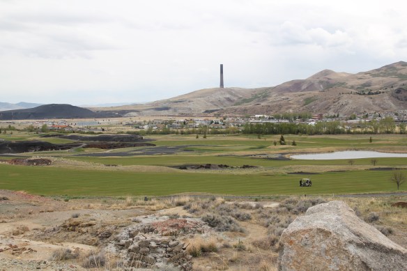 But even on the links of this innovative adaptive reuse project you cannot escape the overwhelming presence of the copper company stack, and mounds of devastation it left behind. Here is an appropriate view that sums up the company influence on the distinctive place of Anaconda.
