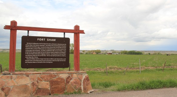
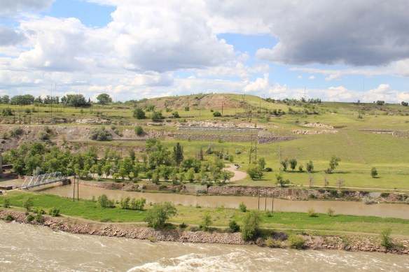
Another common features of heritage areas are properties associated with the nation’s military history and the process of nation building in the post Civil War United States of America. Cascade County has two major sites, one old and often forgotten, the other still at the heart of the nation’s defense. Let’s start with the oldest federal facility, Fort Shaw along the Sun River Valley in western Cascade County. As I was conducting the survey for the state historic preservation plan in 1984-1985, Fort Shaw was on everyone’s mind at the state historic preservation office. A proposal to list it in the National Register of Historic Places had been received, and the response was, generally, it is about time. This place had an important story to tell and was listed in 1985.

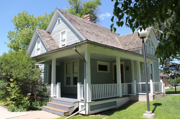
Commanders’ Quarters at Fort Shaw
As I noted in A Traveler’s Companion to Montana History, “Built in 1867 in what was then the heart of the country dominated by the Blackfoot Confederacy, Fort Shaw stood just a few miles west of where the Mullan Road [the important pre-Civil War federal military road through the region] crossed the Sun River. Colonel I.V.D. Reeves designed the fort, which was built with timber from nearby hills and sandstone and fieldstone found nearby. The soldiers also made adobe bricks that were used to construct the walls of many buildings at the fort. You can still see [in 1986 and 2015 as well] several of the original buildings, including two sandstone washhouses for the officers, the officers’ living quarters, and the commanding officer’s house.”
I emphasized in 1985 the property’s military significance in protecting the Mullan Road and the mining camps throughout western Montana. I also noted how it became a focal point for white settlement in the region. But I missed the bigger picture on what the site says and means.
Heritage Areas do a good job of looking at the “whole story” and how a landscape can have multiple meanings. Fort Shaw is an important military story: established two years after the end of the Civil War it represents an extension of federal military might into the West and how federal officials understood that occupation posts (Fort Shaw remained a post until 1891) represented federal power and authority, some 2000 miles away from Washington D.C. But certainly part of that process of nation building post 1865 was the federal policy to convert Native Americans. Here at this same place the Fort Shaw Government Industrial School was established, and here that federal officials and missionaries undertook that process of “civilizing” the Blackfeet. The idea behind industrial schools was that Native American children would be taken from their families, boarded at the school, and then taught skills that allowed them to contribute and compete in the modern white man’s world.
In the last decade, historical markers have been installed to help tell that story at Fort Shaw, highlighting the accomplishments of the 1904 girls’ basketball team, truly a remarkable story. Again, heritage areas like to talk about cultural history, and basketball and Indian nations across the northern plains are linked by this sport. The story of these girls and their successful run to a “World Championship” at the 1904 World’s Fair has been the subject of a PBS documentary (Playing for the World, 2009) and a recent book by Linda Peavy and Ursula Smith,
Full-Court Quest (2014). Their accomplishments are also marked by a monument at the old

industrial school site, an interpretive site not there in 1984-1985 and another great example of how public interpretation of Montana’s landscape has broadened and improved in the last 30 years.
 Fort Shaw was not the region’s earliest mission site. That designation belongs to St. Peter’s Mission, located on the winding Mission Road to the south of Fort Shaw. An earlier blog discussed St. Peter’s but this special property is worth further discussion, as it is linked in time and purpose to what happened at Fort Shaw.
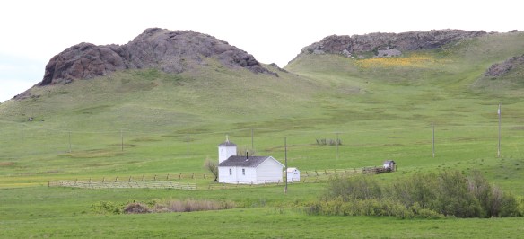 The property has limited public accessibility as an active ranch surrounds it and uses some of the remaining historic buildings. But since my first visit in 1984, a small metal interpretive marker has been installed, which emphasizes its founding date of 1865-1866 by Catholic missionaries, many
whom are buried on a hill, along with some of their Blackfeet converts, overlooking the mission. The Jesuits established this outpost a year or so before the military post at Fort Shaw. In 1884 they too established a girls school for Blackfeet children at the site.
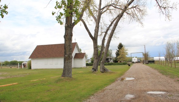 Often we forget these connections between religious missionaries and the nation-building process of government. Within a few hundred yards of Fort Shaw school, for instance, is the old road connecting the school to the historic St. Ann’s Catholic Church (seen above is the historic church building; the congregation has built a modern church in recent years).
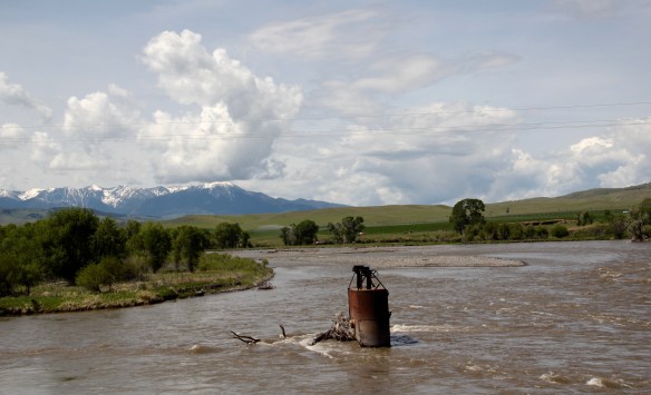
 And we further forget, or choose to ignore, how the messy present lies side by side with these older, seemingly sacred places. Along the Mission Road and the Simms Road are nuclear missile bases, some active, some inactive, that are administered by the Malmstrom Air Force Base in Great Falls. Much like Fort Shaw from 100 years earlier, military commanders in the 1960s saw Cascade County as part of the edge of America’s national defense, the ideal location for nuclear bases that could protect, or retaliate, in case of a nuclear strike from the nation’s enemies.
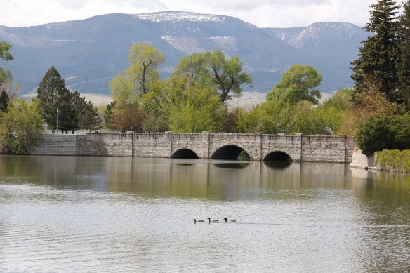
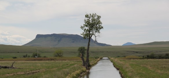 The Sun River Valley was transformed by homesteaders and irrigation during the great boom of the early 20th century; it shares that story of course with many towns in the Great Falls heritage area. Montana Highway 21 (shown above) connects with Montana Highway 200 to provide great opportunities to explore that landscape. The Sun River project of the U.S. Bureau of Reclamation especially left its mark.
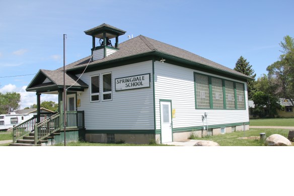
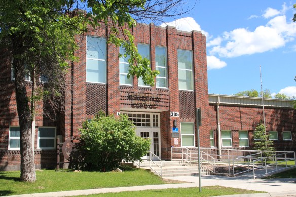
While the old roadside stores at Fort Shaw, the project’s headquarters, suggested that the homesteader landscape was everyday vernacular, not designed to last, other properties, such as the wonderful Simms school complex, tells us that some built to last.
At Simms, reclamation engineers designed what they considered to be a model townsite plan, with the school at the center, and broad avenues radiating out from the school. Simms no doubt never reached the population that the planners envisioned, but here too in an unlikely place is the hand of the federal government, re-orienting the landscape in ways that can be seen, if you know where to look.

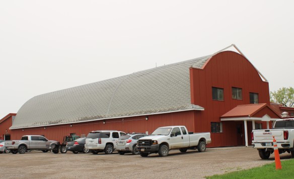
The school is very much the focus of the community–and the gymnasium at the rear has been the place for community events and sports for almost 100 years. The football and track field is in great shape too–a reminder of how sports bind the valley’s residents.

Not far from the school is another community building, the women’s club hall that dates to the Sun River project’s beginning years. I hope to see this building listed in the National Register in the future along with the other historic women’s club buildings scattered across the state.

West of Simms was property of note to my SHPO colleagues in 1984 was the J.C. Adams Stone Barn, which had received a grant for “brick and mortar” work as part of President Reagan’s efforts to jump start the economy in 1982-1983. This magnificent structure predated the federal agricultural programs, dating to the mid-1880s. It rather spoke to the promise of stock-raising and freighting–Adams did both–as the region began to develop in the last years of the Montana territorial period.
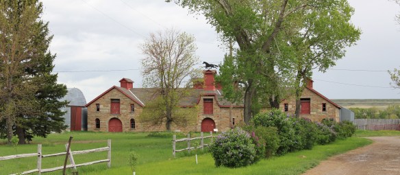 The barn is part of a still active ranch and is on private property. But the stone masonry can be viewed and appreciated from Montana Hwy 200.
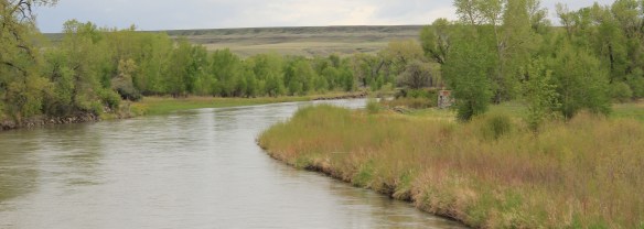 When one considers a Great Falls heritage area, the Missouri River of course will take center stage; as the next postings will show, it should be at the center of the story. But what happened along the Sun River, and what remains today, adds immeasurably to the national story and the overall significance of the region.


 Livingston’s town plan from 1882 was all about the railroad, with the adjacent Yellowstone River an afterthought, at best an impediment since it defined the south end of town. So far from the tracks to be of little worth to anyone, few paid it any attention. 100 years later when I am considering the town for the state historic preservation, I too was all about the railroad and the metropolitan corridor of which it was part. I paid no attention to the river. The town’s schools were on this end, but they were “modern” so did not capture my attention.
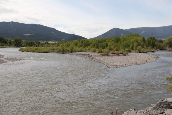 Consequently I missed a bit part of the town’s story, the effort to reform the landscape and create public space during the New Deal era. The Works Progress Administration (WPA) transformed this part of town from 1935 to 1938 expanding an earlier public park into today’s Sacajawea Park.


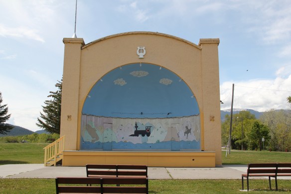 The major addition, however, was the large combination Civic Center and National Guard Armory, an Art Deco-styled building that cost an estimated $100,000 in 1938. It too survives and is in active use by the community.
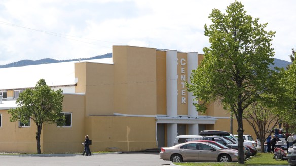 Tourists now come to this area more often than in the past due to additions made during the Lewis and Clark Bicentennial in the early 21st century. The park is part of the Lewis and Clark National Historic Trail.
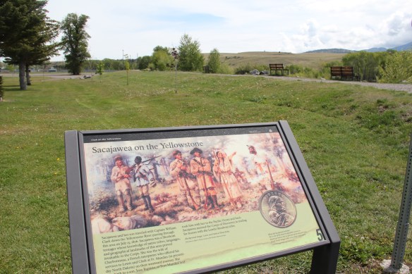


 Livingston was one of the Northern Pacific Railroad’s most important division points. Not only did the massive and architecturally ornate passenger station, discussed in the previous blog, serve as a gateway to Yellowstone National Park, it contained various company offices, serving as a nerve center for the thousands of miles of railroad line. If you do the typical tourist thing in Livingston, you pay attention to the depot and the many late 19th and early 20th century buildings south of the tracks.
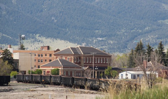
 But to find where the real work of the railroad took place, you have to locate the underpass that takes you to the north side of the tracks, and the extensive Northern Pacific railroad shops. This area is not as busy as it once was, but enough buildings remain and enough activity takes place 24-7 that you quickly grasp that here is the heartbeat of the line. In the photo above, one early shop building, the lighter color brick building to the right center, still stands. Most others date to the line’s diesel conversion in the mid-20th century.
 With the mountains to the south, and the outlines of the town visible as well, the shops are impressive statements of corporate power and determination, and how railroads gave an industrial cast to the landscape.
 The north side, in many ways, was a separate world. Here the homes may date to the Victorian era too, but they are not the stylish period interpretations found in numbers on the south side. Rather they are vernacular styled cottages, or unadorned homes typical of America’s turn-of-the-century working class.

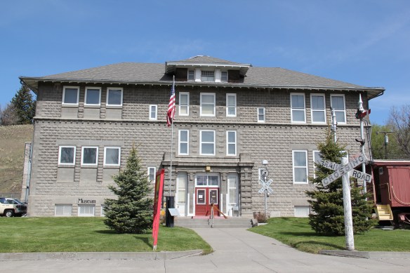 The school was converted into a community museum some 30 years ago, and if you visit the grand passenger station, you also need to stop at the school, to get a fuller picture of Livingston, the railroad town.

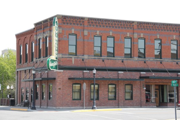
 The above block of commercial businesses was once better known as the Montana Hotel while the block below, called the Hiatt Hotel in more recent years, was the Park Hotel, opened in 1904 to take advantage of increased tourist business due to the new Northern Pacific depot. Noted Montana architect C.S. Haire was the designer.
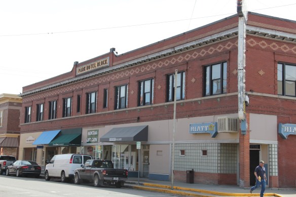 These buildings served tourists in the summer months but throughout the years they relied on the “drummer” trade. Drummers were a word used to describe traveling businessmen, who rode the rails constantly, stopping at towns large and small, to drum up business for their companies. They too, like the machine shop workers on the south side, were a constant presence on the railroad lines of 100 years ago, and helped to make the lines hum with their travel and their stories.
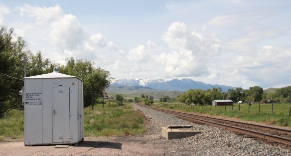
 Continuing west you soon encounter post-World War II service stations and motels, some updated, some much like they were, on the outskirts of town and then, boom, you are in the heart of Livingston, facing the commanding presence of the Northern Pacific depot complex with warehouses–some now converted to new uses–coming first and then
 massive passenger station itself. Opened in 1902, the passenger station was an architectural marvel for the new state, designed by Reed and Stem, who would continue on to great fame as the architects of Grand Central Station in New York City. The station, interestingly, is not Classical Revival in style–certainly the choice of most architects for their grand gateways along the nation’s rail line–but a more restrained interpretation of Renaissance Revival style, completed in red brick.
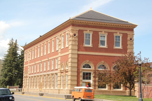 The building is not particularly inviting for locals coming from the business district to the depot–that was not its primary audience. Rather the grand entrance is track side, where passengers headed to Yellowstone National Park could depart for food, fun, frivolity, whatever they needed before the journey into the wildness of Yellowstone.
 Travelers were welcome to use the grand covered walkways to enter the depot proper, or to take a side visit to the railroad’s cafe, Martin’s as I
 knew it back in the day, a place that rarely slept and always had good pie. The cafe changed its orientation from the railroad to the road as automobile travelers on U.S. 10 began to dominate the tourist market. Now it has been restored as a local brew pub.
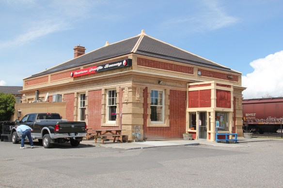


 Directly facing the center of the passenger station was the mammoth Murray Hotel–a flea bag operation in the 1980s but now recently restored as a hipster place to be, especially its signature bar.

 Imagine my pleasant surprise last year when I found that Gil’s still existed but now had been converted into a decidedly up-scale establishment, far removed from the 1980s.
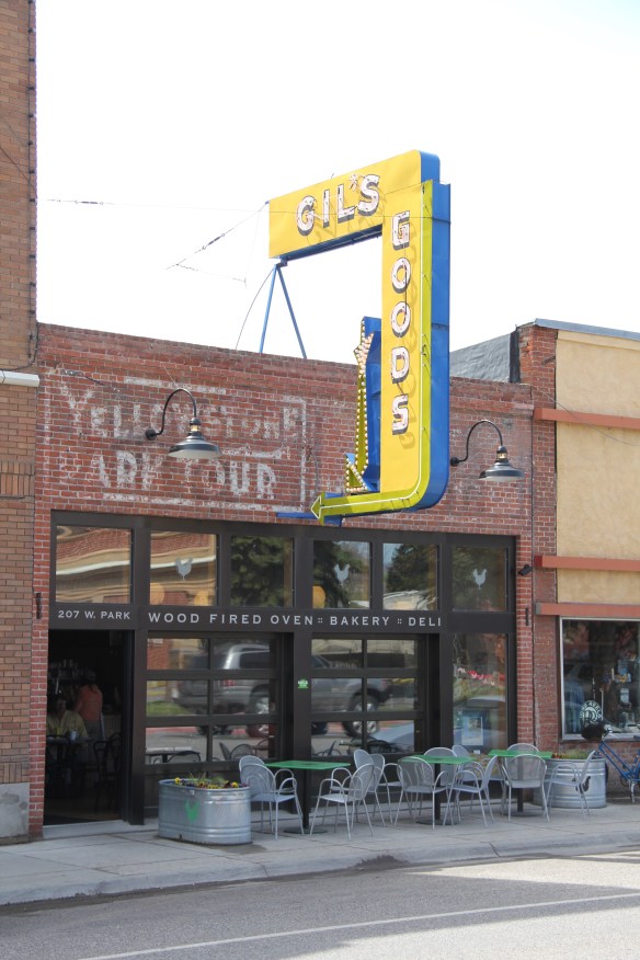 I don’t know if I have encountered a more fundamentally changed place–cheap trinkets gone, let the wood-fired pizzas come on.
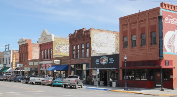 I was not so blinded in 1984 by the concept of the “metropolitan corridor” that I ignored the distinctive Victorian storefronts of Livingston–how could I since they all, in a way, fed into the tracks. But when I got to the end of that distinctive business district and watched the town, in my
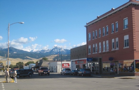 mind, fade into the Rockies, I had captured the obvious but had missed the bigger picture–that’s the next story.
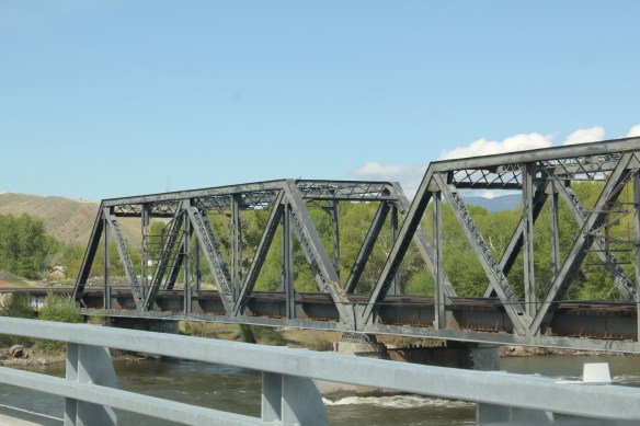
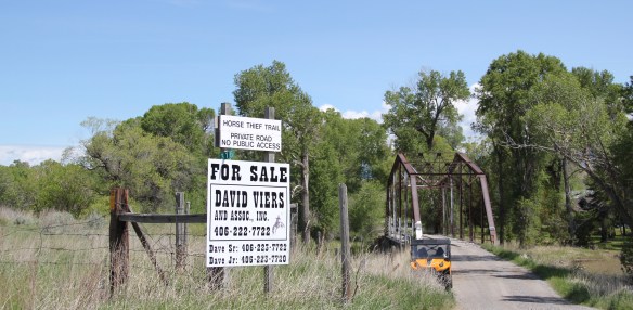 Traveling south of Clyde Park on U.S. 89, you pass by the turn-off for Horse Thief Trail, where a historic steel bridge still allows for one-lane traffic over the Shields River; this bridge and snippet of road is part of the original route of U.S 89. That means you are nearing the confluence of the Yellowstone and Shields rivers, and where U.S. Highway 89 crosses the Yellowstone River and takes you into the heart of Park County. Paralleling the modern concrete bridge is a c. 1897 steel Pratt through truss bridge, to serve the Northern Pacific Railroad spur that runs north to Clyde Park then Wilsall. The Northern Pacific called this the Third Crossing of the Yellowstone bridge; the Phoenix Bridge Company constructed it.
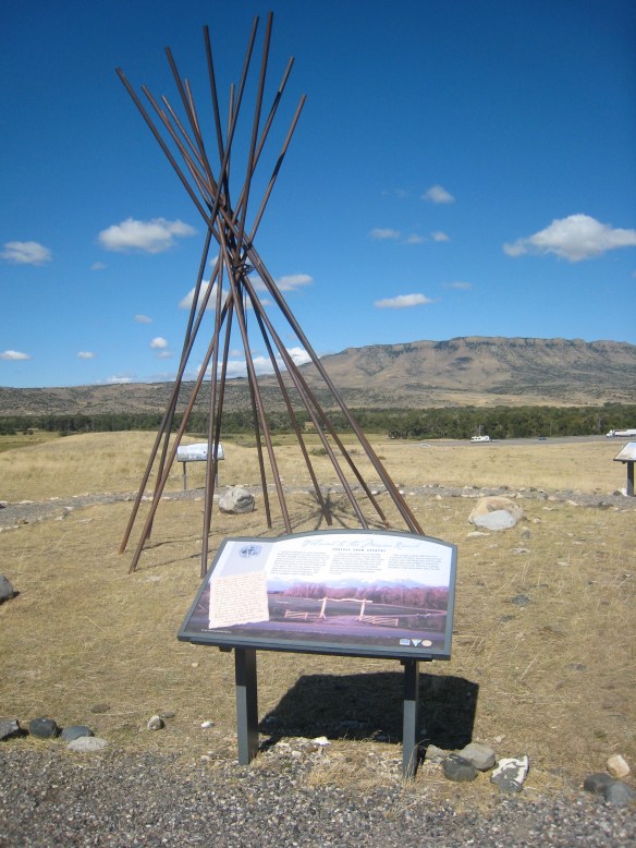
 Before jogging slightly to the west to head to Livingston, the county seat, two places east of the Shields River confluence are worth a look. First is the site of Fort Parker, established as the first Crow Agency in 1869 or the first federal facility in the valley. It operated from this location until 1875.
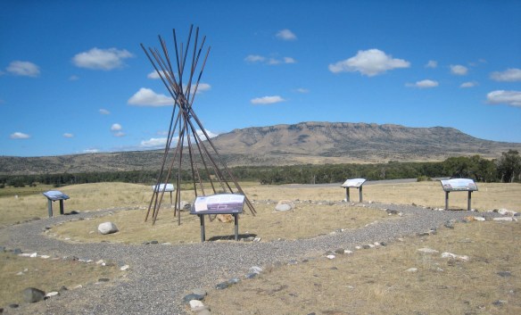 Gladly all of that changed in the 21st century. As a result of another innovative state partnership with land owners, there is an interpretive center for the Fort Parker story, easily accessible from the interstate, which also does not intrude into the potentially rich archaeological remains of the fort. The story told by the historical markers is accurate and comprehensive, from the agency’s beginnings to the land today.
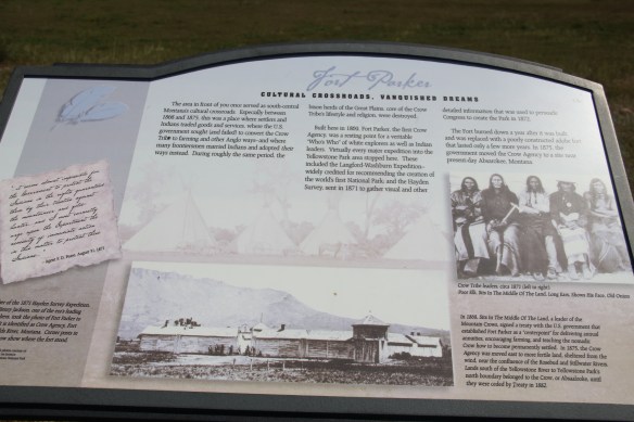
 Few remnants of that early white settlement remain today; you can find some just north of Springdale, at Park County’s eastern border, on the north side of the Yellowstone River. Hunter’s Hot Springs was the first attraction, established by Andrew Jackson Hunter in the 1870s, and receiving its last update in the early years of automobile tourism in the 1920s, as shown below in this postcard from my collection. Today, as the Google image below also shows, there are just scattered stones and fences from what had been a showplace for the valley.

 Commercial businesses once lined the town side of the Northern Pacific tracks. Nothing is open today although trains rumbled down this historic main line every day. What does survive is impressive and worthy of


 As the highway leaves the central plains east of Great Falls, it heads east through coal country (see the earlier post on Belt) and south into the Little Belt Mountains and the old mining towns of Monarch and Neihart (above). Both Cascade County towns are proud of their heritage, a story embodied in the Monarch-Neihart School, a wonderful bit of log craftsmanship from the New Deal era, a WPA project finished in 1940 that is listed in the National Register of Historic Places.
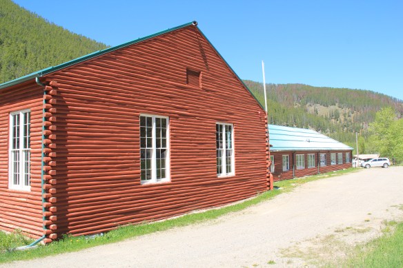


 When I last visited there in 2015 the combined route of U.S. 89 and 12, which passes in front of the courthouse and the center of town, was being rebuilt, giving the historic business district the look of a ghost town.

 U.S. Highway 89 continues south, crossing the historic corridor of the Milwaukee Road at Ringling, another Meagher County town discussed in an earlier post, marked by the landmark St. John’s Catholic Church.
 Travelers continuing south soon find themselves in Park County, entering the Shields River Valley just north of Wilsall, where highway markers and monuments, like that for “Thunder Jack” (2006) by sculptor Gary Kerby, convey the significance of the place.
 Wilsall was not much a place 30 years ago, a small trade town on the edge of a Northern Pacific Railroad spur line, a past still recalled by the tall elevator and old railroad corridor.
 But the growing popularity of the Shields River Valley has led to a new boom in Walsall, with old banks converted into bars and old general stores


 Clyde Park Tavern is still the place to go for an adult beverage, or two. Historic grain elevators still serve local ranchers, marking the railroad line that defined the town’s landscape until the impact of the highway in the early 20th century.


 project, and the Art Moderne landmark Intermountain bus station–once so proudly featured in the Clint Eastwood and Jeff Bridges movie, “Thunderbolt and Lightfoot,” part of that decade from the mid-1970s to mid-1980s when Montana was suddenly in the lens of Hollywood.
 All of these buildings and places help to give Great Falls its unique sense of self, and its sense of achievement and promise. And that is not to even mention the fun, funky stuff, such as the Polar Bears and having the
 supper club experience of 50 years ago at Borrie’s in Black Eagle. Stepping back into time, or looking into a future where heritage stands next to the
 atomic age, Great Falls and its environs–from Fort Benton to the northeast to Fort Shaw to the southwest–can give you that memorable heritage area experience.
 Many heritage areas in the eastern United States emphasize the relationship between rivers, railroads, and industrial development and how those resources contributed to national economic growth and wartime mobilization. Great Falls can do that too. Situated on the Missouri River and designed by its founders to be a northwest industrial center, entrepreneurs counted on the falls to be a source of power and then on the railroads coming from Minnesota, especially the promising Manitoba Road headed by James J. Hill, to provide the transportation.
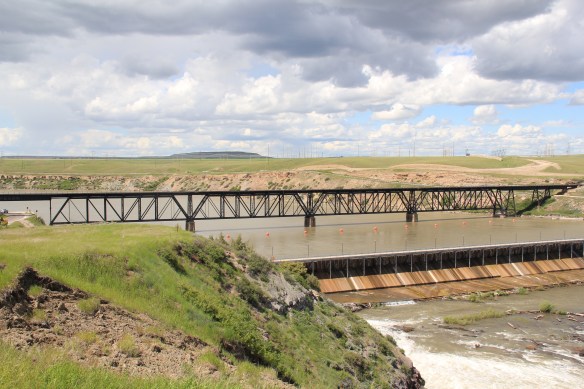 Paris Gibson, the promoter of the Electric City, allied his interests to two of most powerful capitalists of the region: Marcus Daly, the baron of the Anaconda Copper Company interests and James J. Hill, the future rail king of the northwest. Their alliance is embodied in several different properties in the city but the most significant place was where the Anaconda Copper Company smelter operated at Black Eagle until the last decades of the 20th century. When I surveyed Great Falls for the state
 decade of the 20th century and soon erected its tall tower depot right on the Missouri River. But wherever you go along the river you find significant buildings associated with the Great Northern and its allied branch the Montana Central Railroad, especially the downtown warehouses. Some are still fulfilling their original function but others


 The Missouri River runs through Cascade County and is at the heart of any future Great Falls Heritage Area. This section of the river, and the portage around its falls that fueled its later nationally significant industrial development, is of course central to the story of the Lewis and Clark Expedition of 1803-1806. The Lewis and Clark story was recognized when I surveyed Cascade County 30 years ago–the Giant Springs State Park was the primary public interpretation available then. But today the Lewis and Clark story has taken a larger part of the public history narrative in Cascade County. In 2003 the nation, state, and city kicked off the bicentennial of the expedition and that key anniversary date spurred the
 Despite federal budget challenges, the new interpretive center was exactly what the state needed to move forward the story of the Lewis and Clark expedition, and its many levels of impact of the peoples and landscape of the region. The center emphasized the harrowing, challenging story of the portage around the natural falls of what became Great Falls but its
 exhibits and programs have significantly broadened our historical understanding of the expedition, especially its relationship with and impact on various Native American tribes from Missouri to Washington.
 The contribution of the interpretive center to a greater local and in-state appreciation of the portage route cannot be underplayed. In the preservation survey of 1984, no one emphasized it nor pushed it as an important resource. When threats of development came about in last decade, though, determined voices from preservationists and residents helped to keep the portage route, a National Historic Landmark itself, from insensitive impacts.

 late 1850s. Hundreds pass by the monument near the civic center in the heart of Great Falls but this story is another national one that needs more attention, and soon than later.


