
In my 1984-1985 work on the state historic preservation plan, the working assumption was that Madison County was, well, good. Tons of attention since the 1930s had been showered on the mining towns of Virginia City and Nevada City. The former was recognized as a National Historic Landmark; if one back then thought of rural counties where preservation was valued and key resources identified, then Madison County was the place.
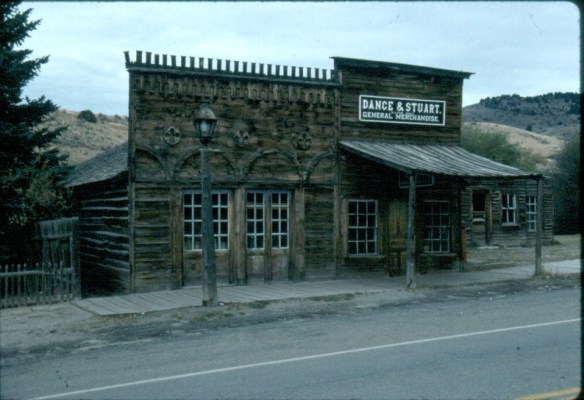
Virginia City, 1984
I came to appreciate that Madison County is much more than ghost towns, and that appreciation has grown in the decades since. It is a rich agricultural landscape, what I like to call a working landscape where ranching still matters, a lot. Here the past blends with the present in interesting and challenging ways, thus several blogs will explore the historical landscapes of Madison County, from the territorial era to today.
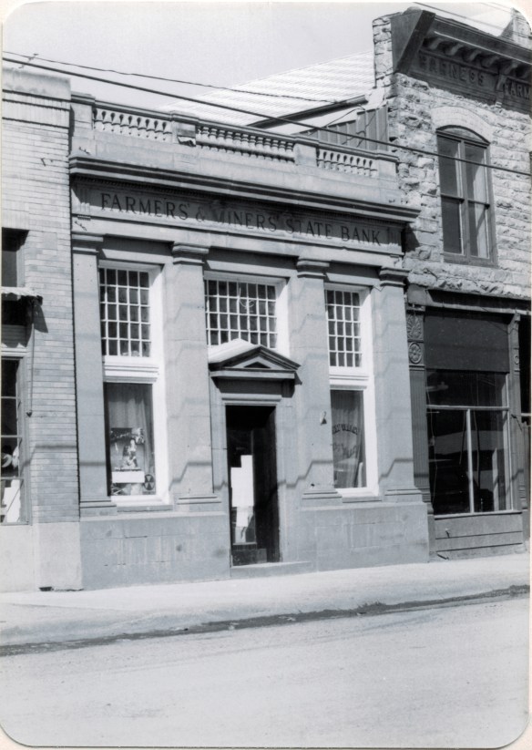
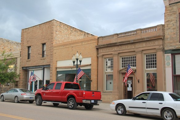
 Montana Highway 41 and the western side of the county is where I start, with the town of Silver Star, nestled between a spur line of the Northern Pacific Railroad, Highway 41, and Jefferson River. Gold was discovered nearby in 1866 and the town is named for a mine, but growth came more from transportation, with Silver Star serving as an early transportation stop between Virginia City and Helena in the 1870s. Today the place is best known for a privately held massive collection of mining machines, tools, and artifacts established by Lloyd Harkins, and for its rural post office that is nestled within the town’s general store.


South of Silver Star along MT Highway 41 is frankly a spectacular rural landscape, with the Jefferson River and the Tobacco Root Mountains providing most of the backdrop. The river
 valley and its irrigation systems helped to produce one of the most famous barns in the state: the Round Barn, just north of Twin Bridges. In 1882 Noah Armstrong, who had made a fortune in mining, built the barn as part of his Doncaster Stable and Stud Farm. In 1933
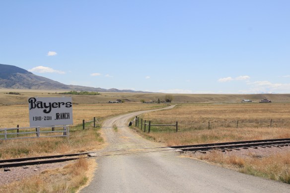 the Bayers family acquired the barn and incorporated it into their cattle business. When I visited in 1912 the barn was still an agricultural structure, with its wedding cake shape casting a distinct profile on the landscape. In 2015, the barn was restored to a new use: as a wedding and event reception space.


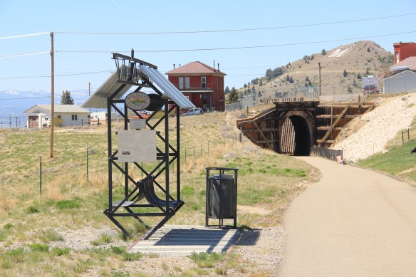
This section of Montana 41 also followed a route traveled by the Lewis and Clark expedition in August 1805. Today, like most of the trail throughout the state, there is much more public interpretation than in the 1980s. The marker below on Montana 41 explains the expedition’s confusion over the junction of the Big Hole and Jefferson rivers; in Twin Bridges there is an outdoor interpretive area at the county fairgrounds that commemorates the expedition, especially the role of Sacajawea.


The real jewels at the Madison County Fairgrounds are the historic buildings themselves–a wonderful set of New Deal-era public buildings crafted by the Works Progress Administration in the mid-1930s. An earlier post reviewed the fairgrounds history, noting that “‘WPA engineer C. D. Paxton drew the plans and Tosten Stenberg, well known for his log structures in Yellowstone Park, directed construction. Local foreman Fred Sommers was brought out of retirement with a special waiver from Washington to supervise the project. Lodgepole pine, fir logs, and other building materials were gathered locally and prepared by workers on site.'”

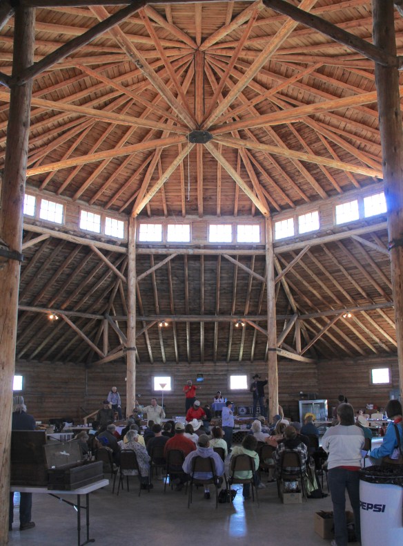 The result is spectacular, and with their restoration in the last 30 years, the buildings are not just landmarks but busy throughout the spring, summer, and fall.


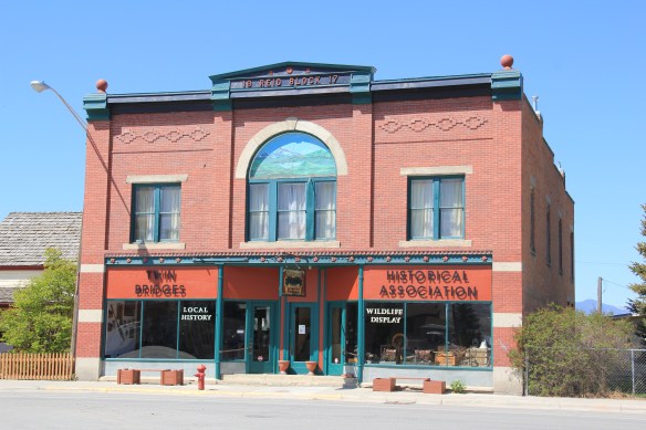
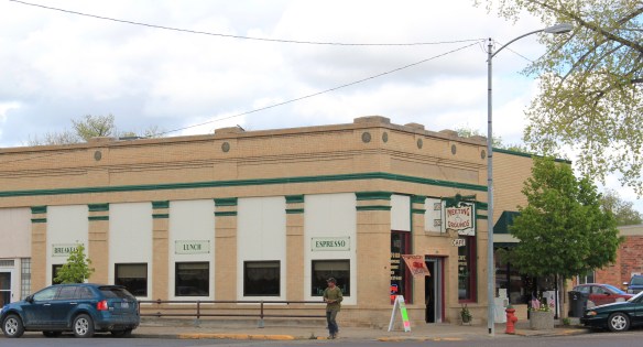
Twin Bridges is also more than the fairgrounds. When I visited for the first time in almost 30 years in 2012, the entire business district has getting an infrastructure facelift. The construction did not diminish my appreciation for the range of historic commercial


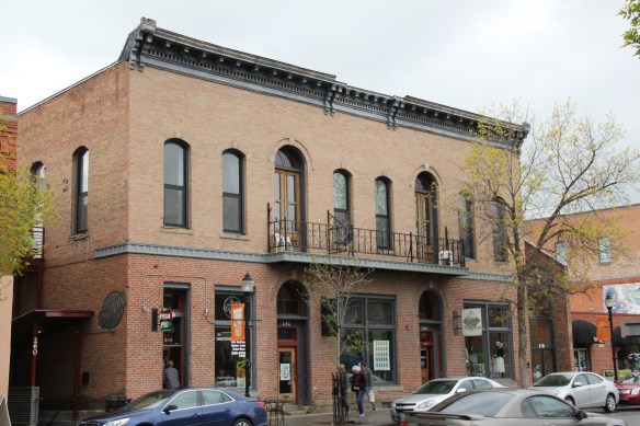
buildings along the highway. Most worthy of note is the late Victorian-styled Reid Block of 1917, the construction of which coincided with the homesteading boom in this part of the county. The Reid Block is now home to the Twin Bridges Historical Association.
 The Old Hotel, a brick two-story gable-front building, also marks the town’s ascent during the early 20th century when the town achieved its highest population, about 750 in 1920. Today about half of that number call Twin Bridges home.
 My personal favorite, and a frequent stop during the 1980s, is the Blue Anchor Bar, nestled on the first floor, with an Art Deco style redesign, in a two-story commercial block.
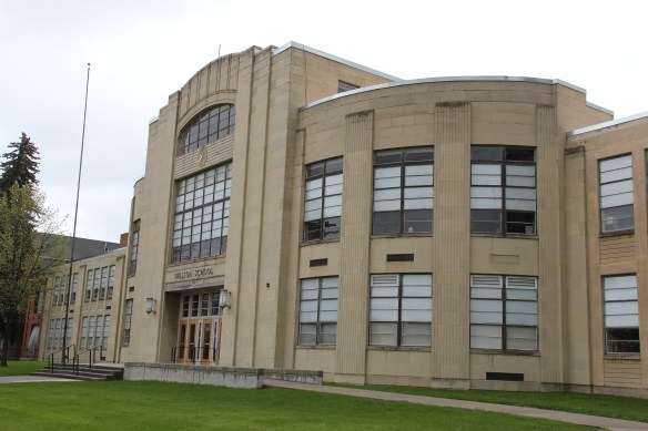
 Twin Bridges is a very important river junction, thus the name, where the Beaverhead, Big Hole, and Ruby rivers all meet to form the Jefferson River. A public park near the confluence just south of the Montana 41/287 helps to tell that story. Nearby is the Twin Bridges School and its amazing modernist styled gymnasium.


Twin Bridges School is award winning and clearly the pride of every resident. Another part of Montana’s history of childhood education is also at Twin Bridges, the Montana State Orphanage later known as the State Home for Children. The Queen Anne-style orphanage

dates to 1894–it was known as “The Castle” and is listed in the National Register– and as the decades passed the state enlarged the facility and added modern-styled facilities to the complex. The state closed the orphanage in 1975. Ever since that time, preservationists statewide and residents locally have tried to come up with an adaptive reuse plan that could put the buildings back in service.


For a brief history of the orphanage, visit the blog post “There’s No Place like Home: The Role of the Montana State Orphanage” on the montanawomenshistory.org blog. It features historic photographs of the orphanage. In 2010 the Bozeman Daily Chronicle featured the deteriorating campus in a news feature, wondering when and if preservation and adaptive reuse would happen. That question remains today.
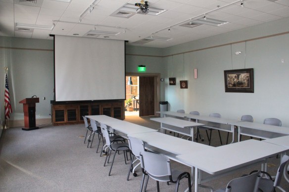
 Let me just jump right in: I do not know of another town in Montana that has done more with the concept of heritage development than Butte in the last 30 years. Heritage development, in brief, means that a community identifies the stories and places that define their past and sense of identity and then uses them as tools for community revitalization and growth. The stories and places must be authentic, meaningful, real–fake pasts don’t get you very far. In 1981, out of fears that its storied and nationally significant history would be lost in the haze of late 20th century urban renewal and economic change, Butte created as part of local government the Butte-Silver Bow Archives–everyone I knew were excited about its potential and its early discoveries at the time of the state historic preservation plan work in 1984-1985. Now that institution is one of the key rocks upon which Butte’s future lays. Above is the conversion of a historic firehall into the modern archives/heritage center the institution is today–in itself a great example of adaptive reuse and historic preservation at work.


 a vibrant institution, always in touch as its community room hosts other heritage groups and special programs throughout the year. The archives is just around the corner from one of the most important, and solemn, places in the city, the location of the Butte Miners’ Union Hall, which was bombed in 1914.
 Heritage development has become part of the basic sinews of Butte. Along with its active archives board, the city also maintains an effective historic district commission, and provided seed money for several key projects over the past generation. The Original Mine site below, the city’s first copper mine, not only serves as part of the city’s public

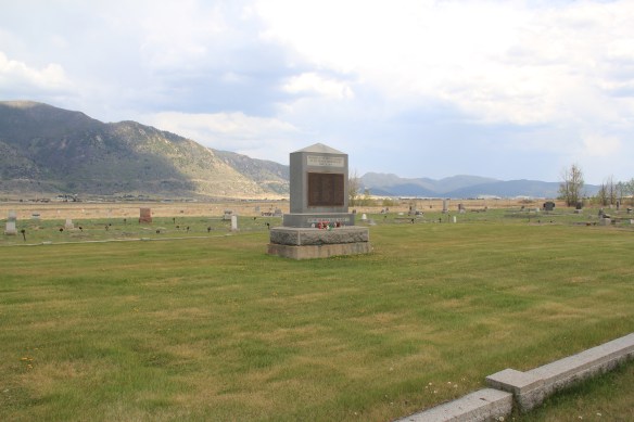
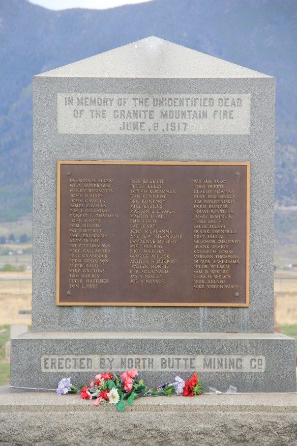 Today the Granite Mountain site is one of the best interpreted mining properties I have encountered. The miners’ stories are told–often with the words they were able to write down before dying from the lack of oxygen–and their multiple ethnic backgrounds are acknowledged, and celebrated.
 The interpretive memorial overlooks the mine, and is located high over town. But when I visited in May 2012 a school group was there too, along with visitors like me.


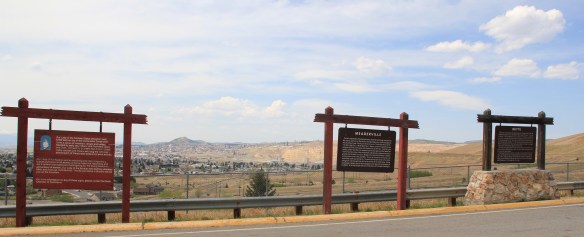 All of these efforts considerably enhance earlier efforts at public interpretation, be they along Interstate I-15 and its overview of Butte or the visitor center maintained just off the
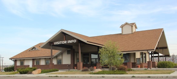 interstate by the local chamber of commerce. The center, yet another change in the last 30 years, is an attractive reproduction of a classic railroad depot design. It also provides a useful perspective of the city from its south side, giving special prominence to the soaring clock tower of the historic Milwaukee Road depot.
 The Berkeley Pit in 1984 was a giant hole in the earth, with a viewing stand. It too now has a more comprehensive heritage experience with a small visitor center/ museum adding to the public understanding of the massiveness and significance of the pit.


 Then Senator Moss took me for a quick tour of its late 1990s renovation in 2007–its conversion into law offices respected both its original spaces and interior design.


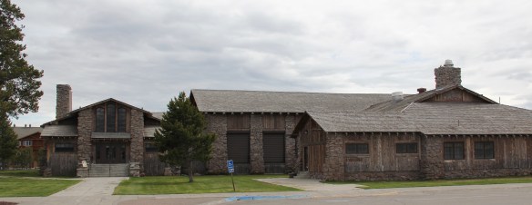
 The district’s architectural jewel, the Dining Room, dates almost a generation later to 1926. Architect Gilbert S. Underwood designed one of the late marvels of the Rustic style as defined in the northern Rockies. With its rugged stone exterior rising as it was a natural formation in the land, the dining room immediately told arriving visitors that an adventure awaited them, especially once they stepped inside and experienced the vast log interior spaces.


 Other former Union Pacific buildings have been given adaptive reuse treatment by the town, with a baggage building becoming police headquarters and the former men’s dormitory has been converted into a local health clinic.

 Thus, West Yellowstone is among Montana’s best examples of roadside architecture as distinctive 19502-1960w motels and a wide assortment of commercial types line both U.S. 191 but also the side arteries to the highway.


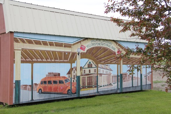
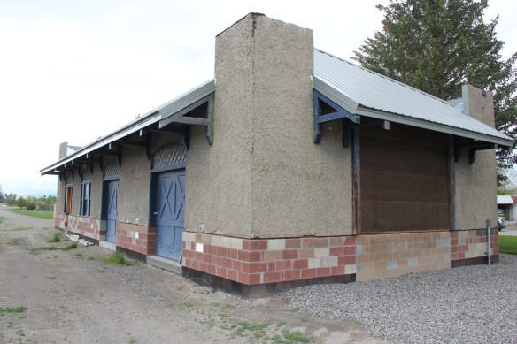
 Three Forks, Montana, is unique in how competing railroads shaped this one small town between the 2008 and 2010. The last post discussed how the Milwaukee Road came first, and its landmark Sacajawea Inn stands at the north end of the town’s main street. On the east side–see the Google Map below–became the domain of the Northern Pacific Railroad and its spur line to the copper kingdom of Butte
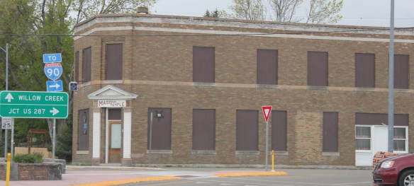


 Company. In 1914 Charles Botcher bought the plant, renamed it the Ideal Cement Company and kept it in business under that name until the 1980s.


 U.S. Highway 89 enters the Blackfeet Indian Reservation on its southern border, heading for its junction with U.S. Highway 2 and the reservation center of Browning. Before the junction, you cross the historic Two Medicine River, a historic corridor for the Blackfeet. To the west of the river crossing is a highway historical marker for Coldfeet School, a one-
 room school (not extant) built for Blackfeet children in 1933 during the New Deal. To the east of the highway river crossing, however, was one of the earliest schools (1889) on the reservation, the Holy Family Catholic
")


 This panorama of the mission site today shows that neither of the dormitories remain, although the historic frame barn and mill still stand (to the left) while the chapel is still a dominating element, and has been incorporated into present-day Blackfeet culture. It is in excellent shape.
 Another change is that the Blackfeet provide public interpretation of the site, through their own historical markers, which is extended into the adjacent historic cemetery, one of the most somber places in the region. The old mission is now part of the reservation’s heritage tourism effort.
 Returning to U.S. 89 and heading northwest, you head to the junction of U.S. Highway 2 and the town of Browning. The town is a center for reservation education, as shown by the new campus for the Blackfeet Community College.
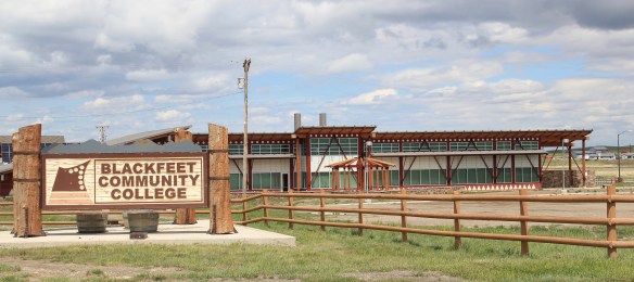 Here too is another historic Catholic Church, the Little Flower Catholic Church, built in 1931, from locally available stone in a Gothic Revival style. The congregation supports a small Catholic school next door.
 The Browning fairgrounds is an important Blackfeet recreation and cultural center, with this recent installation again providing public interpretation of Blackfeet culture.
 and U.S. 89, heading north. It created an appropriate, respectful way for the increasing number of auto tourists headed to Glacier National Park to learn about the Blackfeet in particular and Plains Indian culture in general. The famous mid-20th century anthropologist, John Ewers, had worked tribes to create the museum’s initial exhibits and collections. In the 21st century, the Blackfeet have developed additional institutions to take advantage of tourism through the nearby Glacier Peaks casino and hotel, a complex that has developed from 2011 to 2015.
 These new buildings are part of a long-term continuum of tourism in Browning, starting with this old concrete tipi, built originally as a gas station in 1934 and now converted into a coffee shop. And the Blackfeet
 Trading Post is a business found in all sorts of national park gateways–the classic place to get cheap souvenirs and t-shirts of all types, not to mention moccasins and all of the stereotypical material culture of Native American tourism in our country.
 the primary voice on what the park means, and how visitors can think about it today. The Native American presence on U.S. Highway 89 today is much more evident, with much more public interpretation, than in my travels 30 years ago.
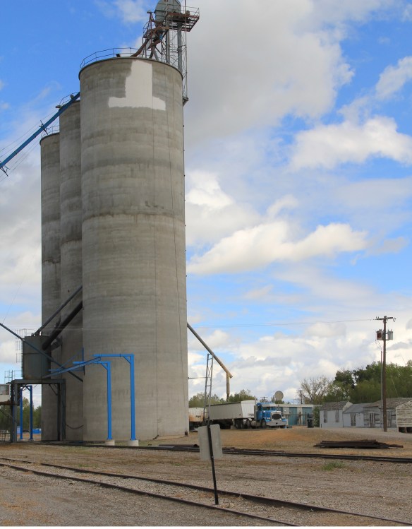 One of my favorite county seats is Choteau, where U.S. Highways 89 and 287 meet. Both of those roads were and are among my favorite to take in the state, and Choteau I quickly found had one of my favorite local dives the Wagon Wheel. Back in the day, however, I did not appreciate how the town’s history and built environment was shaped by the Sun River Irrigation project and the overall growth in the county during the first two decades of the 20th century and later a second boom in the 1940s.
 Choteau has a different look than most towns from this era of Montana history. The centerpiece of the towns plan is not a railroad depot but the magnificent Teton County Courthouse (1906), which occupies a spot where the two federal highways junction. Designed by architects Joseph B. Gibson and George H. Shanley, the National Register-listed courthouse is made of locally quarried stone in a late interpretation of Richardsonian Romanesque style, similar to, but to a much lesser scale and detail, than H. H. Richardson’s own Allegheny County Courthouse (c. 1886) in Pittsburgh.

 This historic neoclassical-styled bank building is now home to a coffee shop but other commercial buildings have changed very little, except for the mix of retail business. This is not a dying business district but one with a good bit of jump, of vitality.


 where the historic Bella Vista Motel–a perfect example of a 1950s motel with separate units like tiny Ranch-styled houses–has given way to a c. 2015 conversion into apartments.


 As the highway leaves the central plains east of Great Falls, it heads east through coal country (see the earlier post on Belt) and south into the Little Belt Mountains and the old mining towns of Monarch and Neihart (above). Both Cascade County towns are proud of their heritage, a story embodied in the Monarch-Neihart School, a wonderful bit of log craftsmanship from the New Deal era, a WPA project finished in 1940 that is listed in the National Register of Historic Places.
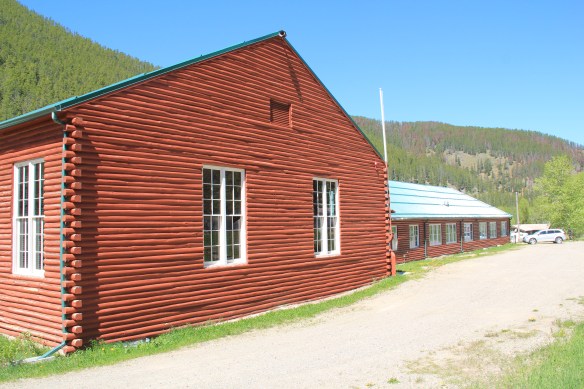


 When I last visited there in 2015 the combined route of U.S. 89 and 12, which passes in front of the courthouse and the center of town, was being rebuilt, giving the historic business district the look of a ghost town.

 U.S. Highway 89 continues south, crossing the historic corridor of the Milwaukee Road at Ringling, another Meagher County town discussed in an earlier post, marked by the landmark St. John’s Catholic Church.
 Travelers continuing south soon find themselves in Park County, entering the Shields River Valley just north of Wilsall, where highway markers and monuments, like that for “Thunder Jack” (2006) by sculptor Gary Kerby, convey the significance of the place.
 Wilsall was not much a place 30 years ago, a small trade town on the edge of a Northern Pacific Railroad spur line, a past still recalled by the tall elevator and old railroad corridor.
 But the growing popularity of the Shields River Valley has led to a new boom in Walsall, with old banks converted into bars and old general stores


 Clyde Park Tavern is still the place to go for an adult beverage, or two. Historic grain elevators still serve local ranchers, marking the railroad line that defined the town’s landscape until the impact of the highway in the early 20th century.

 Many heritage areas in the eastern United States emphasize the relationship between rivers, railroads, and industrial development and how those resources contributed to national economic growth and wartime mobilization. Great Falls can do that too. Situated on the Missouri River and designed by its founders to be a northwest industrial center, entrepreneurs counted on the falls to be a source of power and then on the railroads coming from Minnesota, especially the promising Manitoba Road headed by James J. Hill, to provide the transportation.
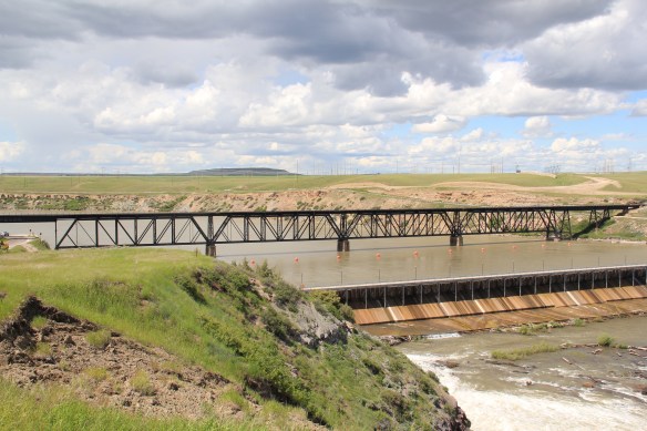 Paris Gibson, the promoter of the Electric City, allied his interests to two of most powerful capitalists of the region: Marcus Daly, the baron of the Anaconda Copper Company interests and James J. Hill, the future rail king of the northwest. Their alliance is embodied in several different properties in the city but the most significant place was where the Anaconda Copper Company smelter operated at Black Eagle until the last decades of the 20th century. When I surveyed Great Falls for the state
 decade of the 20th century and soon erected its tall tower depot right on the Missouri River. But wherever you go along the river you find significant buildings associated with the Great Northern and its allied branch the Montana Central Railroad, especially the downtown warehouses. Some are still fulfilling their original function but others


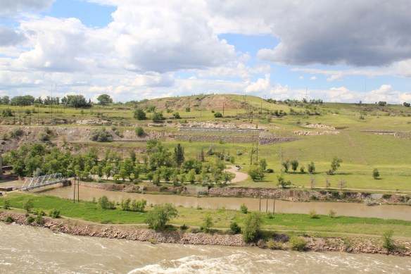
 Along the Missouri River is Paris Gibson Park, deep in the heart of Great Falls, Montana. Gibson was one of the classic civic capitalists of the late 19th century who understood that as the community prospered he too would achieve this dream of building a great western empire, with his town of Great Falls as the center. Almost 100 years after his death, in 2015, residents, preservationists, historians, and economic developers began discussions on establishing a heritage area, centered on Great Falls, but encompassing the Missouri River as the thread between the plains and mountains, that has shaped the region, and the nation, for hundreds of years. I strongly endorse the discussion and will spend the next several posts exploring key resources in Cascade County that could serve as the foundation for a larger regional story.
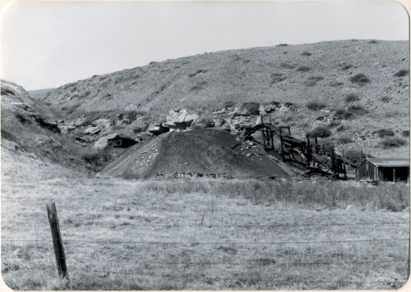
 Thirty years later, Belt’s population had bottomed out, declining to under 600 by the time of the 2010 census. But both times I have stopped by, in 2013 and 2015, the town has a sense of life about it, and hope. The town’s two historic taverns, the Harvest Moon Tavern and the Belt Creek Brew Pub, as well as the Black Diamond Bar and Supper Club attract visitors from nearby Great Falls and elsewhere, giving the place a sense of life at evenings and weekends.
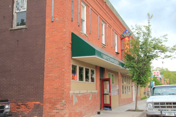
 When planners talk about heritage areas, they often focus on the contributions of local entrepreneurs who take historic buildings, like the Pioneer above, and breathe new life into them. Throughout small town Montana and urban commercial districts, new breweries and distilleries are creating such opportunities.
 Belt has a range of historic buildings, mostly of vernacular two-part commercial style that speak strongly to the boom of 1900 to 1920. The Victorian-styled cornice of the Belt Hardware Store (1896) speaks to the town’s origins. The Knights of Pythias Lodge of 1916 has been restored as a community theater, another reason for visitors to stop and explore.
 The result is a living cultural experience, since nothing in Belt is over-restored or phony feeling. It is still a gritty, no frills place. That feel is complemented by the Belt museum, which is housed in a historic jail on road down into town and within sight on a railroad trestle, a reminder of what literally drove the town’s development, coal for the railroads.
 During the 1984 survey, I gave the jail a good bit of attention since this stone building spoke to the craftsmanship of the era, the centrality of local government as the town developed, and the reality that this building was the only thing in Belt listed in the National Register of Historic Places. But in 2004 the state historic preservation office approved the Belt commercial historic district, and that designation has done much to drive the town’s recent revival. Belt is just the first place that speaks to the promise of the Great Falls heritage area concept.