For 90 years, Billings residents have marked and told the stories of its first cemetery–that of the short-lived Yellowstone River settlement of Coulson (c. 1877)–and of those early pioneers buried on the southern rimrocks overlooking the valley. This early effort of preservation and interpretation was led by leading Billings civic capitalist, I. D. O’Donnell, himself one of the first settlers of the region.
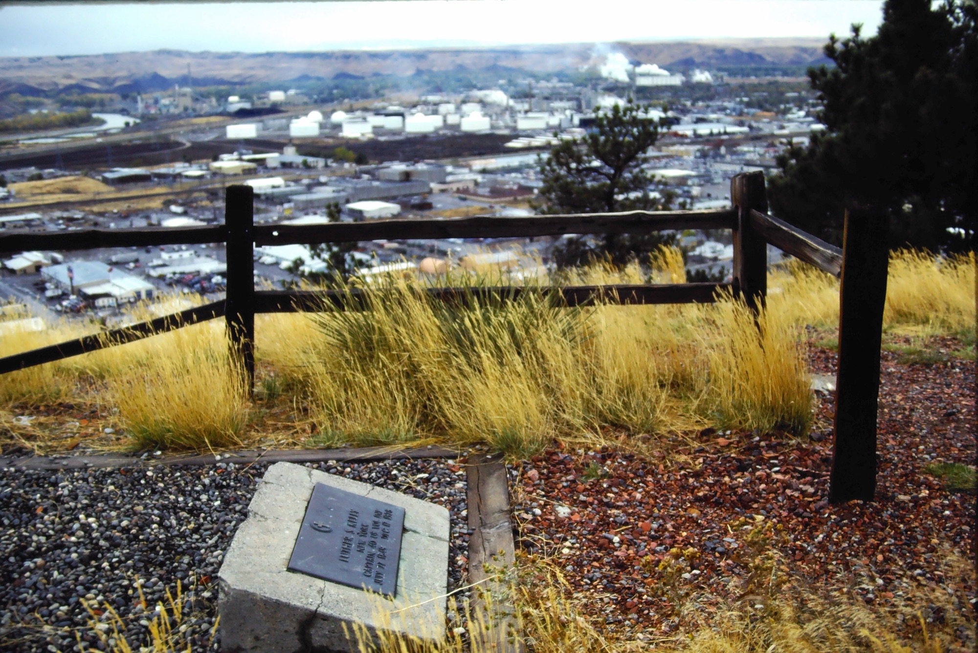
O’Donnell led the creation of both the monument to Luther “Yellowstone” Kelly (a project that now is getting a major renovation) and the monument to the Coulson, or “Foothill,” Cemetery.


In the 1920s, after his retirement as the chief of irrigation for the U.S. Bureau of Reclamation, O’Donnell took up a greater interest in local history. He interviewed many of his fellow early citizens, creating the collection Montana Monographs that you can still read at the Parmly Billings Library, and taking steps to restore the forgotten Coulson cemetery and Kelly gravesite.
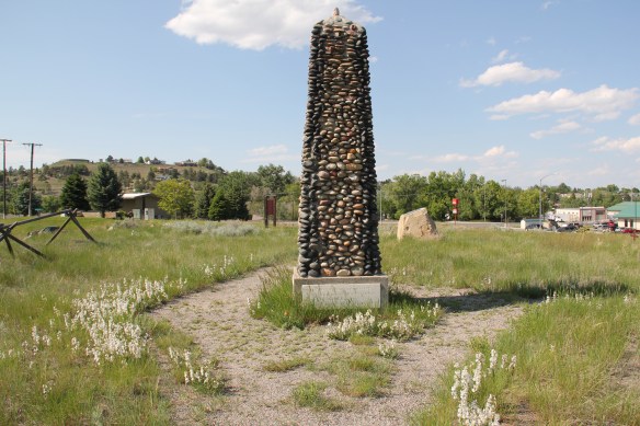
The obelisk monument made of river rock became the city’s initial historic site–or historic spot as the monument stated–and it fed right into the romance of the west as portrayed in movies, popular fiction, and radio: the image of “Foothill,” where men died with their boots on, from gun fights or other stereotypical frontier violence.
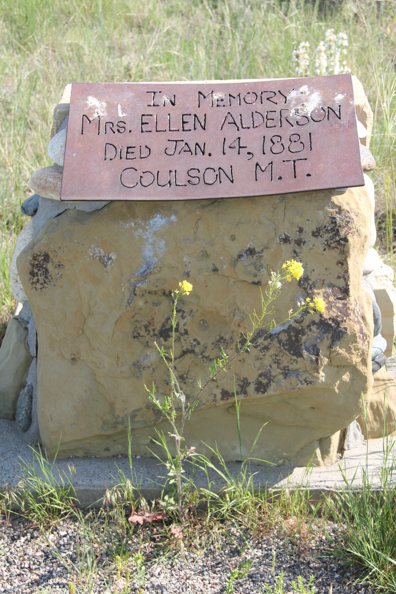
The reality was far different–most, such as Ellen Alderson, the wife of early merchant and hotel operator John Alderson, died from diseases, accidents, and not violence.
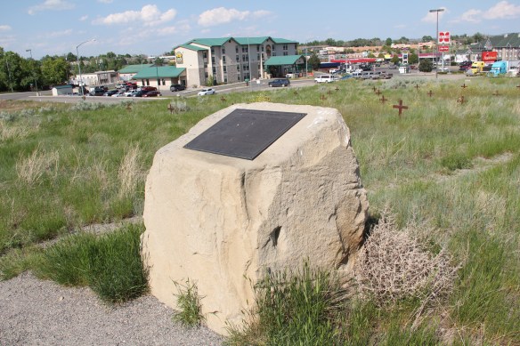
In the last 30 years, the sprawl of the modern city to the east has surrounded what was once a quiet, even forlorn space. Efforts from the city to provide improved parking and walkways in recent years are positive improvements at the cemetery.
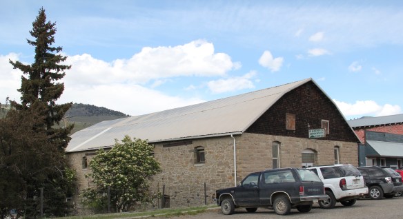
The historic driving tours of Billings always include a stop, or at least a mention, of the Kelly grave and Boothill Cemetery. But on the eastern side of town, along Central Avenue, is just as important of a historic cemetery, the Mountview Cemetery–which expanded c. 1920 out of the earlier Billings Cemetery, established during the town’s initial settlement in 1882.
Many visitors appreciate the beauty and landscaping at Mountview Cemetery but it seems that few consider it to be a historic site. But to my mind, it is certainly the most significant historic cemetery in Billings for here lie the graves–many understated to be sure–of a group of civic capitalists who built not only Billings but led the development of the Yellowstone Valley in the late 19th and early 20th centuries.
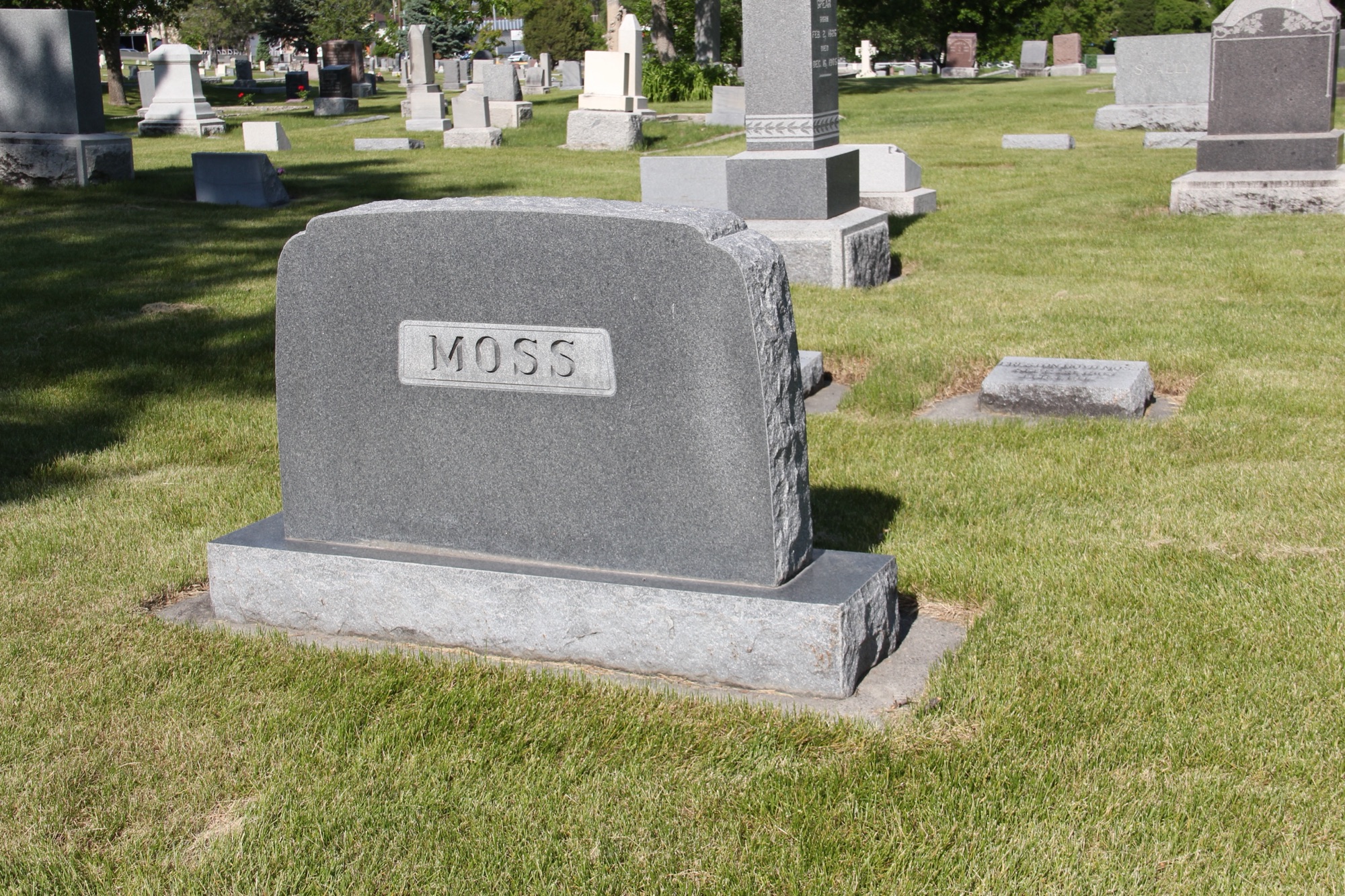
I.D. O’Donnell (d. 1948) is buried here as is his grand collaborator in the early 1900s Preston B. Moss (d. 1947)–their historic homes, both on the National Register of Historic Places, still stand next to each other in downtown Billings.
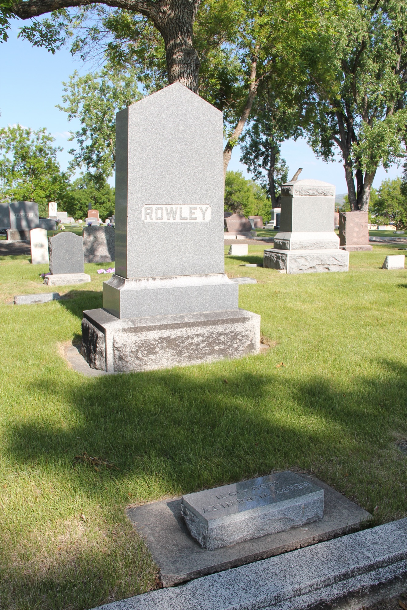
Another neighbor is the home of Henry W. Rowley, the engineer who came with the Minnesota and Montana Land Company to build the Big Ditch in 1882 and who stayed to work with his colleagues to build the city.

Albert L. Babcock was not tight, let’s say, with O’Donnell, Moss, and Rowley, who brought the Billings Sugar Company into existence in the first decade of the 20th century, but Babcock was a Republican political leader and major investor in his own right, as downtown landmarks attest.
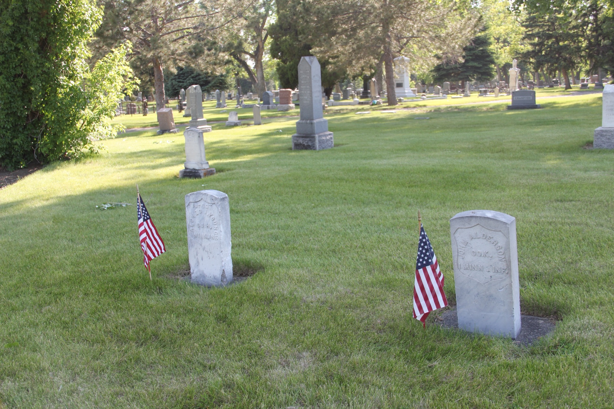
In the earlier Billings Cemetery you find the Civil War veterans markers for Alonzo Young, whose Young’s Point was an early Yellowstone River landmark (now approximately the location of Park City) and the previously mentioned John Alderson, who ran the National Hotel, the two-story log building that put Coulson “on the map” back in 1878. The contributions of Young and Alderson, buried here side by side, are forgotten today–which is truly unfortunate.
The defined family plots, either by property cast-iron Victorian fences or by low stone walls, are a key architectural feature of the earlier cemetery, as well as some of region’s famous stone carved Odd Fellows grave markers, such as that for the Bundys, located just beyond the grave of early settler Thomas McGirl.
 This brief overview does not do justice to the city’s historic cemeteries. Certainly I gave Boothill consideration in the 1984-1985 and even wrote about it in both of my books on Billings history. But Mountview is a historic landscape that only now I recognize–and I hope to do more exploration in the future.
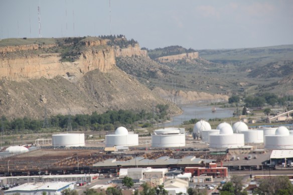
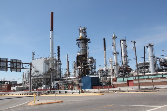
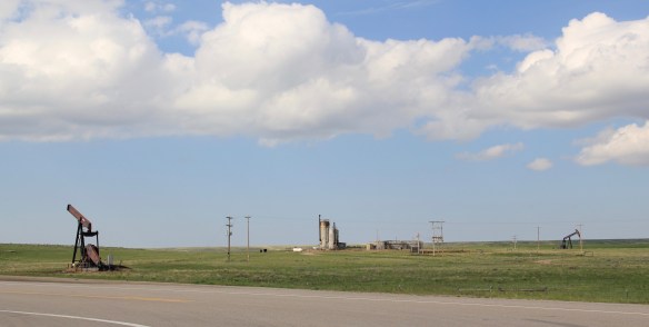
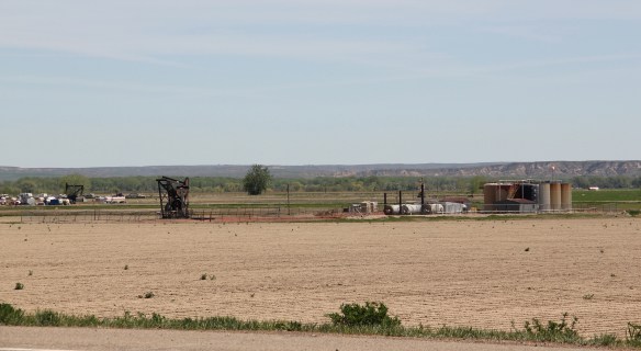
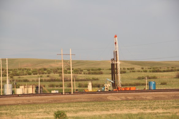
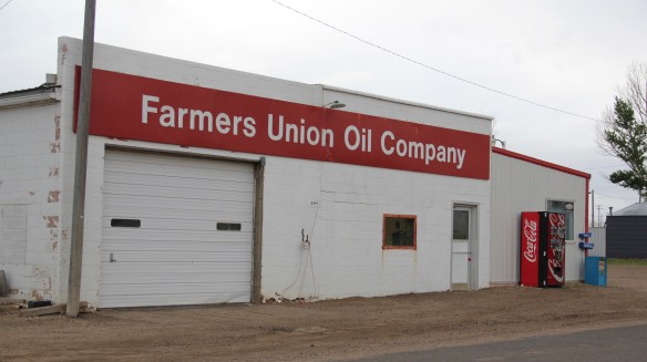
 The last post addressed Montana’s famous ranching landscape. Intermixed with the ranches, especially in the eastern third of the state, is a very different landscape of technology, one of pumps, storage facilities, pipelines, and refineries–the oil landscape of 20th and 21st century Montana.


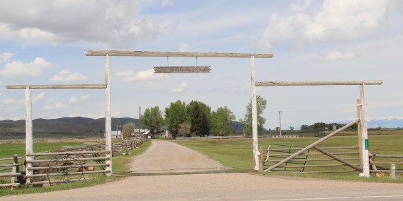
 Here is a property category that could be, probably should be, a blog of its own–the ranching landscape of Big Sky Country. Historic family ranches are everywhere in the state, and being of rural roots myself, and a Tennessee Century Farm owner, the ways families have crafted their lives and livelihood out of the land and its resources is always of interest.
 Preserving merely the ranch house, and adding other period buildings, is one thing. The massive preserved landscape of hundreds of acres of the Grant-Kohrs Ranch in the western end of Montana is a totally different experience. This National Park Service site


 The Bitter Root Stock Farm, established in 1886 by soon-to-be copper magnate Marcus Daly outside of Hamilton, came first. I can recall early site visits in 1985–that started the ball rolling but the deal wasn’t finalized for several years. All of the work was worth it.


 first glance, architecturally magnificent as the properties above. But in its use of local materials–the timber, the rocks from the river bluffs–and its setting along a historic road, this ranch is far more typical of the Montana experience.


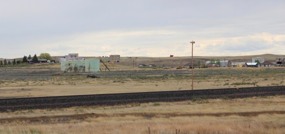
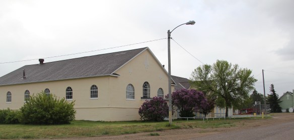
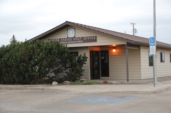
 Kremlin never grew to be much, perhaps 300 residents at its height (around 100 today), not because it never participated in the region’s agricultural boom–the decaying elevators speak to prosperity but a tornado and then drought doomed the town to being a minor player along the Great Northern main line.


 One of my favorite weekend drives, when I lived in Helena over 30 years ago, was to head north, via the Flesher Pass (above) and Montana Highway 279, and hit the very different landscape of Montana Highway 200 (below) and eastern end of the Blackfoot Valley.
 The destination was breakfast, often at Lambkin’s, a family business that, to my delight, still operates when I visited in 2015. Lambkin’s is one of those classic small town Montana eateries, great for breakfast, and not bad for a burger and pie later in the day. The town is


 Bozeman has boomed with many new chef-driven restaurants but of the downtown establishments my favorite for good fresh, creative food remains the Co-Op Downtown nestled within the Gallatin Block, a historic building, tastefully renovated, in the downtown historic district.


 head to Miles City, which is the place to go if you wonder, still, “where’s the beef” and a city that is the proud home of the famous Montana Bar.


 within New Deal landscape that forever changed the look of this region in the 1930s. Locals and tourists mix together–because the hotel is the only place to go, unless you want to backtrack to Glasgow and check out Sam’s Supper Club on U.S. Highway 2, and its equally neat 1960s roadside look.
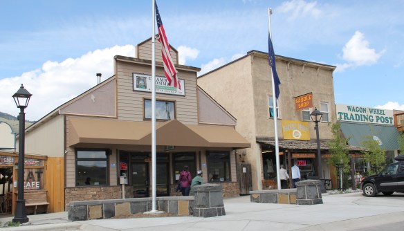
 The most popular Montana gateway into Yellowstone National Park is at Gardiner, in the southern tip of Park County. Here is where the Northern Pacific Railway stopped its trains, at a Rustic styled passenger station long ago demolished, and travelers passed through the gate above–designed by architect Robert Reamer–and started their journey into the park.
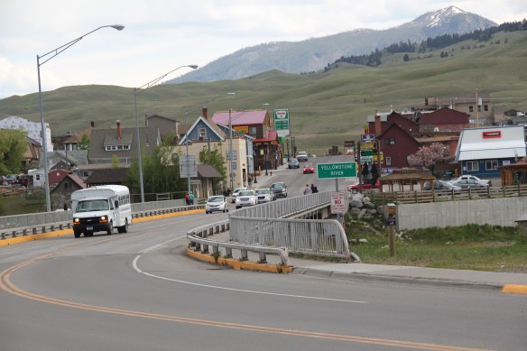 By the mid-20th century, Gardiner had become a highway town, the place in-between the beautiful drive through the Paradise Valley on U.S. Highway 89 (now a local paved road)


 The plan to develop a new Gardiner library at the old Northern Pacific depot site at part of the Gardiner Gateway Project is particularly promising, giving the town a new community anchor but also reconnecting it to the railroad landscape it was once part of. Something indeed to look for when I next visit this Yellowstone Gateway.
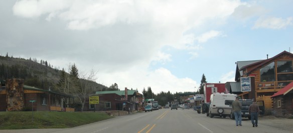 Montana’s gateways into Yellowstone National Park are known far and wide. The most popular are associated with the trains that delivered mostly easterners to the wonderland of the park–West Yellowstone for the Union Pacific line and Gardiner for the Northern Pacific Railway.
 Cooke City, located in the corner of Park County, was never a railroad town but an overland connection that did not become popular until the development of the Beartooth Highway out of Red Lodge in the 1920s.
 It is all about the Beartooth Highway (U.S. 212) here–when it opens, Cooke City booms as a tourism oasis. When the highway closes for its long winter, business doesn’t end since the road to Mammoth Hot Springs far to the west is kept open as best as it can be, but the number of visitors drops remarkably. Snow mobile traffic in the winter has meant a lot to local business in the last 30 years.

 Cooke City uses its mining past to define its identity today, from moving log mining shacks and cabins into town, as shown above, for potential new lures for tourism, to the recently established visitor center and museum, which includes some of the local mining


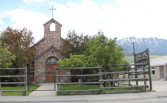
 Perhaps the best example is the rustic yet modern styling of the Mt Republic Chapel of Peace between Silver Gate and Cooke City on U.S. 212. It is no match for the soaring mountains that surround it but its quiet dignity reflects well the people and environment of this part of Montana.

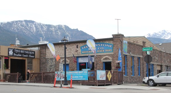
 The same can be said for Hoosier’s Bar–a favorite haunt here in Cooke City for several decades, easy to find with its neon sign, and then there is the throwback telephone booth–a good idea since many cell phones search for coverage in this area. Cooke City and Silver Gate are the smallest Montana gateways into Yellowstone National Park but they tell and preserve their story well.
 My friends in the environs of Helena have been surprised that after 300 something posts I had yet to say anything about Augusta, a crossroads town in northern Lewis and Clark County along U.S. Highway 287, during my revisit of the 1984-1985 state historic preservation plan. They knew that I loved the open range drive to Augusta, whether approaching from U.S. 287 or U.S. Highway 89.
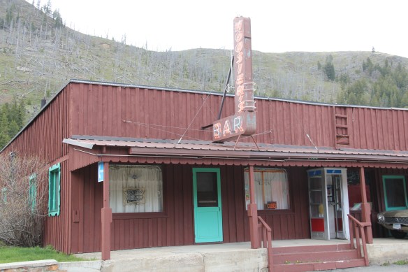
 Then, the various businesses and bars along Main Street represented not just a favorite place in rural Lewis and Clark County, but also document a classic western town with great roadside architecture such as the Wagon Wheel Motel.


 Augusta began as a crossroads town for neighboring ranches; the later extension of a railroad spur to nearby Gilman spurred competition between the two towns. But Augusta
  won that battle–today not much outside of the Montana Highway Historical marker, a steel bridge, and a disappearing railroad corridor remains of Gilman.

 But I like the football field almost as much as the historic school–could a more neighborhood setting even be imagined?
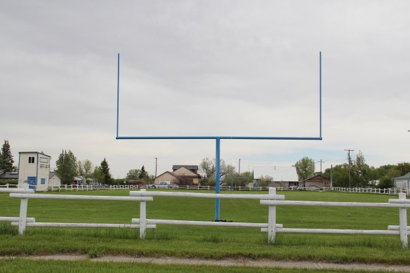 Then there are historic commercial buildings from the early 20th century–several with National Register qualities, especially the F. M. Mack General Merchandise store–a frame building with paired bracketed cornice.


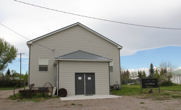
 Over 300 people call Augusta home today, a slight increase since my work 30 years ago. The community not only has kept the historic buildings noted above, residents also have opened the Augusta Area Museum–heritage is clearly part of the town’s future.