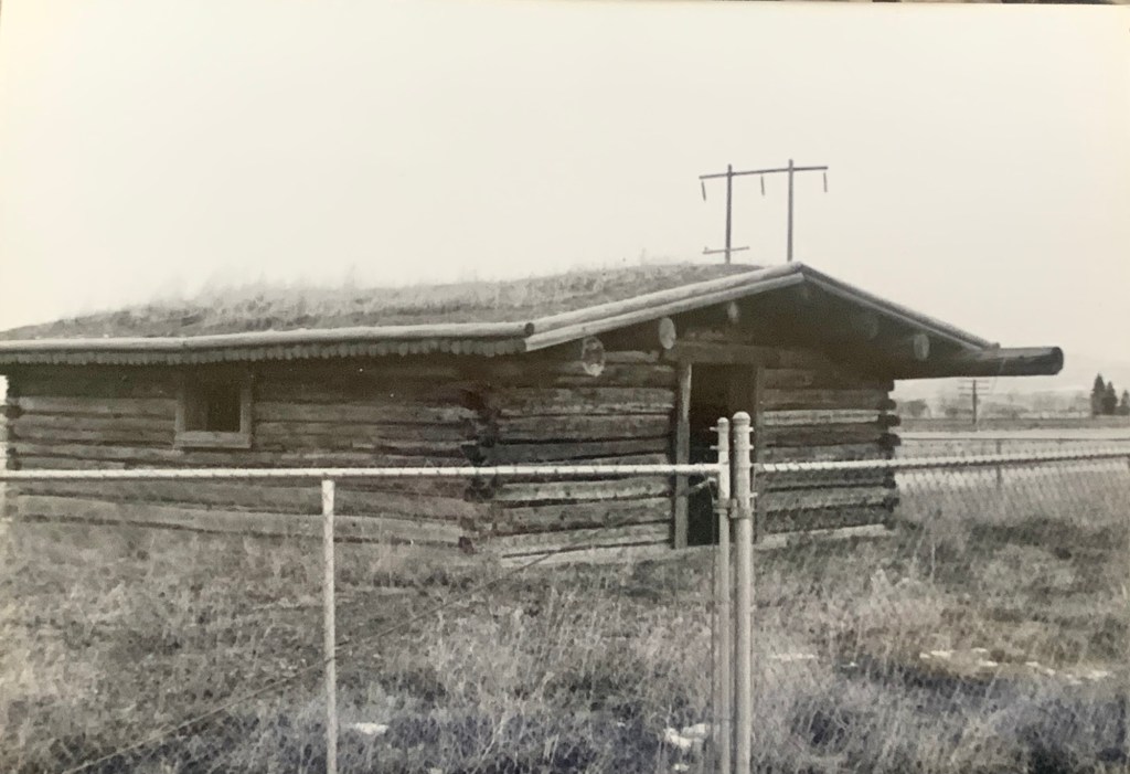
News out of Helena this week is that the historic Manlove homestead has been tagged and within days will be dismantled and placed into storage.
A landmark along U.S. Highway 287 for decades, the log building records the early homesteading era in the Prickley Pear Valley of Lewis and Clark County.
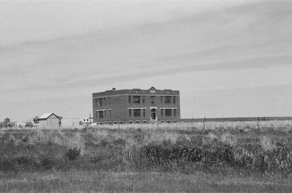
Manlove homestead in 1984
Its core dates c. 1864 but it has been moved to this roadside spot in the 20th century. It rarely has received the attention it had earned and now you wonder, due to the ever expanding sprawl of Helena and environs, if the cabin will ever see the light of day again. Once dismantled too many buildings stay that way.
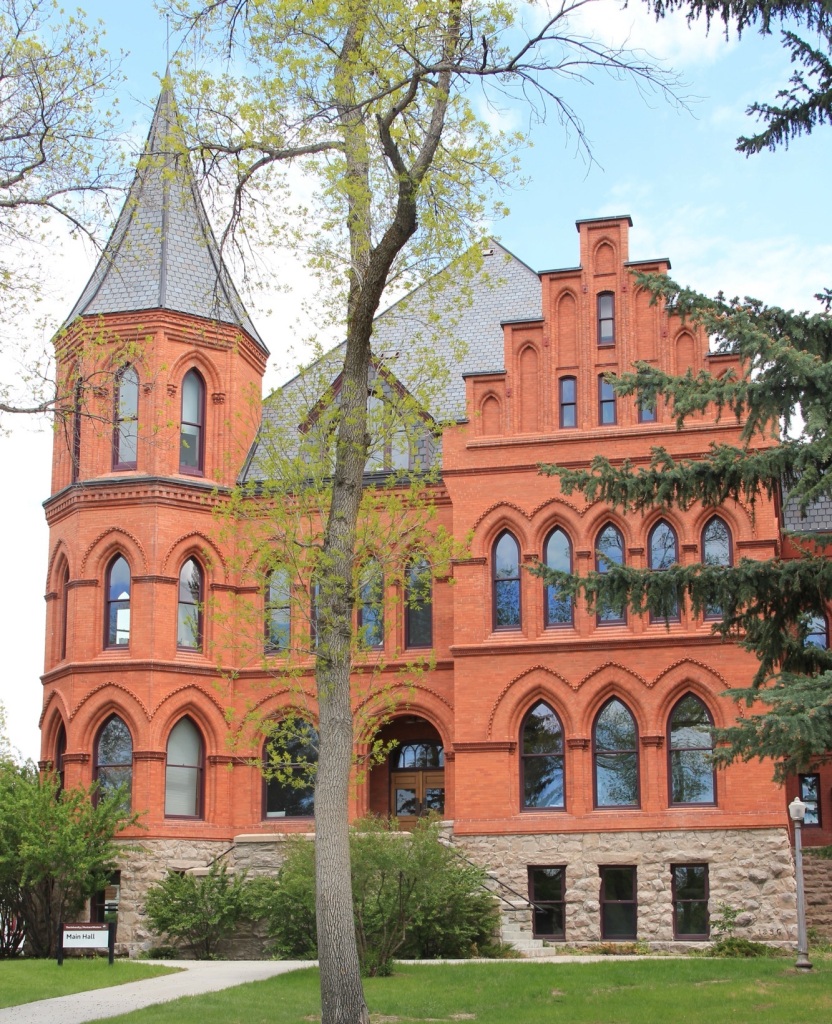
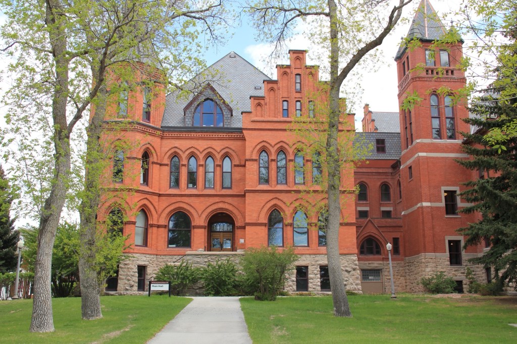
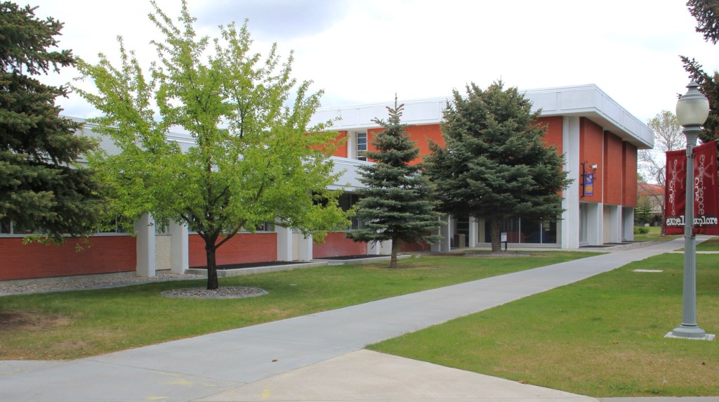
Dillon is one of my favorite towns in western Montana, and a big reason why is the university. It’s a beautiful campus, donated by the Gothic Revival style of Main Hall (1895-1897), designed by John C. Paulsen.
I’m a huge fan of Paulsen’s with across late 19th century Montana and Main Hall of what was originally the Montana State Normal School is one of his best designs.
With the homesteading boom of the early 20th century, the college began to expand. Its name changed to the Montana State Normal College in 1903, and soon thereafter the one huge building was not enough. The state made the first addition in 1907, which included an auditorium.
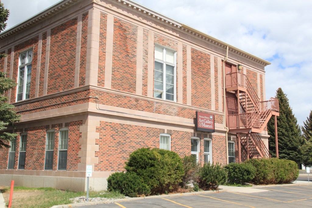
Soon another building was added and a long rectangular, quasi Craftsman style wing was built to hold more classrooms. if I read the internet sources correctly, Billings architect Charles S. Haire was the designer, but the completion of the building was delayed by a constitutional challenge to its funding.
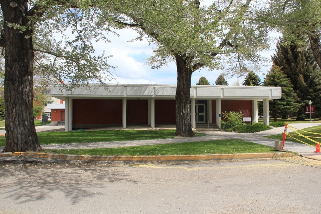
The university art museum ended up in this wing
Despite the funding controversy, the college continued to grow from 780 students in 1910 to about 1800 in 1920.
Matthews Hall, a classically inspired, yellow-brick building, was a residence hall constructed to help meet women student enrollment in 1919. The dining hall in a more Colonial Revival style came along a couple of years later in 1921.
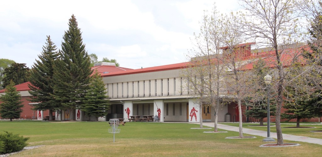
With the construction of a new gymnasium and classroom building (later Business and Technology) in 1924, the first generation of growth at State Normal College came to an end.
The modern era introduced an entirely new architectural vocabulary to the college. The college became Montana State Teachers College in 1931 and then Western Montana College of Education in 1949. The student union building dates to that era and was built in 1958.
Once the institution became Western Montana College in 1965 and started to expand its curriculum, new buildings were a must. The James Short Center and the Lucy Carson Library came in 1969.
Short CenterCarson Library
Then in 1971 came my favorite, Block Hall. Named for science professor Daniel G. Block, the building gave the college modern labs and led to expansion in the college’s environmental studies program.
In 1988 the college again changed names to Western Montana College of the University of Montana and with the turn of the 21st century it changed for perhaps the final time as the University of Montana Western. Two buildings belong to this past generation of development, the Bulldog Athletic and Recreation center and the Swysgood Technology Center, finished in 2001.
BARC buildingSwysgood Center
One other building joined the campus before the end of the twentieth century, and did so in a very roundabout way. Edward and Effie Roe established a large ranch in the Clark canyon area of Beaverhead County. They built a two-story Colonial Revival ranch house. By the 1990s no one lived in the house but media baron Ted Turner owned the ranch. He gave it to the college if the college would move it—28 miles to Dillon. The move took place in 1998 and then the college restored it as offices, with further donations from the Roe family.
The Montana Western campus is a jewel in the state’s public architecture. Dillon is so lucky to have to be its home.
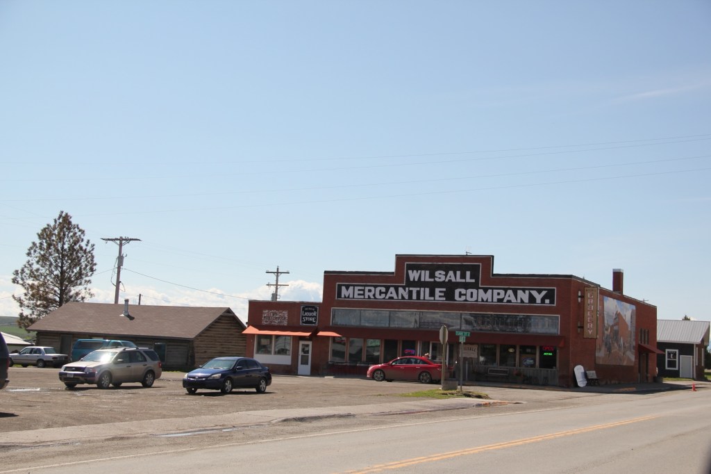
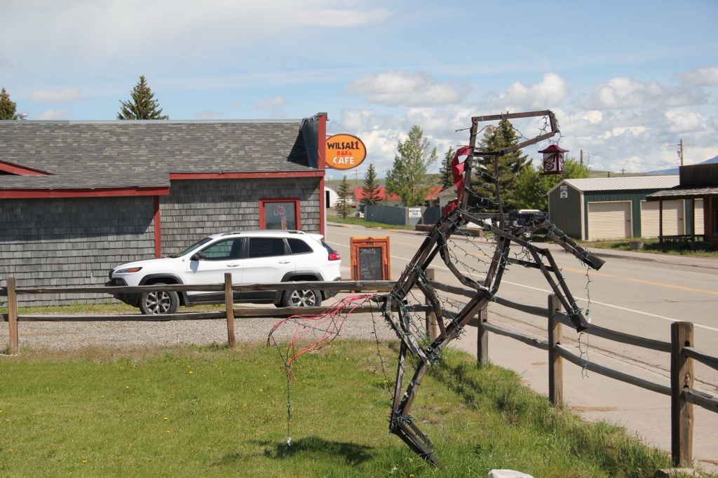
As readers of the blog know, the Shields River Valley is one of my favorite places in Montana. A good place to start any exploration is the village Wilsall, which, from my perspective, is close to a lot of larger towns and population but, then, also thrives quite well in its own.
The town’s past lies with the cattle ranch of Will and Sally Jordan—thus the same Wilsall—and the building of a spur line by the Northern Pacific Railroad in 1909, and the homesteading boom in northern Park County. The historic grain elevator is one potent reminder of both the railroad and homesteading. The tracks ran to the west of the present US 89 highway.
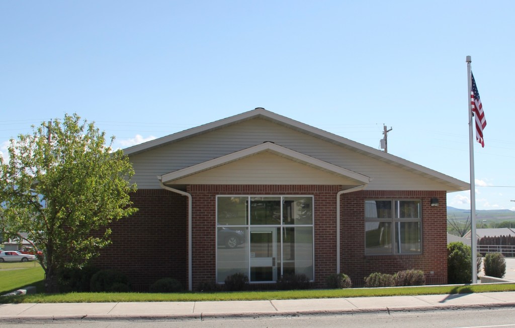
By 1910, the place had a post office; a modern one stands along the highway while an older one is attached to the mercantile building.
Soon the town’s primary crossroads at Elliot and Clark streets was defined by an impressive classical style bank on the west side and a large brick mercantile store on the east side.
The Bank Bar in fact has recently been in the news because, guess what, national media has again “discovered” a great Montana eatery—
something that locals have known about for years. Maybe the review will get more people to slow down a bit and look around.
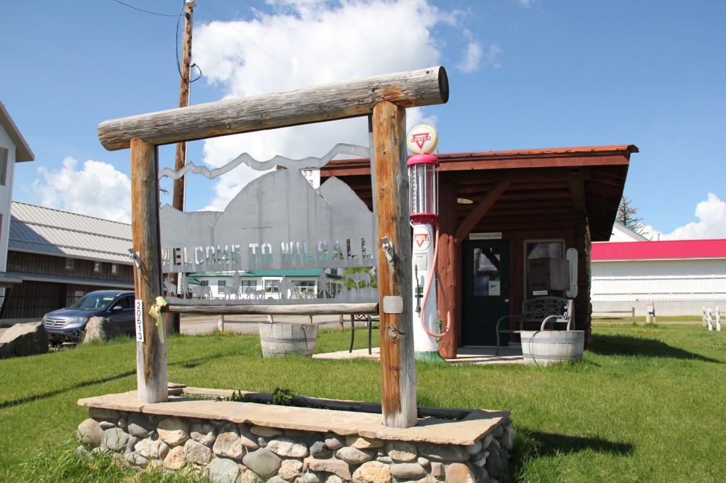
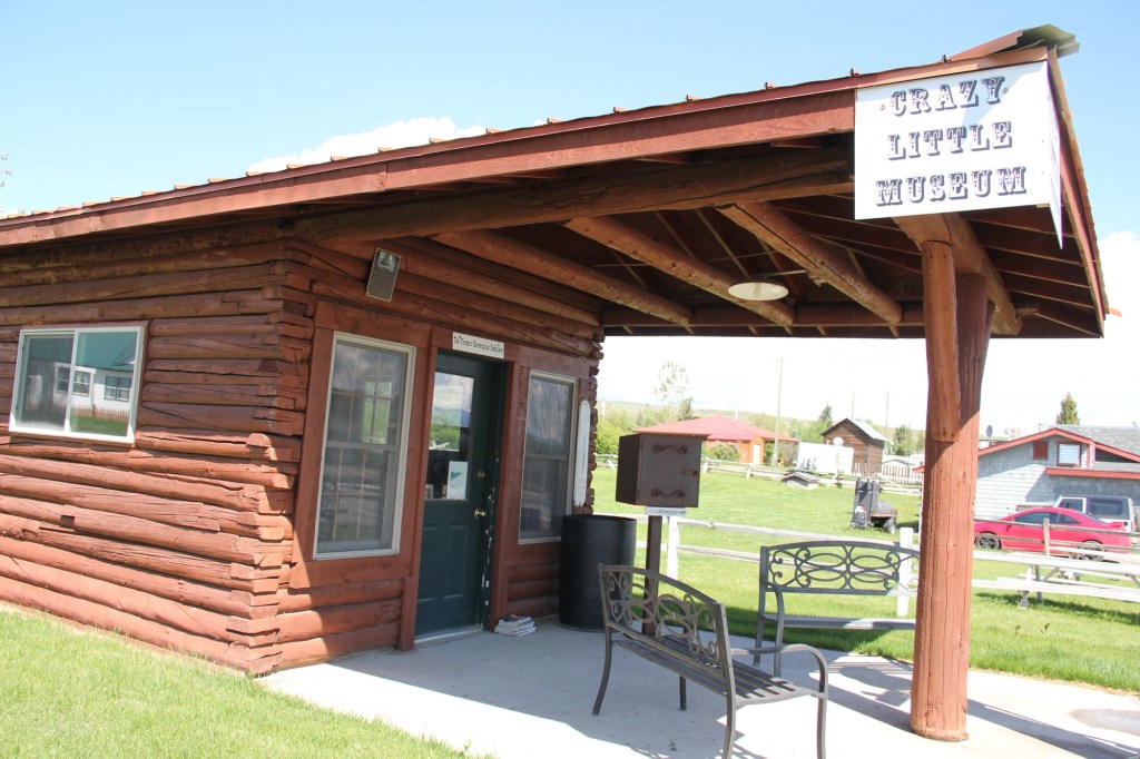
The stop is worth it, not just for a cold brew and perfect burger, but for the town’s Crazy Little Museum (also called the former Norwegian Embassy). It’s always refreshing when a place has a good perspective on itself and honors a person like Bob Tomasko who did a lot for the town before his death in 2012.
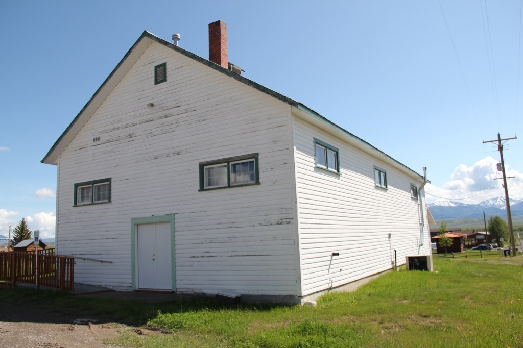
Historic community buildings survive such as the school from the 1910s, now boarded up.
And the town community hall, which remains in use even as the population has dwindled from 237 in 2000 to under 200 in 2020.
US Highway 89 is one of my favorite north-south routes in Montana stretching into Wyoming. I always look forward to my next visit to Wilsall.
Montana Highway 16 stretches north from U.S. Highway 2 following a spur line of the Great Northern Railway laid about 1910. Following that railroad corridor first brought me to Medicine Lake, the actual lake and town of that name in February 1984.
Great Northern depot in 1984
When I returned over thirty years later, the depot was gone, but the lake and town were doing ok.
Depot is gone today
Medicine Lake is a very important place in northeast Montana and the 8,000 + acre lake has been protected as a National Wildlife Refuge since 1935.
Medicine Lake NWRMedicine Lake NWR
Native Americans for centuries visited and hunted here, as hundreds of tipi rings along the lake bluffs documented. The lake remains a touchstone for several tribes today.
Medicine Lake, MT
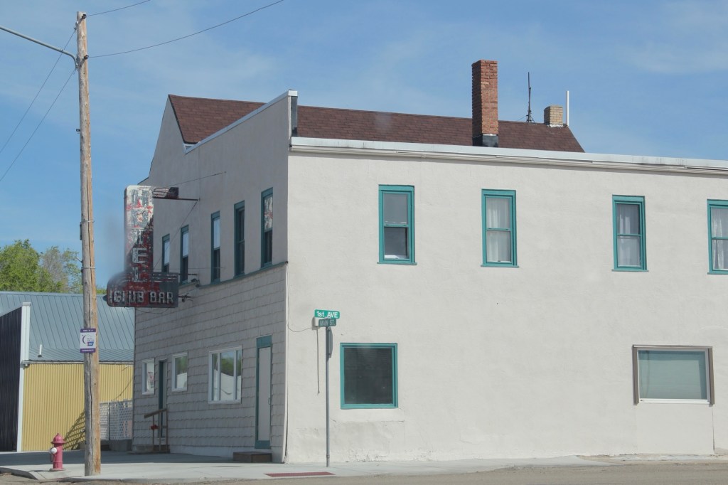
The town is much more recent, established by the railroad in 1910, with the iconic Club Hotel and Bar in business within a year.
I have stopped at the Club Bar where the old neon sign was a bit weathered but hospitality was everywhere. Don’t know about the hotel—maybe rooms was still used during the hunting season.
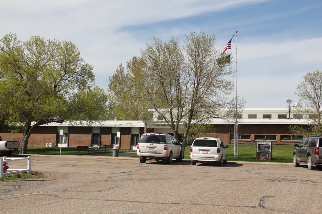
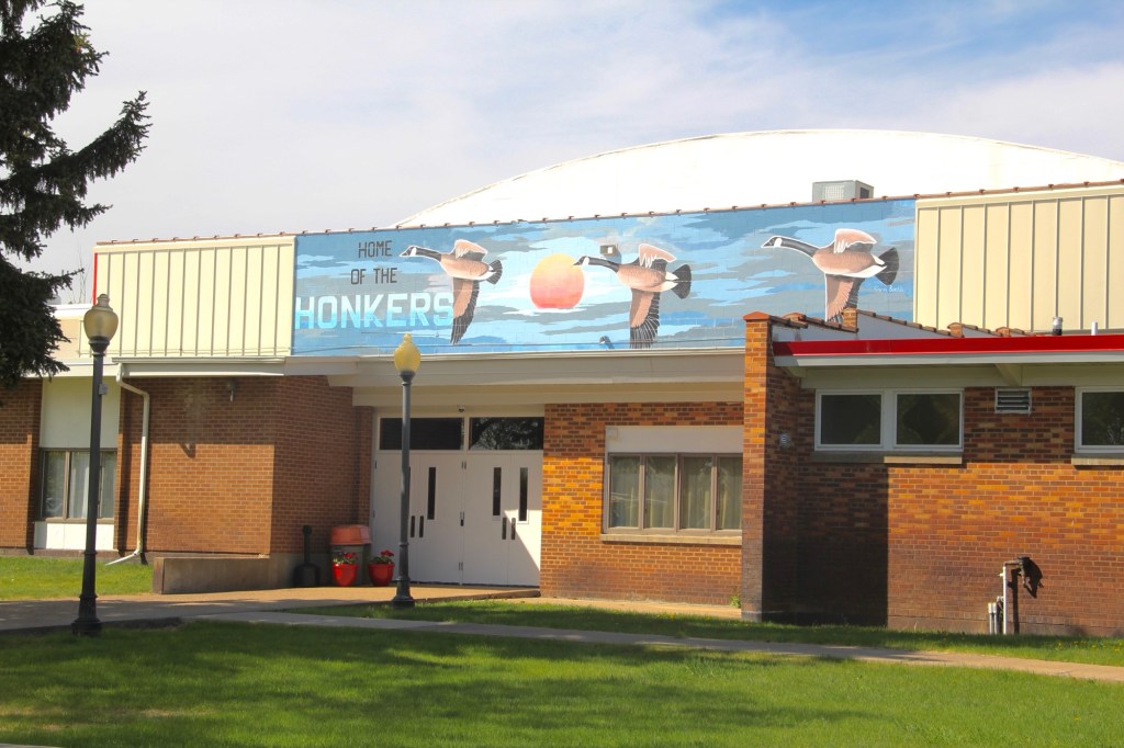
The Medicine Lake K-12 school keeps the town of about 250 people together but since my last visit the school lost its distinctive mascot name of The Honkers. For sports the school has merged with Froid and took us nickname of Red-Hawks. Did that mean that town gathering spot would change its name from the Honker Pit? Absolutely not. Great place!
Medicine Lake, the town, has several buildings from its first generation of settlement, including a corner gas station (adapted into a new business) and classic false-front one-story commercial buildings, including a lumber business and a hardware store.
Yet a dwindling population has hurt the business core. For 40 years between 1940 and 1980 the town’s population stayed around 400. The next 40 years witnessed a decline—and in a small town a loss of 150 people can really hurt.
But the town began a slight rebound in population in between 2010 and 2020, with some of it fueled by fracking man-camps
The bones of an early 20th century homestead town are still there. I hope to visit again and see new changes in 2025.
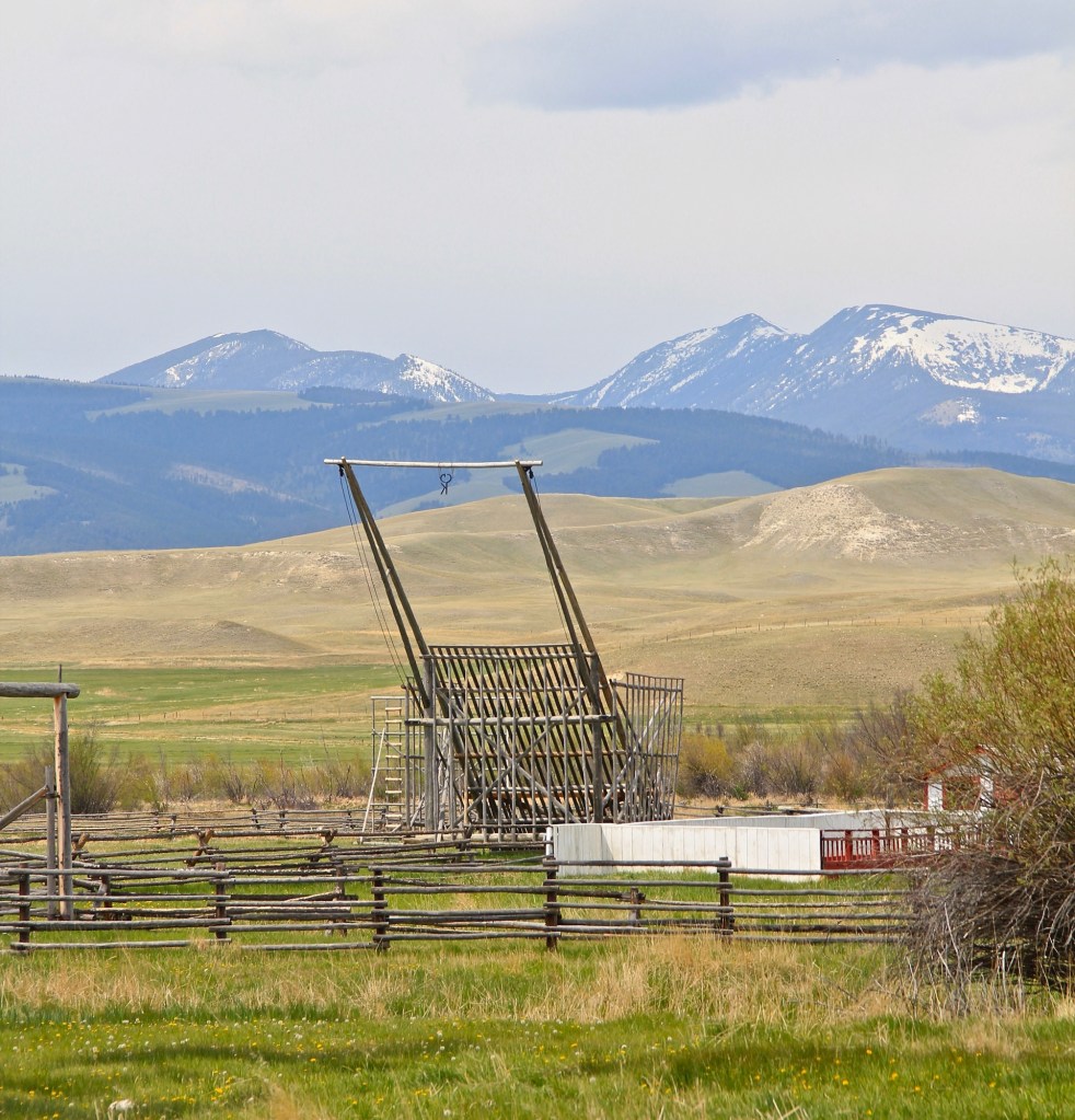
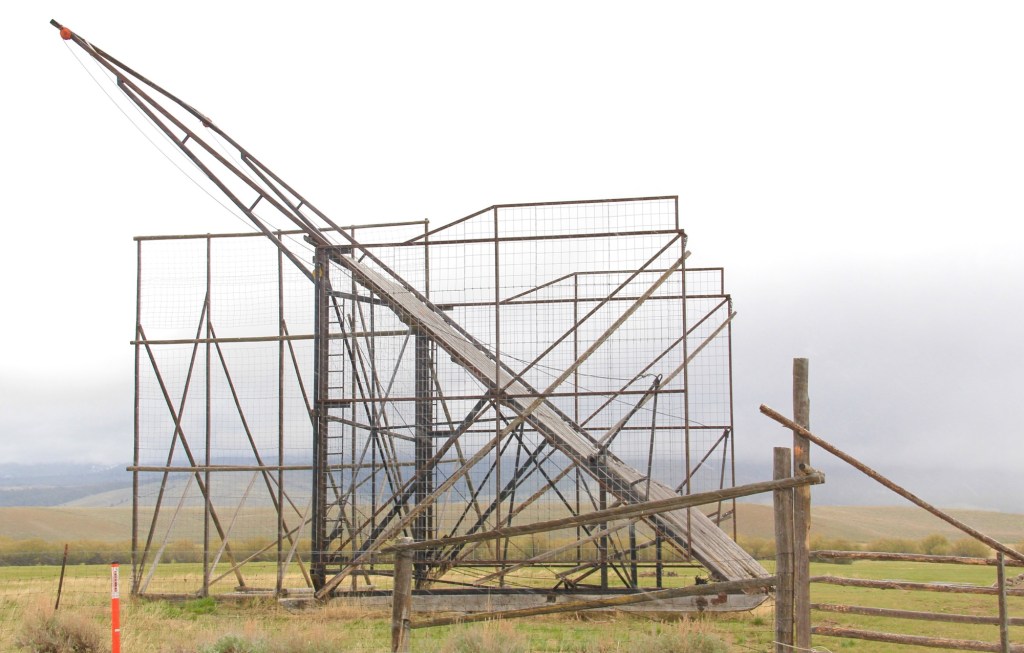
The Missoulian a few days ago had a splendid article about the demonstration of a beaverslide hay stacker at the Grant-Kohrs National Historic Site in Deer Lodge.
Grant Kohrs Ranch
The Deer Lodge Valley is a good place to find these ingenious machines, invented in the early years of the 20th century. Indeed in my 1984 work on the state historic preservation plan I encountered my first beaverslide near Galen, as shown below.
Near Galen, 1984
But to see the biggest concentration go to the Big Hole Valley in Beaverhead County. They were invented there in 1908. It takes two teams of horses to pull the hay up the slide and then drop it into the squarish pen, creating the hay stack.
Just outside of Wisdom Two beaverslides along highway 278
You can find great examples along the county’s historic roads.
Lemhi RoadBannock Pass Road
Powell County along the Blackfoot also has a scattering of the hay stackers.
Orphir Creek Road, Powell County Orphir Creek Road, Powell County A marker along US highway 12 interprets the region’s hay stackers
40 years ago I was certain that the beaverslides were not long for this world. Several folks at community meetings spoke of how many had disappeared. Yet ranch families were not ready to let them go, for tradition’s sake and the fact that loose stacked hay keeps better than modern machine baled hay. Beaverslide hay stackers remain part of the rural landscape of western Montana.
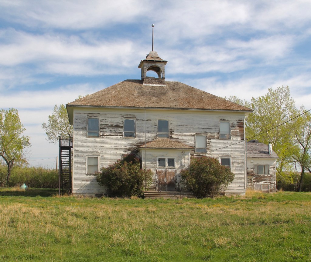
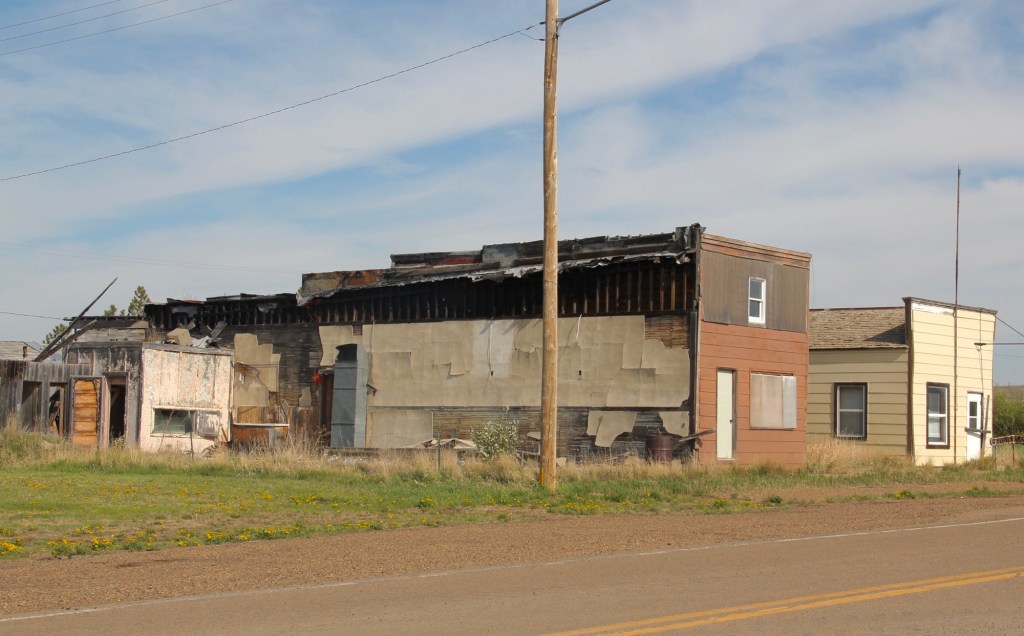
I last visited Whitetail ten years ago. Established along the Canadian-based Soo Railroad line a century earlier, the town was in a free fall, from a height of 500 c. 1920 to a handful of families in 2010. Then the Canadian, then the U.S. government closed the border crossing between 2011 and 2013. Now the town is down to a population of nine in 2020. God bless those still there, doing what they can.
The school building tells much of the story. Built when hopes for the town were high in the 1920s, it’s two-story height and bell cupola made it a landmark in the flat open terrain. I hope when I visit next, the school is there, a silent statement of the dreams with which our high plains were settled.
Secure in its concrete base, the old school bell, removed 50 years ago, is still there to ring, or so I can hope.
The community church, still a gathering place or has it gone the way of the Catholic Church, moved to the Daniels County Museum in Scobey?
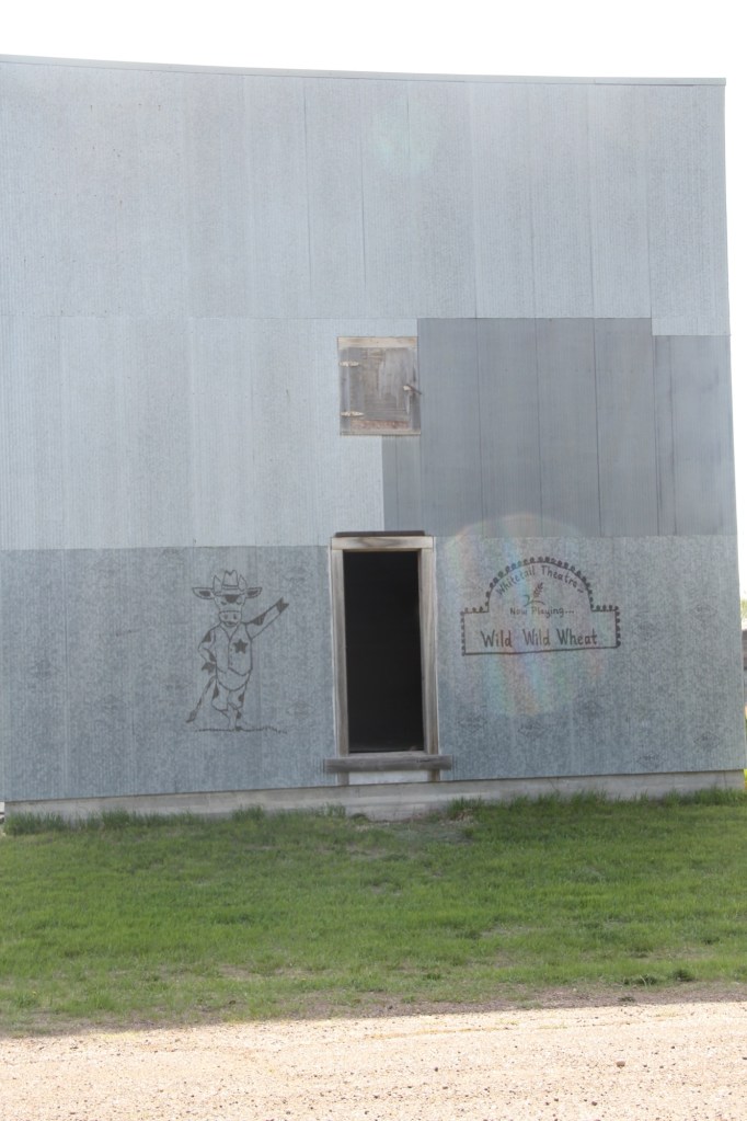
Grain Company BuildingGas station and Garage, 2013Abandoned businesses, 2013A metal facade and open door marked what was left of the Whitetail Theater.
Businesses were largely gone ten years ago. But the post office and grain elevators remained. I bet the elevators are still there serving ranch families but you wonder about the post office.
Whitetail in Montana’s northeast corner is as far removed from Whitefish in Montana’s northwest corner as two places could ever be. They both began as railroad towns. One didn’t make it; the other thrives.
Abandoned home at Whitetail
But what’s been lost at Whitetail tells as much about history as what has been gained in Whitefish. You cannot understand Montana history without both.
In doing the photography for the 1984-85 survey for the State Historic Preservation Office, everything was in Black and White, both for the stability of black and white negatives but also for the cost—color slides were expensive. Thirty plus years later, it’s totally different. Everything is digital and only a few places will even process black and white film.
But I have continued to take a few rolls of black and white film on my recent work in Montana. Here are a few images to share.
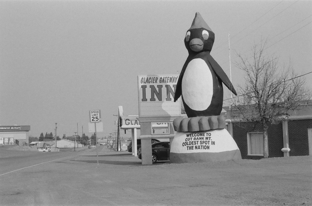
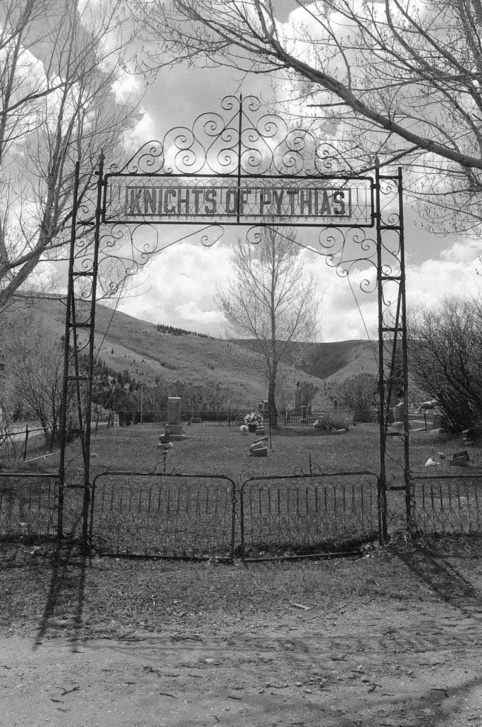
The older US 2 route into Cut Bank features this wonderful piece of roadside sculpture. And back in 1984 the Glacier Gateway Inn was the place to stay.Frank Little Grave in Butte. The starkness and shadows of black and white film is perfect for cemetery work, as this famous grave at Mountain View Cemetery shows.The same is true for Anaconda’s historic cemetery. As I have said in earlier posts, this place is one of the state’s most compelling places. I can explore there all day long. Love the decorative iron work on the gate and entrance to the Knights section at AnacondaGhost towns from either the mining or homestead eras always leave buildings that just seem to say more in black and white. Here we are at Barber on US Highway 12 in central Montana.Abandoned schools that become lonely landmarks of hopes crushed: Buffalo, Montana
In 2024 I began to see media accounts, both regionally and nationally, of how Glasgow, the seat of Valley County, was the most isolated place you can imagine, truly in the Middle of nowhere.
Historic Great Northern Railroad corridor in Glasgow
I’m not one to argue with geographers and economists. I’m sure from their perspective, they got it right. But I never thought of Glasgow as isolated: it is on the Great Northern mainline, and part of the famed Empire Builder Amtrak route, and on U.S. Highway 2.
Great Northern depot, Glasgow
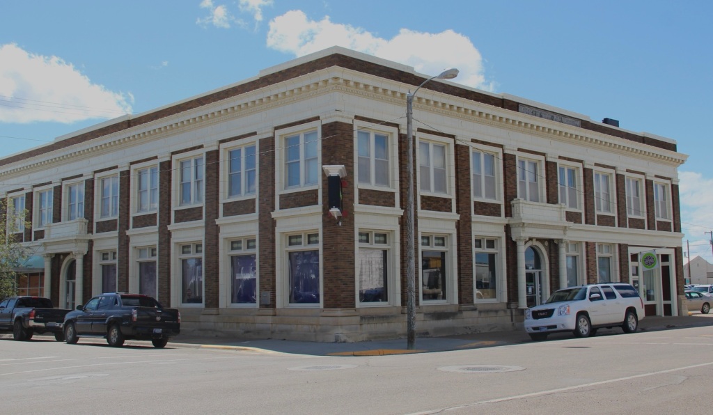
Then the town has always shown a great deal of pride and ambition, conveyed so effectively by its many historic buildings, starting with the First National Bank, built c. 1884 and listed in the National Register of Historic Places.
1st National Bank building, Glasgow
When you enter the town from the underpass of the railroad, the bank is the first landmark to catch your eye, appropriate too for the impact of local banks on a town’s economic prospects during the homesteading boom and bust of the 1910s and 1920s, respectively.
Rundle Hotel, during renovation in 2013
Another landmark from the homesteading era is the Rundle Building, once the Glasgow Hotel and restored in the last ten years as an upscale hotel in the heart of downtown. Built c. 1916 and designed by the important Billings firm of Link and Haire, the Rundle is a captivating statement of an Arts and Crafts-infused Mediterranean Revival style. I have been trying to get back to Glasgow to stay here for the last four years—maybe I will make it in 2025.
The 1930s transformed Valley County through the construction of the mammoth Fort Peck Dam on the Missouri River. Glasgow too has a major New Deal landmark in its U.S. post office and courthouse, built c. 1939 and designed by federal architect Louis A. Simon.
Post office/federal courthouse, Glasgow
Its understated New Deal Deco exterior obscures a jewel of an interior, highlighted by its New Deal-funded 1942 mural depicting local history and the changes brought about by the Fort Peck Dam by artist Forest Hill. This building too is listed in the National Register.
Glasgow post office mural
Another important New Deal supported building was all about the community, and providing new opportunities: the Glasgow Civic Center. It too has a New Deal Deco style, and its large public space has been used for almost every type of event or gathering you can imagine.
Glasgow Civic Center
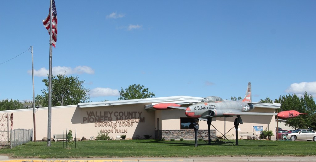
Glasgow’s sense of itself today still respects it past, brilliantly conveyed by its large and expansive museum. When I first visited Glasgow 40 years
Valley County Museum
ago, I held a public meeting on the state historic preservation plan here, and the next morning residents gave me a detailed tour of the recently established museum. I was impressed with its collection then, now it sprawls through the building to the adjoining grounds.
Veterans section of the museumThe high school band sectionLewis and Clark mural, 2095, by Jessie Henderson, a Chippewa/Cree artistThe back bar at saloon exhibit
Indeed, the saloon exhibit underscores another fun part of Glasgow—across from the depot in the original route of Highway 2 is an amazing collection of bars, stores, and eateries, right out of the early 1900s.
Glasgow bars at depot
But back to the museum, and its important Montana decorative arts collection of the work of modern craftsman Thomas Molesworth, once in the town’s Carnegie library.
The newer exterior exhibits led the museum to move entire building to the property, including examples of the homestead shacks of the early 1900s that were followed by permanent homes such as this white painted bungalow.
Representative ranch house from homesteading boom
Pride of place, pride of the past. Glasgow might be in the middle but it is far from being nowhere as this small sampling of properties demonstrates.
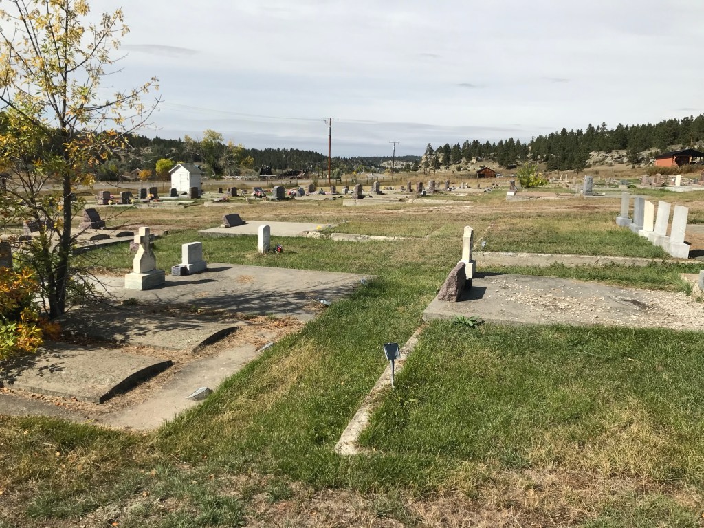
The “new” UMW cemetery refers to the southern section of the cemetery, nestled in the bluffs of the Bull Mountains outside of the historic coal mining town of Klein. The UMW local 2866 operated from 1919 to 1973. The northern section contains early burials of members.
The “new cemetery” has numerous burials from the late 1920s, 1930s, and 1940s but most of the internments date to the second half of the 20th century.
The cemetery faces west (US Highway 87) and is centered on a long driveway that ends at a flagpole. Then the rows of graves on either side are roughly equal in size, giving the “new” cemetery a sense of symmetry not apparent in the earlier north section.
Looking northwest from the center drivewayLooking northwest from the center drivewayLooking south from the center drivewayLooking southwest from the center driveway.
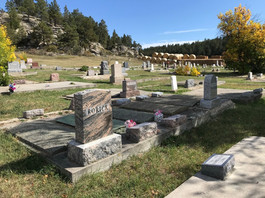
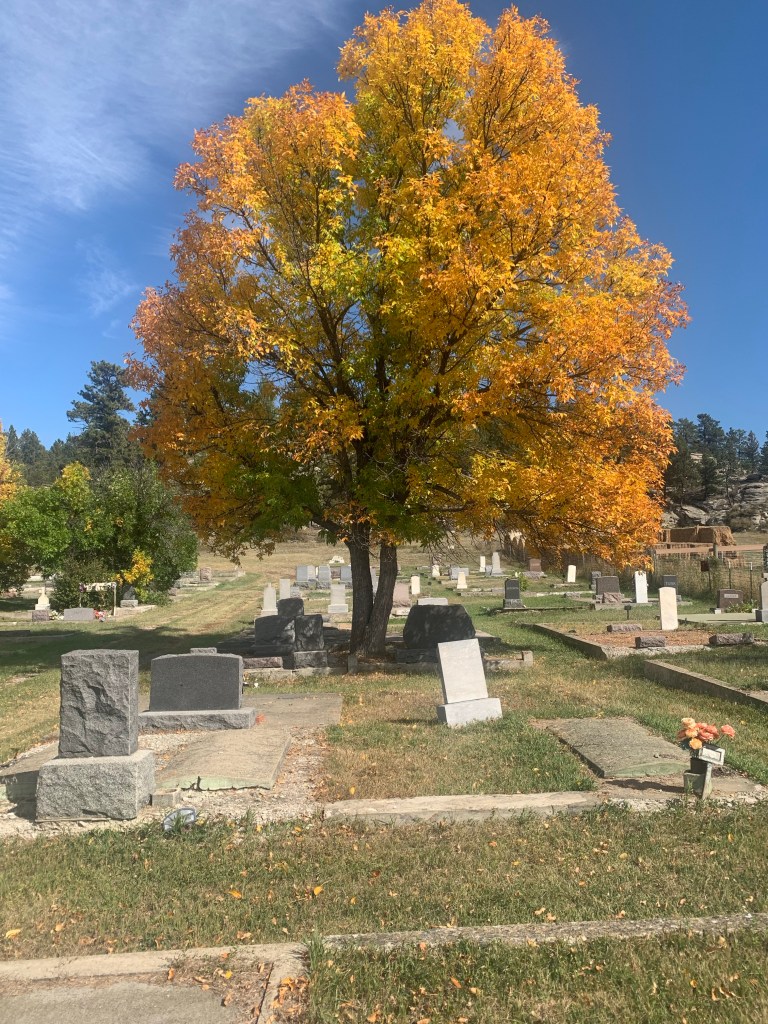
The cemetery’s rocky bluff setting, combined with colorful fall trees, is beautiful in September and October. It’s use of foliage and shade is another difference with the northern section of the UMW Cemetery.
South section facing eastSouth section facing southeast
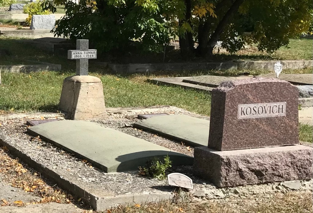
There are several interesting grave markers. Anna Tomko (d. 1944) was born in Croatia in 1866. She arrived in the United States in 1901 and was leaving in Roundup by 1920 where she became known as Annie Tomko.
The beautiful cut and polished stone marker for Carl Eldon Rorick dates to 1941. Rorick was a native of Klein and only 17 years old at the time of his death.
The large grave marker for Mary (b. 1872) and David Murphy (b. 1870) dates to 1942; she died in January while he died in December.
David was a native of Scotland, who was working as a coal miner at Klein at least by 1920. He married his wife Maggie (Margaret) McCann Murphy in about 1892.
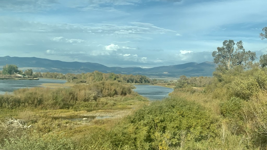
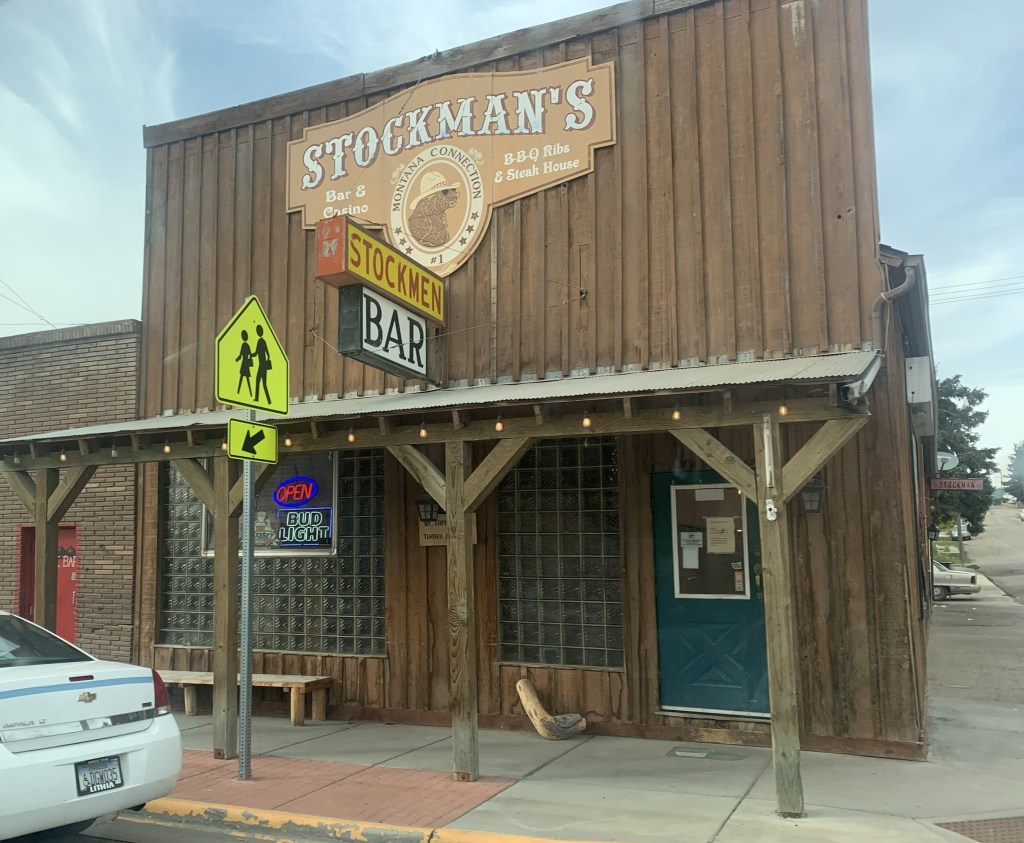
When I lived in Helena from 1981 to 1985 one of my favorite jaunts was along U.S. Highway 12 from Townsend to Roundup. It remains so today, 40 years later. My initial interest centered on railroad corridors. Helena to Townsend followed the Northern Pacific Railroad and a good bit of the Missouri River (now Canyon Ferry Lake).
Northern Pacific bridge over Missouri River near TownsendMissouri River and Canyon Ferry valley near TownsendMissouri River campground near Townsend
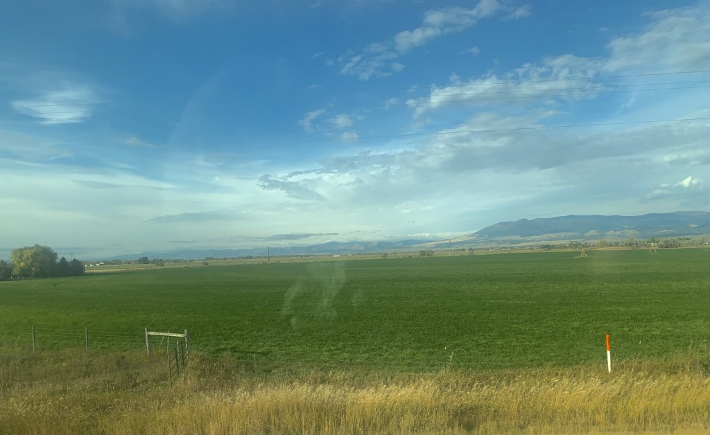
It was a brilliant day with fall colors just popping as we left US 287 and turned into the heart of Townsend.
As soon as you leave town to the east you encounter a lovely mix of ranches and irrigated fields until you thread your way through a national forest along Deep Creek.
Fall colors along Deep Creek
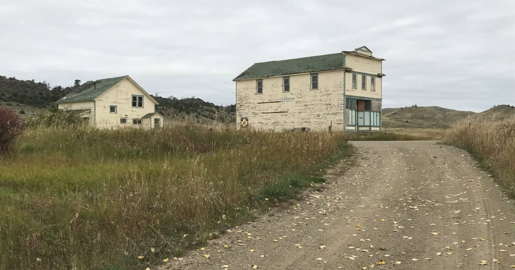
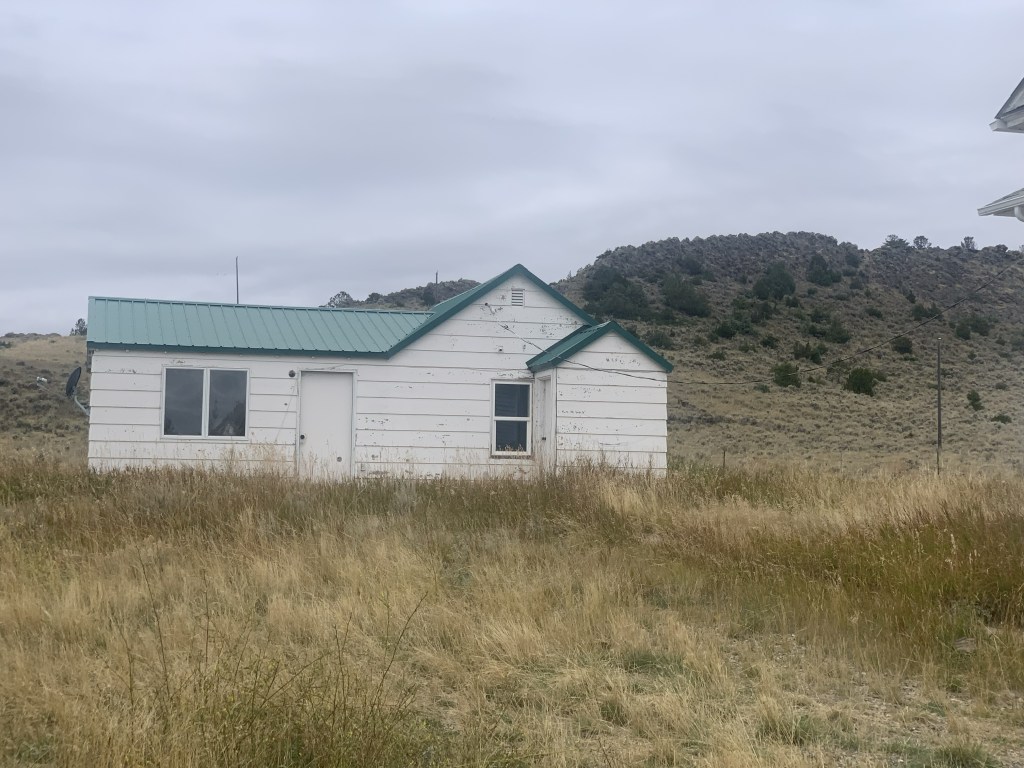
We decided to continue east by briefly jumping off US 12 and go to Montana 284 so we could follow the Milwaukee Road corridor from Lennep to Martinsdale where we would reconnect with US 12. Two of my travelers had never been to the Milwaukee Road “ghost town” of Lennep. It was a beautiful morning to be there.
Milwaukee Road powerhouse
You first realize that this abandoned railroad corridor is different when you encounter an electric powerhouse—the Milwaukee Road’s tracks were electrified from Harlowton Montana west to Idaho.
Lennep
At Lennep the landmarks remain—the Trinity Lutheran Church, the store, the school, a teacher’s cottage and an early notched log house—but all were a little worse for the wear compared to my last visit 10 years earlier.
As we traveled east that morning we quickly moved through the county seats of Harlowton and Ryegate to get to Roundup by lunch. The Musselshell Valley was brilliant even as signs of the old railroad almost disappeared.
Near Ryegate Near Lavina
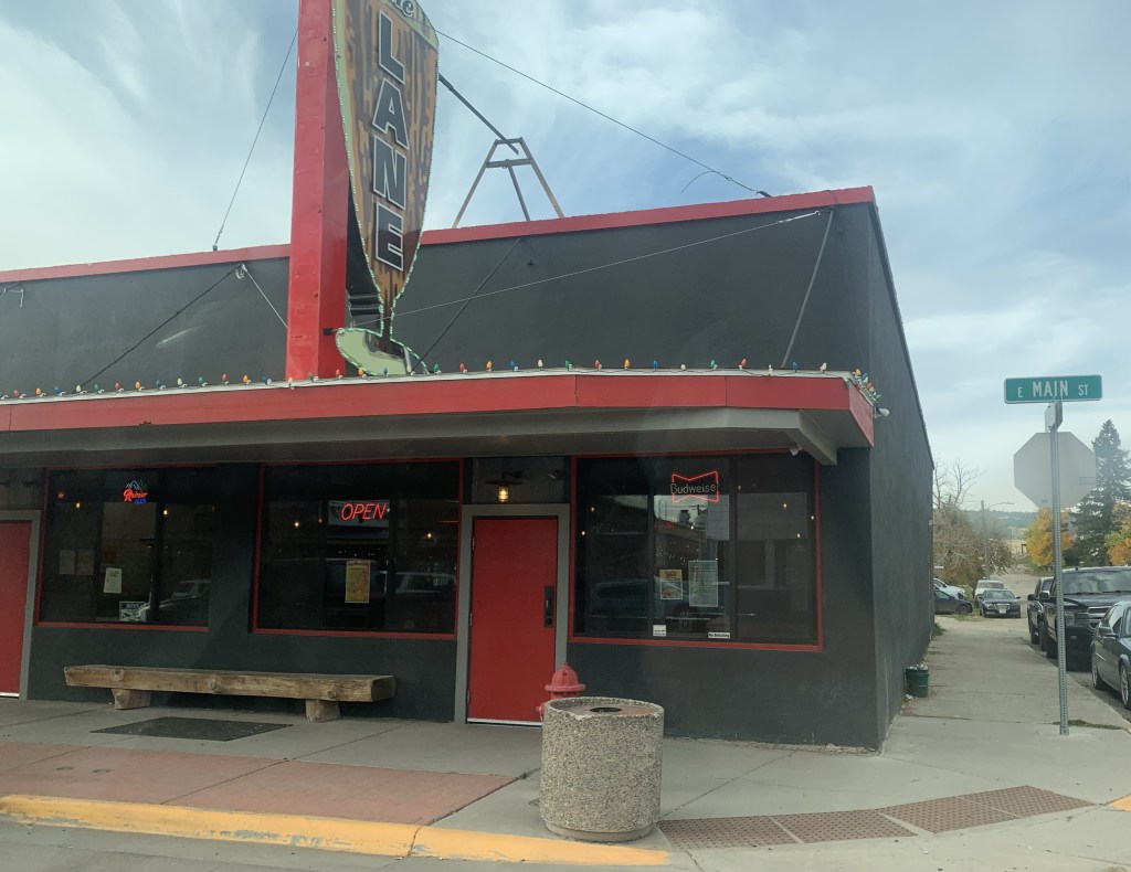
Roundup continues its renaissance with new businesses and restored buildings. The town core, clustered around the intersection of US highways 12 and 87, was busy on a fall weekend.
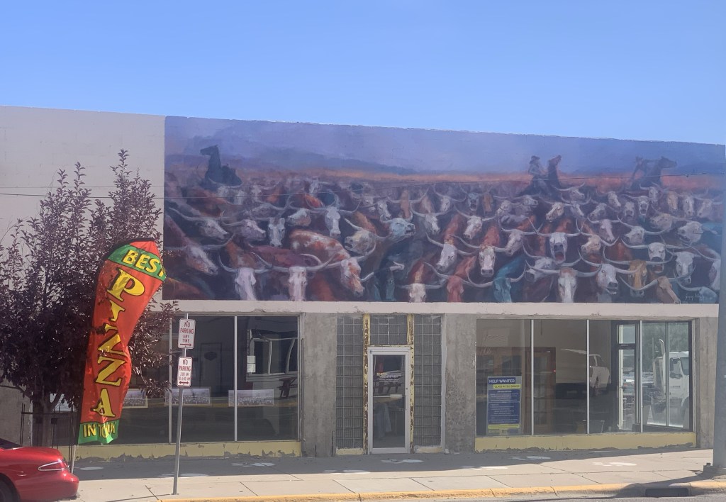
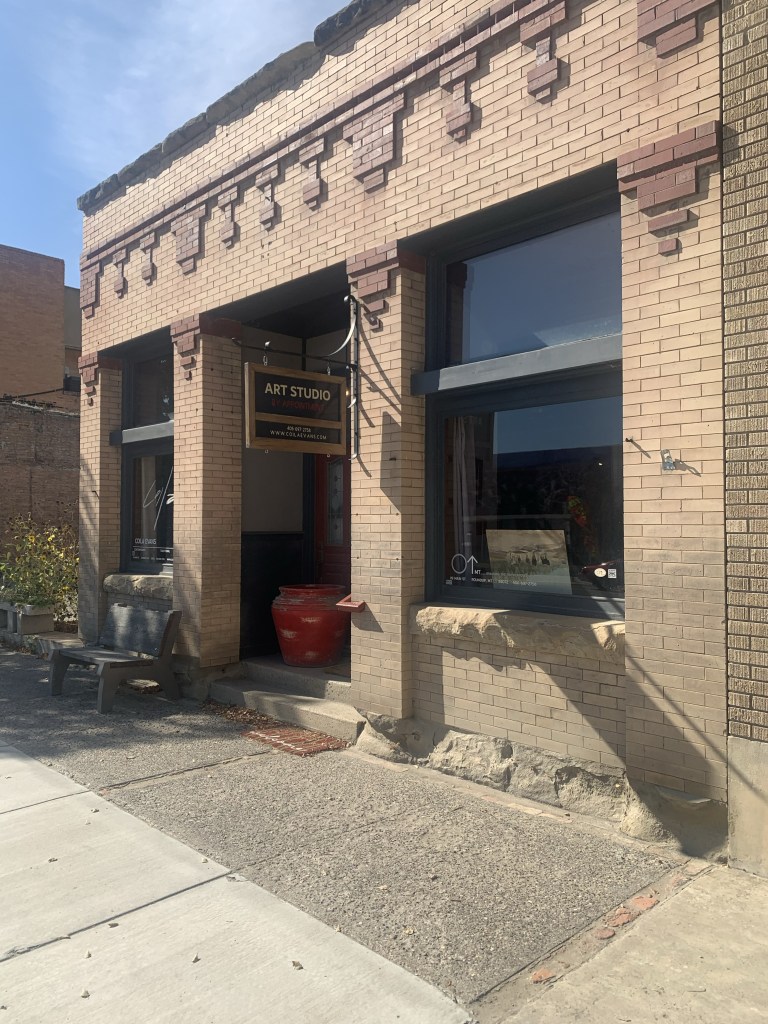
A mural on the great cattle drive of 1989The Backporch—great bbqNew mural at the KegArt studio doing wellAwaiting its renovation Community green spot
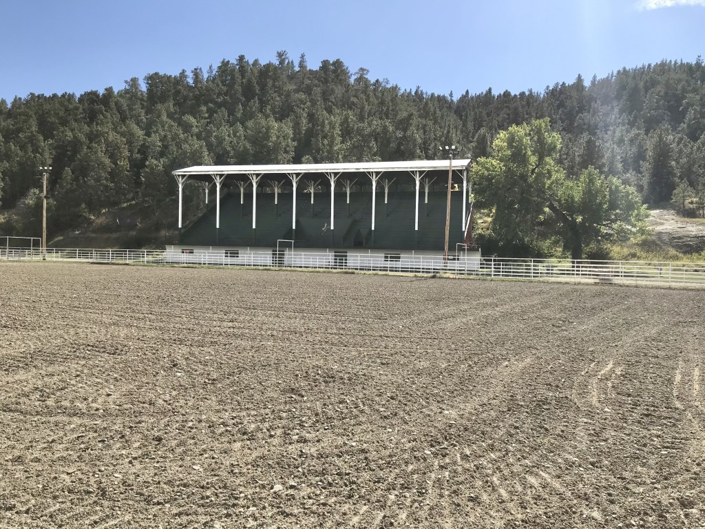
As I observed a few years ago Roundup residents worked together and created a plan—and the place continues to work the plan, from the adaptive reuse of its historic stone school to the careful stewardship of its historic fairgrounds. It’s impressive.
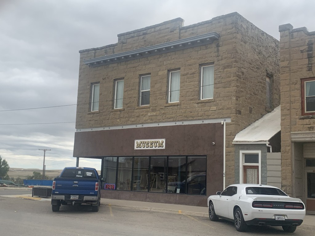
After Roundup we stopped at two county seats on the return to Helena. Harlowton was rocked by the closing of the Milwaukee Road over 40 years ago. It has struggled to reach the economic comeback achieved at Roundup. But the historic stone buildings have great potential. Three of them are now part of a large museum complex.
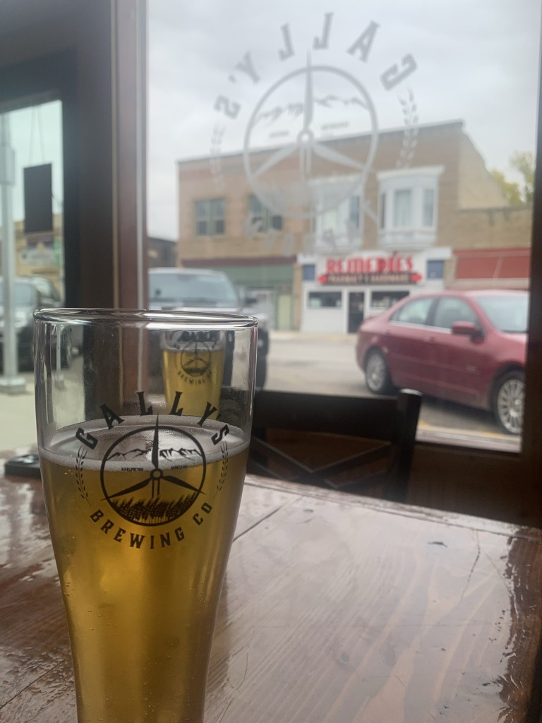
Then there’s the newcomer: the Gally’s microbrewery and pub, housed in the 1913 Montana Block.
It’s a great place for local beer and good conversation—and maybe the start of something good for the town.
US Highway 12 was torn up for major repairs when I last visited White Sulphur Springs last decade. The improvement along its population growth and the ever expanding hot springs gives the place a new look, reflected in new catchy fronts to local bars along with new businesses such as a huge Town Pump.
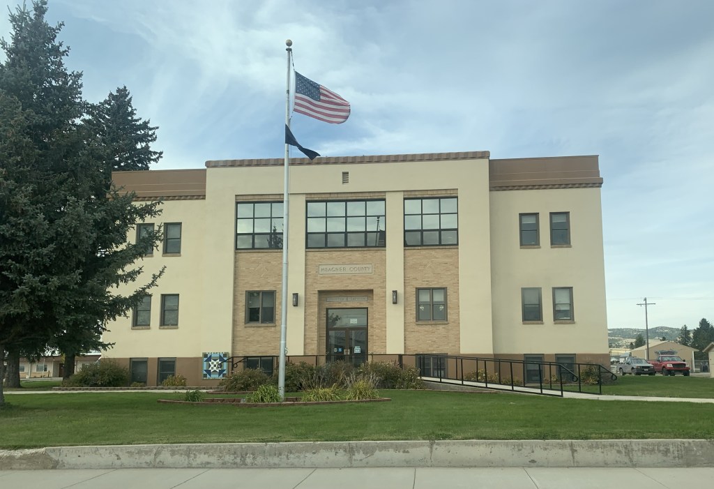
But historic White Sulphur Springs is doing ok too: the New Deal constructed Meagher County Courthouse is still a roadside landmark while the old railroad corridor, just west of the Hot Springs, remains, awaiting its rebirth.
These places are mere highlights along a historic route that’s worth a drive anytime in the fall.