Shifting Meanings in the Big Horn Landscape

IMG_5494
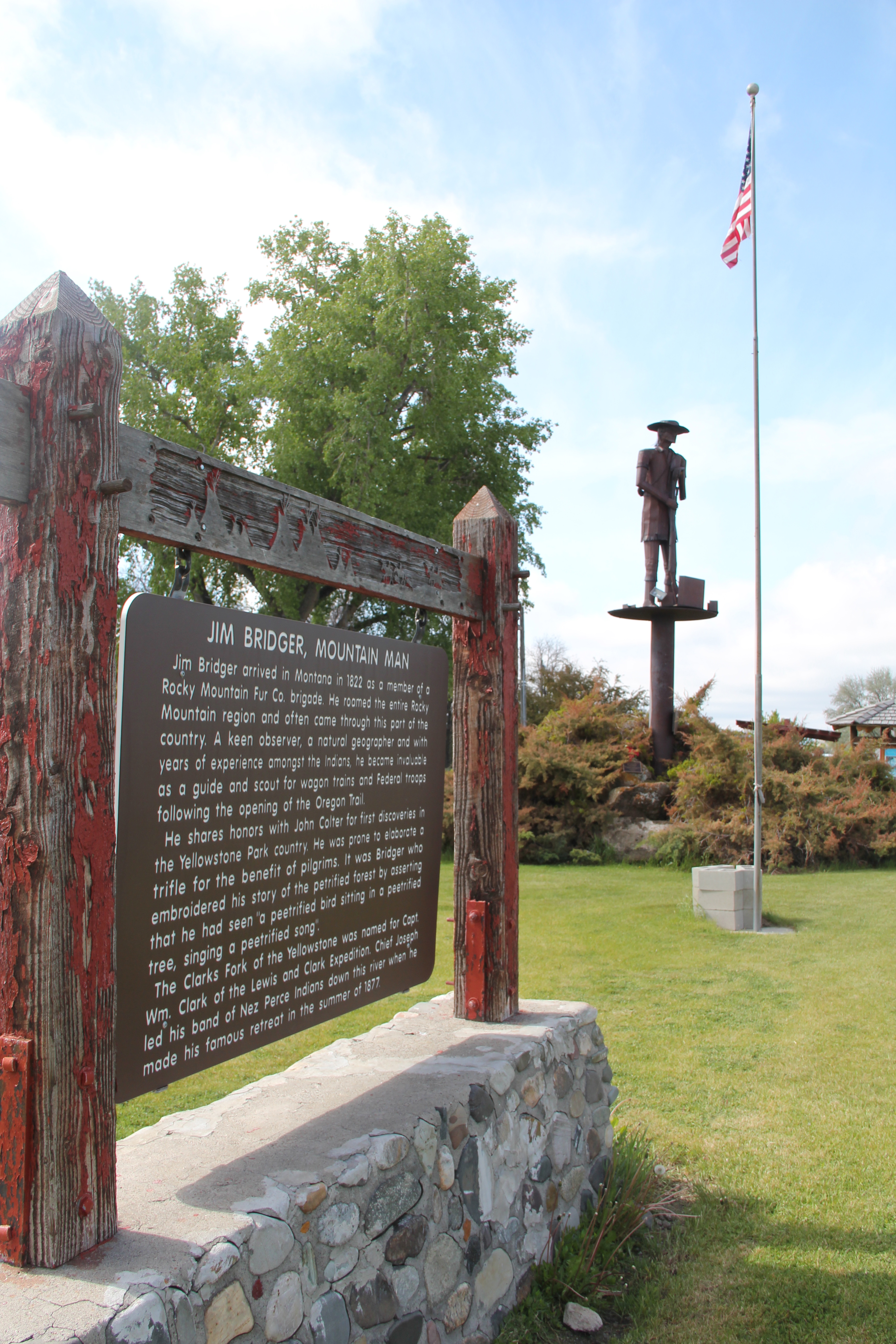
When I first arrived in Montana in 1981 the first place that I stopped at was Little Bighorn Battlefield, then known as Custer Battlefield National Monument.  As a southerner new to the west, here was a place that “everyone” knew about, an iconic western battlefield where Gen. George A. Custer and the 7th Calvary suffered a devastating defeat from a combined Sioux-Cheyenne force.  Everything then was focused on “Last Stand Hill” where

Custer Battlefield, Crow Agency (43-30)

Little Big Horn Battlefield, 1984

Custer and his troops had stood for almost 100 years.  As a veteran visitor to southern Civil War battlefields, it struck me how what you saw and experienced was all about the federal side–similar to what you found back then at southern Civil War memorial parks, where valiant Confederates fought what seemed to be a foe with no name outside of enemy.

IMG_5484

This quotation from Theodore O’Hara’s “Bivouac of the Dead” is found in many Civil War era national cemeteries.

IMG_1364Over the decades I have returned to the battlefield numerous times, even once (by accident I hadn’t even thought that the day would be an anniversary) when re-enactors posed by the famous obelisk monument, creating a very odd juxtaposition between past and present. (I don’t think Custer and his men were smiling on that hill in 1876).

IMG_1383By this time, meaning at the battlefield had shifted to a larger, more inclusive narrative, beginning with the actual name of the park, now Little Bighorn Battlefield.  Public interpretation, fueled not only by the changing times but an intensive archaeological investigation of the park in the late 1980s, suddenly located Native Americans within the battle landscape.  There was a growing feeling that yes this was a battle between enemies, but enemies with names, motivations, and their own sense of what it all meant.

IMG_1377
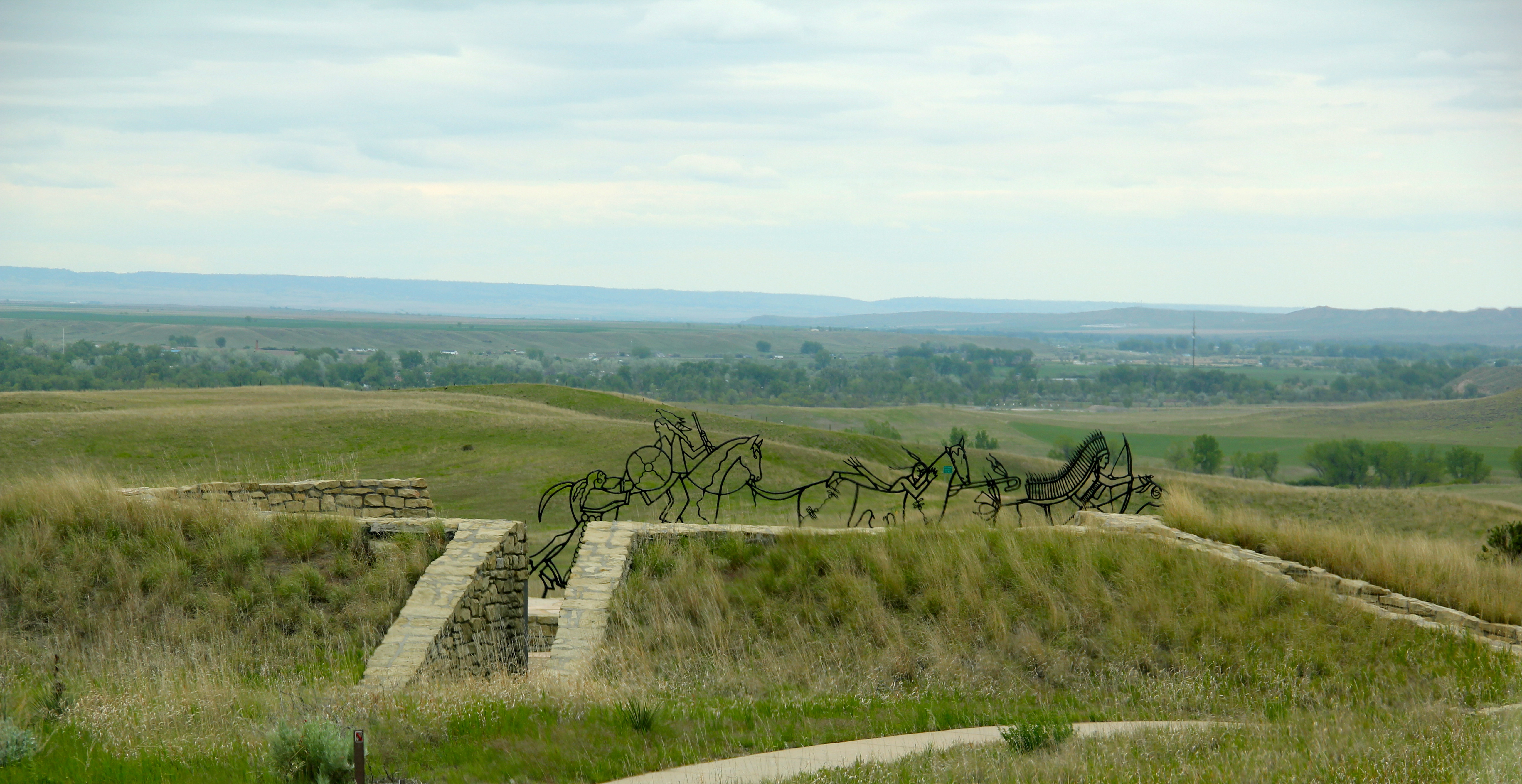
Last Chance Hill was still a focal point in 2015 but now its narrative of unity and sacrifice was countered by a new monument, built to consider the story of Little Bighorn from the perspective of the Native American warriors who fought here.

IMG_5520
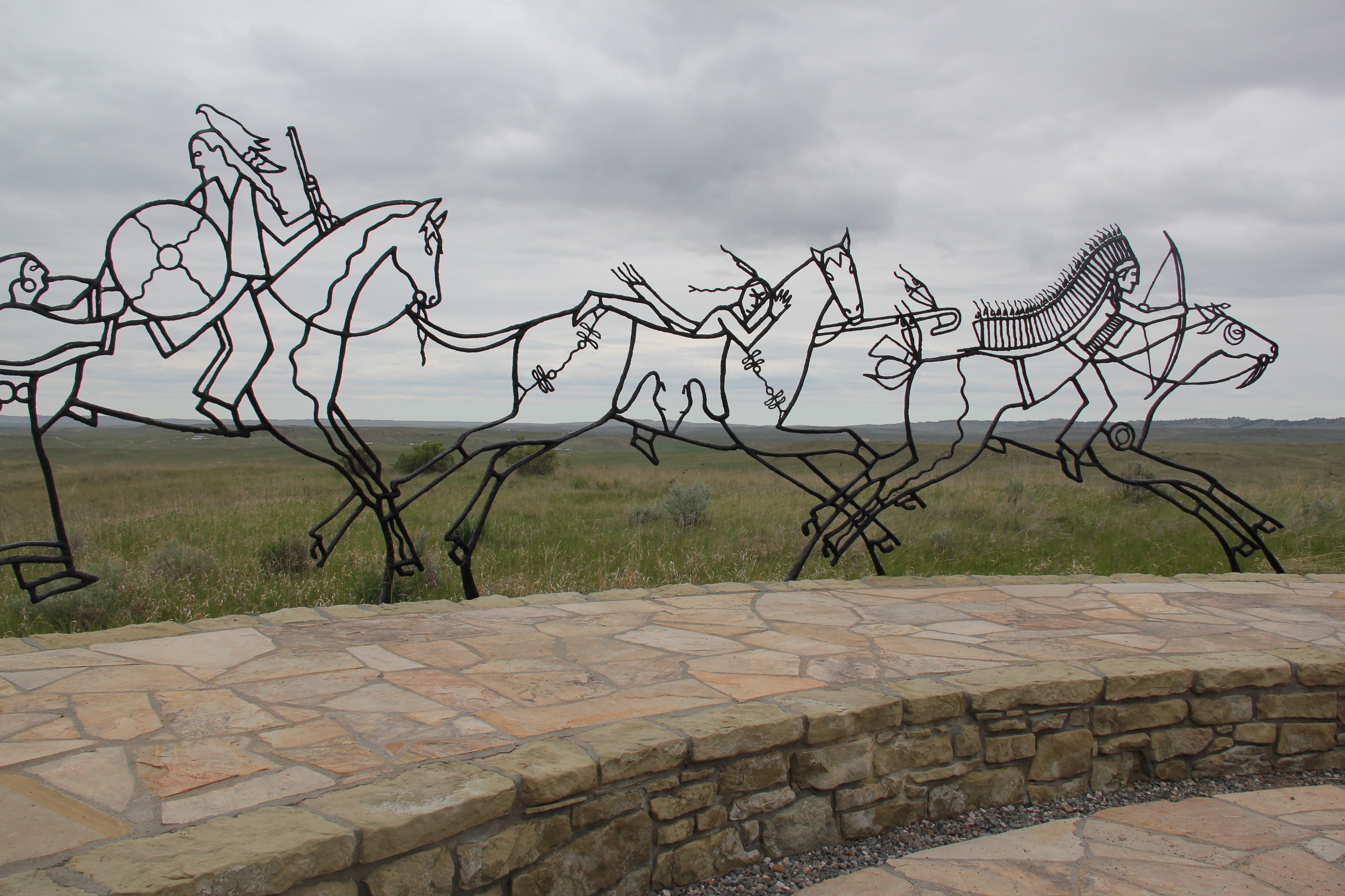
The monument compels reflection—the metal profiles of Native American warriors blend into the actual battlefield landscape as if ghosts of warriors past were again upon the field.  Text and images add additional layers of interpretation and meaning to the battlefield, from a decided Native American perspective.

IMG_5514Then new tombstones, in a brownish stone, distinguished fallen Cheyenne warriors from the marble tombstones for soldiers from the 7th Calvary.  The place has been ennobled, transformed as a both a park and a place of reflection on what the Indian Wars of the 1870s have meant to the nation and to the peoples who fought in them.

IMG_5504Nearby within Crow Agency is a further addition to the public interpretation of the region’s military history: the exemplary Apsaalooke Veterans Park, an installation that celebrates veterans past and present.  IMG_5530
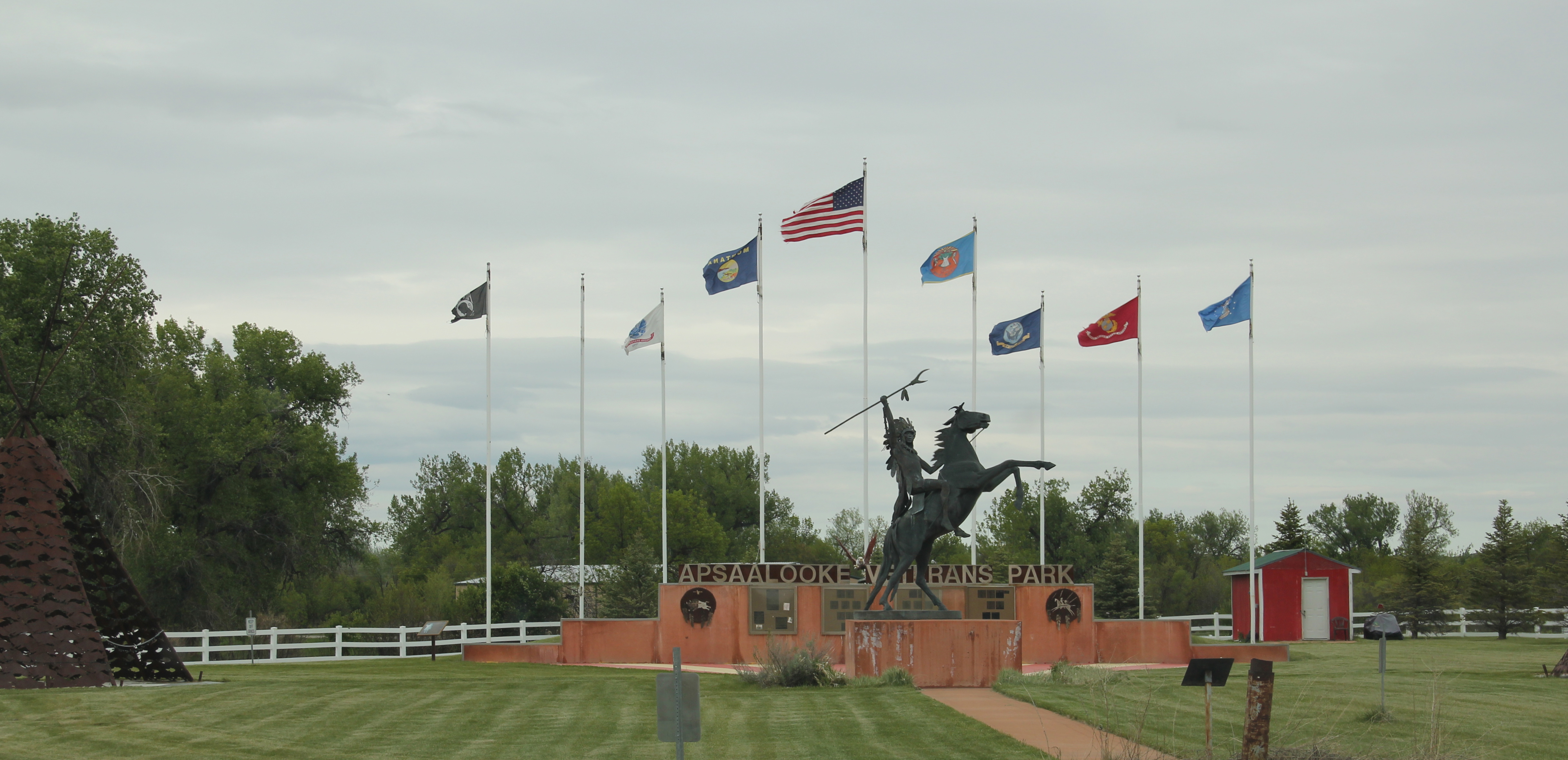
At the I-90 exit for U.S. 212 at Crow Agency, a new landscape has emerged through spaces such as the park, the new Apsaalooke casino, and especially the modernist styled medical center, located near the fairgrounds for the annual Crow fair.

IMG_5527

The sparking bright lights of casino sign stand in stark contrast to the old mission church, now The Father’s House place of worship.

IMG_5524
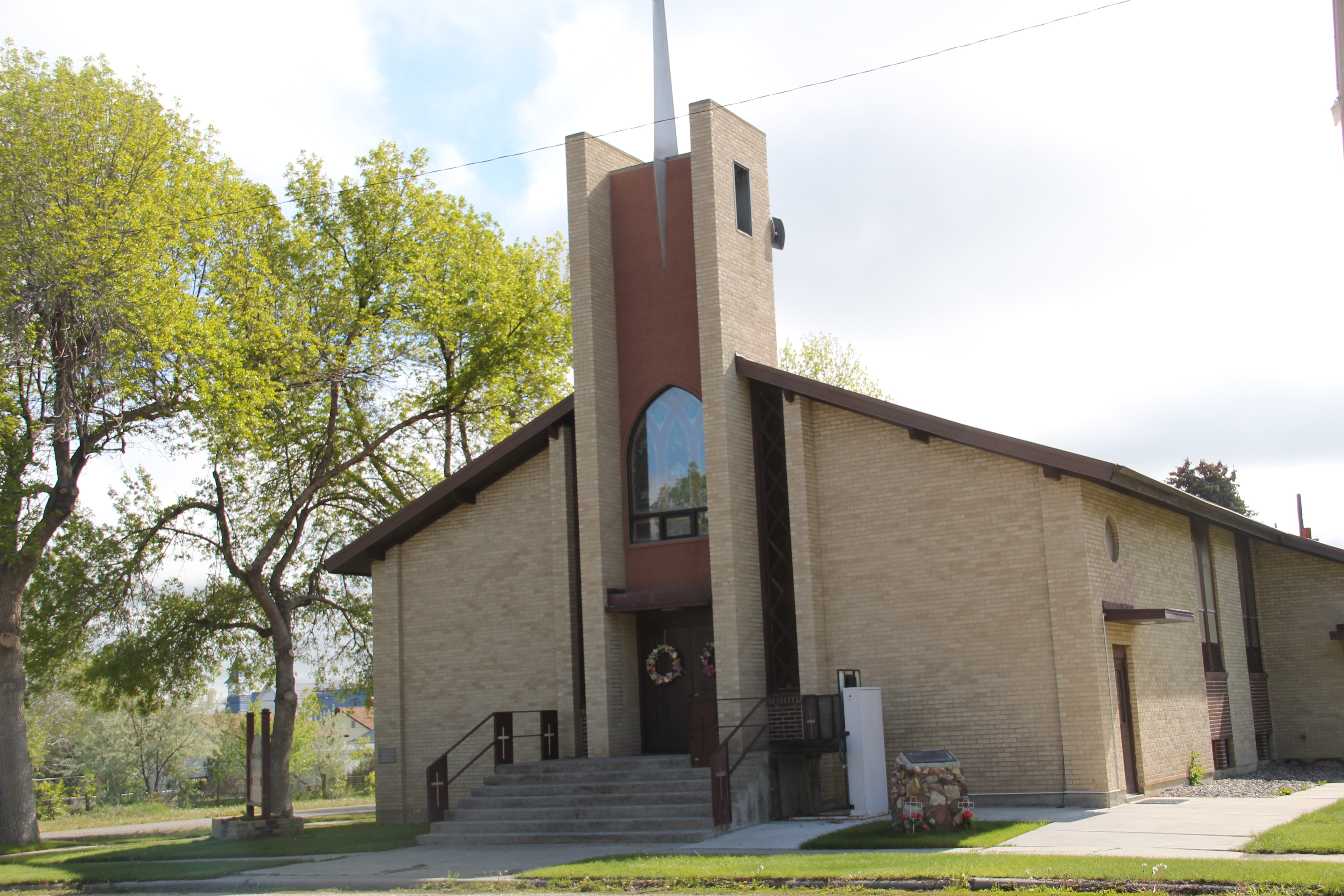
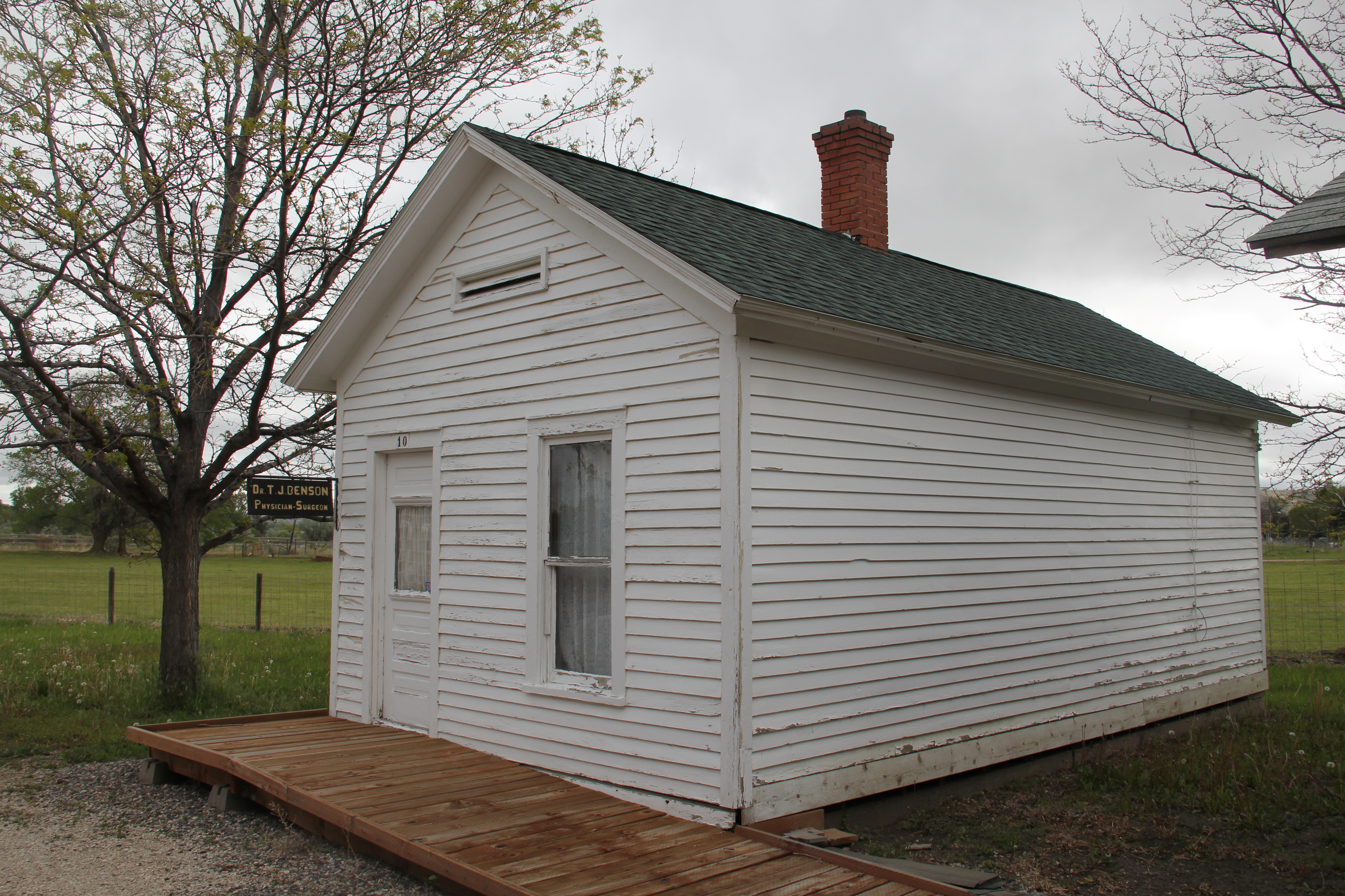
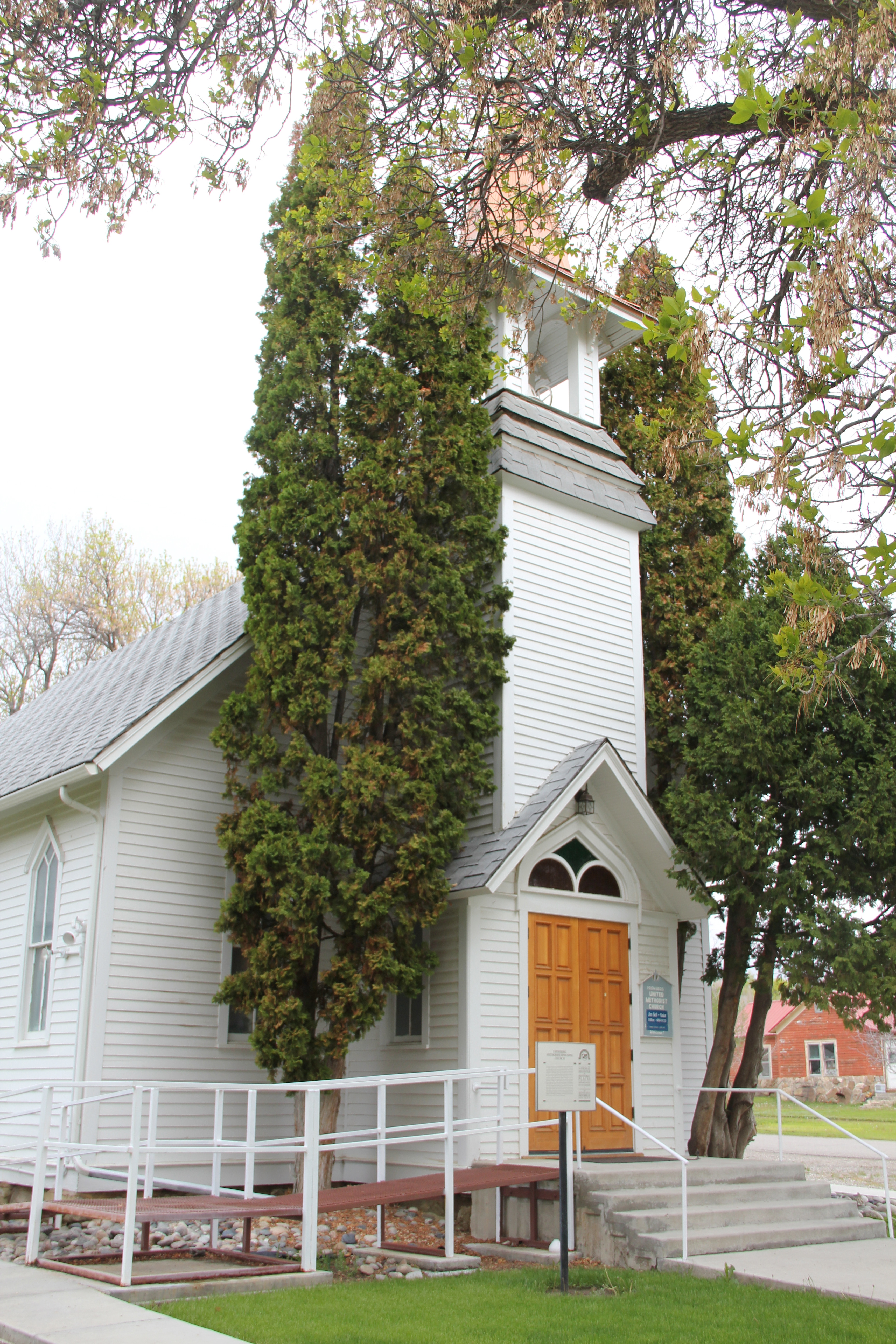
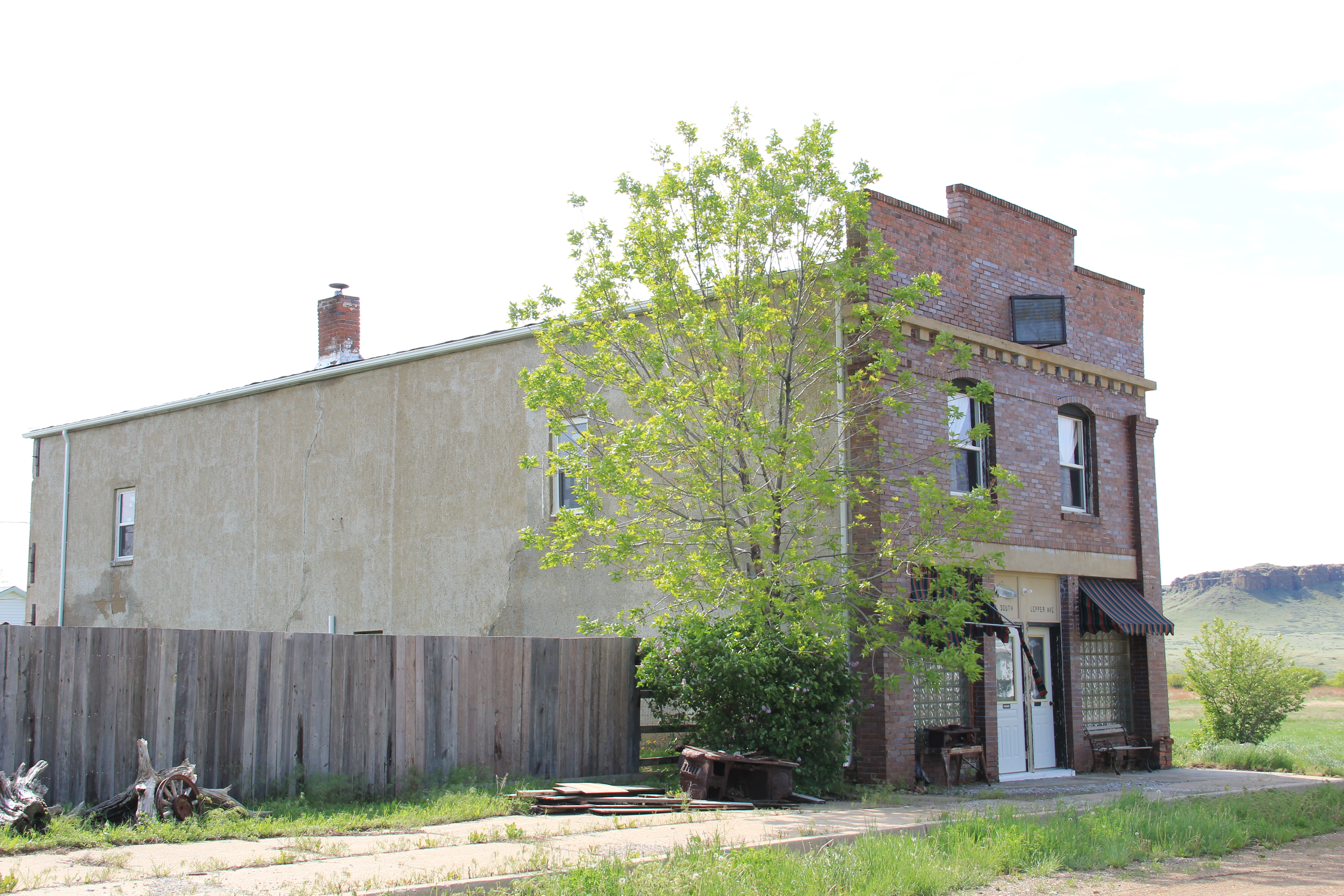
In the middle of the Crow Indian Reservation is another landscape of change, one not so visited by tourists.  St. Xavier was an important Catholic mission among the Crow Indians, established along the Big Horn River in 1887-1888 by Father Peter Prando.  The understated Gothic-styled church was a building documented in my A Traveler’s Companion to Montana History book in 1986 and the survey included both the church and small gable-front residence built for the priests.

St. Xavier Mission Chapel, Crow Reservation (45-2)    

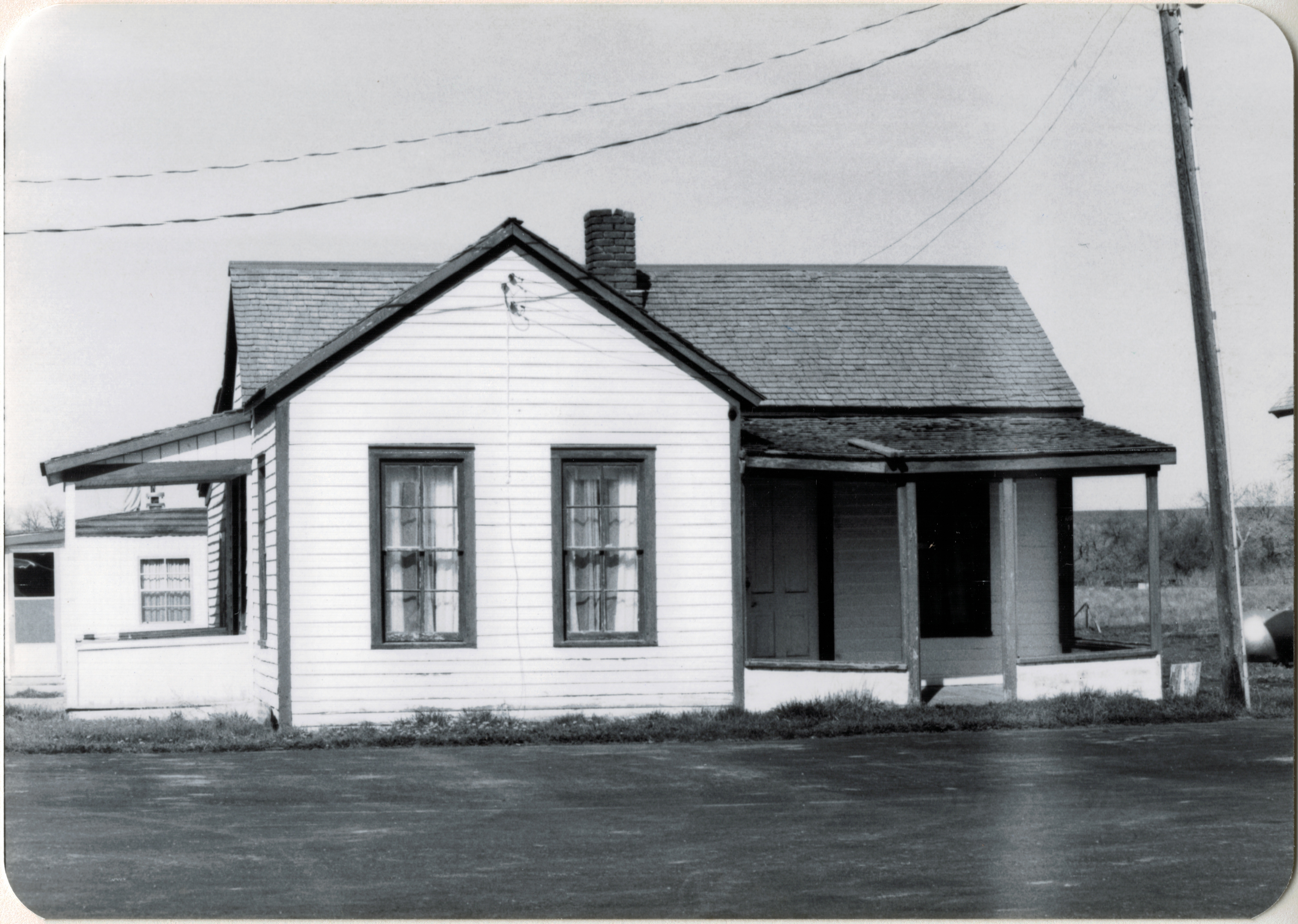
Those same buildings remain today, as does the nearby Pretty Eagle Catholic Academy, representing community continuity and the Catholic commitment to the reservation.  But

IMG_5963

IMG_5961
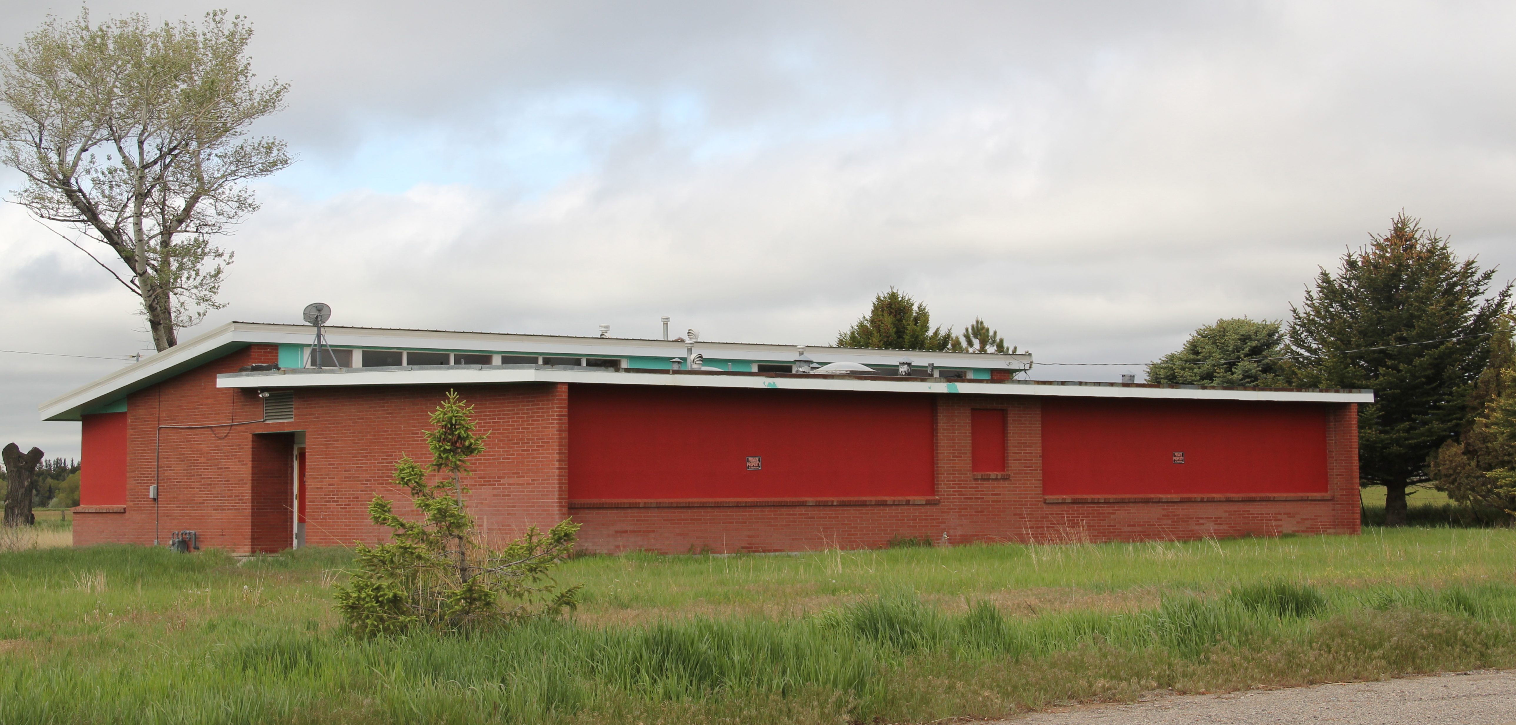
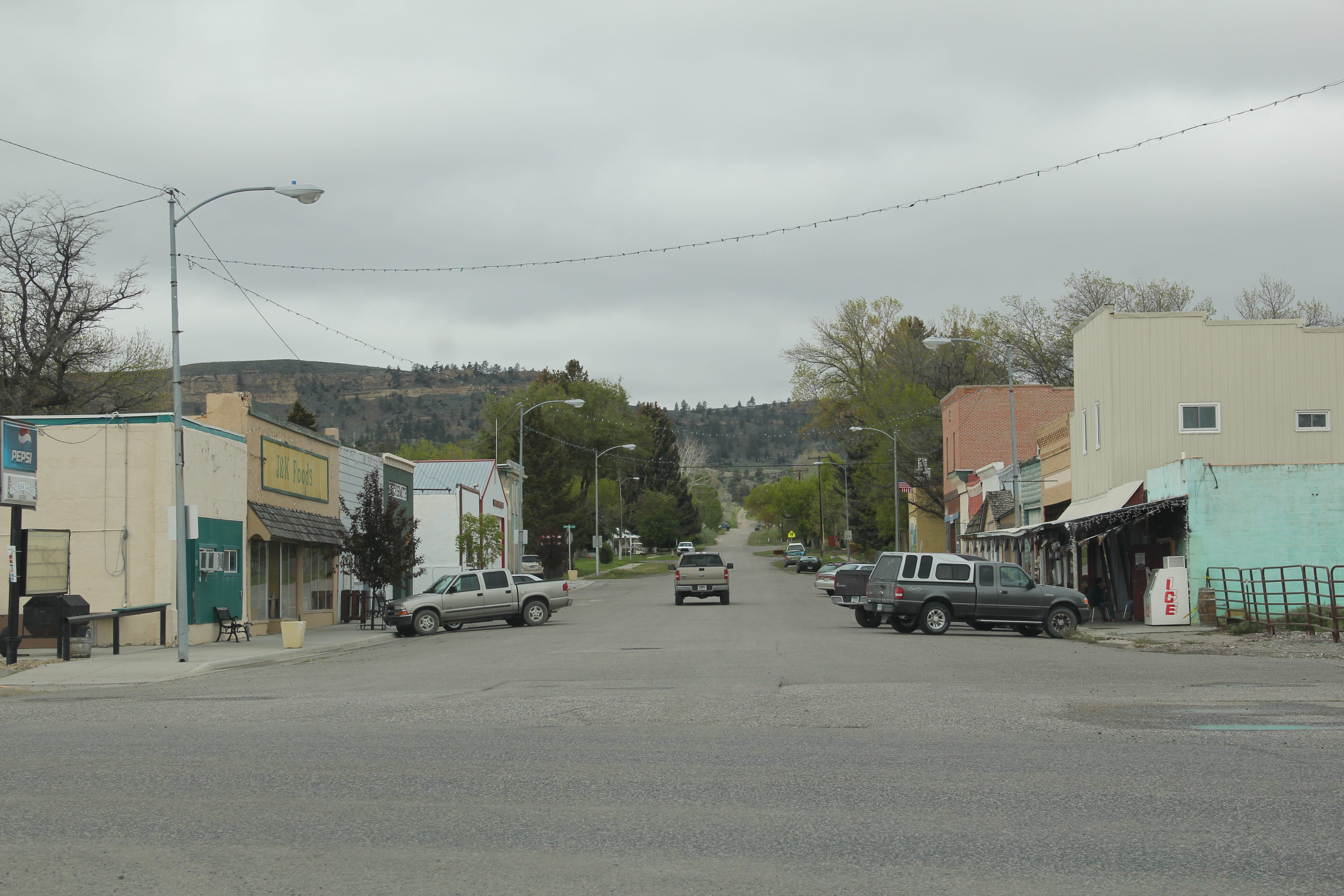
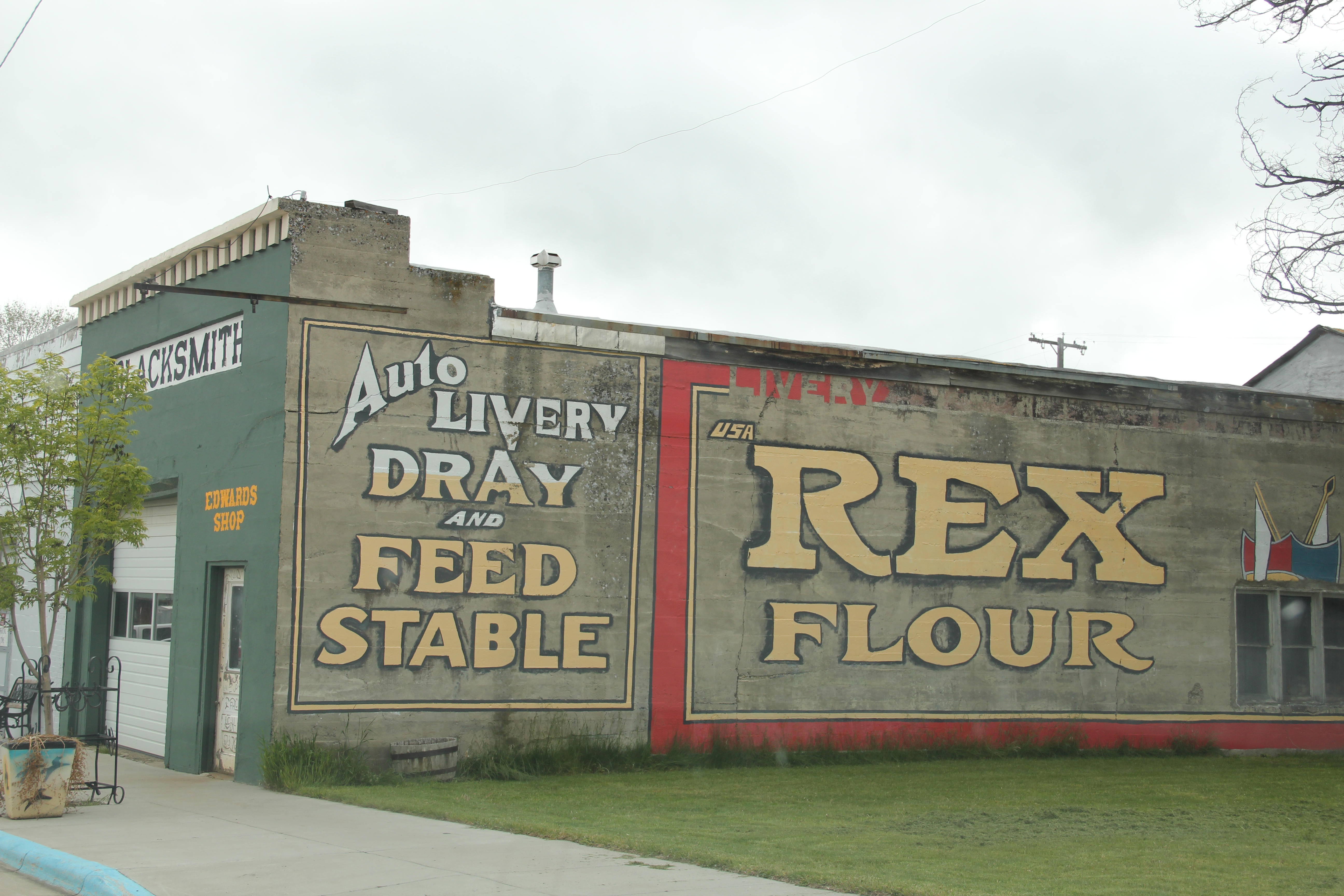
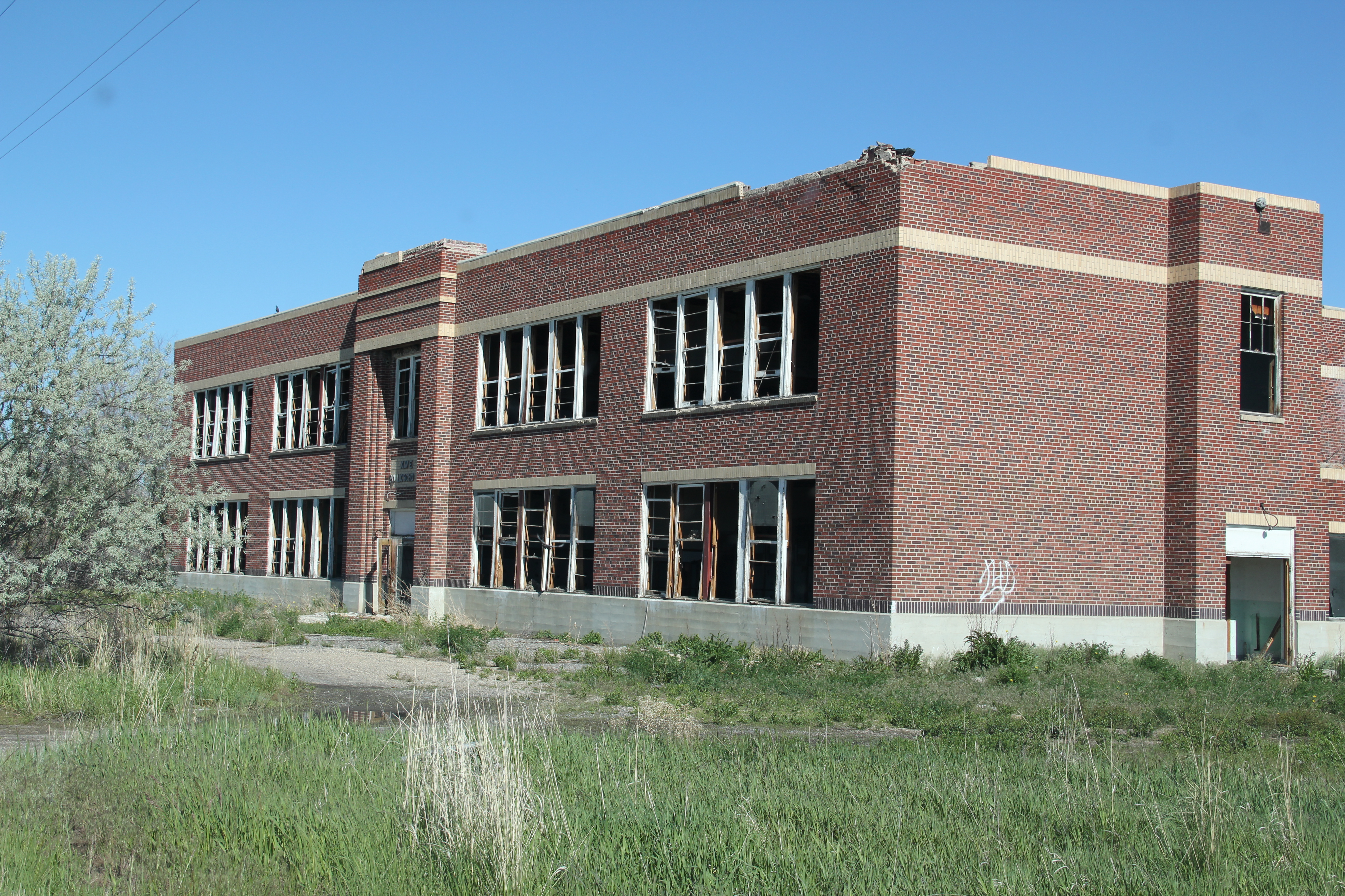
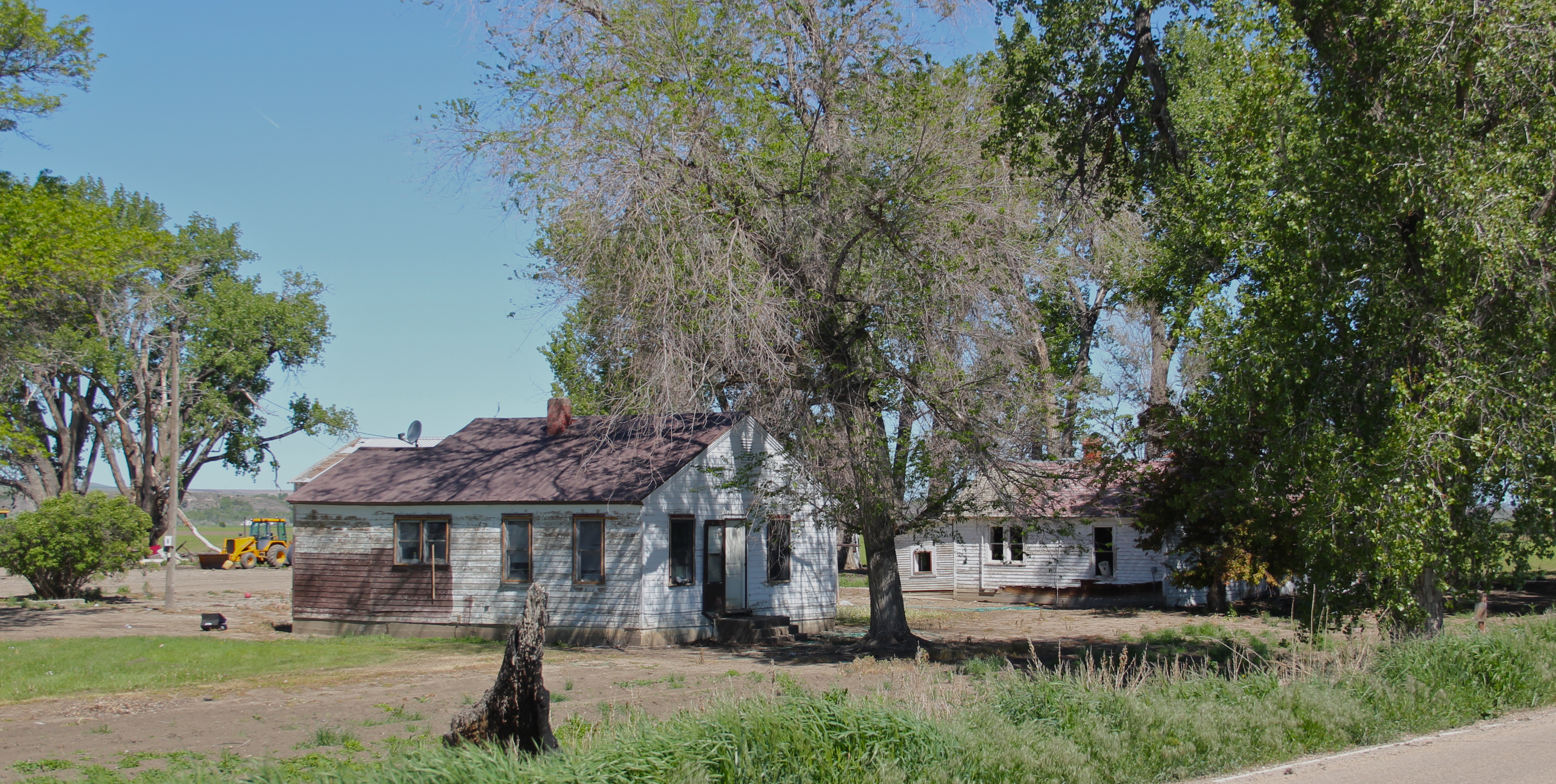
the mid-20th century St. Xavier town site has not weathered the decades so well.  Businesses have largely disappeared and the Art Deco-styled St. Xavier public school, a Public Works Administration project from the New Deal designed by Billings architect J.G. Link in 1938 is now abandoned and decaying.

IMG_6005

IMG_5953
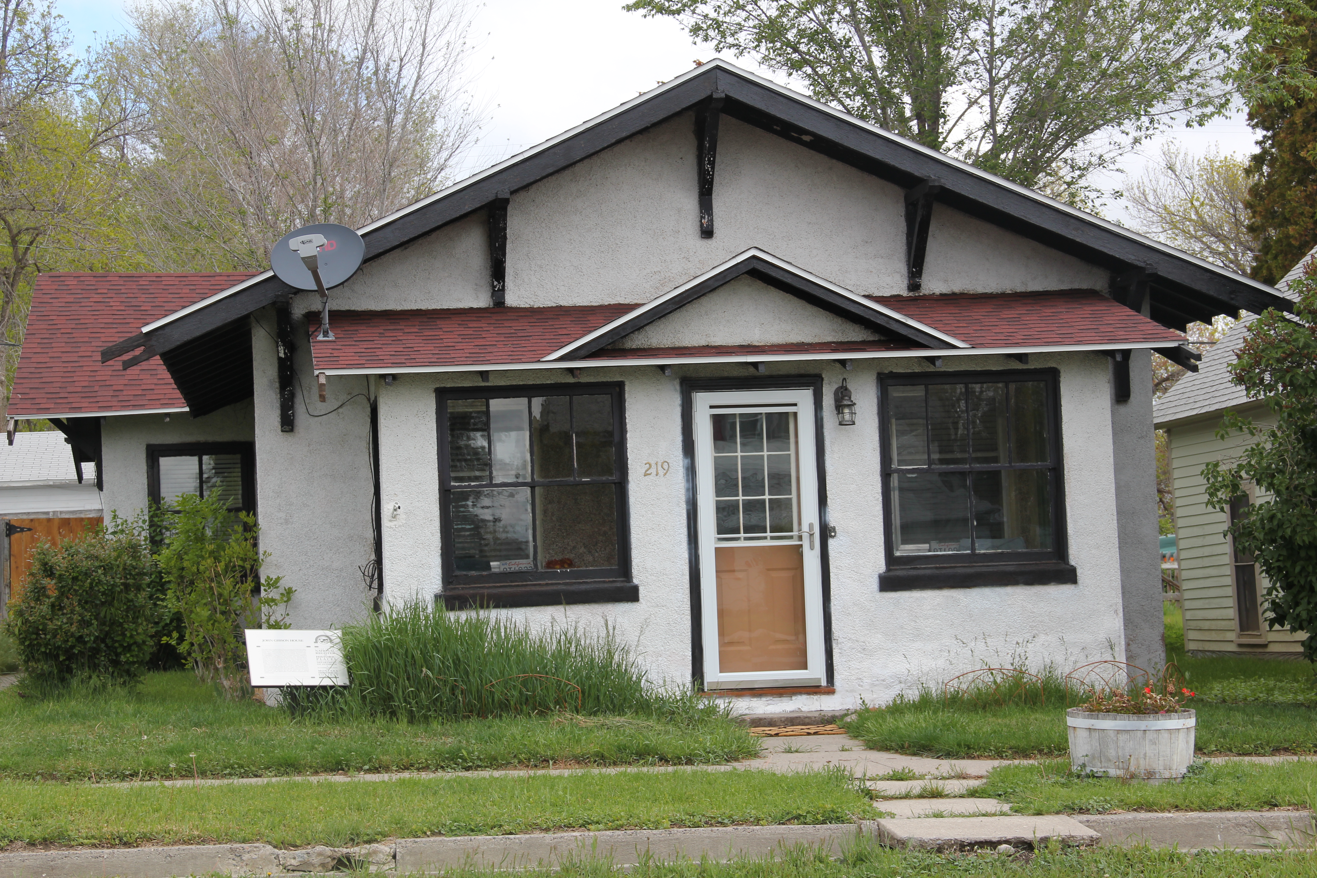
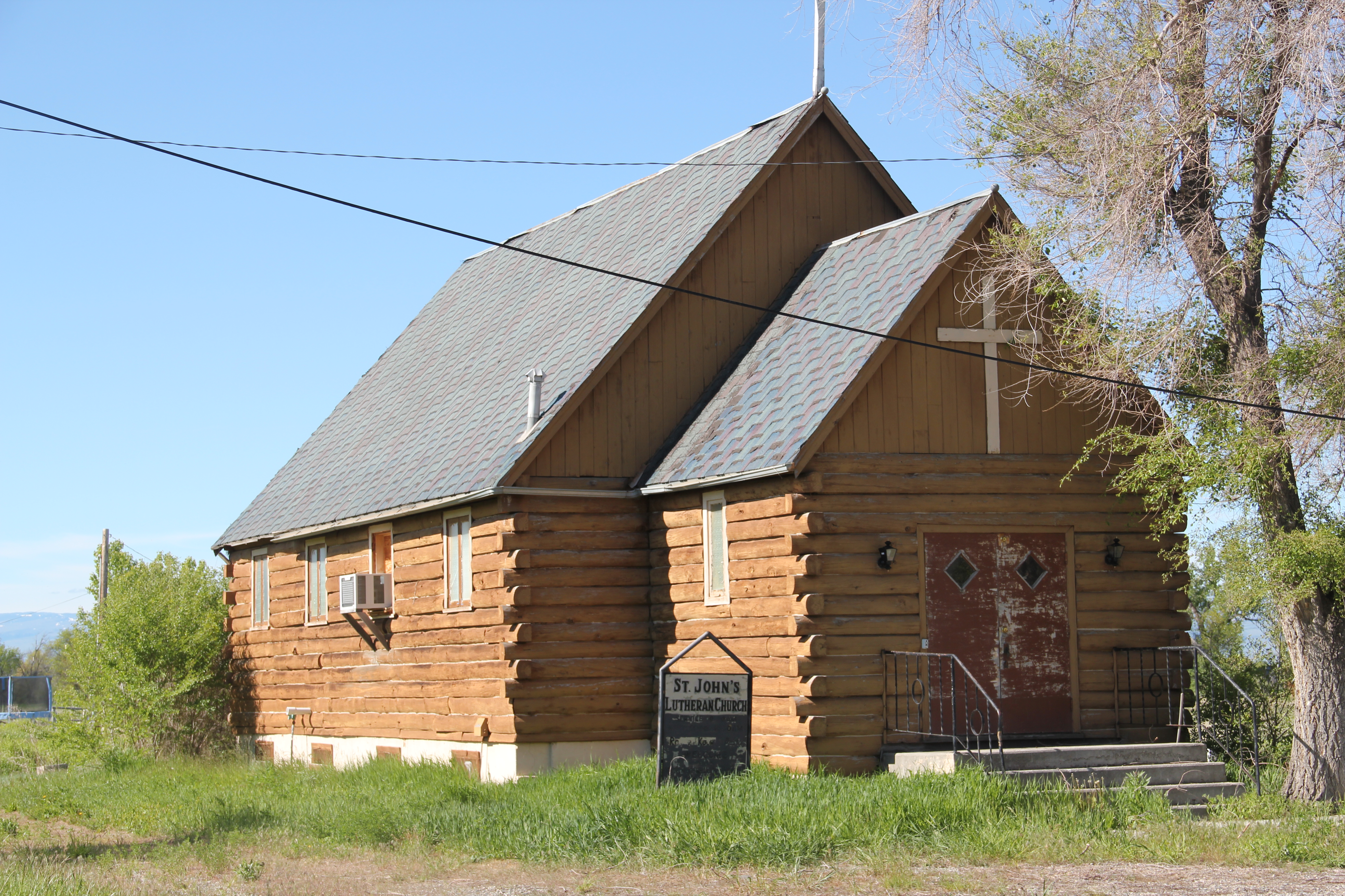
Across the road from the school is St. John’s Lutheran Church, a weather- and time-worn, a 20th century log building speaking more to the past than the present. And running

IMG_5958
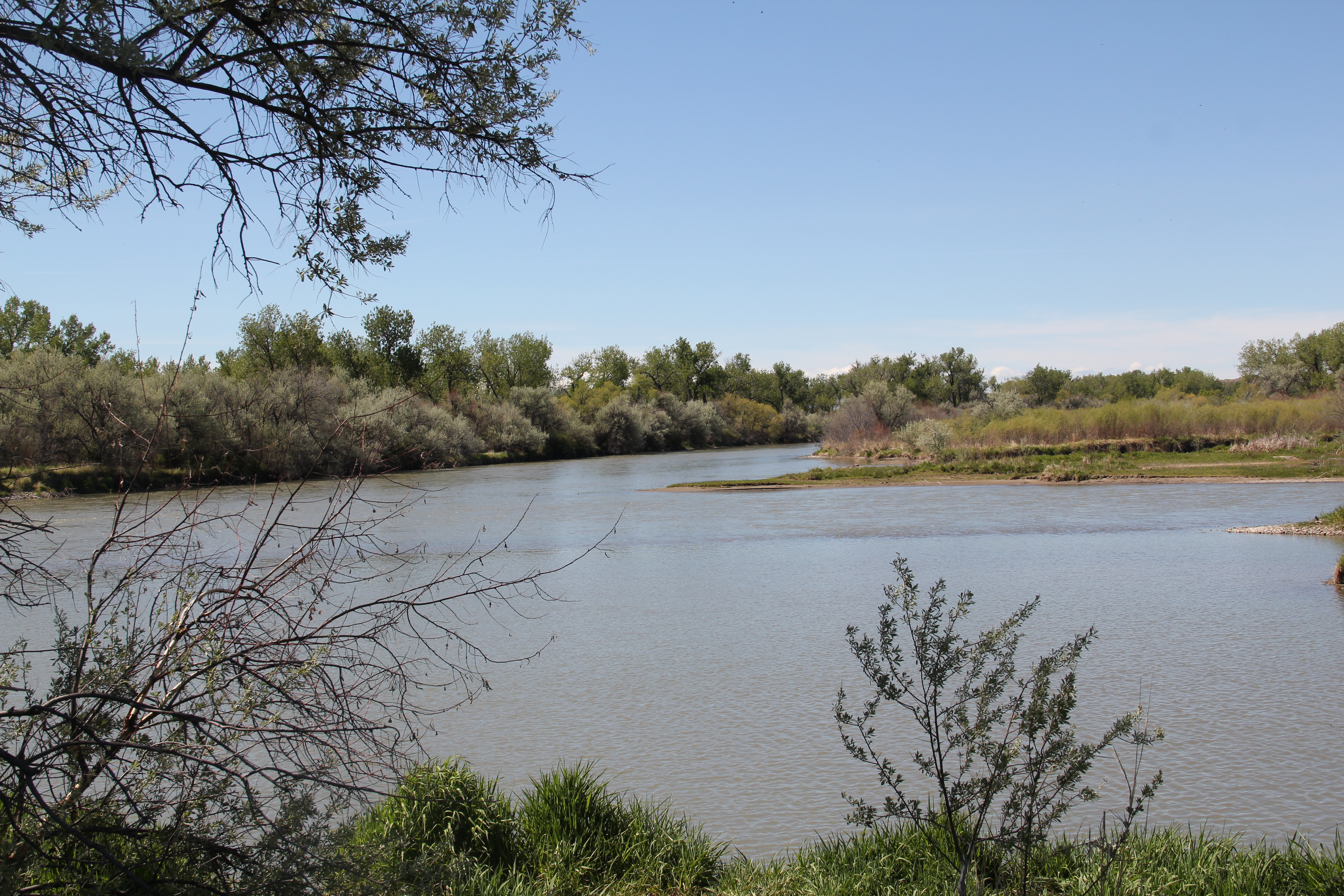
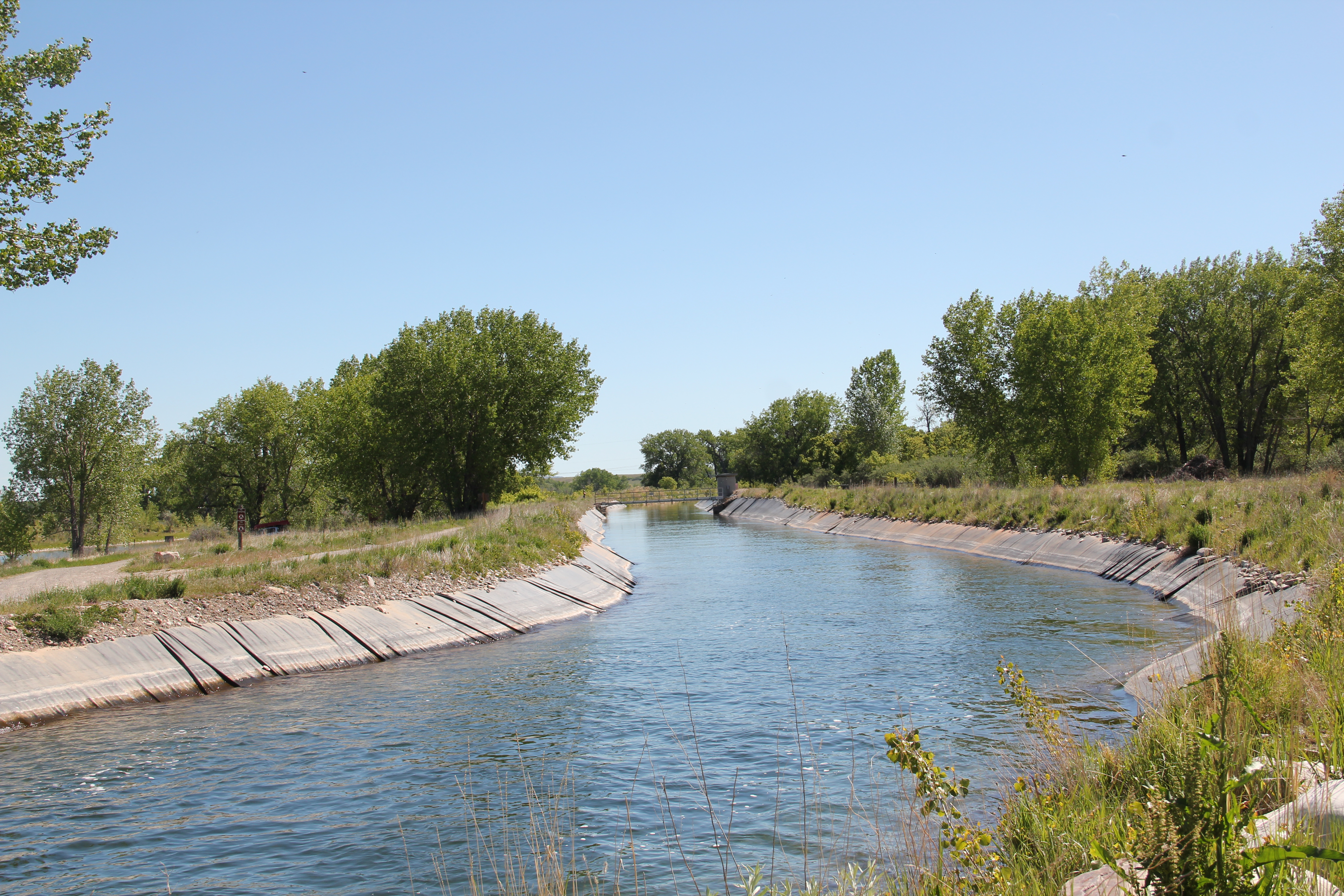
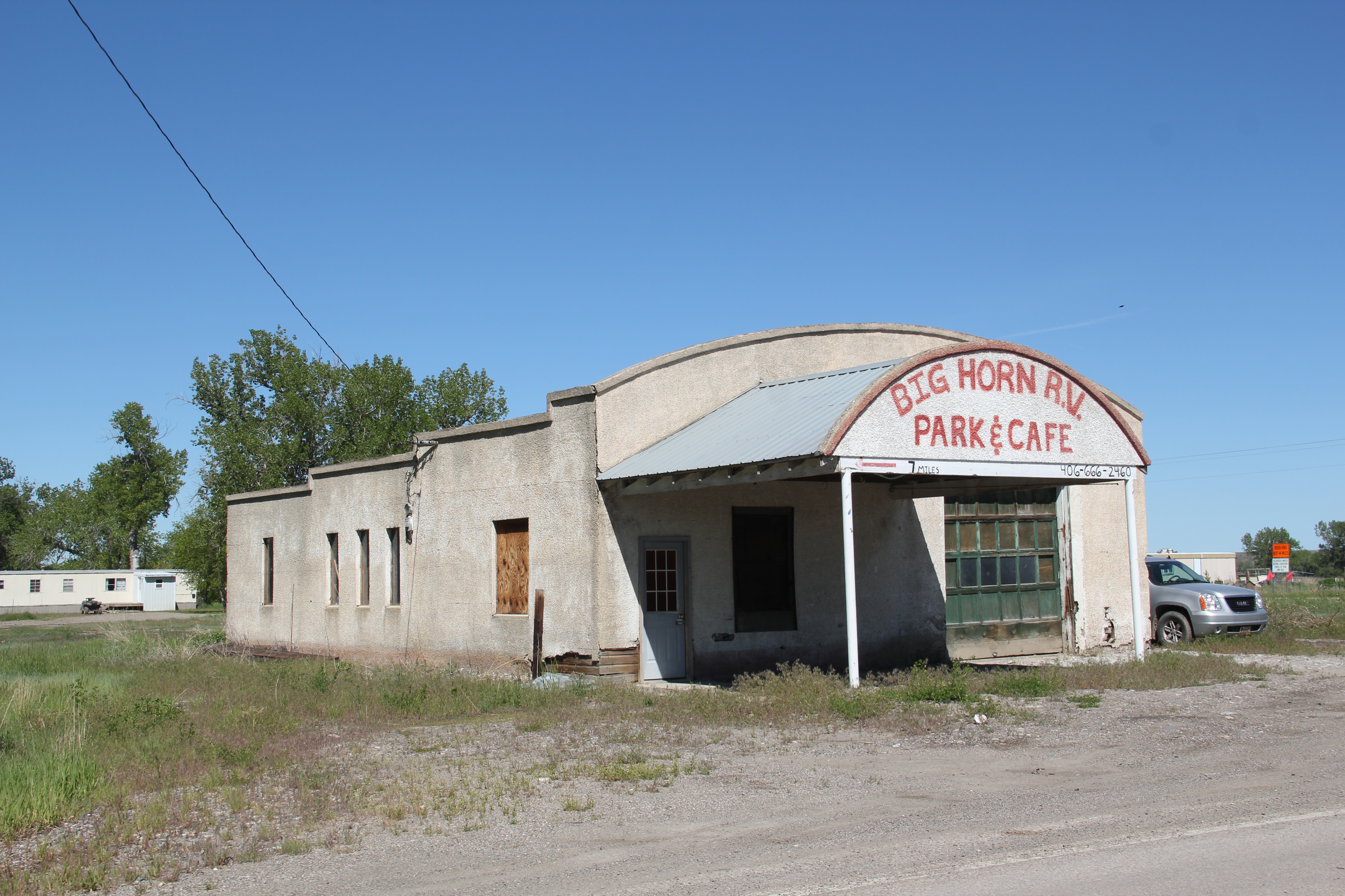
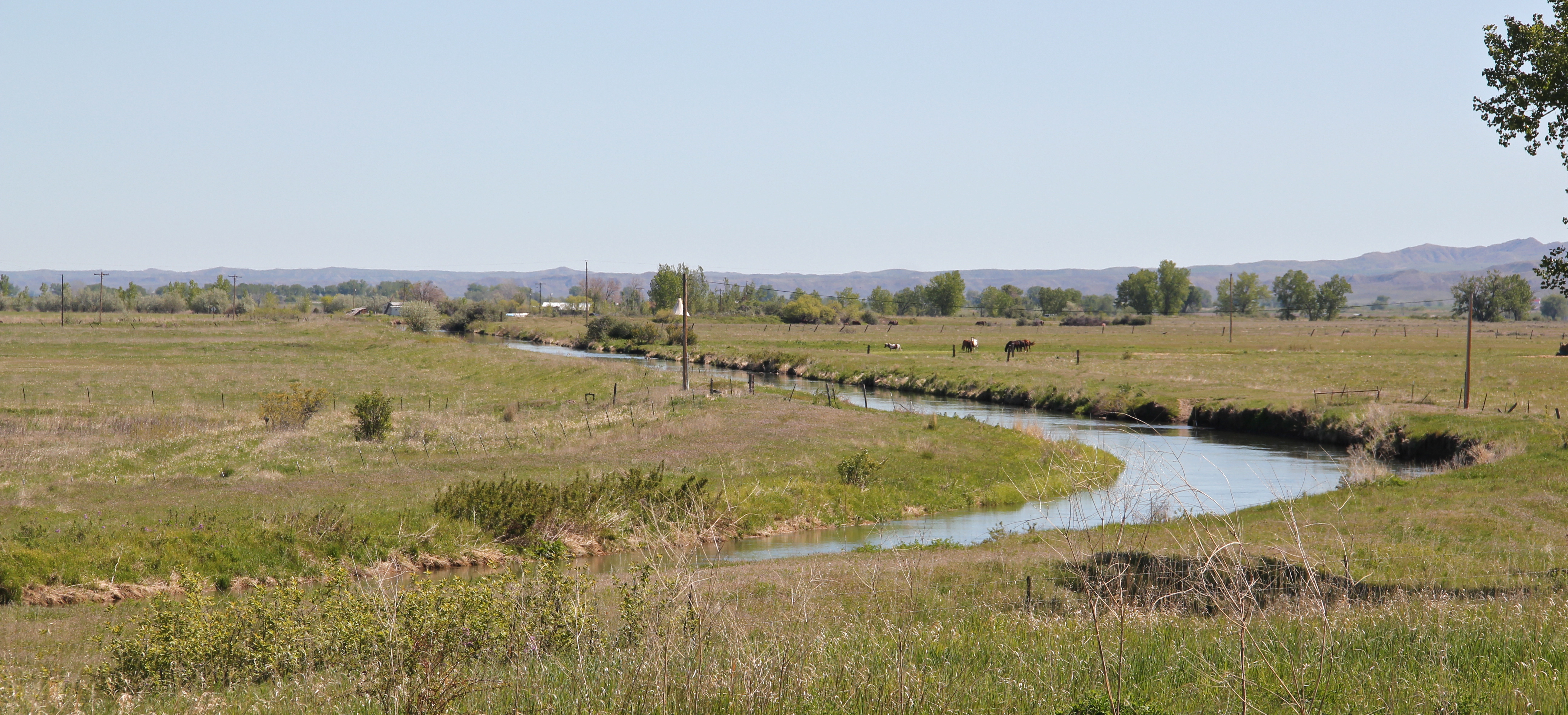
nearby is one of many irrigation ditches that promised the transformation of the Big Horn Valley for 20th century homesteaders but as the forgotten ranches surrounding St. Xavier remind us, the irrigated empire of eastern Montana did not bring riches to everyone.

IMG_6001

IMG_6003
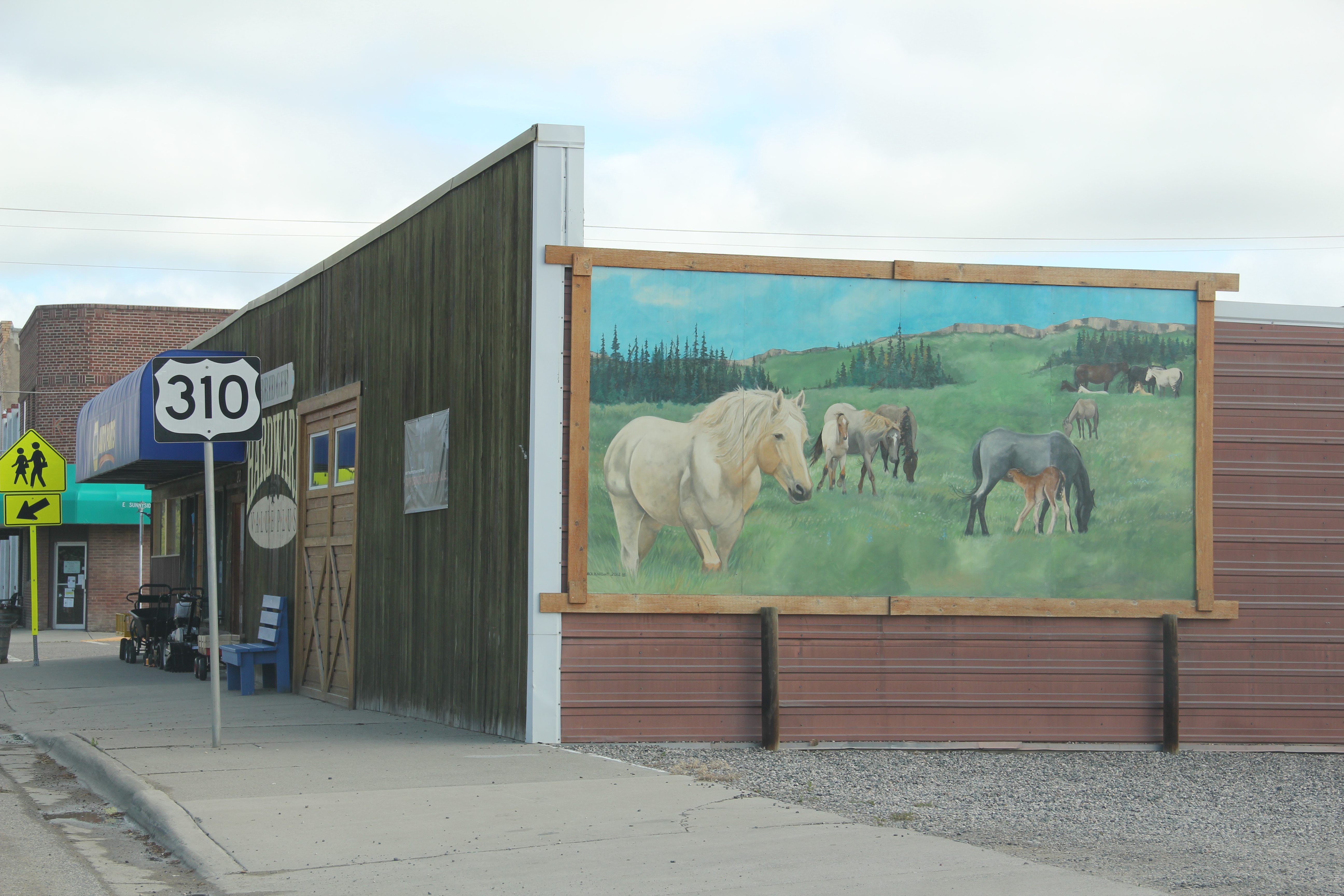
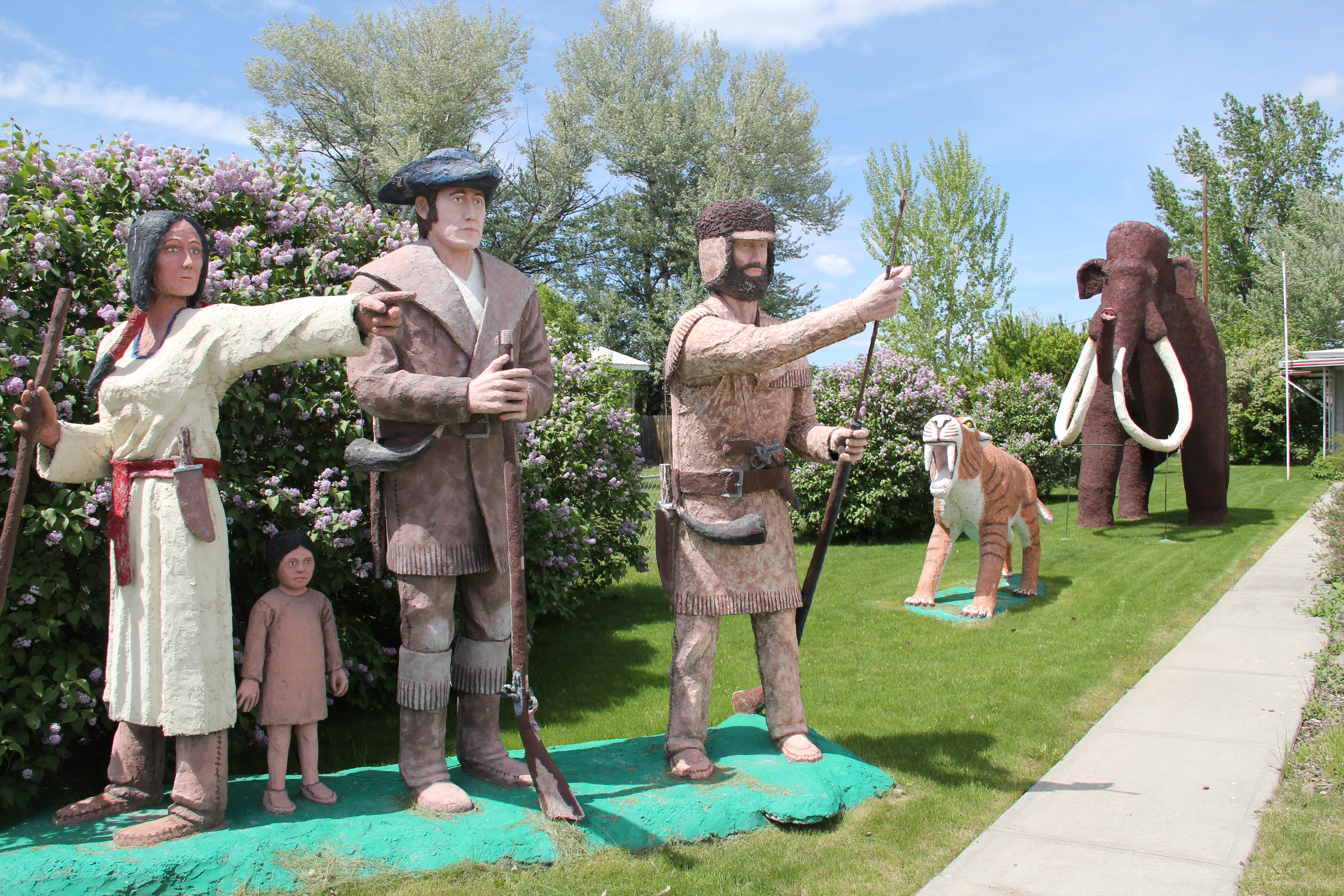
Transformations and shifting meanings of the past from the perspective of the present make the Big Horn a fascinating place to explore.

Two Forts on the Bighorn

IMG_6010The Big Horn River is among Montana’s most famous as it winds its way out of the high mountains and empties into the Yellowstone River near the village of Custer.  In the southern end of Big Horn County are two forts, one barely noticeable today while the other speaks to the radically different history of the Big Horn over the last 50-plus years.

Fort smith mapThe oldest is Fort C. F. Smith, established by the U.S. Army in 1866-1868 as part of its system of defensive installations to protect travelers along the Bozeman Trail.  Named for Civil War general Charles Ferguson Smith, the post stood near the trail, as seen above, and also near a major Big Horn ferry, a location deemed almost 100 years later as perfect for a major federal dam and reservoir project.  A peace treaty between the federal government and Sioux and Cheyenne Indians who had opposed the trail and the forts led to the abode constructed fort’s abandonment in 1868.  Today, the site is marked–the Big Horn County chapter of the Federation of Montana Woman’s Clubs did so in 1933–but on private property.    It has become a forgotten place within the state’s historic landscape.

Fort_CF_Smith_Marker

Photograph courtesy of the National Park Service and its website on the Big Horn Canyon National Recreation Area.

The second Fort Smith is the name given to the government-planned town developed by the Bureau of Reclamation as part of its Yellowtail Dam project of the early 1960s.  The project was part of the massive federal reordering of the plains landscape through the Pick-Sloan Missouri River Basin Program, an attempt to coordinate efforts between the Bureau of Reclamation and the Army Corps of Engineers.  The Yellowtail Dam project received Congressional funding in 1961.  The contractors included Morrison-Knudsen Company from Boise; Kaiser Company from Oakland, CA; Perini Corporation from Massachusetts, the Walsh Construction Company of Iowa, and the S Contracting Company from Butte.  The contractors received almost $40 million for the project.

IMG_5985Built from 1961 to 1966, Yellowtail Dam, named for Crow Indian Robert Yellowtail and standing at 525 feet in height, instantly dominated the surrounding landscape and turned the Big Horn Canyon into a huge lake some 72 miles along, that is managed as the Big Horn Canyon National Recreation Area.

IMG_5983

Access to the dam and its power plant was significantly curtailed after 9/11/2001.

The dam was part of an entirely new engineered landscape that defined this part of Big Horn Canyon and the Crow Indian reservation, with new ditches, the spillway, and a planned town for government employees.

IMG_5998

IMG_5997The town of Fort Smith was an obvious nod to the earlier army installation.  But this was not a rectangle of adobe quarters; it was a typical 1960s suburban development dropped into the middle of the Crow Reservation.  The streets are wide and circular, a concession to suburban models of planning but also taking advantage of the surrounding landscape.IMG_5980

In keeping with other suburbs of the early 1960s, the houses mixed “contemporary” styles such as split-levels and the long, horizontal Ranch house.  There were set-aside open

IMG_5972

IMG_5979

spaces for recreation and parks as well as a separate commercial area.

IMG_5976

IMG_5966

At the heart of the community was not a agency headquarters but a modernist styled public school–recognizing that children and their needs would help to define community among the different federal officials.

IMG_5978

The second Fort Smith is a fascinating landscape documenting the federal impact on the Big Horn River in the middle decades of the 20th century–a basic reordering of nature that created new impetus for recreation in the county and impacted the county seat of Hardin with its own new wave of modernist styling.  A suburb in the middle of nowhere–Fort Smith is among the state’s most distinctive places.

Bridger: Northern Pacific Railroad Hub in the Clark’s Fork Valley

IMG_5650As you head north into Montana from Wyoming on U. S. 310, the first substantial place you encounter is Bridger, named for famed fur trader and early Yellowstone traveler Jim Bridger.  Like its neighbor to the north in Fromberg, Bridger is another turn of the 20th century Northern Pacific Railroad town in the Clark’s Fork River Valley that was much the same from my initial visit 31 years ago.  Its population had remained steady–a tad over 700, about the same as in 1984, and only 150 or so less than its height in 1950.

IMG_5659The town’s grain elevators speak to the formative impact of the railroad.  Here back in the late 1890s engineers followed a well worn and recognized Indian trail–a similar route to what Chief Joseph of the Nez Perce Indians chose a generation earlier as he tried to find safety for his people, traveling from Wyoming into the Clark’s Fork Valley.

IMG_5631The town’s commercial district retains much of its early 20th century look.  Old bank buildings dominate the town center, while substantial 2-story commercial buildings (including properties listed in the National Register) remain, showing how quickly merchants came to Bridger and launched businesses to attract the growing number of homesteaders in the Clark’s Fork River valley in the 1910s.

IMG_5658

IMG_5633

IMG_5655That first generation of settlers did their part to build lasting community institutions.  The Bridger United Methodist Church is an impressive example of vernacular Gothic design. It is listed in the National Register of Historic Places.  The town library is almost a picture perfect example of what this institution should look like in a small town setting.

IMG_5644

IMG_5636The irrigation ditch drifting through the town park is a reminder of how the engineered landscape of irrigated fields provided much of Bridger’s early wealth and development.  The park itself was a creation of the Works Progress Administration in the late 1930s.

IMG_5634

Within the park is a ceramic and brick arch, one of the town’s many examples of public art.  The mural on a side of a store seen earlier in this post is another example while creative metal statues of wild horses grazing or the imposing figure of Jim Bridger himself welcoming visitors at the southern end of the town underscores a local tradition of public art not often seen in Montana’s small towns.

IMG_5635

IMG_5661                     Carbon Co Bridger jim bridger mt 2 - Version 2

IMG_5630

Other historic statements of the town’s sense of community include the 1930s Civic Center, a bit worn today but a center for community gatherings and social events for decades.

IMG_5651Bridger’s schools from the 1960s introduce Montana modernism to the townscape, almost like spaceships landing within the middle of the Clark’s Fork River Valley.  Modernism 1960s style also characterize Sacred Heart Catholic Church, St. Paul’s Lutheran Church, and the Bridger Seventh Day Adventist Church, constructed in 1965.

IMG_5640

IMG_5646

St. Paul Lutheran ChurchIMG_5639                                            Sacred Heart Catholic Church

IMG_5649These community anchors date from 50 years ago, so obviously growth has been stagnant, or stable, pick your terms, since the boom introduced in the valley through expanded irrigation projects in the post-World War II era.  But all of the buildings are well maintained, and are part of the sense of overall sense of pride you get from a visit to Bridger.

IMG_5654Bridger has reminders, both in monuments and in businesses, of the deep past of the Clark’s Fork River Valley.  It is an interesting place of strong institutions, several National Register-listed historic homes, and local business, and a significant part of the often ignored history of the Clark’s Fork Valley.

Railroad Towns of the Clark’s Fork Valley

IMG_5595

The name Carbon County seemingly says it all–here is a Montana place that is mining country, and coal mining at all.  As earlier posts have discussed, coal mining is vitally important to the county’s history.  The county seat of Red Lodge was a major coal mining town. But even Red Lodge’s historic built environment speaks of another side of Carbon County’s history. Its tall shiny grain elevator along the railroad tracks remind us that Carbon County was also agricultural country, especially in the Clark’s Fork River Valley.Carbon Co Red Lodge elevator - Version 2

The next couple of posts will explore this part of Carbon County–the towns and places many tourists roar by as they seek out Red Lodge and the mountains beyond.  Some places were, and are, tiny but still changes over 30 years are apparent. Boyd, for instance.  In 1984 I caught this iconic view of past and present at the historic Boyd store. The building is still there but the facade is changed, to a rustic western style, one more to the liking of fast-moving tourists.

General Store- PO. Boyd Caron Co. MT  IMG_5919

Edgar is a place that admittedly I gave little attention to in 1984.  That was a mistake.  I missed a very interesting modernist-styled school, probably part of the county-wide WPA projects for schools in the late 1930s, along with another 1960s styled addition.  The school closed in 2009.

Carbon Co Edgar New Deal school 3 - Version 2

IMG_5594

Edgar still has its bar, located in a fine one-story brick building–but not much else from the decades when it mattered in the 20th century.

IMG_5589Fromberg is a different story.  Unlike so many country railroad towns in Montana, Fromberg has a strong sense of itself, both in the present and in the past.  Part of that has to be a reflection of its comparative stability.  Its population height came in 1940, with mover 500 residents.  Today the population remains over 400, just about a 100 person decrease over 70 years.  For Montana rural towns that is exceptional.  Indeed, from my first visit in 1984 to my last in 2015, the town had only lost a few families.

IMG_5598 IMG_5597Fromberg has its own museum; the centerpiece of which is its restored railroad depot, part of the old Northern Pacific spur line.  In true northern plains fashion, other historic buildings have been moved onto the museum grounds.  It’s not quite a building zoo but the buildings give the place enough presence to attract visitors speeding along the highway.

IMG_5600 IMG_5599

Fromberg is a t-plan town, and all of the patterns of that type of town planning are apparent.  From the depot, running west, is the primary commercial street, with brick and fame buildings on either side.

IMG_5601

IMG_5622

The historic Odd Fellows hall dominates the commercial district–its conversion into the town’s post office, rather than a historic building being lost so a modern standardized design post office could be put in its place, is an excellent example of historic preservation done right.  Indeed, Fromberg residents have embraced the possibilities of preservation and multiple buildings are listed in the National Register of Historic Places.

IMG_5623

IMG_5618The mural about overland travel on the front of the Clark’s Fork Bank adds a touch of public interpretation.  If you want first-person stories, a stop at the Little Cowboy Bar (and “museum”, located at where the commercial district intersects with the highway, will be worth it.  It is one of the region’s classic watering holes.

IMG_5626

Fromberg also has documented its historic domestic architecture, raining from vernacular styled early 20th century homes to more stylish bungalows and even a couple of good examples of Dutch Colonial Revival style.

IMG_5617

IMG_5614

The homes are clustered around two historic churches, the brick St. Joseph Catholic church and the frame Gothic-styled and National Register-listed Methodist Church, built in 1907-1908 by contractor Charles Darnell and the community.

Carbon Co Fromberg St. Joseph Catholic - Version 2   IMG_5615T

The historic Fromberg school, like its counterpart in Edgar, was part of the countywide program of building modern schools by the WPA during the New Deal.  Its still impressive facade conveys well the WPA’s sense of modernism, and it remains the town’s primary community center today.

IMG_5607

Geraldine: A Milwaukee Road Town that made it

IMG_8825

My last post looked at the disappearing towns of the Milwaukee Road in central Montana’s Meagher County.  Those themes of a railroad, town creation, and abandonment were constant in several posts as I traced the imprint  of the Milwaukee on Montana’s landscape in the 20th century.  However, not all central Montana plains towns tied to the Milwaukee Road have disappeared–Geraldine in Chouteau County is one of those exceptions.

Geraldine MR Depot Choteau Co

Milwaukee Road depot at Geraldine, c. 1998

Geraldine was established c. 1913 along a major spur line of the Milwaukee Road that connected its division point at Harlowtown to the much larger railroad transportation center of Great Falls to the north.  Due to the richness of the high plains agriculture of southern Chouteau County–the land south of the Missouri River–and the commitment of its citizens, Geraldine has remained generally solid through the decades.  According to census records, the town has never topped 400 residents, 375 being the largest number of residents, and now, according to the 2010 count, there are only about 100 less, a little over 260 residents.  Losing what amounts to 25-30% of the population over the 100 years sounds like a disappearing town, true, but in an eastern Montana perspective, it is not.  As this blog has documented at many places, too many plains country towns have lost 50% or more of their population in just the last 30 years.

IMG_8822

In the 1984-85 historic preservation survey, Geraldine impressed me for several reasons.  First was the dominating presence of the grain elevators, as seen above and with the first photo in this blog.  I had grown accustomed to Milwaukee Road towns where the corporate standardized design for the combination depot–a building that joined both freight and passenger operations–dominated the railroad corridor.  Here the elevators punctuate the skyline and loom over the town itself–the railroad created the need for them, certainly, but by the end of the 20th century the elevators were still viable businesses while the depot had become a local museum and community center.

IMG_8808

Then there was the town plan.  Milwaukee Road country towns were “T-plan” towns where the tracks, depot, and elevators defined the top of the T while the town’s business district formed the stem of the T.  Geraldine was a bit different, a tilted T-plan town, where the top

IMG_8818of the T, due to the railroad’s approach was slanted, giving Geraldine, compared to other Milwaukee towns, an off-kilter look.  Geraldine also still had business, although the number of independent places had diminished since 1984-1985.  Two key institutions today are

IMG_8817

the local state bank, a Classical Revival-styled two-story building from c. 1914 that is listed in the National Register of Historic Places as the First National Bank of Geraldine.  Unlike scores of other local institutions in the 1920s and 1930s, the Geraldine bank did not close its doors and continues to serve ranchers and town residents today.  It is a rock from Geraldine’s past that surely helps to define its future.  The same can be said for the

IMG_8823

Geraldine school–home of the Tigers.  This local school has several different building periods, as this image of its facade indicates, but maintaining a school district is vital to the town–plains country towns that lose their schools soon become abandoned places.

IMG_8815

Geraldine touches upon many key theme of eastern Montana history–in subtle yet significant ways.  It even lightly touches on another theme of this blog–Montana Modernism.  No one was much looking at the contemporary styled buildings of the late 1950s and 1960s in 1984-1985.  I was no exception.  But in the 21st century, we want to document those buildings and appreciate how the new architecture expressed the hopes of the post World War II generation.  Geraldine’s contribution is its United Methodist

IMG_8816

Church, with its particularly notable tall concrete bell tower, mixing a bit of tradition with the new look of the postwar generation.

IMG_8820

Geraldine of course has a classic western watering hole–Rusty’s Bar and Grill, completed with its front glass block windows.  It is highly recommended–not much on the outside admittedly but a full community experience on the inside.  Historic depot and bank, modern-styled church, unique town plan, and great bar:  more than enough reasons to come to Geraldine, not once but whenever travels take you between Great Falls and the Musselshell River Valley.

Roundup, Montana: 19th Century Trail Crossroads and 20th Century Railroad Town

IMG_0080

Roundup, the seat of Musselshell County, has long been one of my favorite Montana county seats.  The old 19th century cattle trails are one important defining feature of the eastern Montana landscape; another are the railroad lines that crossed the region.  Here at Roundup, a north-south cattle trail crosses the east-west railroad line,  creating a town environment rich in history.

IMG_0078

Locals gathered at the town’s several good historic bars–the Arcade being my favorite–are rich in tales of the chaos and fun of early September 1989 when cowboys and pretend cowboys gathered in mass to recreate the “Great Montana Cattle Drive.”  A monument to that crazy day stands next to Roundup’s outstanding New Deal-era courthouse.  Another sign to that time is much more lonely, on Main Street, the old historic route of the trail (now part of U.S. Highway 87). Are you supposed to stand there for a selfie if you rode in ’89?

IMG_0077

IMG_0076

Arcade Bar, Roundup, a real Montana classic

IMG_0057

There are so many Stockman Bars in Montana. The one is Roundup has these two great Art Deco-like windows.

The coming of the Milwaukee Road in 1906-1907 created a new look to Roundup.  Like many Milwaukee towns in Montana, it has a T-plan, with the route of the tracks (the rails

IMG_0050

I was glad to see this light industrial adaptive reuse of the Milwaukee depot–it was abandoned in 1985 and could have been demolished.

have been removed since c. 1985) and the location of the depot forming the top part of the T while the stem of the T is the route of U. S. 87 as it stretches to the north.

IMG_0048

U.S. 87 N (Main Street), Roundup

Earlier posts have discussed the town’s contribution to Montana modernism, St. Benedict’s Catholic Church, and the superb Musselshell County Fairgrounds, one of my favorite in the state (and a public property eligible for the National Register IMHO). Roundup has two National Register properties–its two historic schools.  The St. Benedict Catholic School (c. 1920), designed by Roundup’s own John Grant, is now the Musselshell Valley Museum.

IMG_0036

The town’s historic public school, but in two major sections in 1911 and 1913, was designed by the Billings architectural firm of Link and Haire.   It is an impressive landmark, built from stone taken from the bluffs of the Musselshell River Valley, and one maintained with pride by the community.

IMG_0235

Many historic buildings from the early 20th century line Main Street–naturally many one-story buildings but also commercial blocks of style and substance.  There is also a lot of homes that would contribute to a residential historic district.  Roundup has lost population like almost all eastern Montana towns since 1980 but not by such a severe amount–just over 200 in the last 30 years.  Thus, the town’s historic buildings remain in use and in fairly good condition.

IMG_0063

IMG_0046

IMG_0039

The historic schools in Roundup have been a great start for heritage efforts in Roundup but this quick overview shows that more can be done, to document and preserve this pivotal place in the Musselshell Valley.

Winnett and Petroleum County

IMG_0261
West of Jordan, crossing the Musselshell River, on Montana 200 is Petroleum County, the last county to be created in Montana in 1925. Its county seat, Winnett, was never big–even at the height of the Cat Creek oil strike the town numbered only 500 residents. It now has 188 in 2010–a slight decrease of twenty from when I first visited in 1984.

Petroleum County Courthouse, mid-1980s

Petroleum County Courthouse, mid-1980s


In 1928, county officials moved the courthouse into the town’s one substantial business block, a beautiful locally quarried stone building from the town’s beginnings in 1918. The courthouse is now the county’s one listed property in the National Register of Historic Places.
IMG_0255
IMG_0256
Another public building is the 1960s post office–I noted it in the 1984 because of the use of a stone veneer on the front of the building, different than many other standardized designs found in the region. That building is
Created with GIMP
still there, now as then, an important community gathering place, changed only by the growth of landscaping around it in the last 30 years.
IMG_0251
There is only a single historic grain elevator left in Winnett, but it has two bars, one a converted gas station, the other the iconic Winnett Bar, one of the most famed in the region, especially for its steaks. If you only need one reason to visit Winnett, this is the one.
IMG_0250
IMG_0260
IMG_0252
While there, you also can take in a bit of Montana modernism, in the A-frame First Baptist Church, which the town’s “W” overlooks from the bluffs above. Other earlier classic vernacular designs, such as false front stores await new futures.
IMG_0246
IMG_0254
The future in Winnett and Petroleum County is naturally given a physical space by its schools–the most substantial buildings constructed here in the second half of the 20th century. with less than 500 residents in 210, the county’s future seems to be non-existent but the schools say otherwise.
IMG_0248IMG_0245

Hardin and Montana’s Modernist Traditions

The National Register-listed Burlington Route depot  is now the chamber of commerce office.

The National Register-listed Burlington Route depot is now the chamber of commerce office.

Hardin is different than so much of eastern Montana It was created along the Burlington Route–a railroad line that entered the state in the early 20th century and headed north to Billings–and not the three dominant lines of the region:  the Great Northern, the Northern Pacific, and the Milwaukee Road.  Its town plan is different: streets radiate out from the depot, the centerpiece of the design, although tradition soon overruled design:  businesses soon adapted the plan into the standard T-town look that you find throughout the region.

From the depot, looking northwest, the Hotel Becker, also in the National Register, is the town's most recognized landmark from its first decade of development.

From the depot, looking northwest, the Hotel Becker, also in the National Register, is the town’s most recognized landmark from its first decade of development.

IMG_6839

To the northeast of the depot, the street soon took on the look of an alley as owners adapted the plan to the preferred T-town look of a proper “Main Street.”

Hardin is also different because like its huge neighbor to the north, Billings, Hardin’s demographic story is not one of a boom in the early twentieth century followed by decades of declining population.  When I first visited in the early 1980s, the town’s population had grown by one thousand since the 1950s, and it has even grown a couple of hundred more since then, rather than the story so often documented in this blog of rather steep declines in eastern Montana towns from 1980 to 2010.  Hardin even weathered the closing, and now slow demolition, of its industrial mainstay, the Holly Sugar Refinery, which dominated the skyline and local industry from its opening in 1937 to its closing in the early 1970s.

The refinery, shown here in 2013, is  just east of the town proper and has served as a major landmark for travelers on I-94.

The refinery, shown here in 2013, is just east of the town proper and has served as a major landmark for travelers on I-94.

The opening of the refinery in the Depression decade also coincided with yet another trend that makes Hardin different:  its impressive collection of modernist designs, which started with the magnificent Big Horn County Courthouse.

IMG_6872

The courthouse was constructed between 1937 and 1938 as a Works Progress Administration (WPA) effort; J. G. Link of Billings was the architect, as the firm was for so many New Deal projects in the region.  The courthouse is the state’s most successful blending of regional materials with standard WPA Modern design.  South of Hardin is the Big Horn Canyon, a beautiful deep gorge that frames the river.  The striking stonework of the courthouse came from a quarry near Fort Smith and linked the modern courthouse to the local landscape.

Over the next two generations, and into the present, the town has continued to grace its built environment with interesting examples of modern design.  Some naturally reflect the Art Deco styling of the courthouse.  The entrance to the Community Bowling Alley is very mid-century Deco, and other commercial buildings have a hint here and there of Deco styling, especially in the use of a band of glass block windows on the historic Gay Block.

IMG_6877

IMG_6852

What really is really impressive in Hardin are several buildings from Montana’s contemporary era of the 1950s and 1960s, first in commercial buildings and storefronts, especially the metal-clad and International style-influenced Zelka Machine Shop.

IMG_6858

IMG_6849

IMG_6861

Two congregations also caught the modernist favor.  The Methodist built a rectangular brick International styled-influenced sanctuary while the Congregationalists added an almost Saarinen-esque design to the townscape.

IMG_6871

IMG_6876

Nor did residents ignore domestic architecture styles, either in the past, as attested by this Prairie-style dwelling, or in the present, as in the recent Neo-Prairie style addition to the formerly classical-styled town library.

IMG_6868

IMG_6865

Perhaps the best comes last in the dramatic lines and stone aesthetic of the First Interstate Bank Drive-In Bank, located between the town’s commercial artery and its residential district, or the slashed up quonset-hut vernacular of a car wash located on the outskirts of town.  Whatever look you like of Montana modernism, Hardin has something that touches on that design aesthetic.

IMG_6879

IMG_6880

IMG_6881

The Yellowstone’s Treasure County: Small Place, Big History

IMG_6911Treasure County dates to 1919, one of the last counties created in the Yellowstone Valley.  Among the smallest counties in size, it has just over 700 residents, a drop of over 200 since my visit in 1984.  But the county has some of the most evocative buildings in the state, starting with the Yucca Theatre, built in 1931 by brothers David and Jim Manning, who wanted to give their community a spark, a glimmer of hope in the increasing hard times of the depression.  David Manning had liked the Spanish Mission style when he had traveled in the Southwest, and he thought, why not for Hysham, since the town was near the spot on the Yellowstone River where Manuel Lisa had established one of the valley’s earliest trading posts.

IMG_6913

Despite the brothers’ best intentions, the theatre struggled as the town and county dwindled in population, but David was devoted to it and transformed it into his home, a convenient landmark, it would turn out, for his political career.  Manning was elected to the Montana legislature in 1932, and he was still serving in the House when I worked at the State Capitol from 1982-1983.  He told me about his theatre, and urged me to go and enjoy his town, and stay at the house, if needed.

IMG_6916

The Yucca Theatre was the first building listed in the National Register in Treasure County and it serves once again as a theatre but also a historic site. Local sculptor Bob Schulze has added statues of Lewis and Clark, along with Sacajawea and Pomp, and a saber-tooth tiger, wooly mammoth and a white buffalo to boot.  Across the street, in an old storefront, is the county museum, another addition to Hysham’s heritage tourism offerings since my 1984 visit.

IMG_6918

Rep. Manning also recommended a stop at the Brunswick Bar, and I am glad he did–this is a great place with great Montana bar food.  The bar has been in business since the 1950s, at least, and the building stands at the location of the original county courthouse.

IMG_6910

And speaking of the courthouse, it is a sparkling “contemporary style” building of the 1950s, an important contribution to Montana modernism.  Many have commented on unique treatment of the exterior, with a map of the county serving as the primary design motif.  The building, as you might expect, has changed little since its opening in 1955.

IMG_6921

But there’s another Hysham contribution to Montana modernism:  the Treasure County High School Gym–an Art Moderne styled building from the New Deal era right on old U.S. 10 as it passed through town.

IMG_6927

But this is not the National Register-listed New Deal gym in Treasure County, that is at the hamlet of Sanders, where the WPA built the Sanders School Gymnasium and Community Hall in 1940.  This is not Montana Modernism but Montana Rustic, a design from the Billings architectural firm of J.G. Link. It is one of my favorite New Deal buildings in all of

IMG_6929

IMG_6931

New Dealers believed that children needed recreation, and built hundreds of gyms and sports field across the state.  They also believed that devastated, declining rural communities needed spaces–like this community hall–where they could gather for local sports, social events, funerals, and elections.  But the Rustic style in this part of the Yellowstone Valley–not really fitting, the style would have made much more sense in the mountainous western half of Montana.

IMG_6904

At Sanders, the public school has been gone for decades.  But in the northern part of Treasure County, far, really from everywhere is the Rancher School, perhaps the oldest pubic building in the county since its 1910 construction date means that the school predates the actual creation of Treasure County.  Here is a classic early 20th century school–protected still by barb wire and used periodically for community events.  When the National Trust of Historic Preservation placed Montana’s rural schools on its endangered list, everyone had buildings just like the Rancher School in mind.

IMG_6906

Kudos to everyone who has contributed to keeping this building standing as a symbol of communities long gone but not forgotten, not as long as rural landmarks like all of the historic buildings in Treasure County continue to serve owners and residents.

Modernism in Glendive

My last post on Glendive, the primary commercial and transportation center of the Lower Yellowstone Valley, looked at the Northern Pacific Railroad’s imprint on the town. :et’s shift focus into the early 20th century, when the automobile corridors–the Yellowstone Highway or U.S.Highway 10–began to leave their marks on the town.

Historic Texaco Station in Art Moderne style, Glendive , MT

Historic Texaco Station in Art Moderne style, Glendive , MT


IMG_7213
As the Yellowstone Highway left town and headed west, two outstanding examples of roadside architecture survive, the c. 1930 Art Moderne-styled Texaco gas station, complete with a small motor court for lodging in the rear, and a later historic drive-in, Frosty’s, complete with the low canopy typical of the early non-standardized drive-in establishments.
IMG_7215
Also feeding traffic into the heart of Glendive was the 1925 Bell Street Bridge over the Yellowstone River. This National Register-listed bridge was once a gleaming steel and concrete landmark of modern transportation; it continues to serve the town as a pedestrian bridge.
IMG_7220
IMG_7224
Downtown Glendive is dominated by a modern monument to its time of greatest prosperity–the city reached its population high of just over 7,000 in 1960: the Dawson County Courthouse of 1962. Designed by the long-established Billings firm of J. G. Link, the courthouse represents the “contemporary modern” movement in the state’s architecture of the 1950s and 1960s.
IMG_7225
Dawson County Courthouse, 1962, Glendive, MT

Dawson County Courthouse, 1962, Glendive, MT


An even more striking example is the space age aesthetics found in the town’s public library, which when I lasted visited Glendive in the 1980s still served its original purpose as a local bank.
IMG_7266
IMG_7267
The contemporary sixties look even extended into Glendive’s historic neighborhoods, as reflected in the A-frame style of the First Congregationalist Church, and into new commercial buildings, such as the Saarinen-esque sloping roofline of the historic Safeway store, now adapted into the Eastern Montana Events Center.
IMG_7265
IMG_7261
Glendive has lost over a quarter of that 1960 population, checking in the 2010 census at just under 5,000 residents. Before we leave this spot on the Yellowstone, let’s explore more its historic neighborhoods, full of a range of interesting domestic architecture from 1900 to 1960. That’s the next post.