The Milwaukee Road Heads into the Musselshell Valley

As the Milwaukee Road left the Yellowstone Valley at Forsyth and struck northwest toward the Musselshell River valley, it created one of Montana’s most classic prairie railroad towns, Ingomar, established in 1908.  The hamlet, with 25 or so residents today, compared to perhaps the 100 who lived around there in 1980 has several historic buildings that document its quick twentieth century rise, and just as quick fall in the 1920s and 1930s depression years.

IMG_6844

Jersey Lily Bar, Ingomar, 1984

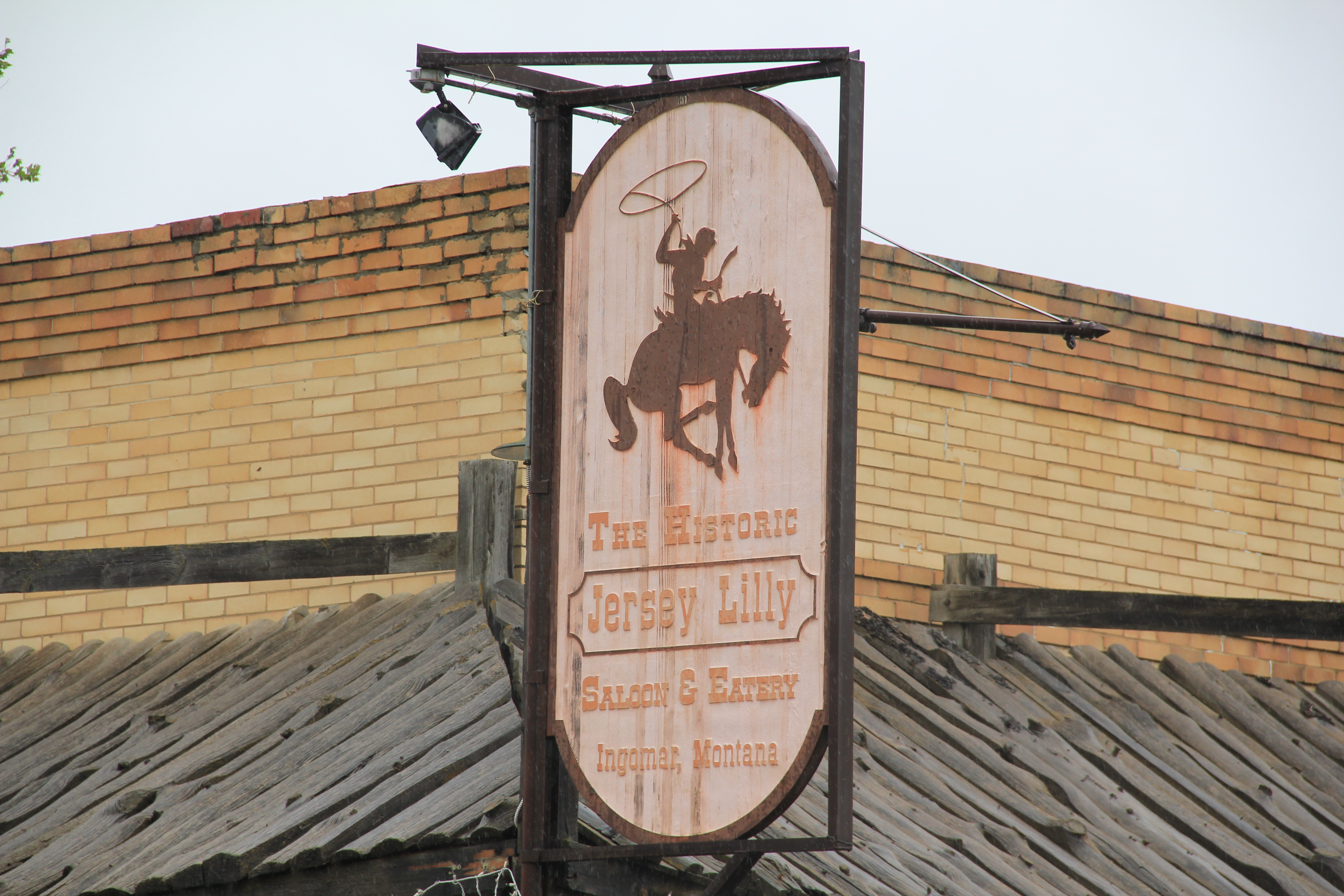
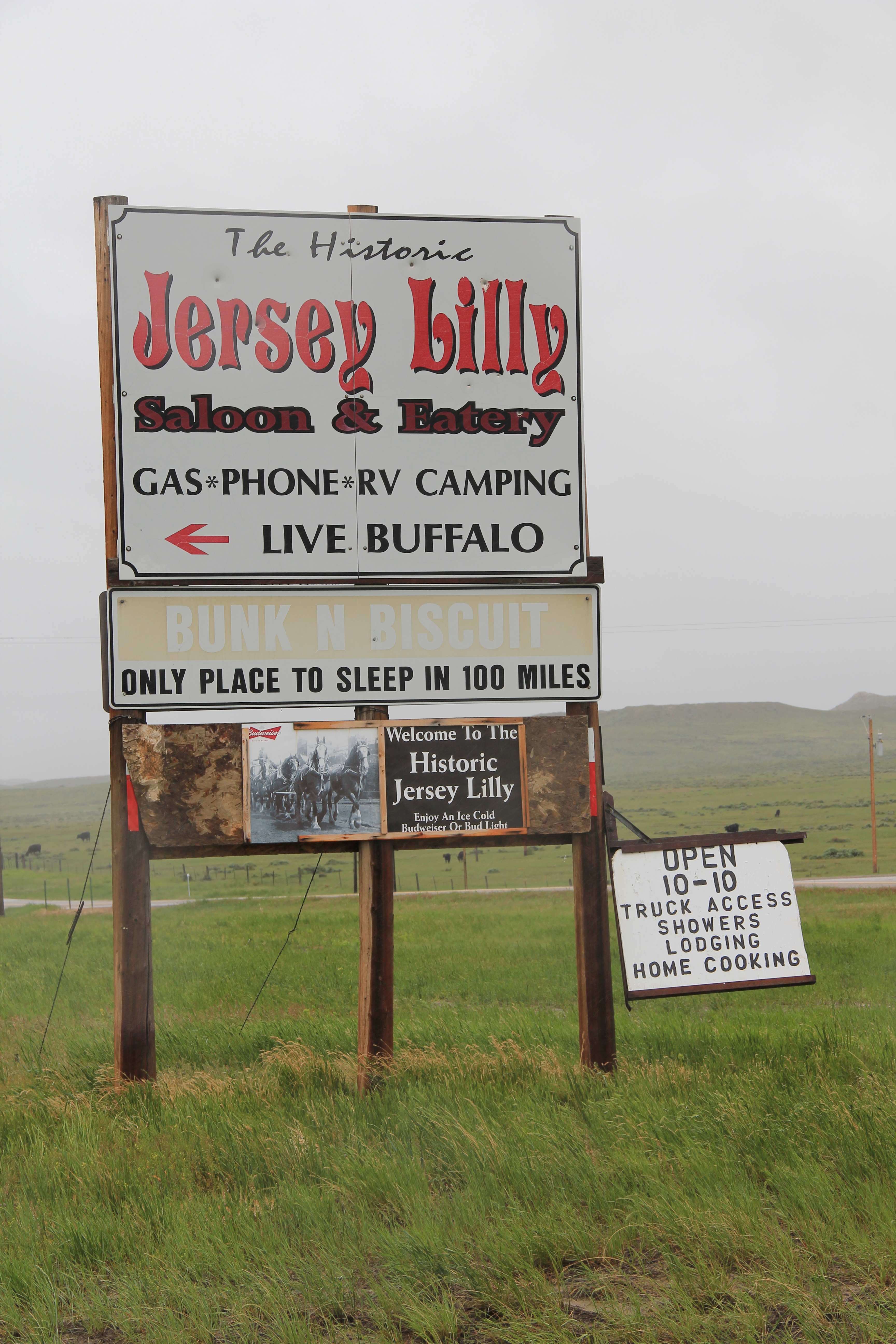
In the 1984 survey of Montana, Ingomar really just had one reason to stop:  the Jersey Lilly Bar, owned and managed by Bill Seward, who had done so since 1984.  That spring Seward and I became good friends.  Few people stopped there in February and March and since I was in the region, I found ways to stop in. do coffee (strong, hot, always ready) and have whatever Bill was thinking of cooking.  He was proud of his beans, and liked sliced red potatoes when he had them.  Seward added the faux western wood porch to a 1914 bank building:  he said that the tourists liked it, that it made the otherwise Classical Revival bank look “Old West.”  Until Seward’s death in 1995, I found reasons to visit Ingomar three other times, in a way just to make sure that both Seward and the bar was still going on.  Since the construction of the interstate highway to the south had so killed traffic along U.S. Highway 12, you wondered when the bar would close.

IMG_0115

This former homestead-era bank building, the Wiley, Clark, and Greening Bank, opened in 1914 and closed as a bank seven years later.  In 1933, the height of the Depression, it re-opened as the Oasis Bar (it certainly was that along U.S. 12) and it became the Jersey Lilly Bar in 1948.  Almost seven decades later, it is a well-known landmark on the highway, and was listed in the National Register of Historic Places in 1995.

IMG_0116

IMG_0126

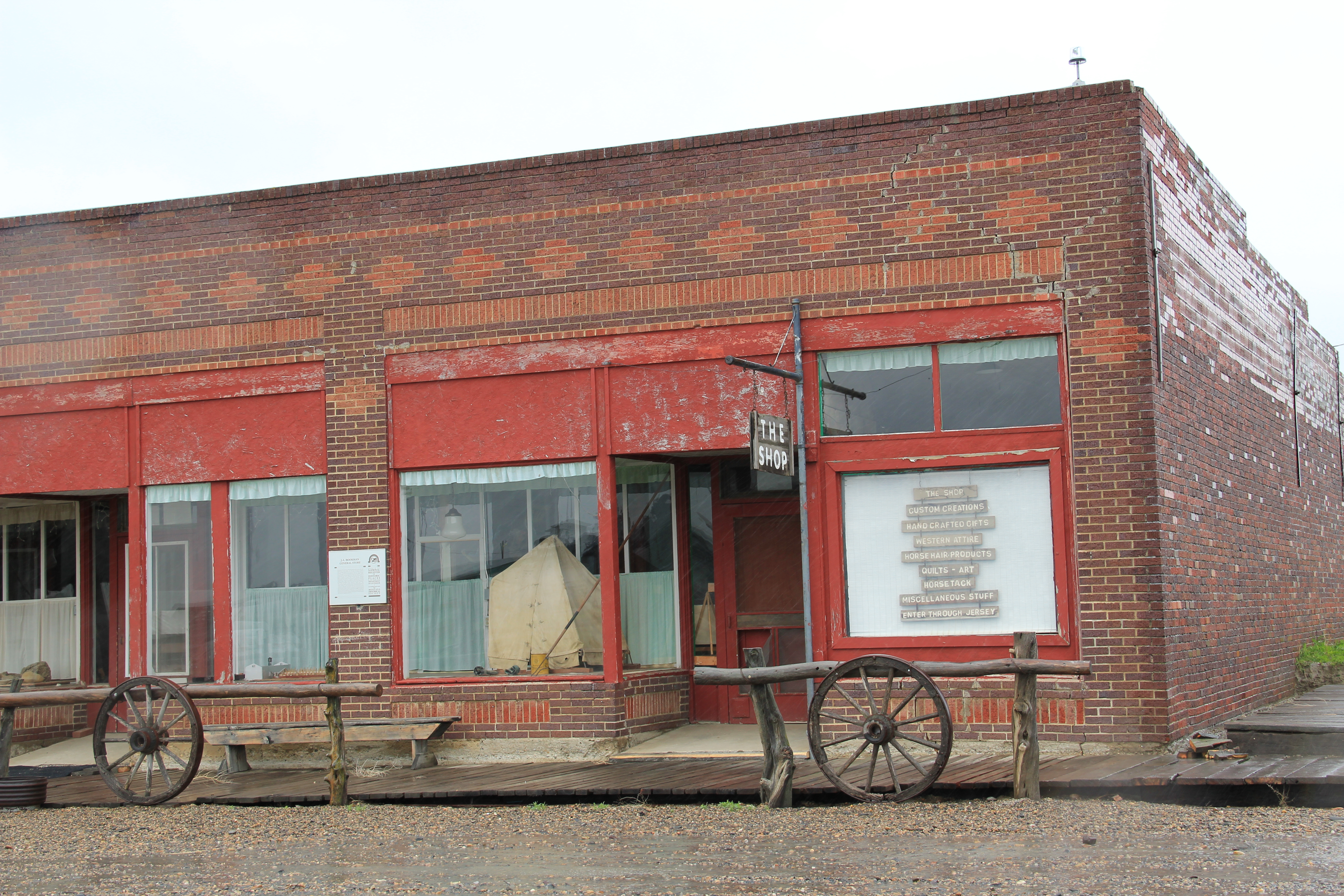
Adjoining the bar, and accessible only through the bar, is another National Register building, the Bookman General Store, constructed as really an act of faith in 1921, replacing an earlier store that had burned.  The prospects for Ingomar was not so rosy by that time but the Bookman family stayed the course–lost the store for two years from 1933-1935–but reacquired it and kept it open to 1943.

IMG_0122

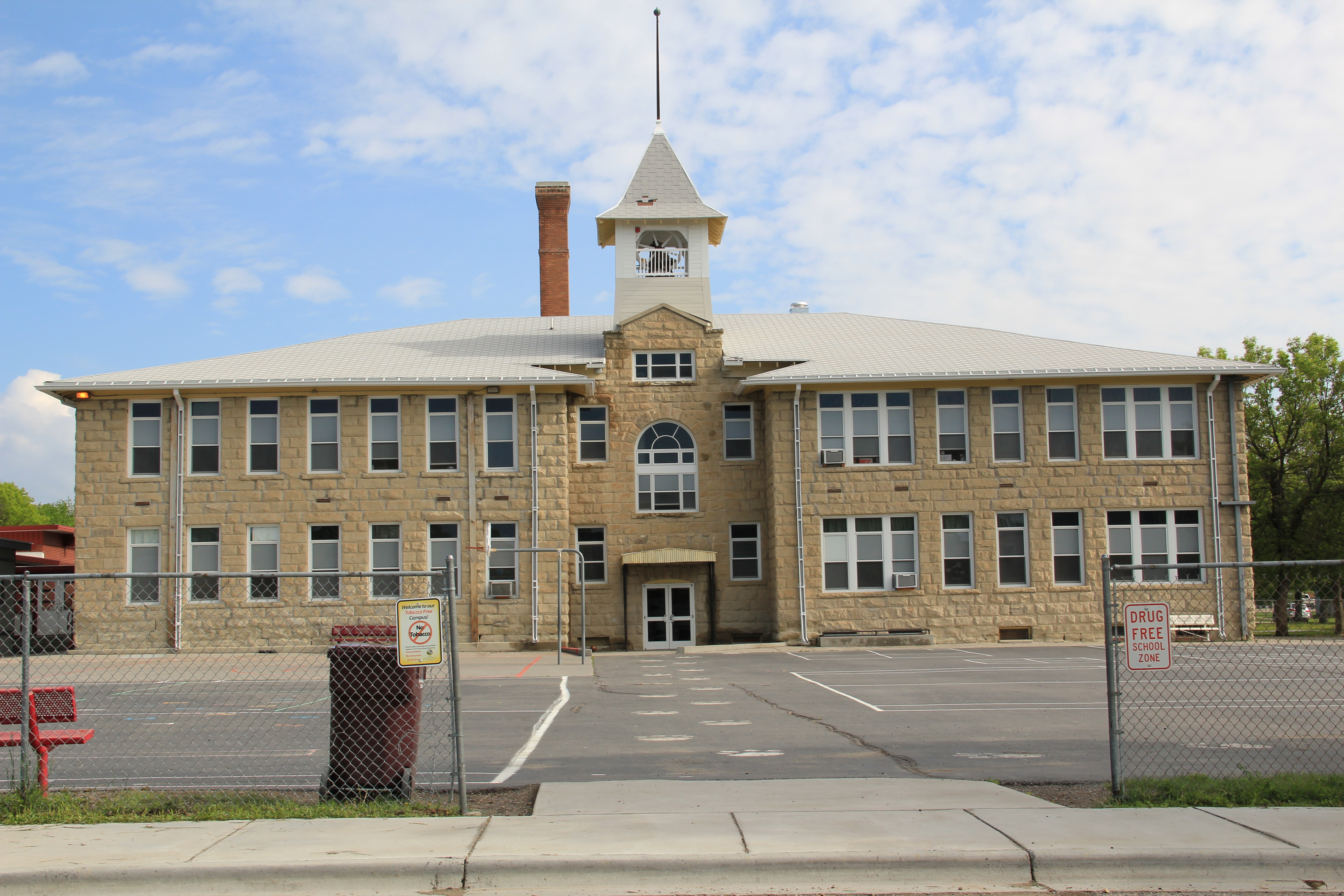
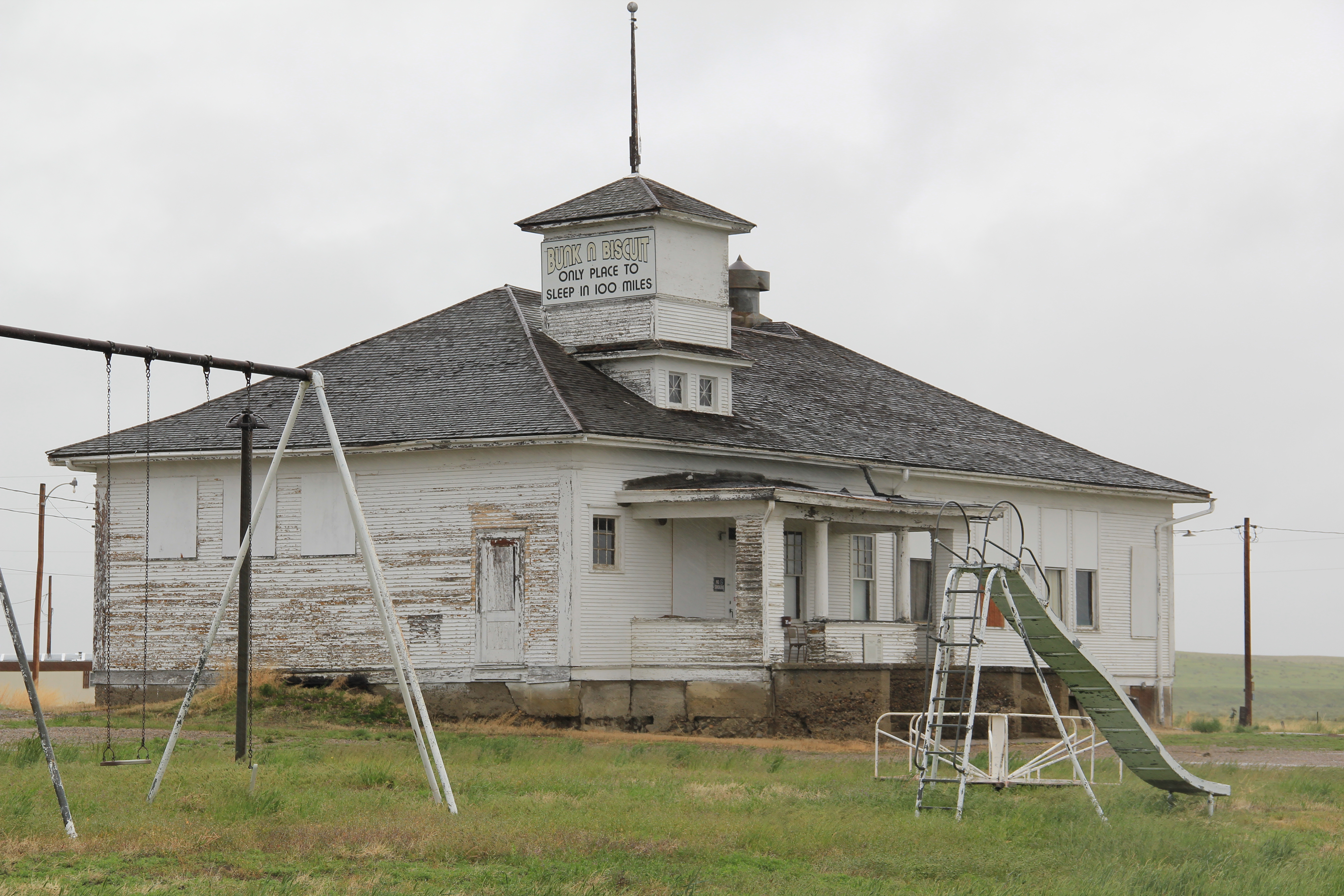
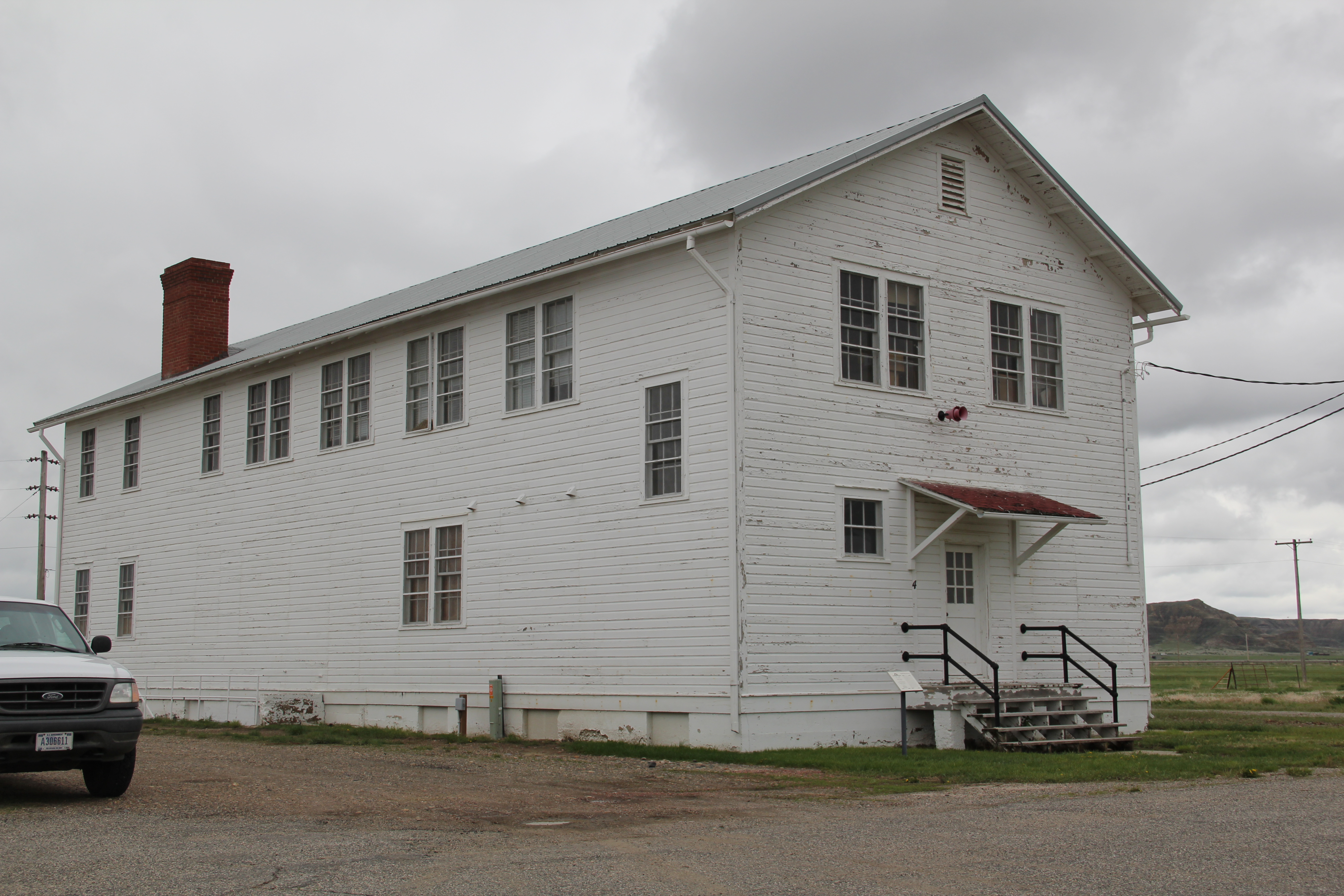
A third Ingomar landmark on the National Register is the public school, which evolved from  a one-room in 1913 to the rambling building you see today, constructed by Neils Hanson of Melstone in 1915.  When I surveyed Ingomar in 1984, the school still operated but closed for good in 1992.  It was converted into a “biscuit and bunk” later that decade.

IMG_0111

Another important historic building is the Milwaukee Road “combination-style” depot, where the passenger and freight service was combined into one building.  Many of these have disappeared along the line since its closure, and too many have disappeared or have been moved since my survey work of 1984-1985.  Ingomar has its depot, converted into a private residence along the now-gone tracks in the 1990s.

IMG_0123

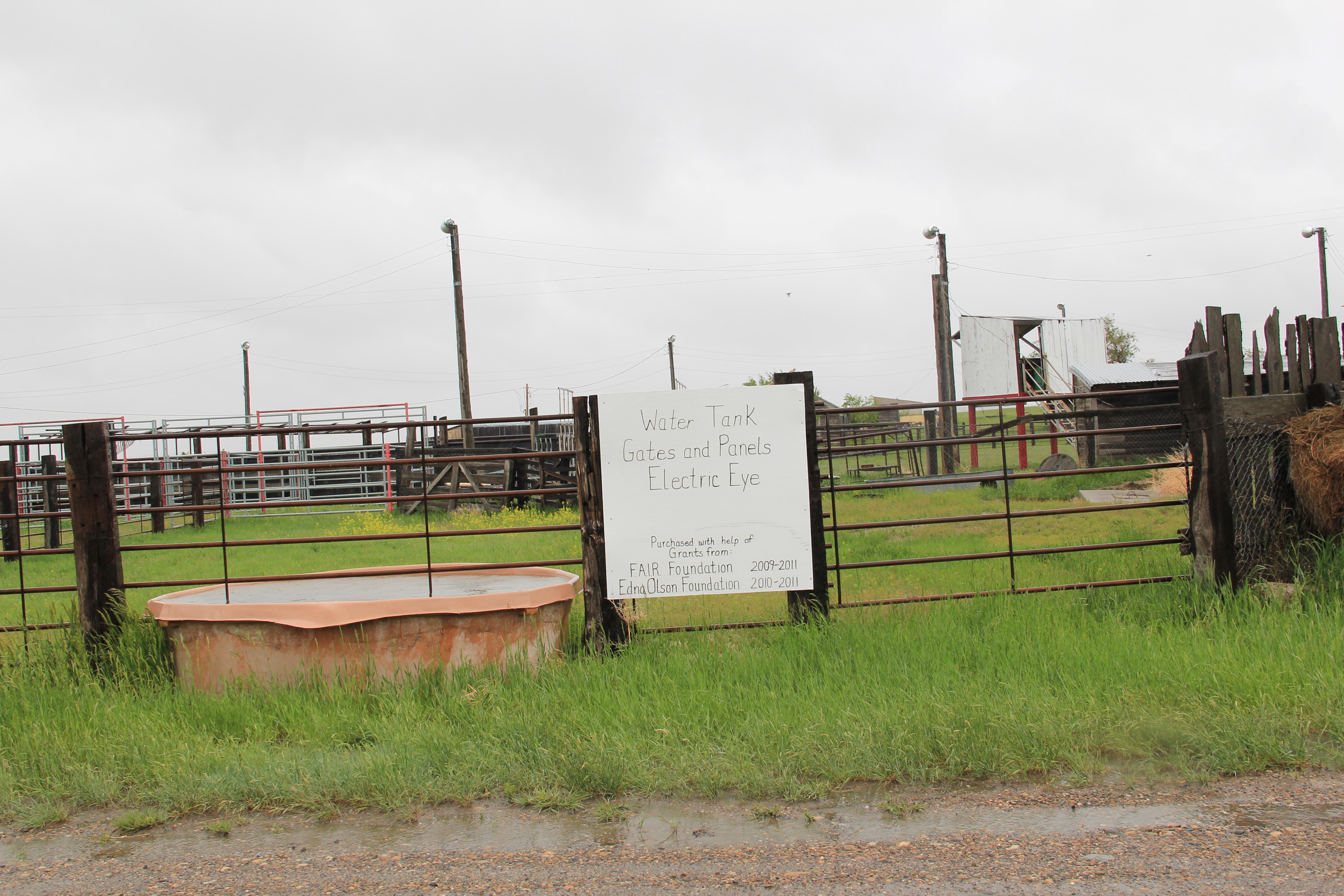
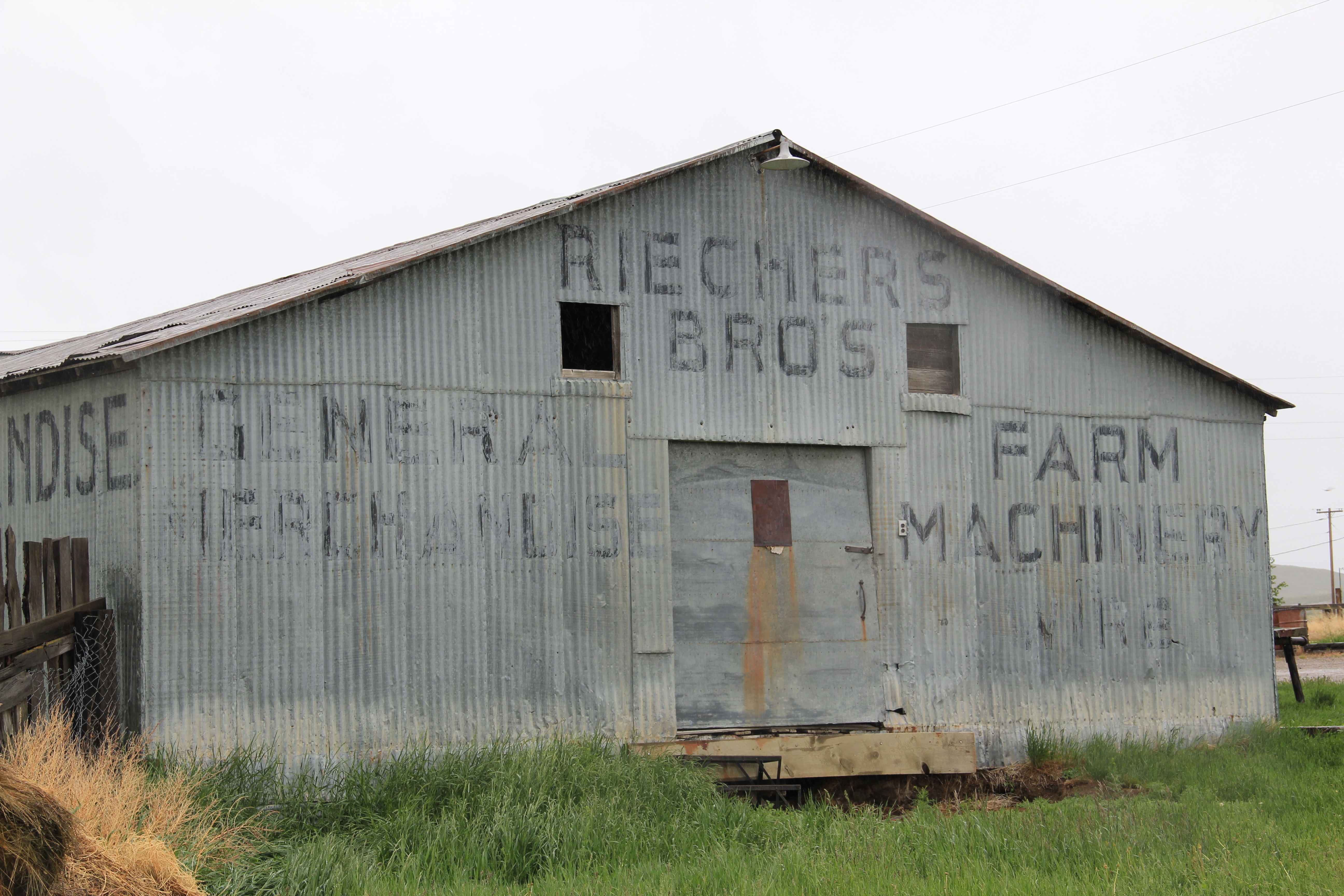
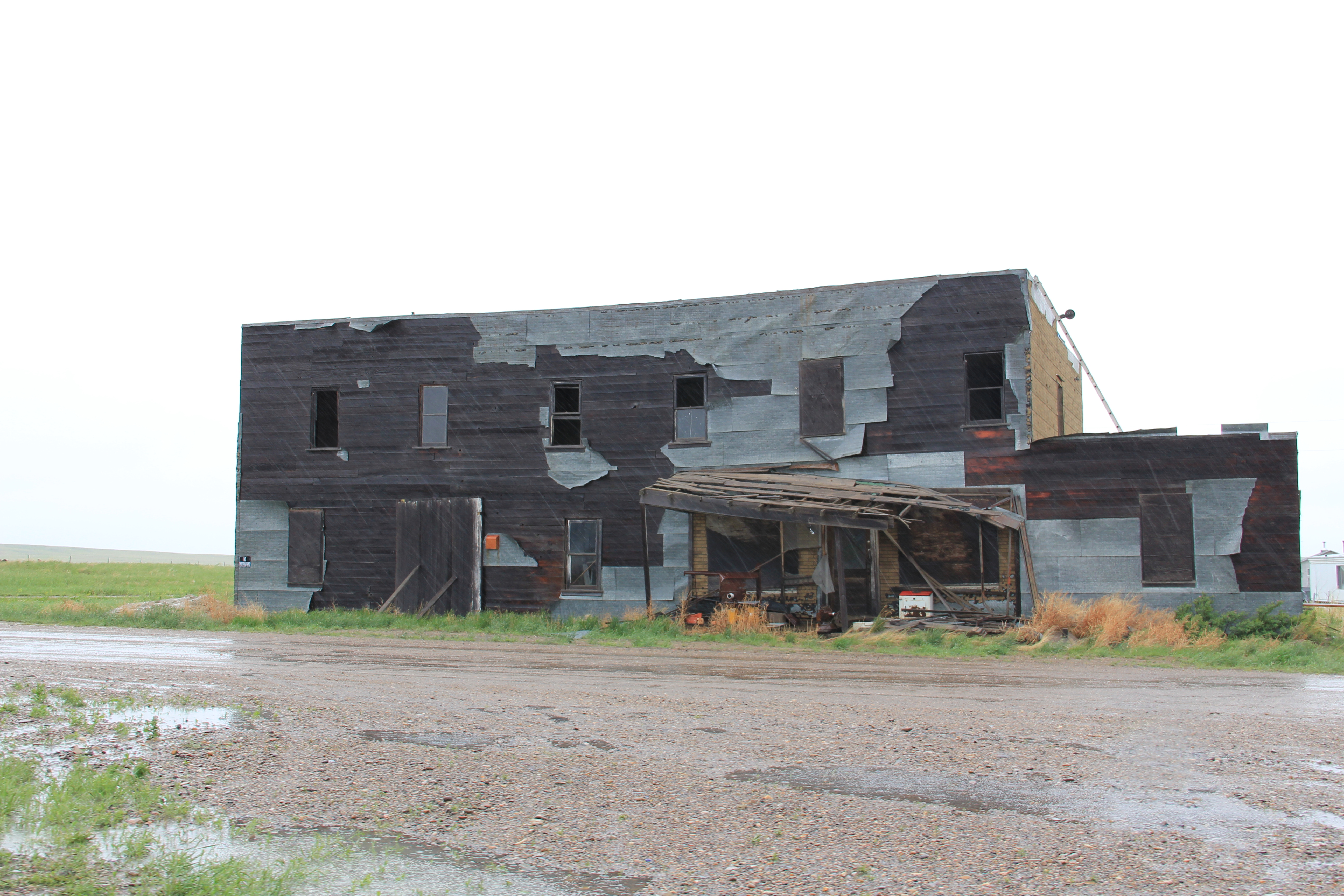
Other historic properties exist, perhaps waiting new futures.  The rodeo grounds stay in use while the Riechers Brothers general merchandise and machinery store building remains standing.  Other structures are barely hanging on.

IMG_0113

IMG_0114

IMG_0109

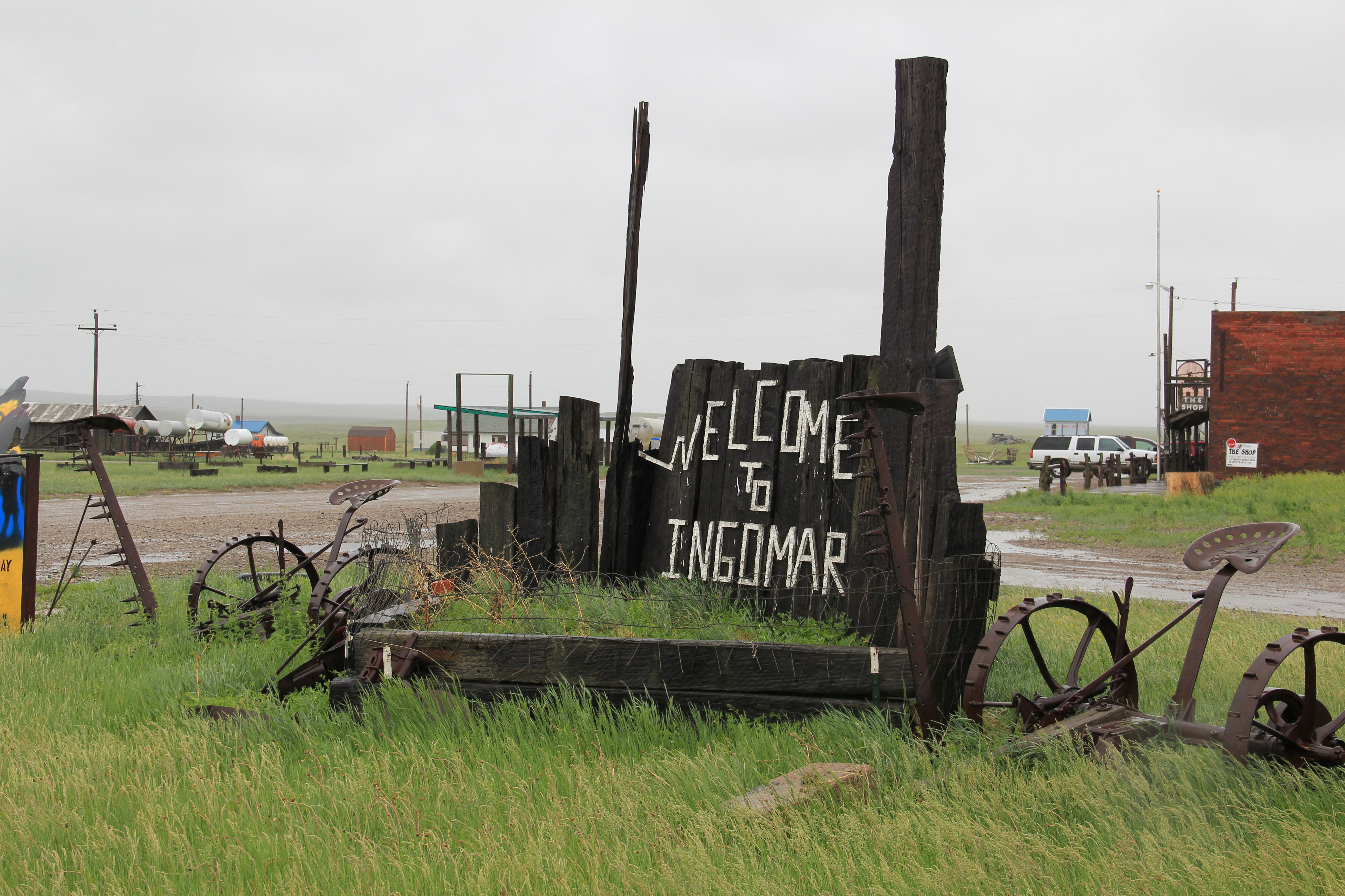
As travel dwindles and population disappears, you worry about the future of Ingomar.  Their signs and their heritage assets beckon visitors daily but will enough even come by to make a difference?

IMG_0108

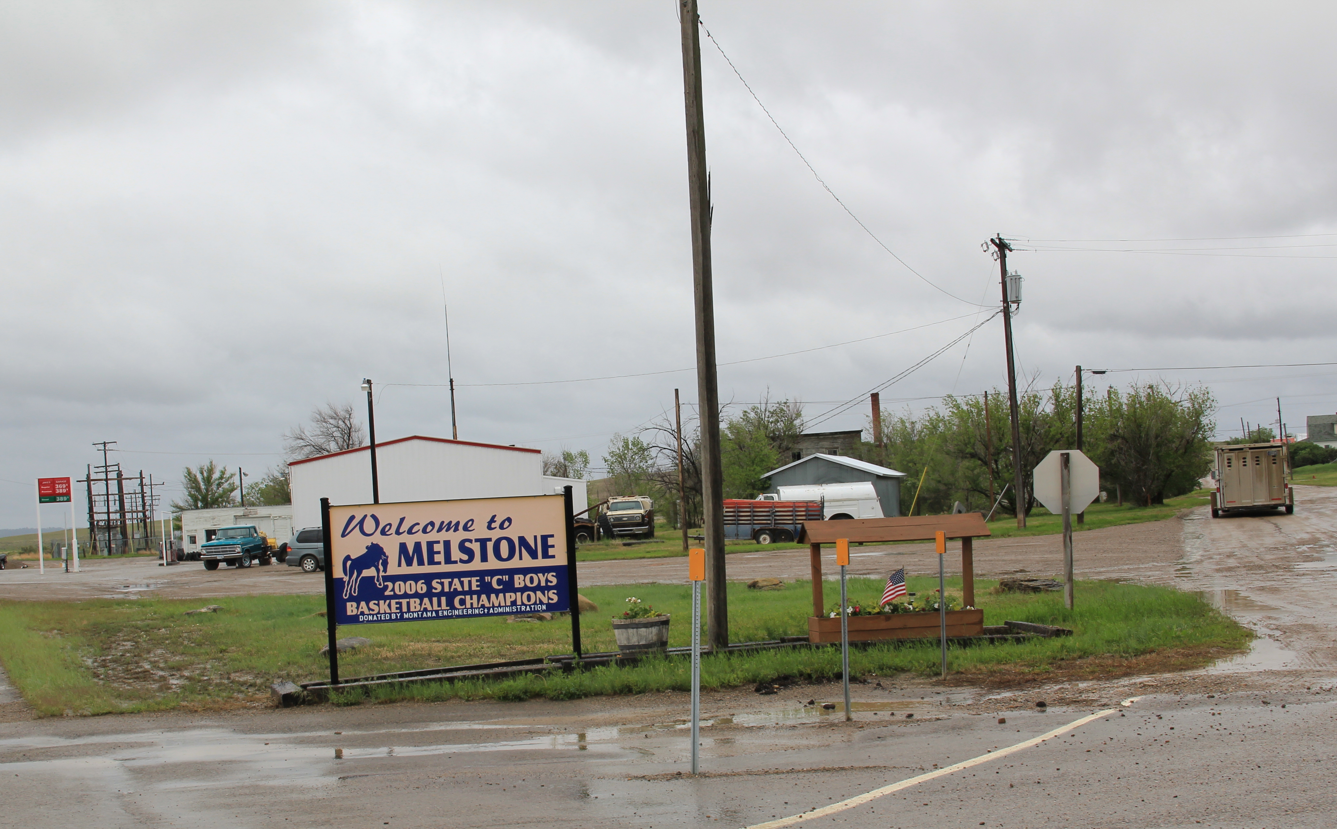
Melstone, just west of where the Milwaukee Road crossed the Musselshell River and entered its valley, is another worrisome case.  Its population has dropped to under 100–almost 150 lost since my visit in 1984.  But it still has its school, which is very much the town’s central institution and point of pride.

IMG_0103

Melstone has lost its signature building, the 1912 Antlers Hotel, located on the town’s most prominent corner between its main street, that leads to the school, and the intersection with U.S. Highway 12.

IMG_4071

Antlers Hotel, Melstone, 1984

The location of the Antlers Hotel is now a grassy spot.

The location of the Antlers Hotel is now a grassy spot.

Melstone has a hardware/general store along with Jakes Garage on the highway and the Melstone Bar and Cafe, another classic roadside stop along u.S. 12.

IMG_0104

IMG_0099

Ingomar and Melstone–I understand to most eyes they are dumps, not worth a look–but in my fieldwork they are interesting and valuable, physical signs of the 20th century determination to make rural settlements work, and despite their losses, they are still here some 100 years later.

Moving and Saving Historic Buildings in the Montana Plains

Created with GIMP

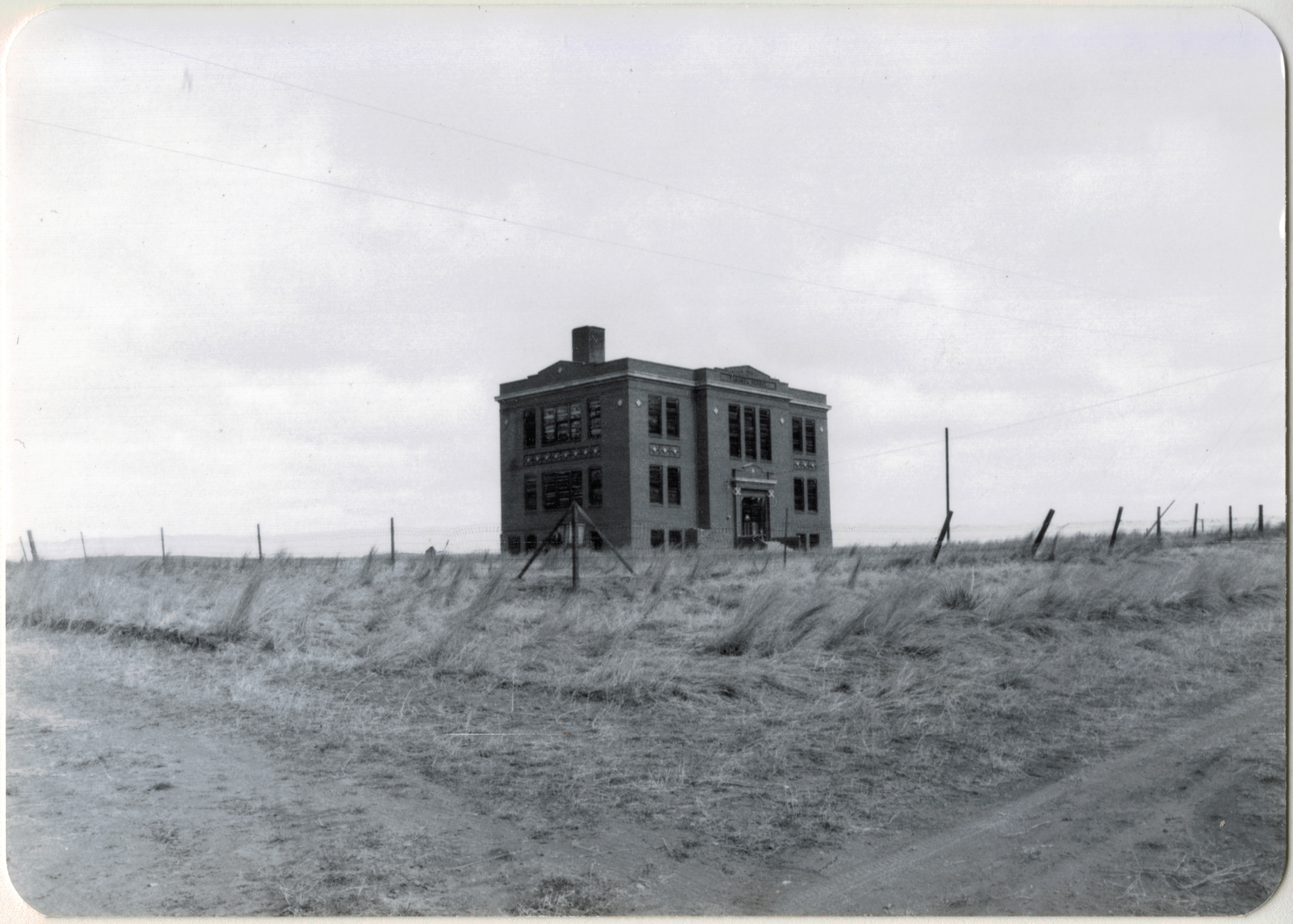
Vananda School, northern Rosebud County. I took this image during the preservation work of 1984.

When I met with residents in Rosebud County in 1984, few places in the county captivated me more than Vananda, one of the county’s Milwaukee Road towns along U.S. Highway 12.  Vananda in 1984 had a few scattered buildings and structures, but two landmarks, a small one-story Classical Revival bank, and the three-story Vananda school. The school in particular spoke to the hopes of the settlers who flooded into the region after the Milwaukee came through in 1907-1908.  In 1917, when Louis Wahl, a Forsyth contractor, built the bank, Vananda like many other homestead towns thought a bright future awaited.  But when the bust came in the 1920s, followed by the Great Depression in the 1930s, people disappeared from here even quicker than they had arrived.

In the years since, I have stopped at Vananda several times, seeing if the buildings still stood as silent sentinels to the homesteading past. The school and the bank survived

Vananda Bank-School Rosebud Co. MT

My favorite image of Vananda, taken in 1998.

the 1990s.  In fact, the Montana State Historic Preservation Office had listed the Vananda historic district in the National Register of Historic Places in 1990, part of a countywide effort to designate local landmarks at that time.

IMG_0130

Vananda historic district, 2013

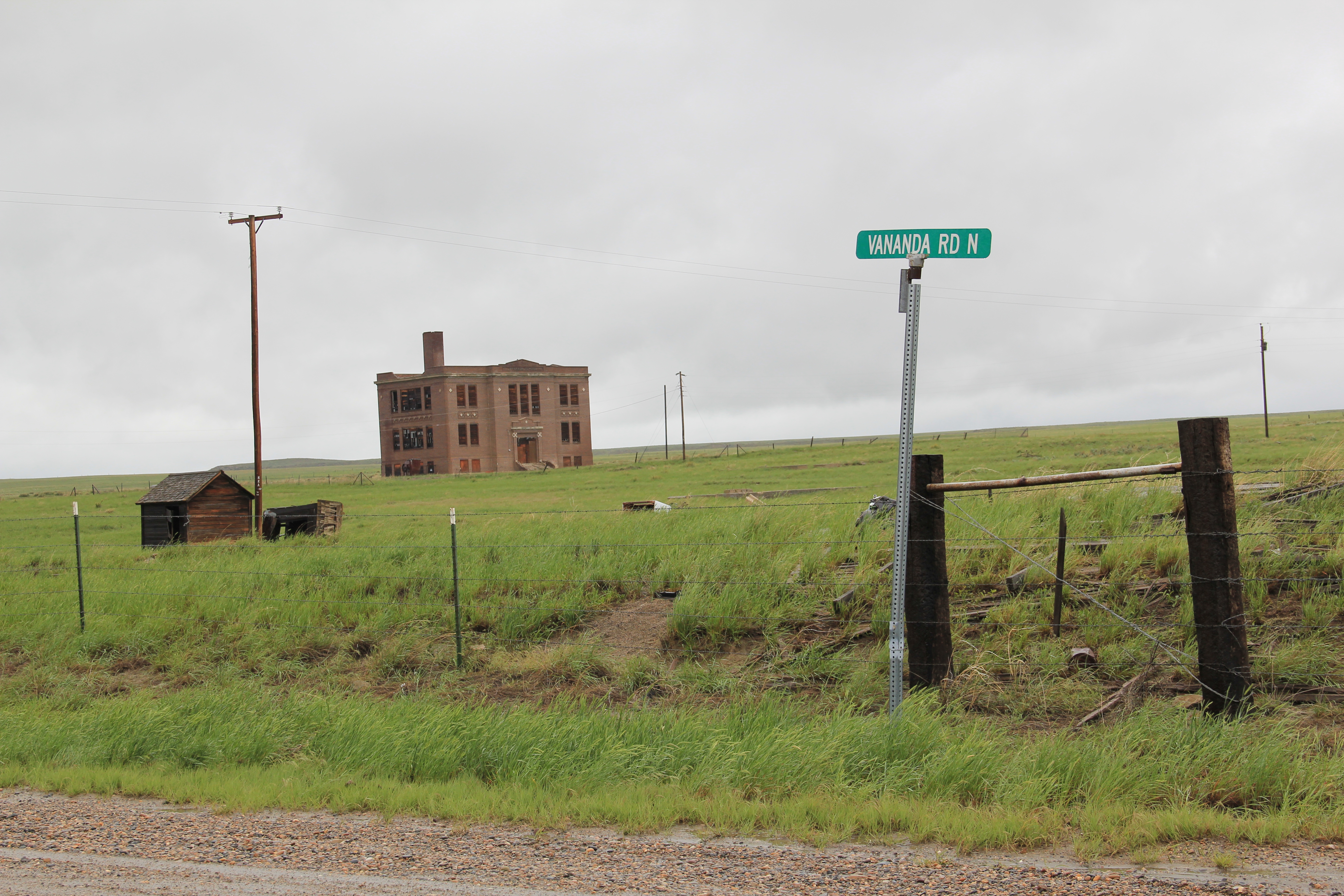
When I next visited Vananda in 2013, fifteen years had passed.  Imagine my disappointment in finding only the school, and it was looking even more worse for the wear.  This was the same year that the National Trust for Historic Preservation listed Montana’s rural schools as one of its most threatened properties in the nation.  One can hope that that designation will eventually bring help and preservation to the school.

IMG_0128

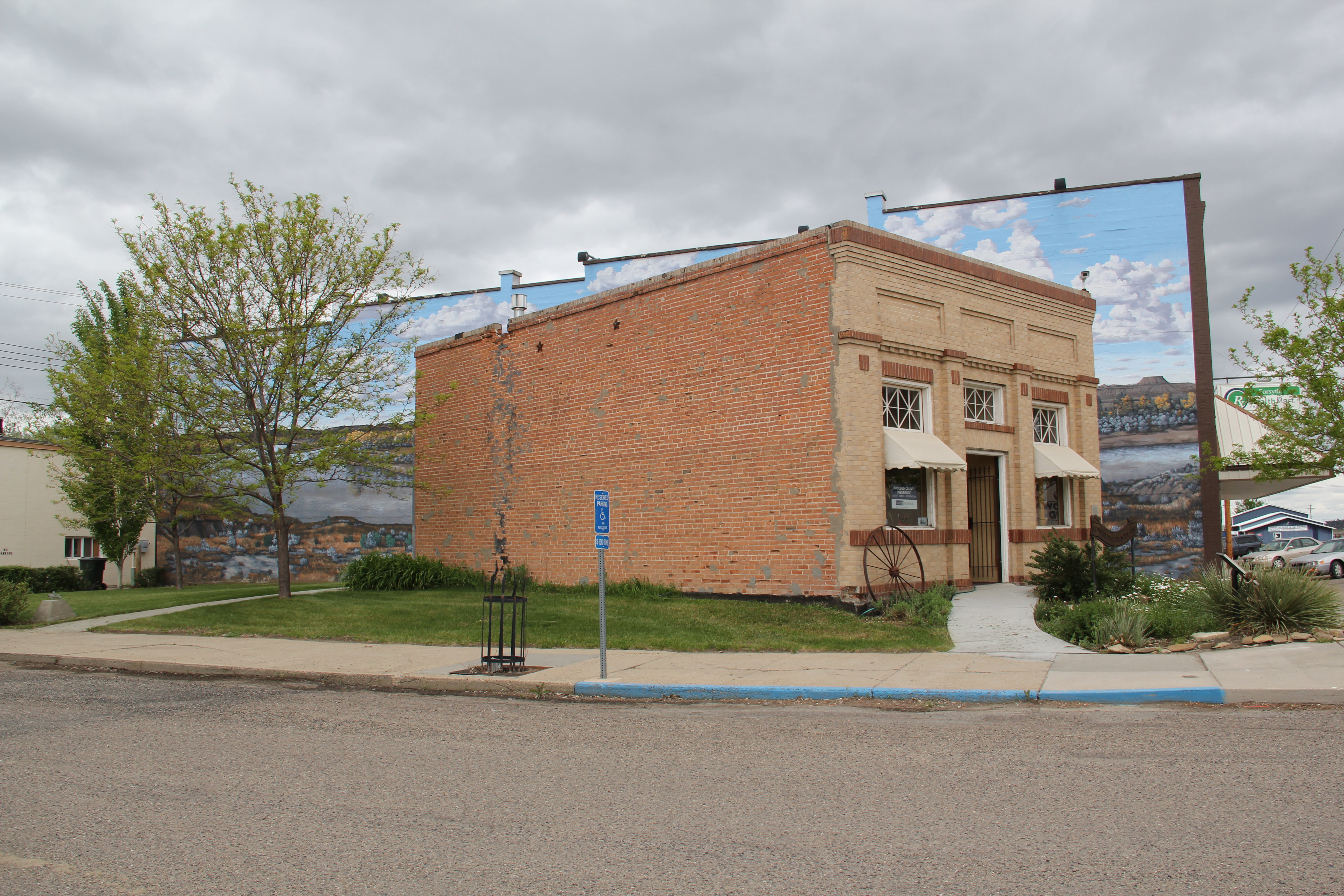
What had happened to the bank?  I found out about 17 miles later when I came into Forsyth, and stopped at something new, at the town’s most prominent crossroads, at Main and 10th Avenue.  It was the Vananda State Bank, moved to that location in 2002-2003.

IMG_6984

The abandoned building was now an insurance building, and an important contributor to town’s historic environment, especially since its corner lot was further enlivened by a mural of the Yellowstone River, “Autumn on the Yellowstone,” by local artist Bob Watts, who has several different murals located throughout town. No. moving the bank to Forsyth and restoring it there, rather than Vananda, is not historic preservation in its purest form.  But it is preservation nonetheless in my opinion.  The historic marker in front of the building tells its story, and there is an active heritage tourism infrastructure in Forsyth, with multiple historic districts, a recently expanded county museum, and a Historic Forsyth walking/driving tour you can download from the Internet.  The bank and the story of Vananda remain active contributors to Rosebud County, fulfilling some of that promise first proclaimed in 1917.

Miles City as a Two-Railroad Town

Northern Pacific Railway depot, c. 1924, Miles City.  It has been listed in the National Register but it needs a preservation hero.

Northern Pacific Railway depot, c. 1924, Miles City. It has been listed in the National Register but it needs a preservation hero.

Miles City has a distinct look and feel due to how historic transportation links have impacted the town. First, certainly, was the Yellowstone River and Tongue River: as discussed in previous posts the military positioned itself here in 1876 because it is where the Tongue River met the Yellowstone. By the end of that decade a rough wagon road connected this place to other early towns along the Yellowstone. Then in 1881-1882 came the tracks of the Northern Pacific Railroad. Soon Main Street boasted new two and three-story brick buildings to signify its arrival as a key transportation crossroads for the northern plains cattle industry.

IMG_7025

Historic stockyards remain a prominent landmark on the west side of Miles City.

Historic stockyards remain a prominent landmark on the west side of Miles City.

The early arrival and commercial dominance of the Northern Pacific left a lasting mark on Miles City.  Main Street, which is listed as a National Register historic district, was the town’s primary commercial artery until the late 20th century.  But so much of the historic built environment you find in Miles City today is due, in large part, to the impact of the arrival of the Chicago, Milwaukee, St. Paul, and Pacific Railroad–better known as the Milwaukee Road–in 1907.

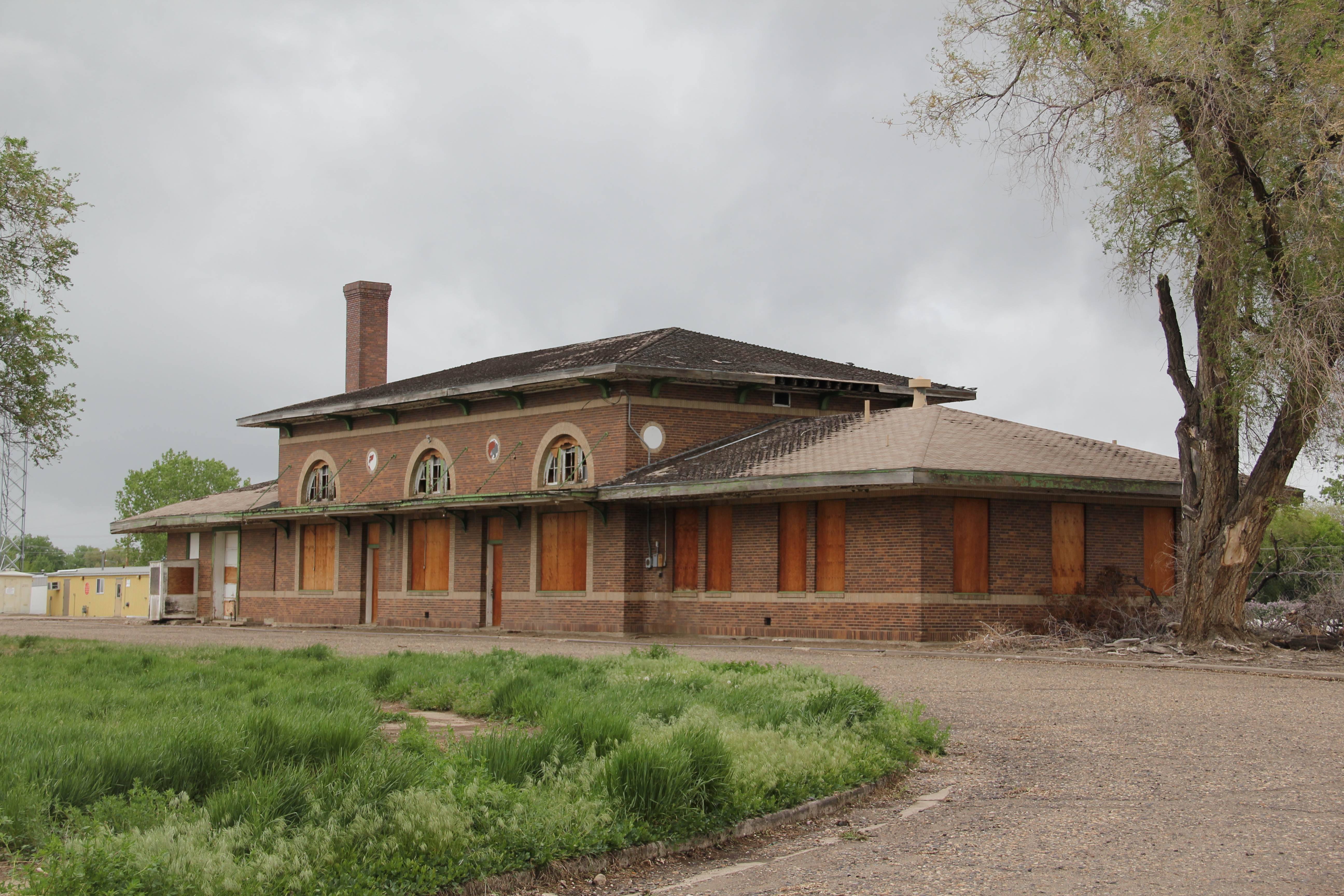
Milwaukee Road Depot, Miles City

Milwaukee Road Depot, Miles City

The Milwaukee Road was the last transcontinental to stretch across Montana. It came into eastern Montana at Baker and angled sharply to the northwest, heading to the Yellowstone Valley, sharing the valley landscape with the dominant Northern Pacific, and typically building its tracks north of those of the Northern Pacific between Terry and Forsyth, where the Milwaukee left the Yellowstone and headed into central Montana.

Milwaukee Road corridor in Miles City

Milwaukee Road corridor in Miles City

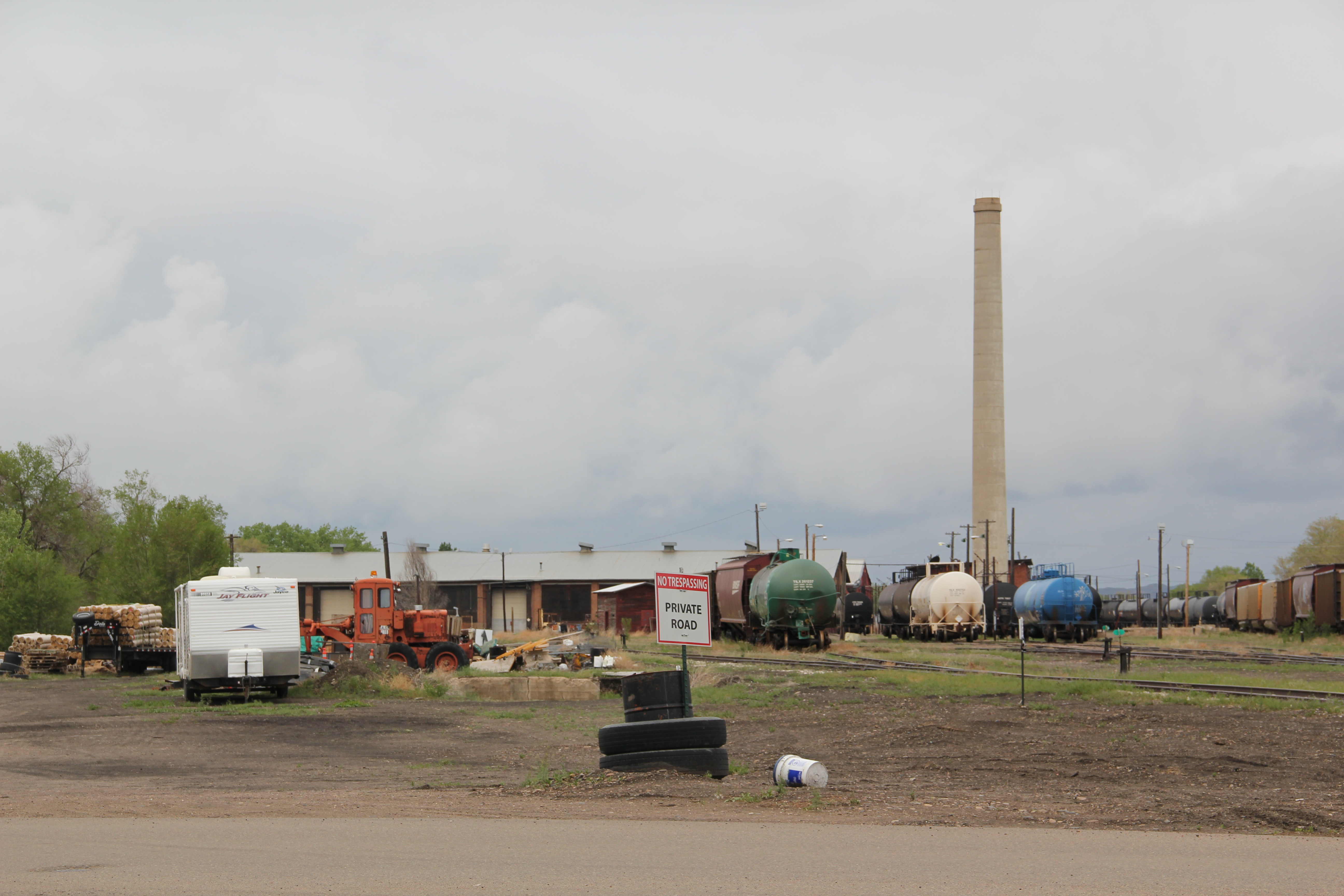
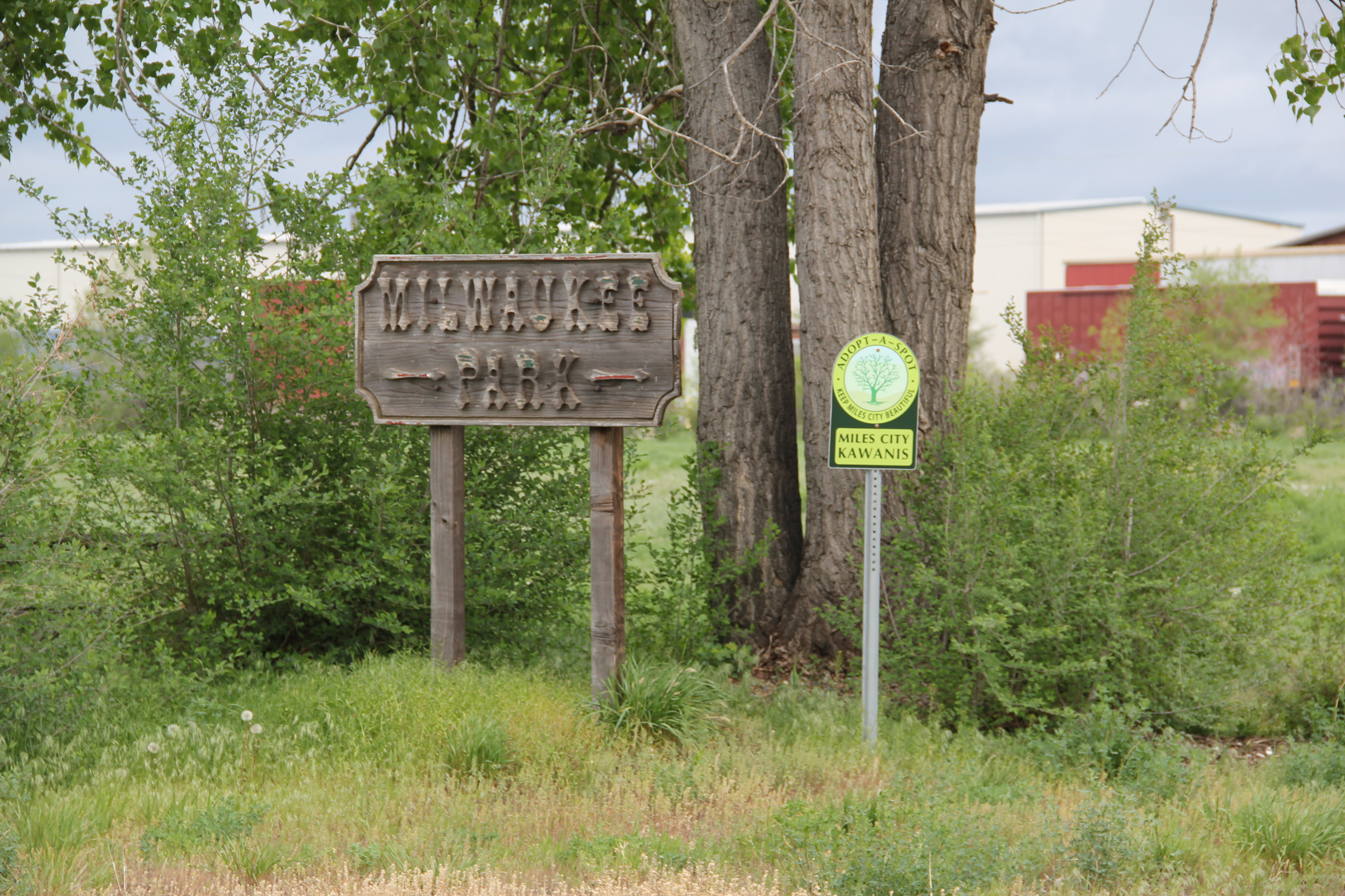
The Milwaukee made Miles City its primary division point for eastern Montana, locating offices, machine shops, and a roundhouse in an entirely new section of the town, northeast of Main Street.  Several of the historic buildings associated with the Milwaukee remain, although there have been many lost buildings in the last 30 years.  One remnant, quite unkempt in 2013 but still in use, was the Milwaukee Park,

Remnants of the Milwaukee Road works, Miles City, 2013

Remnants of the Milwaukee Road works, Miles City, 2013

a parcel of land located between the railroad shops and adjacent working-class neighborhoods.  The park is now a recreation area and playground and provides one of the best ways to look at these historic railroad buildings today.

IMG_7060

IMG_7061

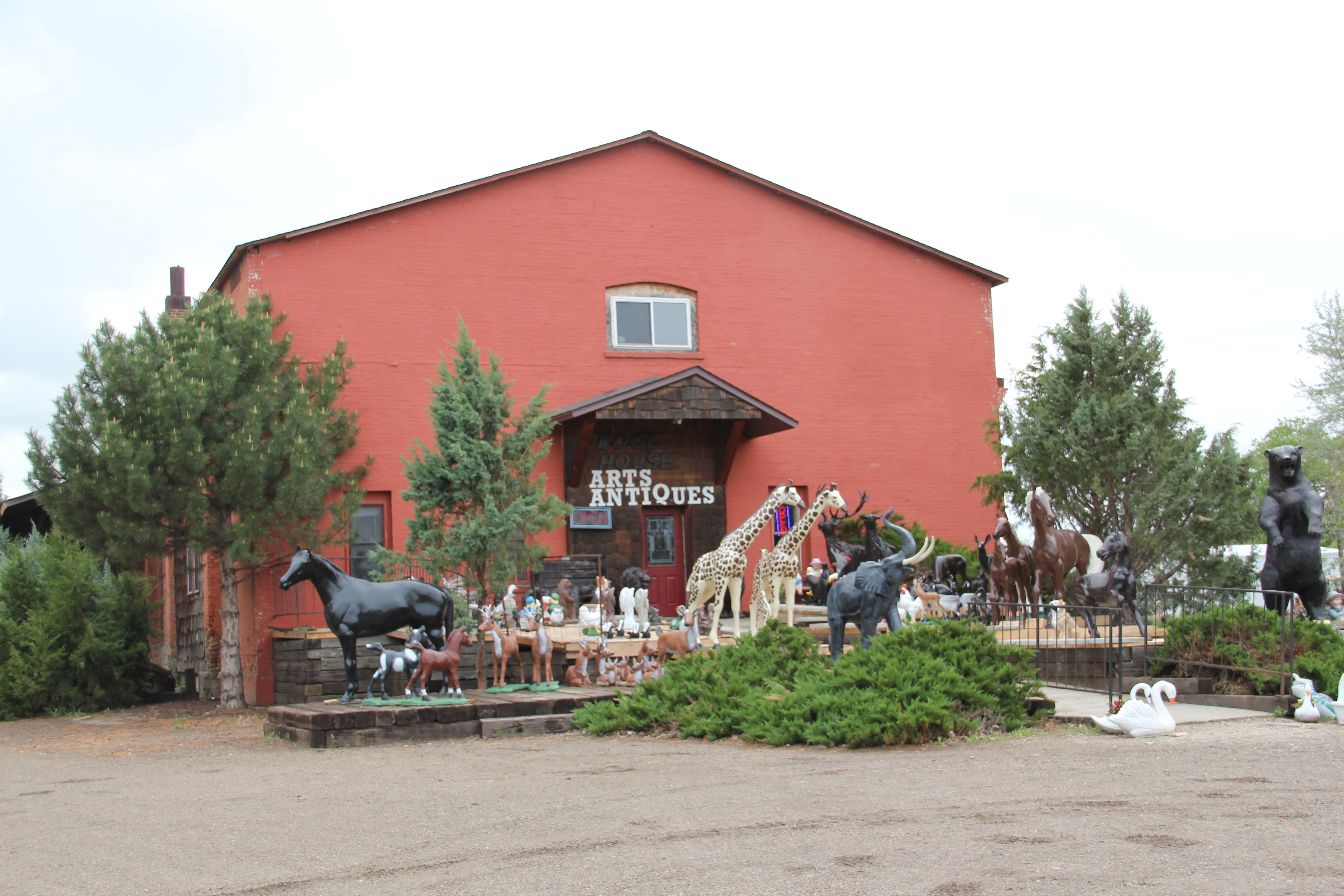
The Milwaukee Road combined with the homesteading boom of the 1910s to spur new construction and investment as nothing else had, either before or since.  Some of the new landmarks were unassuming, such as the Wool Warehouse, built just west of the depot, and now converted into a successful Arts and Antiques business.

IMG_7053

Many others were much more purposeful statements of growth, and the promise of prosperity.  The 1914 City Hall, which is listed in the National Register, gave Miles City not only modern civic space but made an architectural statement that the town was no longer just a cow-puncher’s place.

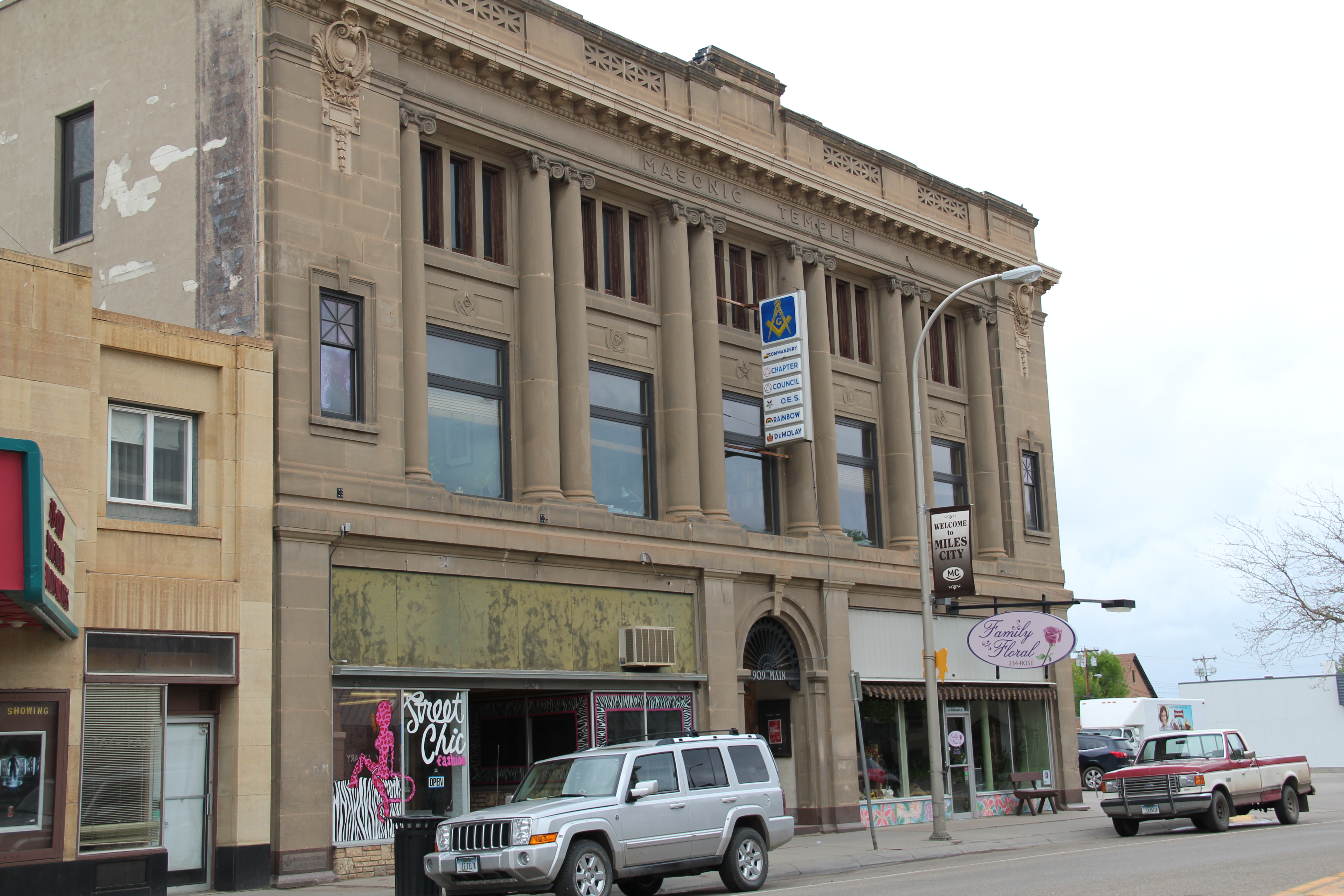
IMG_7040Downtown received new buildings, and an architectural upgrade, with such imposing edifices as the Professional Building (c. 1910) and the Masonic Temple.

IMG_7035

IMG_7080

The arrival of the Milwaukee Road, and the thousands of homesteaders in the following decade, charted a new course for Miles City, evident in the new facades of Main Street but perhaps best shown in the new neighborhoods, churches, and schools that redefined the city in the 1910s and into the 1920s.  Those places will be our next post.

Miles City’s first steps in preservation, 1984

When I next returned to Miles City in March 1984, I found a town much interested in the promise of historic preservation.  At that time, the town and Custer County as a whole only had three properties listed in the National Register of Historic Places:  Fort Keogh, a steam laundry building (since demolished), and the city waterworks along the Yellowstone river.

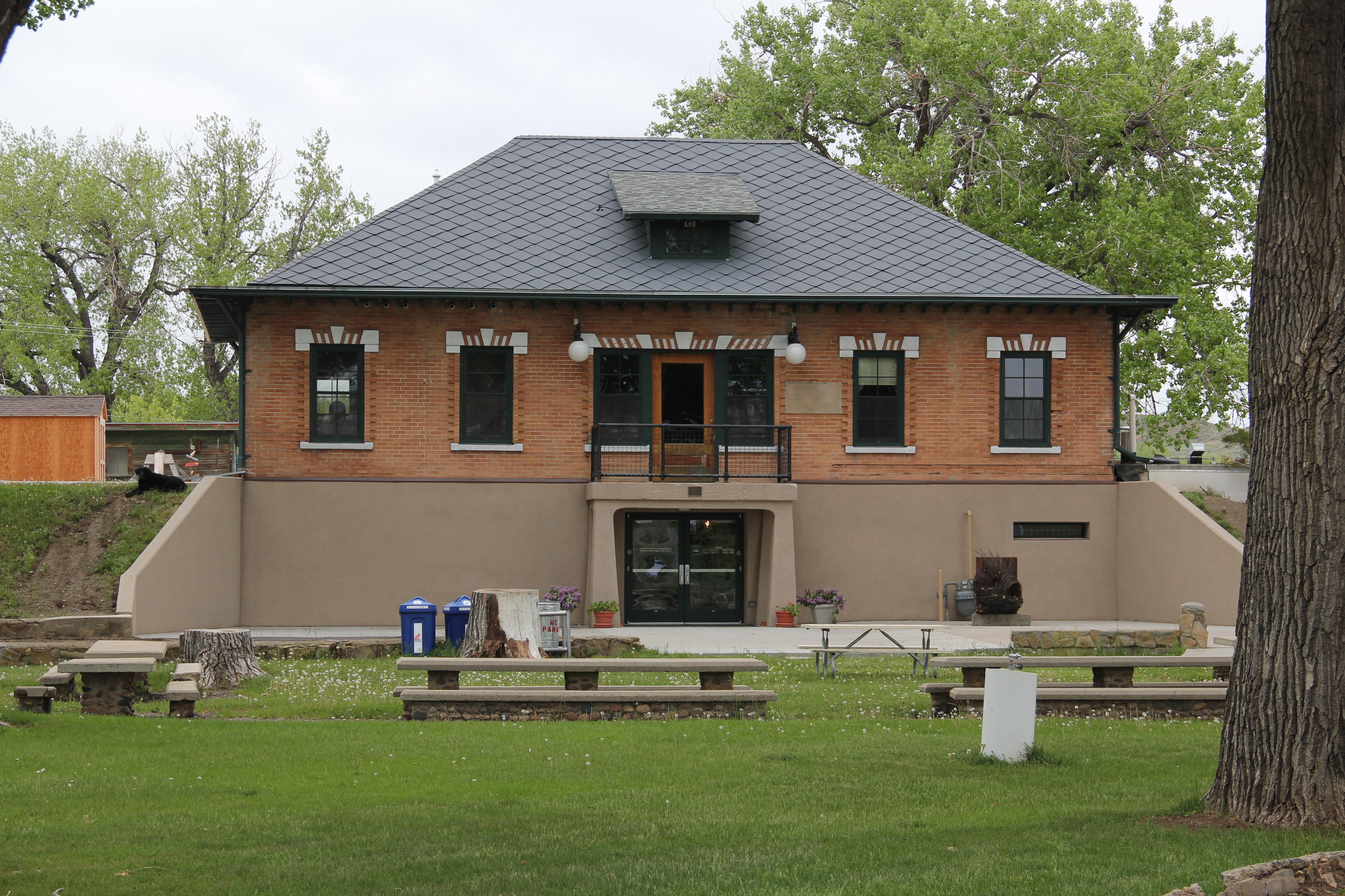
Miles City Water Treatment Plant, c. 1911

Miles City Water Treatment Plant, c. 1911

This local landmark, which had been converted into the Custer County Arts and Heritage Center, came out of Miles City’s golden decade of the 1910s when the town boomed following the arrival of the Milwaukee Road, the railroad’s decision to turn the town into a division point, and the potential of new business brought about by the arrival of thousands of homesteaders either on the Milwaukee line or the earlier Northern Pacific Railroad, which had done so much to establish and develop the town from 1882 forward.

IMG_7017

The Pumping Station park at the waterworks dates to 1939, another public project of the New Deal which did so much to transform the town and county.

The public meeting for the preservation plan took place at the waterworks, organized by the director of the Custer County Arts and Heritage Center (now known as Waterworks Art Museum).  It was a lively and interested crowd, like me concerned about the fate of Fort Keogh and its rapidly disappearing historic buildings and what still remained in town of its railroad era of 1882 to 1932.

IMG_7000

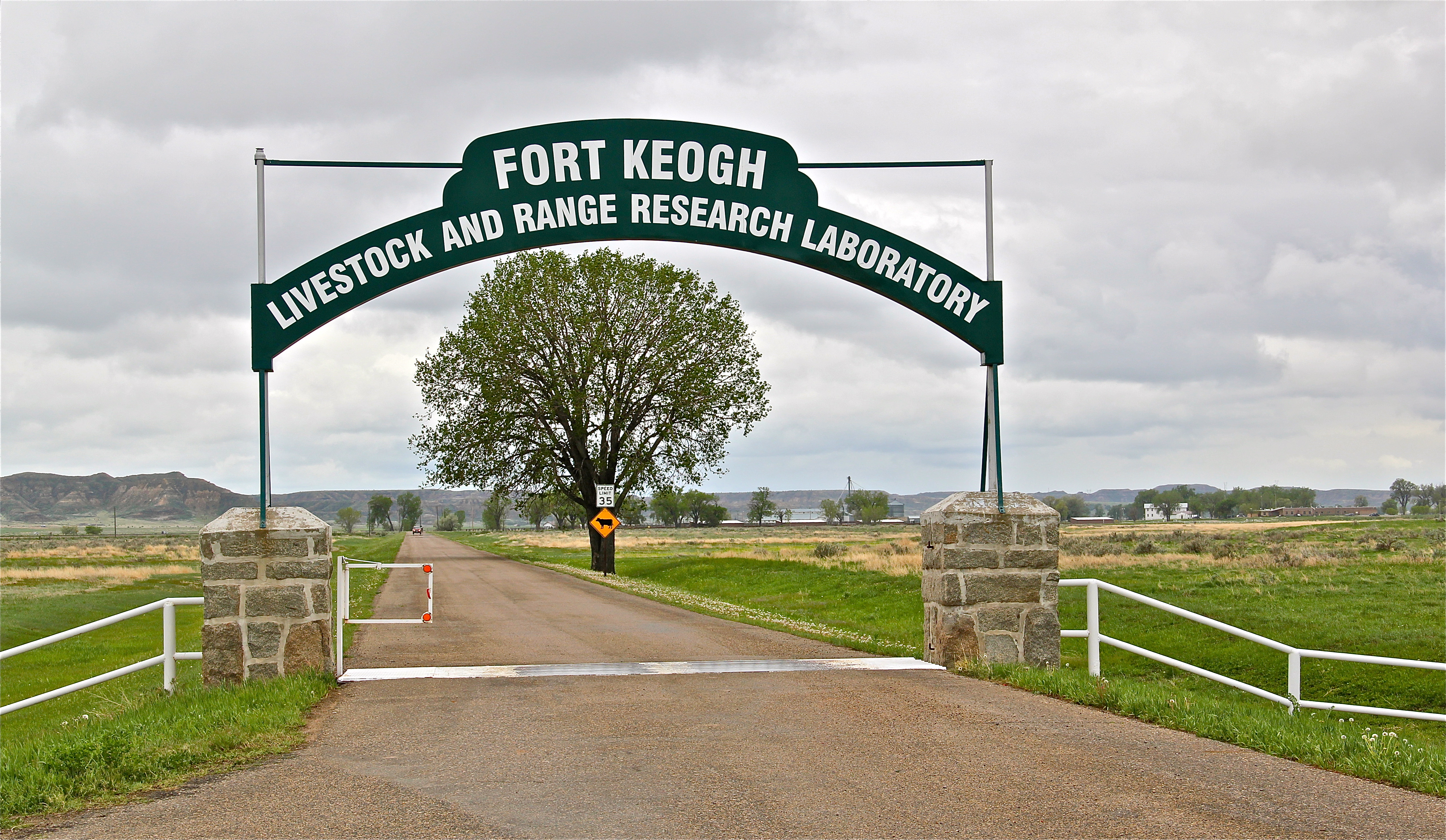
The fort property had been accidentally preserved for decades, ever since its conversion into an agricultural experiment station in the 1920s.  But preserving what had been left was not a priority of the agricultural reformers (who, to be fair, were never awash in funding).

IMG_7003

The tall metal flag pole marks the old parade grounds at Fort Keogh.

In 1984, one officer quarters still remained on the property, in poor repair.  It has been moved a few miles down the highway and restored at the Range Riders Museum.

Photo taken from Range Riders Museum website

Photo taken from Range Riders Museum website

One historic c. 1920 mess hall, from the fort’s remount era, also remains, and is the post’s most noticeable landmark.  But one brick water wagon shed from 1883 still exists (it was converted into a truck garage in the 1930s) as well as another New Deal building, a massive horse barn from 1934.

IMG_7001

The mess hall, c. 1920, at Fort Keogh

The group that night at the waterworks emphasized that they knew more needed to be done, and over the next generation, town residents have done impressive work, especially considering that the town’s population has been in decline, from about 9600 in 1980 to 8400 in 2010.  The arts center no doubt showed significant leadership:  how a historic building could be converted into new community uses.  But one ringleader also introduced himself to me that evening–Dave Rivenes.  Dave and Ella Rivenes were community institutions as owners/operators of the local television station, representing the smallest television market in the entire United States.

Miles City Dave and Ella Rivenes

As soon as the meeting was over, Dave convinced me to come to his house, and go on the air, discussing for the local audience what had happened that night.  He and Ella then put me on the morning show.  Not having any experience before with live television, I hope that I sounded somewhat with it–it was a surreal experience.  But the pride in the town and the appreciation for the past that I gained from Dave and Ella Rivenes left a lasting mark.  I came to understand that when residents embrace their past, and you help them in that quest, good things for history and preservation can happen.  That is apparent in what Miles City has accomplished in historic preservation over the last 30 years–the subject of my next several posts.

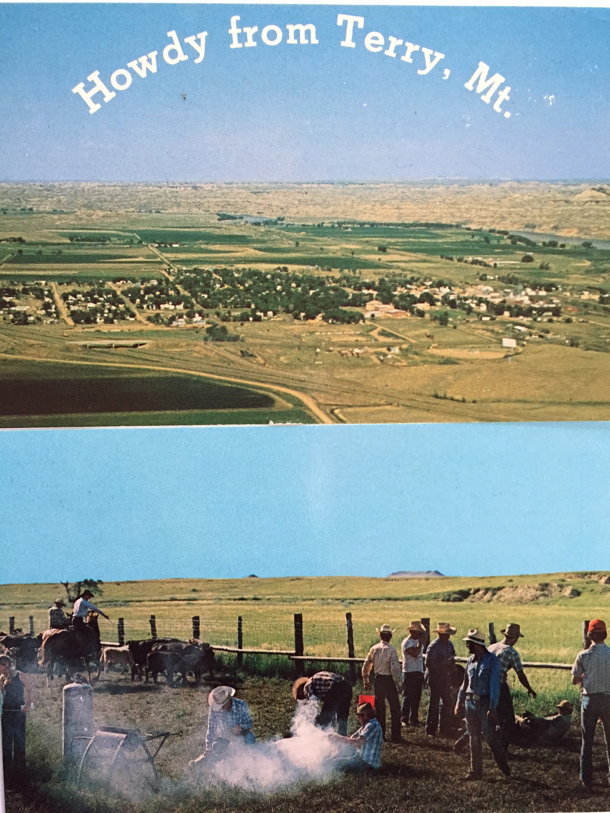
Howdy from Terry!

Terry overview
Terry, the seat of Prairie County, has long been one of my favorite places in the Yellowstone Valley. Stuck between the much larger, and more famed, Yellowstone towns of Miles City (to the west) and Glendive (to the east), Terry has somehow developed and kept its own identity as a western place, and landscape, that still speaks strongly to the patterns that transformed the region over the last 150 years: railroads, homesteading, cattle, and town building.
IMG_4047
In 1984 I focused on the railroad imprint on the town, which began in the early 1880s as Northern Pacific officials understood the need for a railroad stop at place near the confluence between the Yellowstone and Powder rivers.
IMG_7154
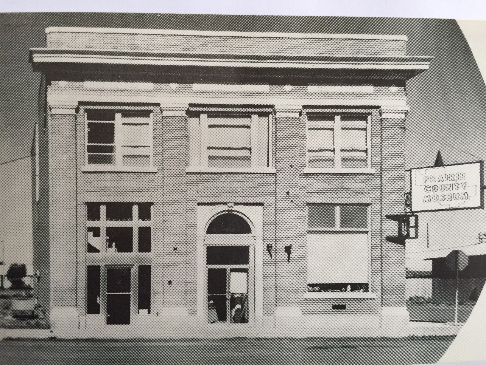
In 2013, however, the depot was gone from the tracks but not the town. It had been moved to become part of the solid Prairie County Museum, a local institution that was still quite new when I first visited in 1984. Located in the town’s most prominent neoclassical bank building from the 1910s, the museum was a place where I held a public meeting about the preservation plan process and found a community totally engaged with its past.
Terry bank
IMG_7141
The museum highlights agriculture and ranching, and includes the Evelyn Cameron Gallery, which displays and celebrates the life and contributions of this important western photographer. One change I noted last year was the creation of the Evelyn Cameron Heritage Center, on Laudre Avenue just a few yards away from the museum, which is at the crossroads of Laudre and Logan Avenues.
IMG_7182
That crossroads was another pattern in Terry’s landscape that caught my eye. Most Northern Pacific towns, originally, were symmetrical plans, with a long line of commercial buildings flanking one side of the tracks and grain elevators and warehouses on the other side. Terry, however, had a classic T-town plan, with the tracks creating the top of the T and then a main commercial artery, in this case Logan Avenue, serving as the stem of the “T.”
IMG_7147
Why was Terry different? It is the impact of the Milwaukee Road as it built through the valley in 1906-1907. In 1984 there was still a second set of tracks, and a few scattered commercial buildings, to the north of the Northern Pacific mainline. Today two buildings remain along with the roadbed that marks this second period of Terry’s growth.
IMG_7144
IMG_7143
IMG_7133
Just west of the “downtown” you can find the one still thriving institution associated with the Milwaukee Road impact on Terry: the Prairie County Fairgrounds, which once faced the Milwaukee’s main line. (I have discussed the fairgrounds in an earlier post.)
IMG_7138
Another wave of change came to Terry in the 1920s as U.S. Highway 10 gave the town another transportation pattern. The highway’s crossroads with the original T-plan commercial artery is marked by a still extant somewhat Art Deco-styled brick gas station/ auto dealership.
IMG_7178
The most recognized roadside landmark is the Kempton Hotel, a true rarity now for this section of the Yellowstone Valley as those rambling montage of buildings that once constituted places of rest and relaxation along the nation’s highways have largely disappeared from the landscape.
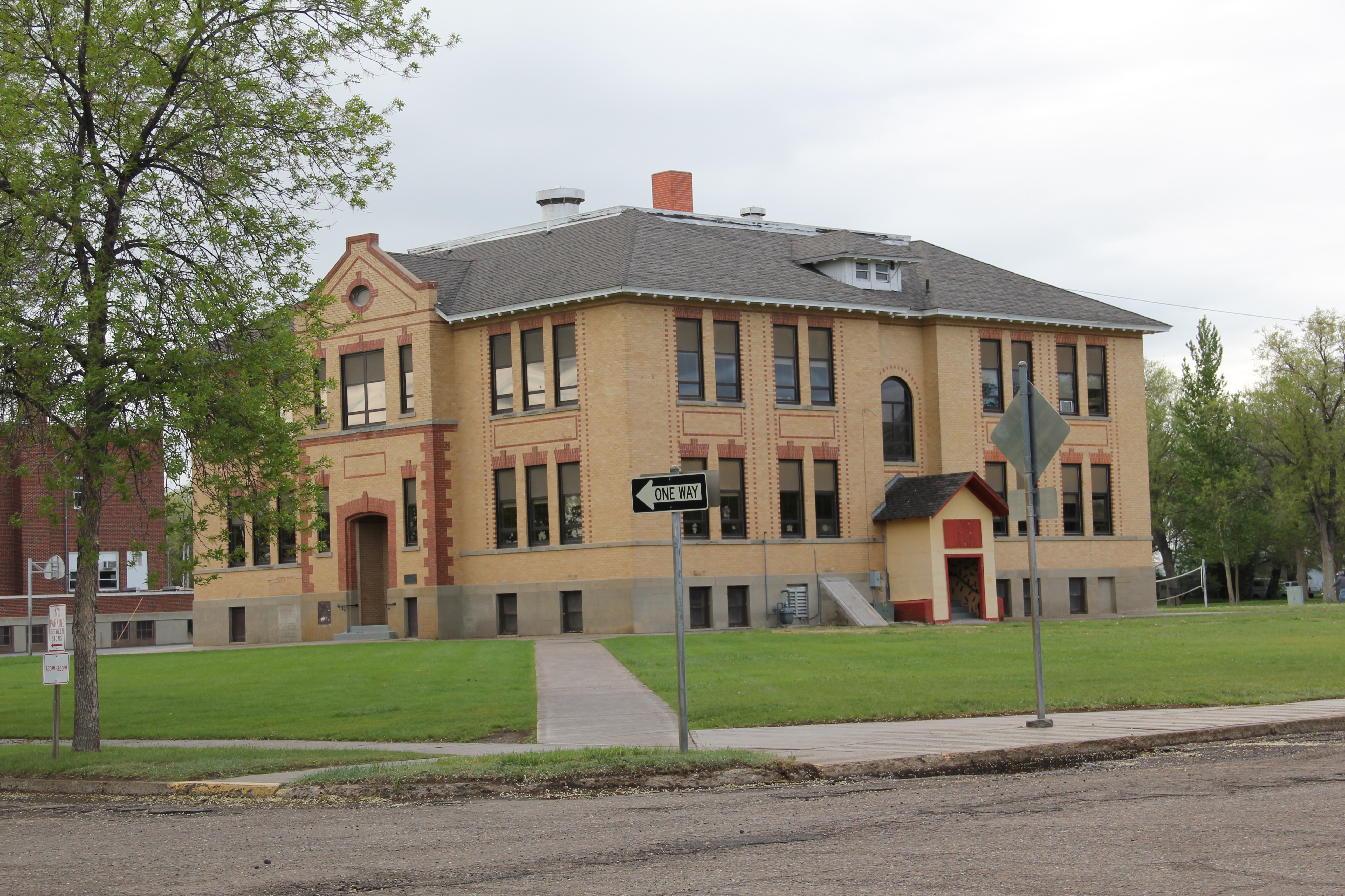
Then, just yards away, is another rambling montage of historic buildings, the schools of Prairie County, ranging from the large stately multi-story brick buildings of the early 20th century to more restrained modern buildings of the second half of the century.
IMG_7168
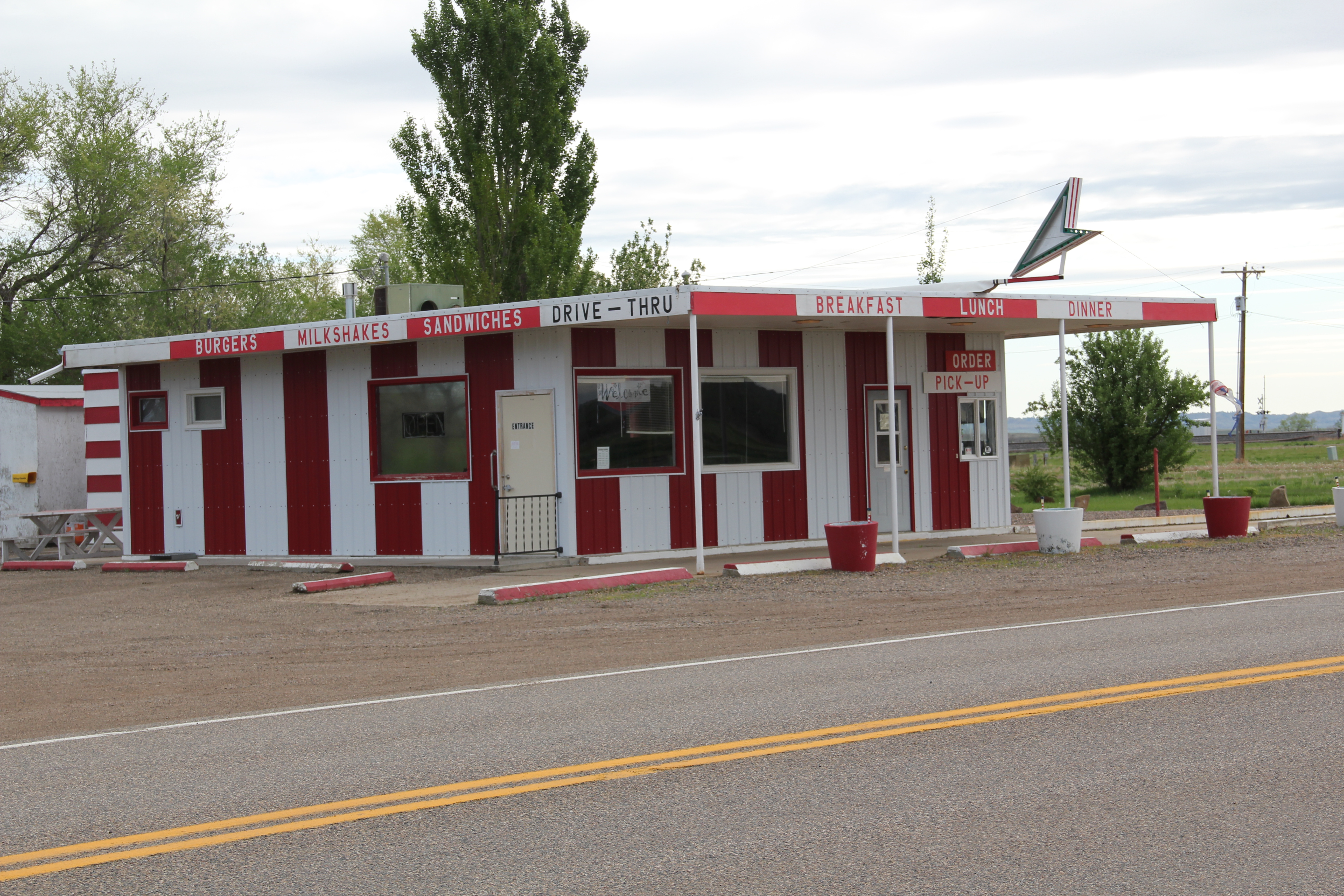
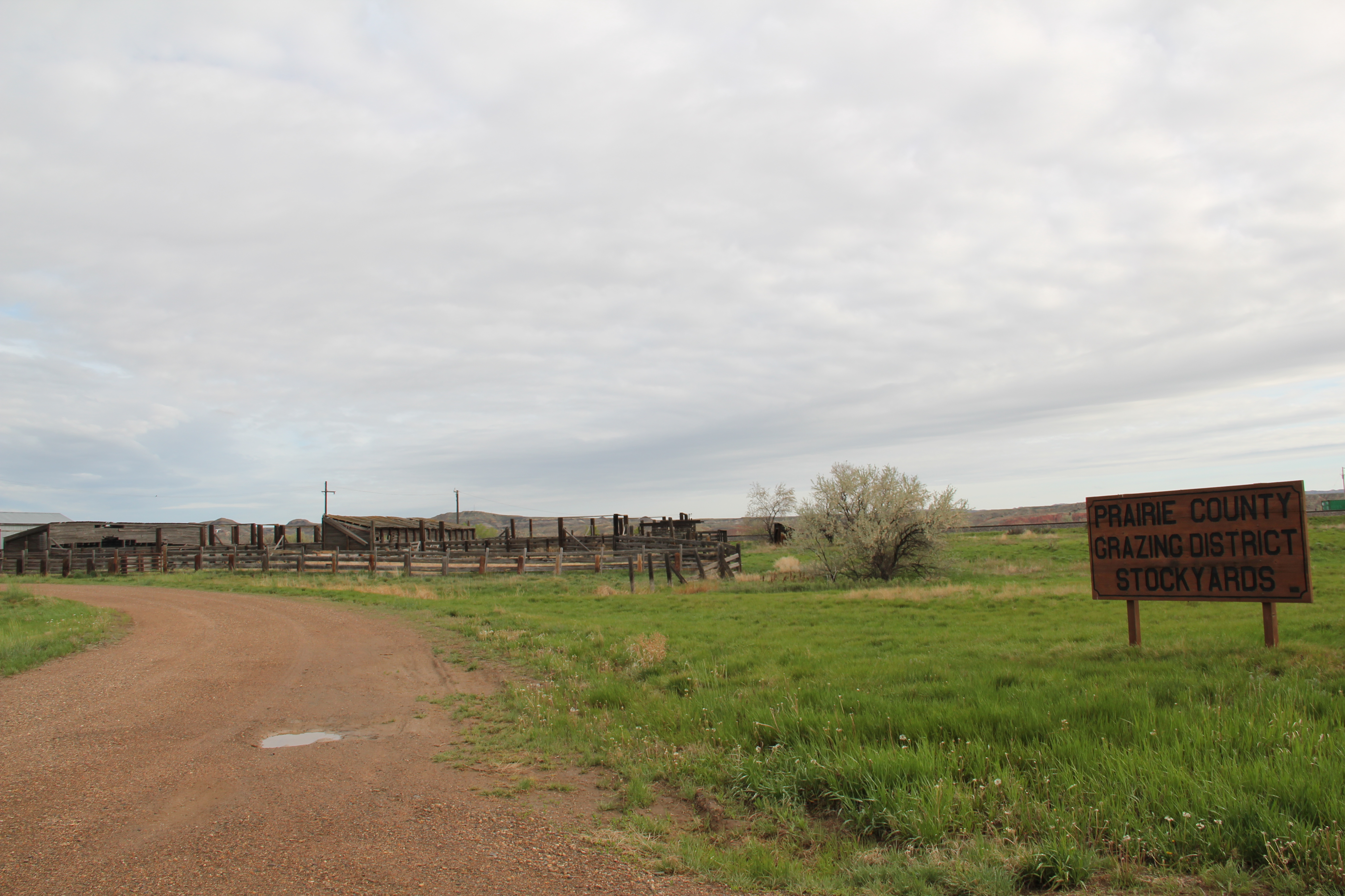
At the edge of town are three different properties, all related to the need for highway transportation. The Dizzy Diner is a classic 1950s drive-in while the crumbling Terry drive-in also speaks to past patterns in popular culture. Then the Prairie County Grazing District Stockyards connects the present to the past traditions of stock raising in this region.
IMG_7187
IMG_7191
IMG_7189
Certainly the biggest change is Terry from 1984 and 2013 was the transformation of the county courthouse. In 1984 I was shocked that there was only an unadorned concrete block building for the courthouse, and I have shared images of that building across the country. Well the concrete block building on Logan Avenue is gone, replaced by a much larger, still unadorned building for local government.
IMG_7174
IMG_7175
Terry’s population has dropped by a third since my first encounter with the town in the early 1980s. But new public investment, and a still commercially relevant “downtown” speaks volumes to the residents’ commitment and faith in this small yet significant Yellowstone valley town.

Square Butte and a spring storm

Image


One of my favorite Central Montana landmarks and small railroad towns is Square Butte.  Once served by the Milwaukee Road, few travelers find the town today.  Yet several key landmarks remain–the historic late 19th century stone jail is listed in the National Register of Historic Places.  

Image


There is a historic brick school building, a bit worse for wear but still a key survivor that marks the height of the homesteading boom in the county.  

Image


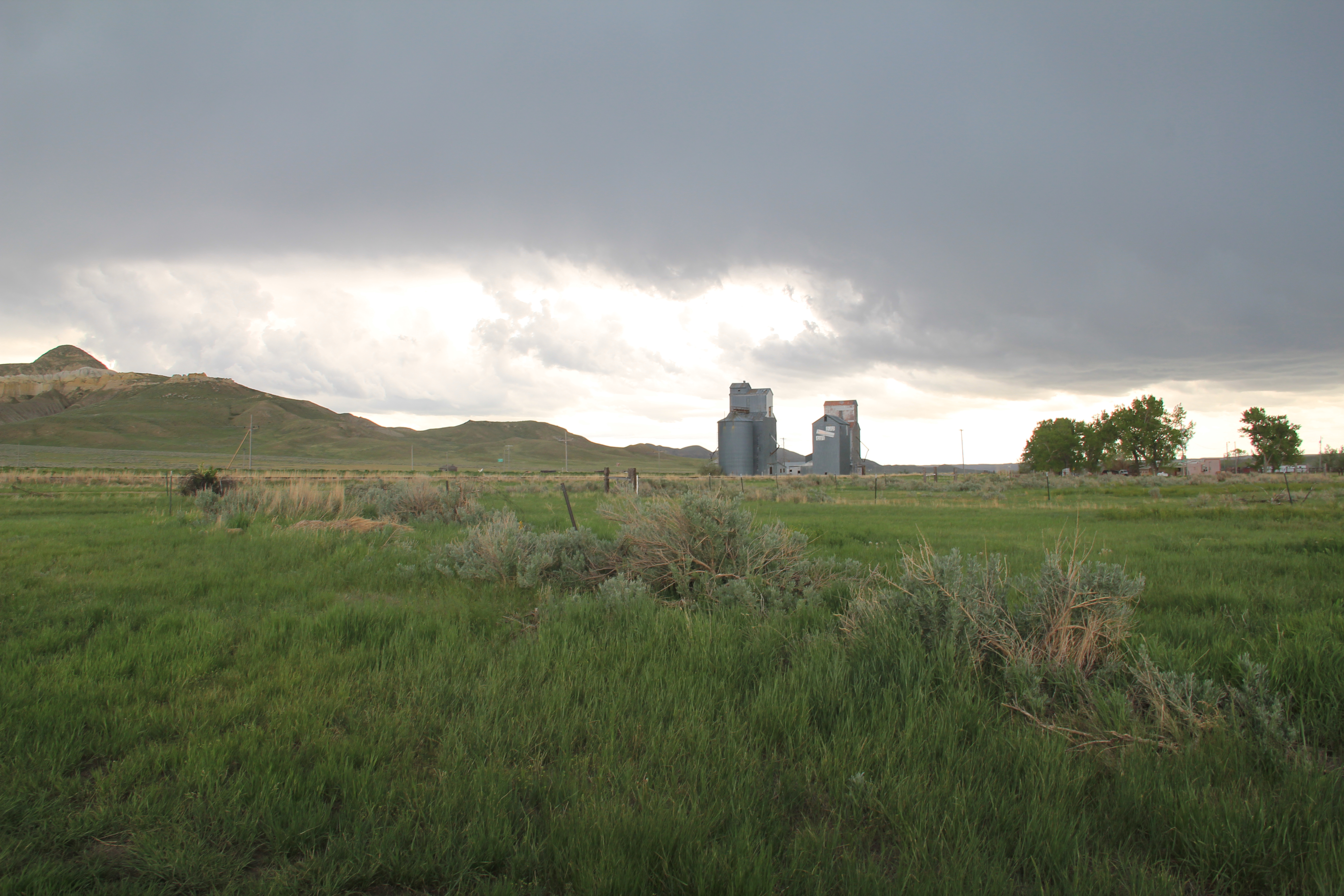
But my favorite resources are the elevators along the railroad corridor–still standing tall, although in that stormy day–I made it through a pretty strong hail storm about 10 minutes after the photo–the elevators perhaps look dramatic than normal.

Image

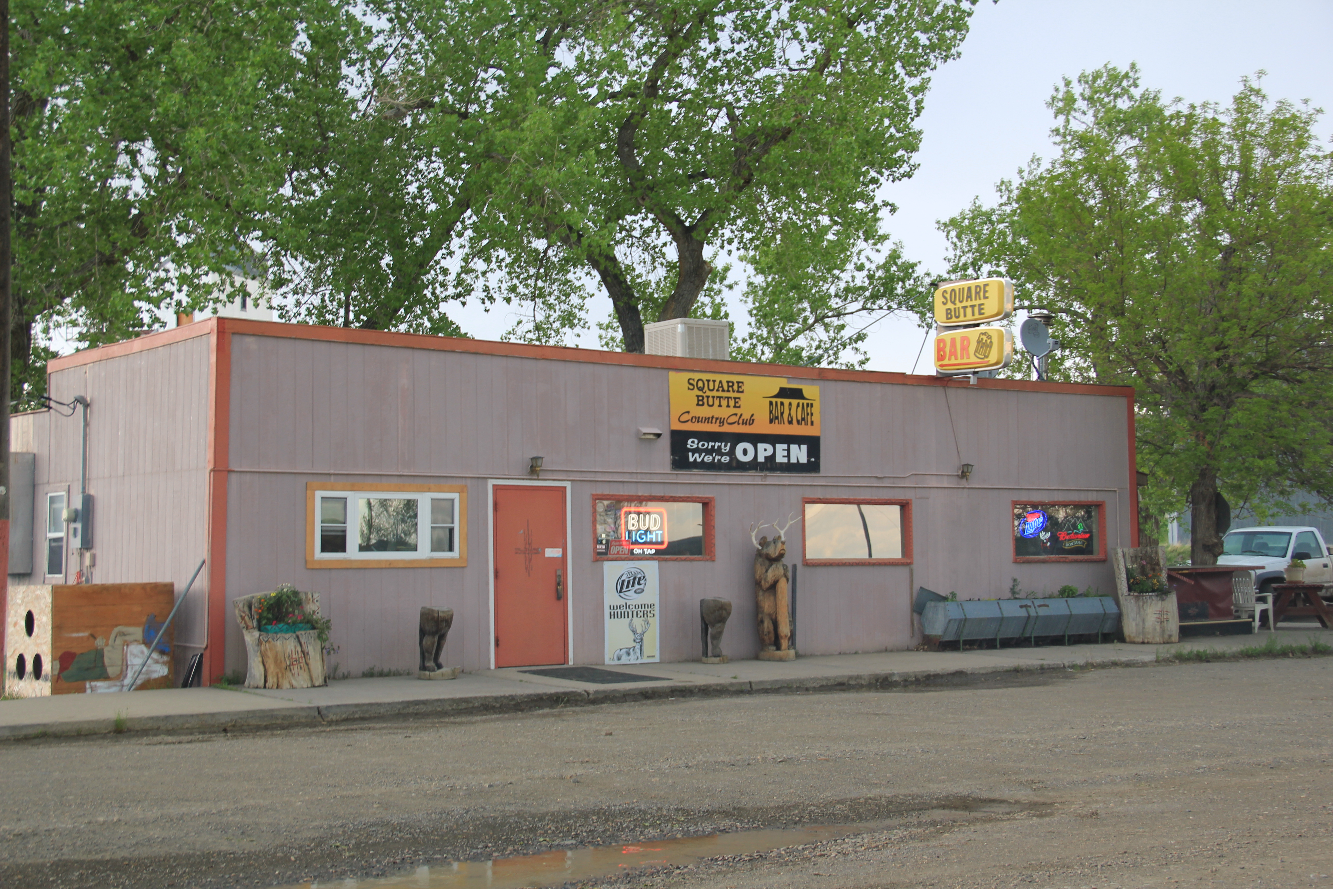
And perhaps most importantly the town still has a local tavern, the appropriately named Square Butte Country Club Bar.  Still an important community center today, as it was in 1984.

Image