
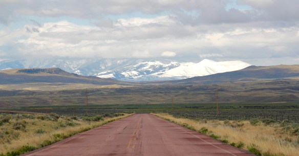
 Beaverhead County’s history has deep roots, perhaps never deeper than at the high mountain passes that divide it from neighboring Idaho. We have already taken a look at Monida Pass, but now let’s shift to the western border and consider Lemhi Pass (Lemhi Road is the image above) and Bannock Pass, both at well over 7000 feet in elevation.
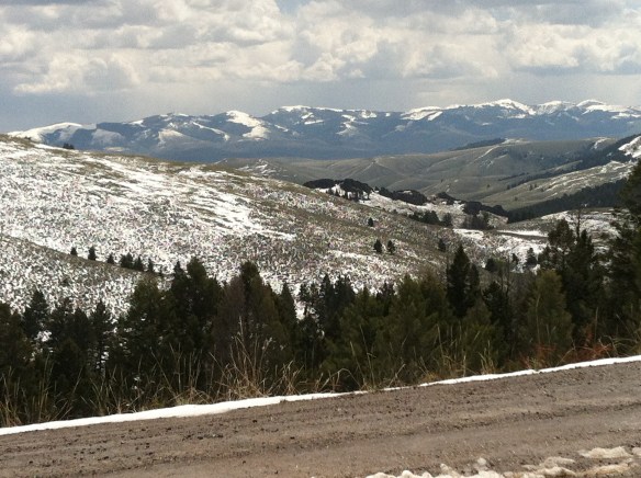
 Lemhi Pass is a magnificent place, reached by a wide dirt road that climbs up to 7300 feet. The roadbed is modern, and lies over a path worn by centuries of Native Americans who traveled this path between mountain valleys in present-day Montana and Idaho. That deep past is why the more famous Lewis and Clark Expedition took this route over the Bitterroot–and the Corps of Discovery connection is why the pass has been protected in the 20th century. The pass is also connected with Sacajawea, since her tribe, the Shoshone, often used it to cross the mountains.


The pass is one of the infrequently visited jewels of the Lewis and Clark National Historic Trail, a place that the expedition used and probably would have never “discovered” if not for the prior Native American use.
 This kiosk by the U.S. Forest Service is part of the new public interpretation of the property, both at the start of the pass to the top of the mountain itself at the Sacajawea Memorial Area.
 Bannock Pass, comparatively has received little in public interpretation. Unlike Lemhi, it is not a National Historic Landmark associated with Lewis and Clark. For today’s travelers, however, it is a much more frequently used way to cross the Rockies despite its 300 foot higher elevation. A historic site directional sign leads to one interpretive


marker explains that railroad engineers used the pass to connect Dillon and Idaho in the early 20th century, changing the ancient appearance of the pass, used by Native Americans for centuries to connect the high plains of Montana to the rich valleys of Idaho. The marker also describes the use of Bannock Pass by Nez Perce led by Chief Joseph in 1877, as they escaped back into Idaho after the Battle of Big Hole. The Nez Perce National Historic Trail is more closely associated with Chief Joseph Pass, located to the north.
 It was a snowy Memorial Day when I crossed Lost Trail and Chief Joseph passes on my way to Big Hole Battlefield. Once again I was impressed by the recent efforts of the U.S. Forest Service to interpret the epic yet tragic journey of Chief Joseph and the Nez Perce in 1877, especially the Trail Creek Road that parallels Montana Highway 43.


Kudos to the National Park Service for its new visitor center, exhibits, and interpretive markers at the battlefield–the finally the whole story of the Nez Perce campaign is explored through thoughtful public interpretation, centered on the Nez Perce perspective,


those who lived here until the military force led by Col. John Gibbon thought it could surprise and rout the Indians. Rather the Nez Perce counter-attacked forcing the soldiers into surrounding woods. The trek of Chief Joseph and the Nez Perce effort to find safety in
 Canada was underway. Today the Nez Perce National Historic Trail and Park mark that journey into history. The park today is frankly an amazing transformation, from a preserved battlefield in the early 1980s that only hinted at the true facts of history to a modern of battlefield interpretation, one that does justice to history and to the Nez Perce story. One only wishes that more western battlefields received similar treatment.

 Dillon is not a large county seat but here you find public buildings from the first third of the 20th century that document the town’s past aspirations to grow into a large, prosperous western city. It is a pattern found in several Montana towns–impressive public buildings designed to prove to outsiders, and perhaps mostly to themselves, that a new town out in the wilds of Montana could evolve into a prosperous, settled place like those county seats of government back east.


 The Dillon City Hall also belongs to those turn-of-the-20th century public landmarks but it is a bit more of a blending of Victorian and Classical styling for a multi-purpose building that was city hall, police headquarters, and the fire station all rolled into one.
 A New Deal era post office introduced a restrained version of Colonial Revival style to Dillon’s downtown. The central entrance gave no hint to the marvel inside, one of the
 state’s six post office murals, commissioned and executed between 1937 and 1942. The Dillon work is titled “News from the States” painted by Elizabeth Lochrie in 1938. It is a rarity among the murals executed across the country in those years because it directly addressed the mail and communication in early Beaverhead County. Ironically, few of the post office murals actually took the mail as a central theme.
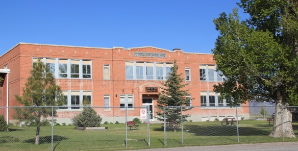
 The New Deal also introduced a public modernism to Dillon through the Art Deco styling of the Beaverhead County High School, a building still in use today as the county high school.
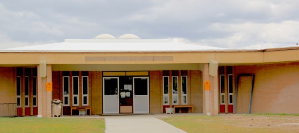
 A generation later, modernism again was the theme for the Dillon Middle School and Elementary school–with the low one-story profile suggestive of the contemporary style then the rage for both public and commercial buildings in the 1950s-60s, into the 1970s.
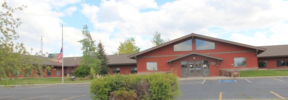
 The contemporary style also made its mark on other public buildings, from the mid-century county office building to the much more recent neo-Rustic style of the Beaverhead National Forest headquarters.


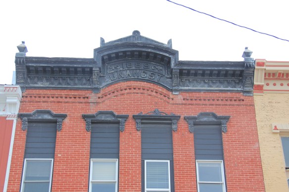
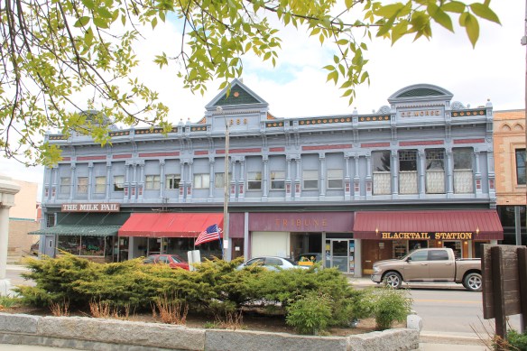
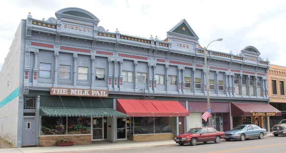
 This birds-eye view of the town is at the Beaverhead County Museum at the railroad depot. It shows the symmetrical plan well, with two-story commercial blocks facing the tracks and depot, which was then just a frame building. To the opposite side of the tracks with more laborer cottages and one outstanding landmark, the Second Empire-style Hotel Metlen. The Metlen, listed in the National Register of Historic Places, remains today, one
 of the state’s best examples of a railroad hotel. I recognized the building as such in the 1984 state historic preservation plan and my book, A Traveler’s Companion to Montana History, included the image below of the hotel.
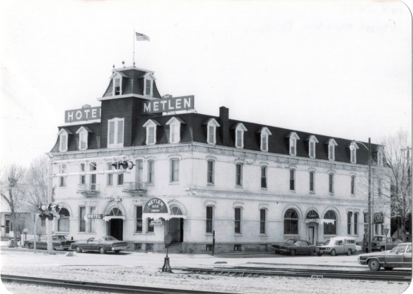 This three-story hotel served not only tourists but especially traveling businessmen–called drummers because they were out “drumming up” business for their companies. The interior has received some restoration work in the last 30 years but little has changed in the facade, as they two images, one from 1990 and the other from 2012, indicate.


 built environment has many stories to tell.
 Jackson, Montana, is another favorite place of mine in Beaverhead County. Located on Montana Highway 278, far away from any neighborhoods, the town dates to the 1880s, as
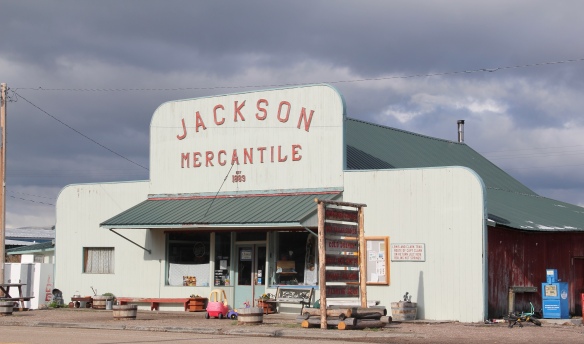 this area of the Big Hole Valley opened up to ranching. Its name came from Anton Jackson, the first postmaster; the town still has a historic post office building even though its

 Jackson grows significantly during the winter, as it is an increasingly popular winter get-away destination, centered on the historic Jackson Hot Springs, which had been upgraded and significantly expanded since my last visit in 1984.
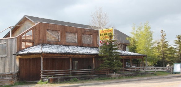 But my real reason to tout the wonders of Jackson, Montana, lie with a simple but rather unique adaptive reuse project. A turn of the 20th century church building has been converted into a hat manufacturer business, the Buffalo Gal Hat Shop–and I like hats!
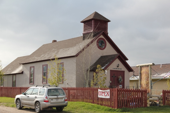 Grant is another ranching town along a Montana secondary highway, this time Montana Highway 324. Like Jackson, it too has enough year-round residents and children from nearby ranches to support a school, a tiny modernist style building while an older early 20th century school building has become a community center.

 Back when I visited in 1984, Monte Elliott (only the third owner of the property he claimed) showed off his recent improvements made within the context of a business location that dated to the Civil War era. The lodge still keeps records from those early days that they share with interested visitors. In the 21st century, new owner Jason Vose additionally upgraded the facilities, but kept the business’s pride in its past as he further expanded its offerings to hunters and travelers.
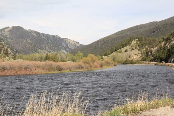 Far to the north along Montana Highway 43 is the Big Horn River Canyon, a spectacular but little known landscape within the state. Certainly anglers and hunters visited here, but the two towns along the river in this northern end of Beaverhead County are tiny places, best known perhaps for their bars as any thing else.


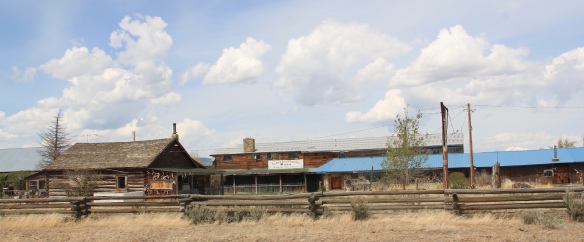
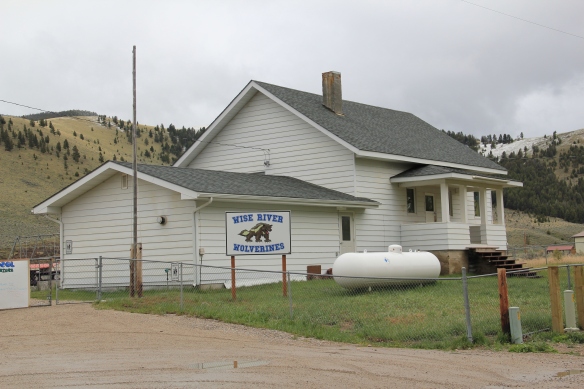 Just as important as a town anchor is the Wise River Community Center, which began in the gable-front frame building as the Wise River Woman’s Club but has expanded over the last 30 years into the larger building you find today.
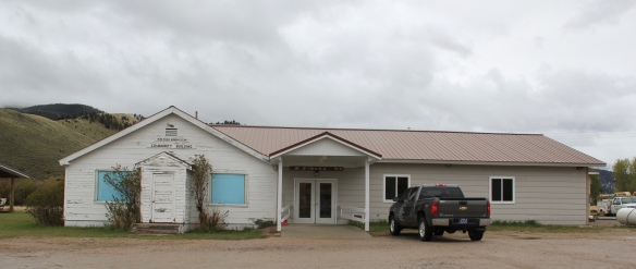
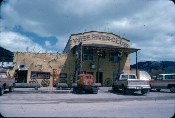 The liveliness of that 1984 exterior–note the mini-totem pole, the log benches, wagon wheels, and yes the many antlers defining the front wall–is muted in today’s building.
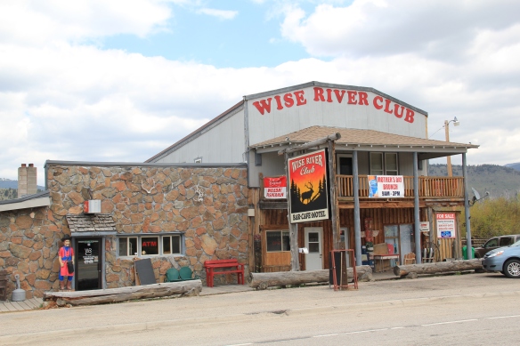 But the place is still there, serving locals and travelers, and a good number of the antlers now grace the main room of the bar.
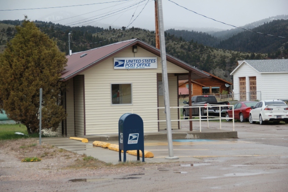
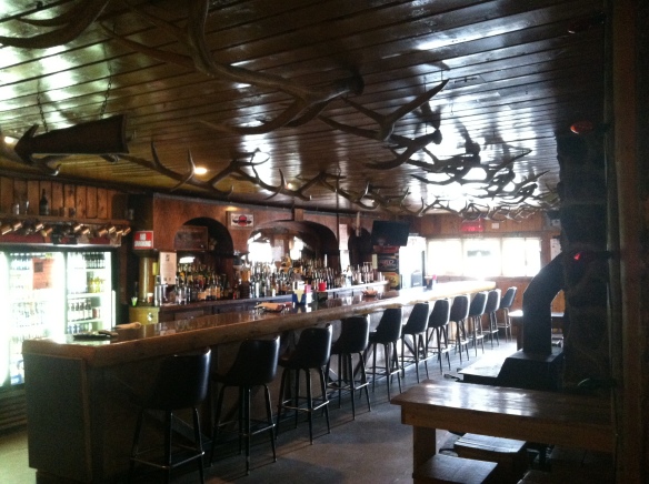 Wise River, unlike Dewey but similar to Jackson, has been able to keep its historic general store in business. The post office moved out in the 1990s to the new separate building but the flag pole remains outside to mark how this building also served both private and public functions.
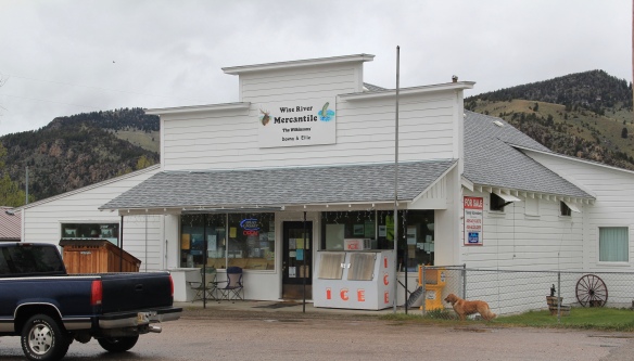 The country towns of Beaverhead County help to landmark the agricultural history of this place, and how such a huge county as this one could still nurture tiny urban oases. Next I will leave the rural landscape and look at Beayerhead’s one true urban landscape–the county seat of Dillon.
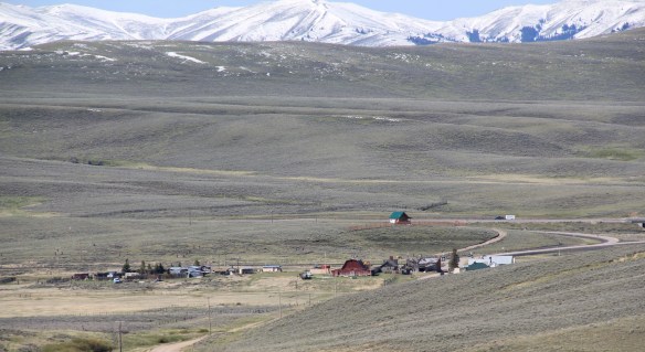
 Let’s start this theme with the railroad/ federal highway towns. Monida, at the state border with Idaho, is a good place to start, first established as a place on the Utah and Northern Railroad line as it moved north toward the mines at Butte in 1881. Monica had a second life as a highway stop on the old U.S. Highway 91 that paralleled the tracks, as evident in the old garages left behind.


 which possesses a Montana welcome center and rest stop. That’s important because at this stop you also can find one of the state’s mid-20th century examples of a tourist welcome center, which has been moved to this stop and then interpreted as part of the state’s evolving roadside architecture.


 The reclamation project, which stored water for irrigation, also covered the site of Camp Fortunate, a very important place within the larger narrative of the Lewis and Clark Expedition and its relationships and negotiations with the Shoshone Indians. An early


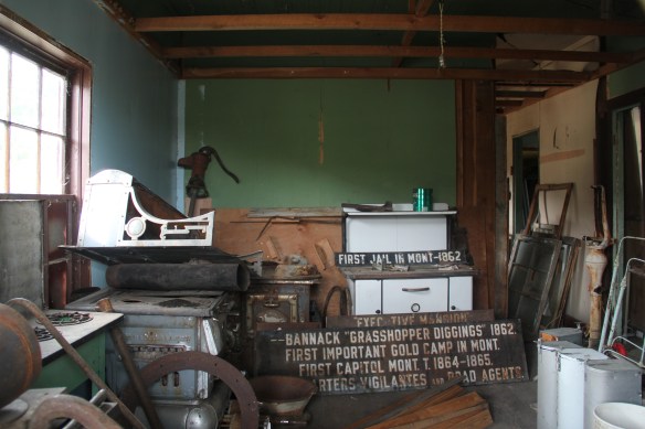
 My first trip to Beaverhead County in 1981 had two primary goals–and the first was to explore Bannack, the roots of Montana Territory, and one of its best connections to Civil War America. As this simple wooden sign below remarks, here in 1862 the first gold strike in what became Montana Territory occurred.
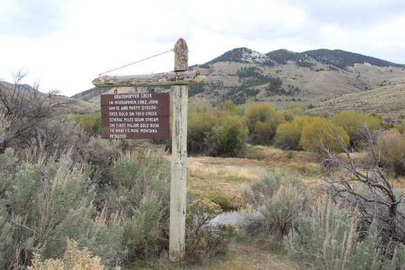
 a path because the glistening bits of metal loose in the sands of the creek had never interested the Native Americans but news of the find was enough to drive easterners, many of them southerners, away from the landscape of war and into a wholly different place, crested by beautiful mountains.
 Grasshopper Creek was not much of place then, and even now, but this stream of water became the source of a boom that eventually reshaped the boundaries of the northern Rockies and nearby its banks grew the town of Bannack, a name taken in part from the Bannock Indians who had used this landscape in far different ways for many years.
 The story of the preservation of Bannock begins with local land owners, who protected the site, and kept most of the buildings from being scattered across the region. There was little official interest in the place at first. The state Daughters of American Revolution
 marked it in 1925, otherwise the buildings remained, some in use as residences or for public purposes, others melting away in the demanding climate. The Boveys moved the Goodrich Hotel to their preservation project at Virginia City and transformed it into the Fairweather Inn, which is still in use as lodging.
 In 1954, the Beaverhead County Historical Society transferred about 1/3 of the present property to the state for protection and development as a state park. Not until 1961 did the National Park Service recognize the town as a National Historic Landmark.


 Gritty, dusty, forlorn: yes, Bannack is the real deal for anyone wanting to explore ground zero of the gold rush era in Montana, and to think about how in the midst of the great Civil War, federal officials found time to support adventurous citizens to launch a new territory in forgotten expanses of the northern Rockies.
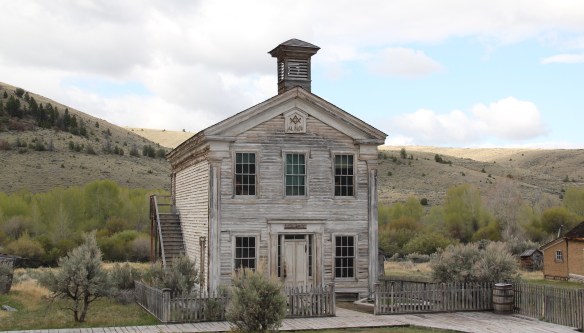 I thought that 30 years ago I “got” Bannack–there wasn’t much that I missed here. I was wrong. Probably like thousands of other visitors who fly into the town, and leave just as quickly, I missed what is still called the “new” town cemetery. Almost hidden in the sagebrush along Bannack Road, the “new” cemetery is not Boot Hill–where is Plummer
 buried people still want to know–but it is a remarkable place of hand-carved tombstones, others rich with Victorian imagery, and a few that are poignant reminders of the Civil War veterans who came here and stayed.


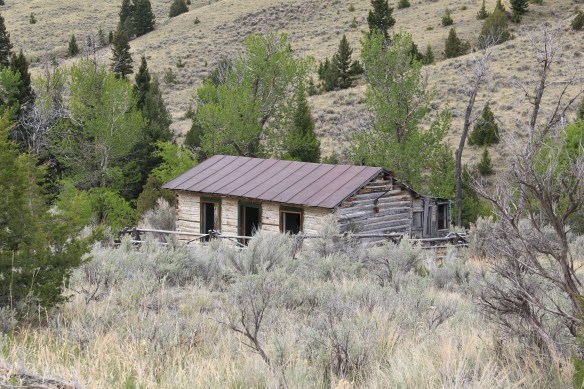


 At Farlin, the scars of mining are everywhere, surrounded by sage grass, brush, and scattered trees, trying to recover in what was once a denuded landscape. Operations had ended by the time of the Great Depression. While never a huge place–population estimates top out at 500–Farlin is representative of the smaller mining operations that reshaped the rural western Montana landscape. Not every place became a Butte, or a Virginia City. Properties like Farlin help to tell us of the often lonely and exceedingly difficult search for opportunity in the Treasure State over 100 years ago.
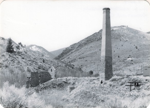
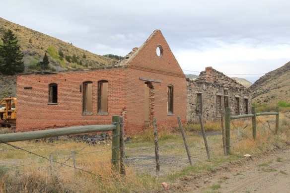
 When I returned to Glendale in 2012, I made sure to take a replica shot of the place I had photographed almost 30 years earlier. But I also went father and did my best to document a mining landscape in danger of disappearing in the 21st century. Below is an image when the Hecla smelter was in full production.
 There are some intact buildings at Glendale, but also numerous parts of buildings, facades and foundations that convey how busy the Glendale Road was some 100 years ago.
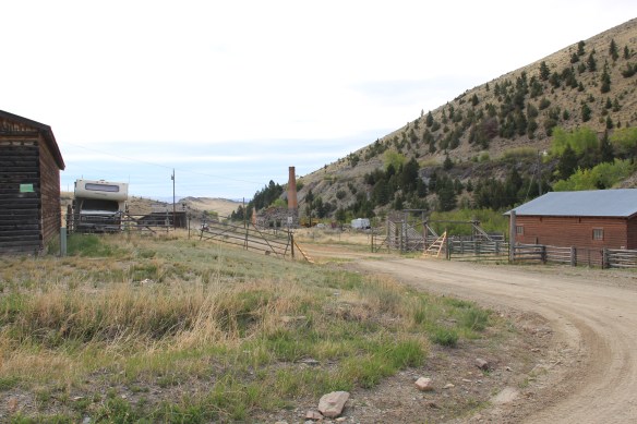


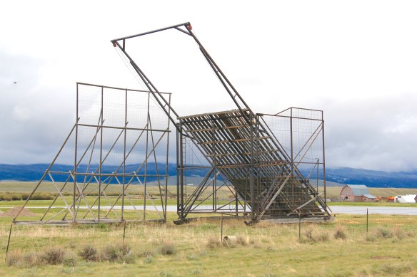
 Hecla Mining Company operated 28 kilns at a site a few miles away. Within the Beaverhead-Deer Lodge National Forest, the Canyon Creek Kilns are a remarkable property, preserved and now interpreted through the efforts of the U.S. Forest Service. The Forest Service should be commended for this effort. As the images below suggest, this property is one of the best places in Montana to stop and think of the mining landscape of the turn of the twentieth century and imagine what a moonscape it would have been 100 years ago when the kilns consumed all of the surrounding timber.


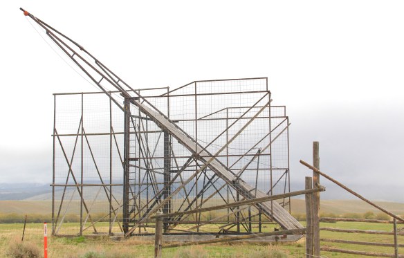
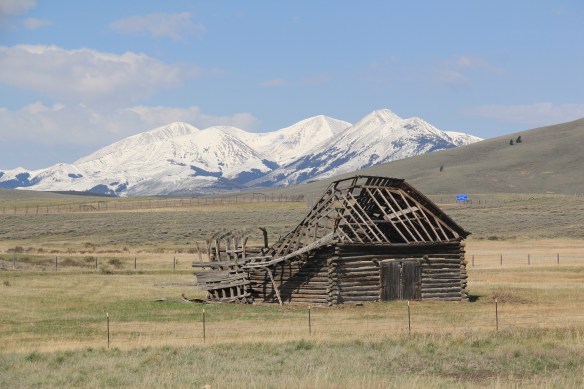
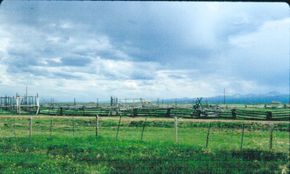 The Big Hole Valley was a place of interest to me in 1984, noted by the image above, for how ranches used logs to build the physical infrastructure–the log snake fences, the gates, the log barns and other ranch structures–of their properties.
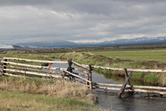
 What I didn’t give as much attention to, already commented on in this blog at numerous places, are the irrigation ditches, a more consistent supply of water that allowed ranchers to expand production.


 Beaverhead County, named for the prominent, ancient landmark on the Beaverhead River at the corner of Madison and Beaverhead county, was the first rural place I visited in Montana after my arrival in Helena in 1981. Why? No pressing reason, except that the place name of Wisdom called out to me.


 The town’s large community hall remains in constant use. The separate Women’s Club
 building once welcomed ranch wives and daughters to town, giving them a place to rest and providing a small library of books. It has been converted into a small lodge for skiers and hunters–a great small town example of adaptive reuse.
 Of course the major landmark for travelers through Wisdom in the late 20th century was Conover’s Trading Post, a two-story false front building–clearly the most photographed place in town, and inside a classic western gun and recreation shop.
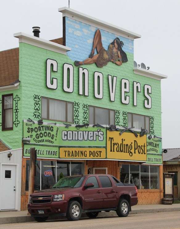 But the Conover’s facade, even the name, is no more. Not long after my 2012 visit to Wisdom, new owners totally remade the building and business, opening a new store named Hook and Horn.


