Howdy from Terry!

Terry overview
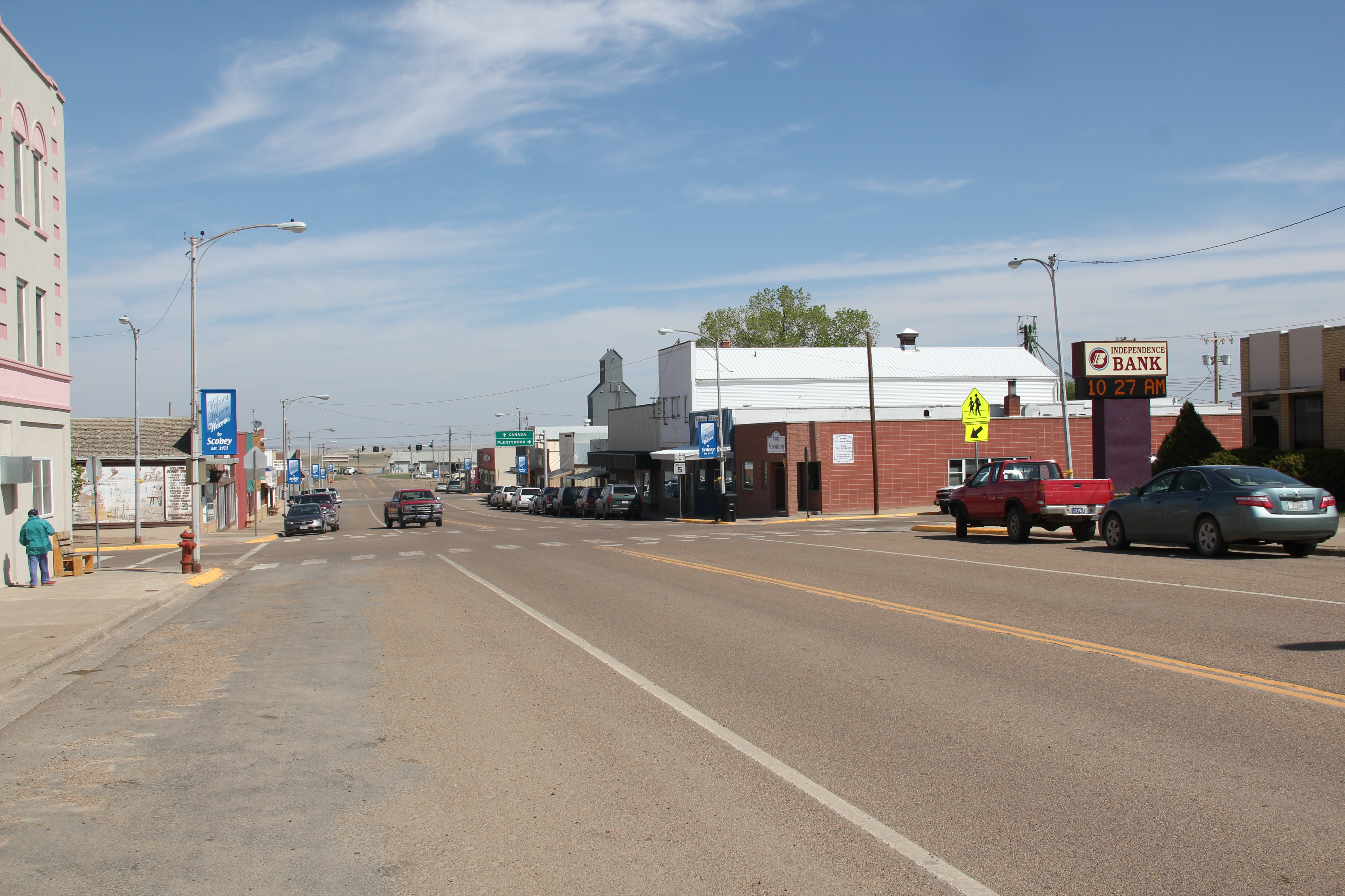
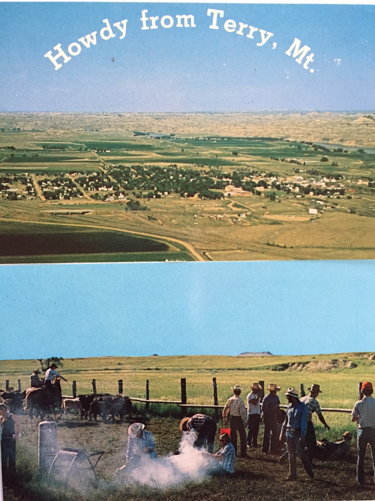
Terry, the seat of Prairie County, has long been one of my favorite places in the Yellowstone Valley. Stuck between the much larger, and more famed, Yellowstone towns of Miles City (to the west) and Glendive (to the east), Terry has somehow developed and kept its own identity as a western place, and landscape, that still speaks strongly to the patterns that transformed the region over the last 150 years: railroads, homesteading, cattle, and town building.
IMG_4047
In 1984 I focused on the railroad imprint on the town, which began in the early 1880s as Northern Pacific officials understood the need for a railroad stop at place near the confluence between the Yellowstone and Powder rivers.
IMG_7154
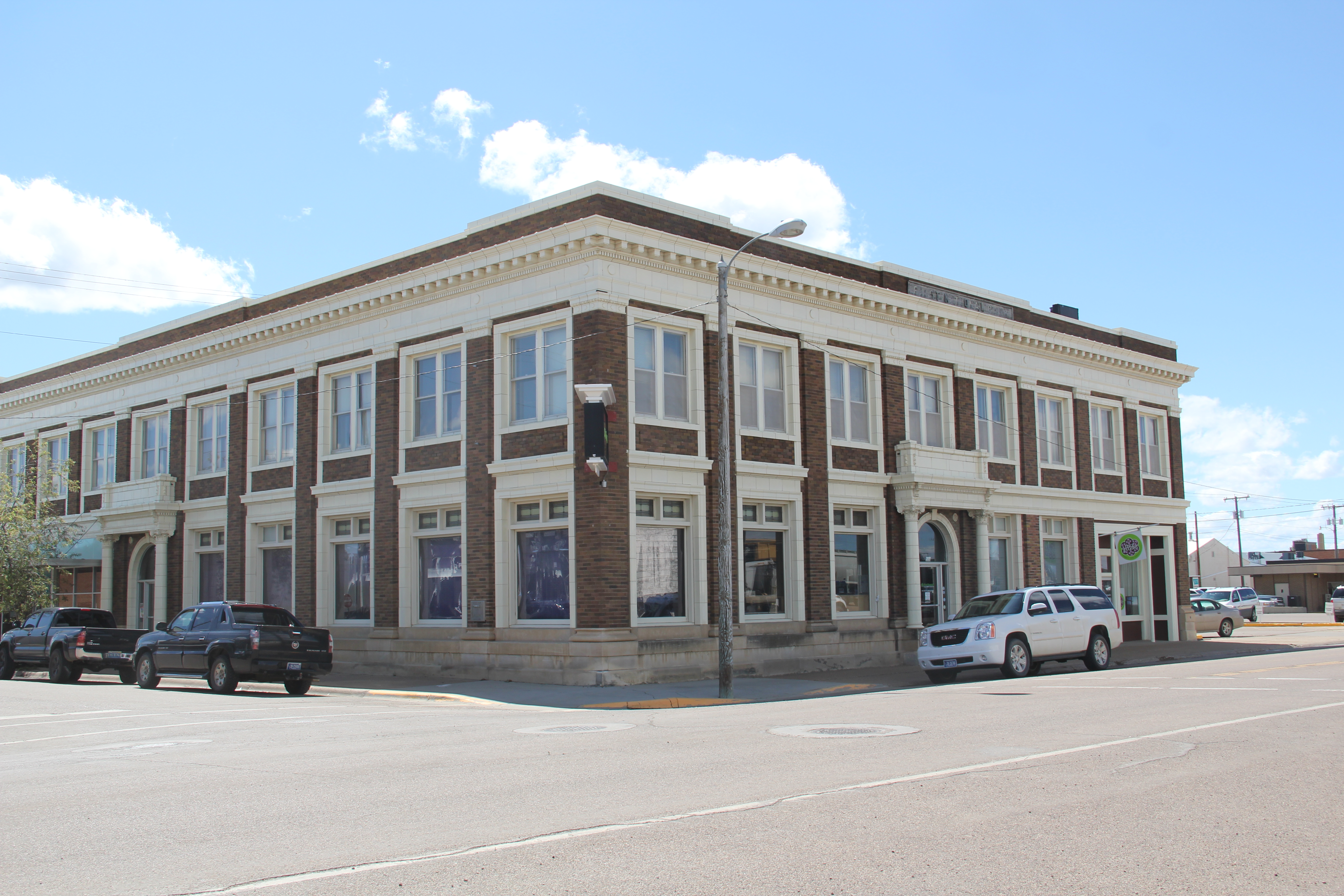
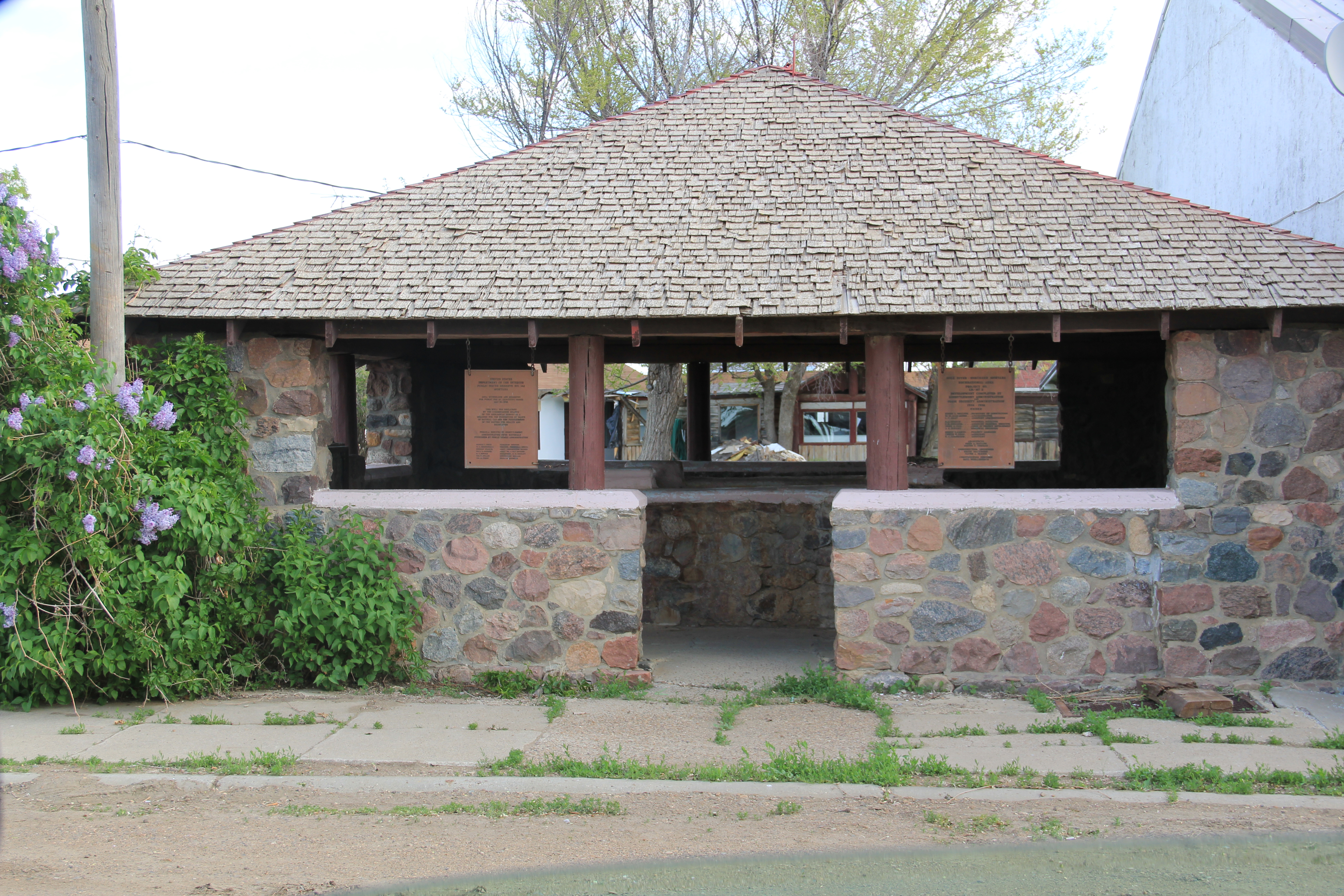
In 2013, however, the depot was gone from the tracks but not the town. It had been moved to become part of the solid Prairie County Museum, a local institution that was still quite new when I first visited in 1984. Located in the town’s most prominent neoclassical bank building from the 1910s, the museum was a place where I held a public meeting about the preservation plan process and found a community totally engaged with its past.
Terry bank
IMG_7141
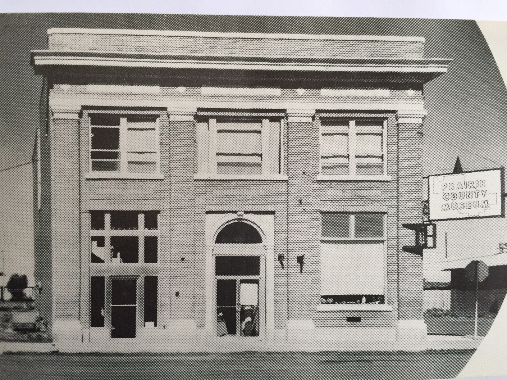
The museum highlights agriculture and ranching, and includes the Evelyn Cameron Gallery, which displays and celebrates the life and contributions of this important western photographer. One change I noted last year was the creation of the Evelyn Cameron Heritage Center, on Laudre Avenue just a few yards away from the museum, which is at the crossroads of Laudre and Logan Avenues.
IMG_7182
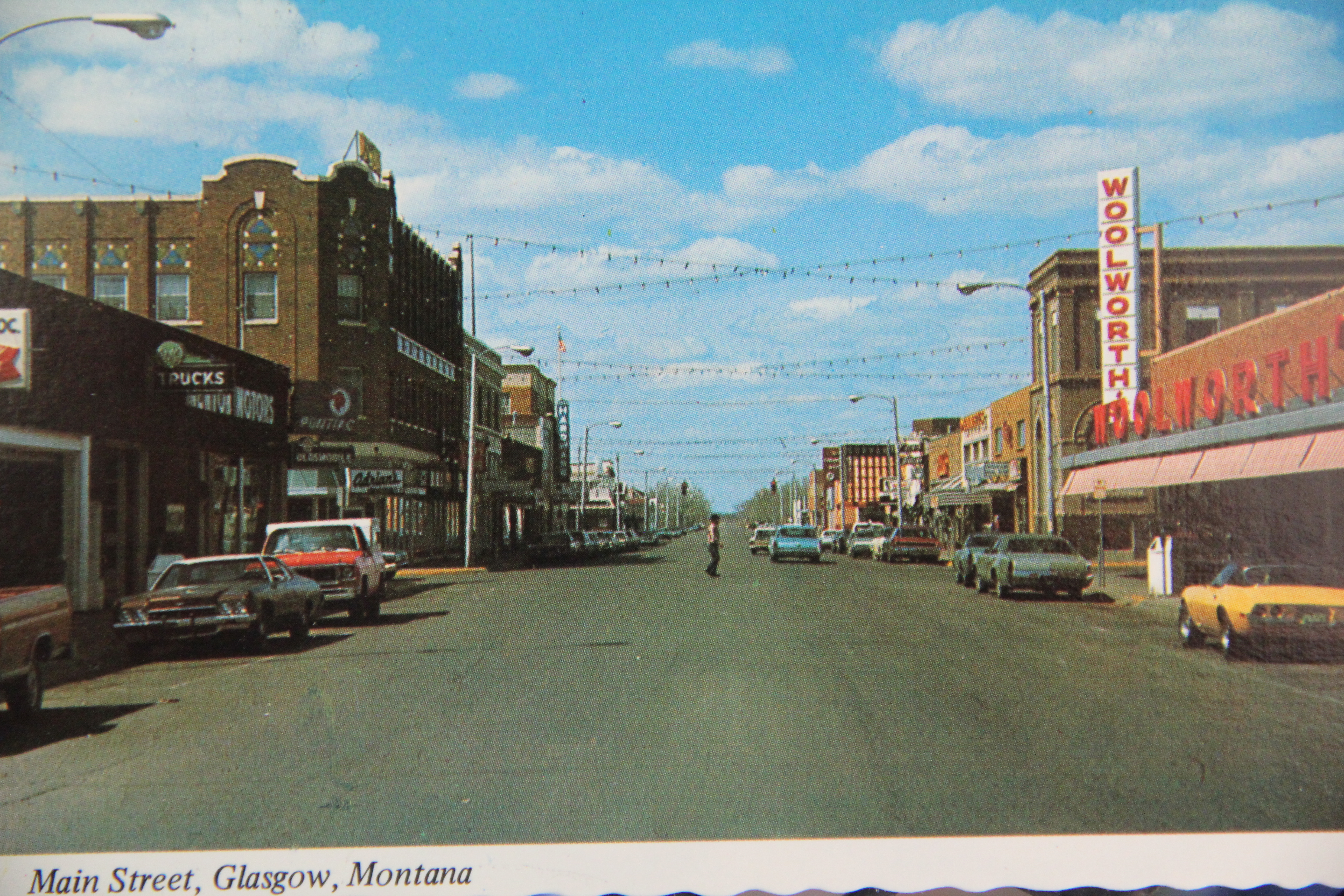
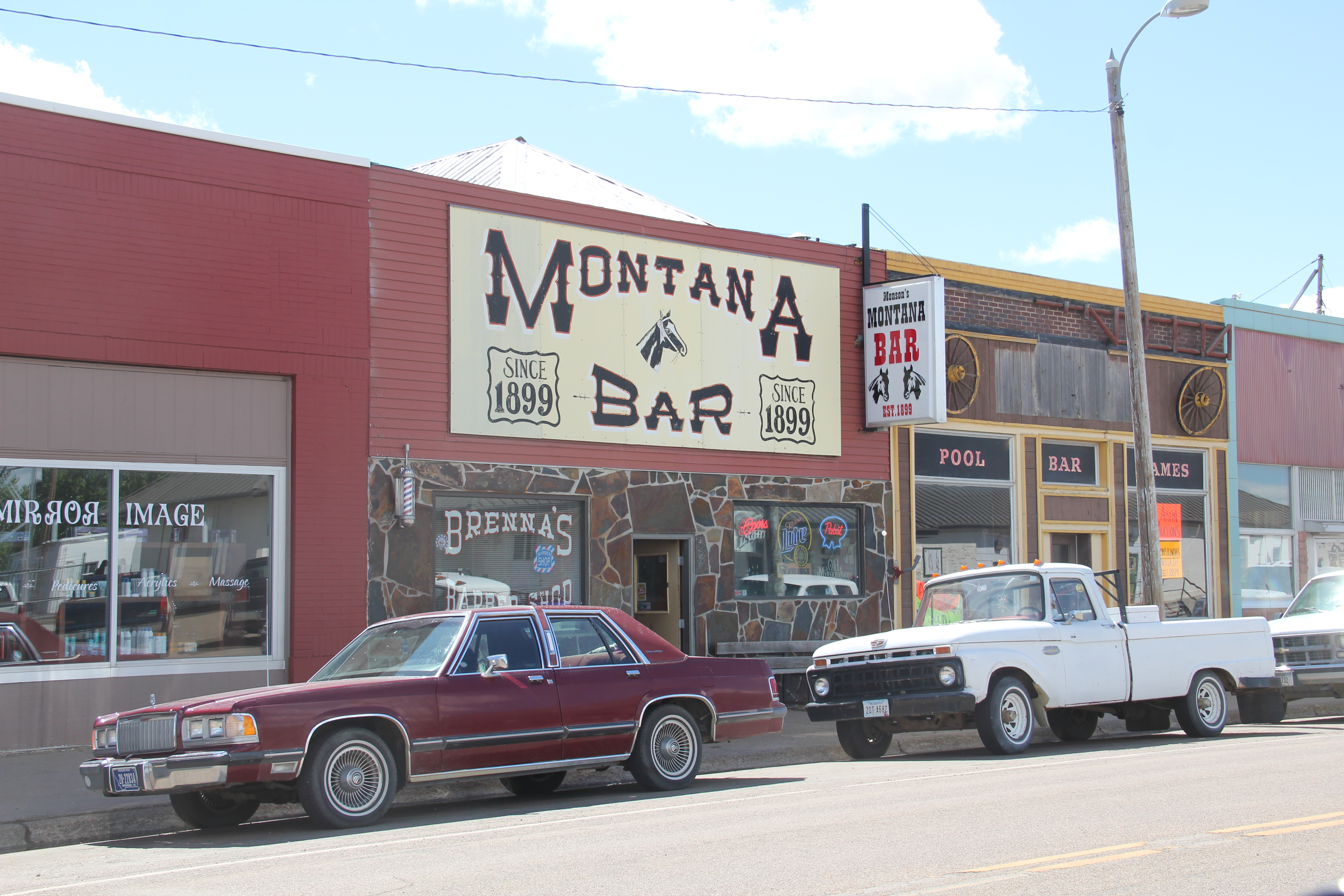
That crossroads was another pattern in Terry’s landscape that caught my eye. Most Northern Pacific towns, originally, were symmetrical plans, with a long line of commercial buildings flanking one side of the tracks and grain elevators and warehouses on the other side. Terry, however, had a classic T-town plan, with the tracks creating the top of the T and then a main commercial artery, in this case Logan Avenue, serving as the stem of the “T.”
IMG_7147
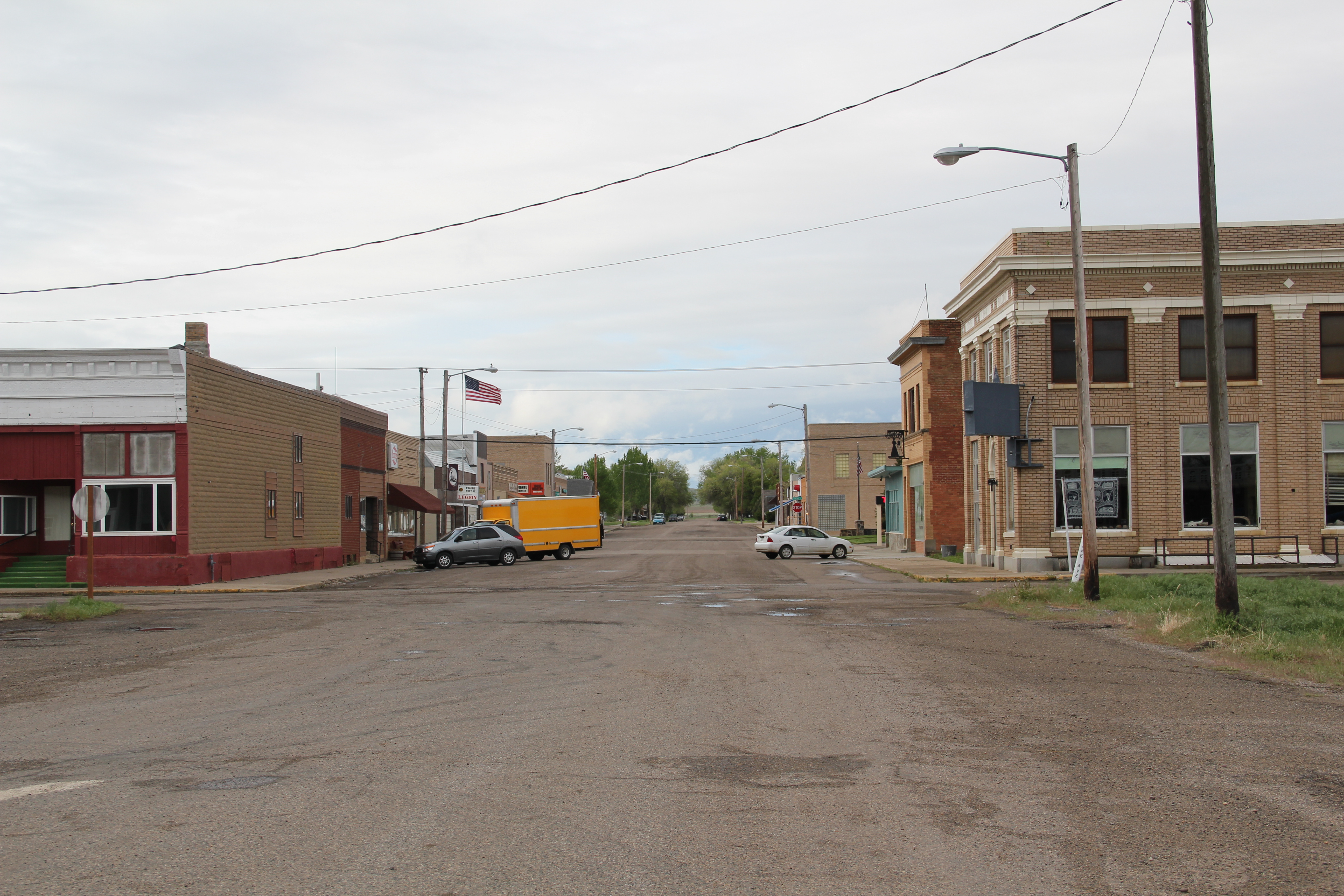
Why was Terry different? It is the impact of the Milwaukee Road as it built through the valley in 1906-1907. In 1984 there was still a second set of tracks, and a few scattered commercial buildings, to the north of the Northern Pacific mainline. Today two buildings remain along with the roadbed that marks this second period of Terry’s growth.
IMG_7144
IMG_7143
IMG_7133
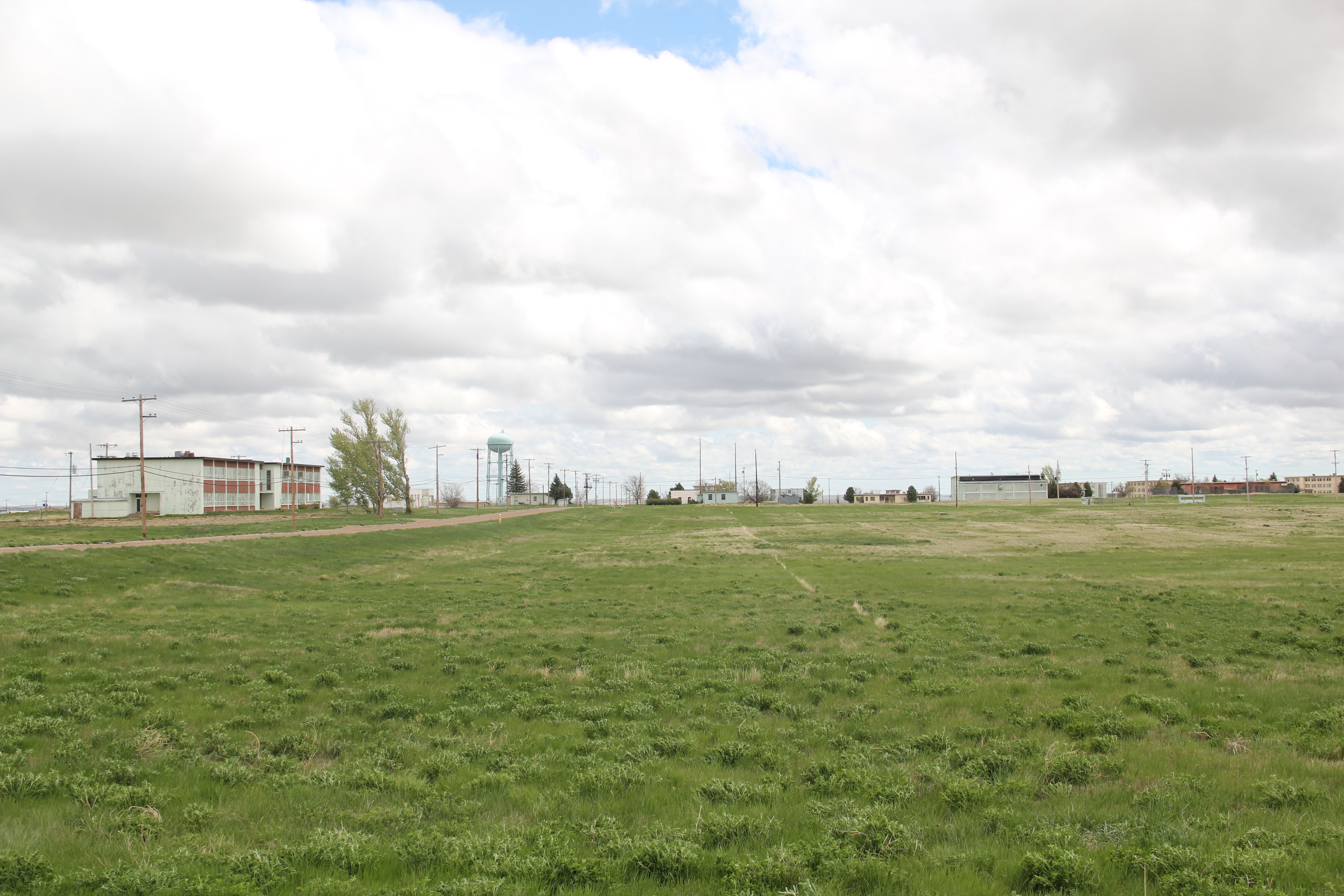
Just west of the “downtown” you can find the one still thriving institution associated with the Milwaukee Road impact on Terry: the Prairie County Fairgrounds, which once faced the Milwaukee’s main line. (I have discussed the fairgrounds in an earlier post.)
IMG_7138
Another wave of change came to Terry in the 1920s as U.S. Highway 10 gave the town another transportation pattern. The highway’s crossroads with the original T-plan commercial artery is marked by a still extant somewhat Art Deco-styled brick gas station/ auto dealership.
IMG_7178
The most recognized roadside landmark is the Kempton Hotel, a true rarity now for this section of the Yellowstone Valley as those rambling montage of buildings that once constituted places of rest and relaxation along the nation’s highways have largely disappeared from the landscape.
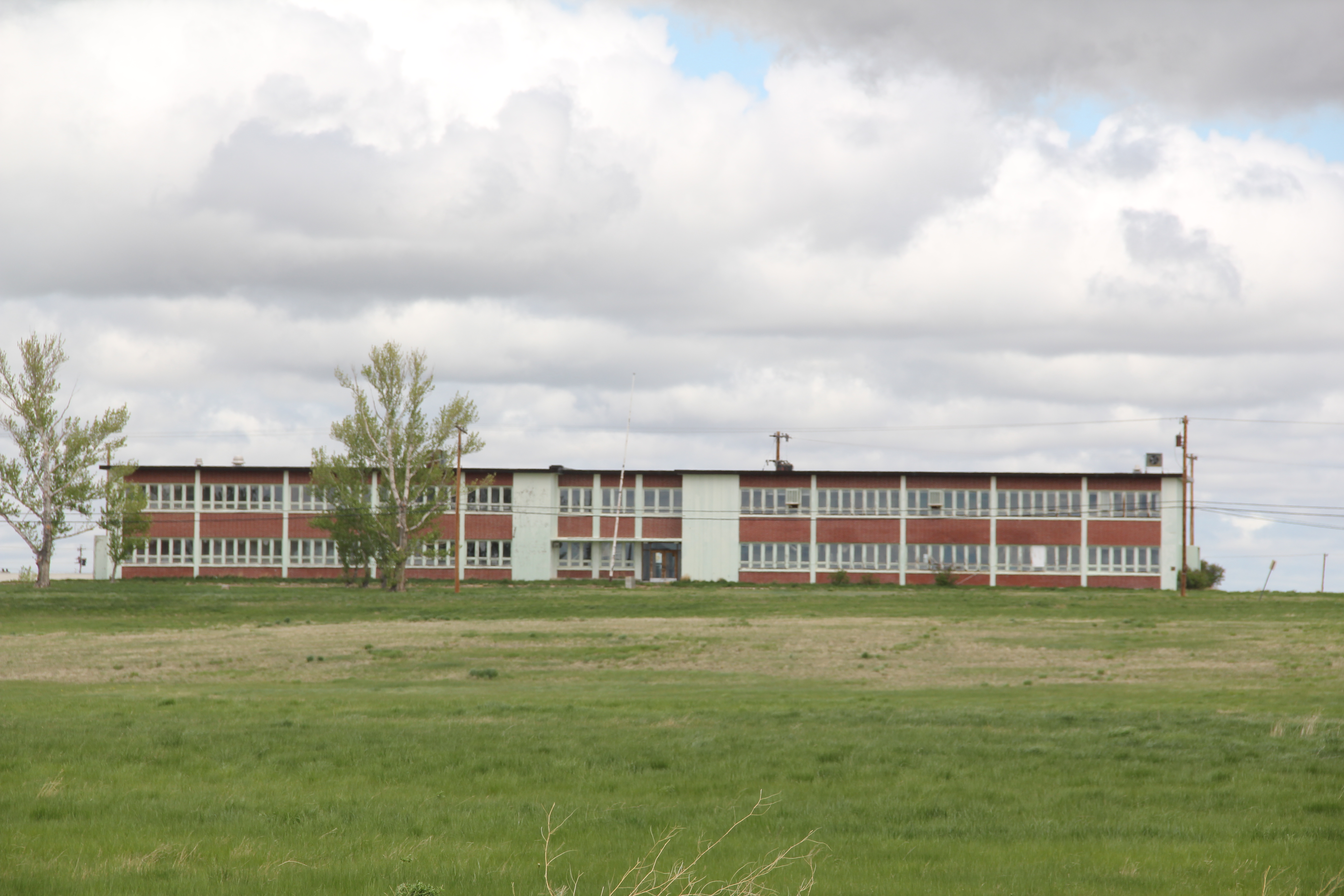
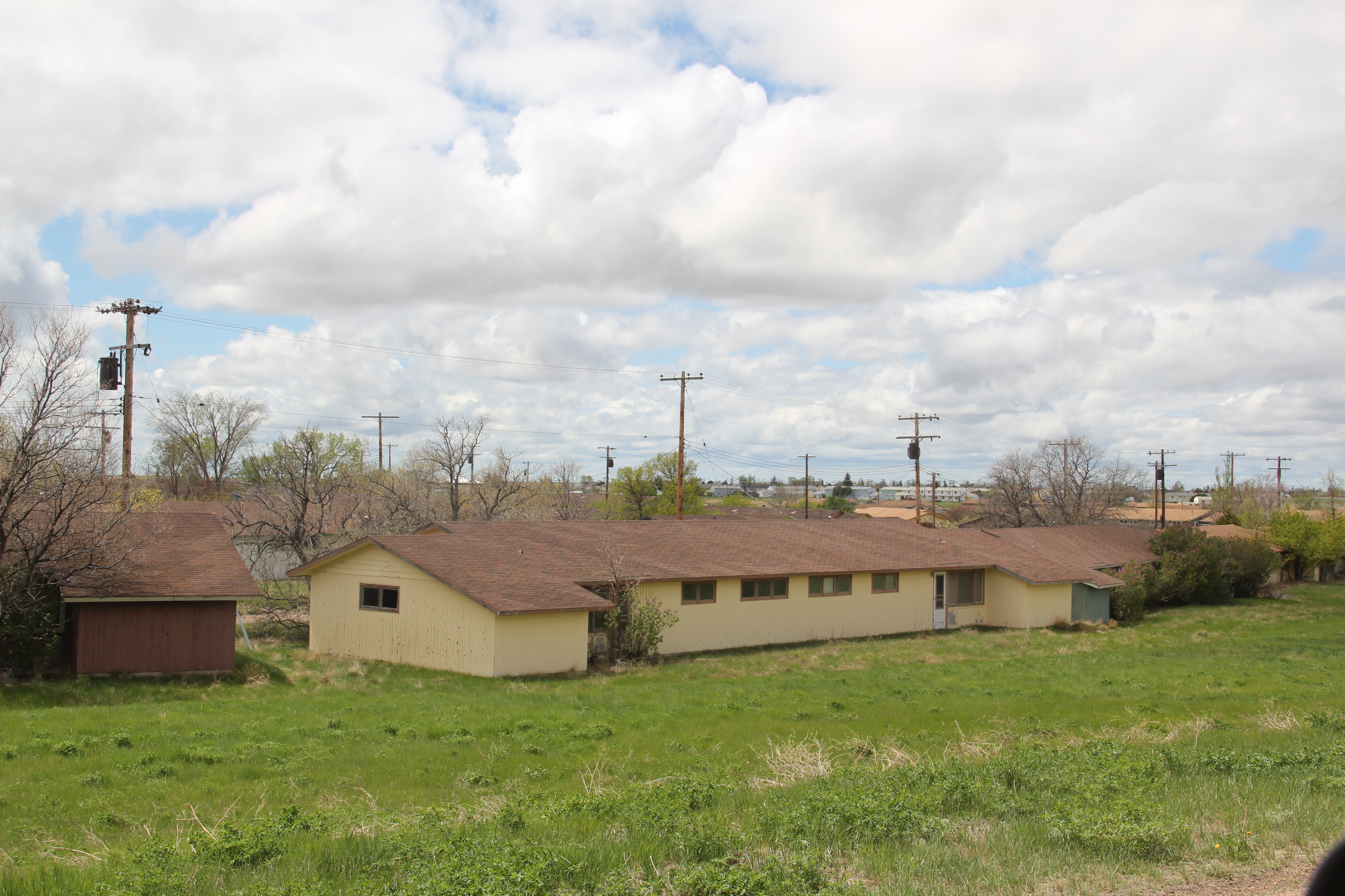
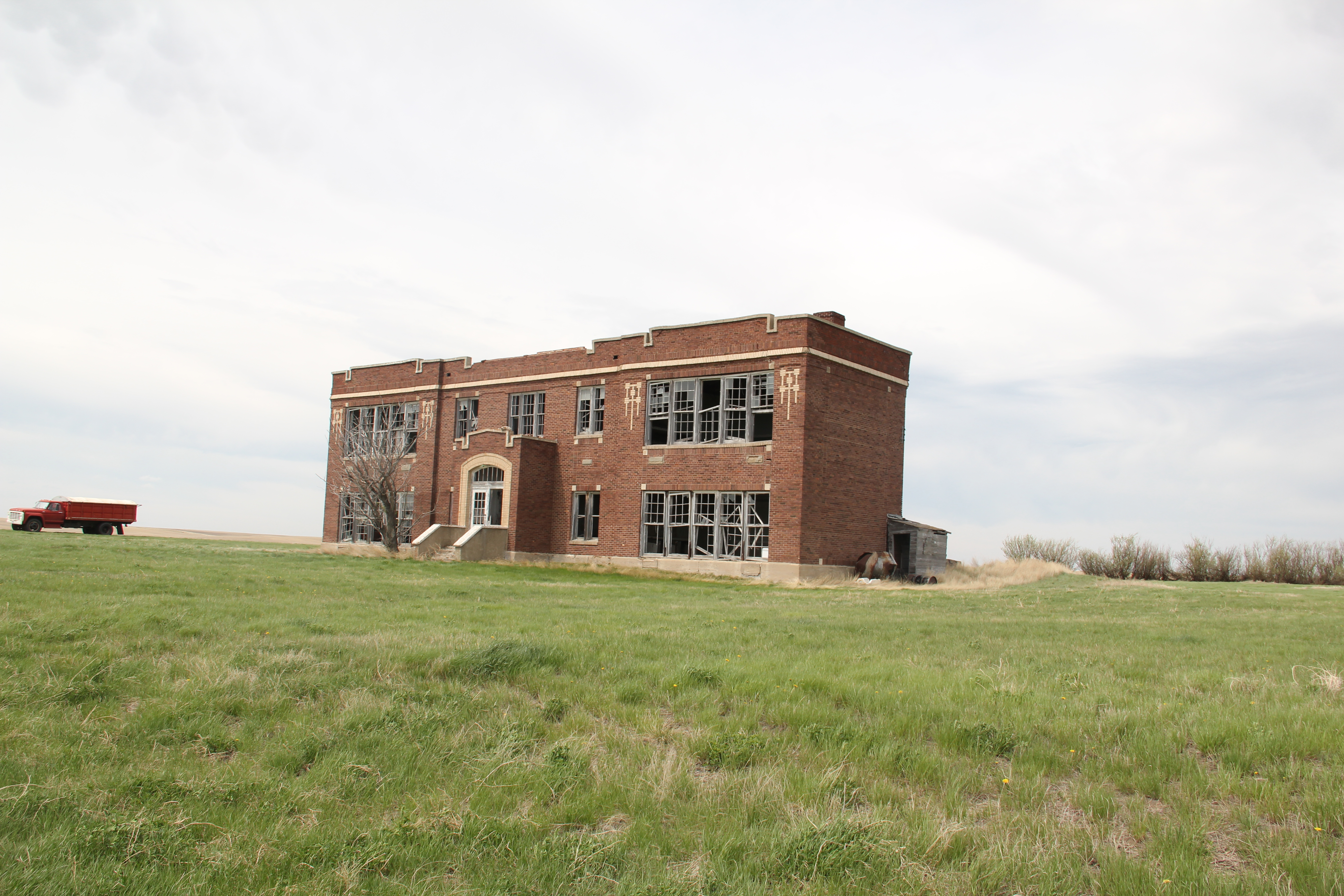
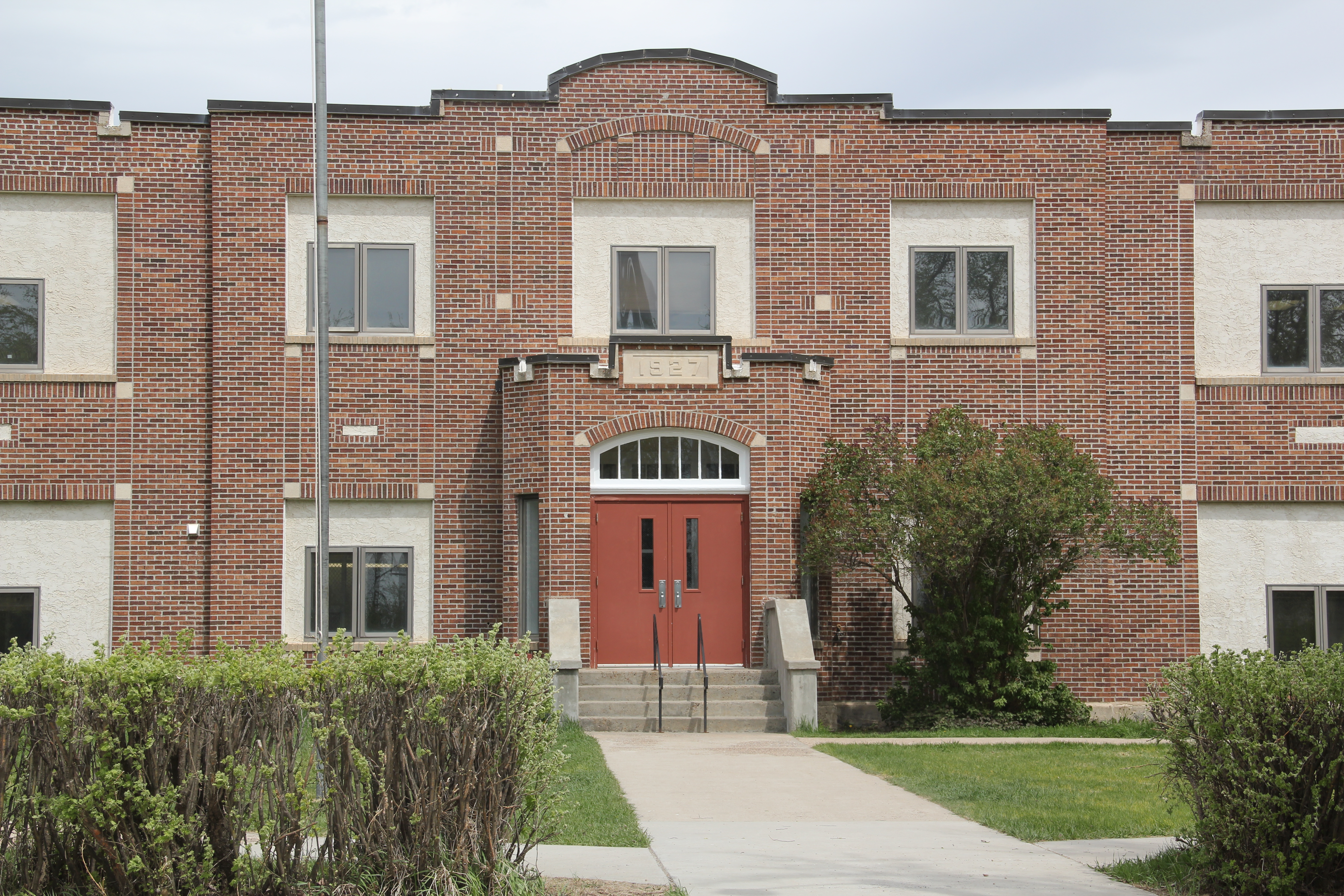
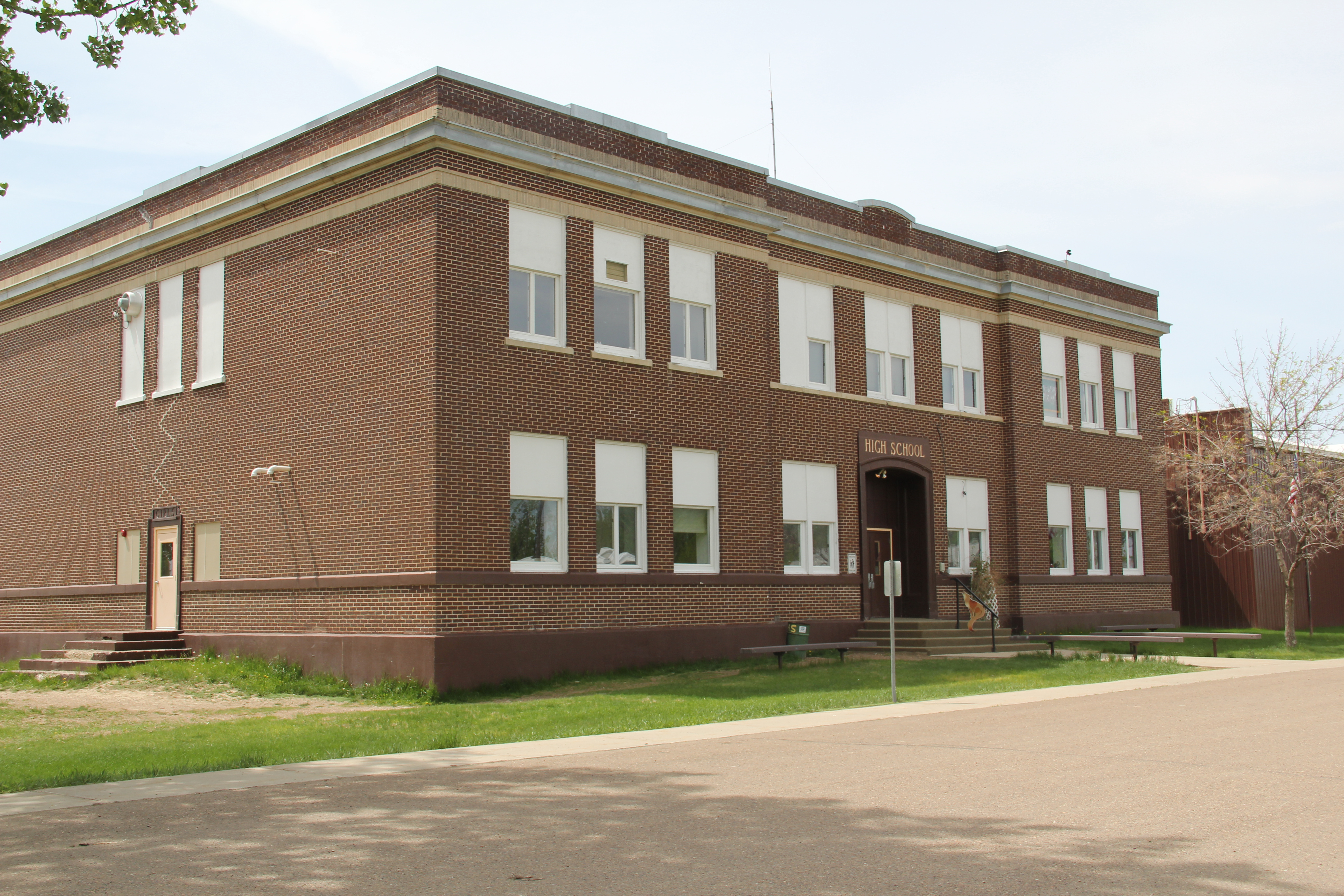
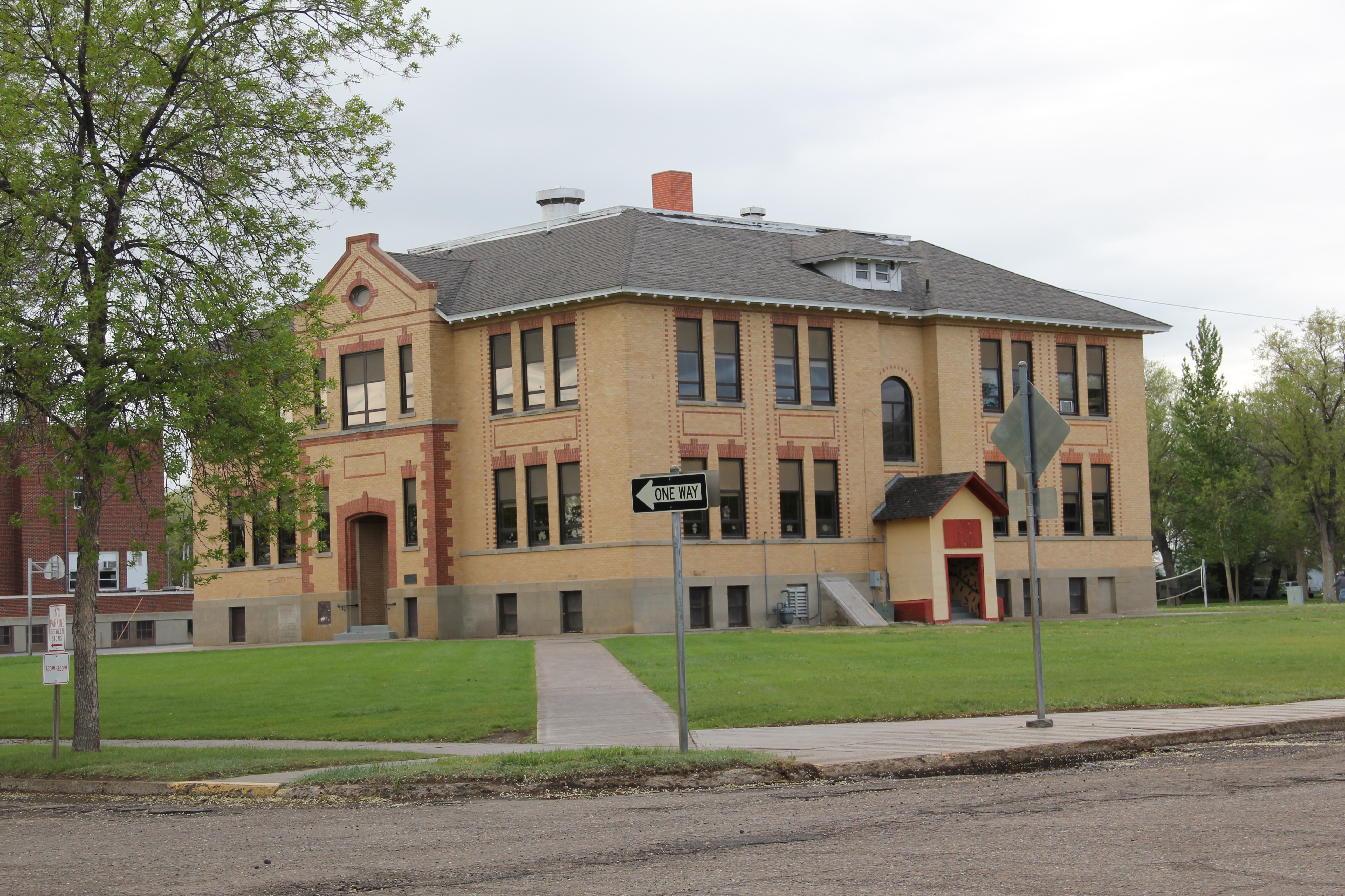
Then, just yards away, is another rambling montage of historic buildings, the schools of Prairie County, ranging from the large stately multi-story brick buildings of the early 20th century to more restrained modern buildings of the second half of the century.
IMG_7168
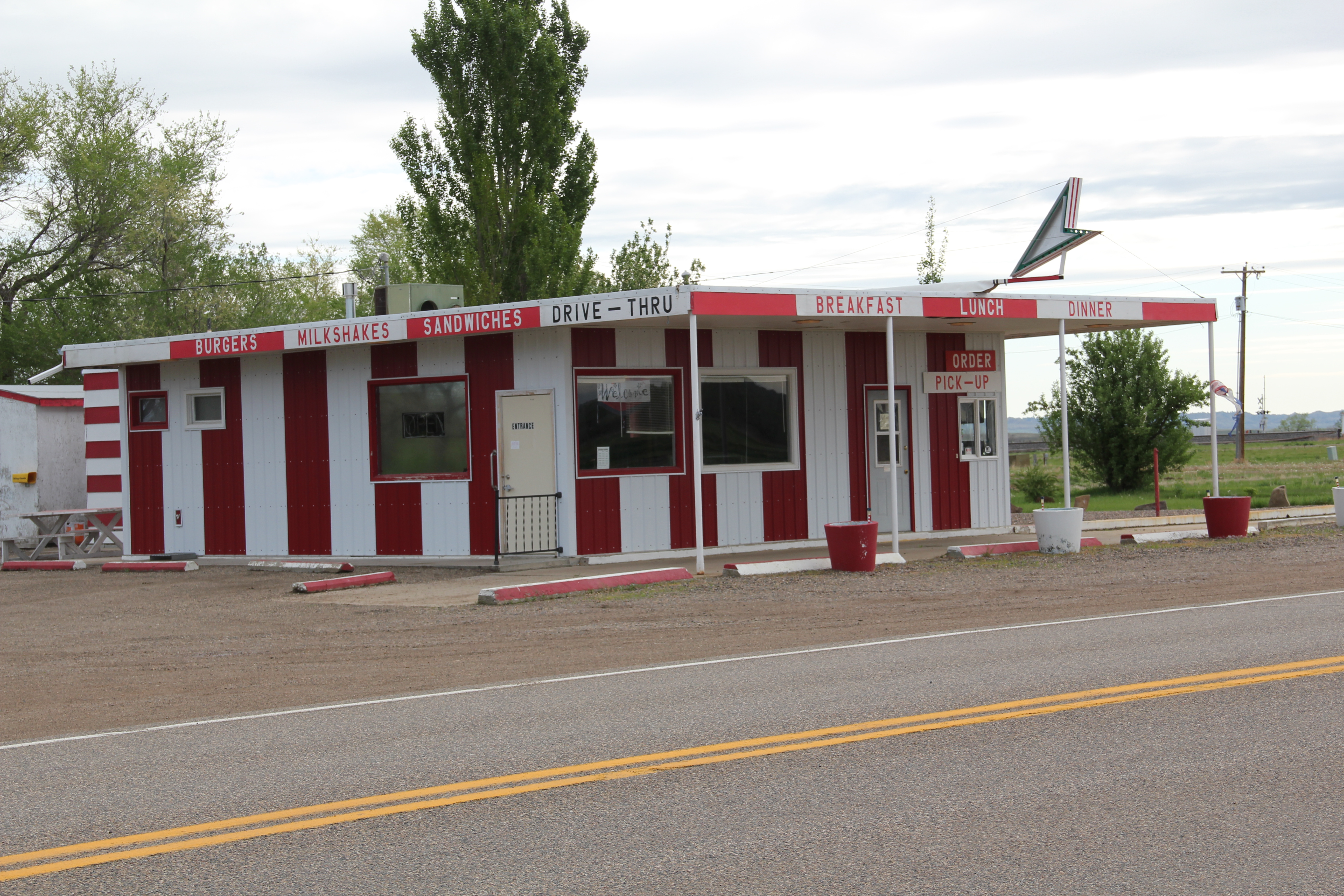
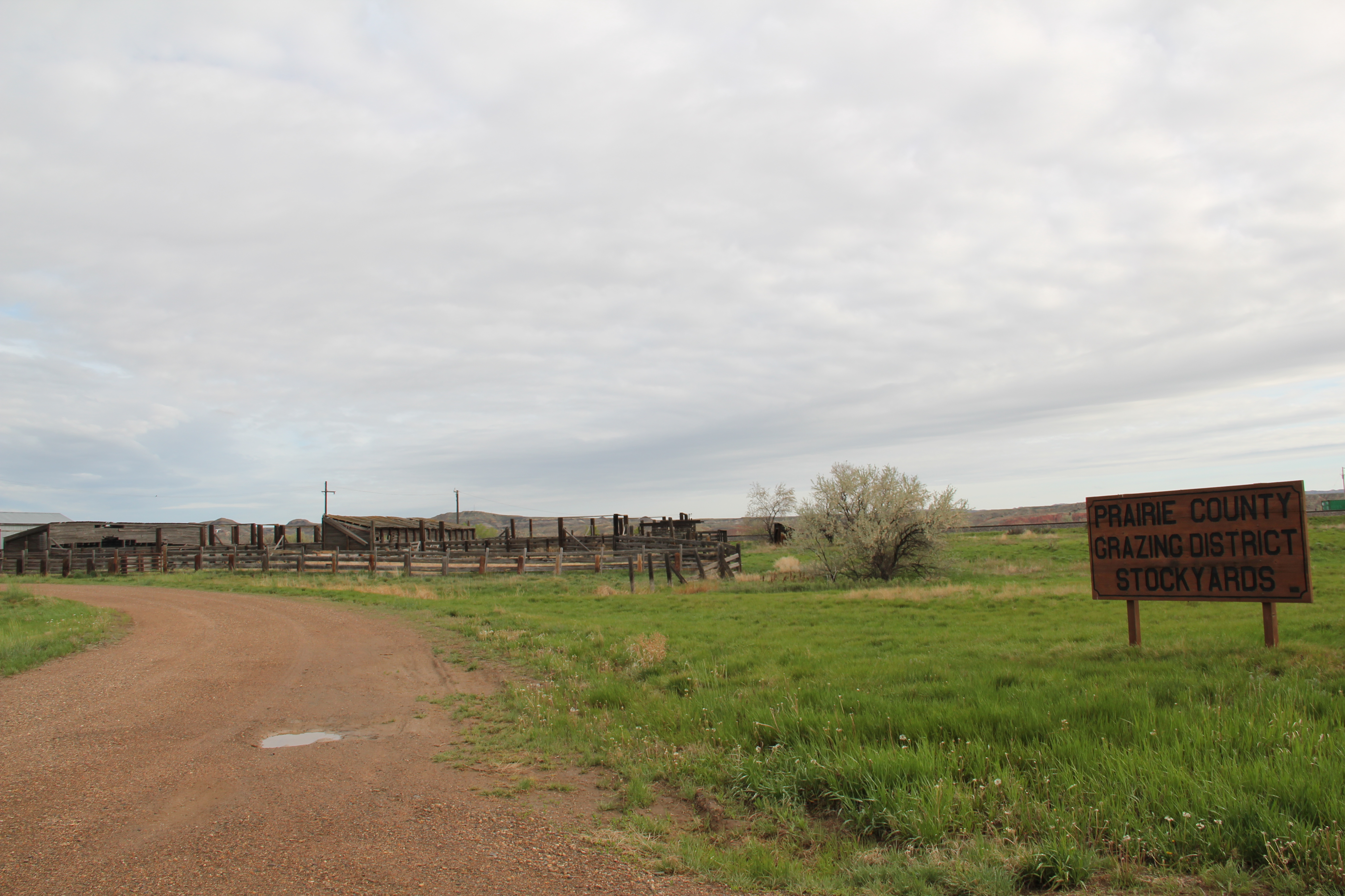
At the edge of town are three different properties, all related to the need for highway transportation. The Dizzy Diner is a classic 1950s drive-in while the crumbling Terry drive-in also speaks to past patterns in popular culture. Then the Prairie County Grazing District Stockyards connects the present to the past traditions of stock raising in this region.
IMG_7187
IMG_7191
IMG_7189
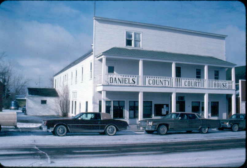
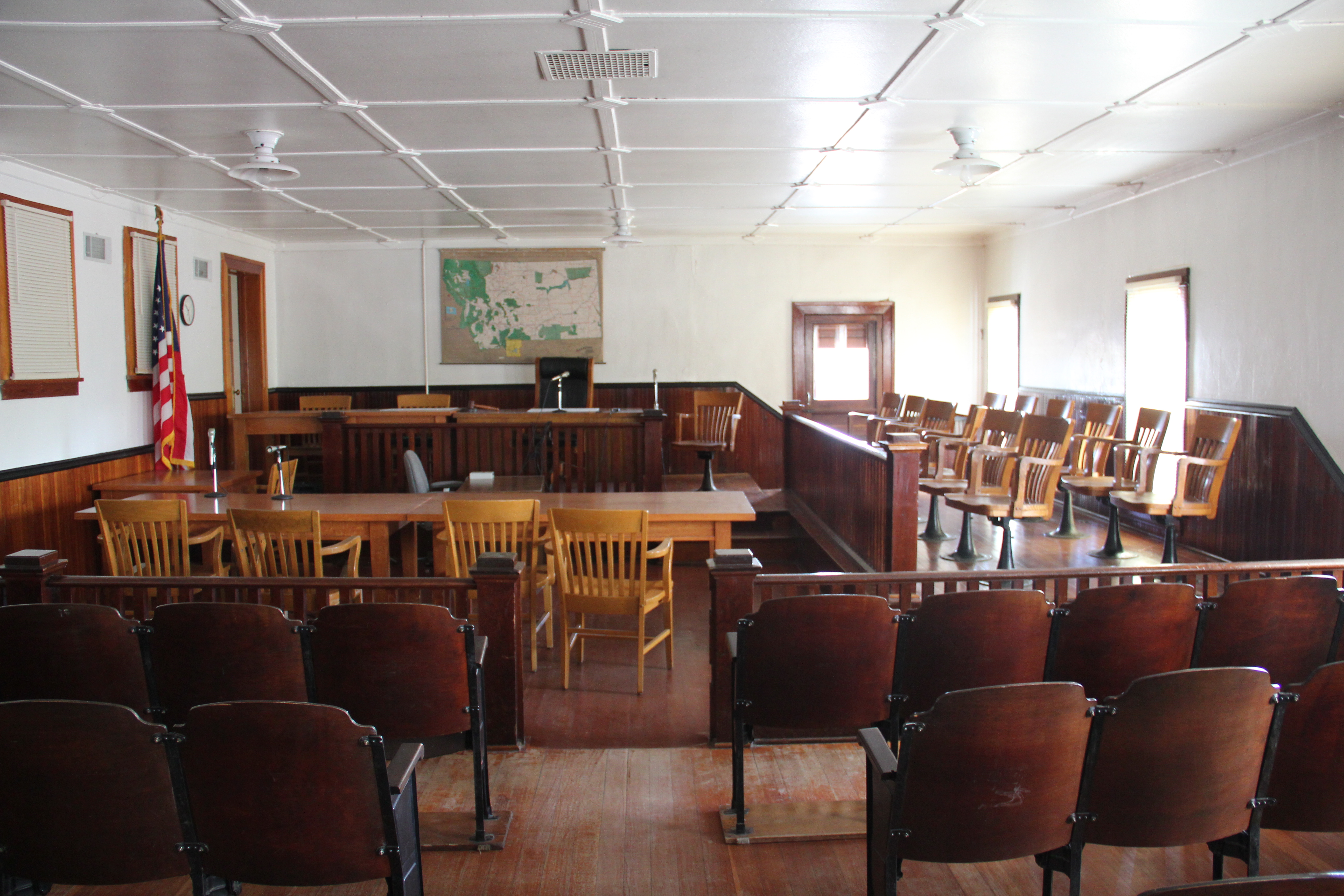
Certainly the biggest change is Terry from 1984 and 2013 was the transformation of the county courthouse. In 1984 I was shocked that there was only an unadorned concrete block building for the courthouse, and I have shared images of that building across the country. Well the concrete block building on Logan Avenue is gone, replaced by a much larger, still unadorned building for local government.
IMG_7174
IMG_7175
Terry’s population has dropped by a third since my first encounter with the town in the early 1980s. But new public investment, and a still commercially relevant “downtown” speaks volumes to the residents’ commitment and faith in this small yet significant Yellowstone valley town.

The high plains of Daniels County, Montana

IMG_7623

The high plains of Daniels County are among the most isolated places in all of Montana.  You may reach this place by heading straight north out of Wolf Point on a state road or you can come from the east on another paved road. Gravel roads are available as well.  Federal highways have never touched this place; railroads came, above is the Soo Line Corridor at Whitetail. They arrived from the east and dead-ended here on the prairie.

IMG_7650

Yet the isolation, the vernacular buildings, the fact that nothing is overtly special here actually makes it a special place. I liked it in 1984, when I made this image of the courthouse in Scobey–certain it would not be there for long.

Scobey MT jpeg

I liked it enough to return in 1988, and couldn’t wait to explore some more in 2013. In this blog, I have already spoken of the some of the remaining rural schools; the fairgrounds; the Soo Line railroad corridor; and, the survival of the Daniels County Courthouse, an old homesteader hotel that was once a bordello and still is used today by the citizens of Daniels County. As we take this detour from U.S. Highway 2 far to the south–the Canadian border is much closer to the north–here’s to Daniels County–the residents’ persistence, sense of community, and dogged determination means there is much to commend here.

IMG_7642

The courthouse proudly displays its National Register of Historic Places marker, although officials admitted that they do not get many “faraway” tourists (I found out Canadians naturally were not faraway-but someone from Tennessee, yes indeed).Dropped ceilings may be about but the courtroom retains its turn of the 20th century feel. The place was in great shape, considering the fact it was never built to be a public building, and its condition speaks to the pride residents have in this old false-front frame building.

IMG_7654

Another favorite haunt was the Scobey school, perhaps, next to the Catholic Church, the most architectural stylish building in the county. Keeping the Scobey in good shape and open is crucial to a town and county that has steadily lost population over the last 50 years. The population had dropped over 300 since the 1980s, and now is just over 1,000 residents.

IMG_7633

The Daniels County Cemetery, just outside of town, tells part of the story of those who came and are no longer here. But in the next post I will look in depth at the place that tells that story of change best–the quite wonderful Daniels County Museum, building zoo without rival in northern Montana.

IMG_7682

Dinosaurs on the Roadside

IMG_7916


One of the most fun discoveries I made along the U.S. Highway 2 roadside in Valley County was the Buck Samuelson “zoo” just west of Glasgow.  No dinosaurs hunting mountain sheep roamed the high plains when I traveled this region in 1984, and again in 1988, but they are there now, thanks to this self-taught sculptor.

IMG_7919

IMG_7918


Samuelson began adding the sculptures to the roadside in the early to mid-1990s, just as the region’s latest dinosaur touring craze took off.  Now there is a small zoo of creatures overlooking the road, and railroad tracks, adding a bit of whimsy, but also a strong dose of patriotism to the mix.  Who still thinks that roadside art–so famous in stretches of U.S. 2 to the east in North Dakota and Minnesota–is not a Hi-Line tradition?

IMG_7917

IMG_7915

Glasgow on the Hi-Line

IMG_2790

Glasgow, the seat of Valley County, has a rich small-town urban landscape, among the best along the Hi-Line of U.S. Highway 2.  Although businesses and population has struggled since I spent time there during my 1984 fieldwork (the population dropped from 4,455 in 1980 to 3,250 in 2010), the town retained an edge of vibrancy and vigor.

IMG_7984


Many of the patterns shaping life in the northern reaches in Montana are still on display within Glasgow, starting with the original impact of the Manitoba Road, then Great Northern Railway.  The combination passenger station continues to serve travelers, who if they wish to step off the train will find a classic strip of bars and cafes facing the depot.

IMG_7977


The railroad corridor has deeply imprinted the town, with giant elevators dominating the skyline while even the highway as it dips under the tracks by means of the New Deal-era underpass pays tribute to the true “right-of-way” through Glasgow.

IMG_7985  IMG_7983


So too has the federal government left a deep imprint on the town, from the irrigation projects of the U.S. Reclamation Service to the construction of Fort Peck Dam in the 1930s and then the Glasgow Air Force Base in the late 1950s and 1960s. The Glasgow Post Office and Federal Courthouse lies at the heart of downtown, reflecting in its blocky massiveness and Art Deco styling the federal presence.

IMG_7949

Just as important, the building tells the federal side of the local story through the New Deal mural, “Montana Progress,” by artist Forest Hill that adorns the lobby.  It is one of the state’s six extant New Deal post office murals. Here the coming era of progress–symbolized by railroads, irrigation (the sugar beet factory), Fort Peck Dam and electric power–supplants cowboys, Indians, and the rural landscape itself.

IMG_7945 IMG_7942


Another landmark featured in the mural is the Glasgow Civic Center, part of the larger effort to create community institutions in the face of the often overwhelming sense of change and despair during the Great Depression.  The Civic Center still serves as a town anchor, an important part of Glasgow’s public landscape.

IMG_7964

The federal imprint left a decided modernist turn to the townscape, although preservation efforts in the last generation have kept earlier classical or revival-inspired buildings part of the town, such as the Goodkind Block, the First National Bank, and especially the Rundle Building, which may be the town’s most distinctive architectural statement from its initial settlement and development era.

IMG_7982


IMG_7980

IMG_7952

The highway corridor shows the modernism of the 1950s most graphically through restaurants, bank buildings, and signs designed to grab the attention of all those who entered.

IMG_7888 IMG_7956


IMG_7988


Glasgow’s built environment tells the story of how federal programs, from irrigation to New Deal to the Cold War, could leave marks still apparent in the 21st century.


Fort Peck’s Transformation of Valley County, part 2

IMG_8015


For many visitors to Fort Peck, the grand, mammoth concrete spillway (which is actually in McCone County) is the takeaway lesson of this nationally significant New Deal project.  Photos in Life magazine made this place famous, and its modernist design was lauded not only in the United States but overseas as well.  When he visited the construction site in 1934 President Franklin D. Roosevelt insisted:  “people talk about the Fort Peck Dam as the fulfillment of a dream.  It is only a small percentage of the whole dream covering all of the important watersheds of the Nation.”

IMG_8109  IMG_8069


Fort Peck Village, constructed for officials of the project, visitors, and workmen, is on a wholly different scale.  One and two-story buildings, a general Arts and Crafts aesthetic with Colonial Revival buildings thrown in for good measure, curvilinear streets, open public spaces:  an attempt in general to establish a 1930s suburb feeling among the key administration buildings of the project.

IMG_8099  IMG_8094


IMG_8097

Historian Fred Quivik has written insightfully about the townsite, its development, and the changes it has experienced since, especially the expansion of the 1950s and the addition ranch-style houses and a contemporary-design school.

IMG_8106  IMG_8105


Fort Peck Village provided respite and recreation for administrators and workers.  The village’s most impressive legacy–and one of the most important buildings of New Deal Montana, is the Fort Peck Theatre.

IMG_8089


Nothing in Montana matches its Arts and Crafts-infused Swiss Chalet styling.  Details abound on both the exterior as well as the interior.

IMG_8078


IMG_8087


In 1984 I marveled at the building.  My colleagues at the Montana SHPO, especially Lon Johnson, had prepared me for it by sharing images and stories.  But nothing quite matches being in the space, as then experiencing a stage show as I did in 2013.

IMG_8111

The theatre, the town, and the colossi of the dam, reservoir, spillway, and powerhouses create a landscape like none other in the northern plains and one of the nation’s most powerful statements of the New Deal landscape.

Fort Peck Dam and the Transformation of Valley County, part 1

IMG_8000

The southern end of Valley County has forever transformed by the construction of the Fort Peck Dam, Powerhouse, and Reservoir during the New Deal of the late 1930s.  The huge construction project, building an earthen-filled dam across the river near an old fur trading post, employed tens of thousands of Depression-era workers and left a permanent federal imprint in the lake, the huge, iconic concrete spillway, and the village of Fort Peck.

IMG_8115

The massiveness of the project–reflecting the boundless ambition and optimism alike of government planners, engineers, and workmen–is difficult to grasp.  As you drive across

IMG_8005

the top of the dam, the high vantage point of the Montana plains is spectacular, and a reminder of just how radically the dam changed the Missouri River Country.  An interpretive kiosk–in need of repair and refreshening–tells of the Lewis and Clark Expedition and what it found and learned.  But as soon as you turn to the east, it is not a open, wild landscape, but one dominated by the soaring towers of the power plant turbines, two concrete and steel obelisks to the 1930s ability to transform, and that decade’s faith in hydroelectric power.

IMG_7995

The Corps of Engineers has recently opened a full interpretive center, not only about the dam’s construction but of the environment and wildlife of the region.  But the story of the federal imprint is most graphically portrayed in the village of Fort Peck, built for the key administrators and officials of the project as well as important guests in the 1930s. We will look at that story next.


Valley County’s St. Marie: The Federal Imprint, part 2

Image

A month ago, I explored the important of the U.S. Reclamation Service (now Bureau of Reclamation) on the middle of Valley County through its Milk River project, and paid particular attention to now largely forgotten towns such as Vandalia.  irrigation to make the arid prairie bloom was crucial to the county’s history.  But now let’s jump ahead and look at when the federal government literally just saw the county as a spot on a continental map–the perfect location high near the Canadian border to locate a major Air Force base.  

Image

The Glasgow Air Force Base, activated in 1957, was initially part of the Air Defense Command, a base for interceptors to stop any air attack from the Soviet Union.  By 1960 the base’s mission had expanded to the Strategic Air Command, and the runways lengthened to handle huge B-52 bombers and tankers (like those shown at the beginning of the iconic film Dr. Strangelove).  SAC abandoned the base in 1968–and although the military came back briefly in the mid-1970s and various private companies have tried to invigorate the base ever since, what the Cold War brought in the 1960s has largely turned into a Cold War ghost town.

Image

Local heritage leaders eagerly showed me what was then known as St. Marie’s Village, and spoke of it as a retirement location for the many airmen that had passed that way twenty years earlier.  Frankly, I wondered why they would come back–certainly the town then looked like a television set for Bewitched or countless other 1960s sitcoms.  

Image Image


Image Enlisted men barracks


Image Commanders quarters–single family homes

Rows of ranch-style houses, contemporary, modernist public buildings, modernist styled school buildings, curvilinear roads–it was a California suburb plopped down some 25 plus miles north of Glasgow.  

Image The Chapel

Image The school

Image Post Office & Community Center

The 1980 visions for St. Marie were never achieved–although just over 200 people in 2013 had bought into the idea and and restored to one degree or another the slowly disintegrating homes.  Most impressive to my mind was how respectfully they restored one of the buildings into City Hall–a statement of pride of what a few hundred people could achieve.

Image

And that is what I found a few ago–a huge place largely abandoned but still with life.  One in fact with some hope since there was new talk of a company buying the decayed place, rescuing homes, and turning it into the shelter for the oilfield workers of the Williston Basin, many miles to the east. Much had been lost in 30 years–how much more will survive the next 30 years?  Will the fate of St. Marie be, in general, the fate of Cold War installations across the West?

Image

Image

Valley County’s Farming Outposts, and some Lefse

Valley County–another huge Hi-Line county stretching from the border with Canada to the Missouri River–became one of my favorite places to explore in 1984, and then again in 1988. Fort Peck Dam made it a targeted area because I was interested in the New Deal agencies as back then an under-studied part of the national built environment, and because I came from Tennessee. Nowhere else did the New Deal leave such a heavy hand as the series of dams and lakes of the Tennessee Valley Authority. But in its massiveness–Fort Peck on the Missouri River came damn close.

Image

But let’s start considering Valley County not from its most visited landscape–Fort Peck Dam and Lake–but from its least visited the northern third of the county, where once thousands of homesteaders tried to make their mark but today only hundreds remain to help tell that story still documented by abandoned schools, scarely populated towns, and miles of open prairie. But some places from 1984 were so powerful that linger today, and Glentana School is one of those.

Image

It was abandoned but had hope in 1984–today it is 30 years into becoming a ruin, perhaps a majestic one at that, of the hopes and dreams of homesteaders at the end of the Great Northern spur line almost 100 years ago.

Image

Glentana had lost its post office–replaced by a plexiglass and metal postal delivery system one may guess it is called, a sure sign of being forgotten. Not so for its neighbor Richland, where the post office remains open (let’s hope it stays that way).

Image Image

But schools turned into homes and community halls are always signs of withering communities–indeed almost every business Richland had in 1984 was now closed.

Image


Image

Opheim, established in 1911, is the biggest place by far in the northern reaches of Valley County.  It had 85 residents in 2010, down from about 210 in 1984 and more than double that number in 1960, during the years that it served as federal radar base during the Cold War.

Image Image

Its population loss is documented not only in the historic town cemetery but also in its abandoned buildings. Yet, compared to other towns, Opheim had more than a sense of life about it, it had a strong sense of place and self, starting with the 1927 school remained vibrant, with a recent addition in place.

Image

The Mint Bar and Outpost were still in service, and the flag flew proudly over the town, and post office.

Image  Image

Most importantly, well at least after the school, is Granrud’s Lefse, once a family business that was fairly new in 1984 but that is now a regional institution for its traditional Norwegian lefse–a rolled potato snack that is fairly tremendous, and can be ordered online.

Image Opheim in 2013 is what it was, for so many years now: an outpost of America’s agricultural economy. Ignored and usually forgotten by most–true enough. But to those I have met there over 30 years, it is a place that helps to center life and community in the far northern reaches of Montana. And don’t forget the lefse.

Image

New Deal Transformations: A Hot Springs in Phillips County, Montana

 In 1922 the Bowdoin Oil and Gas Company was drilling on land about 4 miles north of U.S. Highway 2 and the tracks on the Great Northern Railway, on the high benchlands north of the Milk River. They struck not oil but “a flow of warm sulphur water,” estimated at 24,000 barrels per day. The oilmen didn’t need a hot spring and moved on. But local citizens in Phillips County thought long and hard about harnessing that natural resource, which was just east of the Nelson Reservoir of the Milk River Irrigation Project of the U.S. Bureau of Reclamation.

Image

By the mid-1920s local residents, led by the Malta Commercial Club, developed a plan–known as the “Malta Plan,” that involved the federal purchase of submarginal land in order to enhance conservation and also to gather greatly scattered ranchers into central locations in order to address land erosion and settlement patterns. As summarized by Bernie Alt and Glenn Mueller in their “Evolution of the National Grasslands”:  “The gist of the plan was that the Federal Government would take options to buy or buy outright land from farmers and ranches who could not continue to operate as in the past because of low prices, drought, erosion of land, and other reasons.  Any of the individuals who desired would then be resettled in the Milk River Valley.”  The Malta Plan became the proverbial first step towards not only the later Resettlement Administration (1935-37) but its successor the Farm Security Administration and then the National Grasslands. Re-purchase and then re-seeding in grass of abandoned homestead land was the big picture, and Phillips County was front and center in this national experiment from the 1930s on.

Image

But this story focuses on what changing federal land policy meant for one place in the county–Sleeping Buffalo Hot Springs–that is now being re-energized and restored by determined property owners. When I visited the hot springs in 1984, I did not consider it much of a place. The buildings needed work; everything looked dated, worn. I did not dig deeper–and just assumed that there was not much a story here. Matters looked maybe even worse when I visited in 2013–the place was closed, abandoned, and seemed to have little hope. Local residents told me great stories of the springs’ best days. Those seemed to be gone forever.

Image

Then I noticed a small hipped roof open-structure which was certainly there in 1984–but my eyes had not been trained by viewing hundreds of New Deal-era structures to notice it. Here was existing truth in the ground that spoke strongly to the larger story of the New Deal transformation of Montana’s plains.

Image

The structure covered Public Water Reserve No. 141, federally established in 1931 by executive order from President Herbert Hoover to protect the hot springs. In 1932, the federal government transferred the well to the Saco Post #79 of the American Legion for development of recreation uses. By the mid-1930s, the American Legion Health Pool was open, and the tradition of the Sleeping Buffalo Hot Springs was underway. The New Deal guidebook for Montana encouraged visitors to go to the Health Pool for its recreational and “curative” waters and the Legion sold postcards like the one below.

Image

In the second half of the 20th century, the American Legion transferred the property to private owners, who expanded operations and launched the Sleeping Buffalo Hot Springs, so named for a sacred rock that stood down on U.S. Highway 2.

Image

What happened to the well? It is still there, with bronze markers explaining how this spot is part of the Resettlement Administration’s Land Utilization program–what became known as the Malta Subsistence Homesteads project centered around Wagner between Malta and Dodson. When I traveled Montana in 1984, I did not give enough attention to federal law, water rights, and the impact of the Reclamation Bureau.  You cannot miss the impact as you travel U.S. 2 between Chinook and Saco.

Image

Blaine County spawned the landmark Supreme Court decision on federal water rights of Winters v U.S. (1908). Phillips County spawned the first federal resettlement project and the “Malta Plan.” Historian Joseph Kinsey Howard in 1946 remarked: “So many federal agencies have had their ambitious fingers in the Malta pie that few even among project officials can be quite sure of all of them.”

Image

Today there is little but the transformed landscape itself to mark how these two rural places shaped national law. The next period of the hot springs’ history is being written right now. Michelle Lefdahl Simpson (a Phillips County native) and her husband Dennis are restoring the place–a process you can follow on the Facebook page for Sleeping Buffalo Hot Springs. Michelle Simpson told the Phillips County News in May 2014: “When I was little and we would head to the Sleeping Buffalo, we would travel the approximately 20 miles from Whitewater on the gravel roads,” Michelle said. “I would be sitting in the back seat with my siblings waiting to see that big blue slide come out of literally nowhere and all I could think about was getting my wrist band on and racing up to the top. For me, it was as if our parents took us to Disney-land or something.”  Here’s to the Simpsons for stepping forward to reclaim a forgotten 20th century Montana landmark.

Montana’s Malta: More Travels along the Hi-Line

Phillips County is one of my favorite places along the Hi-Line. The Milk River Valley is beautiful; the high plains at Loring and Whitewater are lonesome yet compelling. Empty I guess is how many would describe the county as just over 4250 people live there–in a county of 5,212 square miles.

Image

Loring Hall in 1984

But the diversity of the landscape is memorable. The southern tip of the county is the gateway to the Charles M. Russell National Monument, truly one of the great national parks that few people know about but home to some of most overwhelming views of the Missouri River. North of the Missouri are the southern end of the Little Rocky Mountains and the old mining towns of Zortman and Sandusky.

Image

Abandoned cabins at Zortman, 2013

I have already written about the two Hi-Line towns on the west end (Dodson) and the east end (Saco). Now it is Malta’s turn. When I visited there in 1984 little did I know that Malta was at its population peak.

Image

The 1980 census counted 2,367 residents–never had the town had that many people, and judging from the last three decades, that number is never returning: the population is now under 2,000. The 1980 as a peak population decade–not common among Hi-Line towns, but that wasn’t all that set Malta apart from what I encountered east or west.

Vibrant community institutions anchored the town. The neoclassical Phillips County Courthouse (1921) served as the foundation for the east end residential neighborhood. Designed by Great Falls architect Frank E. Bossout, the red brick courthouse reflects a more restrained expression of the popular classical revival movement, especially compared to Bossout’s earlier more flamboyant Beaux-Arts design for the Hill County Courthouse (c. 1914) in Havre. (I wish they would remove the vines–not good for the bricks.)

Image

Nearby was the Carnegie Library, which had been recently converted to serve as a county museum. In 1984 the community was quite proud of the place, recently (1980) listed in the National Register of Historic Places.

Image

Now the museum has moved to new quarters, the Phillips County/ Great Plains Dinosaur Museum, on U.S. Highway 2, where dinosaurs are the primary attraction moreso than local history after a major nationally-noted dinosaur discovery happened in the county in 2000. Yet the town has preserved a notable local house, the Victorian-style H.G. Robinson House (1898), nearby the new museum and there in a domestic setting the town’s early history and settlement is interpreted. The new highway historical/cultural institutions are improvements–but have come at a real cost: a crumbling Carnegie Library, the town’s only National Register-listed property that needs help, now.

Image Image

Another community institution was the Woman’s Club of the late 1930s, a Rustic-style building that has been discussed earlier in the blog, as part of the institutions that spoke to women’s history that I missed and could not “see” in 1984. But it was also one of three major New Deal buildings that missed–the others being the two-story brick WPA-constructed City Hall and the massive brick “Old Gym” that once served the high school.

Image

Image

Malta also had its share of schools and churches, although again I did not “see” in 1984 the beauty of the contemporary-styled St. Mary’s Catholic Church from c. 1960.

Image

Malta’s business district is the classic T-town type of design found all along the Great Northern line. It too had its anchors: massive grain elevators and grain storage bins, along with the Arts and Crafts styled Great Northern passenger depot, defined the top of the “T”.

Image Image

Once you took the New Deal-era underpass to go under the tracks, there was the neoclassical First State Bank introducing the “stem” of the T and several blocks of businesses: two movie theaters (both closed now unfortunately) and an Art Deco-styled auto dealership being particularly notable buildings.

Image


Image

Although it was in rough shape Malta also had its railroad/highway park (Trafton Park) on the north side of U.S. 2, where the original U.S. Highway 2 passed using a steel Parker through truss bridge to cross the Milk River.

IMG_8224

Nearby was a railroad bridge allowing Great Northern passenger trains to do the same.

Image

Malta, Great Northern Bridge over Milk River, 1984

The town also had its own rodeo grounds, tucked away next to a historic livery stable at the corner of N 2nd Street and N 2nd Avenue. The Maltana Motel–even in 1984 it struck me as a classic 1950s motor court–was the place to stay then, and now. It is one of the few survivors of the “Mom and Pop” roadside abodes I enjoyed in 1984 along the Hi-Line.

Image

Malta has many potential National Register listings–as the many photos here suggest. And all of these heritage assets could be a valuable foundation for new visions and investment. The community is keeping the buildings in use and in general decent repair. But you worry about the future–if the town’s recent trend of population decline continues.