
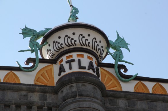
 Recently one of my graduate students from almost 20 years ago, Carole Summers Morris, contacted me. Carole had just discovered that her family had roots in Carter County, Montana–and she wanted to know if I had ever been in Ekalaka. I told her yes, in 1984, as documented by the postcard below I picked up on that trip, and most recently in 2013.

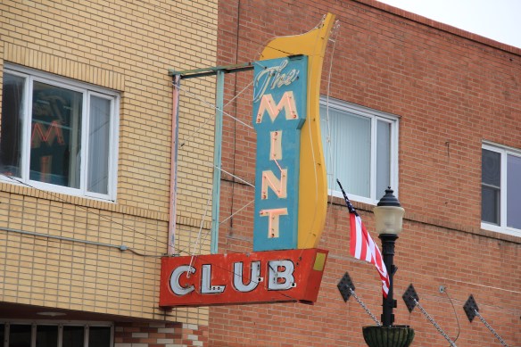
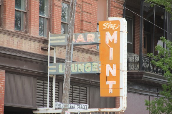
I pointed Carole to my December 2014 blog post on Ekalaka. When I visited that post itself, to remind me what had caught my eye in Ekalaka in 2013, I found out that I promised another post on the area–and had never done it. So, to honor that initial promise and to show Carole more of the town, here is Ekalaka revisited.
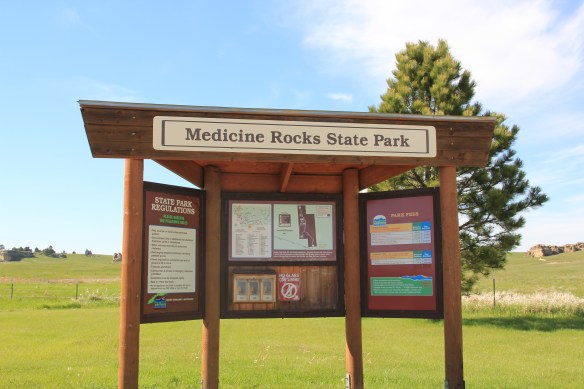

My big omission in the December 2014 post was to say something about Medicine Rocks State Park. As I drove south on Montana Highway 7 to Ekalaka in 1984, nothing quite had prepared me for this collection of wind-carved rocks lining both sides of the highway.

Medicine Rocks State Park in 1984.
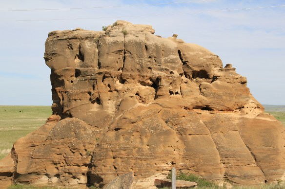
The same exposed boulder in 2013.
I immediately thought that here was a landscape of both natural beauty but also of great cultural significance. In A Traveler’s Companion to Montana History (1986) I noted that “The Sioux called the country Inyan-oka-la-la, or “rock with hole in it.” The Medicine Rocks, which stretch for several miles, have ceremonial and religious significance for Montana Indians. It is a place where they often gathered to pray to the Great Spirits, and to ask for spiritual guidance. Within the park, several stone circles mark the location of Native American camps, and there is a large medicine wheel… In the hills visible on the horizon, Indians found sources of red and blue pigments for the ceremonial paints they work at the Medicine Rocks.” The text included the black and white image above.
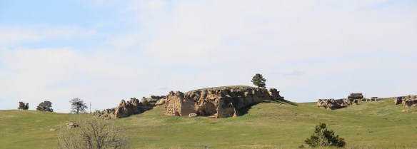


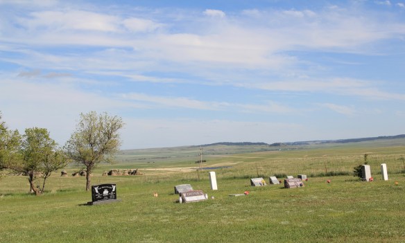
In 1984 I thought that this place would surely become Carter County’s first National Register nomination–that still has not been achieved. In 2013, I also picked up a rural church and cemetery that I somehow missed 30 years earlier, the Medicine Rocks Church, which overlooks the park. The cemetery is particularly at a beautiful site.

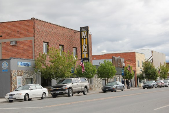
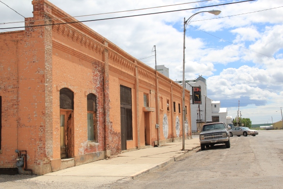
 For Ekalaka itself, my 2014 post focused on public buildings such as the Carter County Courthouse and the historic elementary school. I did not include an image of the old town

bank, which is now restored as city offices and is the first property to be listed in the National Register of Historic Places. Nor did I include the old hotel building below.

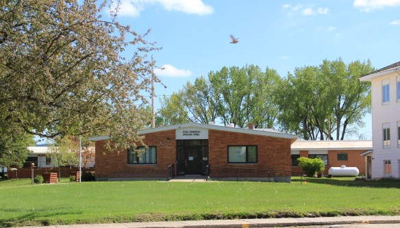 I mentioned the existence of the nursing home next to the county courthouse–an arrangement of space not seen elsewhere in the state–but did not include a photo of the c. 1960 Dahl Memorial Nursing Home.


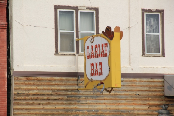
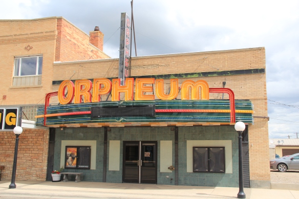
Indeed I did little with the town’s domestic architecture, even though several buildings are noteworthy, as commercial buildings become residences and then historic houses become tourist-oriented businesses, as seen above.
 I didn’t even include all of the buildings at the excellent Carter County Museum, such as this well-crafted log residence from the early settlement period, the Allenbaugh Cabin, dated c. 1882-1883, probably the earliest surviving piece of domestic architecture in the county today. When I visited the museum in 1984, the cabin had been acquired but it was not restored and placed for exhibit until the late 1990s.

So thanks Carole for prompting me to return to Ekalaka–a remarkably friendly place, and one where a tiny town in a wide open landscape still speaks to the roots of Montana history and culture.


 The Montana State Capitol was my first heritage project in the state–the Montana Department of General Services worked with the Montana Historical Society to have me prepare an interpretive guide to the capitol, and then set up the interpretation program, following an excellent historic structures report prepared by the firm of Jim McDonald, a preservation architect based in Missoula.


 When I worked at the capitol, of course I passed daily by other state government buildings, and rarely gave those “modern” buildings another thought, except perhaps for the museum exhibits and archival collections at the Montana Historical Society. Years later, however, what seemed unbearably recent in the early 1980s were now clearly historic. One of my MTSU graduate assistants, Sarah Jane Murray, spent part of a summer last decade helping develop a inventory of the buildings and then, finally, in 2016 the Montana State Capitol Campus historic district was listed in the National Register of Historic Places.


 The Capitol Annex (1910) was the first building added to the capitol campus, and its restrained classicism came from the firm of Link and Haire.
 The nearby Livestock Building (1918) is like the annex, complimentary of the capitol’s classicism but also distinguished in its own Renaissance Revival skin. Link and Haire were the architects.
 The mammoth Sam W. Mitchell Building (1948-50) reflected the post-World War II interpretation of institutional modernism and its mammoth scale challenged the capitol itself, especially once a large addition was completed at the rear of the building in 1977. The architect was Vincent H. Walsh of Helena.
 Another Link and Haire building on the campus is the Board of Health Building (1919-1920), which continues the pattern of more restrained architectural embellishment that shaped the look of the government buildings in the middle decades of the century.
  The Cogswell Building (1954-55, 1981) is another Vincent H. Walsh design, again reflecting the stripped classicism institution style often found in Cold War era public buildings.
 While the capitol campus took form on a hill about a mile east of Last Chance Gulch, the state’s governor still lived downtown, in the Queen Anne-style “mansion” originally built by miner and entrepreneur William Chessman and designed by the St. Paul firm of Hodgson, Stem and Welter. The state acquired the house in 1913 to serve as the residence for the governor and his family, and it remained the governor’s “mansion” until 1959.
 It was the opportunity to be the curator of this house museum that attracted my newlywed wife Mary Hoffschwelle that led me to come with her to Montana. She was born in Billings; I had never been west of Dallas. But then over 25,000 miles of driving, visiting, and looking in Montana transformed me, and led not only to the 1986 book A Traveler’s Companion to Montana History but now this Montana historic landscape blog. Fate, perhaps. Luck–I will take it any day.
 Helena, the capitol city of Montana, was where I made my home from 1981 to 1985, and served as my base for travels far and wide across the state during my work for the Montana State Historic Preservation Office’s preservation plan in 1984-1985. I started the project at the 1950s modernist Montana Historical Society building next door to the state capitol.

 Helena then was a small town but a big urban environment, and I used to enjoy exploring its two sided urban landscape: the 1970s “Last Chance Mall” where planners and designers closed the street for a few blocks and inserted a pedestrian mall, thinking that a “walking mall” experience would keep businesses downtown, and then the rest of the downtown before urban planners decided to change it into something it never was.


 The impetus behind the urban renewal of the 1970s was not only federal dollars through the Model Cities program but also federal presence. Officials wished to anchor the new Last Chance Gulch Urban Renewal project with a Park Avenue section that

 The pedestrian mall on its west side ends at the imposing Richardsonian Romanesque styled T.C. Power Block, one of my favorite commercial buildings not just in Helena but in all of Montana.

 This downtown has several architectural landmarks, as you see below with the Art Deco-styled First National Bank building, and then a short block away, a magnificent statement of power and influence, the Montana Club, designed by noted architect Cass Gilbert.


 Once you cross Neill Avenue, you enter a new downtown of 21st century Helena, created by the demolition of the historic Great Northern Railway passenger station in the 1990s and the construction of a new Federal Reserve Bank. Here suddenly was a new downtown
 anchor, similar to that of the 1977 Federal Building on the opposite end of Last Chance Gulch. And the name given to this? the Great Northern Center, where not only the


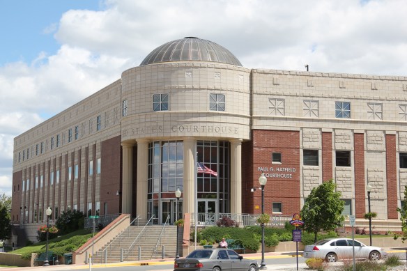 Federal Reserve lived but also a huge new Federal Courthouse, the Paul G. Hatfield Courthouse (2001-2002), a neoclassical monument of a scale that Helena had not seen since the construction of the State Capitol more than a century earlier, along with its more
 modern styled neighbor, the Senator Max Baucus Federal Building. In less than 40 years, the federal presence not only moved from one end of the gulch to another, it had become much larger and architecturally distinct.


 At first glance, Dutton is like many northern plains railroad towns, located on the Great Northern Railway spur line between Shelby and Great Falls. The false front of Mike’s Tavern, then other plain, functional one-story buildings–we have seen hundreds of similar scenes across the Big Sky Country.
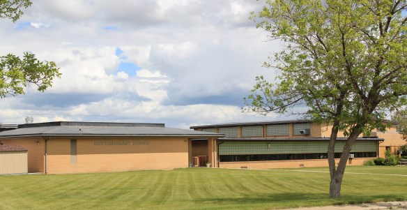 Then, suddenly, there is the cool mid-century modernism of the Dutton-Brady School (Brady is another neighboring railroad town), a style also embraced by the Bethany Lutheran Church.

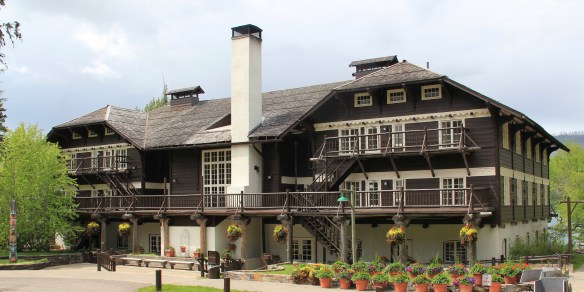
 All of Glacier National Park is spectacular, frankly, but as you reach Logan Pass and consider the historic architecture on the east side of the park, often the landscape itself overpowers the man-made environment, be it the modernist visitor center at Logan Pass, above to the left of center of the image, or the Many Glacier Hotel on the north end of the park, below. The manmade is insignificant compared to the grandeur of the mountains.
 The reverse is true at East Glacier, where the mammoth Glacier Park Lodge competes with the surrounding environment. The massive log hotel was the brainchild of Louis Hill, the president of the Great Northern Railway, who wished for a building that could mirror the earlier 1905 Forestry Hall for the Lewis and Clark Centennial Exposition. Hill had the vision but architect Samuel L. Bartlett of St. Paul, Minnesota, carried the vision into an architectural plan.
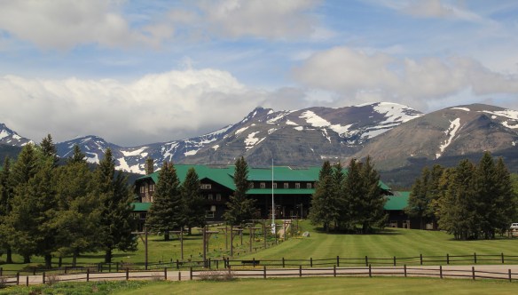


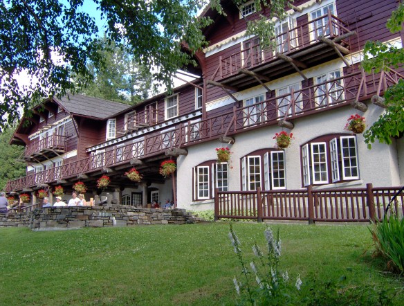
 But the long landscaped walkway from the Glacier Park Lodge to the Great Northern passenger station, also themed in Rustic style, let everyone know who was in charge–the railroad, whose influence created the national park and then built the facilities that defined the look of the park for the next 100 years.


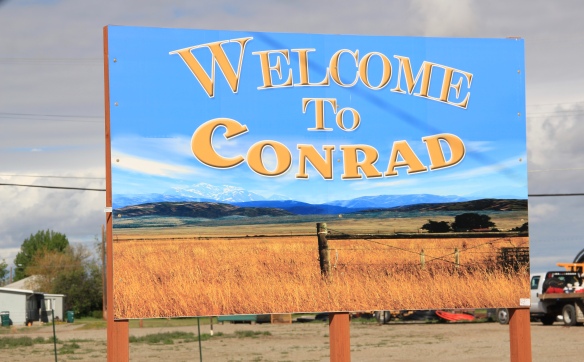 Conrad, the seat of Pondera County, is a railroad town, although the town’s close proximity to Interstate I-15 means that so many have forgotten the importance of this Great Northern Railway spur line that stretches from Shelby on the main line south to Great Falls.
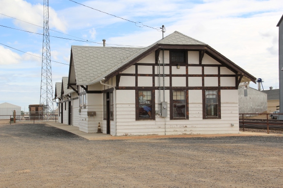
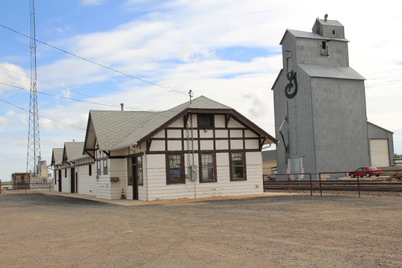 The town’s 1920s Arts and Crafts/ Chalet style Great Northern passenger station, along with grain elevators, serve as a reminder of the railroad’s importance to transporting the grains from neighboring ranches.
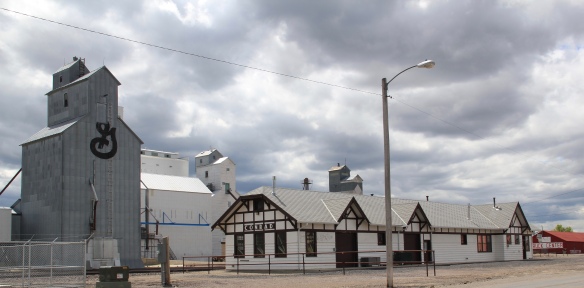 Facing the depot is a combination symmetrical town, with one story brick buildings, several of them classic western bars, and then a block long T-plan that connects to the historic federal highway U.S. 87.
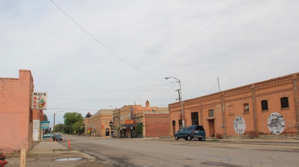

 I am speaking instead of the wide range of images and themes that visually interpret the town’s and county’s history. Finding public art murals about the open landscape once dominated by the Blackfeet Indians and the buffalo is not surprising–communities often embrace the deep history of their land.
 That Cut Bank also has a large expressive mural about the Lewis and Clark Expedition is not surprising–murals about Lewis and Clark were installed across several towns during the bicentennial of the expedition in the first decade of this century. East of Cut Bank is Camp Disappointment, one of the more important sites associated with the Corps of Discovery.
 Nor is it surprising to see communities commemorate their homesteading roots, and the importance of agriculture and cattle ranching.
 But I was surprised, pleasantly, by the number of murals that also documented the town’s twentieth century history, whether it is the magnificent steel trestle of the Great Northern Railway just west of the commercial core, or a mural that reminded everyone of the days when the railroad dominated all traffic here.

 It is this first half of the 20th century feel that the murals interpret–the era that actually built most of the historic buildings you find there today–that I find so impressive and memorable about Cut Bank, be it people on bicycles or what an old service station was like.
 Space matters when you interpret the built environment, and these various murals reflect not only a sense of town pride and identity they also give meaning to buildings and stories long forgotten.
 Somehow it is most appropriate that my 300th post for Revisiting the Montana Landscape would find me back at Glacier National Park, especially the west side or Flathead County part of the park. From the first visit in 1982, Glacier always intrigued me–at first because of the tie between park creation and railroad development, then the Arts and Crafts/Chalet architecture associated with the park, and then high mountain Alpine environment. In the years since, I have eagerly grabbed a chance to get a cabin by Lake McDonald and just re-charge for a few days.
 For the 1984-1985 state historic preservation plan work, however, I did not visit the west side of the park–the bulk of the travel took place between mid-February to mid-May 1984, meaning only the lower elevations such as Apgar Village were accessible. But already the state historic preservation office was aware that a major effort was underway to identify and nominate key properties within the park to the National Register of Historic Places, and by the end of the decade that process was largely complete. The National Park Service identified a range of historic resources from the turn of the 20th century to the Mission 66 program of the National Park Service during the 1960s–Glacier became one of the best studied historic landscapes in all of Montana.


 Register as an excellent example of Mission 66-associated architecture within the park. Burt L. Gewalt of the Kalispell firm Brinkman and Lenon was the architect.
 Great Northern officials considered the lodge to be the center of the mountain experience on the park’s west side. From there visitors could take overnight hikes to two other facilities, shown below, the Granite Park Chalet to the northeast or the Sperry Chalet to the southeast of Lake McDonald, both of which are also listed in the National Register.

