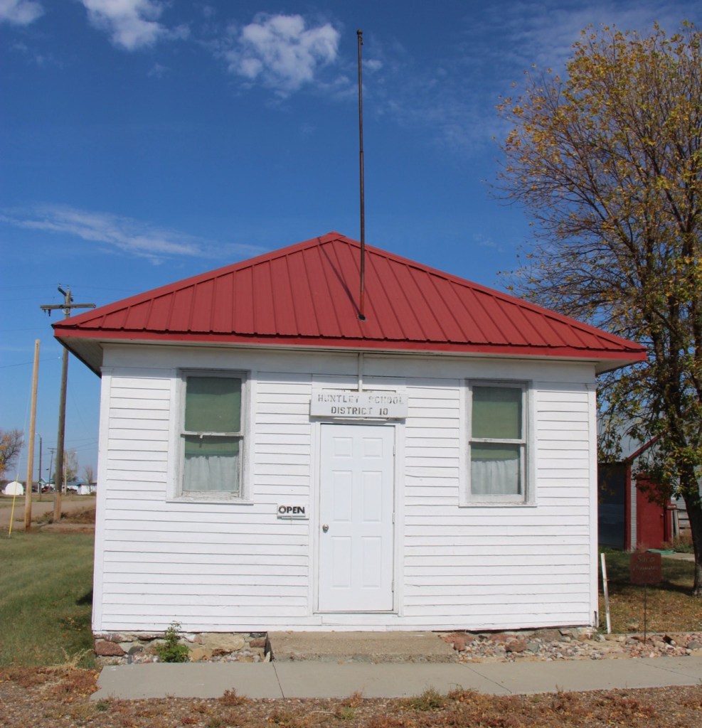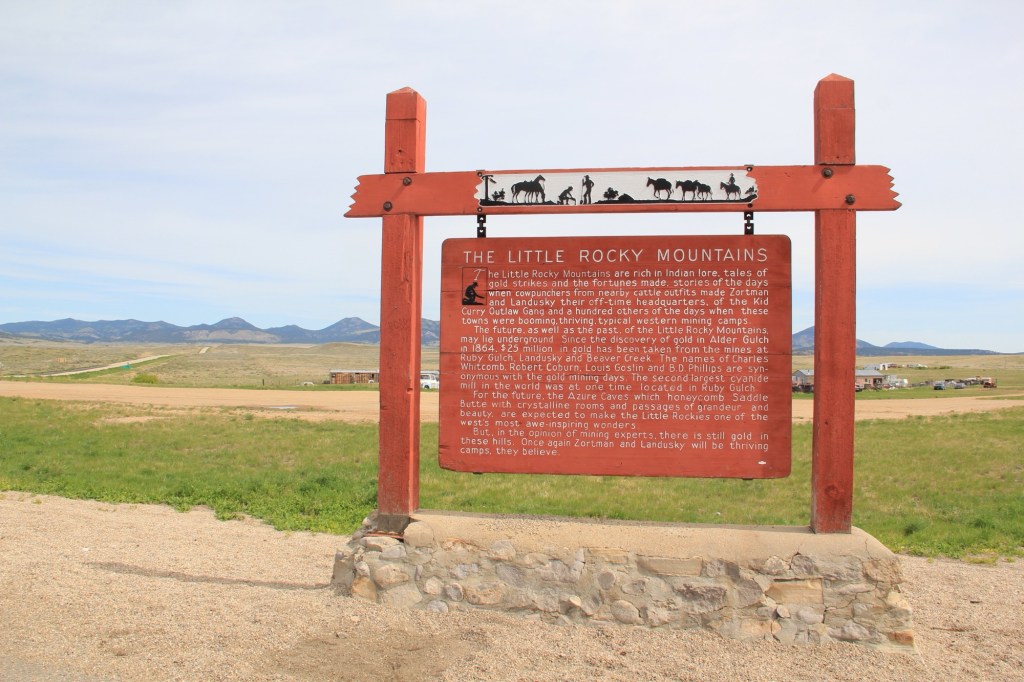
It would not be unfair to suggest that, perhaps, Montana has too many highway history markers. There are the classic ones of the mid-20th century by the state highway department with wonderful silhouettes from Helena artist Shorty Shope, as shown above.
Then there are hundreds of contemporary interpretive markers everywhere—markers that you just didn’t see back at the time of my historic preservation plan survey of 1984.
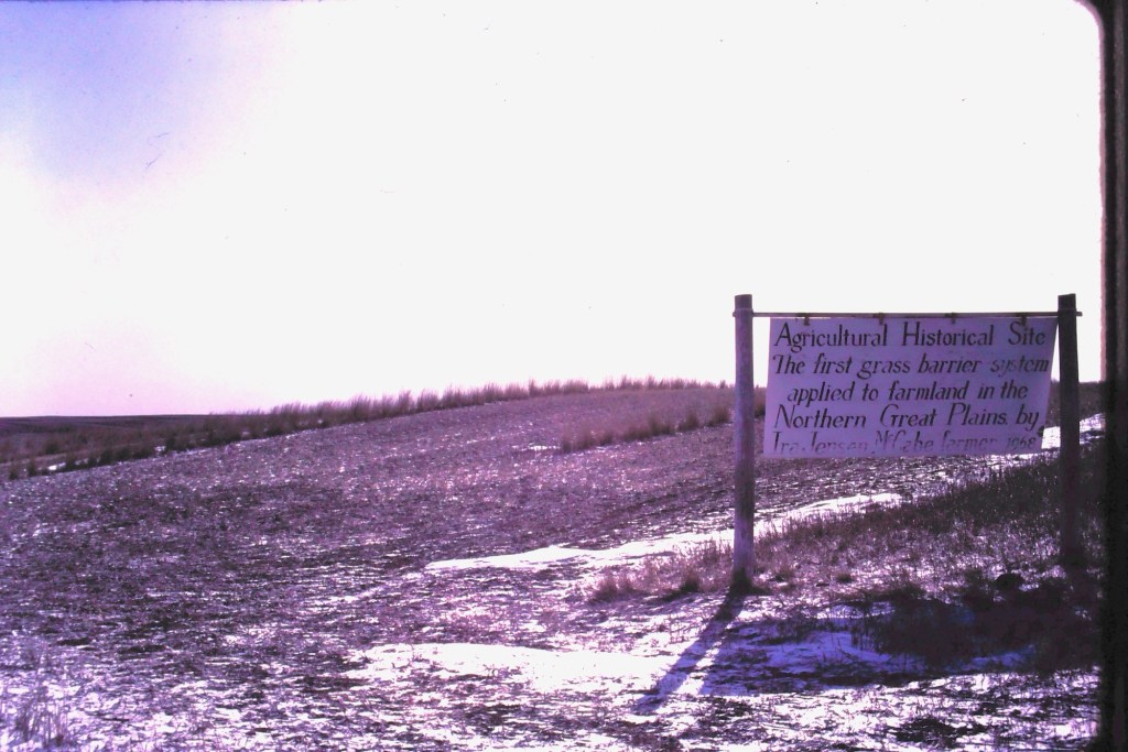
But early in that survey work in March 1984 I encountered along Highway 16 in Roosevelt County a sign that marked an “Agricultural History Site” crediting farmer Ira Jensen McCabe for the northern plains’ first “grass barrier applied to farmland.”
Ever since that encounter, I have been fascinated by Montana’s handmade history signs. Here are some of my favorites.
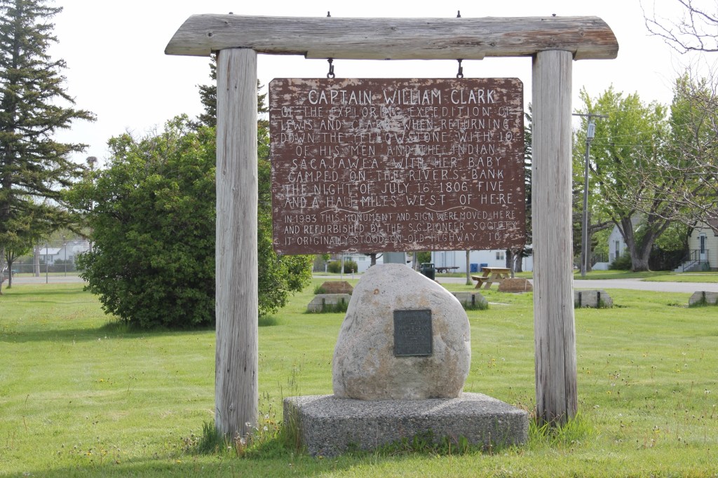
In Big Timber this marker (above) about Captain William Clark was on old U.S. Highway 10 until 1983 when it was moved to the city park of Big Timber. It was fresh and somewhat shiny then—40 years later it’s a bit worse for wear.
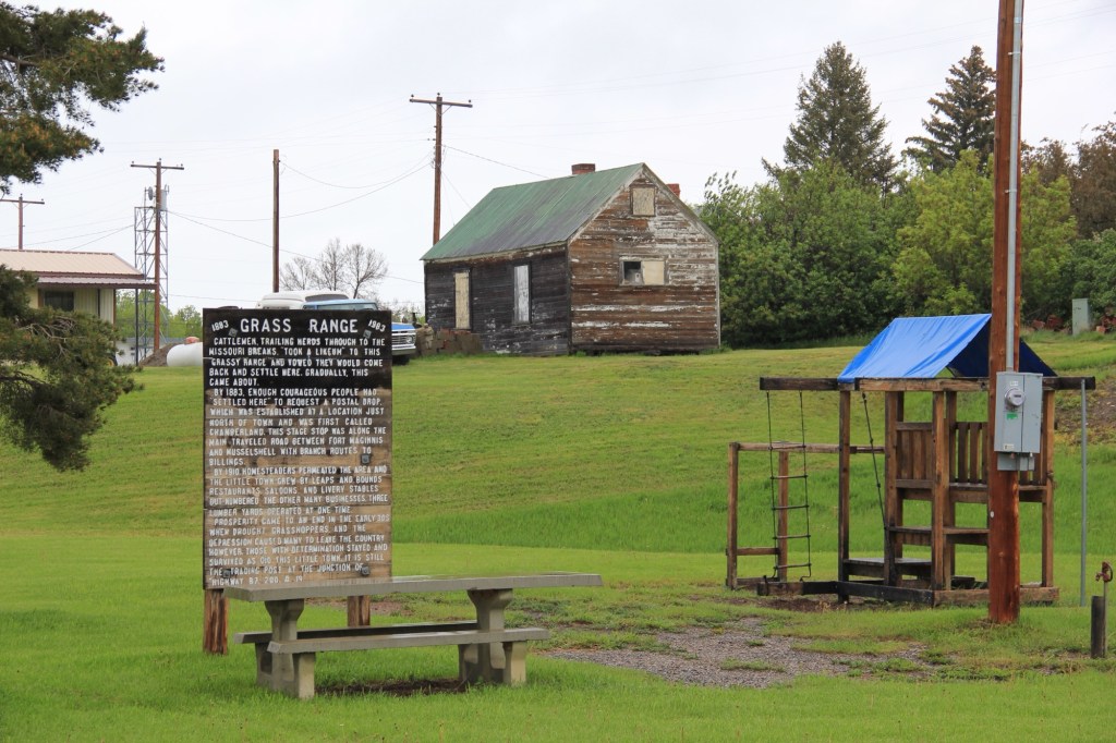
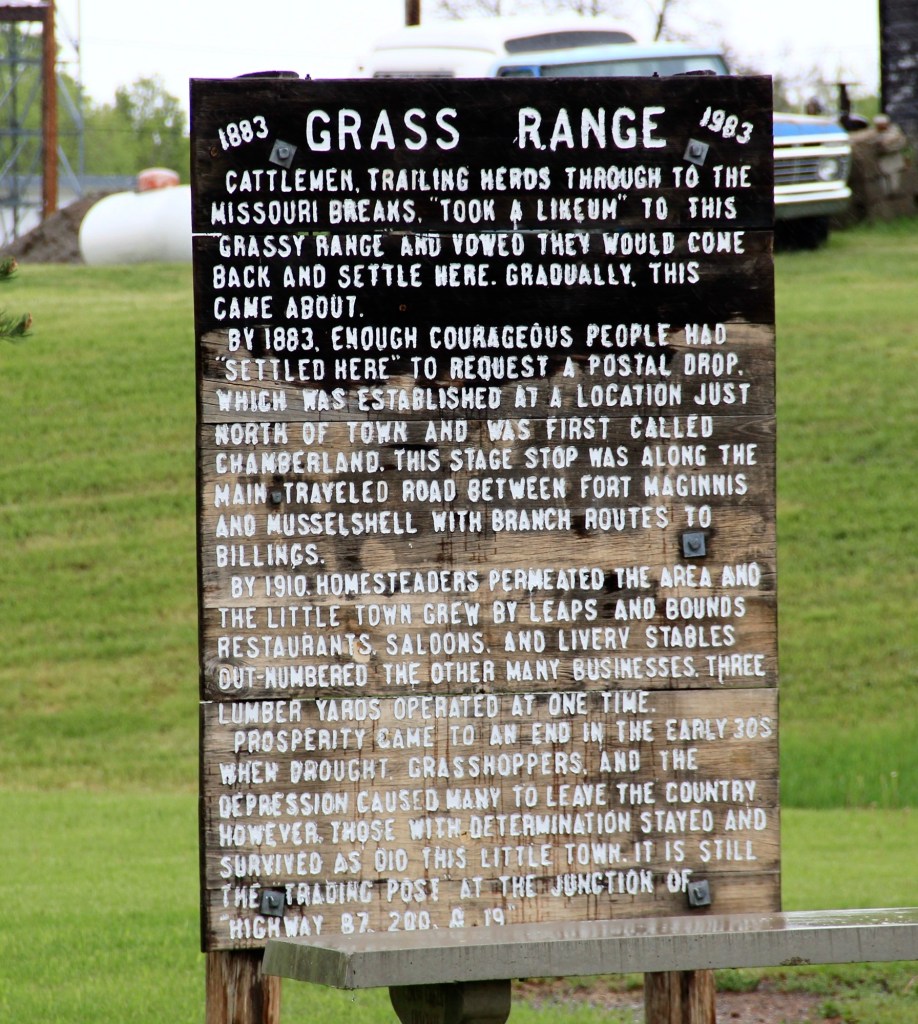
At the town park of Grass Range in Central Montana residents shared their history at some depth. This place is not on Highway 200 and it’s almost like the 1983 sign is there to remind residents of their past—then you find out that the park was where the community celebrated its 100th anniversary in 1983.
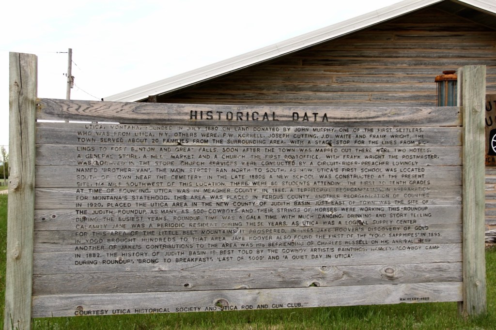
Grass Range seems concise and to the point compared to the Historical Data marker at Utica crafted by R.W. Reedy in 1980 for the Utica Historical Society and the Utica Rod and Gun Club.
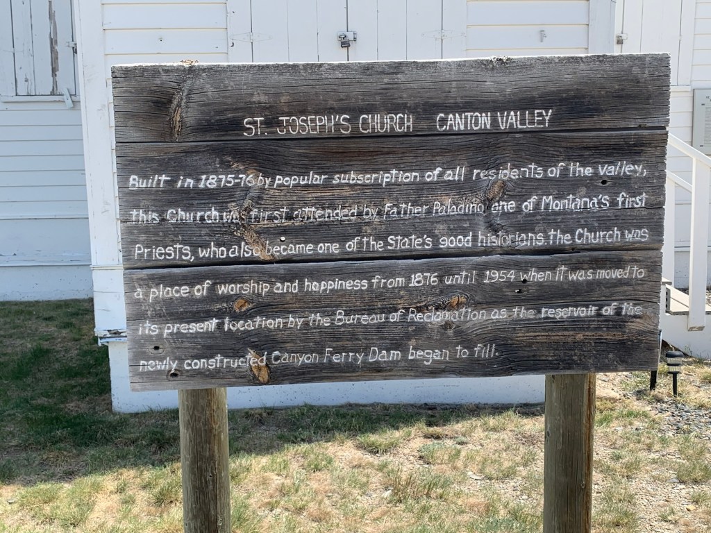
Sometime after 1954, residents of Broadwater County added the marker below about the history of St. Joseph’s Catholic Church.
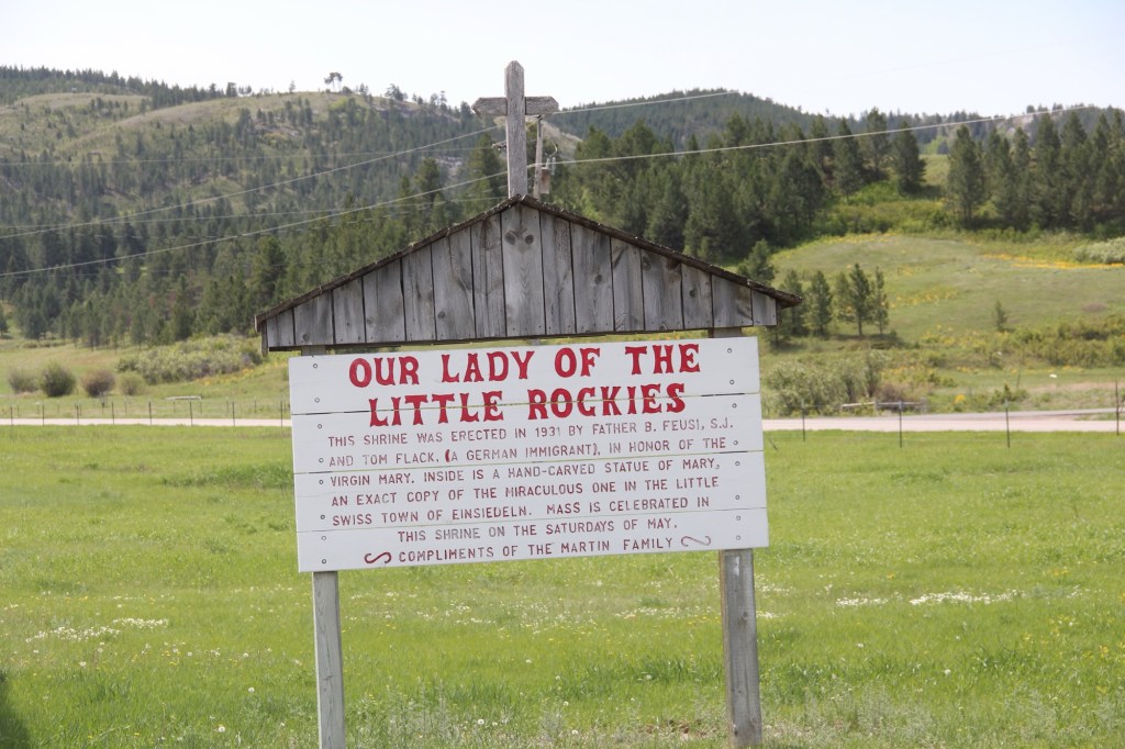
The Martin family explained the story of Our Lady of the Little Rockies” (below) outside of Hays in Blaine County.
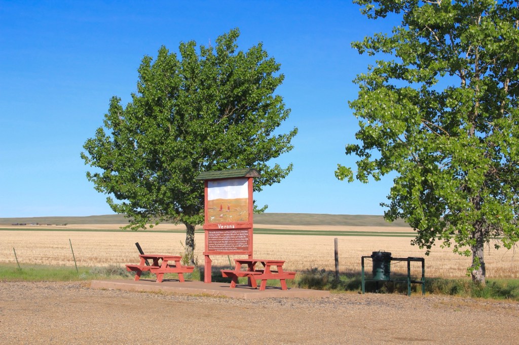
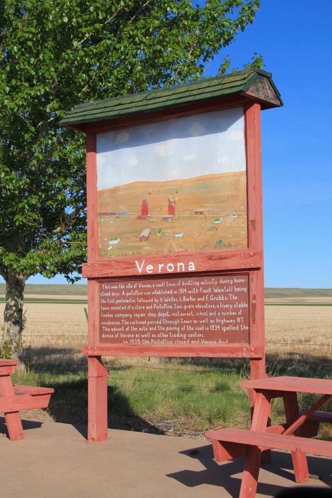
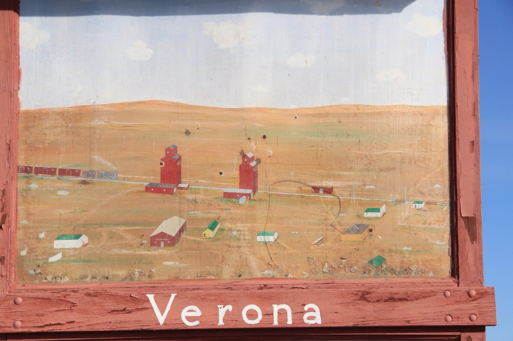
My favorite, however, is in Chouteau County along old Highway 87. It tells the story of Verona, one of the many homestead era towns that once covered Central Montana. The marker serves as a roadside stop but it’s not for tourists as it’s far from the present highway. It serves as a tribute to the past, complete with a painting of what Verona was like more than 100 years ago.
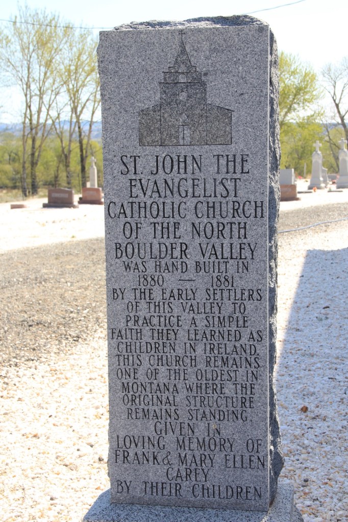
Handmade history hasn’t disappeared, but it does take different forms, such as a permanent stone marker for St John the Evangelist Catholic Church in the Boulder Valley (below) put up by the Carey family.
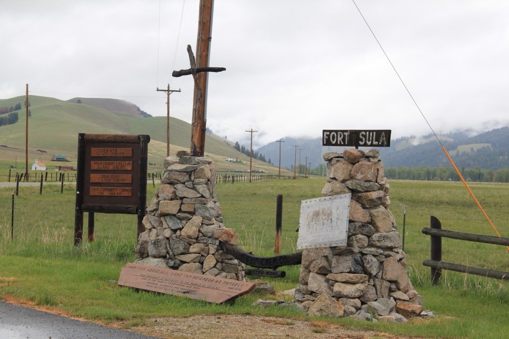
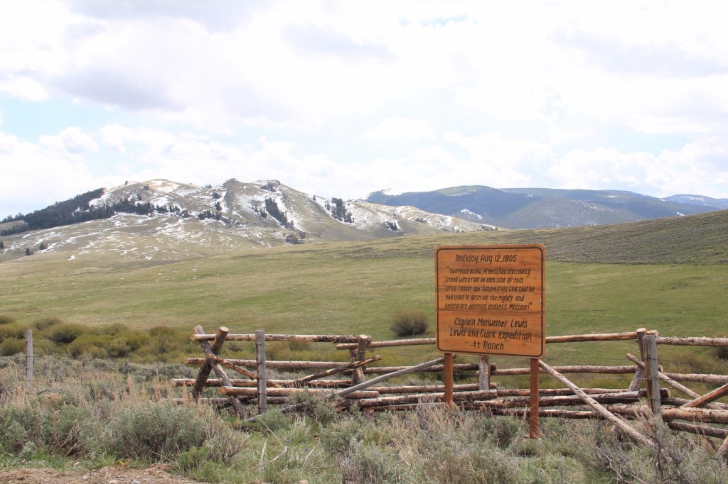
Or the interpretive marker for local history at Sula, in the state’s southwestern tip. Ranches have gotten into the act as well as seen by this wooden sign (below) about the location of Meriwether Lewis on August 12, 1805.
Montanans sharing stories about the places that matter to them—it doesn’t get more “public history” than this.