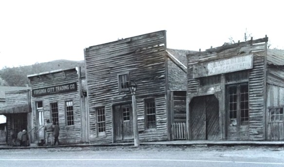
 Virginia City was Montana’s first effort to protect a large district of buildings, and it took place through private initiative. In the late 1980s, out of the earlier fieldwork that decade, I was preparing an article on Montana’s preserved landscapes, and eventually the piece appeared in a book on historic preservation in the West published by the University of New Mexico Press. Virginia City had always intrigued me, because of how the Bovey family admitted to anyone who would listen that their encouragement came from the success of Colonial Williamsburg, in Virginia, where I had began my career.
As I discussed in the article, “the Bovey family spent its own money and raised funds to restore Virginia City, then largely abandoned and in decay, to its appearance during the years the town served as a major western mining center and the territorial capital of Montana. Like the Williamsburg restoration, which focused on one key story—the revolution—in its depiction of history, the Virginia City restoration also showcased one dramatic event—the vigilante movement for law and order of the late 1860s. Success at Virginia City led the restoration managers to expand their exhibits to the neighboring “ghost town” of Nevada City, where they combined the few remaining original structures with historic buildings moved from several Montana locations to create a “typical” frontier town.”
 “The Bovey family lost interest in the project during the 1990s and at one time it appeared that many of the valuable collections would be sold and dispersed. The State of Montana and thousands of interested citizens stepped forward and raised the money to acquire the

property and keep both Virginia City and the recreated Nevada City open to the public.” The black and white photos I am sharing here come from a trip in 1990 that I specifically took to record Virginia City as the restored town out of the fear that the place would be dismantled, and this unique experiment in preservation lost.

About ten years ago, I was given the opportunity to return to Virginia City and to see what the public efforts had brought to the town. At that time local and state officials were interested in pursuing heritage area designation. That did not happen but it was a time when I began to understand even larger stories at Virginia City than 20 years earlier.

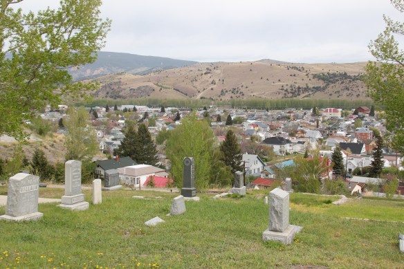
One of the “new” properties I considered this decade in my exploration of Virginia City was its historic cemetery. Yes, like tens of thousands of others I had been to and given due deference to “Boot Hill,” and its 20th century markers for the vigilante victims
 I am speaking instead of the very interesting historic city cemetery, just a bit to the north. It has a wide of grave markers, that show the confluence of folk burial practices of the mid to late 19th century with the more popular, and mass produced imagery of Victorian burial markers. There are, just as in southern cemeteries, family plots marked by Victorian cast-iron fences. Or those, in a commonly found variation, that have a low stone wall marking the family plots.


There are hand-cut stone grave houses, placed above ground–the burial is actually below the ground, but the houses for mid-19th century Americans symbolized home, family, and the idea that the loved one had “gone home.” The one at the Virginia City Cemetery has a “flat roof” while I am more accustomed to a sharp gable roof on such structures.

The cast-metal prefabricated grave markers, according to early literature on the topic, are “rare.” Compared to masonry markers, yes these Victorian era markers are few in number. But they are not particularly rare; I have found them in rural and small town cemeteries across the South. They are here in Virginia City too.
One of the most prominent belonged to Union Civil War veteran, and Kentucky native, James E. Callaway, who served in the Illinois state legislature after the war, in 1869, but then came to Virginia City and served as secretary to the territorial government from 1871 to 1877. He also was a delegate to both constitutional conventions in the 1880s. He died in Virginia City in 1905.
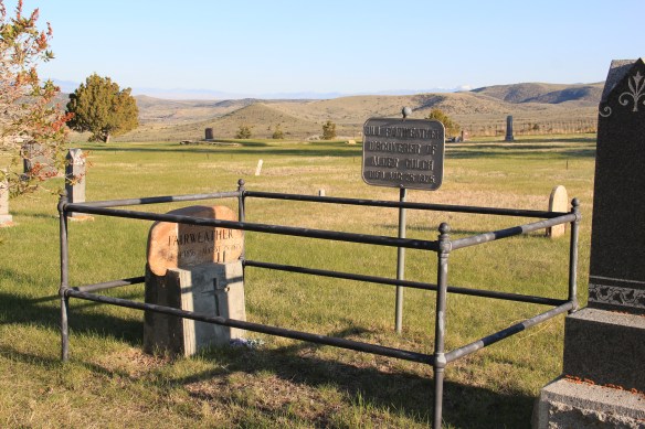
 Callaway’s grave is one of several of individuals significant in the territorial era. Thomas J. Dimsdale, the chronicler of the vigilante movement, is buried here as well as a more elaborate grave site for Bill Fair-weather, which includes a marker that describes him as the discoverer of Alder Gulch.

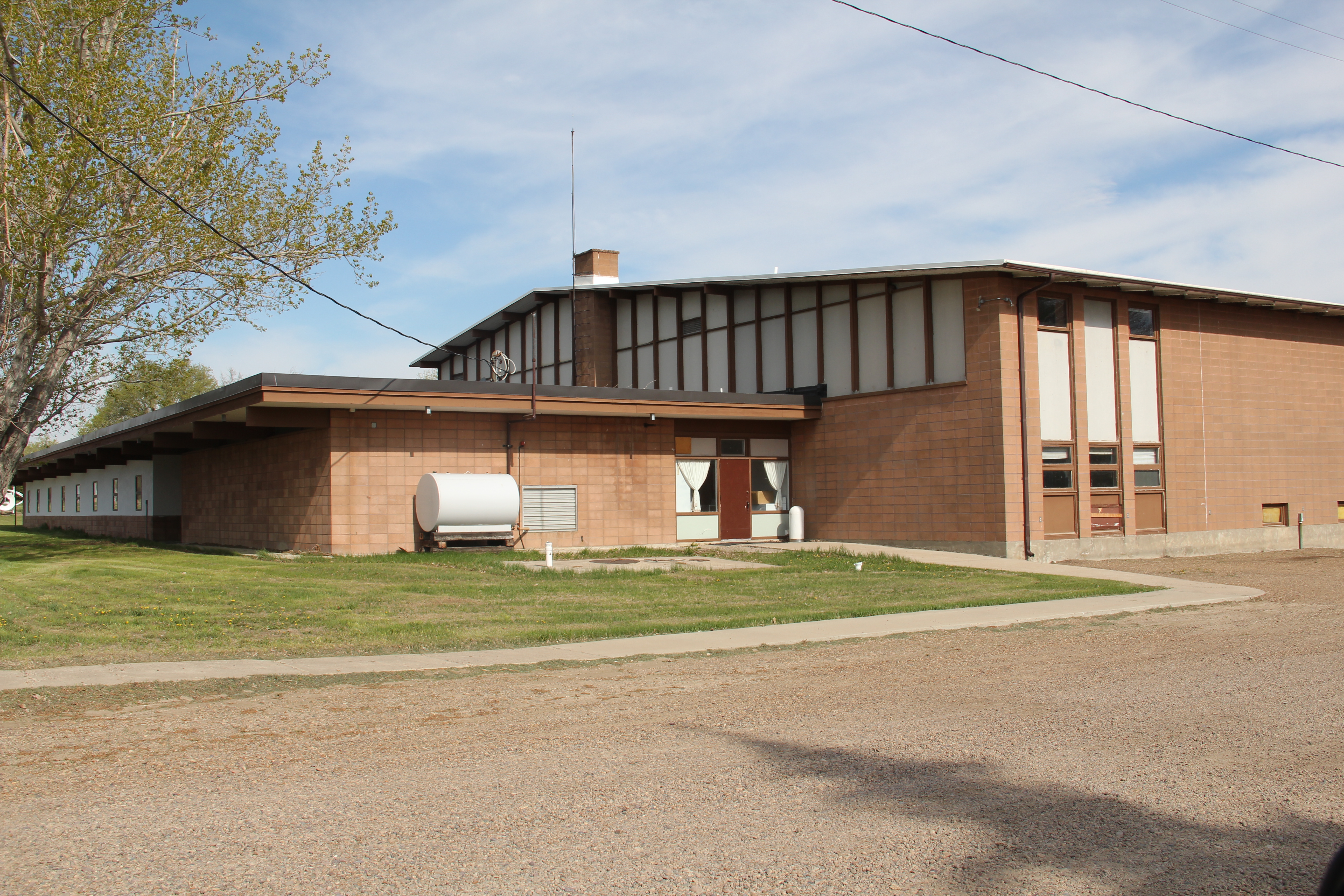
Another property type I ignored in 1984-85 during my work in Virginia City was the impact of the New Deal. The town has a wonderful WPA-constructed community hall/ gymnasium, which is still used for its original purposes.
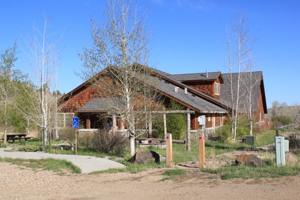
The impact of the Montana Heritage Foundation and the concerted state effort beginning in the mid-1990s has been profound on Virginia City. There has been a generation of much needed work of collection management at the curatorial center, shown below. The Boveys not only collected and restored buildings in the mid-20th century, they also packed them with “things”–and many of these are very valuable artifacts of the territorial through early statehood era.
 The impact on the buildings, and the constant efforts of repair and restoration, is very clear today. Virginia City is far from a sanitized outdoor museum environment. Residents still work and live here, but the historic built environment is in better shape than at any time in the early 1980s, as the images below attest.

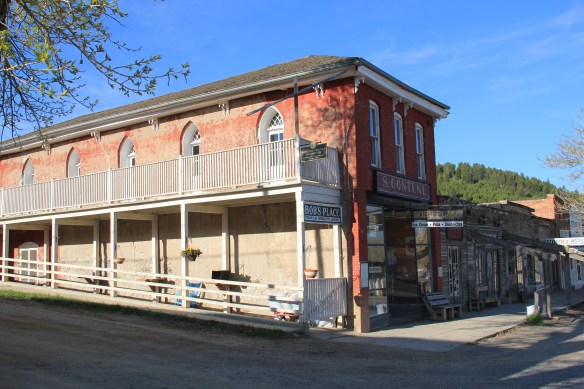 Save America’s Treasures funding has been leveraged with private donations and state funding to shore up the most significant properties. There is also a much greater, and more accurate, public interpretation found through the historic district. Visitors get much
more than a “quaint, Old West” experience–they can actually learn about the rigors, challenges, and opportunities of the gold rush frontier in the northern Rockies.
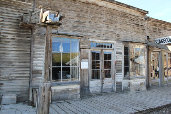 As the image above of the Smith Store attests, there is no need to paint too rosy of a picture about the future of Virginia City. This National Historic Landmark will always need a lot of care, attention, and funding if it is to survive another century. During the national hoopla of the Civil War sesquicentennial in the first half of this decade, the same sesquicentennial of the gold rush to the northern Rockies (Bannock, Virginia City, Helena, etc.) has passed by quietly. But both nation-shaping events happened at the same time, and both deserve serious attention, if we want to stay true to our roots as a nation.
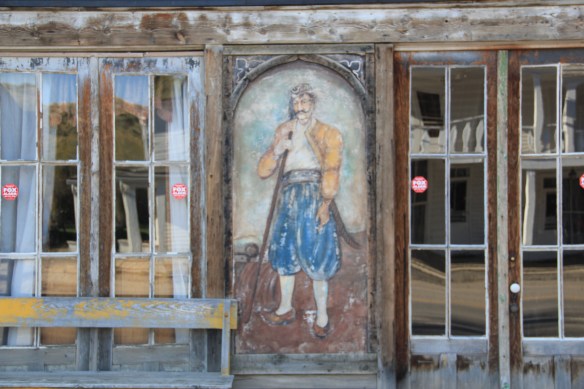
Here in 2016, the preservation community is commemorating the 50th anniversary of the National Historic Preservation Act. The impact of that federal legislation has been truly significant, and can be found throughout the state. But the earlier efforts by families, local communities, and state governments to save what they could of the past, in some cases to market it as a heritage tourism asset, in other cases, to save it for themselves, must also be commemorated. Virginia City begins the state’s preservation story in many ways–and it will always need our attention.

 Beaverhead County, named for the prominent, ancient landmark on the Beaverhead River at the corner of Madison and Beaverhead county, was the first rural place I visited in Montana after my arrival in Helena in 1981. Why? No pressing reason, except that the place name of Wisdom called out to me.


 The town’s large community hall remains in constant use. The separate Women’s Club
 building once welcomed ranch wives and daughters to town, giving them a place to rest and providing a small library of books. It has been converted into a small lodge for skiers and hunters–a great small town example of adaptive reuse.
 Of course the major landmark for travelers through Wisdom in the late 20th century was Conover’s Trading Post, a two-story false front building–clearly the most photographed place in town, and inside a classic western gun and recreation shop.
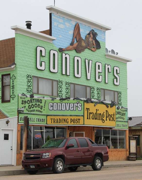 But the Conover’s facade, even the name, is no more. Not long after my 2012 visit to Wisdom, new owners totally remade the building and business, opening a new store named Hook and Horn.


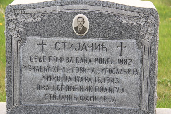

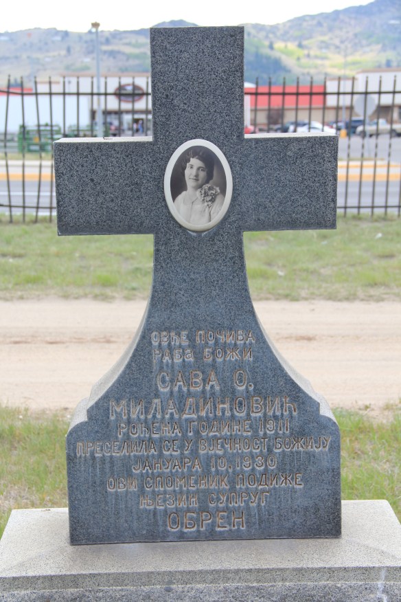

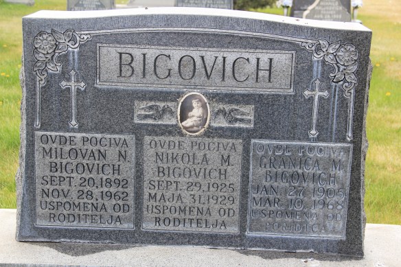


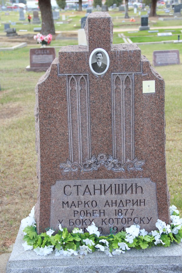


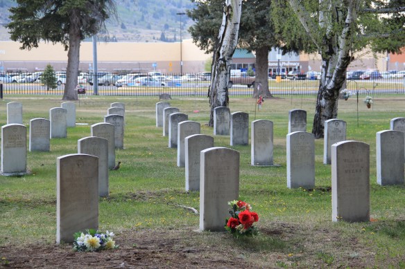
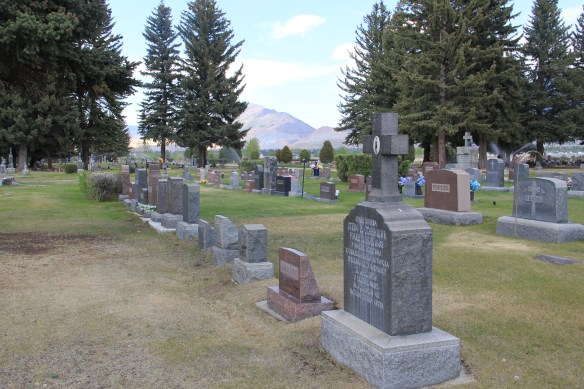

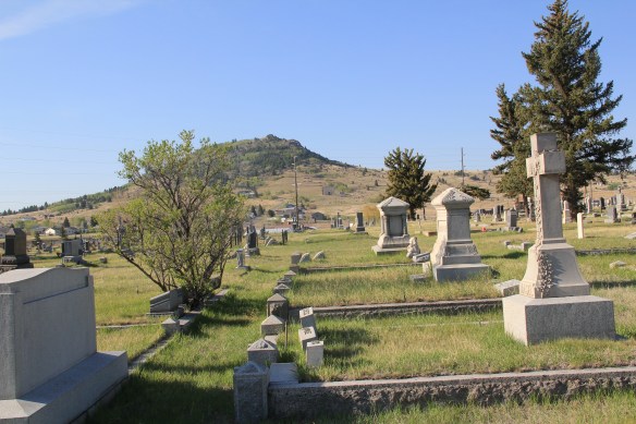
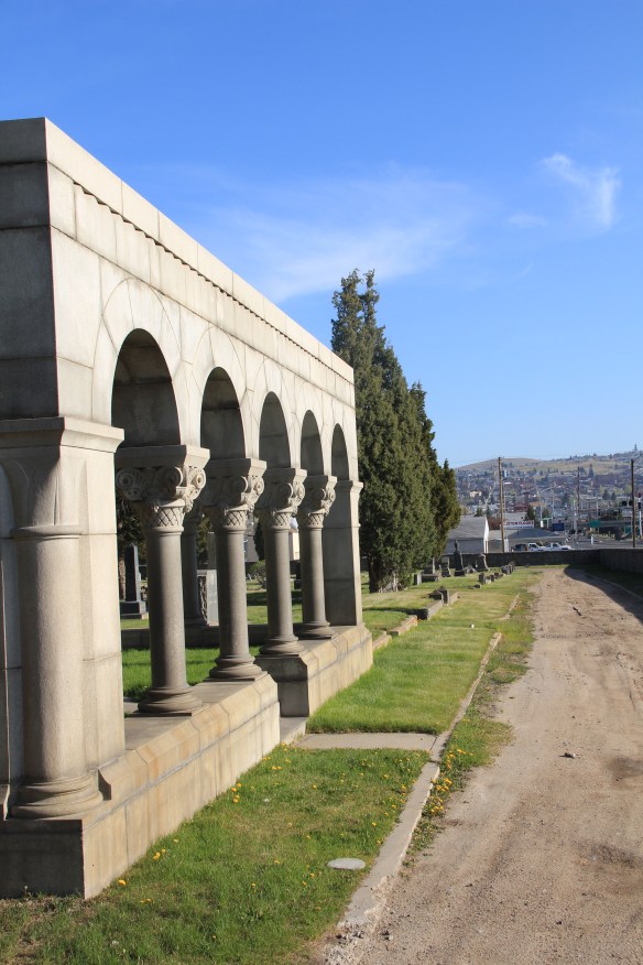 Far from the bustle and grime of the Richest Hill on Earth are the historic cemeteries of Butte. As I have said many times already in this blog, I rarely considered cemeteries during the 1984-1985 state historic preservation plan work. That was a huge mistake for Butte. The three historic cemeteries I wish to consider here–Mt. Moriah, St. Patrick’s, and B’nai Israel–document the city’s ethnic diversity like few other resources, reinforcing how groups survived in a city together although they often keep to their separate communities. But the cemeteries also have sculpture and art worthy of attention and preservation–they are outstanding examples of late 19th and early 20th cemetery art and craftsmanship in the United States.
 The Masons established Mr. Moriah Cemetery Association in 1877. The cemetery has many striking markers, especially the Thompson Arches (seen above and below), an elaborate statement to mark a family plot, especially when compared to the cast-iron
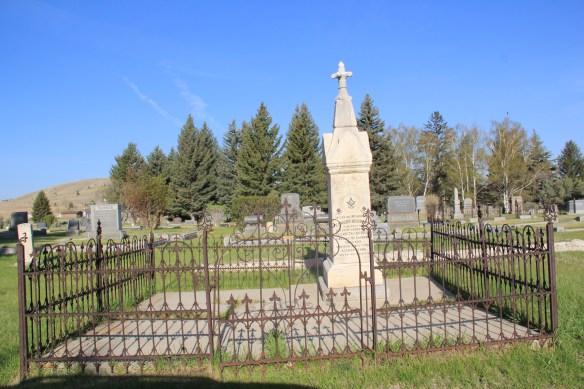 iron fence, when combined with the carving and detail of the gravestone itself makes quite the statement for Cornish identity in Butte at the turn of the century. Note the dual fraternal lodge marks, one for the Masons, another (the linked chain) for the Odd Fellows.
 Frank Beck left this earth in 1909, and the marker for Frank and his wife Agnes is remarkable for the inclusion of the family pet, noted above as Frank and His Faithful Dog.


 1881 when the Hebrew Benevolent Association first acquired the land from the Northern Pacific Railroad. Congregation B’nai Israel acquired the property in 1905, two years after finishing its landmark synagogue in uptown Butte.


 The cemetery seems to stretch to the very edge of the city, but it is worth a long walk around for what you can discover about the Catholic impact on Butte in the late 19th and early 20th centuries.
 There are spectacular sculptural monuments to prominent city builders, such as the Classical Revival-style temple crypt for merchant price D. J. Hennessy.
 Adjacent are separate plots maintained for Sisters who served and died in Butte as well as larger, more elaborate memorials for priests who served in Butte over the years.


 In the preservation plan survey of 1984-1985 rarely did I give much attention to historic cemeteries–no one in the Helena office was focused on this property type and in all of my public meetings I never heard someone to make a case for cemeteries as either designed landscapes or community memory palaces. But in the thirty years since my work in the south has constantly drawn me to cemeteries, and when I began my re-survey of the Montana historic landscape in 2012 I was determined to look closely at cemeteries across the state.
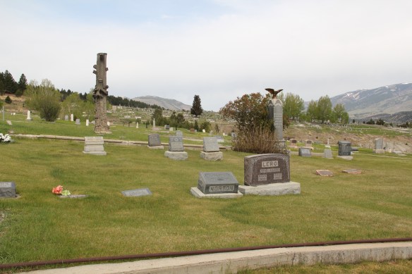 As i climbed the hill behind the courthouse and walked into Upper Hill Cemetery, I found acres of graves and monuments, a reflection of the town’s late 19th and early 20th century roots, and marker upon market that spoke to the ethnic groups, trade loyalties, and general working-class makeup of Anaconda. Here was a true artifact that I most certainly missed in 1984, and worthy of listing in the National Register of Historic Places.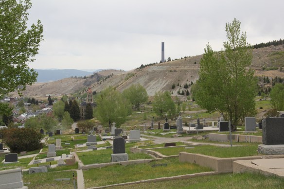
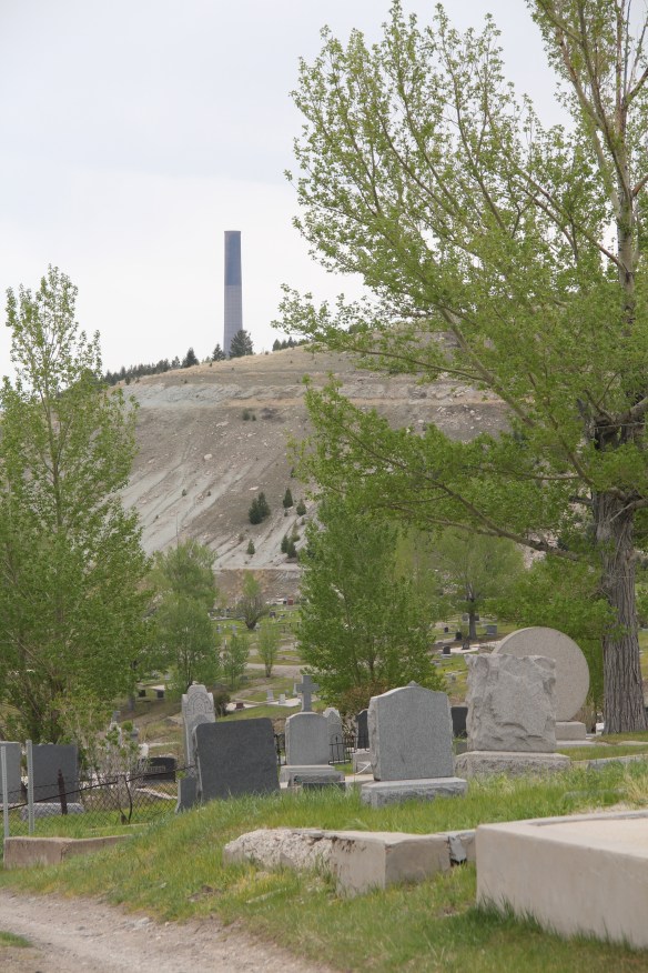 One unmistakable reality was that in death, as in life, Anaconda laborers could never leave the overwhelming presence of the Stack–wherever you go within the acres of the Upper Hill and Mt. Carmel Cemeteries you need leave the presence of the concrete and steel giant of the Anaconda Copper Company. Striking how many of the headstones face the stack.
 Another reality was that fraternal loyalties–the brotherhood of labor–remained even as the bones that had once labored so diligently had decayed into dust. Fraternal organization often offered burial insurance–you were guaranteed a place within the fraternal plot even if your own birth family–who might be on the other side of the ocean–had long ago forgotten your face.
 The Brotherhood of American Yeomen offered a gated plot, defined by a Victorian cast-iron fence that made a perfect rectangle.
 The Knights of Pythias, on the other hand, offered a monumental cast-iron gate, emblazoned with their name, as the entrance to their fraternal plots.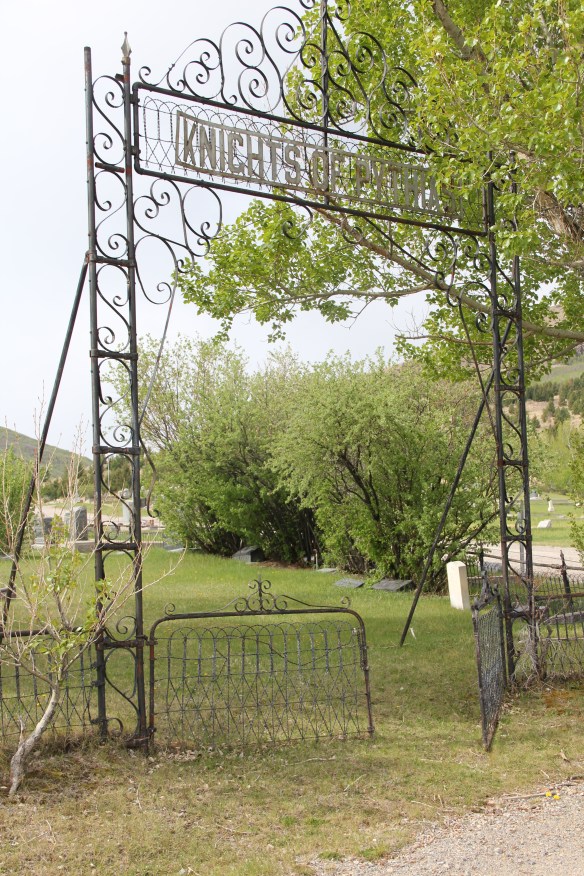


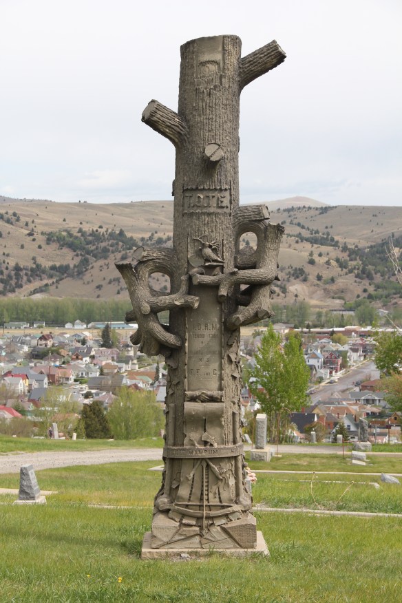
 Details and hidden meanings abound in this graveyard sculpture, and it is impossible to take it all in at once.

 Hayes Lavis, who died in the Great Depression, is one of the few of the Improved Order of Red Men identified in this fraternal grouping.
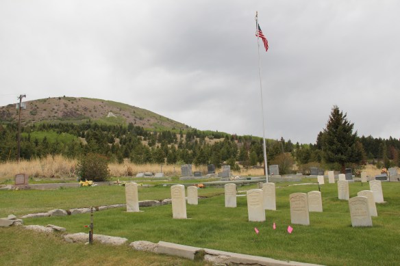 Military veterans are found throughout the cemetery–that is no surprise, but then it is surprising to see how many local men fought and died in the Spanish-American War of the late 1890s. The plot in their honor rests at one end of the cemetery, under the watchful gaze of the town “A” on the nearby hillside, but the low concrete wall that once defined the memorial is crumbling, just as our memory of this war and its veterans fade in the 21st century.


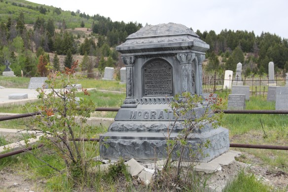 Family plots are also prevalent, with that of the Brown family and the loss of a child being particularly poignant.