Forsyth’s historic districts

Forsyth, the seat of Rosebud County, has used historic preservation effectively as one of many community assets to guide its economic sustainability over the last 30 years.  When I first visited there in 1984, the community had already started to grapple with the impact of the coal mining far south at Decker.  The passing of coal trains defined much of rhythms of traffic and life back then.  But even 30 years ago, residents were determined to keep their identity and to celebrate their heritage, despite being drawn into a different world.  That was impressive–and from 1986 to 1990, they put their commitment into physical terms by listing many properties in the National Register of Historic Places.

IMG_6943

You really haven’t been to Forsyth unless you take in a movie at the Roxy Theater (1930) and an after-movie libation at the Lariat Bar

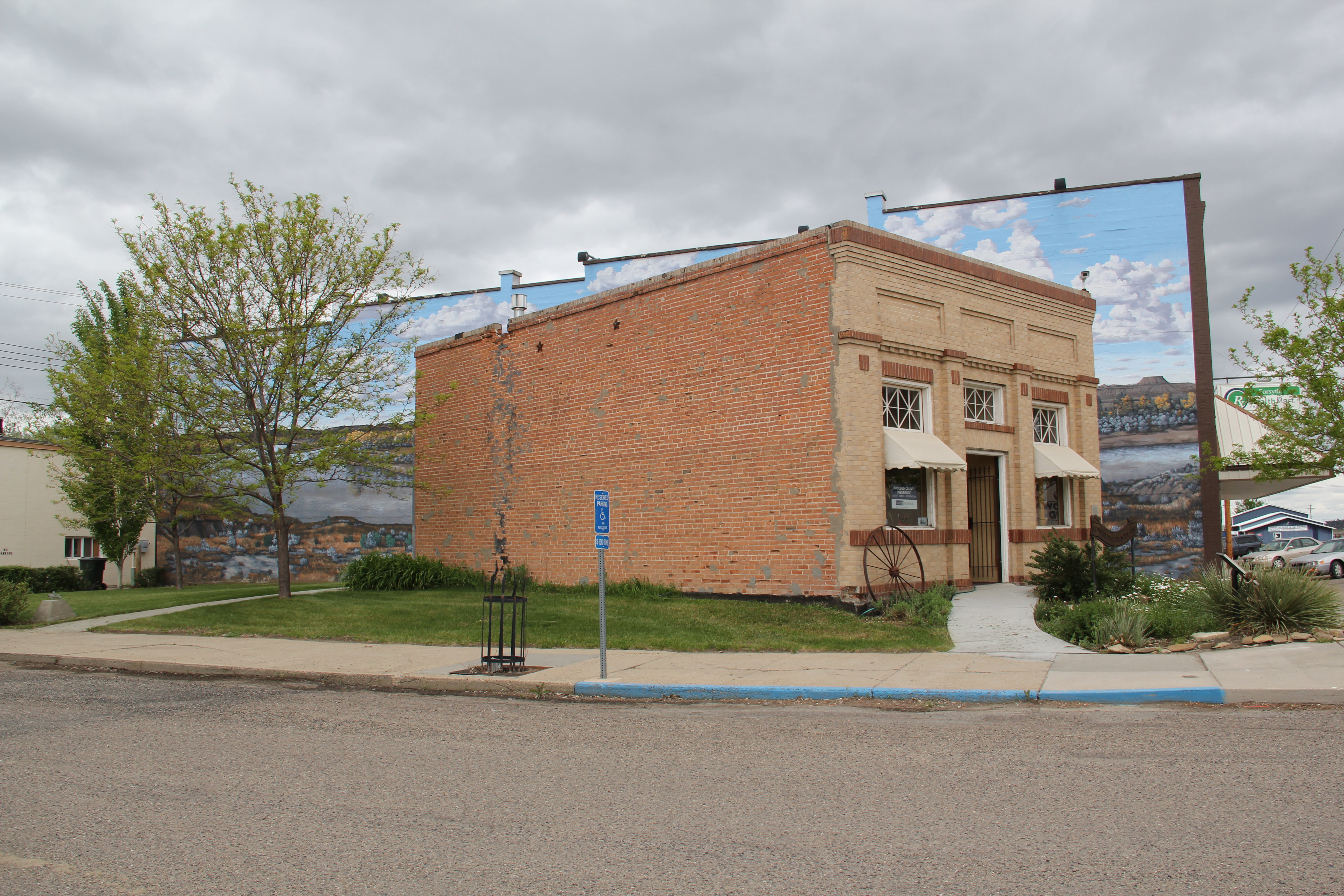
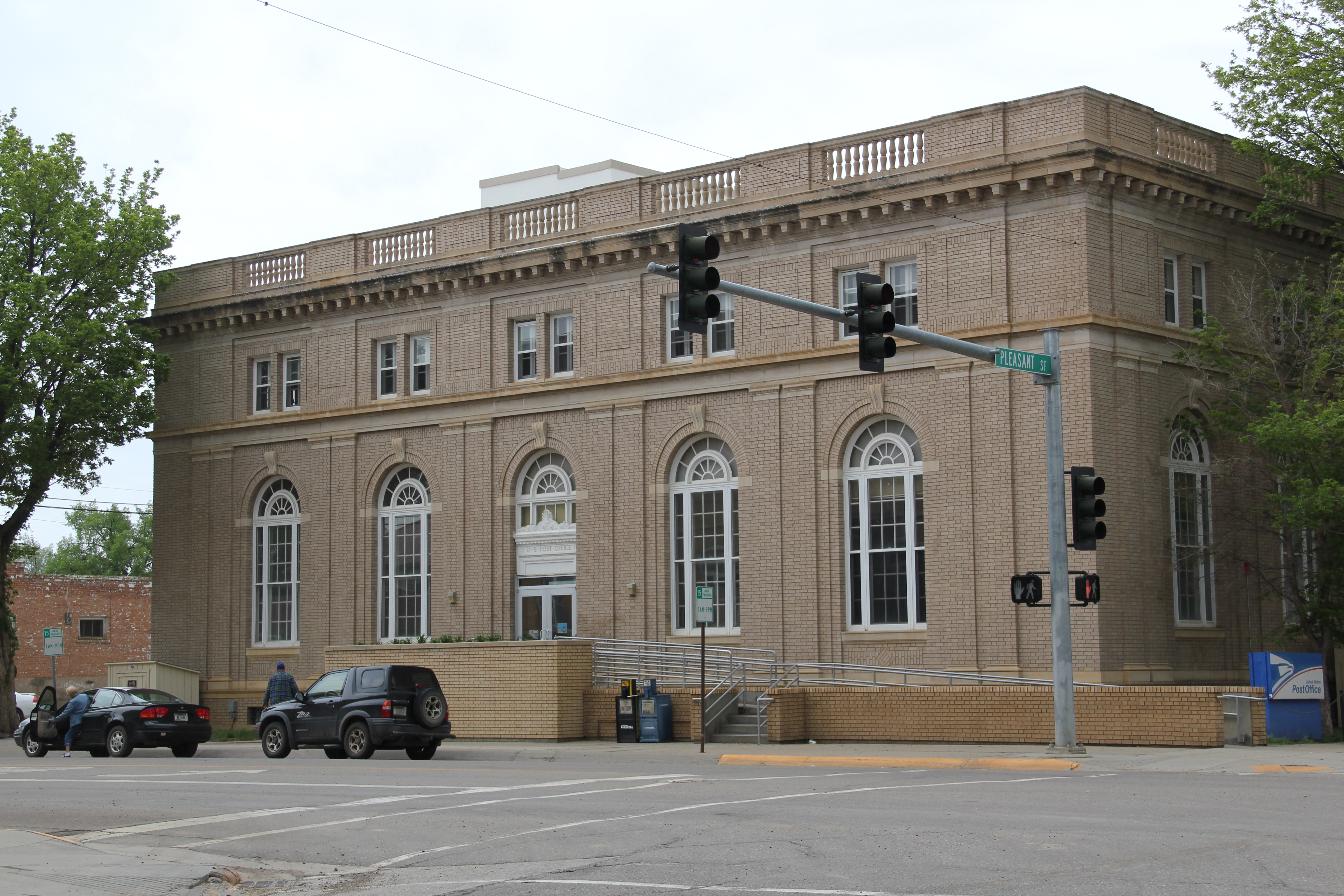
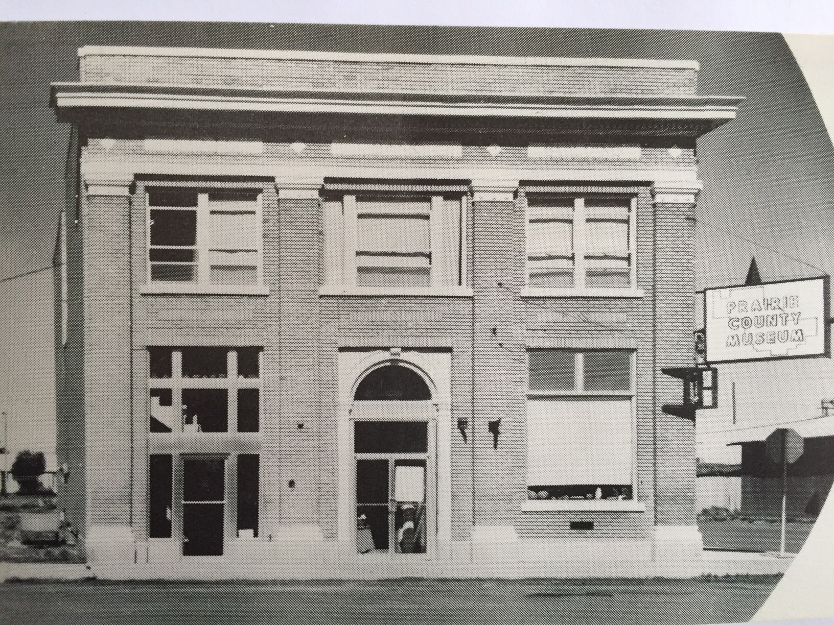
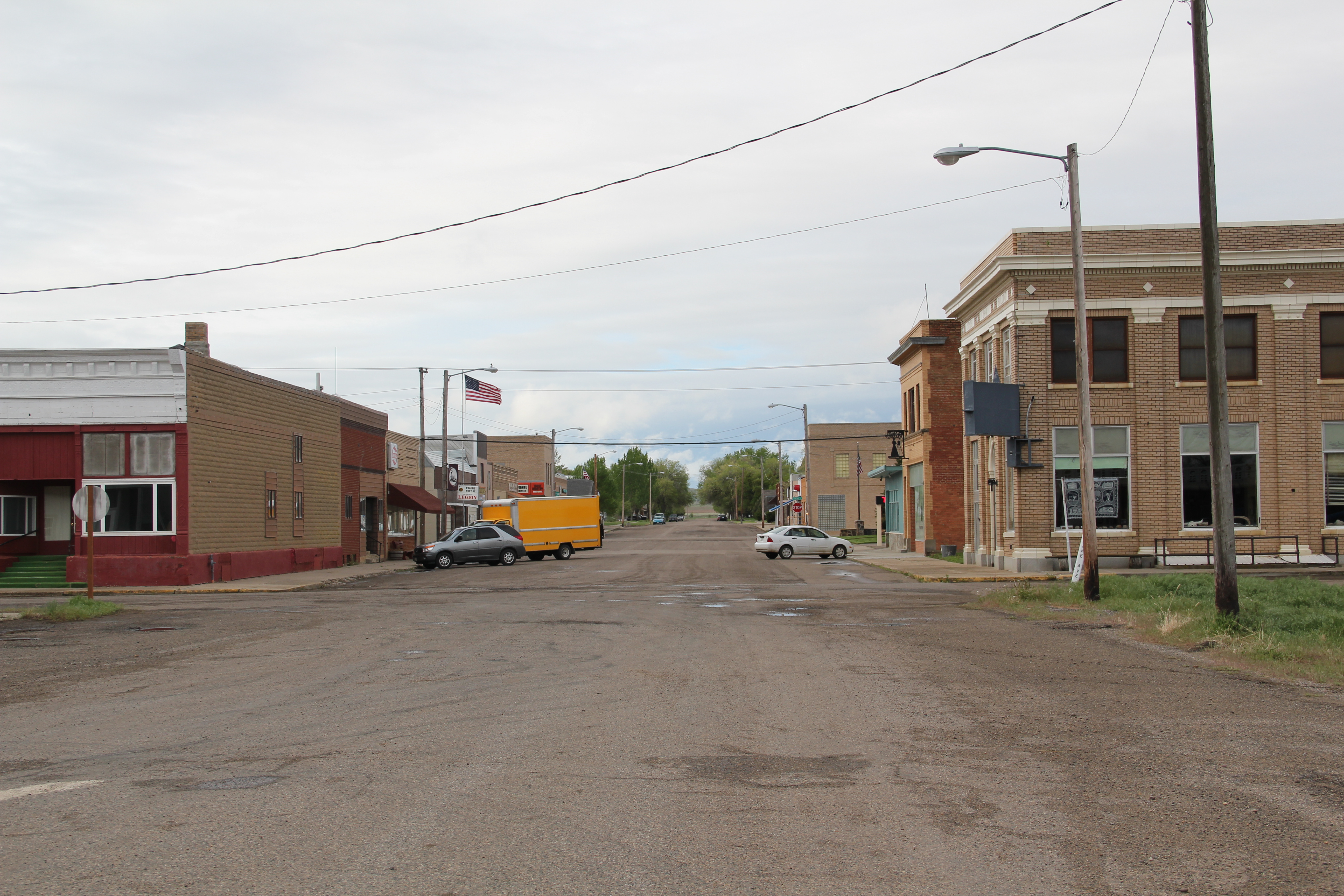
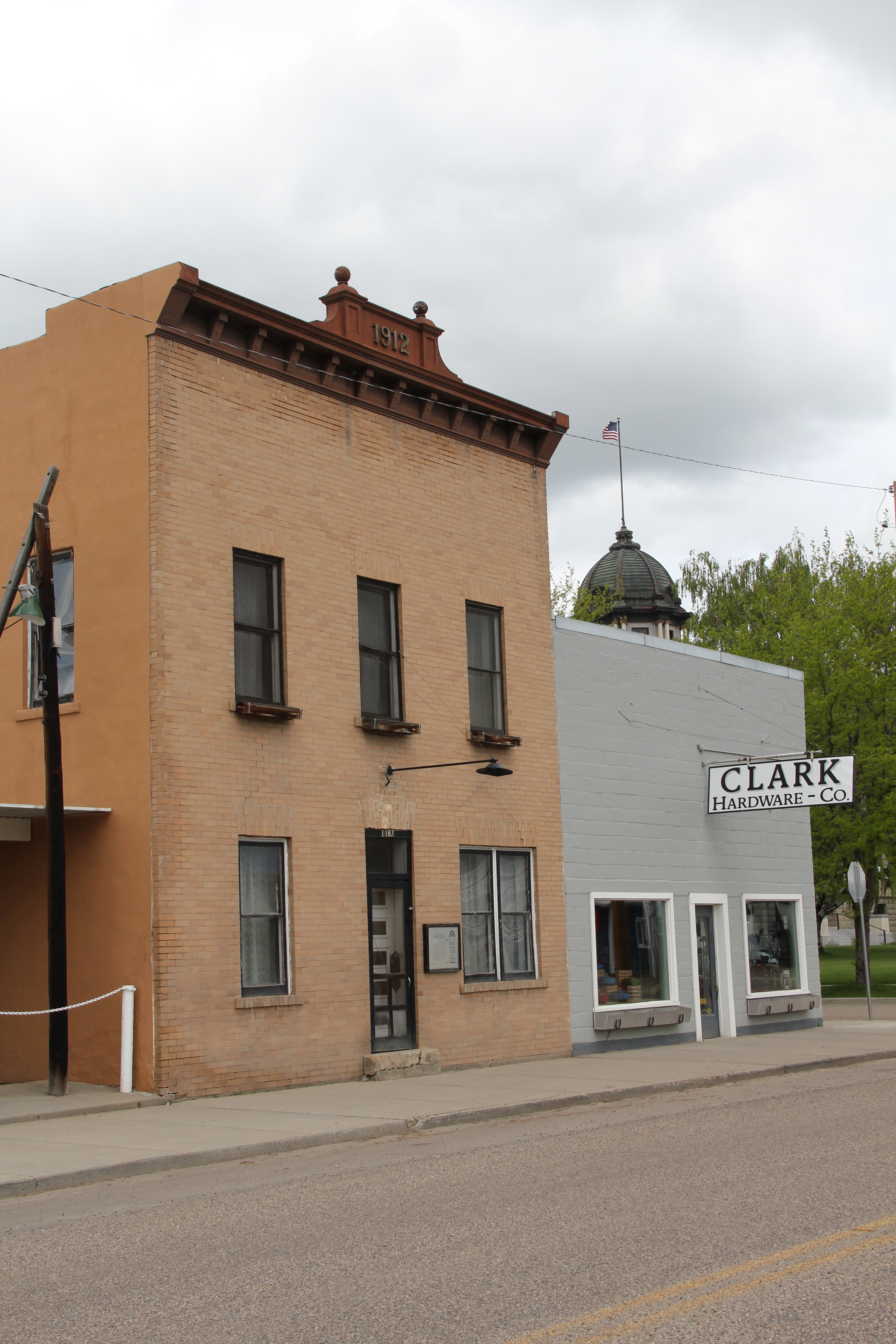
Earlier posts talked about such key heritage institutions as the Rosebud County Courthouse, the adjacent Rosebud County Museum, the Howdy (Commercial) Hotel, and then the adaptive reuse of the Vananda State Bank as new landmark business.  Forsyth also has a downtown commercial historic district, which includes both the hotel, bank, the Roxy Theater shown above, but additional classic Montana two-story commercial buildings, with their understated Victorian or classical cornices.

IMG_6944

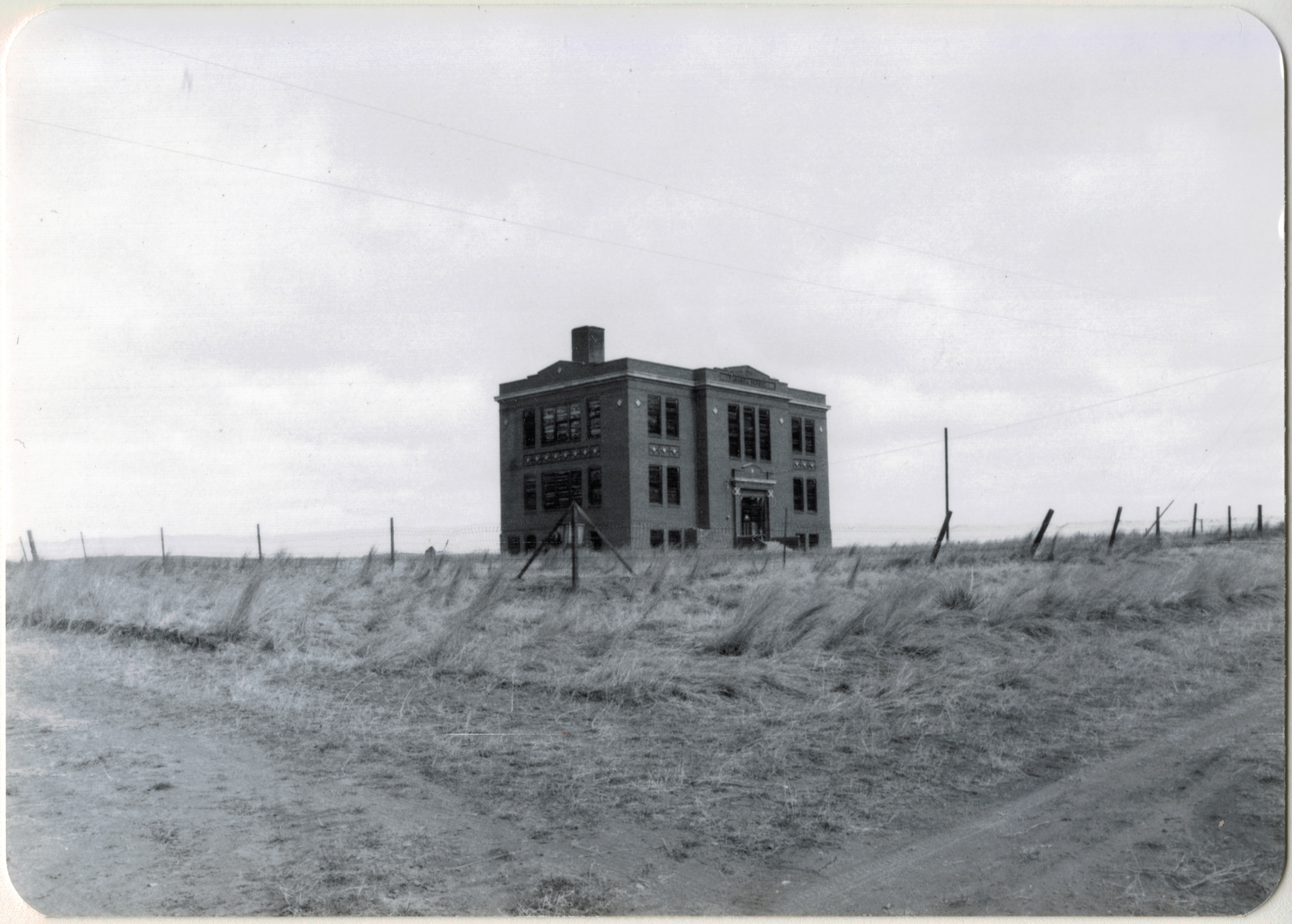
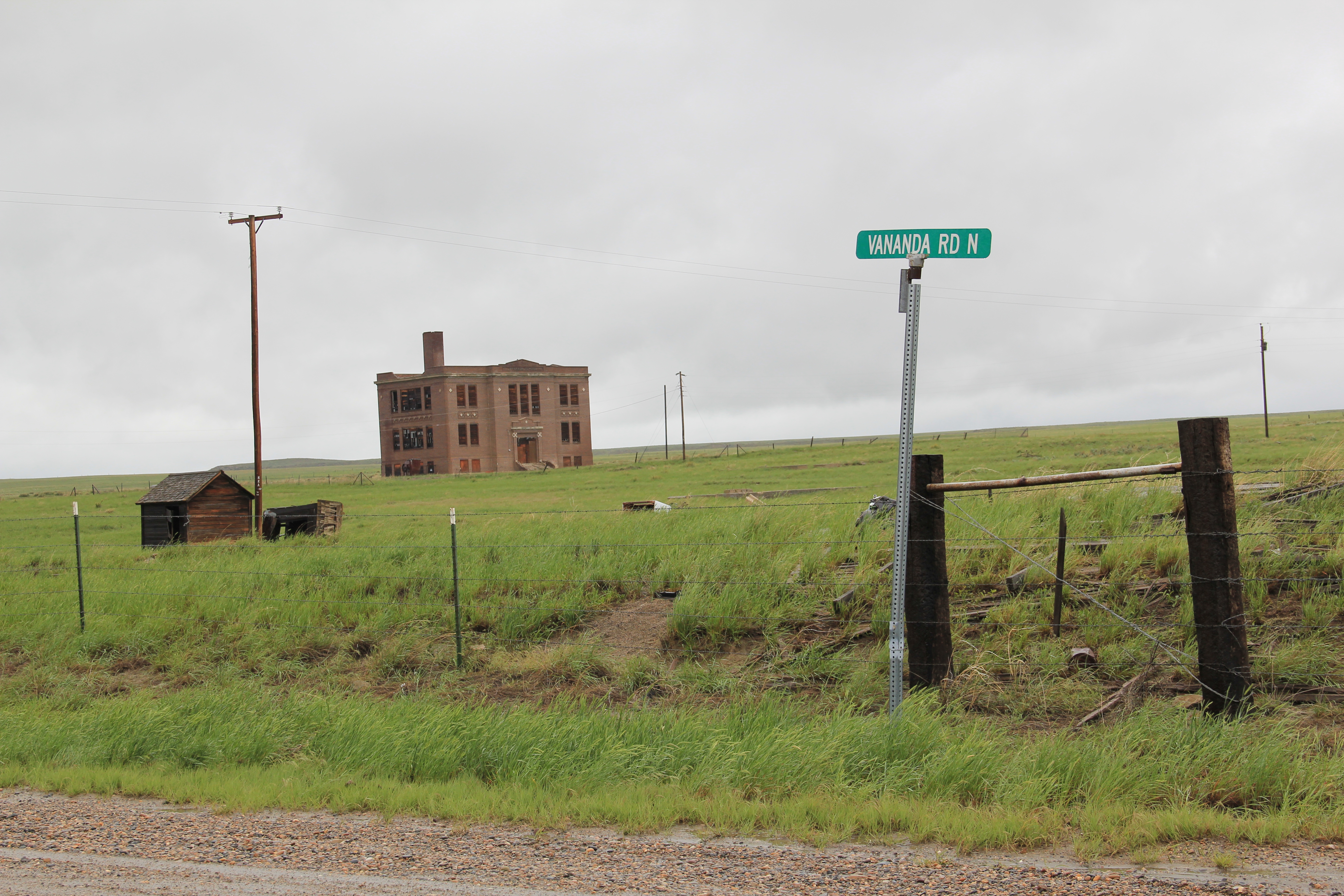
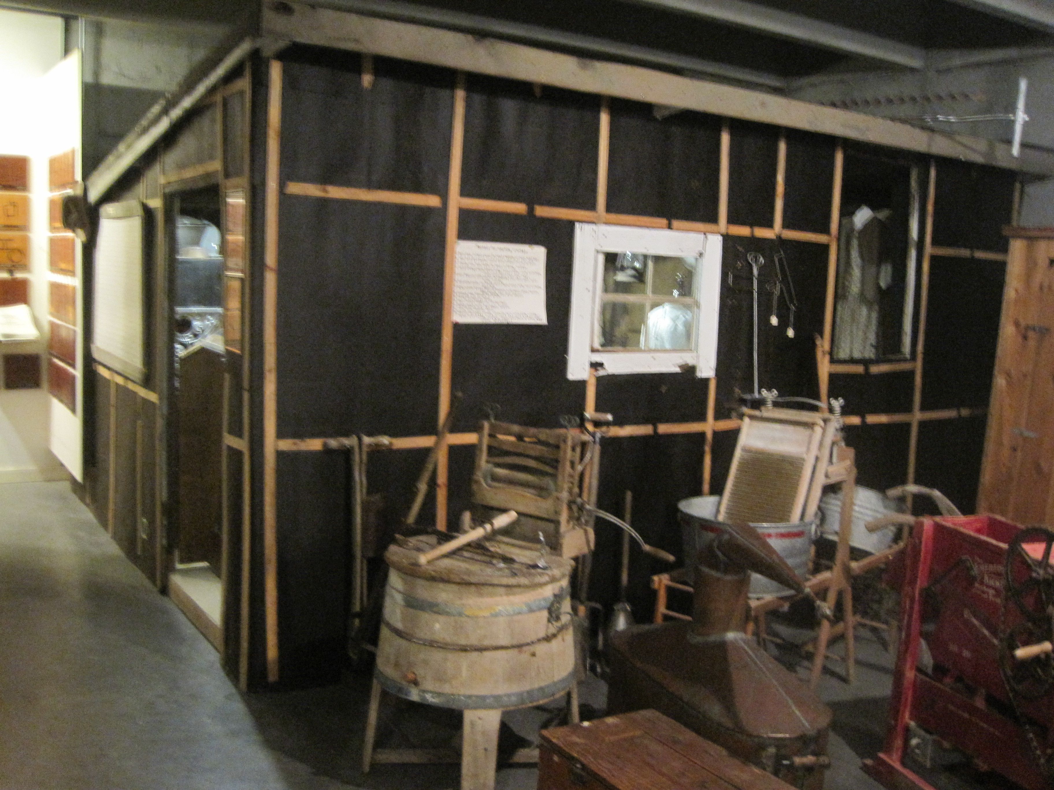
The Masonic Temple, designed by Miles City architect Byrnjulf Rivenes in 1911, served the community in many ways during its formative years, including the town library.  The Blue Front rooming house came in 1912 and served as home for Northern Pacific railroad employees for many years–today it is a remarkably intact example of that type of single-man housing from 100 years ago.

IMG_6945

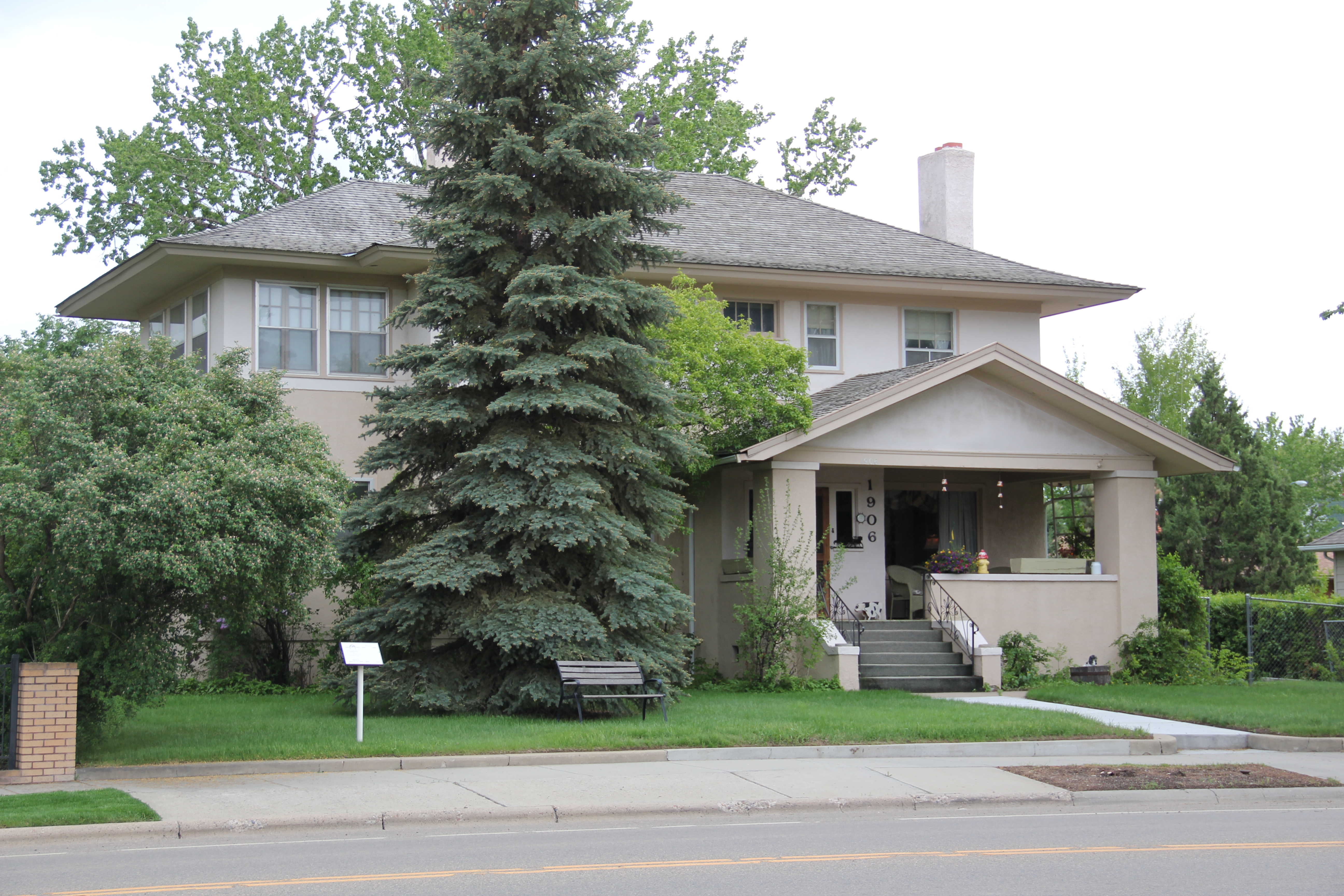
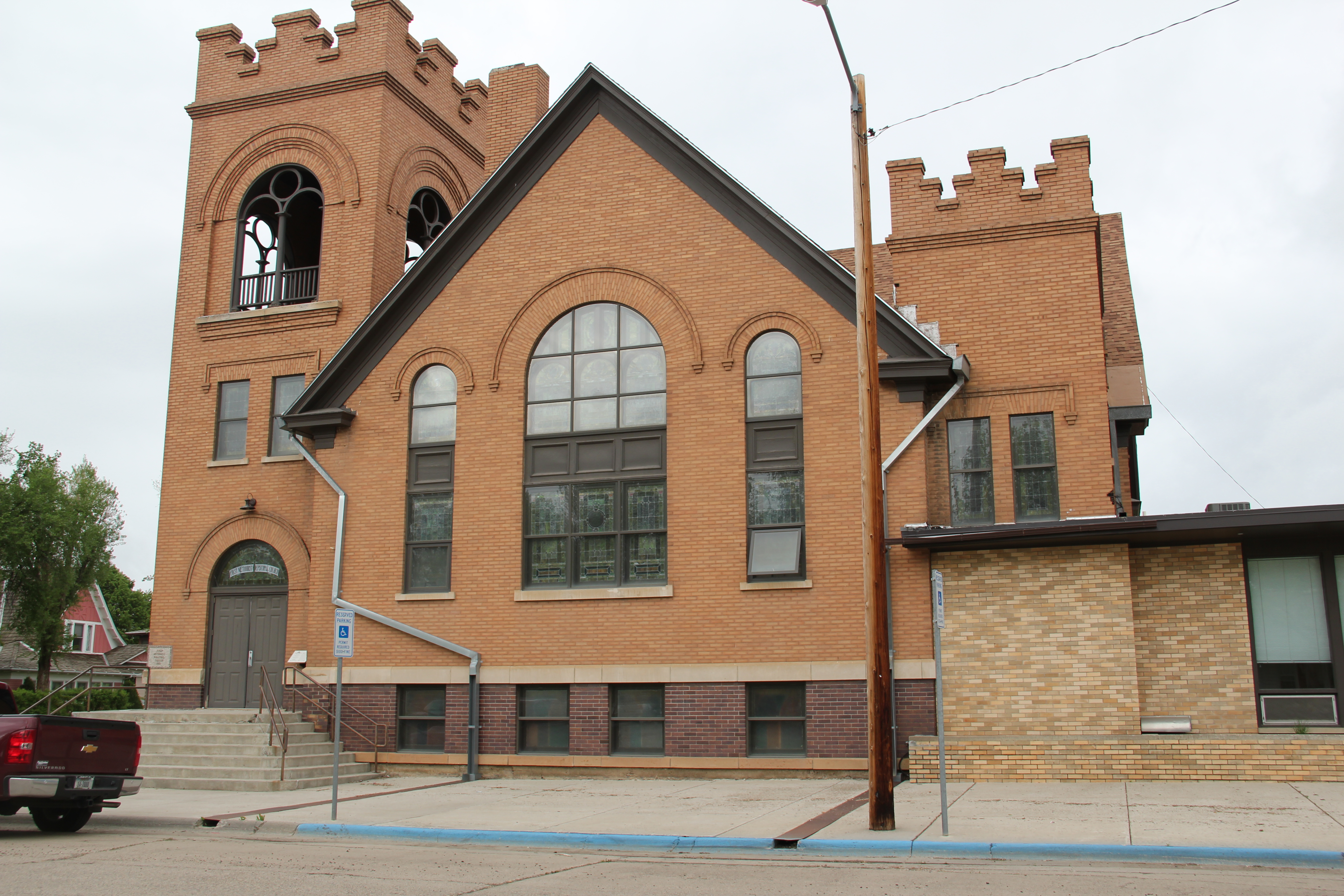
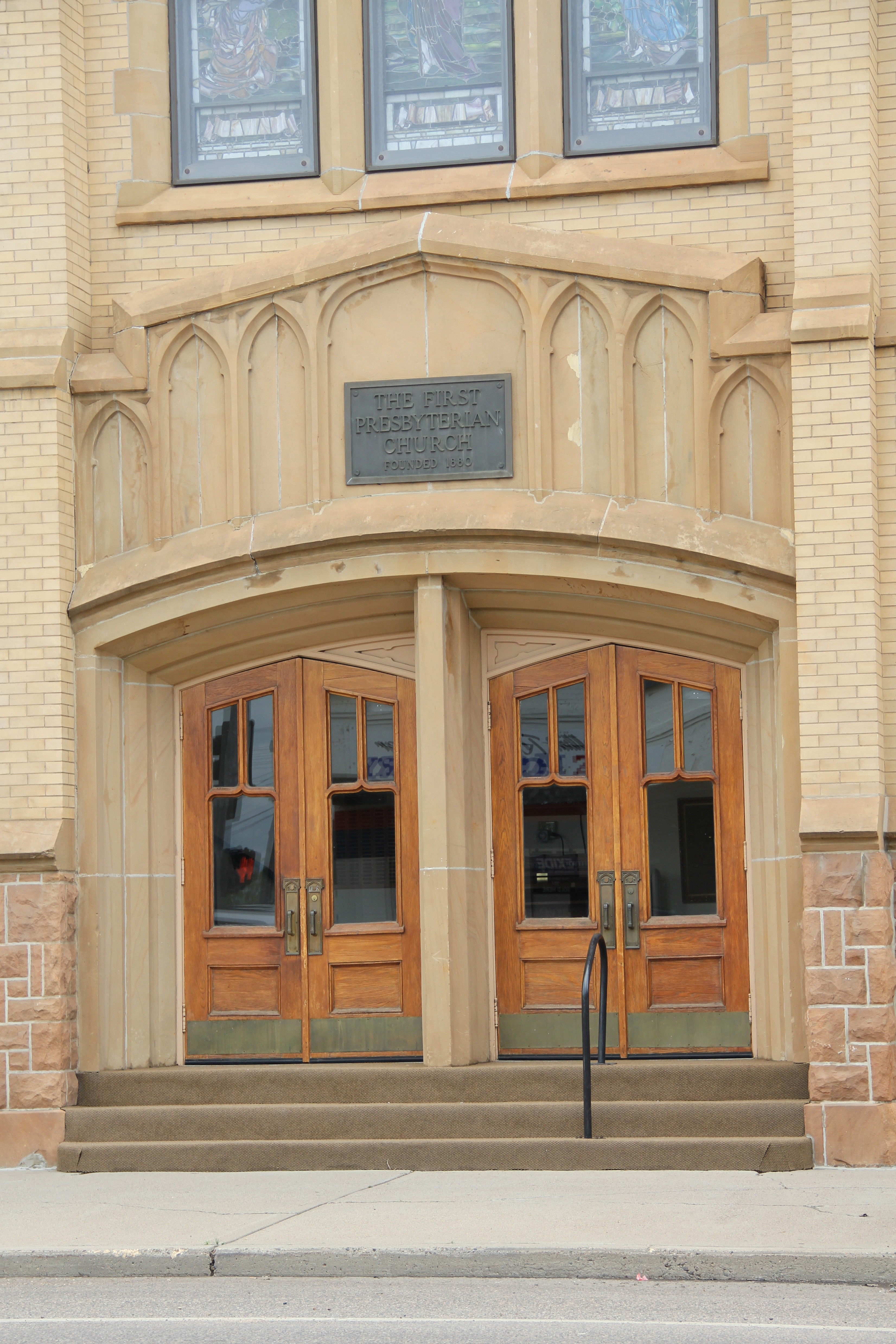
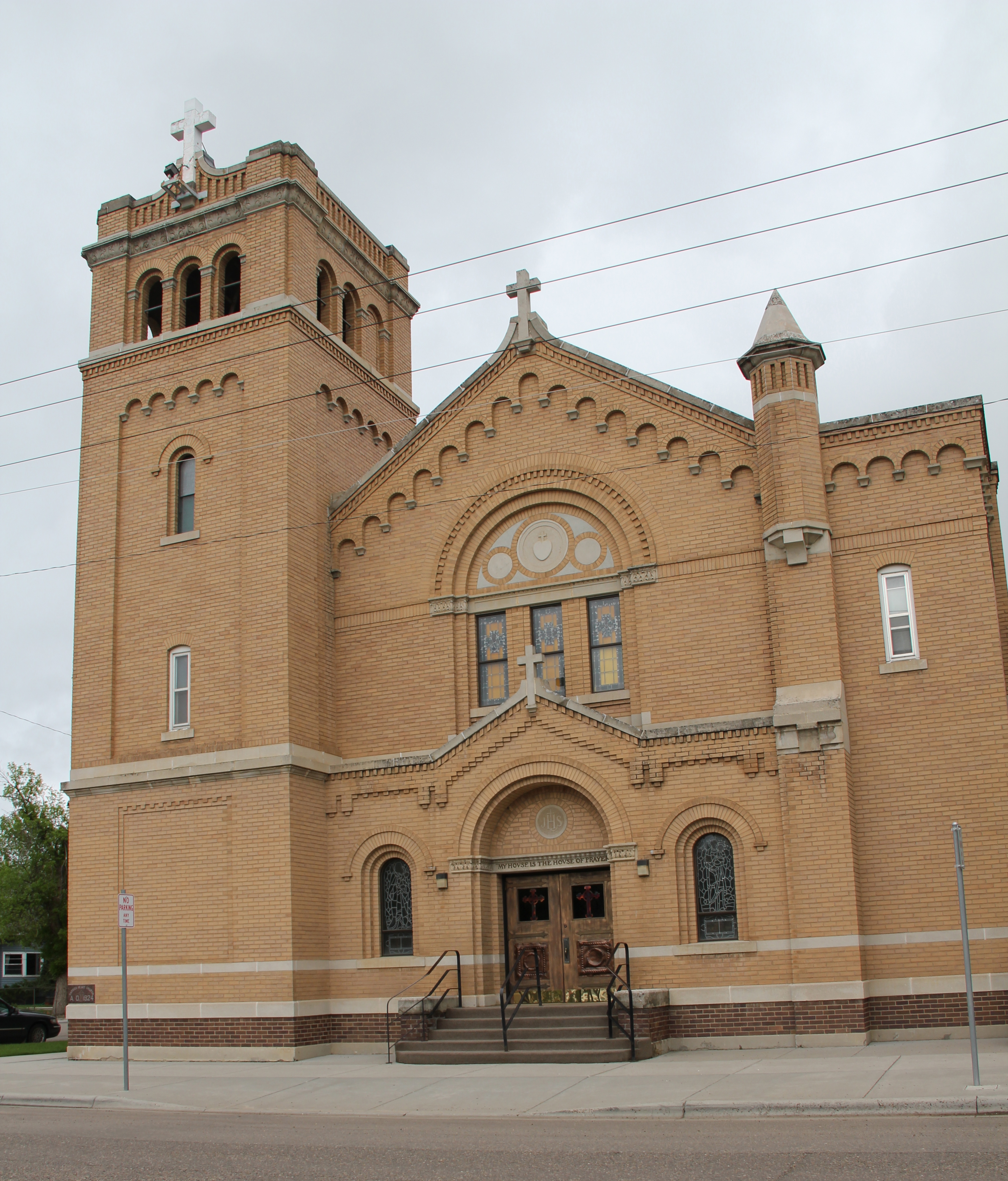
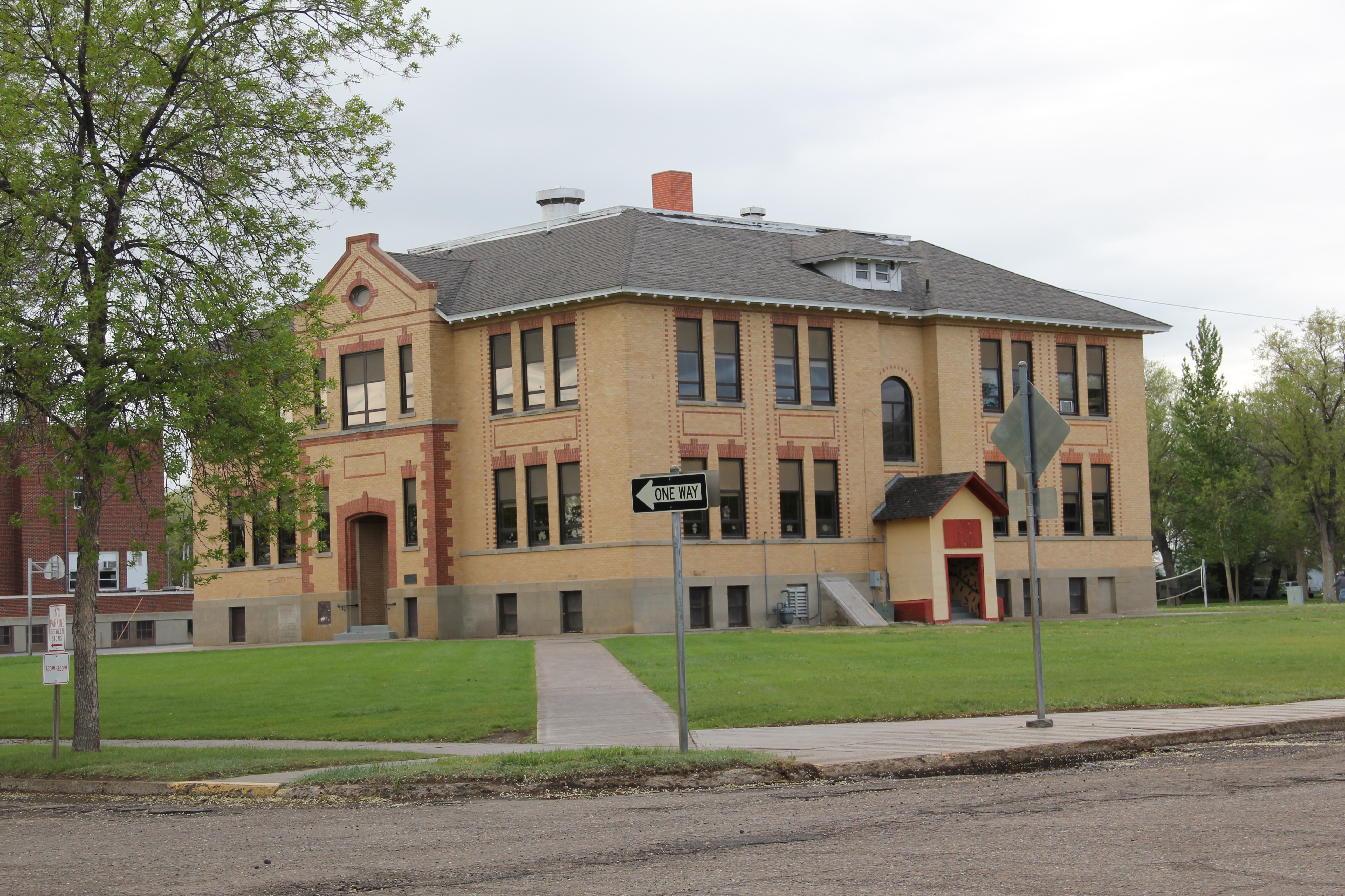
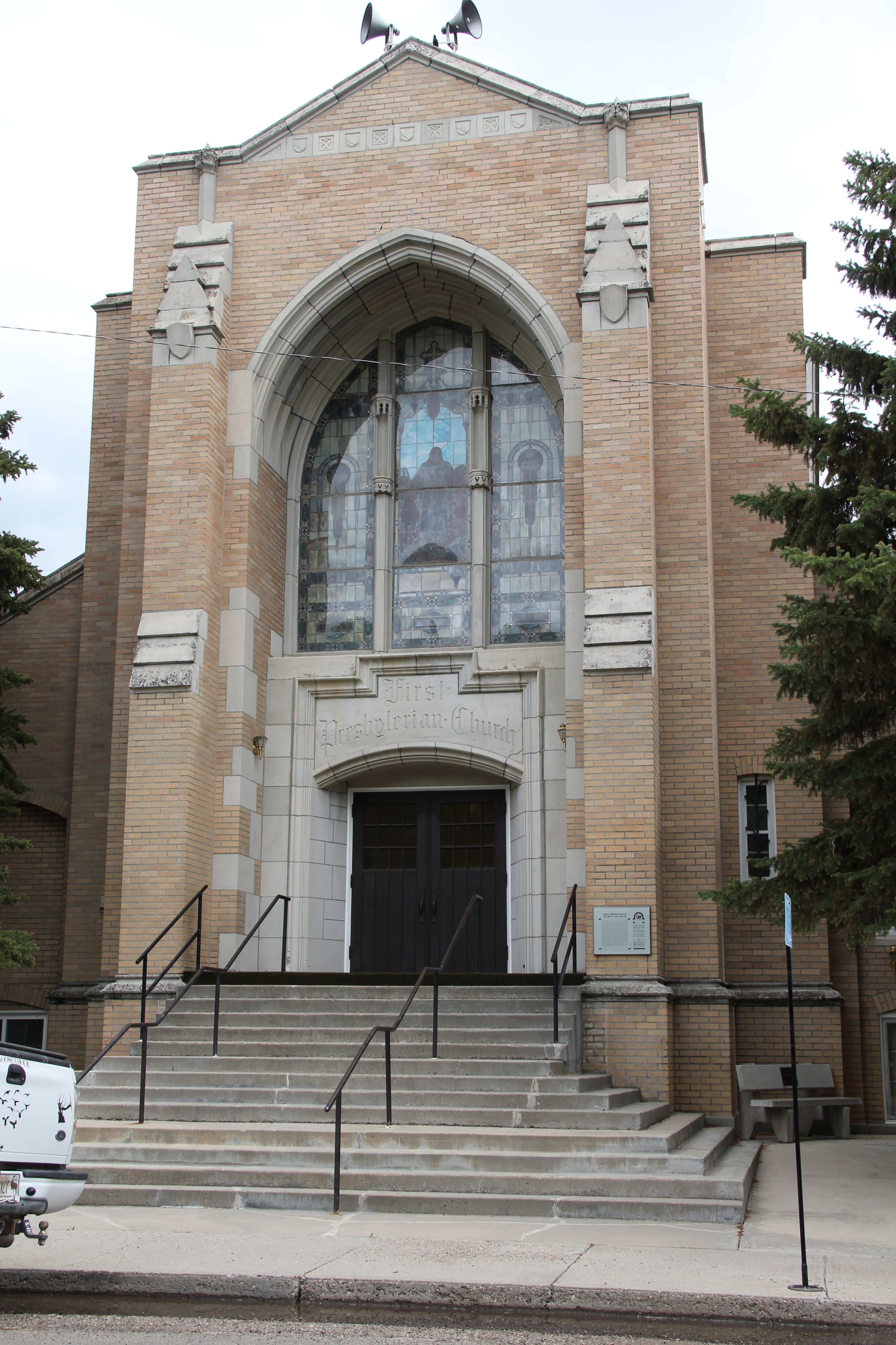
Residents also have designated a historic district of their homes and churches that developed in the early 20th century.  It is an impressive array of buildings, from the c. 1920 First Presbyterian Church, a Gothic Revival design by Howard Van Doren Shaw of Chicago in partnership with McIver and Cohagen of Billings, to the brilliant Craftsman-style of the McQuistion House (1914) built by Louis Wahl of Forsyth for ranchers Joshua and Grace McQuistion as their “town” home.  Then there is the 1897 Queen Anne-style house moved to its Forsyth lot by ranchers Robert and Dora Lane in 1909.  The Lanes moved on but the house has stayed, becoming over 100 years a real cornerstone to the historic neighborhood.

IMG_6967

IMG_6963

IMG_6966

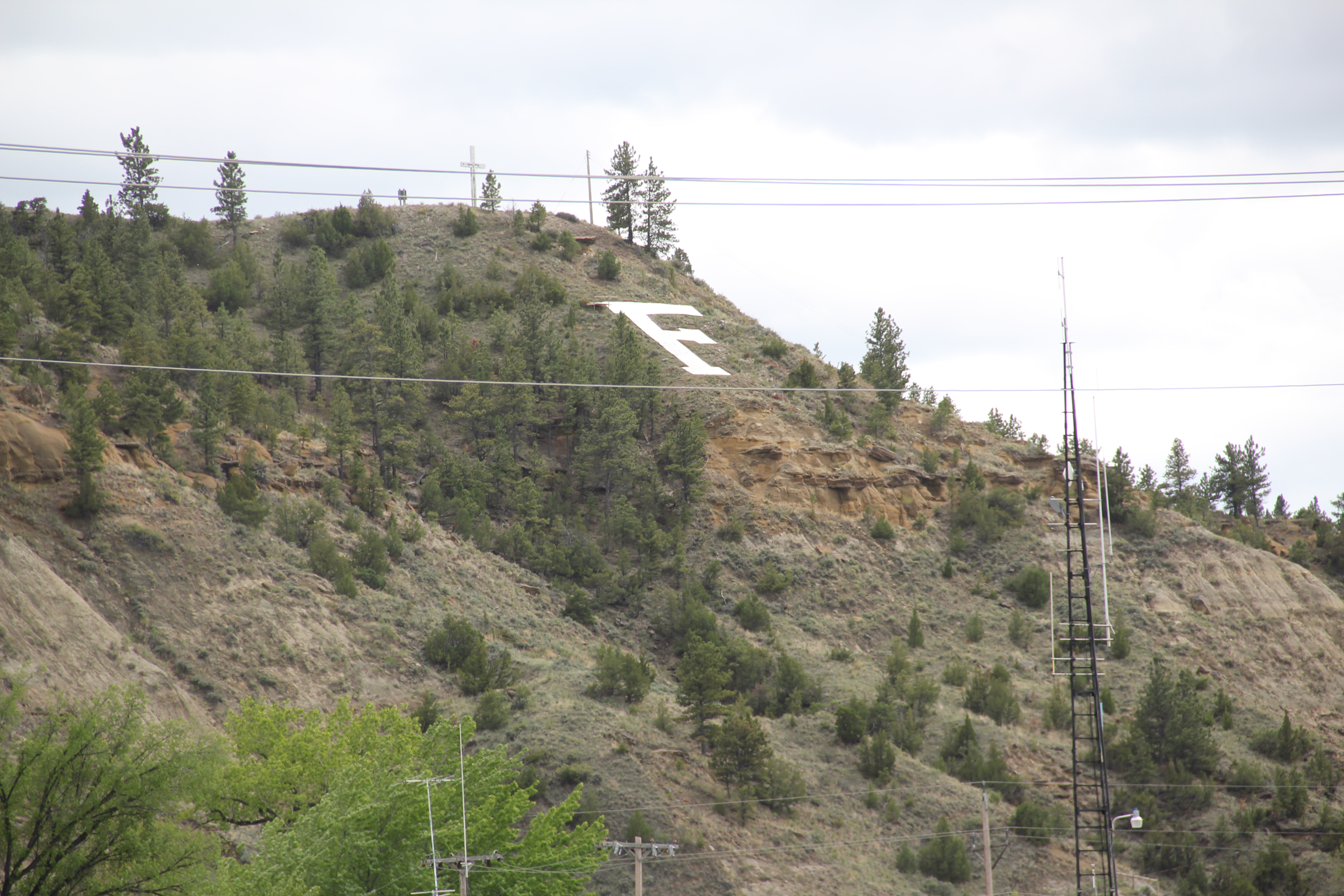
Indeed, that is a theme found throughout town. Despite the coal industry that rumbles in the southern end of the county, Forsyth still holds on, and shows pride in, its ranching past.  No better emblem can be found than the modern front to the Forsyth high school.

IMG_6974

Like the vast majority of eastern Montana towns I visited in 2013, Forsyth has lost population from 1980.  Then over 2500 lived there; in 2010 the census takers counted over 1700 residents.  But unlike many, Forsyth is not beat up, abandoned, forgotten, depressing.  The murals by Bob Watts, discussed in an earlier post, are part of the

IMG_6975

answer.  Local stubbornness is another.  But pride in community as expressed through the town’s many historic preservation projects is another.  Forsyth has figured out how to gain a future through an appreciation of the past.  Let’s hope others follow their lead.

IMG_6985

Moving and Saving Historic Buildings in the Montana Plains

Created with GIMP

Vananda School, northern Rosebud County. I took this image during the preservation work of 1984.

When I met with residents in Rosebud County in 1984, few places in the county captivated me more than Vananda, one of the county’s Milwaukee Road towns along U.S. Highway 12.  Vananda in 1984 had a few scattered buildings and structures, but two landmarks, a small one-story Classical Revival bank, and the three-story Vananda school. The school in particular spoke to the hopes of the settlers who flooded into the region after the Milwaukee came through in 1907-1908.  In 1917, when Louis Wahl, a Forsyth contractor, built the bank, Vananda like many other homestead towns thought a bright future awaited.  But when the bust came in the 1920s, followed by the Great Depression in the 1930s, people disappeared from here even quicker than they had arrived.

In the years since, I have stopped at Vananda several times, seeing if the buildings still stood as silent sentinels to the homesteading past. The school and the bank survived

Vananda Bank-School Rosebud Co. MT

My favorite image of Vananda, taken in 1998.

the 1990s.  In fact, the Montana State Historic Preservation Office had listed the Vananda historic district in the National Register of Historic Places in 1990, part of a countywide effort to designate local landmarks at that time.

IMG_0130

Vananda historic district, 2013

When I next visited Vananda in 2013, fifteen years had passed.  Imagine my disappointment in finding only the school, and it was looking even more worse for the wear.  This was the same year that the National Trust for Historic Preservation listed Montana’s rural schools as one of its most threatened properties in the nation.  One can hope that that designation will eventually bring help and preservation to the school.

IMG_0128

What had happened to the bank?  I found out about 17 miles later when I came into Forsyth, and stopped at something new, at the town’s most prominent crossroads, at Main and 10th Avenue.  It was the Vananda State Bank, moved to that location in 2002-2003.

IMG_6984

The abandoned building was now an insurance building, and an important contributor to town’s historic environment, especially since its corner lot was further enlivened by a mural of the Yellowstone River, “Autumn on the Yellowstone,” by local artist Bob Watts, who has several different murals located throughout town. No. moving the bank to Forsyth and restoring it there, rather than Vananda, is not historic preservation in its purest form.  But it is preservation nonetheless in my opinion.  The historic marker in front of the building tells its story, and there is an active heritage tourism infrastructure in Forsyth, with multiple historic districts, a recently expanded county museum, and a Historic Forsyth walking/driving tour you can download from the Internet.  The bank and the story of Vananda remain active contributors to Rosebud County, fulfilling some of that promise first proclaimed in 1917.

Miles City’s Boom, 1907-1925

The Renaissance Revival-styled U.S. Post Office, designed by Oscar Wenderoth, opened in 1916 during the height of the region's homesteading boom.

The Renaissance Revival-styled U.S. Post Office, designed by Oscar Wenderoth, opened in 1916 during the height of the region’s homesteading boom.

Following the construction of the Milwaukee Road and its various shops, roundhouse, and offices, Miles City entered a boom period unlike any other in the town’s history.  The boom lasted for just under 20 years, ending soon after the Northern Pacific Railroad constructed its new passenger depot in 1924.  In between the arrival of the Milwaukee, and the opening of the new Northern Pacific depot, an array of new middle-class homes, churches, new public elementary and high schools, and businesses gave the city its early twentieth century “look” still prized today and protected by three historic districts.

IMG_7063

Washington School, Miles City

Census records tell us a mere 1,938 people lived in Miles City in 1900, but by 1910 that number had jumped to 4,697 and ten years later, 1920, almost 8,000 people lived there.  Hemmed in by the Yellowstone River and the mainline of the Northern Pacific, the town spread to the east, along Main Street, and then north into the new neighborhoods associated with the Milwaukee Road developments.

The East Main Historic District has a number of architecturally distinctive buildings from the 1910.  The Horton House (1911) is an excellent example of the “American Four-Square” house designed by Miles City architect Brynjulf Rivenes.  The two-story house is now a bed and breakfast business.  You don’t typically equate eastern Montana towns with the latest in domestic architecture styles, but the Love House (1916) is an excellent Montana example of the Prairie style, first created by famed architect Frank Lloyd Wright and here executed in a design from George Wageley. Another example of the Prairie style from that same decade is the Pope House, built by Thomas Horton.

Horton House Bed and Breakfast, Miles City

Horton House Bed and Breakfast, Miles City

Love House, Miles City

Love House, Miles City

Pope House, Miles City

Pope House, Miles City

Just off of East Main Street is the Wibaux Park neighborhood, centered around a public space donated by cattleman Pierre Wibaux in 1915.  Here the dwellings included bungalows, Colonial Revival cottages, and an impressive example of Tudor Revival style.

Wibaux Park, Miles City

Wibaux Park, Miles City

Tudor Revival style house facing Wibaux Park, Miles City.

Tudor Revival style house facing Wibaux Park, Miles City.

Congregations also built large, architecturally distinctive church buildings to serve their growing congregations.  The Methodists added a Gothic Revival style building, designed by Woodruff and McGulpin, in 1912.  The Presbyterians added their own Gothic edifice two years later, a mammoth building designed by Brynjulf Rivenes that stood between the downtown commercial district and the new residential areas.  The Catholics added a new Sacred Heart church in 1924, adding to the contributions started by the Ursulines at the first of the century.

Methodist Church, Miles City

Methodist Church, Miles City

First Presbyterian, entrance, Miles City

First Presbyterian, entrance, Miles City

Sacred Heart Catholic Church, Miles City

Sacred Heart Catholic Church, Miles City

New public schools–with the buildings still in use today–completed the process of urban growth between 1907 and 1925.  The Custer County High School, finished in 1922, became a centerpiece not only of Miles City but the the county as a whole.  Here was a modern facility that gave local students opportunities their parents never had. The boom had been magnificent but as drought and homesteading failures multiplified across eastern Montana by the mid-1920s, residents were learning that the bust would be transformative too.  We will look at the era of bust and recovery next.

Custer County High School, 1922

Custer County High School, 1922

Ekalaka: Montana’s Southeast Corner

IMG_0424Traveling south along Montana-Dakota border on Montana Highway 7, Ekalaka appears as an oasis of settlement, as it lies almost hidden away along Russell Creek.  The seat of Carter County, the town is perhaps best known for the Carter County Museum, a solid institution of natural and local history.  Since I had last visited 25 years earlier the museum facility had grown substantially–while the town had slipped to just over 300 residents, according to the 2010 census.

IMG_0427

The museum is best known for its dinosaur collections but it also has rich local history collections, and features one of the county’s homesteading era schools moved to the grounds. Central School operated from 1920 to 1947.

IMG_0425

So much of what you find in Ekalaka dates to that same time period.  The state established Carter County in 1917 and three years later the present-day Carter County Courthouse was opened for business. Wwhen I visited in 2013 this three-story frame building with a Colonial Revival-styled cupola was undergoing renovation.  It stands at the heart of the

IMG_0430

town, creating a large public space that is shared by the county’s two demographic extremes, represented by the elementary school and a more recent county nursing home.

IMG_0432

The physical fabric of Ekalaka’s main street was much the same as it had been in 1984, but now there were more shuttered buildings.  Community landmarks included the combination town library and Masonic Lodge building from the first half of the 20th century and the new post office from the first decade of the 21st century.

IMG_0438

IMG_0448

Deb’s Coffee Shop, the Guest House, and the Mainstreet grocery are still-going concerns while the most obvious commercial landmark–the old Eagles Lodge building–is home to the Ekalaka Eagle, one of the oldest small-town newspapers in the state, almost as old as the town itself.

IMG_0443

IMG_0446

Carter County in 2013 did not have a property listed in the National Register of Historic Places, and the Eagle Building appears to meet the register criteria, but you could also consider the whole commercial area as a historic district for how it still reflects a rural county seat of the 20th century.

IMG_0428

IMG_0444

Other historic properties abound in Carter County, from the Medicine Rocks north of Ekalaka to Camp Needmore–an old Civilian Conservation Corps camp–south of town in the Custer National Forest.  More on those landmarks in later posts.  I am still not finished exploring Montana’s southeastern corner.

IMG_0460

Down the Powder River to Broadus

IMG_0149

When I was able to carve some extra fieldwork in my limited time in Montana in 2013, there were two places in particular I was eager to revisit, both in the state’s far southeast corner. Broadus, the seat of Powder River County, and Ekalaka, the seat of Carter County, were tiny places in 1984.  Yet both made me very more than welcome in my work for the state historic preservation plan.

IMG_0146

My 1984 public meeting on the historic preservation plan took place at what was then the new Powder River County Courthouse, a real point of pride, obviously, for all of the residents.  Built in 1978 from designs by Harrison G. Fagg and Associates, the building is 1970s modernism at its best: low profile, earth-tone brick, at one with its setting but also with a functional modern interior where all of the work of county government could take place.  That night, the residents’ passion and interest in the past were intense.  They couldn’t wait, they said, to show me the oldest homestead house in the county, from 1916. I have recounted that story many times since:  it all depends on the context when you think of how “old” a property may be.  In the Powder River County context, it made sense: the county itself wasn’t formed until 1919.

Cross Ranch, Powder River Co

Another property I visited in 1984 following the public meeting was the Cross Ranch, and took the photo above of its overall setting.  At that time the county had no properties listed in the National Register:  the Cross Ranch Headquarters, with its distinctive hipped roof, would be the first, in 1996.

IMG_0147

Broadus itself has several properties that are also National Register worthy.  Although the population decline has been steep, from 712 in 1980 to merely 468 in 2010, I found its distinctive town square plan intact.  Town squares are common in the south and midwest but not so much in Montana since so many county seats are either mining towns, that grew quickly and haphazardly, or railroad towns with their familiar symmetrical plan or T-plan design.  My favorite landmark is the historic Montana Bar and Cafe, which is now the Montana Casino and Bar–the wild game collection is still there but like most historic bars across the state the pings of gambling machines now dominate the interiors as bar owners do what they can for income as rural populations continue to decrease.

IMG_0161

For a place under 500 people, in a county of just over 1100 residents, Broadus provides a range of outlets for recreation and entertainment besides the public school, from the county museum for visitors, the local library, a bowling alley, and a small movie theater.

IMG_0148

IMG_0156

IMG_0155

IMG_0154

The most important, and historic, community institution–again in addition to the public schools–is Cottonwood Park, where the annual Powder River County Rodeo takes place.

IMG_0178

IMG_0176

IMG_0175

The Let ‘Er Buck Rodeo is one of the region’s best, and makes the town come alive every summer.  Fairgrounds are so important in the rural west:  community gatherings matter to those who are scattered across this vast landscape.

IMG_0179North of Broadus on Montana Highway 59 is another landmark of community, but one quite rare to find in today’s west.  The Coalwood Ladies Aid Society was established in 1915; it still meets in the historic Coalwood School, c. 1945.  Women’s organizations like the Coalwood Ladies Aid served not only as a support group but also community builders for rural places across the region.

IMG_0183

Broadus was, and is, a place where the past matters and residents still embrace their way of life and special place in the Montana landscape.

Howdy from Terry!

Terry overview
Terry, the seat of Prairie County, has long been one of my favorite places in the Yellowstone Valley. Stuck between the much larger, and more famed, Yellowstone towns of Miles City (to the west) and Glendive (to the east), Terry has somehow developed and kept its own identity as a western place, and landscape, that still speaks strongly to the patterns that transformed the region over the last 150 years: railroads, homesteading, cattle, and town building.
IMG_4047
In 1984 I focused on the railroad imprint on the town, which began in the early 1880s as Northern Pacific officials understood the need for a railroad stop at place near the confluence between the Yellowstone and Powder rivers.
IMG_7154
In 2013, however, the depot was gone from the tracks but not the town. It had been moved to become part of the solid Prairie County Museum, a local institution that was still quite new when I first visited in 1984. Located in the town’s most prominent neoclassical bank building from the 1910s, the museum was a place where I held a public meeting about the preservation plan process and found a community totally engaged with its past.
Terry bank
IMG_7141
The museum highlights agriculture and ranching, and includes the Evelyn Cameron Gallery, which displays and celebrates the life and contributions of this important western photographer. One change I noted last year was the creation of the Evelyn Cameron Heritage Center, on Laudre Avenue just a few yards away from the museum, which is at the crossroads of Laudre and Logan Avenues.
IMG_7182
That crossroads was another pattern in Terry’s landscape that caught my eye. Most Northern Pacific towns, originally, were symmetrical plans, with a long line of commercial buildings flanking one side of the tracks and grain elevators and warehouses on the other side. Terry, however, had a classic T-town plan, with the tracks creating the top of the T and then a main commercial artery, in this case Logan Avenue, serving as the stem of the “T.”
IMG_7147
Why was Terry different? It is the impact of the Milwaukee Road as it built through the valley in 1906-1907. In 1984 there was still a second set of tracks, and a few scattered commercial buildings, to the north of the Northern Pacific mainline. Today two buildings remain along with the roadbed that marks this second period of Terry’s growth.
IMG_7144
IMG_7143
IMG_7133
Just west of the “downtown” you can find the one still thriving institution associated with the Milwaukee Road impact on Terry: the Prairie County Fairgrounds, which once faced the Milwaukee’s main line. (I have discussed the fairgrounds in an earlier post.)
IMG_7138
Another wave of change came to Terry in the 1920s as U.S. Highway 10 gave the town another transportation pattern. The highway’s crossroads with the original T-plan commercial artery is marked by a still extant somewhat Art Deco-styled brick gas station/ auto dealership.
IMG_7178
The most recognized roadside landmark is the Kempton Hotel, a true rarity now for this section of the Yellowstone Valley as those rambling montage of buildings that once constituted places of rest and relaxation along the nation’s highways have largely disappeared from the landscape.
Then, just yards away, is another rambling montage of historic buildings, the schools of Prairie County, ranging from the large stately multi-story brick buildings of the early 20th century to more restrained modern buildings of the second half of the century.
IMG_7168
At the edge of town are three different properties, all related to the need for highway transportation. The Dizzy Diner is a classic 1950s drive-in while the crumbling Terry drive-in also speaks to past patterns in popular culture. Then the Prairie County Grazing District Stockyards connects the present to the past traditions of stock raising in this region.
IMG_7187
IMG_7191
IMG_7189
Certainly the biggest change is Terry from 1984 and 2013 was the transformation of the county courthouse. In 1984 I was shocked that there was only an unadorned concrete block building for the courthouse, and I have shared images of that building across the country. Well the concrete block building on Logan Avenue is gone, replaced by a much larger, still unadorned building for local government.
IMG_7174
IMG_7175
Terry’s population has dropped by a third since my first encounter with the town in the early 1980s. But new public investment, and a still commercially relevant “downtown” speaks volumes to the residents’ commitment and faith in this small yet significant Yellowstone valley town.

The Yellowstone’s Prairie County

Old U.S. 10 bridge over Yellowstone River, Prairie County, MT Old U.S. 10 bridge over Yellowstone River, Prairie County, MT

From Glendive in 1984, I began to move up the Yellowstone Valley, taking a particular interest in the various Northern Pacific railroad towns–that over-arching pattern in the region’s historic landscape was clearly my over-riding interest in 1984. But places like Prairie County added their own intriguing challenges. Here the Milwaukee Road, coming from the southeast, entered into the valley. And then there was the real treasure trove of early settlement photographs produced by Evelyn Cameron. Thirty years ago, Cameron’s stark yet compelling images were just become re-discovered and appreciated. Her images were also in my head as I traveled this small eastern Montana county.
Evelyn cameron
Fallon was the first town I encountered in Prairie County. Established during the building of the Northern Pacific in the early 1880s, it has never been a big place. Its National Register landmark is probably rarely recognized, since it is the steel truss bridge on old U.S. 10 that crosses the Yellowstone at this place. This magnificent continuous span Warren through truss bridge is Montana’s longest truss bridge, 1,142 feet. It was built in 1944 as a wartime emergency project after a ice flow destroyed an earlier crossing at this place. It is also a reminder of how crucial old U.S. 10 was to the nation’s transportation system in the mid-20th century.
IMG_7194
When I visited Fallon 30 years ago, the school was a focal point of the community. In 2013, it was closed, and counted as one of the National Trust for Historic Places threatened rural schools of Montana.
IMG_7206
The old bank building was the post office, a great adaptive reuse I thought in 1984. This neoclassical brick building is still the post office–having survived the earlier postal service to close many small town Montana post offices.
IMG_7196
Another really important place of continuity was the Lazy Jo’s bar and cafe. Housed in one of those typical Eastern Montana buildings that grew, morphed, and changed again over the last 100+ years, it is still a great place, and an active community center.
IMG_7197
Across from the bar, between the town’s main street and the railroad tracks, was the water trough, a reminder of those days amply recorded in Cameron’s photographs 100 years ago, and the town’s only marked historic structure.
IMG_7203
Community pride is probably expressed best through the tiny but still active Fallon Town Park and the quietly dignified Grace Lutheran Church. These are anchors for a place that has experienced and survived much and faces an uncertain 21st century future.
IMG_7199
IMG_7200
IMG_7201
I apologize for the gaps in recent posts, just extremely busy in the job that actually pays money–hopefully I can catch up in what goes for winter in Tennessee. Next is Terry, Montana.

A turn into the Yellowstone Valley

Note: sorry about the delayed posts–real life, and work, interfered in October.

In the 1984 survey of Montana’s landscapes for the state historic preservation office, when I turned southward at the Bainville depot, a Great Northern Railway landmark now sadly missing from the landscape, I understood that a new phase of the project, and of the state, was opening up before my eyes as a cold February turned into March.
IMG_4077
I first encountered Fairview, at the tip of the Lower Yellowstone Valley and a product too of the Lower Yellowstone Irrigation Project, which I addressed in earlier posts this fall.

Historic Hotel Albert, a 3-story brick relic of the homesteading boom

Historic Hotel Albert, a 3-story brick relic of the homesteading boom


Fairview then and even more so now was a place of transition between the agriculture made possible through the engineering marvel of the federal irrigation project and the slowly creeping westward push of the oil boom associated with North Dakota’s Williston Basin.
Ft. Gilbert highway marker, north of Fairview: note oil well to the right

Ft. Gilbert highway marker, north of Fairview: note oil well to the right


As I drove south along MT Highway 16, I passed through the Lower Yellowstone Project towns of Crane, Savage, Sidney, and Intake–discussed in earlier posts–and then hit Interstate I-94: the first interstate I had seen in weeks. But instead of turning into Glendive, the major town in the region, I veered to the east to explore Wibaux County.
IMG_1683
I knew a bit about Wibaux through the standard narratives of Montana history because here stood the ranch house of Pierre Wibaux, one of the most famous early cattlemen in Montana. The house had long served as a heritage tourism stop, even as a state welcome center since Wibaux is positioned a few miles west of the Montana-North Dakota border on I-94. In 1984 I knew that I wanted to visit the ranch house, and see the monument erected to Wibaux to commemorate his life and achievements.
IMG_0494
I also found, however, the heavy imprint left in the wake of the Northern Pacific Railroad as it headed into Montana and aimed for the Yellowstone Valley. For the next several weeks I explored this connection between rail and river that so defines the valley still today.
Underpass separating MT 16 from the Northern Pacific mainline at Wibaux

Underpass separating MT 16 from the Northern Pacific mainline at Wibaux


Wibaux is a town of bars–the Shamrock became my favorite in 1984, but the Rainbow Bar, housed in a building with more than a nod to Northern Pacific iconography, and the Stockman Bar were always worth a stop. Among newcomers in 2013, the Firelite was friendly but the big hit with locals and visitors was the Beaver Creek Brewery, a microbrewery way out on the plains of Montana.
IMG_0384IMG_0385
IMG_0387
IMG_0381
IMG_0383
With old historic hotels, business blocks, and bank buildings–one transformed into the town library–still intact, here is a commercial historic district just waiting one day to be placed into the National Register of Historic Places.
IMG_0382
Besides the bars, however, I enjoy Wibaux for its sense of a western ranch town, even in the face of the expanding reach of the Williston oil boom. There is the 1950s contemporary-styled Wibaux County Courthouse; the county fairgrounds south of town; and a bit farther south on MT 16 the historic Nunberg Ranch, which is listed in the National Register.
IMG_0483
IMG_0480
IMG_0479
Also listed in the National Register is the striking St. Peter’s Catholic Church, certainly a Gothic Revival landmark when the congregation built it on a high point west of the business district but then made into a western landmark with the addition of river stone in 1938. Here was a statement in the depression era: we are here and we are proud.
IMG_0493
But if you turn to the north, however, on the other side of the tracks is the life of the community, the school. And this image of the high school football field is perhaps the best way to close a post about Wibaux. Yep, it is small, determined, and still here, even when many think it should have blown away decades ago.
IMG_0496

Sidney, Montana, and the Lower Yellowstone Irrigation Project

The initial success of the Lower Yellowstone Irrigation project, along with the homesteading boom of the early 1910s, led to the creation of Richland County in 1914. The new county, so named for the promise of the U.S. Reclamation Service project and the booster rhetoric of the era, used the existing town of Sidney as the county seat.

Northern Pacific Railway corridor at Sidney, MT

Northern Pacific Railway corridor at Sidney, MT


Sidney was the largest town on the Northern Pacific’s spur that ran up the Lower Yellowstone Valley. The historic grain elevators along the tracks testify to generations of agricultural products shipped from the town, although today the incessant freight traffic serving the booming oil fields of the nearby Williston Basin overwhelm the earlier agricultural focus.
IMG_7354
But the oil boom has not overwhelmed the city’s traditional agriculture-based economy, yet. The reason why is the persistence of two institutions that both received an economic shot-in-the-arm in 2002. First was the former Holly Sugar refinery that came to Sidney in the mid-1920s. Sidney Sugars Inc. took over the plant in 2002 and sugar beets by the thousands of tons are still processed here. The second key institution that speaks to the primacy of agriculture in Richland County is the USDA’s Northern Plains Agricultural Research Laboratory, located just north of town. USDA established the center in the 1950s; the current complex dates to 2002, following a reorganization of its program two years earlier. One section of the unit stays focused on the center’s original program to support agriculture in the Lower Yellowstone project through research to enhance the productivity and profitability of dry land irrigated farming. The laboratory’s second focus studies how to better maintain weed and pest control through biological solutions rather than an over-reliance on chemicals.
IMG_7334
The Richland County Courthouse, which was undergoing a massive renovation when I visited a year ago, spoke to the hopes and dreams of Sidney in the early 20th century. This neoclassical monument stood above all buildings in the town–save for the grain elevators. Another important building was the post office, a New Deal era project of Colonial Revival design that featured one of the handful of Montana post office murals, a depiction of the Yellowstone River landscape before the railroads and irrigation project by J. K. Ralston. This building since 1984 had been converted into county offices.
IMG_7338
The 1930s also added two new buildings that have served the town’s youth ever since. Most prominent was the Sidney High School, now middle school, completed in the mid-1930s. A second was the log-construction Boy Scout Lodge, finished in 1932.
IMG_7331IMG_7346
The town also retains several examples of 1920s domestic architecture, speaking to the impact of the sugar beet industry on its fortunes. Despite the on-going oil boom, these historic homes confer a bit of stability to a rapidly expanding area.
IMG_7344
IMG_7343
When I visited in 1984 the town proudly hosted a lecture about the state preservation plan at its brand new MonDak Heritage Center. The museum’s creators and leaders spoke with pride about how their history nor town would not disappear–the center was among the most impressive Eastern Montana history institutions of the time.
IMG_7353
Little had changed over the past 30 years when I visited in 2013. The center had an over-flowing library and archives. Its art exhibits still celebrated J. K. Ralston. And its history exhibits still followed the model, set earlier by the Montana Historical Society in Helena in the 1970s, of a recreated frontier town, with period rooms, businesses, churches, and homesteading shacks.
IMG_7348
IMG_4241
IMG_4242
The MonDak Heritage Center was a comfortable step back into time–not only for the persistence of museum interpretation from 30 years ago but also from the realization that despite the rapid change all around them, some in Sidney still retained that earlier sense of self, of ranchers making do and building a community out of the demanding environment of the Lower Yellowstone.

The Lower Yellowstone Project

Irrigation ditch at Intake, MT

Irrigation ditch at Intake, MT


Established by the Newlands Reclamation Act of 1902, the U.S. Reclamation Service moved early to transform the northern plains of Montana. The Lower Yelllowstone Project dates to 1904-1905, and the diversion dam and ditch established at Intake, north of Glendive, the seat of Dawson County, is the best single place to see the engineered landscape of the U.S. Reclamation Service.
IMG_7312
The dam, shown above, diverts water from the Yellowstone River into the big ditch, see below, which in turns waters thousands of acres of ranches in Dawson and Richland counties.
IMG_7308
Intake itself was initially a town of promise, as the two historic elevators suggest, but the spur line built from the Northern Pacific Railway at Glendive north to Sidney. But there is nothing left there now but the recreation area on the Yellowstone River.
Intake elevators

Intake elevators

IMG_7311
A much more successful story happened to the north at the town of Savage in Richland County. Here you cannot escape the ditch as it winds through the town. But residents also have established their own local museum about their community and the irrigation project, centered on the historic Breezy Flats school.
IMG_7321
IMG_7325
Savage still has its high school, built by the New Deal in Art Deco style in the late 1930s, and new churches speak to recent growth. Like other Richland County towns, rapid growth as exploration of the Williston Basin could transform this little town that the railroad and federal irrigation projects built. That time has not arrived here yet–but at Sidney the county seat, the transformation is well underway. That story is next.
IMG_7317
Football field at Savage

Football field at Savage