The Phillipsburg Boom

Over eight years ago I wrote about Phillipsburg as a Victorian mining town that had the “bones” to become a heritage tourism magnet along the Pintlar Scenic Route.

A booming weekday in Early June 2021

I was astounded at the number of people there in early June 2021 Thursday—not the weekend. Certainly the reputation of the Sweet Shop has grown, and grown. it was a busy place.

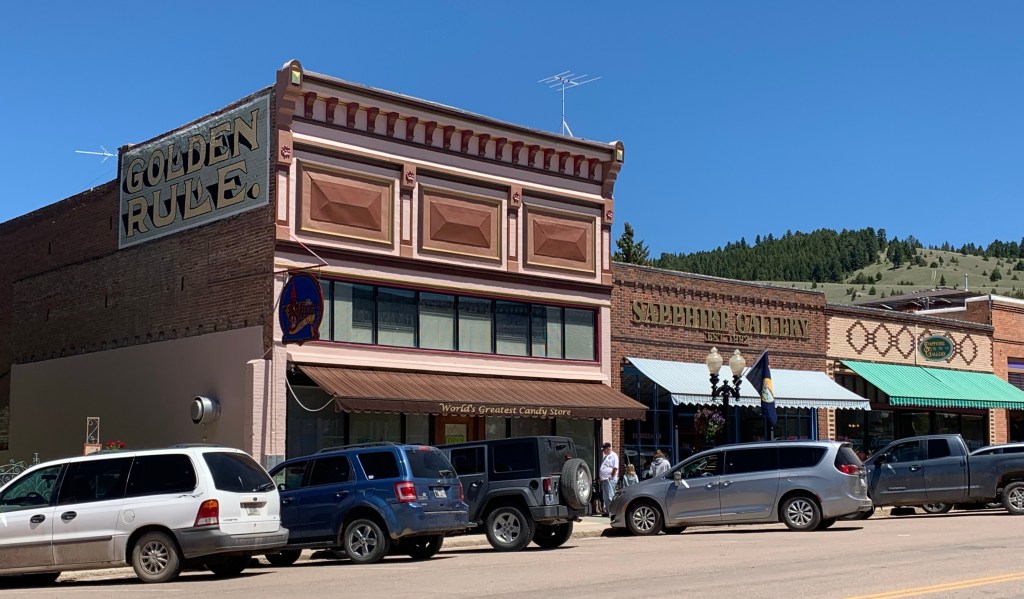
The other attraction was just under construction when I visited in 2012. The Phillipsburg Brewery, located in the late 1880s Sayres Building, is a great local micro brewery but you can taste its wares at restaurants statewide.

It’s an impressive adaptive reuse project for even the interior still retains a late 19th century. Not over built or over restored. Just re-energized to serve the town again.

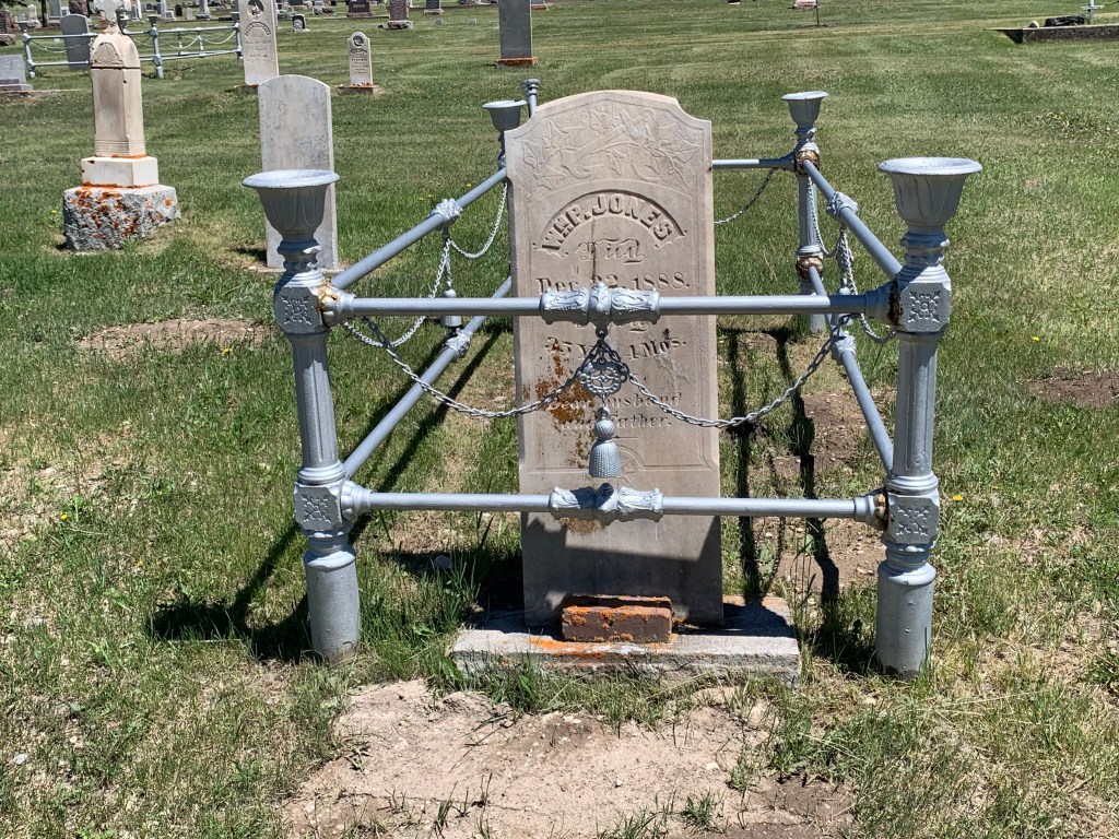
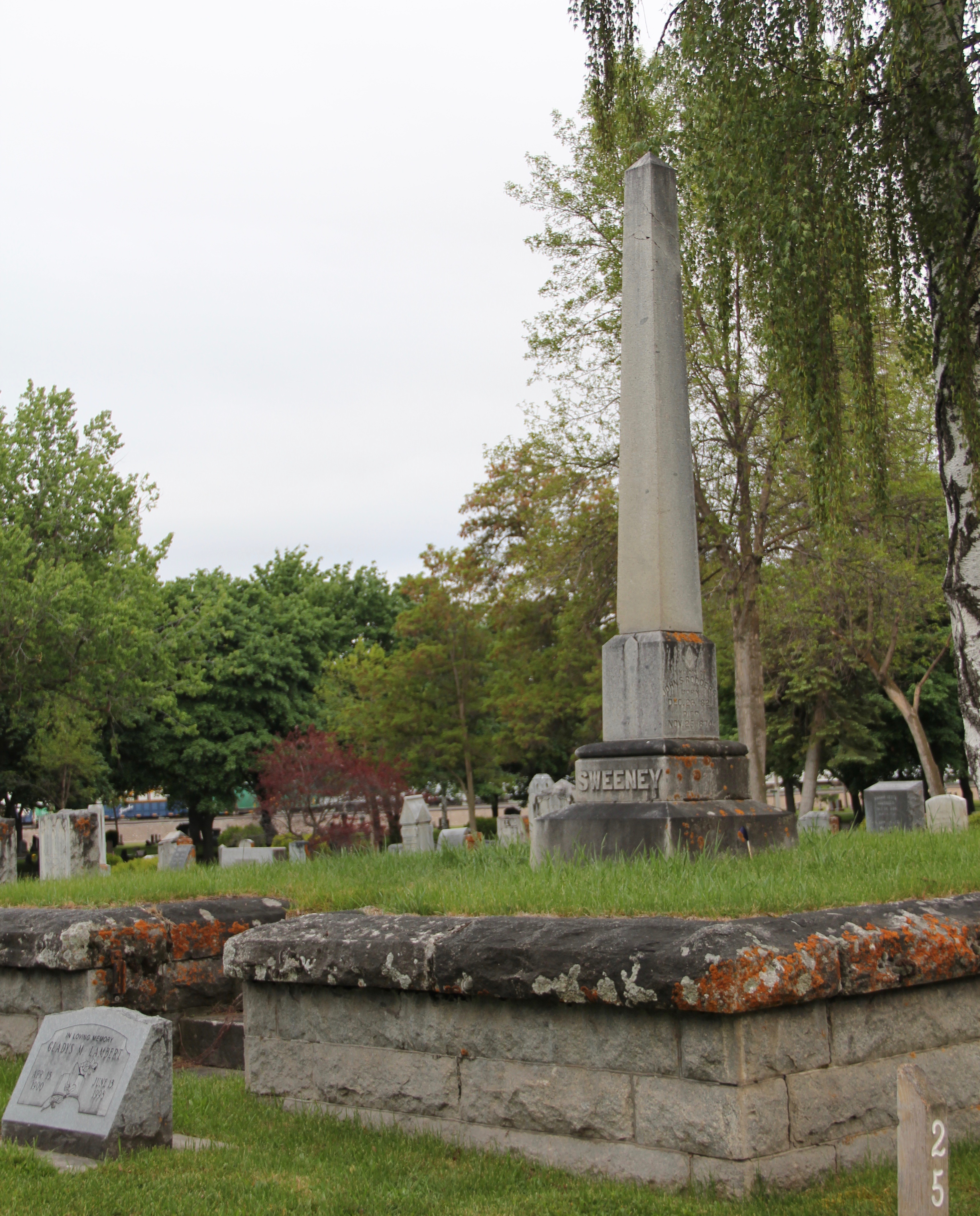
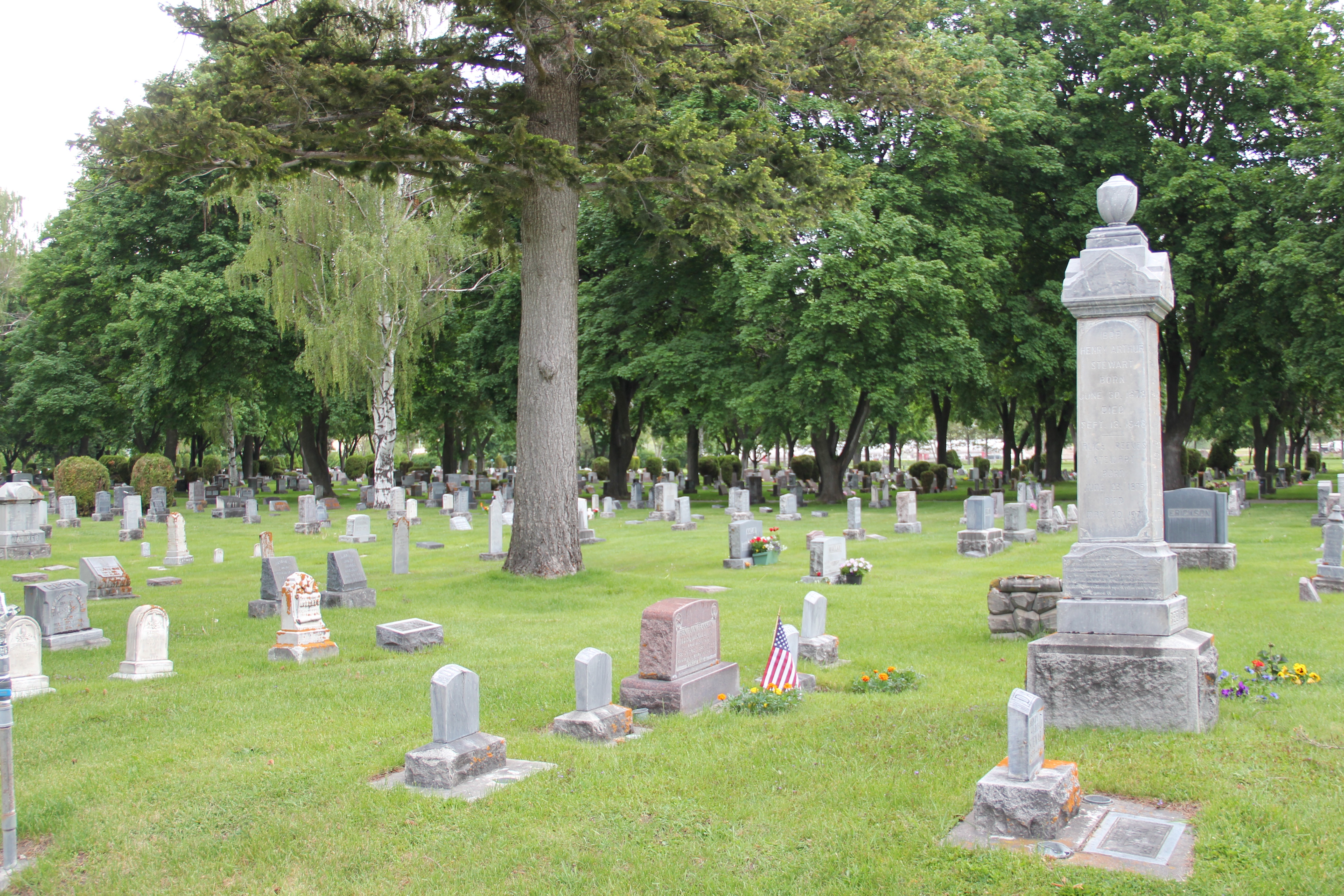
There was a historic change from 2012 at the most unlikely place—the city cemetery. In 2012 I commented on the Victorian theme of several of the burial plots. It remains a remarkable place for that artwork in cast iron.

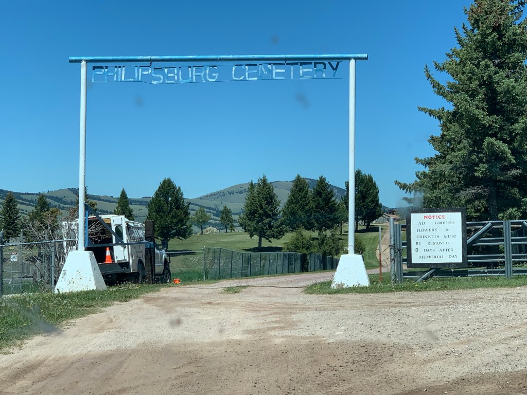
What was new? A commendable effort to address the silences of the past, in the case of Phillipsburg the large Chinese community who once lived there, worked there, and many prospered there during the mining boom of 1890-1920s.

The Granite County Historical Society in 2014 placed an interpretive marker in the cemetery to tell the story of the Chinese burial ground—located in a corner far from the Victorian center of the cemetery. We are now challenged to learn more about the names on the plaque and understand better their contributions.

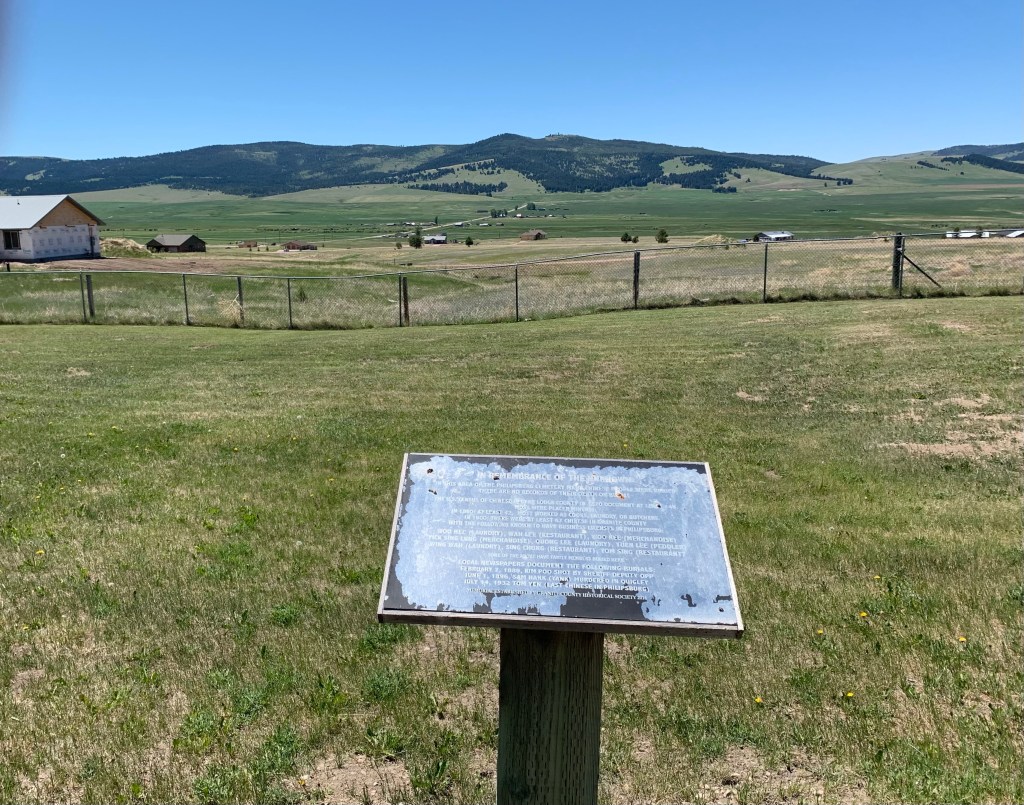
The marker stands alone, as did the Chinese community in the era of racial segregation. The burials in this section range from the late 1880s to 1932. When were the headstones removed? I don’t know yet. But here is the place, several names are listed in primary sources. The next steps to end this silence await.

Shawmut school, Then and Now

I always enjoy driving along US Highway 12 in the Musselshell Valley. It is lightly traveled plus it was the historic route of the Milwaukee Road. Ever since the railroad ceased operations in 1980, the small towns along the line began to fade away.

Shawmut school, 1984

Shawmut was one of those towns but in 1984 it still operated an elementary school, then about 50 years old, having been built during the New Deal of the 1930s. Towns that retained enough population and commitment to keep their school but had a chance.

Shawmut school, 2021

Shawmut school district, as shown above, continued to renovate the building and make it last for another generation. The school made it into the 21st century but closed in 2015 due to declining enrollment.

The Silos of Canyon Ferry Lake, then and now

As I traveled through Montana in 1984 documenting the state for its historic preservation planning, I photographed all sorts of structures. None were more compelling than the 40-foot plus brick silos between the west side of Canyon Ferry Lake and US Highway 12/287 north of Townsend.

The Silos on Canyon Ferry Lake, 1984

At that time, they were the only remnants of the ranching operation of A. B. Cook, constructed about 1920 as he and his ranch hands were raising sheep along a stretch of the Missouri River. The construction of Canyon Ferry Dam in the 1950s forever changed that landscape, but the silos were an important reminder of the earlier past.

The Silos on Canyon Ferry Lake, 2021

Thirty-seven years later, the Silos are no longer just lonely reminders of a sheep ranch. They are the landmarks for a lake-focused suburb of Townsend. The community embraces the brick structures and has recently carried out preservation and restoration. May The Silos remain a landmark along this federal highway for generations to come.

Montana’s National Historic Landmarks: Burton K. Wheeler House, Butte

I’m looking to the time when I can resume my exploration of Montana’s historic places, hopefully in the late summer when travel may be easier as the pandemic eases it impact on everyone. In the meanwhile, I wanted to make several posts about Montana properties that are listed as National Historic Landmarks–the highest possible federal designation for national significance. Montana has its fair share of NHLs because so much nationally significant history has happened within the state, and so many nationally historic individuals has passed its way for its centuries of history.

Burton Kendall Wheeler (1882-1975), however, does not carry the name recognition, say of Lewis and Clark. However, as a national political leader of the first half of the 20th century, Wheeler more than made his mark just on the West. He served four terms in the U.S. Senate, from 1923-1947, and ran as the Vice-Presidential nominee for the Progressive Party third party candidacy of Robert La Follette of Wisconsin in the 1924 presidential campaign. He strongly supported the New Deal of Franklin D. Roosevelt during the Great Depression, but then emerged as an isolationist as the storm clouds of World War II gathered from 1939 to 1941.

His bungalow on Butte’s E. 2nd Street is known locally as the “blue house,” for obvious reasons. Wheeler began his career in Butte c. 1905 and was elected to the Montana legislature in 1910. He served as U.S. Attorney in Butte later that decade and ran as the Democratic nominee for governor in 1920 but lost that election to Joseph Dixon.

The Sentinels of Toole County

Kevin, Toole County, Montana

Grain elevators not only record the industrialization of plains agriculture; they also show you places–where the railroad left a siding and some sort of town, mostly gone now, took root over 100 years ago. Kevin is in northern Toole County, maybe 20 minutes south of the Canadian border. This lone elevator documents its homesteading era, that with the bust of the 1920s gave way to a boom in oil production in the middle decades of the 20th century. several oil tanks still remain from that era.

Kevin, Toole County, Montana

Kevin is the outlier–the rural grain elevators of Toole County record places that were once large agricultural communities, and have not been in population decline for decades. But elevators, both from the early days and from more modern times, remain as the sentinels of Toole County.

At Devon, Toole County, the elevators face U.S. Highway 2 and the tracks of the Great Northern Railway, now the Burlington Northern Santa Fe railroad. I wonder if you can see them from the Sweet Grass Hills. some 30 miles to the north.
More recent metal grain silos surround the older grain elevator at Dunkirk, a land-locked place surrounded by grain fields for as far as the eyes can see.
Galata, on the eastern end of Toole County, captures the fundamental nature of the Hi-Line landscape–bands of steel on raised roadbeds, dotted here and there by tall grain elevators and the spare building or two.

A new future for Missoula’s City Cemetery?

The City Cemetery is one of Missoula’s oldest extant public properties, if not the oldest since it dates with a year of the arrival of the tracks of the Northern Pacific Railroad in the early 1880s. Recent news stories have spoken of surplus land and new development. I hope that as those plans for change are implemented that city officials also consider listing the cemetery in the National Register of Historic Places. It is one of the most interesting public cemeteries I have encountered in Montana. The cemetery also meets the criteria for eligibility of the National Register.

One of the best ways to document a cemetery for the National Register is to explore its historical significance. In the case of the Missoula cemetery, it dates to c. 1883-1884 as a public institution and represents an important way that early town officials began to build the public infrastructure for the city to come. Also the cemetery has several important markers that commemorative key groups and events in local history.

Missoula Co Missoula Cemetery 12

Missoula Co Missoula Cemetery 11

For example, this section of early graves of the Montana Pioneers at the cemetery, marked initially by the large cross, has been memorialized by a recent (1982) commemorative tablet.

Missoula Co Missoula Cemetery 3 Relief Corps

This large obelisk marker dates to 1919 and refers to the effort of a once large and significant women-led group, the Women’s Relief Corps, who initially led the commemoration of Union dead from the Civil War, as an auxiliary organization to the Grand Army of the Republic.  The WRC stayed active through the Spanish-American War and World War I and this marker recognizes veterans from all of those conflicts.  

Missoula Co Missoula Cemetery 4

Fraternal organizations were very important in Missoula’s late nineteenth and early twentieth century history.  Their membership is well represented throughout the cemetery; here are images of the Order of the Eastern Star and then a strategically placed Masonic monument at one of the cemetery’s crossroads.

Missoula Co Missoula Cemetery 1

Missoula Co Missoula Cemetery 17

The image above speaks to the cemetery’s overall design, a reflection of the mid-nineteenth century Rural Cemetery Movement, which perceived a well designed cemetery serving almost like a city park, with curvilinear drives, landscaped grounds, and lots of ornamental plantings, from boxwoods to large, expressive trees.  The Missoula City Cemetery, as the next images show, has all of the traits of a Rural Cemetery Movement property.

Missoula Co Missoula Cemetery 7

Missoula Co Missoula Cemetery 13

Missoula Co Missoula Cemetery 6
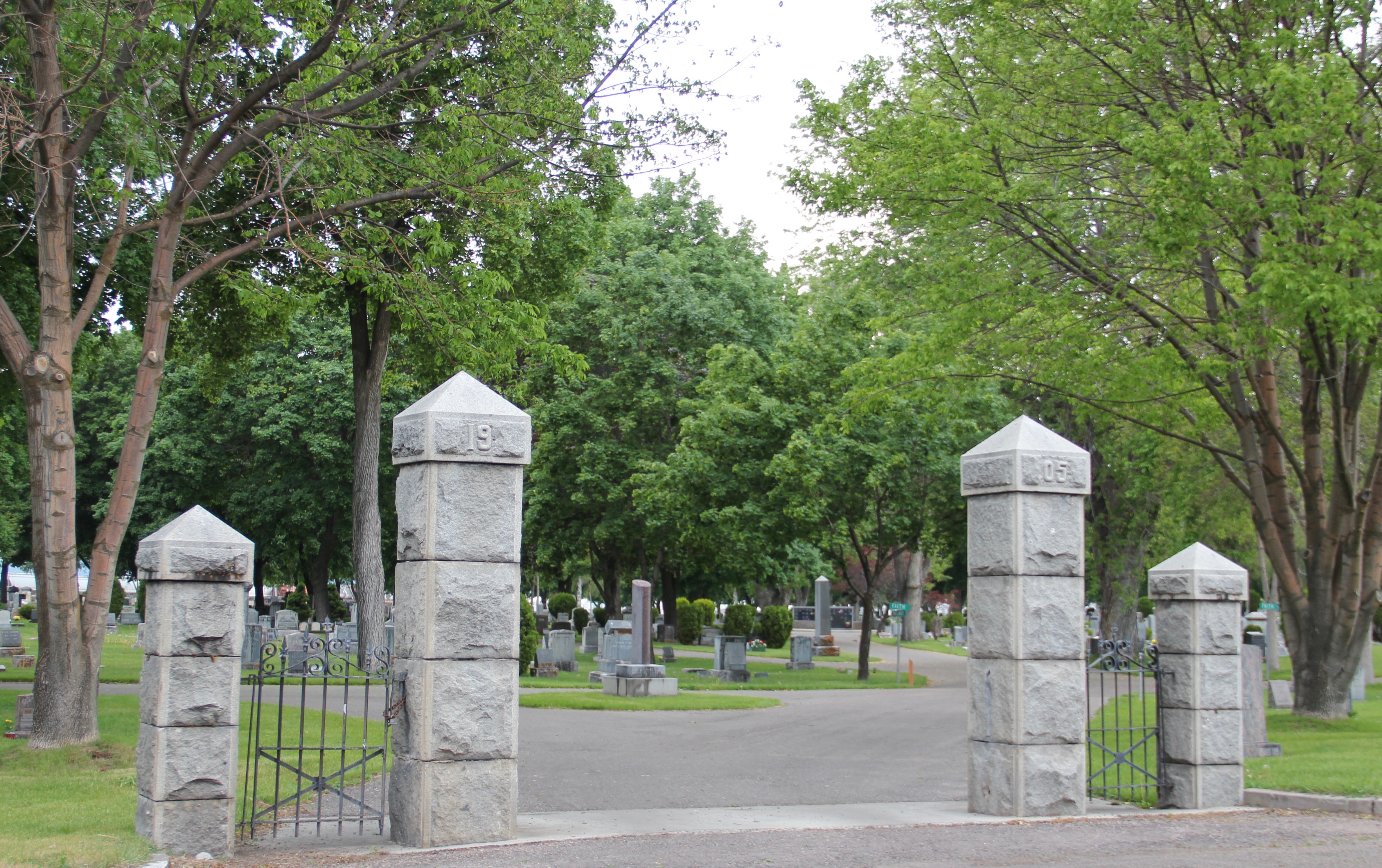
These images speak to the cemetery’s architectural significance, another point of emphasis for a National Register nomination.  The cemetery has several elaborate grave markers, a virtual sculpture garden that also speaks to the city’s artistic expressions.

Missoula Co Missoula Cemetery 15

Missoula Co Missoula Cemetery 9

Missoula Co Missoula Cemetery 14

Yet as the image directly above suggests, the cemetery also represents the community and many of its grave markers are small and largely unadorned, reflective of a working to middle-class centered place as Missoula was for so much of its first 75 years.

Missoula Co Missoula Cemetery 16

Missoula Co Missoula Cemetery 8

Nestled as it is south of the Northern Pacific mainline, the cemetery is a relaxing but noisy environment at many times.  Let’s hope that its new future reflects the importance of its past and this urban cemetery is not surrounded by high-rise buildings and development that transforms what has been an urban oasis for over 130 years into a mere dead end.

Fort Owen: 2020 update

Great news this weekend from the Stevensville newspaper. A new parking area and expansion of the Fort Owen State Park is now in its planning stages. Parking a car and not being in the way of the ranchers who live next door has been problematic for decades. As the photo below indicates the ranch is immediately adjacent to the park.

The new parking area will be at the south entrance to the fort, eliminating traffic snafus and creating new possibilities for public interpretation rather than the only single marker of today.

Plus the new parking area should not distract from the marvelous view of the Bitterroot Valley from this oh so important place. let’s hope the archaeological work before the lot is built uncovers new information.

The Milk River Project and its Impact on Northern Montana

Phillips Co Dodson ditch

Milk River Irrigation Project Ditch at Dodson, Phillips County

In today’s New York Times (June 15, 2020), Montana Jim Robbins reported on the looming disaster facing Montana’s northern states if the St. Mary’s canal, which recently collapsed, is not repaired.  The informative, insightful story focuses on the beginnings of the U.S. Bureau of Reclamation’s Milk River Irrigation Project, its pathway through southern Alberta, and its emergence in central Montana’s Hill County.  It included several wonderful images of Havre, the seat of Hill County, and discussed the wide-ranging disaster faced by ranchers and small towns along the Hi-Line if the ditch did not get its long overdue repairs–to the tune of $200 million.

Valley Co Tampico ditch

The Great Northern, the Milk River Project, and original U.S. 2 at Tampico

Robbins’ story immediately took my mind back to my travels throughout the Milk River Valley, from Hill County to Valley County, in 2013.  The story of how modern transportation and engineering combined to transform the northern plains is so fundamental to the region’s history, yet it remains a story seldom told (another reason Robbins’ New York Times story matters).  The image above represents the forces that led to the settlement and development of the Milk River Valley.  Taken outside of the village of Tampico in Valley County, it centers the ditch between the two transportation systems–the Great Northern Railway on the left and the original route of U.S. Highway 2 on the right– that served the settlers drawn by the water.  The image below shows the village of Tampico from the perspective of the ditch–the place would not exist without the ditch.

Valley Co Tampico ditch 3

Valley Co Tampico Milk river bridge hwy marker
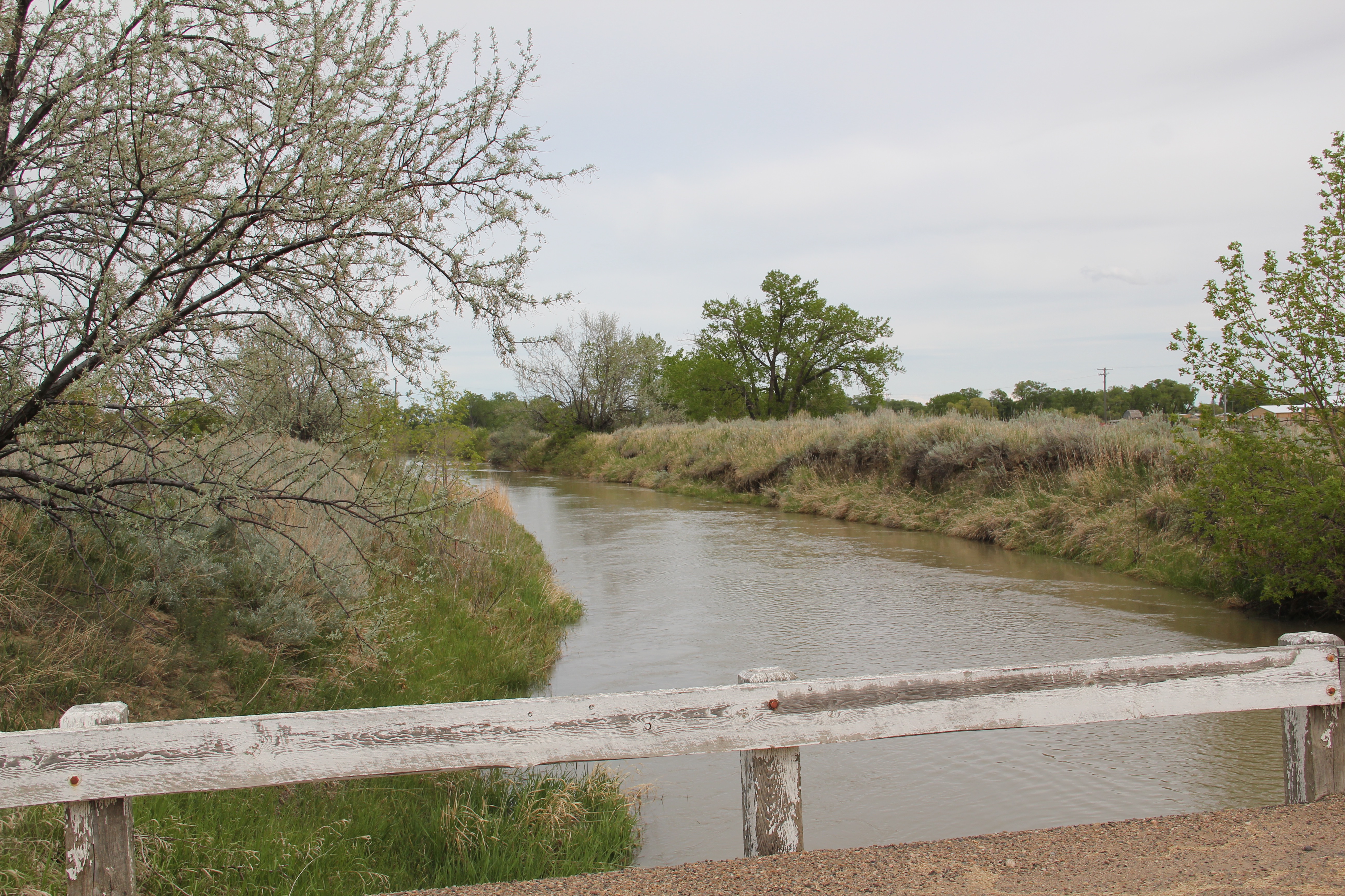
One of the very few historical markers in Montana that touches on the state’s irrigation history focuses about a historic bridge that once stood nearby at Tampico.

Hil Co Fresno dam 2

Hil Co Fresno reservoir
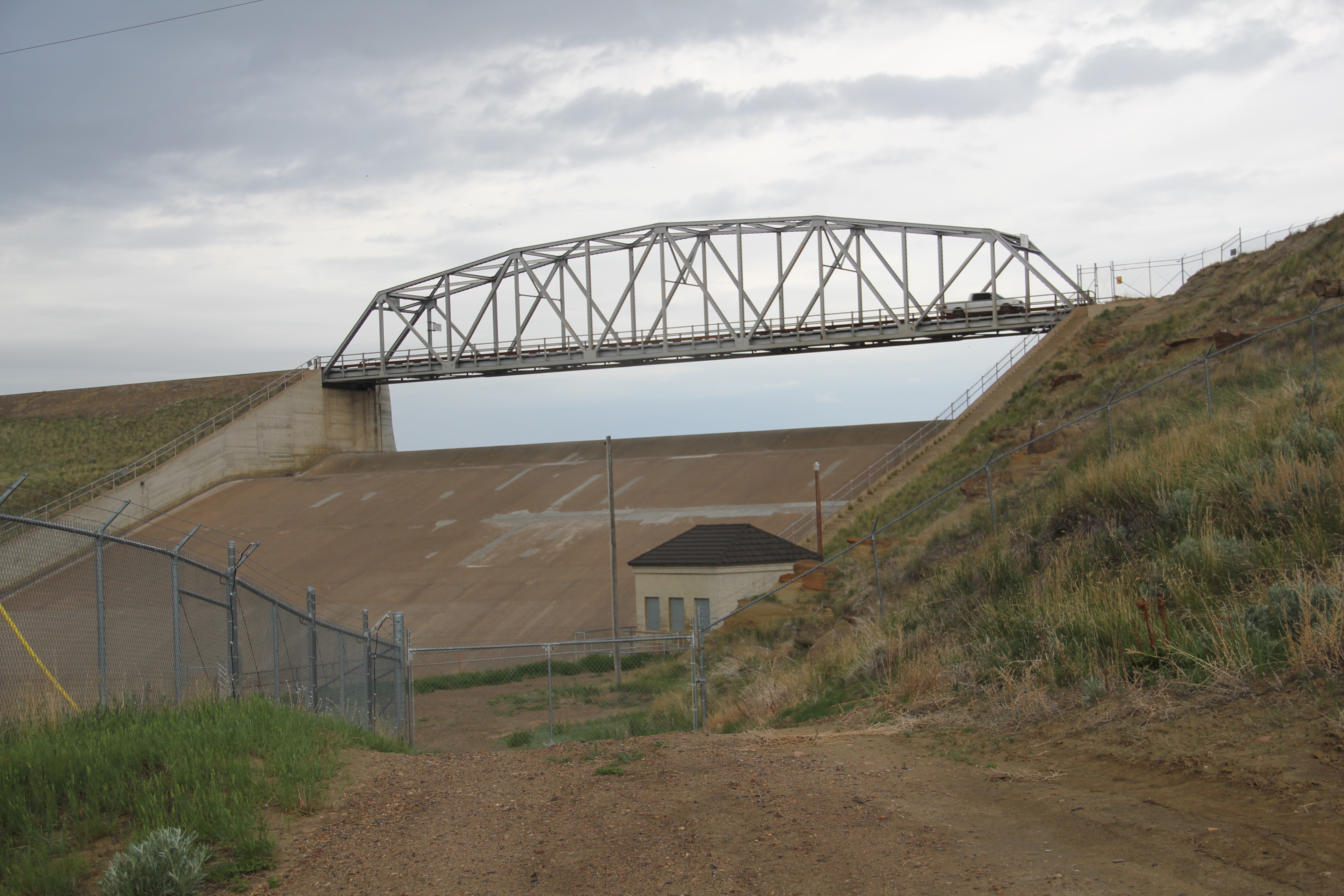
Large man-made lakes capture water to reserve it for use throughout the growing season.  The images above are of Fresno Reservoir, on a rainy morning, in Hill County.  While the two images below are of Nelson Reservoir, on a typically bright sunny day, many miles downstream in Phillips County.

Phillips Co Nelson reservoir sign irrigation

Phillips Co Nelson Reservoir USBR 1
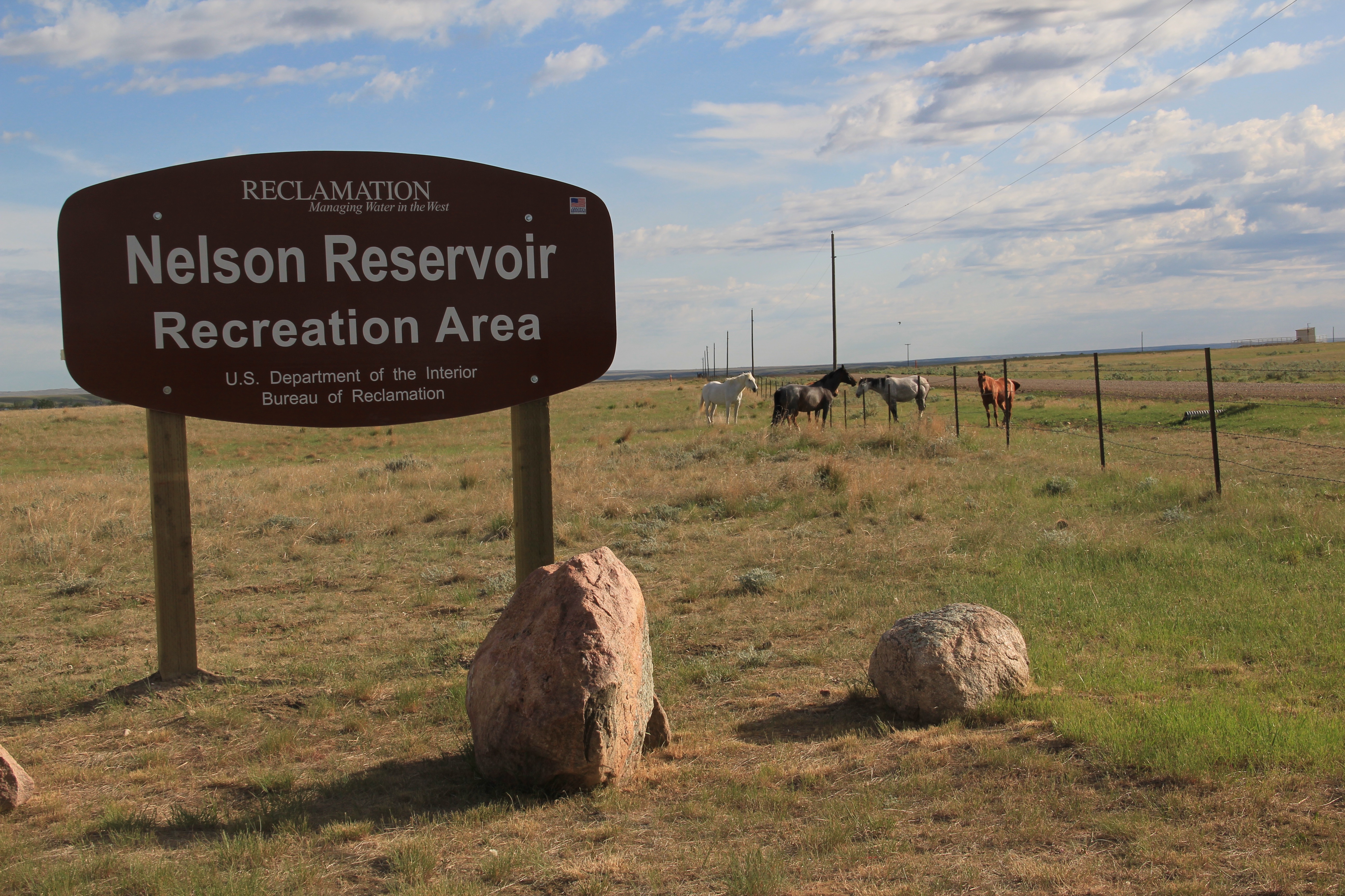
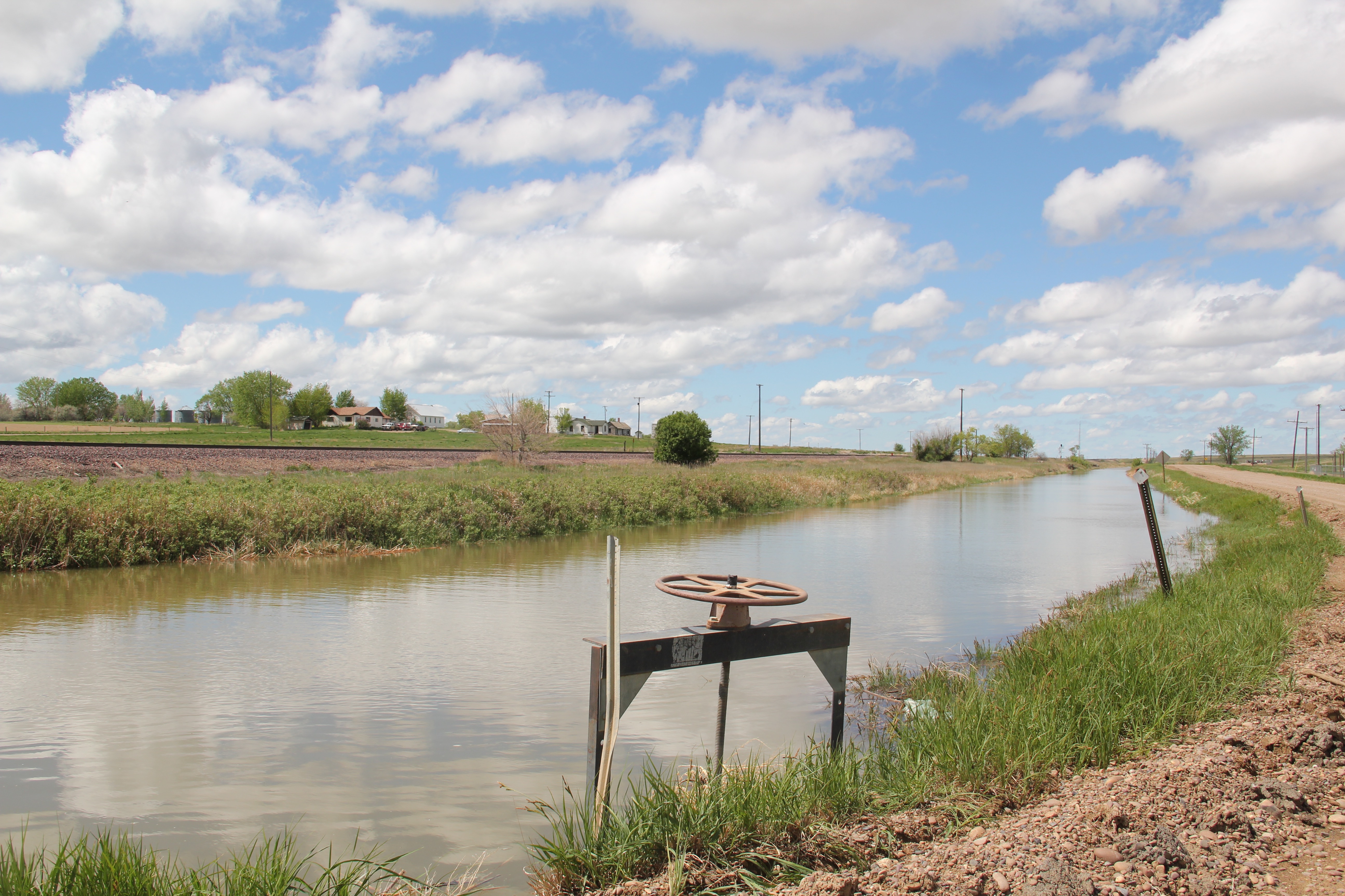
The Milk River Project shapes so much of the Hi-Line, it has become just part of the scenery.  I wonder how many travelers along U.S. Highway 2 in Phillips County even notice or consider the constant presence of the ditch along their route.

Phillips Co Milk river irrigation ditch near Robinson ranch

Not only are their scattered small towns along the Milk River Project, early agricultural institutions are often centered on the project.  A great example is the Phillips County Fairgrounds, outside of Dodson, and the question may be well posed–why there?  Dodson

Phillips Co Dodson Phillips Co FairgroundsPhillips Co Dodson Phillips Co Fairgrounds 3
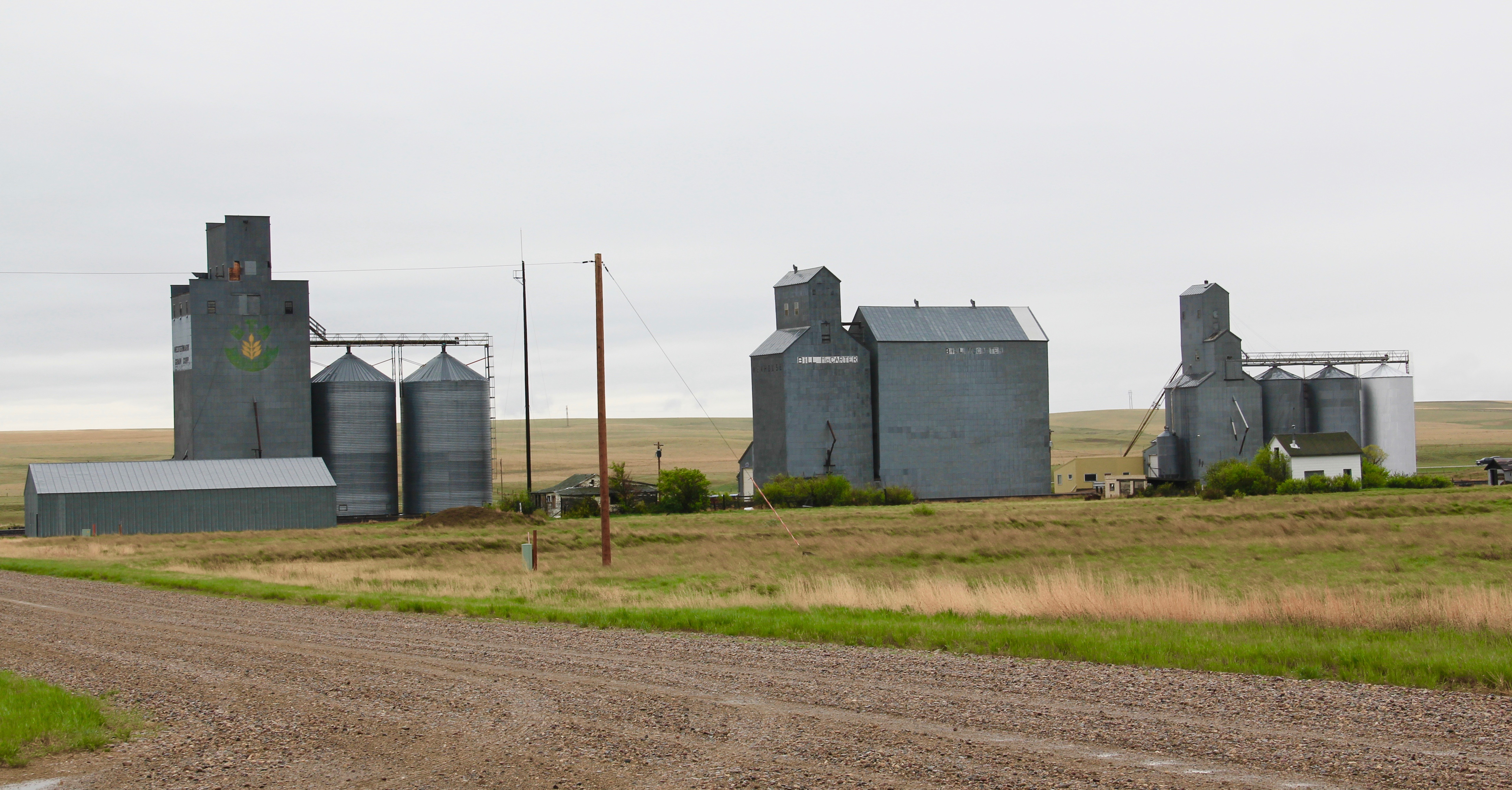
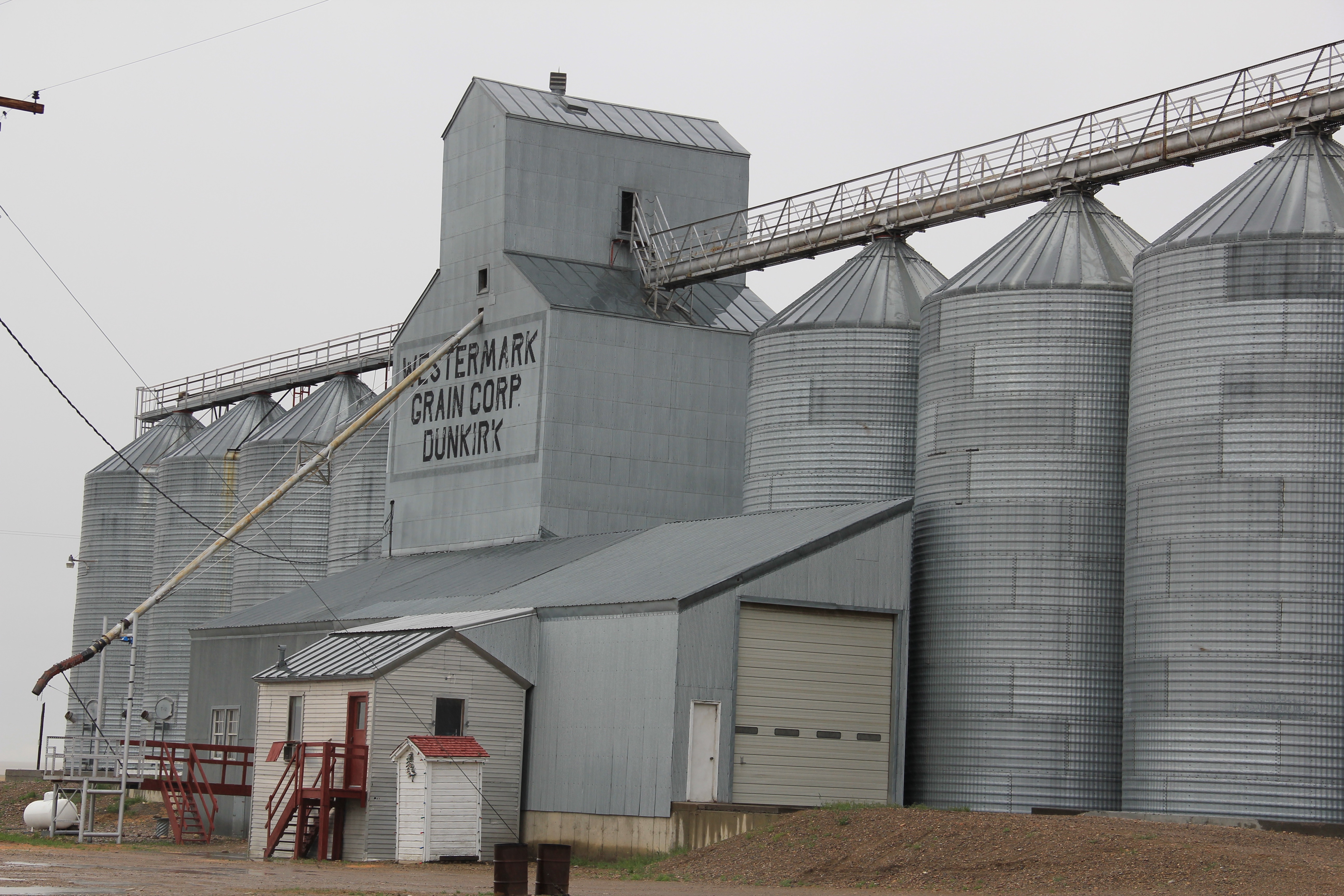
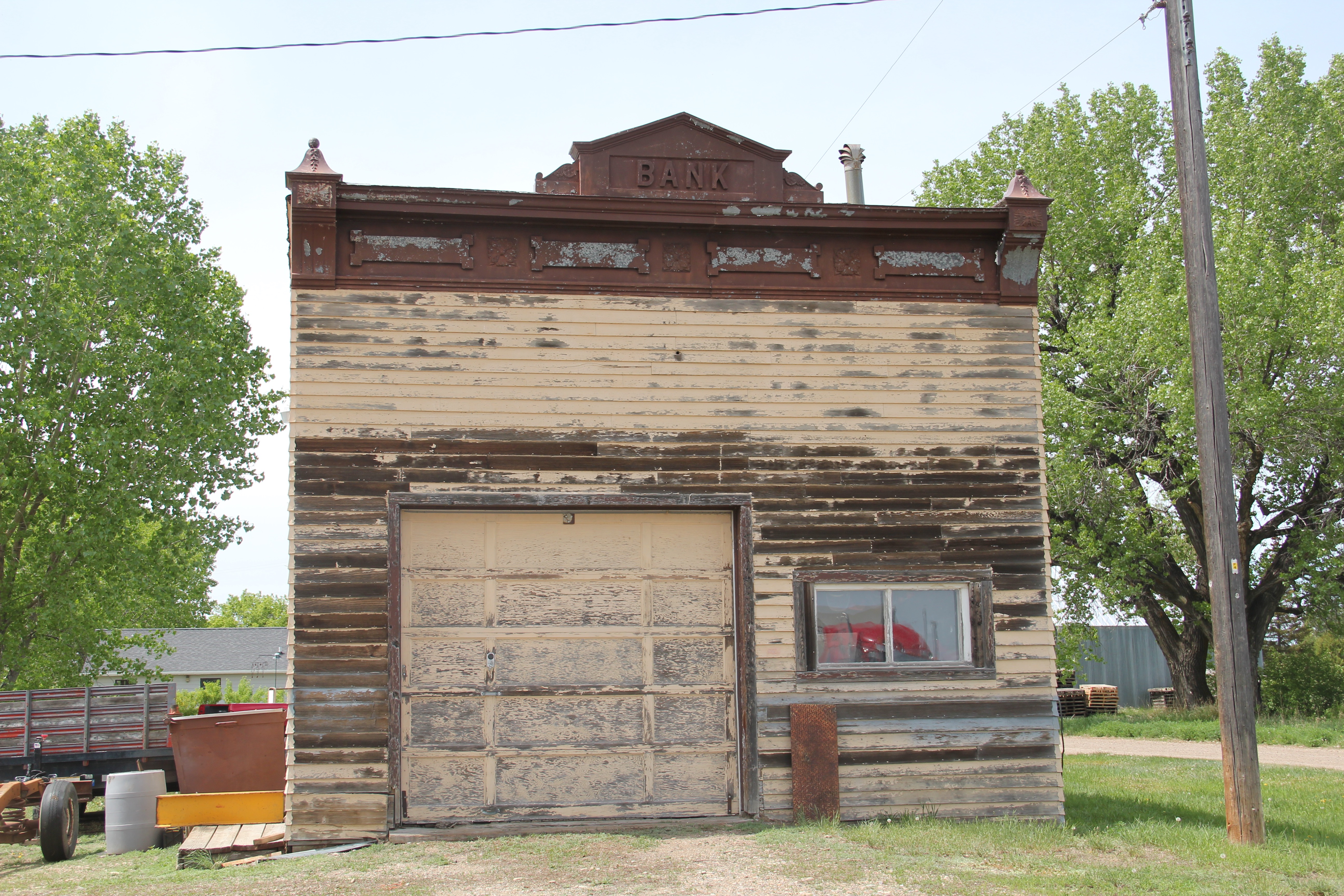
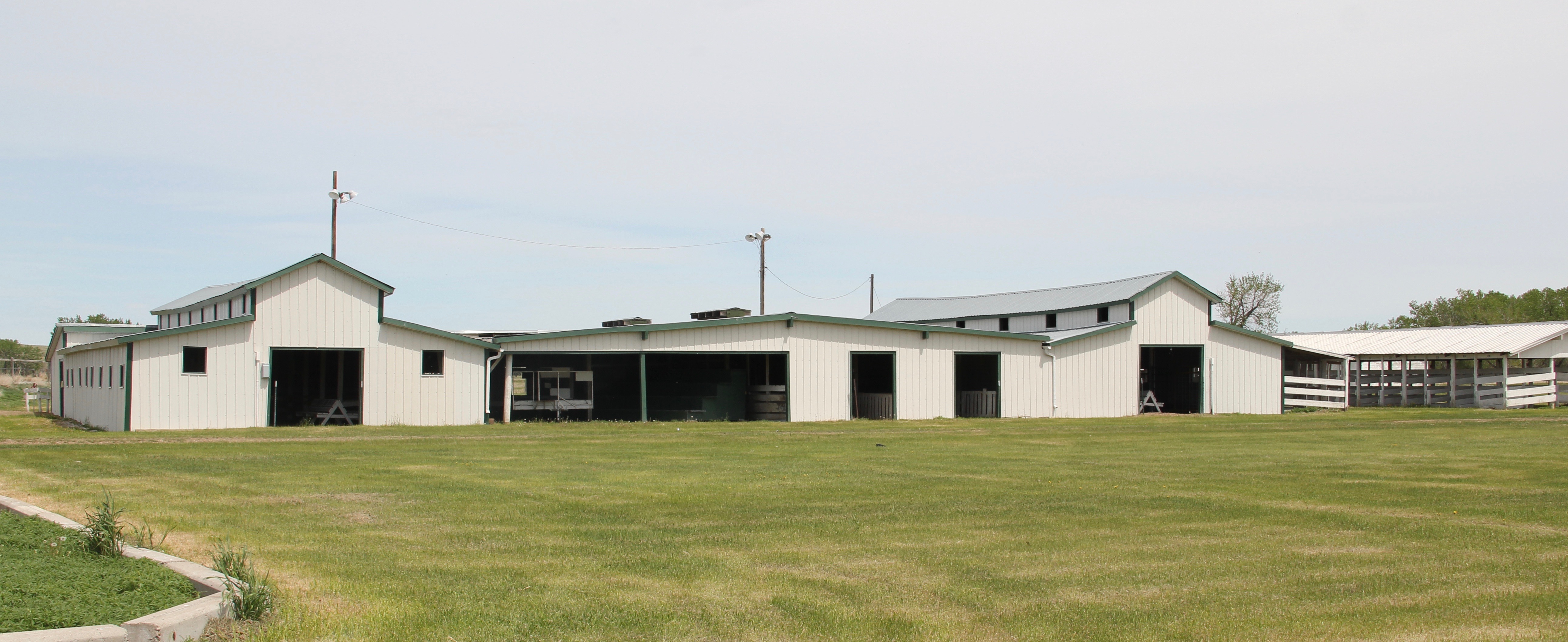
is a tiny place, almost 20 miles from the county seat of Malta.  But at the time of the Milk River Project, Dodson was vital; the ditch neatly divided the town into two halves, and a major diversion dam was just west of town.  Here was a perfect place, at the turn of the century, for a fairgrounds.  And it is a gorgeous historic fairgrounds.

Phillips Co Dodson Phillips Co Fairgrounds 6

Phillips Co Dodson Phillips Co Fairgrounds 7

Phillips Co Dodson Phillips Co Fairgrounds 4

My first encounter with the Milk River Project and the beautiful valley it serves came in February 1984 when Eleanor Clack took me on a tour of the bison kill historic site just west of downtown Havre.  It remains an excellent place to see how the waters of the Milk have nurtured countless generations of peoples who called this place home.

Hill Co Havre Wapka Chugn Site 7

Just last week I posted about two other Milk River Project towns–Lohman and Zurich–in Blaine County.  My next post will continue this second look at the Milk River Project as I revisit Chinook, the Blaine County seat, where the ditch once again is almost everywhere, but rarely given a second thought.

Blaine Co Chinook Milk River ditchs of cemetery


Zurich and Lohman: Two Hi-Line Towns in Blaine County, Montana

IMG_2509

Zurich, Montana, taken north of town looking south, 1984.

I have always enjoyed exploring Blaine County, Montana.  In earlier posts I have discussed such famous places as the Fort Belknap Reservation, and Harlem, its north gateway town, as well as Hays near the south end of the reservation and Cleveland, one of my favorite places in the region.  Chinook, the county seat, has been featured in a couple of posts, and I might add another one yet.  then the Chief Joseph Battleground of the Bear’s Paw has gotten a considerable deal of attention, due to the national significance of the place, and the recent improvements to the battlefield from the National Park Service.  Why so much on Blaine County places?  Regular readers of this blog know of my interest in the irrigation systems of the U.S. Bureau of Reclamation in

Blaine Co Milk River s of Chinook

the early twentieth century.  The Milk River system was an important project, and the towns along U.S. Highway 2 and the Great Northern Railway mainline prospered, temporarily, because of the growth of the system.  Plus the Milk River, in my opinion, doesn’t get the attention of many–and it is a spectacular river valley in many places.

Blaine Co Lohman GN corridor
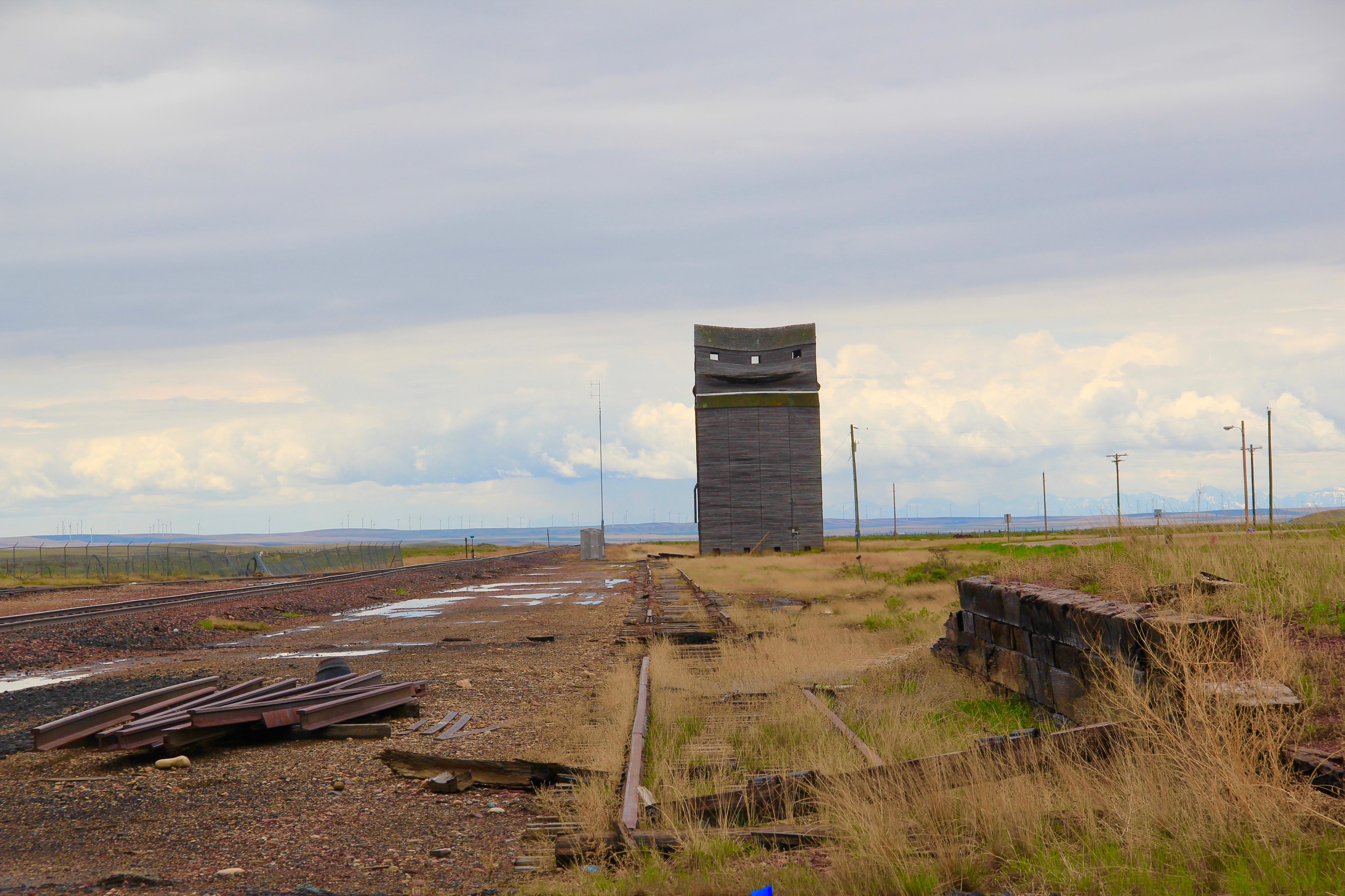
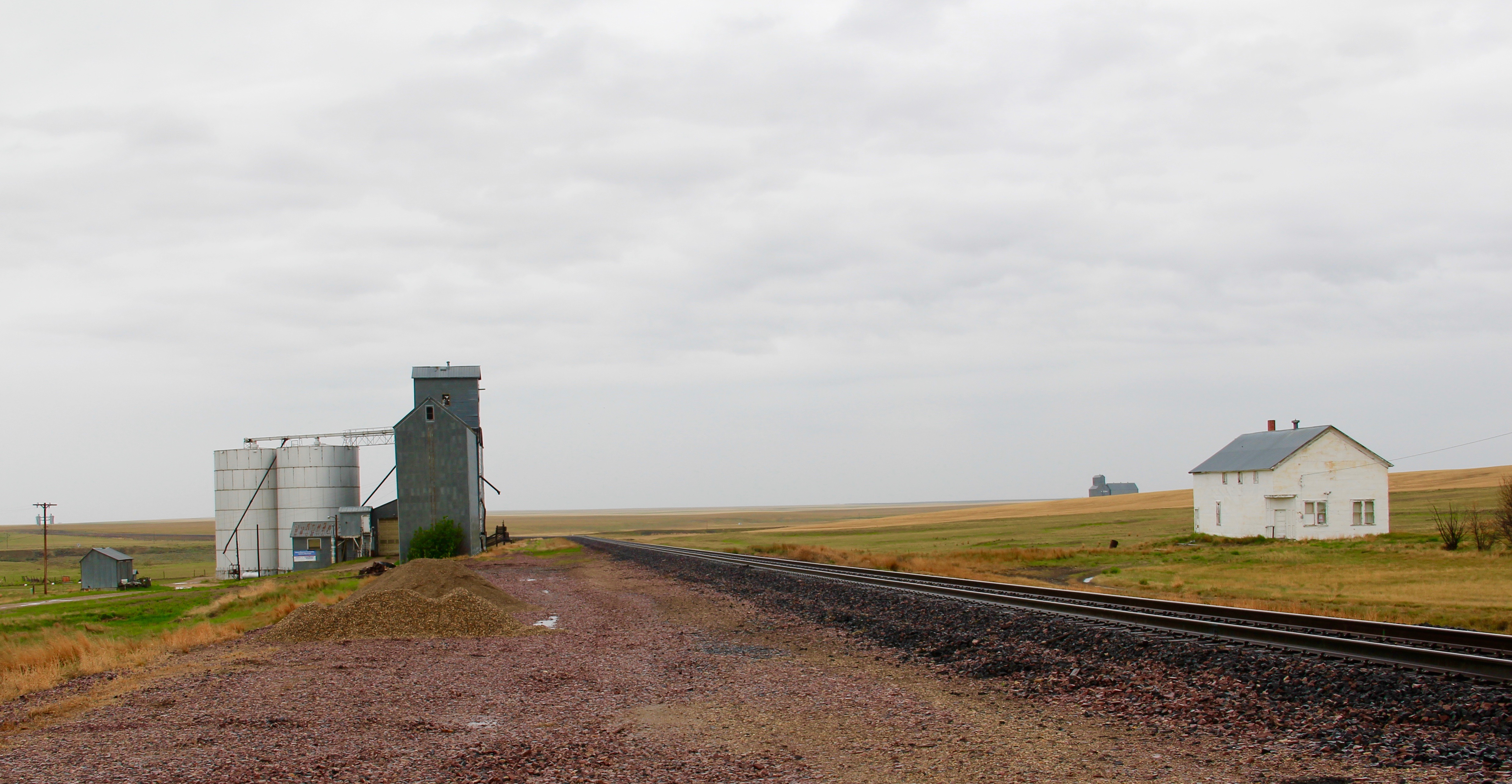
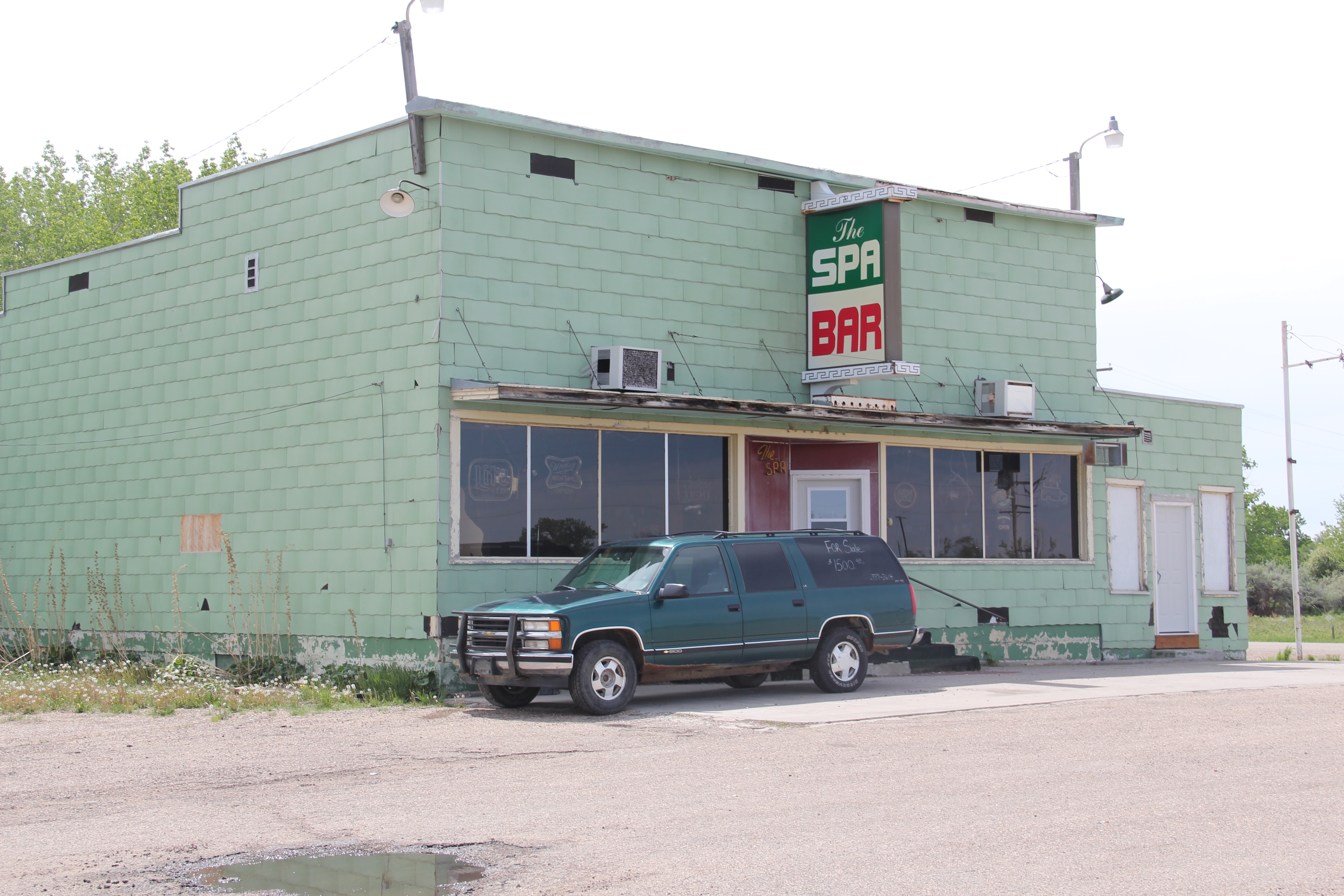
Lehman, west of Chinook adjacent to both the Milk River and U.S. Highway 2, has almost totally disappeared as a place along the tracks.  What is left of the town–this deteriorating commercial building in 2013–might even be gone today.

Blaine Co Zurich 5 elevators

Zurich, west of Chinook and also abutting the river and the highway, has fared somewhat better.  I have earlier commented on the existing street names–Park Avenue highlighted here–and the hopes for the future of the very names chosen at the turn of the century.  Compared to my visit in 1984, the town has lost business and population over the last 30 years.

Blaine Co Zurich

Blaine Co Zurich 1 bank

The Spa Bar still operated sporadically when I visited last in 2014.  I wonder if it still opens its doors today.  I love the name–a sly reference to Zurich, Switzerland, which is internationally known for its many spas.

Blaine Co Zurich 7 Spa Bar

What appears to be an old rural church–or was it a school, or both?–still stood, its gable front slowly coming apart.

Blaine Co Zurich 4 historic school

But across the street was the modern Zurich Elementary School–an attractive touch of modern school design in such a small place.  According to the public schools website,

Blaine Co Zurich 2 school

Zurich had 23 students in 2020–while another internet source said the school was permanently closed.  I hope that has not happened–if the school goes Zurich will be yet another Hi-Line ghost town quickly.

Back on the Hi-Line: Hinsdale and Saco

Phillips Co Saco west on US2 showing old road, new, and GN tracks

Hinsdale (just over 200 people in Valley County) and Saco (just under 200 people in Phillips County) are two country towns along the Hi-Line between the much larger county seats of Glasgow and Malta.  I have little doubt that few visitors ever stop, or even slow down much, as they speed along the highway.  Both towns developed as railroad stops along the Great Northern Railway–the image above shows how close the highway and railroad tracks are along this section of the Hi-Line.  Both largely served, and still

Phillips Co Robinson Ranch w of saco roadside

serve, historic ranches, such as the Robinson Ranch, established in 1891, in Phillips County.  Both towns however have interesting buildings, and as long as they keep their community schools, both will survive in the future.

Valley Co Hinsdale school

Hinsdale School, Valley County

Phillips Co Saco school

Saco School, Phillips County

Of the two towns, I have discussed Saco to a far greater extent in this blog because it was one of my “targeted” stops in the 1984 survey.  The State Historic Preservation Office at the Montana Historical Society had received inquiries from local residents in Saco about historic preservation alternatives and I was there to take a lot of images to share back with the preservationists in Helena.  But in my earlier posts, I neglected two community

Phillips Co Saco post office
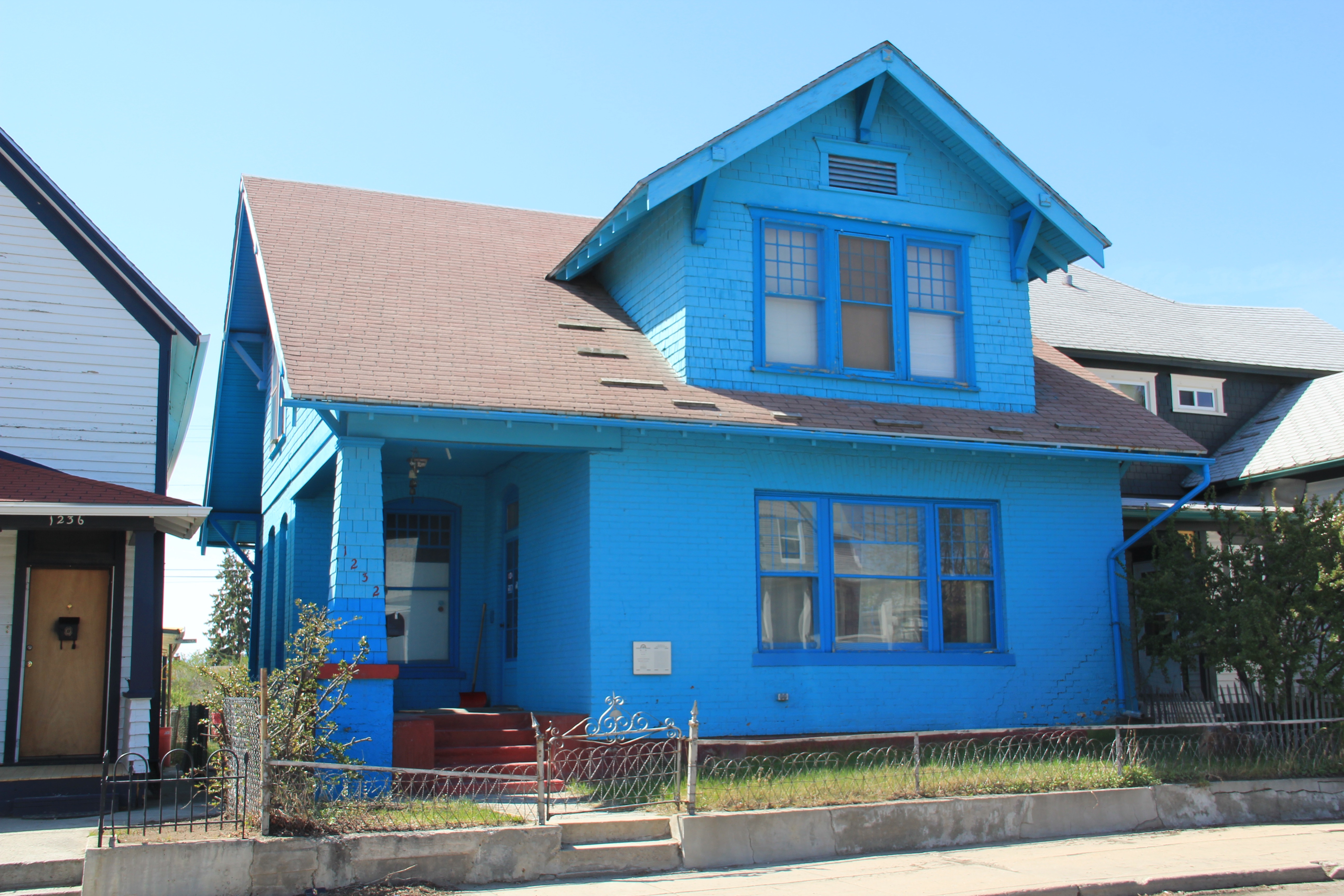
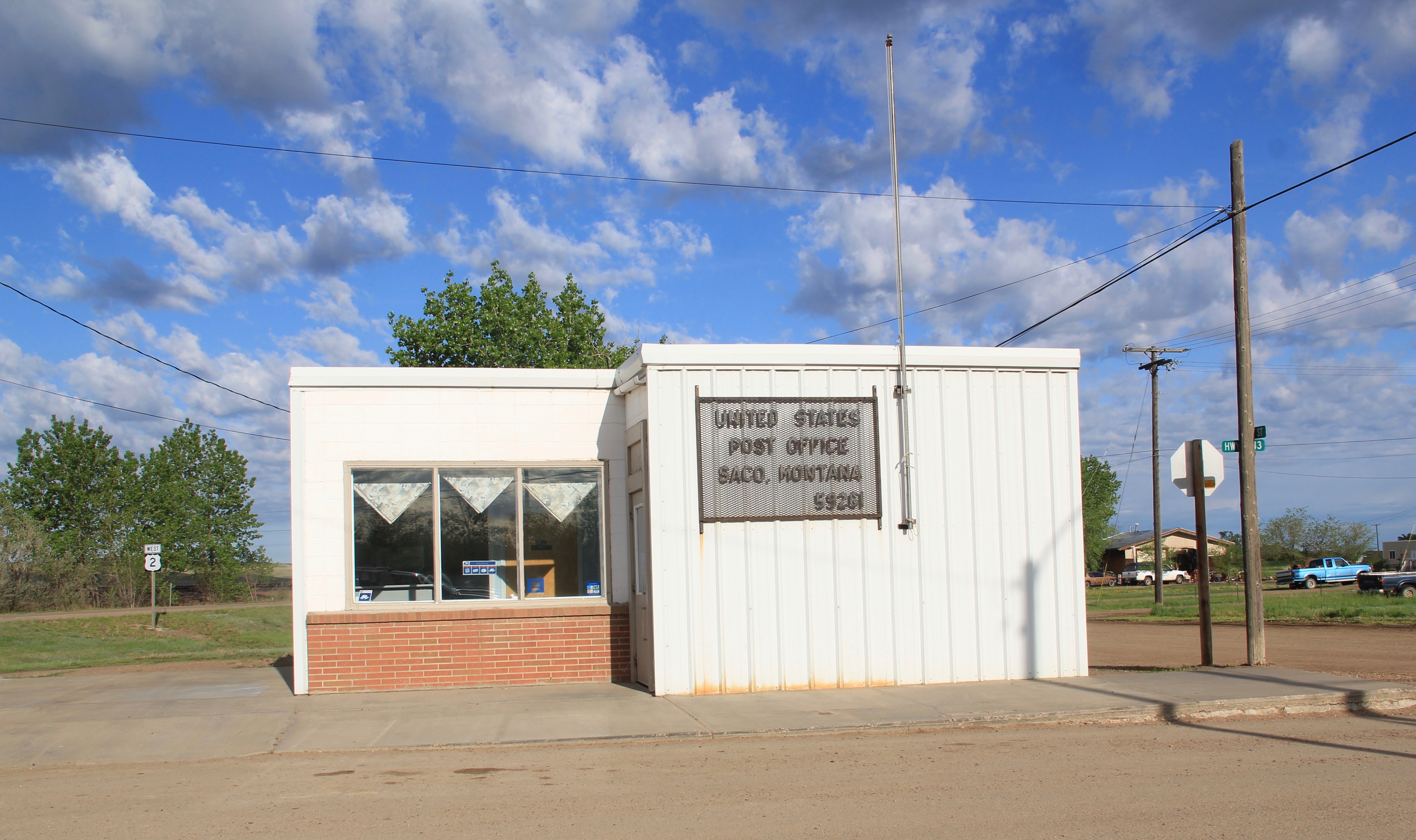
buildings, the rather different design of the post office from the 1960s and the vernacular Gothic beauty of the historic Methodist Church, especially the Victorian brackets of its bell tower.

Phillips Co Saco UM church

I ignored Hinsdale almost totally in its first posting, focusing on roadside murals.  This Valley County town is worth a second look, if just for its two historic bank buildings.  The former First National Bank and the former Valley County Bank both speak to the hopes for growth along this section of the Milk River Project of the U.S. Reclamation Service in the early 20th century.  Architecturally both buildings were touched by the Classical Revival style, and both took the “strongbox” form of bank buildings that you can find throughout the midwest and northern plains in the first two decades of the 20th century.

Valley Co Hinsdale 4 1st national bank

Valley Co Hinsdale 2 bankValley Co Hinsdale 1 bank

The rest of Hinsdale’s “commercial district” has the one-story “false-front” buildings often found in country railroad towns along the Hi-Line.

Valley Co Hinsdale 3

Local residents clearly demonstrate their sense of community not only through the school, which stands at the of the commercial area.  But community pride also comes through in such buildings as the c. 1960s American Legion Hall, the c. 1902 Methodist church (the separated cupola must be a good story), and St. Anthony’s Catholic Church.

Valley Co Hinsdale American Legion hall

Valley Co Hinsdale UM Church 1902

Valley Co Hinsdale St Albert's Catholic

These small railroad towns of the Hi-Line have been losing population for decades, yet they remain, and the persistence of these community institutions helps to explain why.