It had been over a decade since I last stopped in late September 2025 at the tiny railroad town of Nashua in Valley County. Recently in the state and regional press, there have been stories about the uptick in tourism in northern Montana. It’s about time, especially for intrepid heritage tourists. As my posts from over ten years ago emphasized, an amazing array of stories and places await those who venture beyond Havre on U.S. Highway 2.
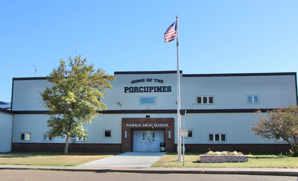
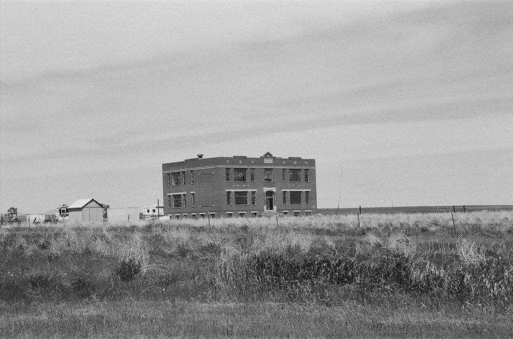
Even tiny Nashua (probably less than 300 residents today) reflects virtues worth exploring—community pride especially as reflected at the recently renovated Nashua High School, above. Since the town had lost population since my last visit, I had wondered if the school was still there as an anchor. Indeed it was, and looked almost modern as its 1935 core from the New Deal had been layered over with a new facade.
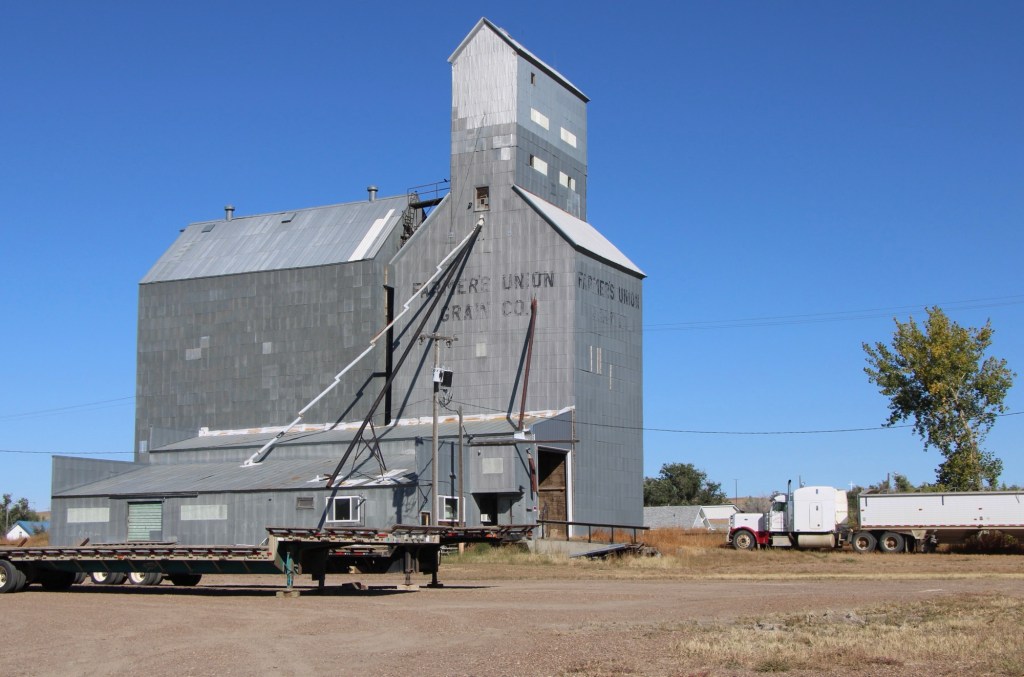
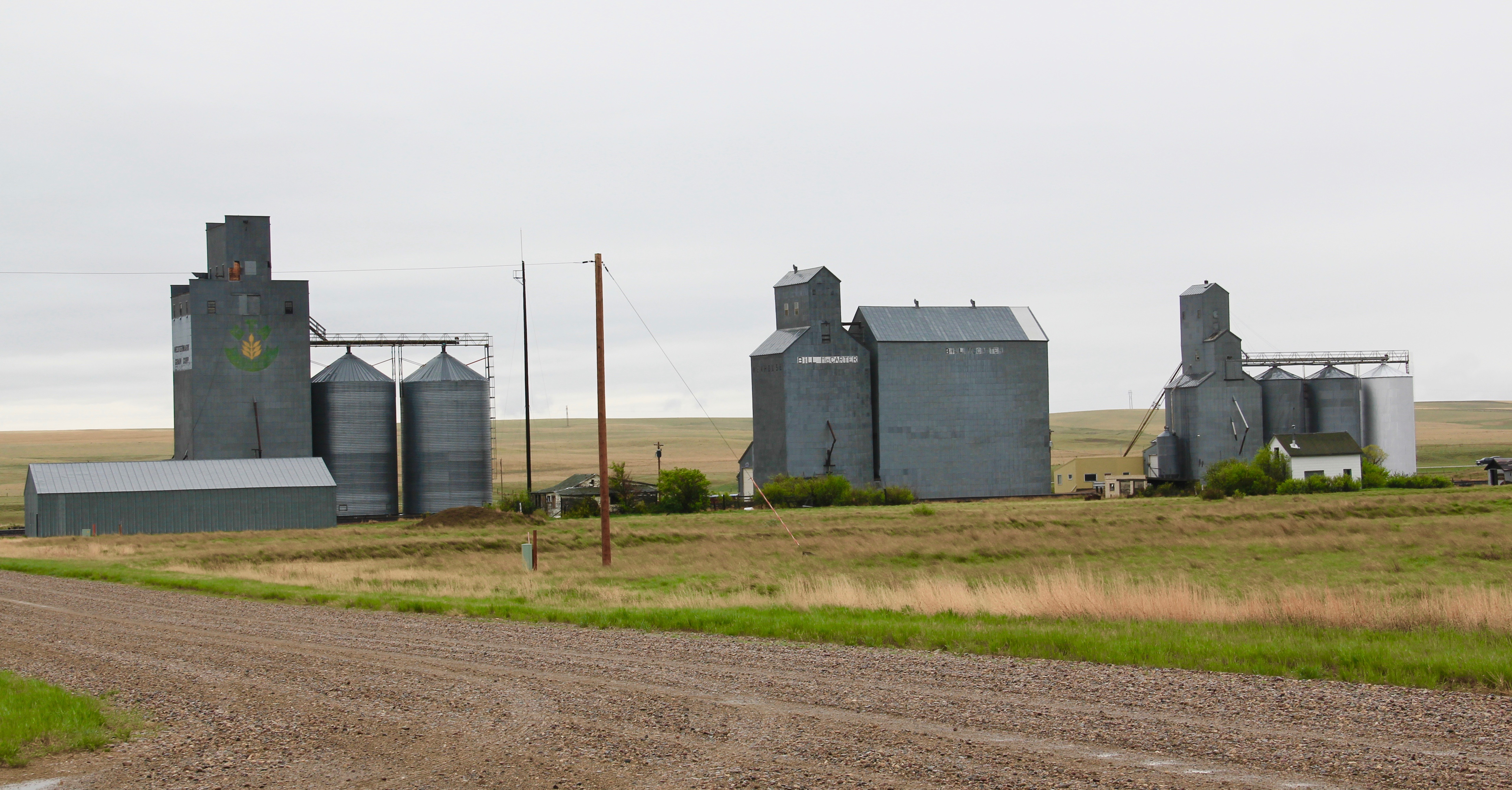
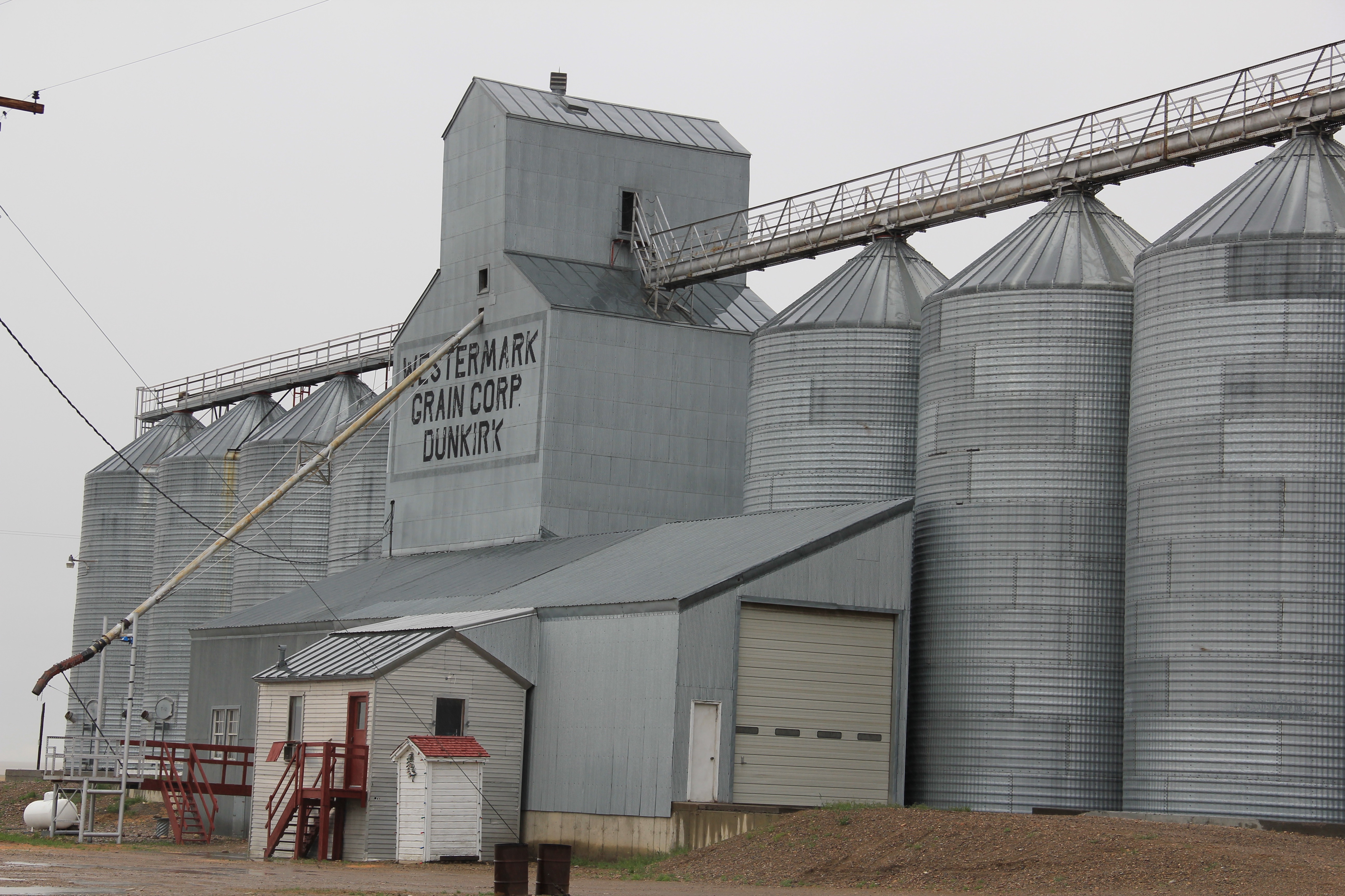
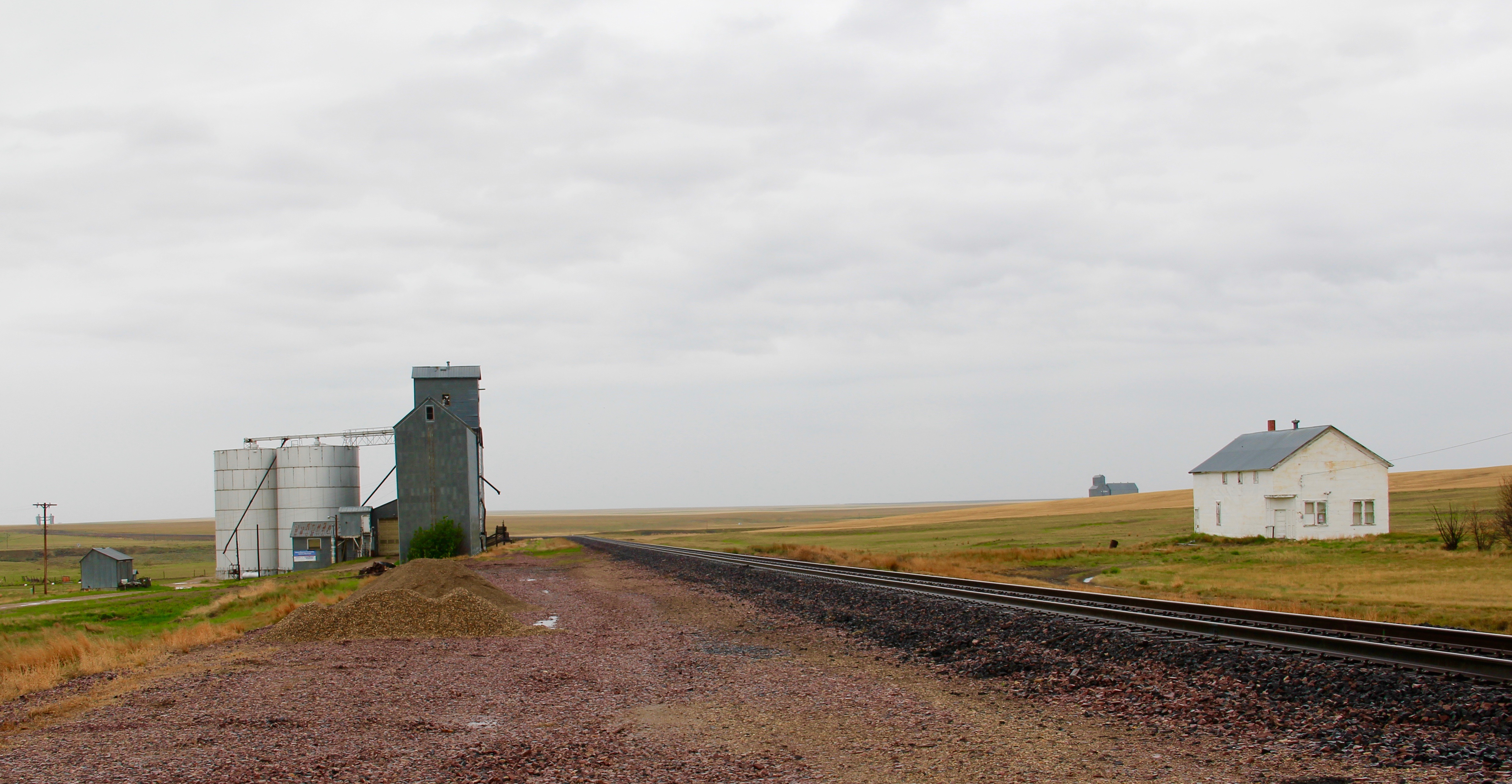
The railroad was the dominant influence in the town’s history—save for the 1930s boom during the construction of nearby Fort Peck Dam—and the town’s rail corridor is still defined by its grain elevators.
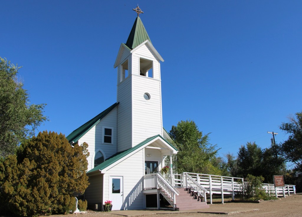
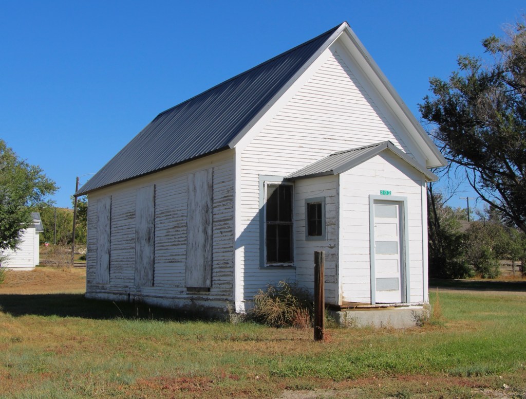
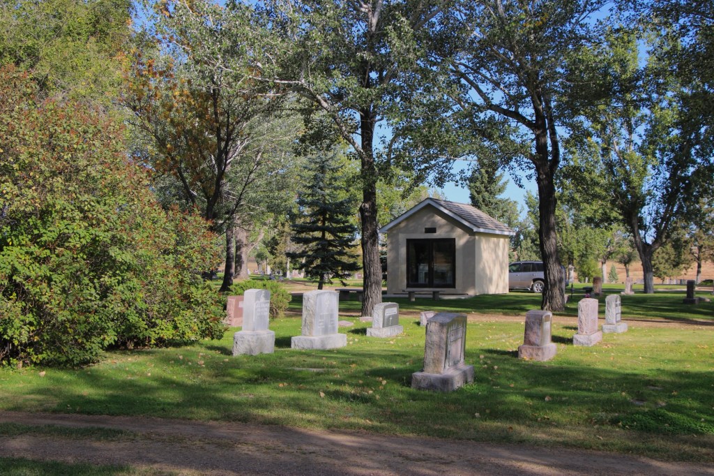
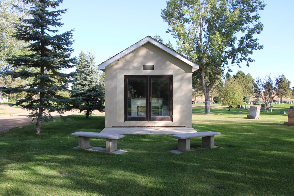
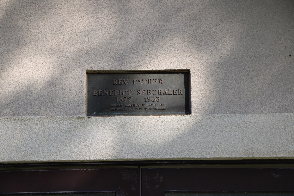
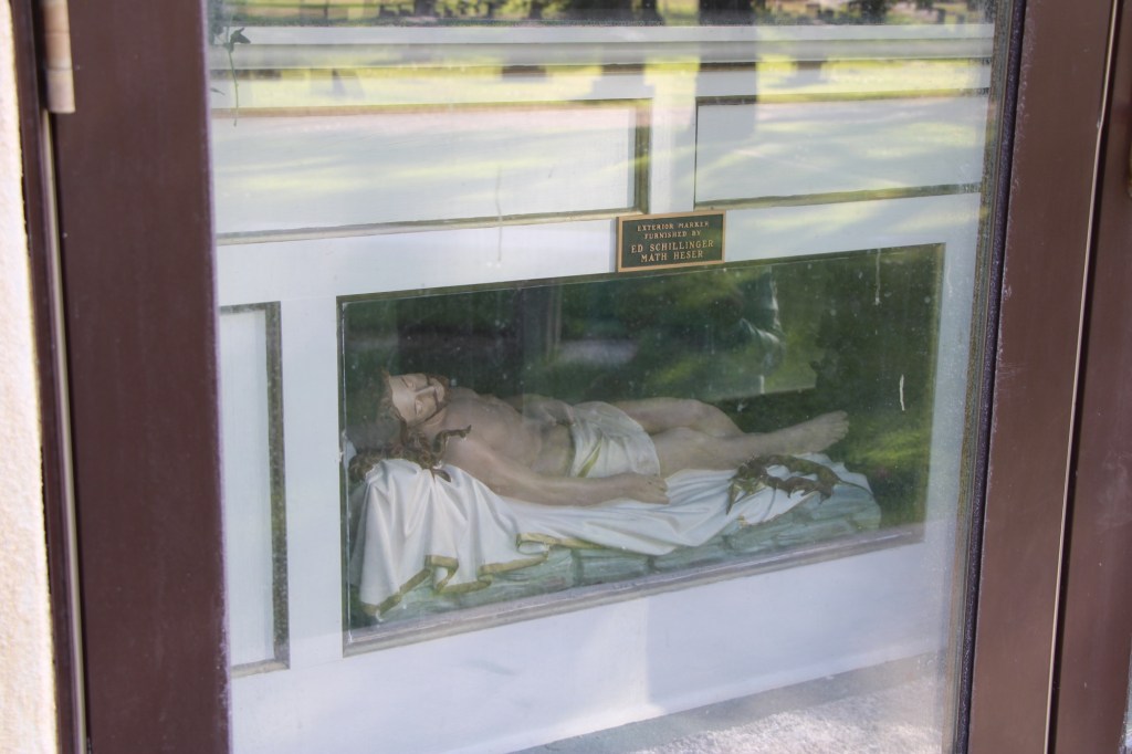
Competing for the Big Sky line of Nashua is the tall Gothic style bell tower of the Catholic Church. Established in 1917, Queen of Angeles Catholic Church began as a mission church. The Sisters of Charity worked with the diocese to establish an adjacent one-room school, below, as a way of growing and maintaining the congregation after the end of the Fort Peck Dam boom.
Then in 1953 Rev A. J. Schuh wrote an appeal to The Catholic Worker, a major newspaper, asking for the support for the construction of a rectory so that a more permanent foundation for the church’s work in Nashua could be laid. I had no idea if the appeal worked or not—but something happened. Queen of Angels Catholic Church was in great condition, and a major town landmark.

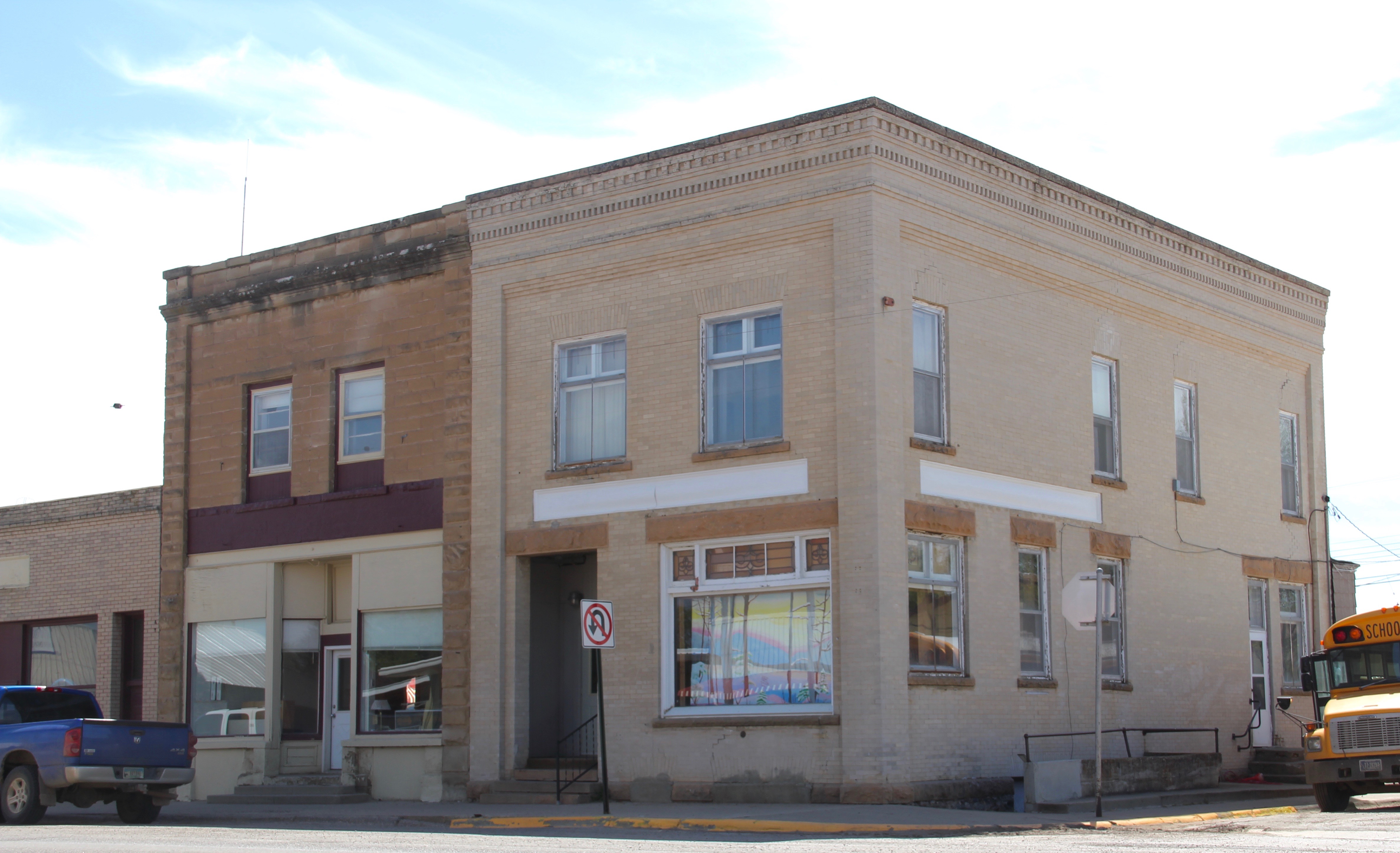
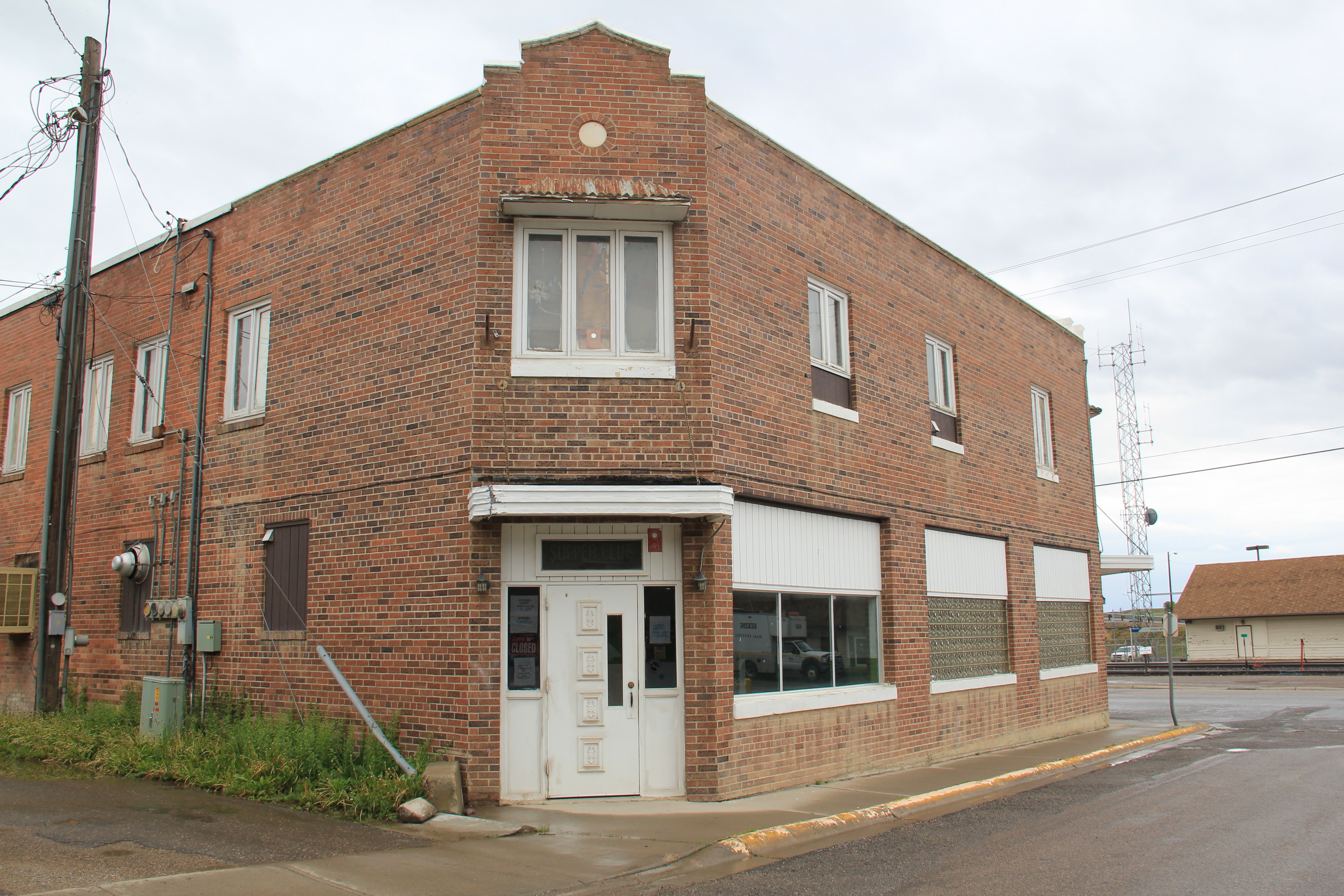
Along the old highway route was another landmark, of a quite different purpose: Vic’s Bar and Bowling Alley. Here is the private social center for the town. Great rural Montana towns always have at least one traditional watering hole. Vic’s is that place in Nashua.
Victor Dostert (1886-1961) homesteaded south of the town along the Milk River during the boom of the 1910s but when the bust came in the 1920s Dostert, his wife Anna, and their three sons stayed, making their mark with construction projects (from a theater to the Catholic Church) and taking advantage of the thousands of construction workers passing through by building and operating Vick’s Bar in 1935. He added the bowling alley in the 1950s—a decade when the bowling craze as a community institution reached its peak across the nation.
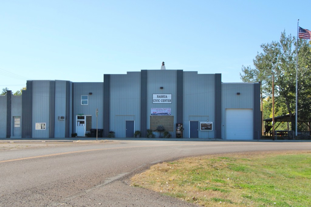
Dostert as Nashua’s town official had already been instrumental a few years earlier in the creation of the Nashua Civic Center, the public community center for this part of Valley County still today.
These places and brief stories hint at the richness of heritage experiences in Valley County. I’m glad I stopped at Nashua again (just too bad that it was early in the morning and Vic’s Bar was not yet opened). But give the residents much credit—they hung through another tough decade through commitment, community spirit, determination and faith.


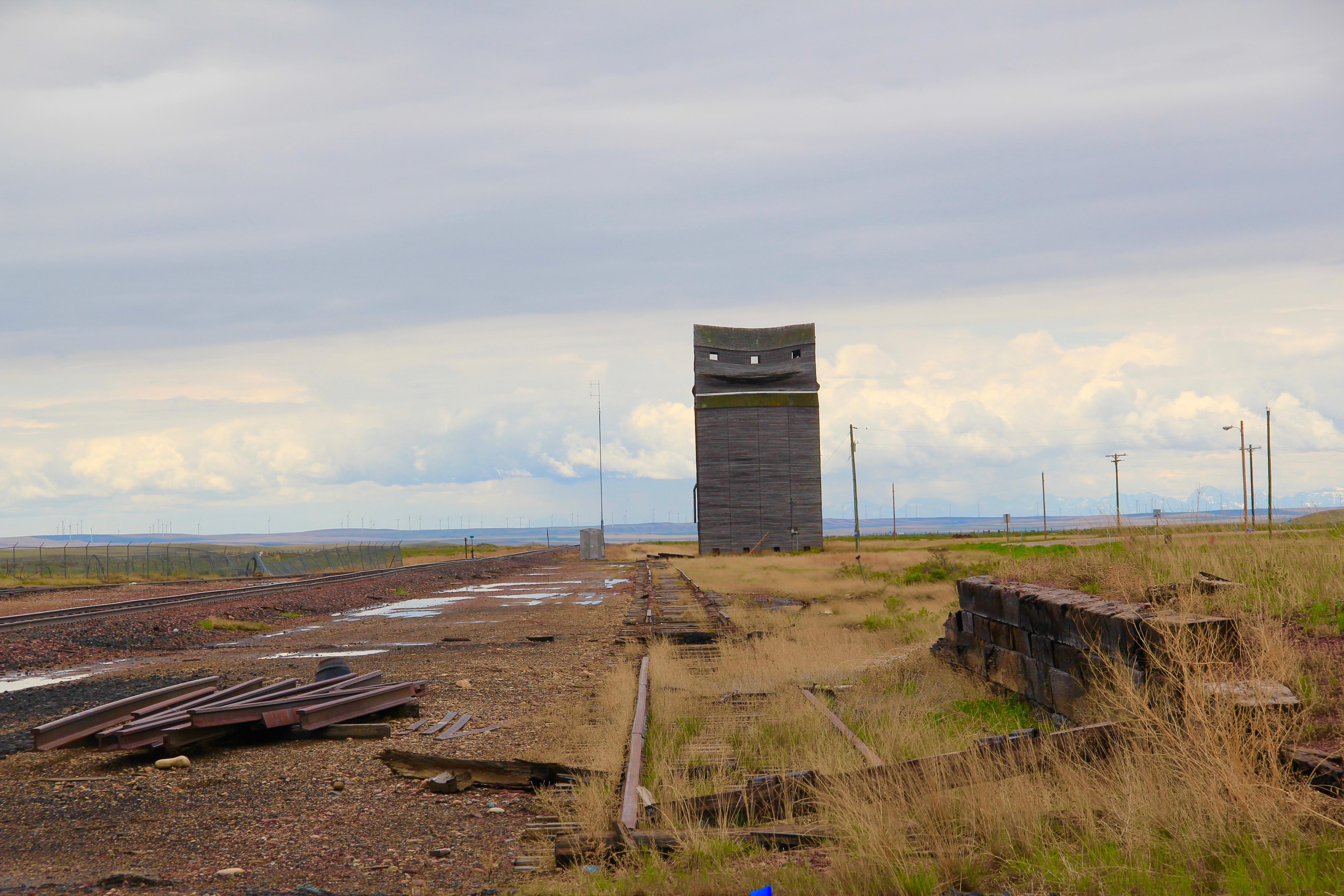


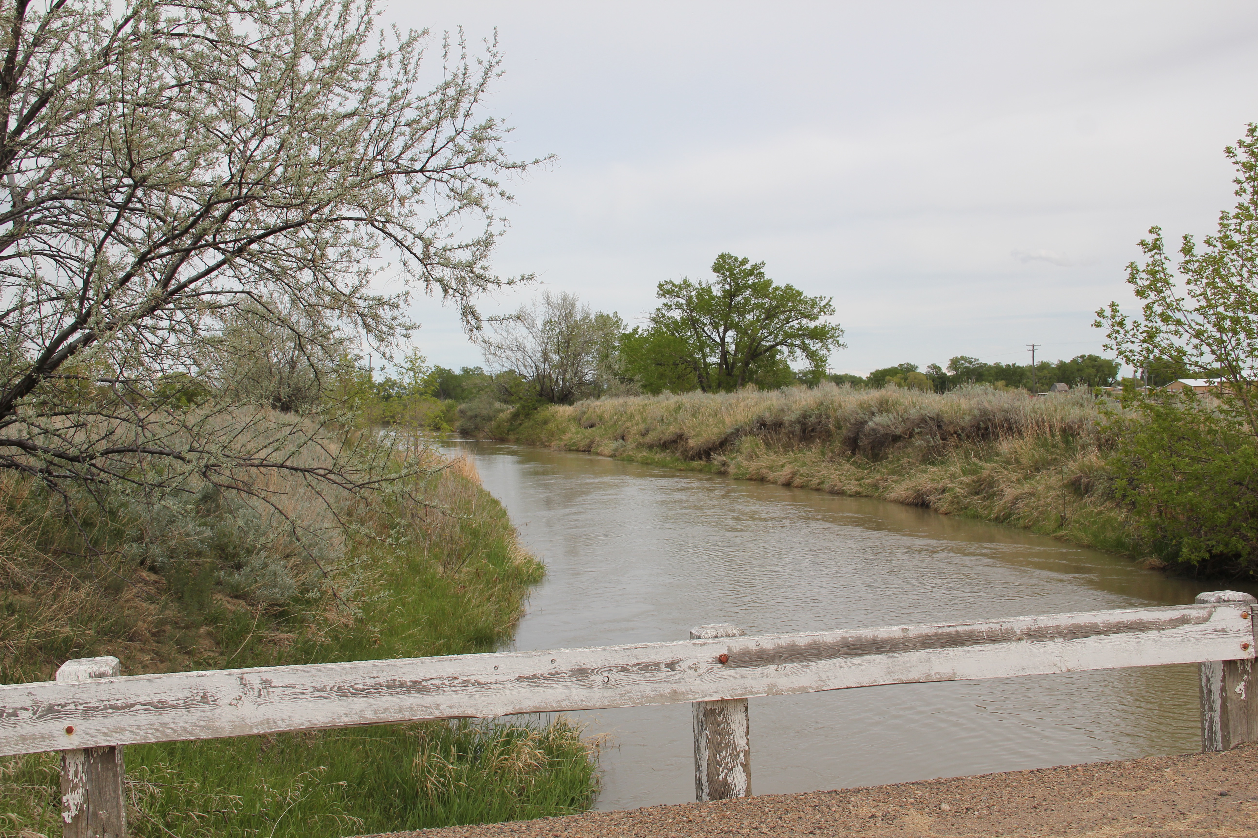
 One of the very few historical markers in Montana that touches on the state’s irrigation history focuses about a historic bridge that once stood nearby at Tampico.
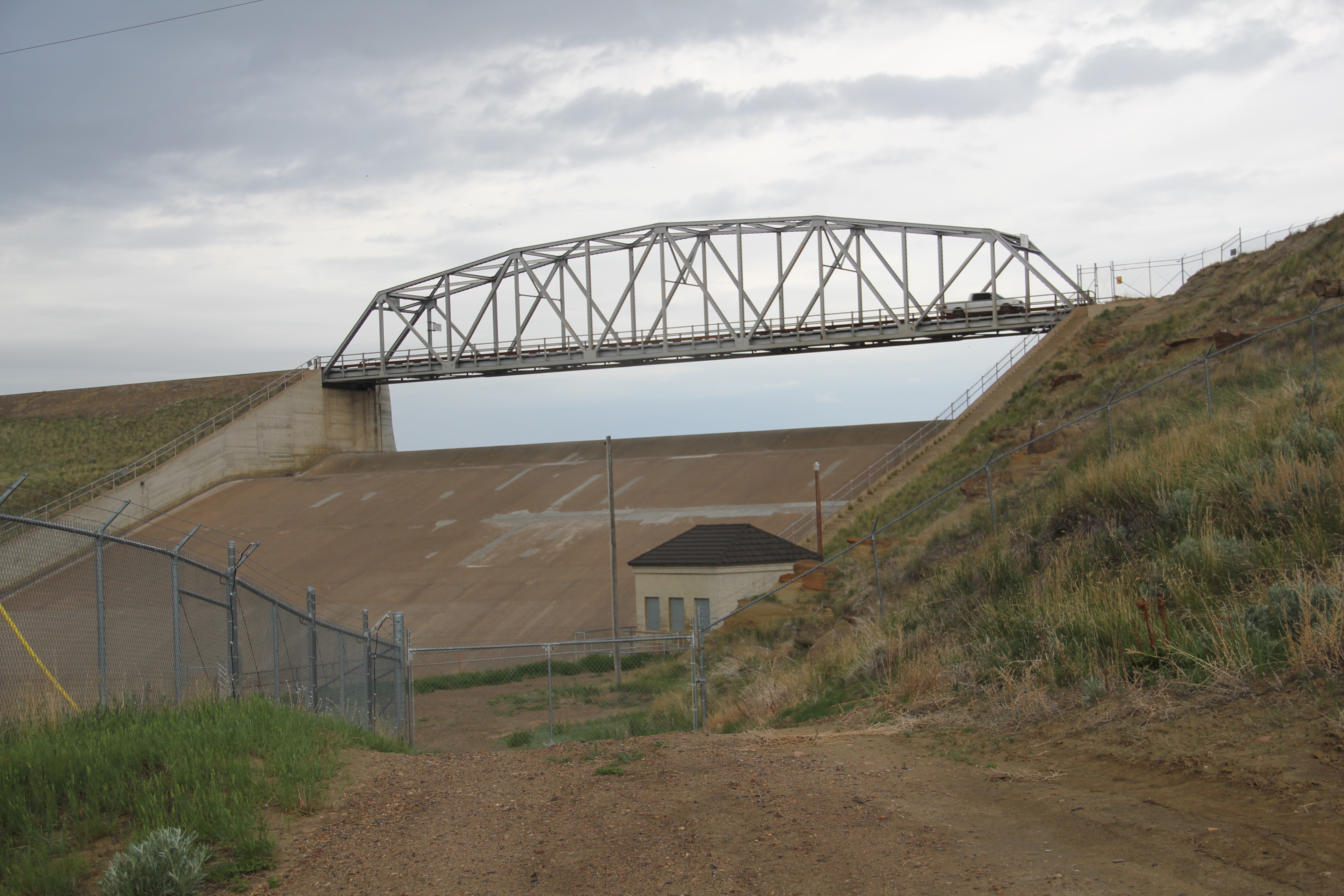
 Large man-made lakes capture water to reserve it for use throughout the growing season. The images above are of Fresno Reservoir, on a rainy morning, in Hill County. While the two images below are of Nelson Reservoir, on a typically bright sunny day, many miles downstream in Phillips County.
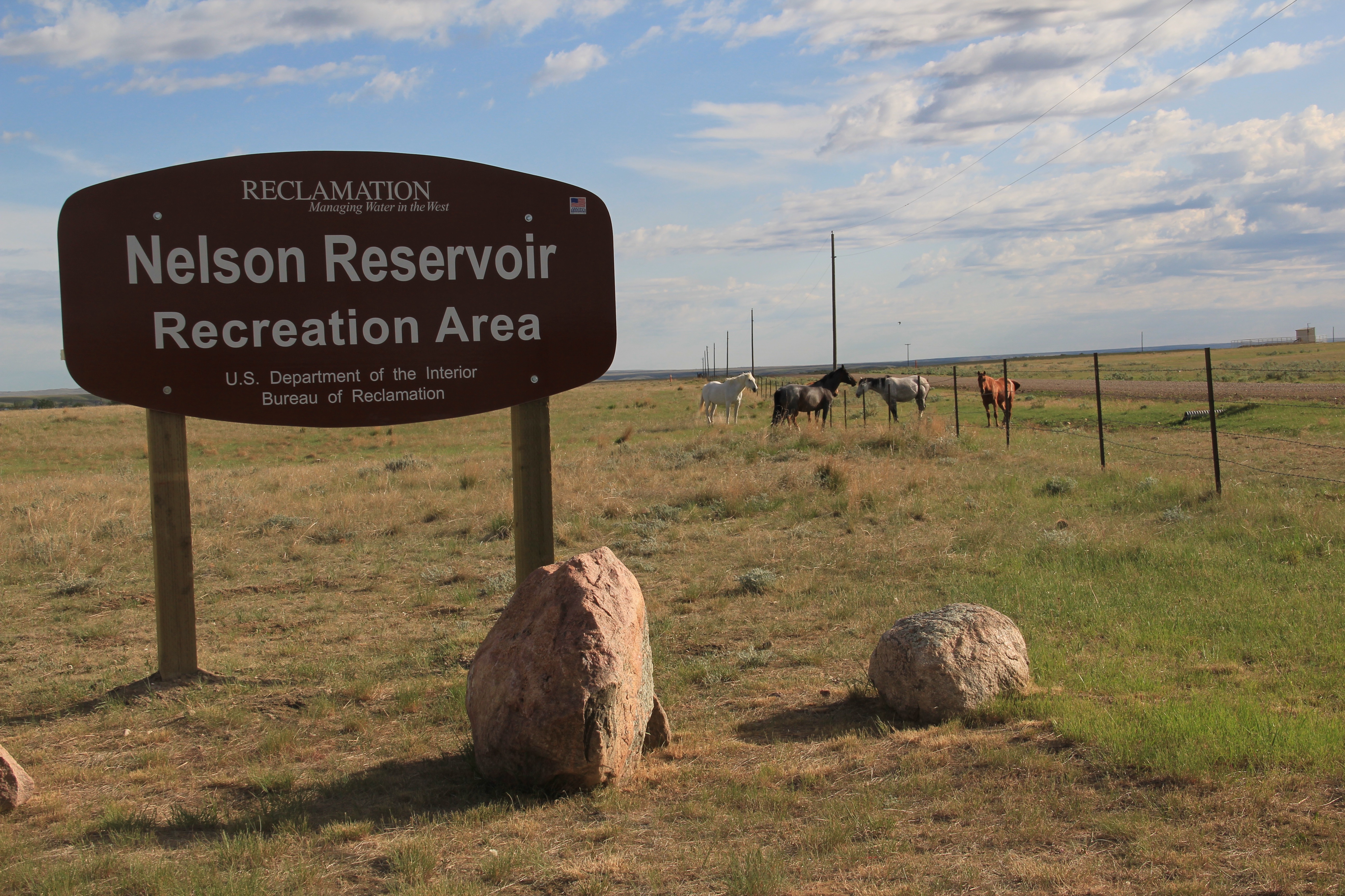
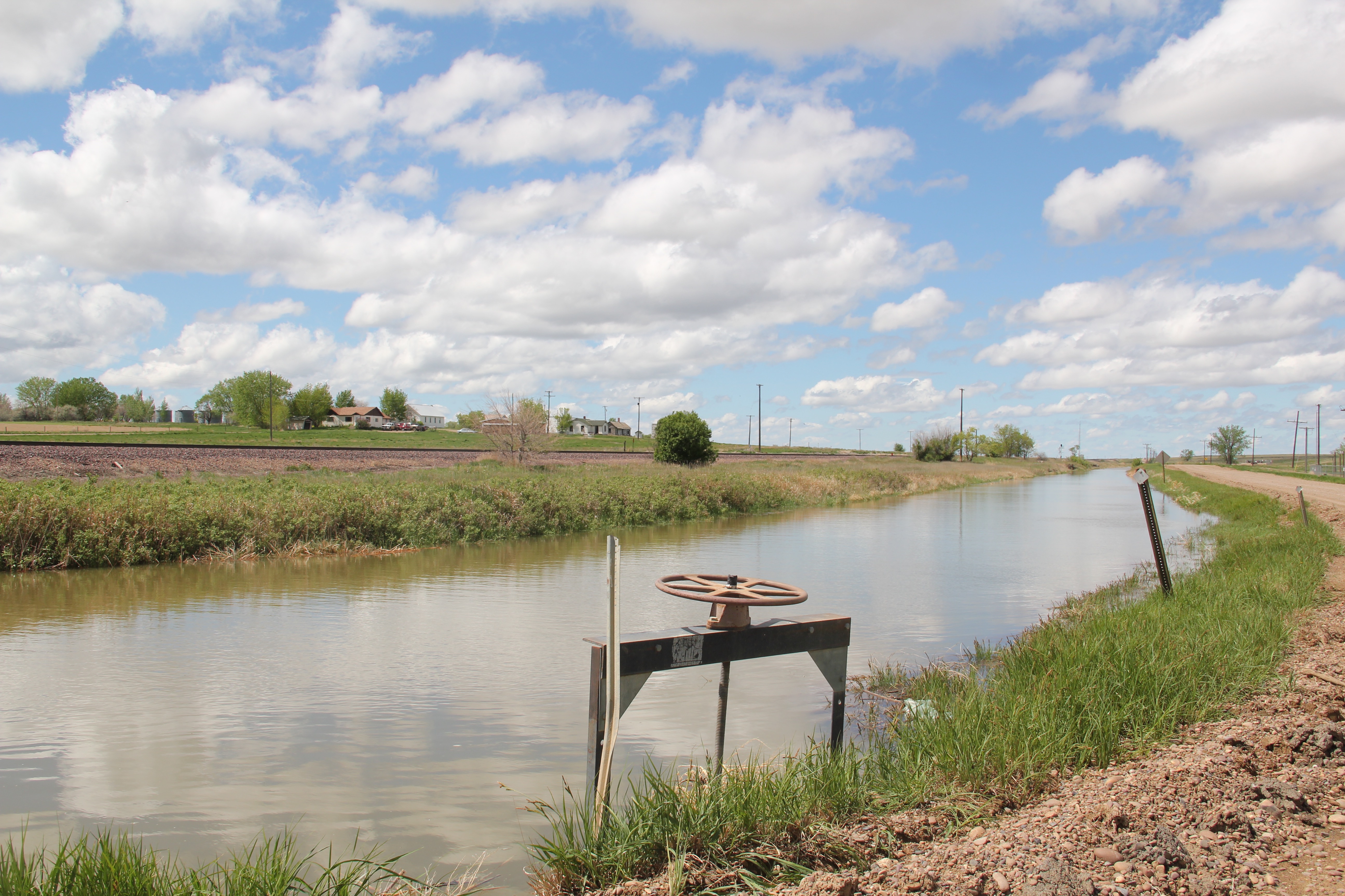
 The Milk River Project shapes so much of the Hi-Line, it has become just part of the scenery. I wonder how many travelers along U.S. Highway 2 in Phillips County even notice or consider the constant presence of the ditch along their route.

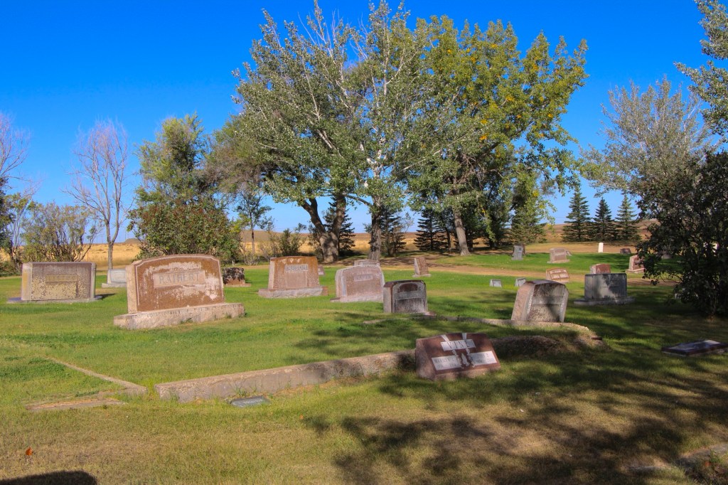
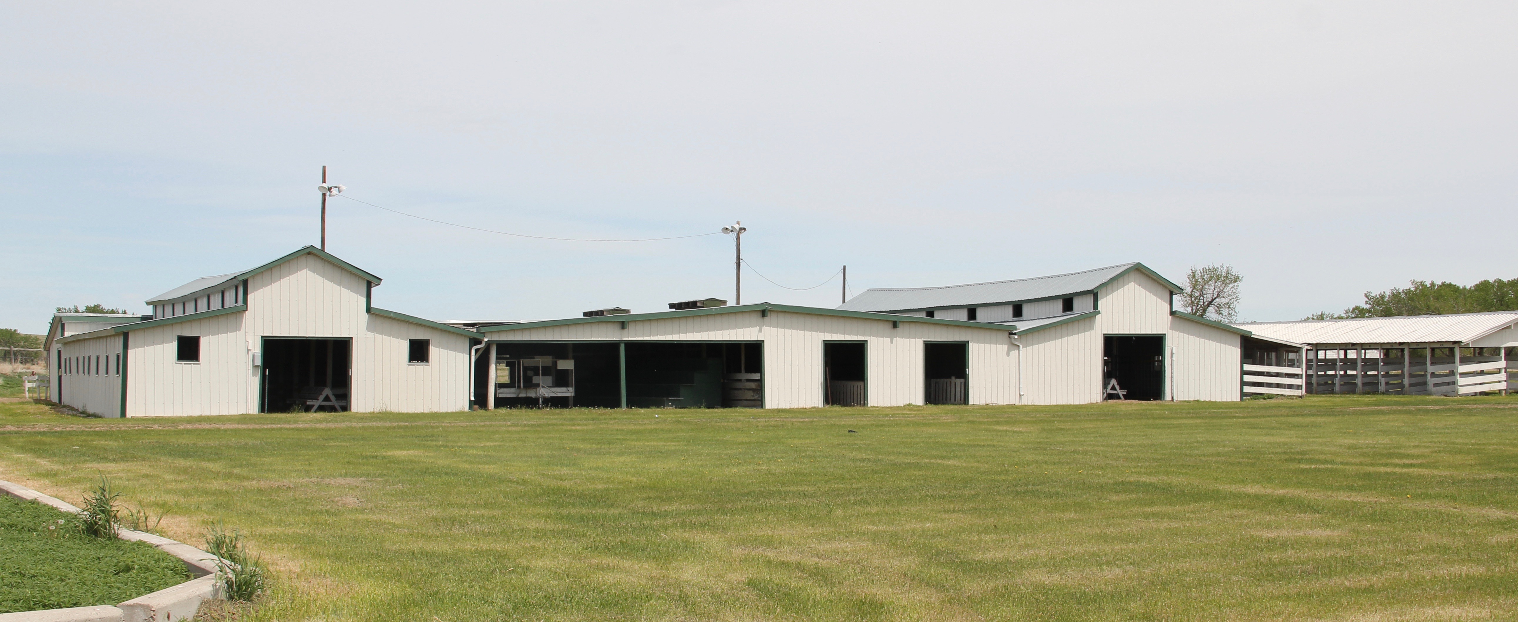 is a tiny place, almost 20 miles from the county seat of Malta. But at the time of the Milk River Project, Dodson was vital; the ditch neatly divided the town into two halves, and a major diversion dam was just west of town. Here was a perfect place, at the turn of the century, for a fairgrounds. And it is a gorgeous historic fairgrounds.


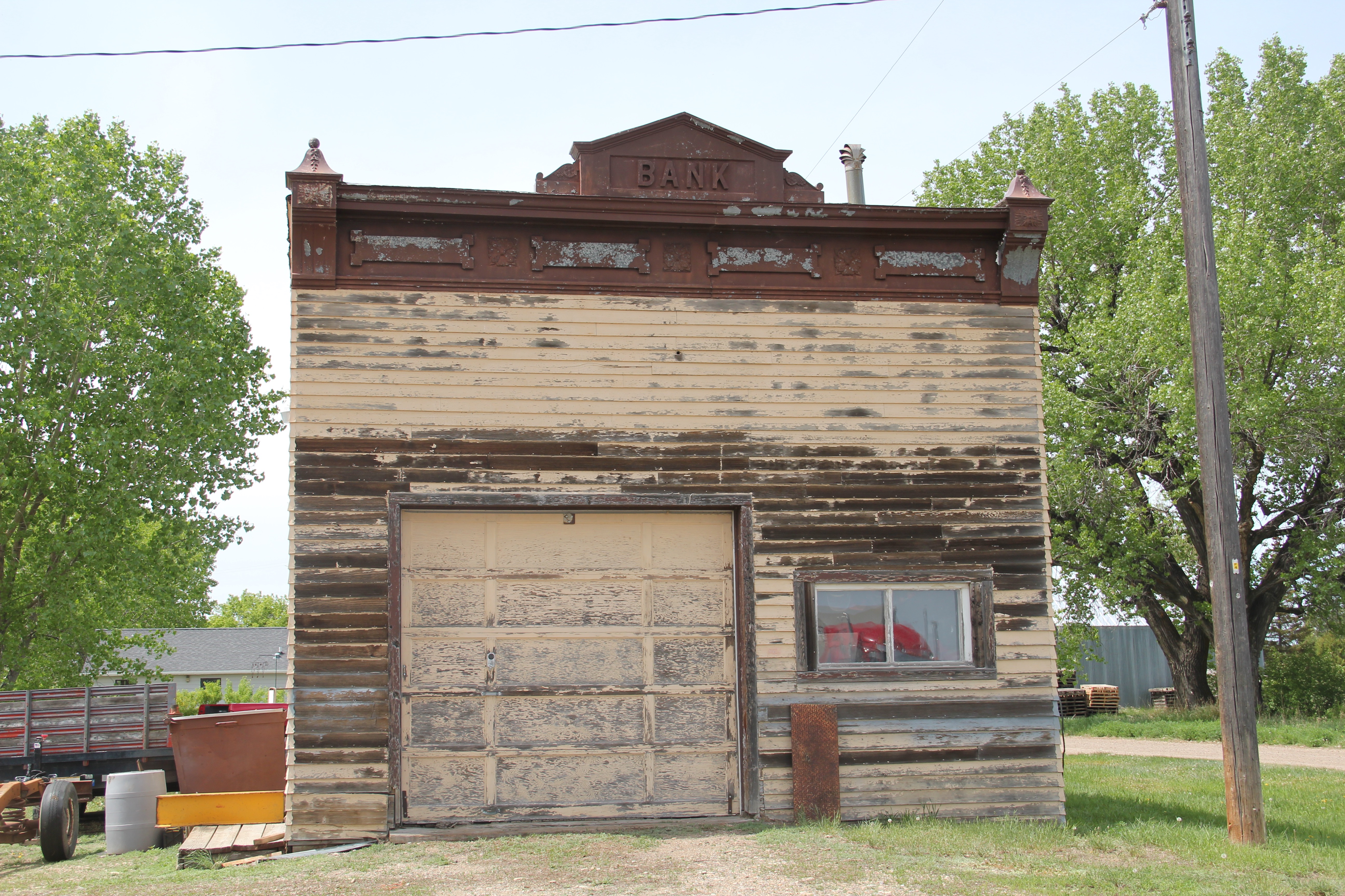
 Lehman, west of Chinook adjacent to both the Milk River and U.S. Highway 2, has almost totally disappeared as a place along the tracks. What is left of the town–this deteriorating commercial building in 2013–might even be gone today.


 modern style for many Catholic churches in eastern Montana. The Culbertson church is a good example of that pattern. Another church that belongs to the modern design era of the 20th century is Trinity Lutheran Church, especially as this distinguished building expanded over the decades to meet its congregation’s needs.
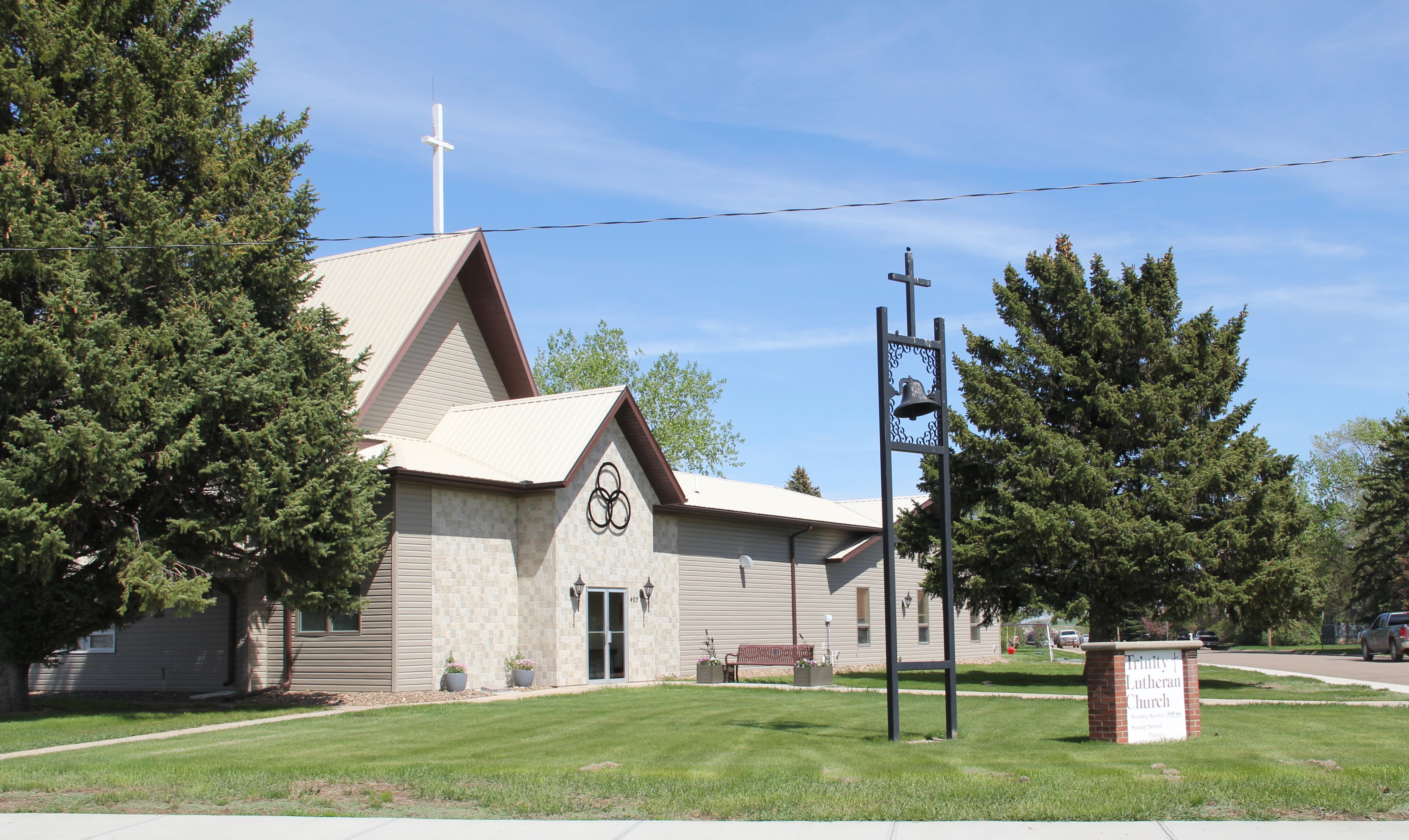


 In late may I return to the Big Sky Country, my first visit in two years, when I will once again be looking for changes in the historic built environment as I speed along the state’s
 highways and backroads, crossing the bridges over the Yellowstone River, and trying my best to catch as many Burlington Northern and Santa Fe Railroad freight trains as possible, although I doubt that I will ever have such a fun moment than in 2013 when I
 caught this freight along the original Great Northern route while I was driving on the original–still dirt and gravel–road of U.S. Highway 2 between Tampico and Vandalia.
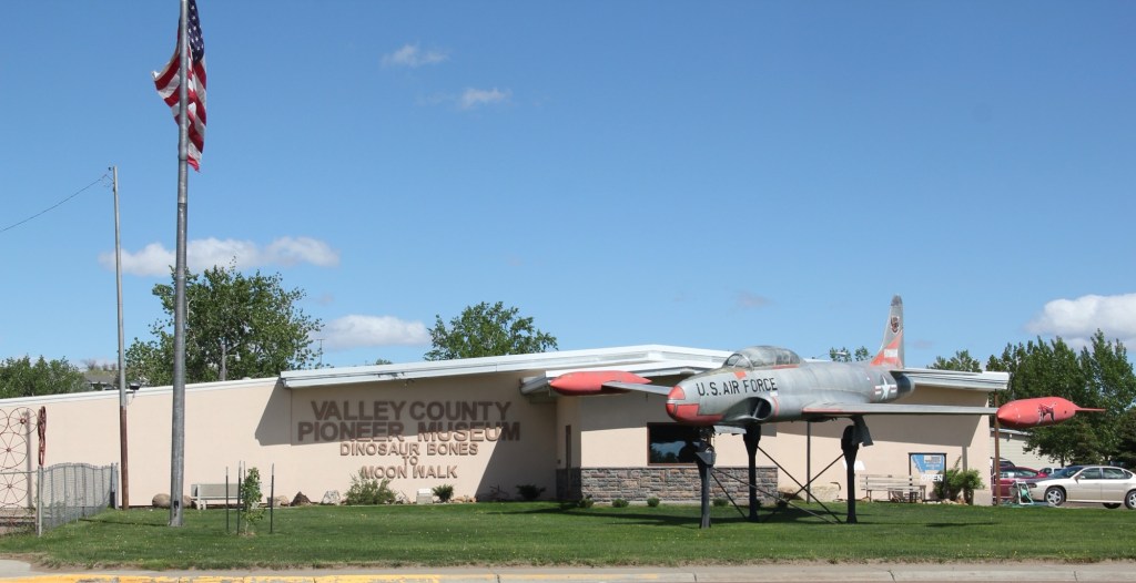
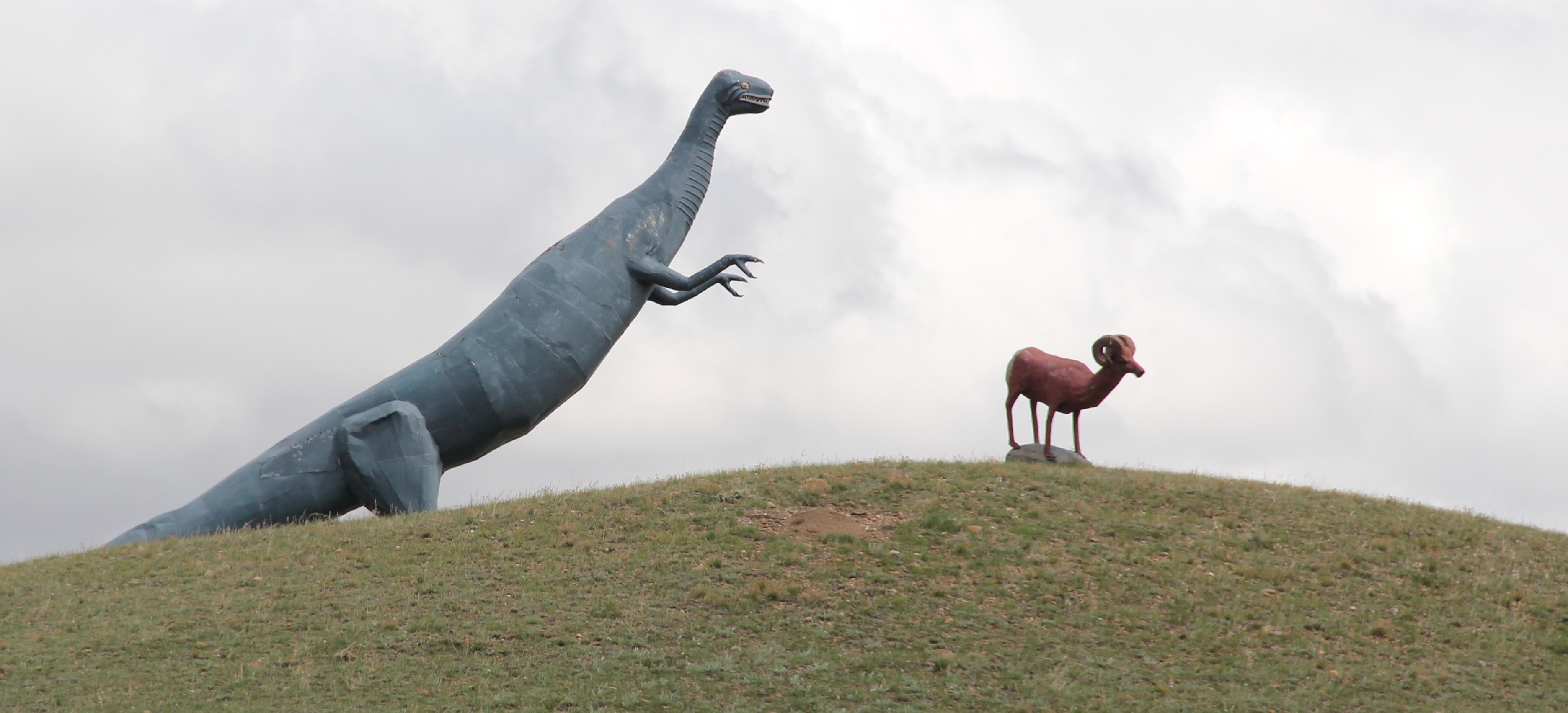 Certainly I will keep my eye out for Montana’s famed wildlife, although I don’t expect again to see a bighorn sheep outside of Glasgow, especially one being chased by a dinosaur. I will also stay on the lookout, as regular readers of this blog well know, for the beef–it is rarely a question of where’s the beef in Montana.
 No doubt there will be both new and older historical markers to stop and read; the evolving interpretation of Montana’s roadside continues to be such a strong trend.
 And through all of the brief stay in the state–perhaps 10 days at the most–I will also stop and enjoy those local places, far removed from the chain-drives roadside culture of our
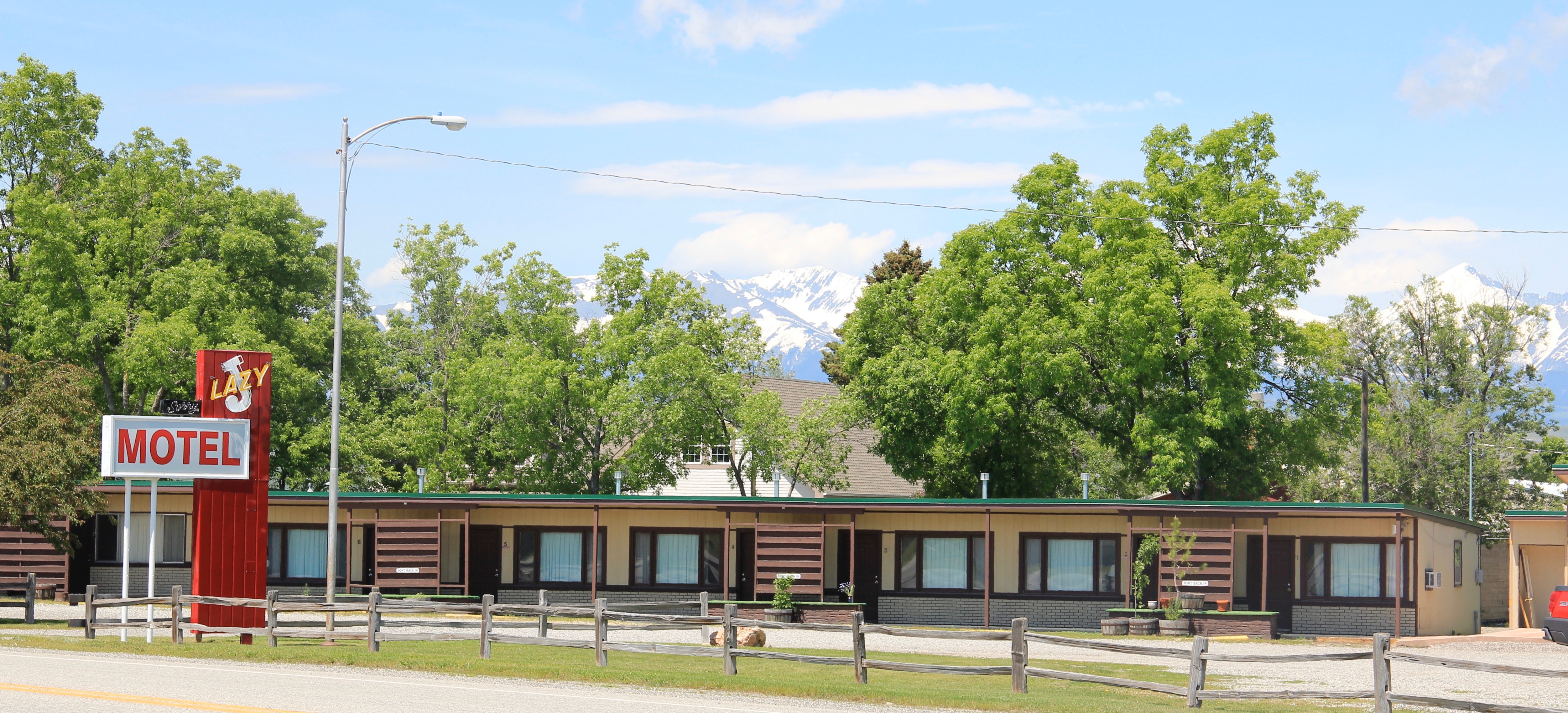
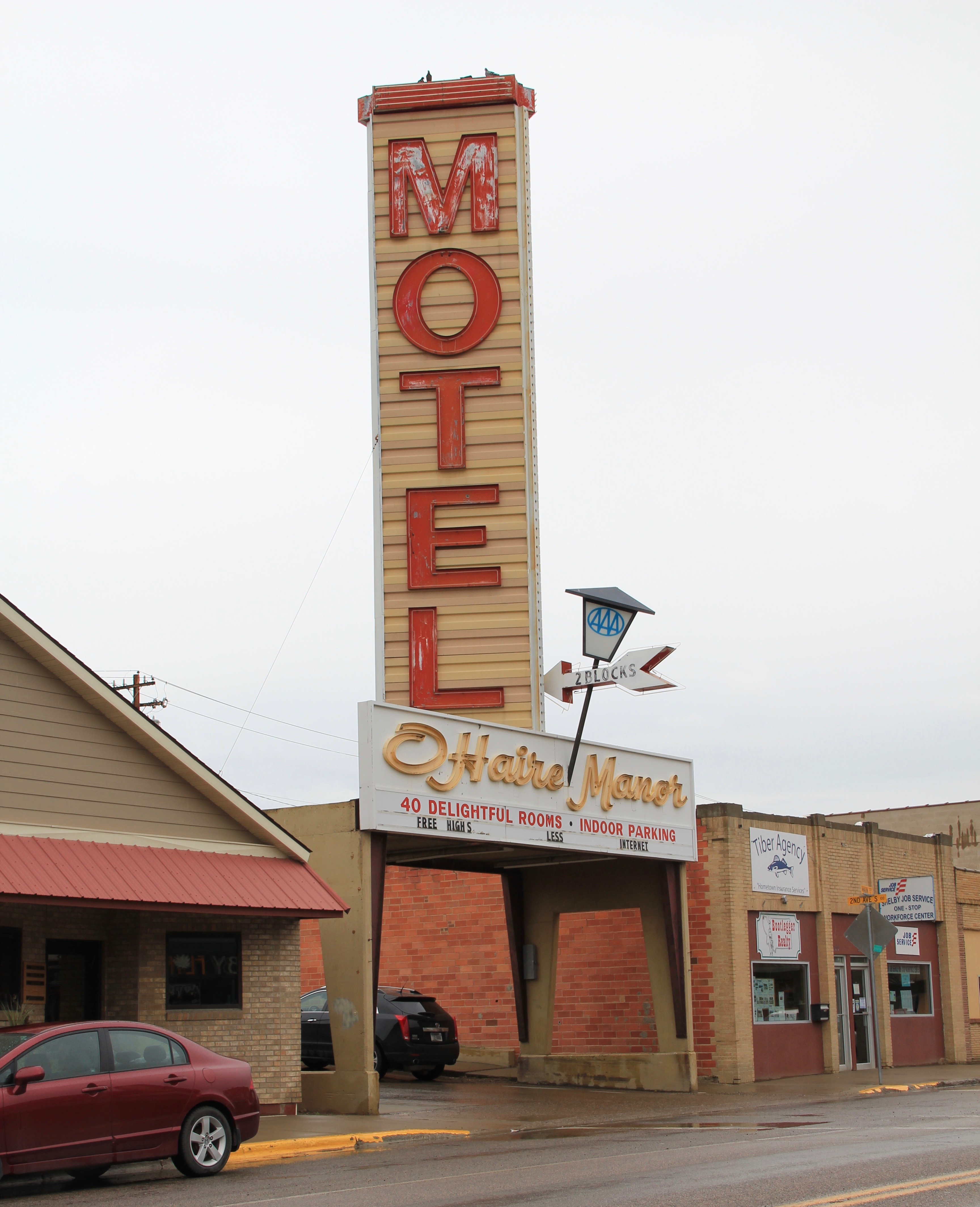
 nation, where you can enjoy a great burger, rings, and shake, like Matt’s in Butte, or a good night sleep at any of the many “Mom and Pop’s” motels along the state’s highways, such as this one in Big Timber.