
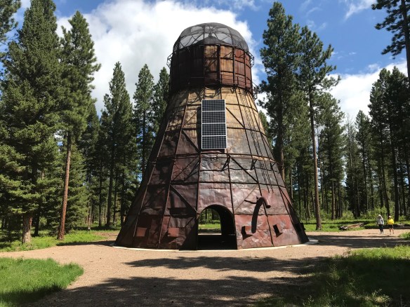
As I carried out my new exploration and documentation of the Montana historic landscape from 2012 to 2016, there were new developments underway that I missed as I moved from one region to another during those years. The creation of Blackfoot Pathways: Sculpture in the Wild within a section of the national forest at Lincoln happened after I had revisited Lincoln–so I did not visit this exciting new sculpture park until May 2018. The park’s mission is to celebrate “the rich environmental and cultural heritage of the Blackfoot Valley through contemporary art practice.” Moving the TeePee Burner, which had stood for decades outside of the town between the Blackfoot River and Montana Highway 200, was the appropriate first step. This large metal structure once burned wood refuse from the Delaney and Sons sawmill–now it is the centerpiece of creative space set within the national forest just off of the highway.

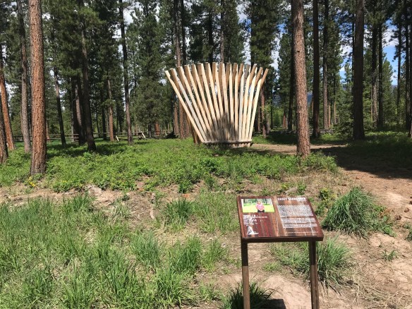
The Gateway of Change (2014) by Jorn Ronnau of Denmark serves as an effective transition from the TeePee Burner to the other installations in the sculpture park. Casey Schachner’s Stringer (2017), below, is a great pine fan, recalling in its strength and lift the industrial works of the past.
My favorite installation in 2018 was the Picture Frame by Jaakko Frame of Finland, a massive interpretation of how we take nature and frame it constantly in our mind’s eye, or in our camera lens!

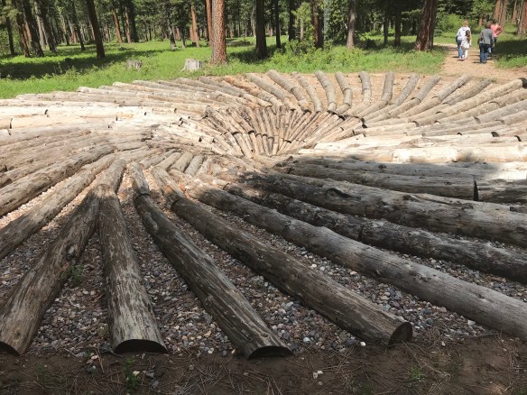
Another favorite was what seemed to be a trench, but is named the East West Passage (2015) by its creators, Mark Jacobs and Sam Clayton of the UK. The “walkable” structure creates a below-grade passage, giving a sense of direction in what can otherwise be a directionless landscape.

Tyler Nansen’s Bat Beacons (2016) at first glance seems redundant–why have pine poles installed in a pine forest? But Nansen wants to “encourage the preservation of bat habitats in Montana,” by creating possible roosts for bats with the black bat boxes at the top of each pole.

Frankly everything you encounter as you walk through this special landscape is interesting, if not thought provoking. And the artists are international, just as in the past the people who carved out the forests, dug the mines, and created towns came from across the globe. What an appropriate representation of the people who made the Blackfoot River Valley a distinctive place. In my earlier posts I have discussed how the

U. S. Forest Service really upped its game in public interpretation at historic sites from my fieldwork in the mid-1980s to the new survey of the mid-2010s. Blackfoot Pathways takes the interpretive experience in new and worthwhile directions, acknowledging the industrial past of the forests but also identifying new paths for the future.

 St. Joseph Catholic Church, perched now on a barren bluff facing the lake, was moved about 2.5 miles east to its present location in 1954. Originally near the river in what was then known as the Canton Valley settlement, the church building is one of the state’s oldest, dating to 1874-1875 and is listed in the National Register of Historic Places. The proud Gothic styled church is the remnant of one of the valley’s earliest settlements.


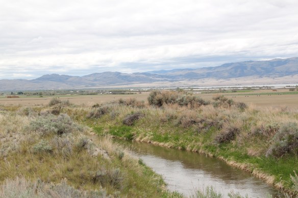
 One of my favorite weekend drives, when I lived in Helena over 30 years ago, was to head north, via the Flesher Pass (above) and Montana Highway 279, and hit the very different landscape of Montana Highway 200 (below) and eastern end of the Blackfoot Valley.
 The destination was breakfast, often at Lambkin’s, a family business that, to my delight, still operates when I visited in 2015. Lambkin’s is one of those classic small town Montana eateries, great for breakfast, and not bad for a burger and pie later in the day. The town is


 My friends in the environs of Helena have been surprised that after 300 something posts I had yet to say anything about Augusta, a crossroads town in northern Lewis and Clark County along U.S. Highway 287, during my revisit of the 1984-1985 state historic preservation plan. They knew that I loved the open range drive to Augusta, whether approaching from U.S. 287 or U.S. Highway 89.
 Then, the various businesses and bars along Main Street represented not just a favorite place in rural Lewis and Clark County, but also document a classic western town with great roadside architecture such as the Wagon Wheel Motel.


 Augusta began as a crossroads town for neighboring ranches; the later extension of a railroad spur to nearby Gilman spurred competition between the two towns. But Augusta
  won that battle–today not much outside of the Montana Highway Historical marker, a steel bridge, and a disappearing railroad corridor remains of Gilman.

 But I like the football field almost as much as the historic school–could a more neighborhood setting even be imagined?
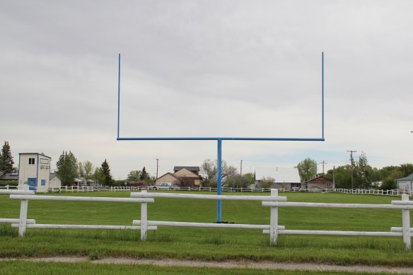 Then there are historic commercial buildings from the early 20th century–several with National Register qualities, especially the F. M. Mack General Merchandise store–a frame building with paired bracketed cornice.


 Over 300 people call Augusta home today, a slight increase since my work 30 years ago. The community not only has kept the historic buildings noted above, residents also have opened the Augusta Area Museum–heritage is clearly part of the town’s future.
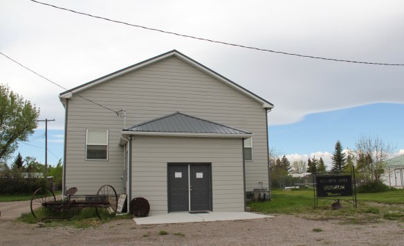
 The Montana State Capitol was my first heritage project in the state–the Montana Department of General Services worked with the Montana Historical Society to have me prepare an interpretive guide to the capitol, and then set up the interpretation program, following an excellent historic structures report prepared by the firm of Jim McDonald, a preservation architect based in Missoula.


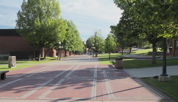
 When I worked at the capitol, of course I passed daily by other state government buildings, and rarely gave those “modern” buildings another thought, except perhaps for the museum exhibits and archival collections at the Montana Historical Society. Years later, however, what seemed unbearably recent in the early 1980s were now clearly historic. One of my MTSU graduate assistants, Sarah Jane Murray, spent part of a summer last decade helping develop a inventory of the buildings and then, finally, in 2016 the Montana State Capitol Campus historic district was listed in the National Register of Historic Places.


 The Capitol Annex (1910) was the first building added to the capitol campus, and its restrained classicism came from the firm of Link and Haire.
 The nearby Livestock Building (1918) is like the annex, complimentary of the capitol’s classicism but also distinguished in its own Renaissance Revival skin. Link and Haire were the architects.
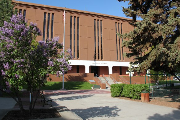
 The mammoth Sam W. Mitchell Building (1948-50) reflected the post-World War II interpretation of institutional modernism and its mammoth scale challenged the capitol itself, especially once a large addition was completed at the rear of the building in 1977. The architect was Vincent H. Walsh of Helena.
 Another Link and Haire building on the campus is the Board of Health Building (1919-1920), which continues the pattern of more restrained architectural embellishment that shaped the look of the government buildings in the middle decades of the century.
  The Cogswell Building (1954-55, 1981) is another Vincent H. Walsh design, again reflecting the stripped classicism institution style often found in Cold War era public buildings.
 While the capitol campus took form on a hill about a mile east of Last Chance Gulch, the state’s governor still lived downtown, in the Queen Anne-style “mansion” originally built by miner and entrepreneur William Chessman and designed by the St. Paul firm of Hodgson, Stem and Welter. The state acquired the house in 1913 to serve as the residence for the governor and his family, and it remained the governor’s “mansion” until 1959.
 It was the opportunity to be the curator of this house museum that attracted my newlywed wife Mary Hoffschwelle that led me to come with her to Montana. She was born in Billings; I had never been west of Dallas. But then over 25,000 miles of driving, visiting, and looking in Montana transformed me, and led not only to the 1986 book A Traveler’s Companion to Montana History but now this Montana historic landscape blog. Fate, perhaps. Luck–I will take it any day.
 Helena, the capitol city of Montana, was where I made my home from 1981 to 1985, and served as my base for travels far and wide across the state during my work for the Montana State Historic Preservation Office’s preservation plan in 1984-1985. I started the project at the 1950s modernist Montana Historical Society building next door to the state capitol.

 Helena then was a small town but a big urban environment, and I used to enjoy exploring its two sided urban landscape: the 1970s “Last Chance Mall” where planners and designers closed the street for a few blocks and inserted a pedestrian mall, thinking that a “walking mall” experience would keep businesses downtown, and then the rest of the downtown before urban planners decided to change it into something it never was.


 The impetus behind the urban renewal of the 1970s was not only federal dollars through the Model Cities program but also federal presence. Officials wished to anchor the new Last Chance Gulch Urban Renewal project with a Park Avenue section that

 The pedestrian mall on its west side ends at the imposing Richardsonian Romanesque styled T.C. Power Block, one of my favorite commercial buildings not just in Helena but in all of Montana.

 This downtown has several architectural landmarks, as you see below with the Art Deco-styled First National Bank building, and then a short block away, a magnificent statement of power and influence, the Montana Club, designed by noted architect Cass Gilbert.


 Once you cross Neill Avenue, you enter a new downtown of 21st century Helena, created by the demolition of the historic Great Northern Railway passenger station in the 1990s and the construction of a new Federal Reserve Bank. Here suddenly was a new downtown
 anchor, similar to that of the 1977 Federal Building on the opposite end of Last Chance Gulch. And the name given to this? the Great Northern Center, where not only the


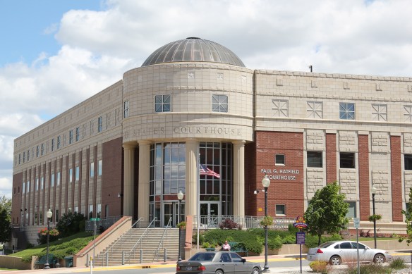 Federal Reserve lived but also a huge new Federal Courthouse, the Paul G. Hatfield Courthouse (2001-2002), a neoclassical monument of a scale that Helena had not seen since the construction of the State Capitol more than a century earlier, along with its more
 modern styled neighbor, the Senator Max Baucus Federal Building. In less than 40 years, the federal presence not only moved from one end of the gulch to another, it had become much larger and architecturally distinct.


