
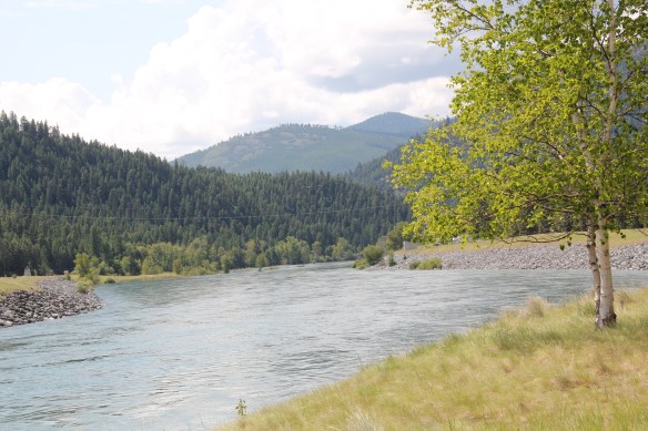
Kootenai River at Libby Dam
In 1966 the U.S. Corps of Engineers began the construction of one of the largest dam projects of that decade–the massive Libby Dam and Lake Koocanusa reservoir. By 1972, the project was complete, and the entire center of Lincoln County had been transformed.
 The dam is 422 feet tall and stretches across the river for 3,055 feet–well over a 1/2 mile. It creates a huge reservoir, extending 90 miles to the north and into British Columbia, among the ten largest reservoirs in the nation. And like that, a historic river valley became a recreational lake in a joint project between the United States and Canada.


The impact of the project on Lincoln County was immense–especially the boom it created in the county seat of Libby, which will be explored in the next post. But the lake did create new recreational opportunities, and led to the establishment of a federal scenic route along Montana Highway 37, which the project also created.
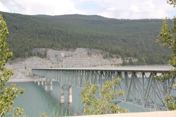
 The Lake Koocanusa Bridge, which provides access to a Mennonite community and a backroad way to Yaak, is the state’s longest, and in many ways, its most spectacular multi-truss bridge. The bridge is 2,437 feet long, and stands, depending on water level, some 270 feet above the lake.


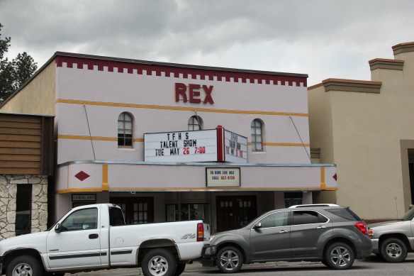
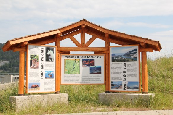 There was no interpretation at this bridge in 1984, but the scenic highway designation has led to the placement of overlooks and interpretive markers at some places along the lake. One wishes for the same at the Montana town that the lake displaced, Rexford. This once
 small river town had to move, or be inundated. And since the move took place in the mid to late 1960s, the town embodies the mid-century modern aesthetic, both in the design of many buildings but also in the town plan itself as the federal government finished relocating Rexford in the early 1970s.


Here is another place in Montana worthy of National Register consideration as a landmark of mid-20th century modernism and the lasting, transformative impact of federal construction projects on the state’s rural landscape from that same era. The Rexford
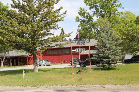
 school by itself is a fascinating statement of both design but also a community’s determination to stay, no matter what the federal government threw their way. Needless to say, in 1984 I paid Rexford no attention–nothing historic was there, it was all new. But now it is clear what a important place in Lincoln County’s 20th century history Rexford came to be.
 U.S. Highway 2 enters northwest Montana in Lincoln County and from there the federal highway stretches eastward through the towns of Troy and Libby with vast rural stretches along the way to Kalispell. Paralleling the highway is the historic route of the Great Northern Railway, which brought timber and mining industries to this corner of Montana.
 Before you encounter the towns, however, there is a spot that is among my favorite in the state, and a place that I discussed in some depth in the book A Traveler’s Companion to Montana History: Kootenai Falls.


 The falls is spectacular, no matter what time of the year you visit. But do stop and consider the mountains and bluffs that surround it. The entire landscape is what mattered to the Native Americans as they navigated through the area, or took vision quests at isolated places, or stopped to fish along the banks or hunt the wild game who also came to the falls for nourishment.
 There are few less untouched places than Kootenai Falls. The county park provides access and information. It is then up to you to explore, stop, and think about how humans have interacted with this places, taking aways thoughts and messages that we can only guess at, for thousands of years.
 Flathead Lake is a beautiful body of water and my favorite way to explore it by automobile is to take Montana Highway 35 north from Polson to Bigfork in neighboring Flathead County. Why is this winding, often slow, somewhat dangerous two-lane route my fav?
 Because it takes you by one of Montana’s most unique roadside landscapes–the orchard stands that sell Flathead cherries during the summer months. There isn’t really a Flathead cherry–the name comes from the lake region, especially this east side of the lake that has proven perfect for growing the sweet treat once Harry Chapman started the first orchard here around the turn of the 20th century.


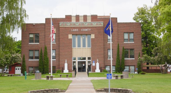


 But in the last 30 years, Polson has boomed as a lakeside resort town, with a population of 4700 today compared to the 2800 of the 1980s. Key landmarks remain but nothing has been listed in the National Register of Historic Places since my 1984 visit, even the great New Deal modern courthouse above.


 These landmarks need to be treasured because a new Polson is emerging all around town–and could crowd out the places that frame the community’s identity. Right now there is a balance between old and new, but a tipping point is around the corner.


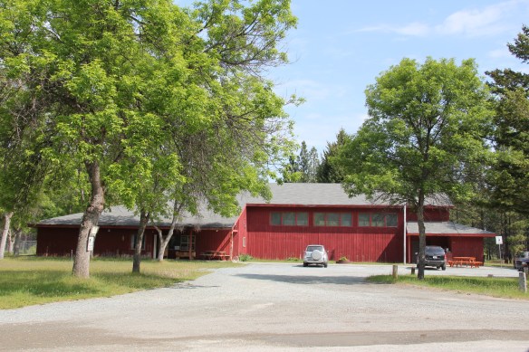
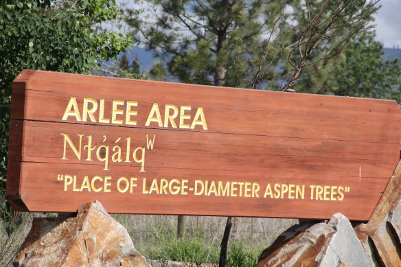
 Moiese is best known, by far, as the entrance to the National Bison Range, where a general store stands nearby the refuge gate. Created by Congress in 1908, the refuge took
 additional land–almost 19,000 acres- from the tribes, without their consent, to create a safe haven for the remaining bison in the region. A few hundred bison live within its boundaries today. In 2016 the National Park Service began discussions with the Consolidated Kootenai and Salish Tribe to transfer management of the refuge to the tribe.
 Eight miles north of Moiese along the railroad line is the town of Charlo, named in honor of Chief Charlo of the Bitterroot Salish, who was forced from the Bitterroot Valley to move to the reservation in 1891. Charlo served as head chief of the Bitterroot Salish from 1870-
 1910. As a railroad town, Charlo is like many along the Northern Pacific, with a brief strip of businesses facing the railroad tracks, marked by the town’s sole grain elevator. It has a classic rural bar, Tiny’s Tavern, with its brightly painted exterior of concrete block, with brick accents. Built in 1946 by Tiny Browne, it was both a motel and a tavern, and a local museum of items that Tiny thought were interesting. Browne died in 1977 and his sister, Celeste Fagan, next owned the tavern, managed by Edna Easterly who recalled in a story in the Missoulian of April 20, 2007 that Tiny “was known as the bank of Charlo. Tiny always carried a lot of money in his pocket and if you needed to cash a check, you went to Tiny.”
 Most important for its architecture, however, is the town’s public school, a wonderful example of Art Deco style from the New Deal decade of the 1930s.
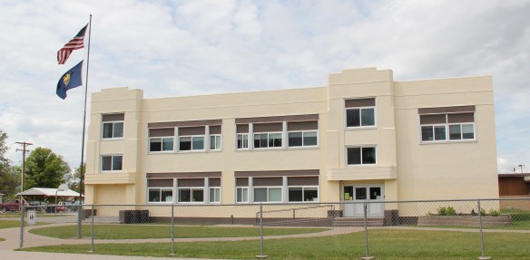 Ronan is a third town along the railroad corridor, named for a former white superintendent of the reservation. The town’s demographics today are mostly white, with a little more than a quarter Native American population. Ronan proudly proclaims its existence not only with a gate sign, connecting the business district to the sprawl along U.S. Highway 93 but also a log visitor center and interpretive park on the highway.


 The facade expresses a confident future, which is needed in today’s uncertain economic climate for rural hospitals across the state. But my favorite building in Ronan speaks to my love for adaptive reuse and mid-20th century modern design. The town library is an
 exquisite example of mid-century modern, and was once a local bank before being converted into the library.


 There is a new school and a really different lakefront of businesses, homes, and parks. The town’s population was over 1600 in 2010; it’s now 2700 and counting.


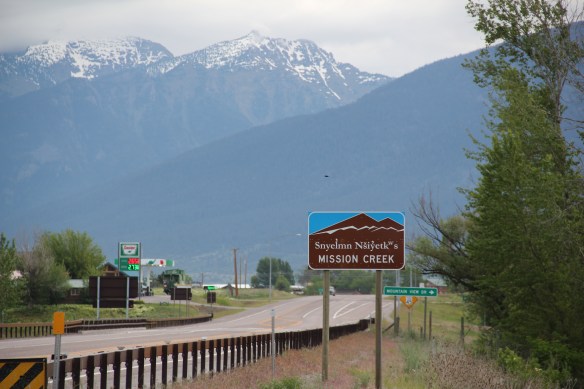
 To get the full meaning of Flathead Lake, however, you have to consider the lake’s deep time, and its long history with the Salish and Kootenai peoples. When I surveyed the county in 1984-1985, you came away impressed with the different vision that the tribes had for the region, and what was already happened at Pablo. In 2014, however, I left Lake County was a deeper impression on what the tribes have meant to the lake and vice versa.
 The People’s Center at Pablo is part of that lesson as it affords a powerful, lasting introduction to both the history and continuation of tribal traditions.


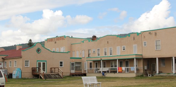
 Hot Springs, off from Montana Highway 28 on the eastern edge of Sanders County, was a place that received little attention in the survey work of 1984-1985. Everyone knew it was there, and that hot springs had been in operation trying to lure automobile travelers since the 1920s–but at that time, that was too new. The focus was elsewhere, especially on the late 19th century resorts like Chico Hot Springs (believe or not, Chico was not on the National Register of Historic Places in 1984). This section of what is now the reservation of the Consolidated Salish and Kootenai Tribes was opened to homesteaders in 1910 and first settlement came soon thereafter. The development of the hot springs as an attraction began within a generation.
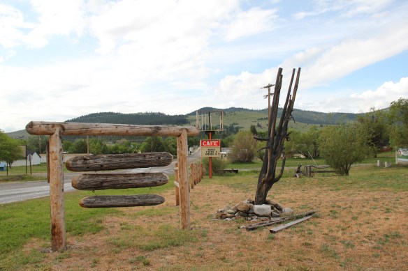 Due to the 21st century fascination from historic preservationists for the modern movement of the mid-20th century, however, Hot Springs is now squarely on the map as a fascinating example of a tourist destination at the height of the automobile age from the 1930s to 1960s.


 Not everything fit into this mold, naturally. There remains a representative set of gable-front shotgun-form “cabins” that housed visitors staying for several days and various one-story buildings served both visitors and year-round residents.
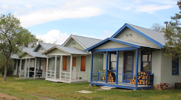


 The loss would be significant because few mid-20th century buildings in Montana, especially rural Montana, are so expressive of the modernist ethos, with the flat roofs, the long, low wings and the prominent chimney as a design element. Then there are the round steel stilts on which the building rests.
 As this mural suggests, today Hot Springs embraces its deep past as a place of sacred meaning to the Confederated Salish and Kootenai. And it continues to try to find a way to attract visitors as a 21st century, non-traditional hot springs resort.
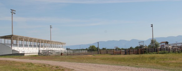
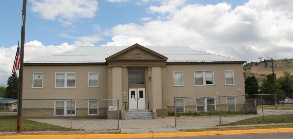 Plains is the second largest town in Sanders County, noted as the home of the county fairgrounds, the center of the local agricultural economy, and like Thompson Falls a significant place along the Clark’s Fork River and the Montana Highway 200 corridor.
 century feel, be it in institutions, such as the local Grange above, or the continuation of the local VFW hall and bowling alley, below.
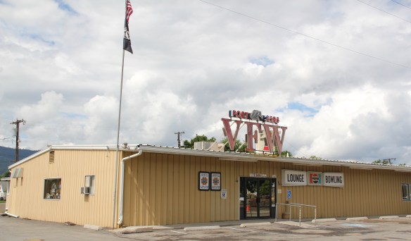


 The Noxon Dam was finished in 1959. It is a mile in length, 260 feet in height and 700 feet wide at its base. Its generators can power approximately 365,000 homes, making it the second-largest capacity hydroelectric facility in Montana.
 Today visitors can view the dam from various parking areas and short walking trails, one of which passes over the historic line of the Northern Pacific Railroad. The property has interpretive signs about the history of the project as well as about the engineering of hydroelectric power.
 Along the banks of the river/reservoir, a much more recent public park has opened–with public sculpture reminding everyone of the Native Americans who once camped along the
 river at this place. By bringing the deep past of the region in view of the modern, this site is a new favorite place–wherever you are in Montana, and there are many modern engineering marvels–the Indians were always there first, using those same natural resources in far different ways.
 On the outskirts of town, the 1920s monument to David Thompson was the centerpiece of the town’s heritage tourism attractions in 1984-1985, now it is more of an afterthought. David Thompson was a Welsh-Canadian who established the first trading post in this river valley, called Saleesh House, for the tribe with whom this veteran of both the Hudson Bay Company and North West Company had targeted for the fur trade. His last visit to Saleesh House came in the winter of 1812. Thompson, I thought in 1984, was a very important figure in Montana history but increasingly a neglected trader–in fact most of the early traders, like those of the American Fur Company on the Missouri and Yellowstone Rivers, are neglected, even though significant places associated with them remain intact on the state’s landscape.
 About one hundred years after David Thompson’s last winter at Saleesh House, an entirely different landscape emerged along the Clark’s Fork River, one that introduced the recent technology of electricity to the region. To support and encourage the development of hydroelectric facilities, the city of Thompson Falls combined with investors to build what became known as the “High Bridge,” a way for automobile traffic to cross this gorge in the Clark’s Fork and unite settlement on both sides of the river.
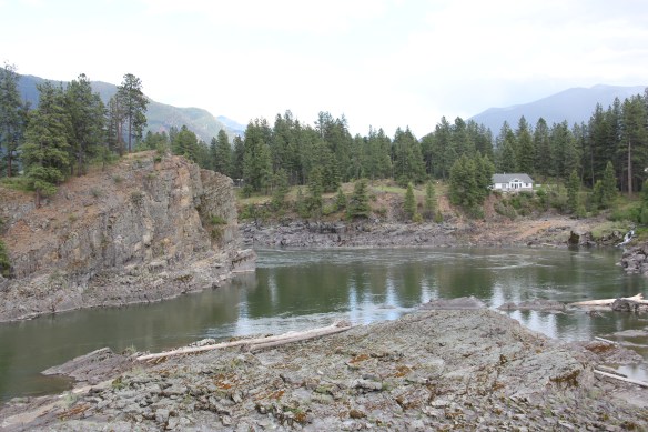 The High Bridge was an early 20th century Montana engineering marvel. It was 588 feet in length, designed for automobile traffic, with a 18-feet wide deck standing on a combination of Pratt and Parker trusses. It is the longest bridge of its kind in Montana.


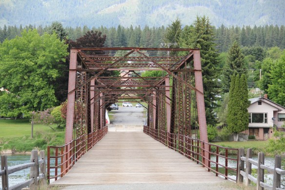 But within two years, residents and officials combined together to place the bridges and hydroelectric facilities in the National Register of Historic Places as a historic district. They were preserved, but still not used, for a generation.
 In 2009-2010, residents worked with local, state, and federal government officials to restore the bridge, add a pedestrian deck, and to open the bridge and either side of the bridge as a public park. Funding in part came from the American Recovery and Reinvestment Act of 2009, one of the ways that short-lived federal building effort benefited historic preservation in Montana small towns.
 The High Bridge experience not only reconnected Thompson Falls to its river roots, it also creates an unique experience for heritage travelers. The site is not that far different from 100 years ago, giving you the chance to cross a river and peer below but also to realize just how “wild” automobile traffic was in the 1910s and 1920s.
 In my state historic preservation plan work of 1984-1985, Thompson Falls became one of my favorite stops. No one much in the professional field had been surveyed here yet, and then I was particularly interested in how the Northern Pacific Railroad transformed the late territorial landscape. As the image above shows, Thompson Falls was a classic symmetrical-plan railroad town, with a mix of one and two-story buildings from the turn of the 20th century. I focused on this commercial core.
 The public meeting at the mid-20th century Sanders County Courthouse was well attended and most were engaged with the discussion: the pride, identity, and passion those in attendance had for their history and their interest in historic preservation was duly noted. The courthouse itself was not a concern–it dated to 1946 and wasn’t even 40 years old then. But now I appreciate it as a good example of Montana’s post-World War II modern movement, designed by Corwin & Company in association with Frederick A. Long
 Little did I understand, however, that the sparks of a local community effort were already burning–and within two years, in 1986, Thompson Falls had placed many of its key historic properties in the National Register of Historic Places.
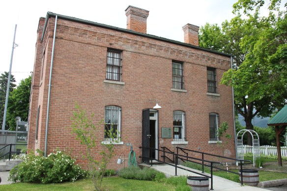 The old county jail (1907) has been transformed into a museum, both preserving one of the town’s oldest properties but also creating a valuable heritage tourism attraction. The contractors were Christian and Goblet, a local firm that had a part in the construction of the town’s building boom once it was designated as the county seat.

 The mid-20th century Sanders County Courthouse is to the west of the commercial core and it marks how the town stretched to the west in the latter decades of the century.
 Along with the conversion of businesses and the adaptive reuse of older buildings, Thompson Falls also has located key community institutions, such as the local library first established in 1921, along Main Street facing the railroad tracks.
 But many community institutions–fraternal lodges such as the Masonic Lodge above, the public schools, and churches are on the opposite side of the tracks along the bluffs facing the commercial core. Thompson Falls is a very good example of how a symmetrical plan could divide a railroad town into distinctive zones.


