

Nestled within the Tobacco Valley of northern Lincoln County is the town of Eureka, which serves as a northern gateway into Montana along U.S. Highway 93. I first encountered the town in 1982, as I returned from a jaunt into Alberta, and immediately thought here is a classic linear town plan, a landscape created by a spur line of the Great Northern Railway.
 As I would come to find out, on two return trips here in 1984, the town was much more than that, it was a true bordertown between two nations and two cultures. The two trips came about from, first, a question about a public building’s eligibility for the National Register, and, second, the fieldwork for the state historic preservation plan, where such obvious landmarks as the National Hotel and Eureka passenger depot were noted. Thirty

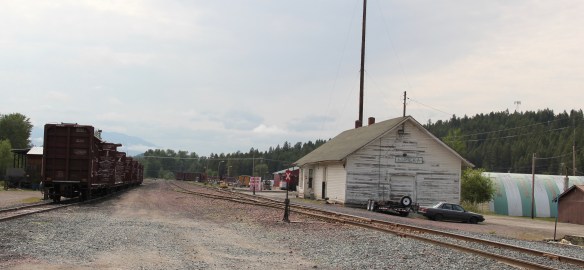 years later I was pleased to see the National Hotel in much better condition but dismayed to see the Great Northern passenger station–a classic example of its early 20th century standardized designs–is far worse condition that it had been in 1984.
 Otherwise, Eureka has done an impressive job of holding together its historic core of downtown one and two-story commercial buildings. In 1995, owners had the Farmers and Merchants State Bank, built in 1907, placed in the National Register. Walking the town, however, you see the potential of a historic district of this turn of the 20th century place.


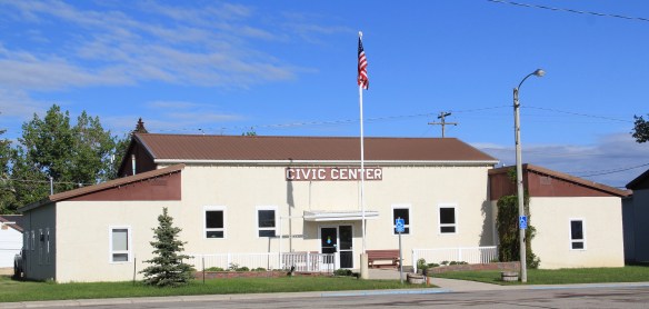
Oh yeah, what about that second reason for two trips in 1984? That would be the Eureka Community Hall, one of the last public buildings constructed by the Works Progress Administration in Montana in 1942.
 Located on a hill perched over the town, the building was obviously a landmark–but in 1984 it also was just 42 years old, and that meant it needed to have exceptional significance to the local community to merit listing in the National Register of Historic Places. Eureka had been a logging community, and the depression hit hard. The new building not only reflected community pride but also local craftsmanship, and it became a
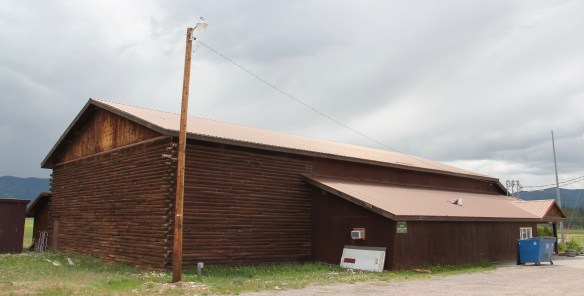
 foundation for community resurgence in the decades to come. The building was listed in 1985, and was the first to have my name attached to it, working with Sally Steward of the local historical society. But credit has to go to Pat Bick and especially Marcella Sherfy of the State Historic Preservation Office for urging me to take it on, and to guide me through the maze of the National Register process. Today, it has experienced an adaptive reuse and serves as a rustic log furniture store.
 During those visits in 1984 I also held a public meeting in Eureka for the state historic preservation plan, where I learned about the Tobacco Valley Historical Society and its efforts to preserve buildings destined for the chopping block through its museum village on the southern edge of town. Here the community gathered the Great Northern depot (1903) of Rexford, the same town’s 1926 Catholic Church, the Mt. Roberts lookout tower, the Fewkes Store, and a U.S. Forest Service big Creek Cabin from 1926.


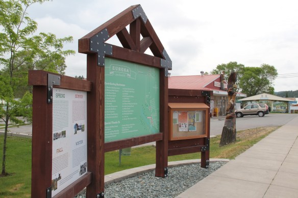
But thirty years later I found new public interpretation not just in the museum village but in the town itself, as Eureka introduced visitors to its history and setting and also told its
border story of such fascinating people as Joseph Peltier, who built the first dwelling at the town site in 1891, and especially the cross-border entrepreneur Sophie Morigeau, who was trading in the area as early as 1863.


The Peltier log dwellings came within a year of each other, 1891 and 1892, and their size, finish, and log notching speak to the region’s rapid development. His 1891 low pitched roof, v-notched cabin is typical, throughout the mountain west, of first homes–quickly constructed shelter. The second house, with its hewn log exterior and crafted corner notching speaks to permanence. The settler was here to stay in 1892.


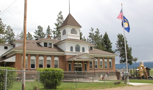
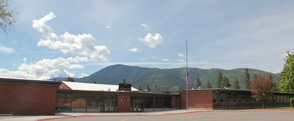
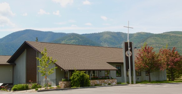
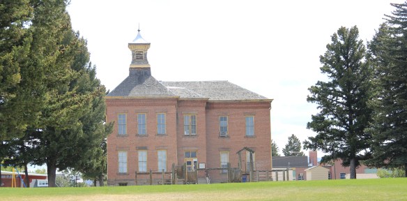
Eureka has held its population steady over 30 years, just a few families over 1,000 residents, a sizable achievement considering the change in both railroading and logging over that time. I think community pride and identity has to be contributors, because you see it everywhere, and I will close with two last examples. The town’s library and nearby veterans park, and then the magnificent Art Deco-influenced high school–yet another New Deal era contribution to this special gateway town.


 It is a land watered by the river, framed by the mountains, and famous for its beef–which they even brag about at the crossroads of Montana Highways 200 and 83.
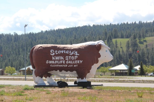 But soon after passing the junction, you enter a much different landscape, particularly at the point where the Blackfoot River meets the Clark’s Fork River. This is an industrial world, defined by the company town design of Bonner and the active transportation crossroads at Milltown. Suddenly you shift from an agricultural landscape into the timber industry, which has long played a major role in the history of Missoula and northwest Montana.
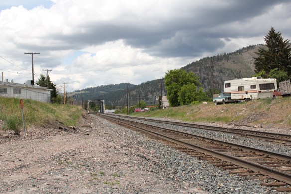 In 1881 the Northern Pacific Railroad was approaching the river confluence. It contracted with a company led by E. L. Bonner, Andrew Hammond, and Richard Eddy to supply everything the railroad needed but steel as it passed through the region. Two years later the railroad provided the capital for Bonner, Hammond, Eddy, and M.J. Connell to establish the Montana Improvement Company. In c. 1886 the improvement company dammed the rivers and built a permanent sawmill–the largest in the northern Rockies, and created the town of Bonner. The sawmill works and town would later become the Blackfoot Milling and Manufacturing Company and eventually by the late 1890s it was under the control of Marcus Daly and his Anaconda Copper Company. Anaconda ran Bonner as a company town until the 1970s.
 Although buildings have been lost in the last 30 years, especially at the sawmill complex which had a disastrous fire in 2008 and a heavy snow damaged another historic structure in 2011, I found Bonner in 2014 to remain a captivating place, and one of the best extant company towns left in Montana.
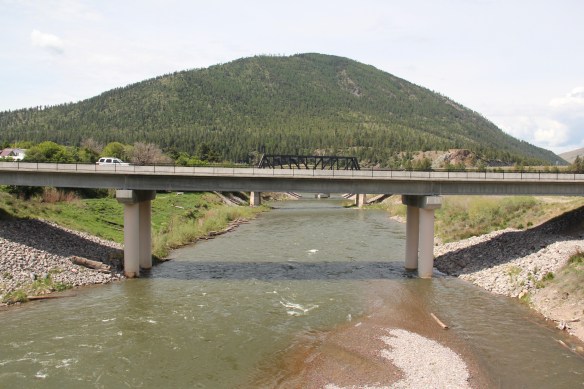 Montana Highway 200 passes through the heart of Bonner while Interstate I-90 took a good bit of Milltown when it was constructed in the 1970s. Both Bonner and Milltown are heavily influenced by transportation and bridges needed to cross the Blackfoot and Clark’s Fork rivers.
 The Milltown Bridge has been restored as a pedestrian walkway over the Blackfoot River. It is the best place to survey the Blackfoot Valley and the old sawmill complex.
 The pedestrian bridge and heritage trail serve as a focal point for public interpretation, for the Lewis and Clark Expedition, the Mullan Road, and then the lumber industry, which all passed this way over time, a conjunction of rivers and history that lie at the heart of the local and state (Milltown State Park) effort to interpret this important place.


 Powell County’s Deer Lodge Valley is another favorite western Montana landscape. I visited there often during the 1980s, and in the years since I found myself often back in places like Deer Lodge, the county seat, if for nothing else to stop at the R&B Drive-In.
 Let’s start with the town of Deer Lodge, a place that has changed much in the last 30 years, a process that was underway in the early 1980s after the Milwaukee Road closed its division point and declared the entire line bankrupt. Besides Miles City, it is difficult to find a town more impacted by the Milwaukee’s failure than Deer Lodge.


 Yet, Deer Lodge was not a typical small town base for the Milwaukee Road; railroads typically wanted to create their own place. But Deer Lodge was one of the oldest places in the state, where ranchers in the 1850s first arrived–the early site is now interpreted at the Grant-Kohrs National Historic Site of the National Park Service–soon followed by Capt. John Mullan as he and his soldiers built the Mullan Road through this valley.

 The Northern Pacific passenger depot exists across the tracks from the Milwaukee Road station. It too has a new use: the Northern Pacific depot is now the senior citizens center.
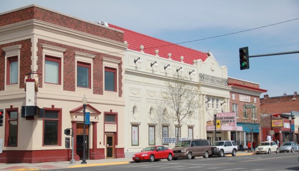

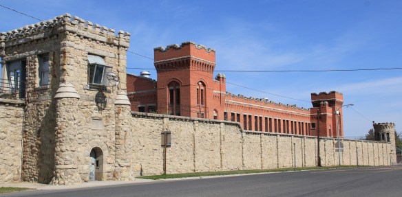 Before Deer Lodge was a railroad town, it was a prison town, the location for the Territorial Prison, and later the state prison. Most of the buildings you can visit today are from the state prison era. It operated here until 1980 when it moved to a facility outside of town.

 Deer Lodge also was an early center for education, represented by Trask Hall (1870s), which, like the territorial prison, is listed in the National Register. So with the themes of settlement, ranching, railroads, education, prisons, and the beauty of the valley why has Deer Lodge struggled to be recognized as one of Montana’s premier heritage designations? As the next post will discuss, citizens are taking steps to remedy the situation.
 As the historic promotional image above conveys, the Bitterroot Valley is an agricultural wonderland, but one dependent on irrigation and agricultural science. This image is on display at the Ravalli County Museum, which is located in the historic county courthouse from the turn of the 20th century.
 Local ranchers and boosters understood the economic potential of the valley if the land was properly nurtured. Some of the best evidence today is along the Eastside Highway,


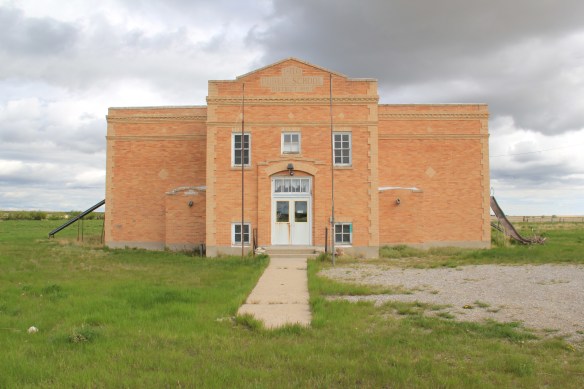
 railroad spur through the valley. With its Four-Square style dwelling, the Bailey Ranch, immediately above, is a good example of the places of the 1910s-1920s. The Popham Ranch, seen below, is one of the oldest, dating to 1882.
 One major change in the Bitterroot over 30 years is the fruit industry has diminished and how many more small ranches and suburban-like developments crowd the once expansive agricultural wonderlands of the Bitterroot. The dwindling number that remain deserve careful attention for their future conservation before the working landscape disappears.
 The two lanes of U.S. Highway 89 as it winds northwest from Choteau to the southern boundary of the Blackfeet Indian Reservation, cross a stark yet compelling landscape, a jaunt that has never ceased to amaze me. To those only with the mountains of Glacier National Park in their minds will see merely open land, irrigated fields, scattered ranches.
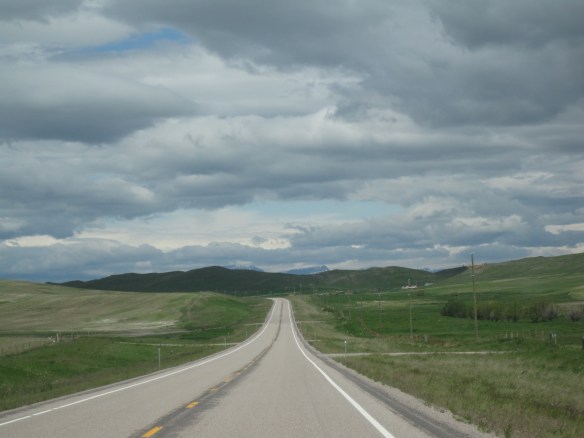 But there’s a deeper landscape here, some embodied in the tiny towns along the way, others in places just ignored, certainly not recognized. In the first post of 2016, and the 200th of this series of explorations of the Montana landscape, let’s once again look a bit harder.
 For one, this is a landscape shaped by Cold War America. Nuclear missile silos were installed throughout the region with some easily accessible from the roadway. You wonder how many tourists realize that.
 The federal imprint has lingered on this land for almost 150 years. Today north of Choteau this highway historical marker, and a lonely boulder set square in the adjacent field, mark the first federal intrusion, the creation of the Teton River Agency, where in 1868-69 the federal government established its reservation headquarters for the Blackfeet Indians. The agency was only here for about 7 years but this spot was where the first white-administered schools for Blackfeet children began, in 1872.
 Irrigation systems would be a third federal imprint on the landscape and it came early to this region–through the Reclamation Service’s Valier Irrigation Project–but to find that place you need to venture a bit east of U.S. 89 to the town of Valier, on the banks of Lake Frances, which was created as a reservoir for the irrigation project.
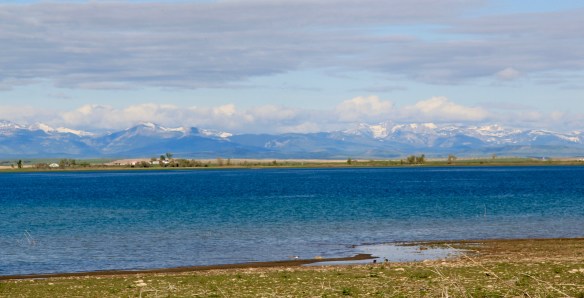 Valier has never been a very big place, but its investors in 1908, including William S. Cargill of the powerful Cargill family of Wisconsin (today’s Cargill Industries), had high hopes that the engineered landscape could create a ranching and farming wonderland.

 Listed in the National Register of Historic Places, the school remains in use today, as a bed and breakfast establishment. Even though Valier never reached the dreams of the Cargills and other outside investors, it has been a stable agricultural community for 100 years–the population today is only 100 less than what the census takers marked in 1920. Valier has that


 Heritage tourism also remains alive along U.S. Highway 89, and for those travelers who slow just a bit there is now the Two Medicine Dinosaur Center at Bynum.


 Another highway pull-off provides one of those “Scenic Overlooks” found through the state. This one perhaps not as spectacular as others but also giving travelers a sense of what this landscape is like, and what awaits them as they continue down to Highway 78’s southern terminus at Red Lodge, where the preservation ethic and the successes over 30 years will be the next topics of the blog.