Finding the Lewis and Clark story at Coal Banks Landing

Image

Coal Banks Landing, on the Missouri River in Chouteau County, was another site already recognized as significant when the preservation planning survey got underway in the spring of 1984.  Here was yet another documented place associated with the Lewis and Clark expedition:  it took its name literally from the band of lignite easily observed in the banks along the Missouri.

Image


The landscape here not only speaks to the age of river transportation; to the west at Virgelle you can also find the original roadbed of James J. Hill’s Manitoba Road as it came down from Havre and connected with the Missouri River valley, its route to Great Falls.  Virgelle has National Register-listed properties in its historic pressed tin-sided general store and brick bank; across the road are a school and grain elevator.  These properties marked the forgotten town as a place once prominent along the Great Northern network.

Image Image

Image Image

Coal Banks Landing, in comparison, was a place on the river, with little to tell its story.  Today, however, Coal Banks Landing is a prominent spot, with a modern boat landing, a seasonal interpretive center, and then year-round interpretive markers for its multiple layers of history.

Image Image


The landing and its significant Lewis and Clark story are now preserved as part of the Upper Missouri River Breaks National Monument, one of the state’s most important conservation and heritage tourism developments in the 21st century.  This national monument preserves not only one of the most breathtaking sections of the Lewis and Clark National Historic Trail it also preserves open land little changed from the centuries of occupation by various Native American groups and scattered often log-built homesteads of the multi-ethnic groups that flooded into northern Montana in the first two decades of the 20th century.

Image Image


Little was here in 1984 to help residents and visitors understand the deep significance of the Missouri River.  Today Coal Banks Landing is a must stop for any heritage tourist of northern Montana.


Lewis and Clark and finding the “true Missouri” at Loma, Montana

Image

During the early weeks of fieldwork in northern Montana in 1984, I certainly had notes and reminders to document sites associated with the Lewis and Clark expedition.  Here was one part of the region’s history that had been given its due by generations of historians, and the brown Pathfinder-themed markers of the Lewis and Clark Trail made the historic route one of the state’s most recognizable heritage assets.  Yet as I left Hill County and moved into Chouteau County, heading toward Fort Benton, there was little to mark the story along the Marias River and the decision that the expedition made regarding the “true” path westward–the Missouri River or the Marias River (the latter they had not expected to encounter).  There was a state highway marker at Loma, but that seemed not enough, considering the importance of the events on the Marias and the high integrity of this historic landscape.

Image


Opportunities not gained during the Lewis and Clark sesquicentennial in the 1950s were not missed during the bicentennial of the past decade.  As you approach the highlands above Loma, a major new interpretive kiosk not only presents a compelling view of the Marias landscape, it also interprets the significance of the location.

Image

Image Image


Here is an example of the partnerships now driving the interpretation of the Lewis and Clark Trail:  the Lewis and Clark National Historic Trail of the National Park Service being the most important, bringing a consistency of design and message to the interpretation.

Image 

With these partnerships, working with property owners, in place, visitors can experience such key sites as Decision Point, at the confluence of the Missouri and Marias rivers, where the expedition made the correct choice and followed the “true Missouri” westward.  Loma, rather than being a neglected place in the Lewis and Clark story, now has become a centerpiece of the region’s interpretation, thanks to new visions and new installations in the 21st century.

Image


Traveling the historic Manitoba Line, from Havre to Big Sandy

Image

The impact of the Great Northern Railway on the settlement of northern Montana really can never be over-emphasized–its mark on the settlement landscape and later transportation routes is that important.  Most travelers, and many residents, do not realize that the railroad, then named the St. Paul, Minneapolis & Manitoba, did not initially strike straight across the plains to Glacier National Park.  In 1887 it turned at Havre and headed southwest towards Great Falls, creating a distinct modern landscape along Big Sandy Creek that you may still follow today.

Image 

The first important stop was Fort Assinniboine, a U.S. army base established in 1879, before the first settlers arrived. The army maintained this major base until the 1910s and later in that decade its land and buildings became the Northern Montana demonstration farm, allowing state and federally supported agricultural reformers learn and demonstrate best practices in farming techniques and crops for the region.  Today it remains part of the state’s extension service, which has adapted some buildings for new uses while keeping others preserved as part of the nationally significant story of the U.S. military and its occupation of the northern plains.  

Image Image 

When I visited the fort site in 1984, the highway marker was the primary interpretation.  The farm’s administrators have since worked with the Montana State Historic Preservation office to locate interpretive markers outside of several buildings.  Tours of the complex are also available by reservations.

Image

Image Image

 As part of the federal process of transforming the landscape of Big Sandy Creek, the homesteading boom left its mark everywhere in the 1910s.  But also in 1916 the federal government established the Rocky Boy Indian Reservation for the Chippewa Cree.  The Manitoba Road’s intersection with the reservation came at Box Elder, at the border between Hill and Chouteau counties.  In 1984 one of the early Great Northern-era combination depot still stood at the town, although it seemed destined for destruction. Imagine my surprise in 2013 when the depot still remained, but barely so. 

Image Image

The gas station’s roadside architecture also faces an uncertain future.  But St. Anthony’s Catholic Church remained a key landmark and along U.S. 87 in the reservation stood a new architecturally distinctive building:  the Northern Wing Casino.  

 ImageImage


Image

Big Sandy is easily the largest town of northern Chouteau County, a place that abounds in surprises.  In 1984 the town’s old homesteader hotel remained, and so many other Montana towns had lost these artifacts of the early 20th century settlement. 

Image


Image

Thirty years later, the hotel remains in place, as do several other architecturally important buildings, from the Northern Monana State Bank, a vault-like neo-classical style building to the modern contemporary styling of St. Margaret Mary’s Catholic Church.

Image

Image

 Impressive adaptive reuse projects also had taken place, with the community turning the historic Great Northern depot into a center for its historical society and museum.  Big Sandy has a t-town plan, with its stem lined by businesses and other ventures, such as the false front Odd-Fellows Lodge or the recently established coffee shop.

Image


Image

The town’s New Deal era school remained, although the building’s original International Style design was somewhat muted by a new roof and other cosmetic changes. Yet, here was the school that nurtured Jeff Ament, who moved to Seattle and gained fame as part of the internationally significant band, Pearl Jam.  

Image

Big Sandy has steadily lost population since 1984–600 people remained in the 2010 census–but key landmarks remain standing and in use.  Impressive.  The days of the Manitoba Road are long gone but this early railroad town still makes a powerful historical statement.

Havre’s preservation legacies: final thoughts

Image

In its first year of existence, this blog has looked at Havre several times, from its historic African American church building located near the Great Northern Railway shops to its impressive statement of modern design, from the roadside architecture of U.S. 2 to the impressive campus buildings at the former Northern Montana University. This is a last look, considering especially the impact of that first generation of entrepreneurs and residents who left behind in the downtown and older residential neighborhoods such an impressive array of buildings and homes.

First and foremost, Havre is a railroad town, with its monumental statue of James J. Hill, the empire builder himself, still standing proud outside of the depot at the head of town’s central business district.  When first established, Havre was little more than a stop where the line turned southwest to Great Falls, the initial terminus.  But once Hill decided to push his mainline directly west of Havre in the first decade of the twentieth century, the town’s history changed drastically.  Havre became the seat of a new county–Hill County–and soon houses all throughout the town competed architecturally with the impressive Beaux-Arts classicism of the Hill County Courthouse, designed by Frank Bossout.

Image

Bossuot stayed in Havre and left quite a legacy in domestic architecture.  Not all homes are by Bossuot but certainly he was the trend setter.  In 1989 property owners worked with the Montana State Historic Preservation Office to place a huge chunk of the residential district in the National Register of Historic Places; at the turn of the present century, Havre had created a historic district commission to ensure the continued restoration and preservation of these dwellings.

ImageImage

Image Image

Image This Spanish Colonial design is attributed to builder Charles Harper. The local Catholic Church is also a Spanish Colonial design.

Another key decision made by city leaders and heritage advocates in the new century was the conversion of the monumental Federal Building into a heritage center, where the Clack Museum, once isolated away from downtown at the fairgrounds, could be relocated and other heritage groups could also maintain a presence.  When you pair the colossal Colonial Revival design of the Federal Building with the similarly overstated Mission style of the neighboring Masonic Temple, the town is messed with two architectural anchors for the rest of the century.

ImageIMG_8418

But there is work remaining in this classic town of the Hi-Line:  especially in the commercial area, where muddled rehabs have taken quite a bit away from the grandeur that once marked these streets.

IMG_8414IMG_8512

But the spark created by homeowners in the late 1980s, and then added to by heritage advocates in the last decade, has given Havre a heritage tourism foundation, upon which now is a growing heritage tourism industry.  Havre has found its heritage assets, and is building new futures for its residents through the promotion and conservation of its distinguished past.

IMG_8416

Havre’s historic preservation legacies

Havre, the seat of Hill County and more importantly the commercial and transportation hub of the Hi-Line, has already been the topic in several posts over the past year.  In 1984, it was the first place where one of the state historic preservation review board members, Eleanor Clack, took me around and explored the town’s history.  So let’s review the historic Havre of 1984 and consider what Mrs. Clack showed me, and what we see today as significant properties.

Clack’s spouse was Earl Clack, a businessman with concerns up and down the Hi-Line and a heritage advocate to boot.  The county museum bears his name and that is where we started, at the fairgrounds along U.S. Highway 2 west of downtown on a bluff overlooking the Milk River.

Image


The fairgrounds acknowledged the role of the Great Northern Railway in the town’s and county’s history–indeed Havre was a virtual shrine to the Empire Builder as I would discover–but Mrs. Clack was especially hurried to cross what was then a two-lane highway and go to the other side of the bluff, where she unlocked a fence and we explored the Wahpka Chu’gn buffalo jump, then one of the handful of properties in Hill County on the National Register.


Image


Today, it is difficult to find the property, even with the buffalo sculpture and signage along U.S. 2.  When the highway doubled in size, that improvement led to intensive development of the river bluffs, and today access to the site is behind a shopping center.

Image


The site was the Clacks’ pride and joy.  Not only was the setting stunning, with the valley crossed by the Great Northern mainline, they had worked with other preservationists to open the property for tours and interpretation.  At that time, it was the best interpreted buffalo jump–make that the best interpreted prehistoric site–in the region, if not the entire state.

After hours of exploring the property, Mrs. Clack next took me to the town’s turn of the century historic neighborhood.  There I encountered the first of several historic Carnegie-funded public libraries I would see in Montana (the actual town library had already moved into new quarters).

Image

Carnegie library, 1984

Image

Carnegie library, 2013

We also visited the Young-Almas house, a rambling Classical Revival dwelling, which was the second National Register anchor in the historic residential neighborhood.

Image


Today, of course Havre has a large National Register residential district, with state-funded markers telling the stories of the houses and families on almost every block.

Image

Finally we turned into the business district, where we stopped at the Federal Building and Post Office–a New Deal building–and then the commercial district.

Image

Mrs. Clack expressed her hope for the future, that the distinguished set of two-story commercial buildings that lined U.S. 2 would find a new future through historic preservation.

Image

U.S. 2 corridor, north, downtown Havre, 1984

ImageImage


As these 2013 photos attest, Havre’s historic downtown survives 30 years later, although the historic preservation potential still waits to be fully tapped.  After all, the historic preservation funding available in 1984–and the assumption that the movement’s early successes in sustainable urban renewal would bring about more–never happened.  Federal funding, in adjusted dollars, reached its hey-day in the Reagan administration, and has declined ever since. Mrs. Clack and I could not know the future in 1984.  But if she could see Havre today, I think she would be pleased with how residents and officials have built on the early foundation:  that is the topic of the next posting.

The Irrigated West: U.S. Bureau of Reclamation and Montana’s Hi-Line

Image

Fresno Lake, Hill County, 2013

The impact of federally funded irrigation projects is apparent throughout Montana but perhaps even moreso along the Hi-Line.  As I started his fieldwork in 1984 in Toole County, one of the first places I visited was Tiber Dam, a project that turned a large chunk of the Marias River into Lake Elwell.  The dam was finished in 1952 but numerous expansions and alterations occurred in the late 1960s and then late 1970s.

Image

Lake Elwell, Liberty County, 1984


When I encountered the town of Fresno in 1984, there was not much there but a tavern, built in the 1950s to take advantage of the increasing number of folks traveling to Fresno Lake for recreation, and a huge elevator complex.

Image


Today both the elevators and tavern remain, and the only changes found at the dam was additional fencing and pre-cautions for the security of the facility.

Image Image


Fresno Dam was part of the huge Milk River Project of the New Deal era.  The dam dates to 1937-1939, but was raised in 1943 and again in 1951 when “a concrete parapet and curb walls were constructed on the crest.”

Image 

The Milk River project is the one of the state’s oldest and most influential federal irrigation projects.  Dating to 1903, the project slowly unfolded across the plains, starting at St. Mary’s in Glacier County in 1905 and moving to the Dodson pumping station in Phillips County by 1944.  The Fresno Dam was funded by FDR’s National Industrial Recovery Act, making it a rarely identified place associated with the New Deal transformation of Montana.  

Image

We will be returning to this project and the story of the irrigated West often as we move across the state.


Joplin in Liberty County: A Disappearing Railroad Town

Image

Joplin today has a population hovering around 150, a decline of about 50 since 2000. E. C. Tolley, a real estate locator during the homesteading boom and Joseph E. Rehal, a Syrian-born merchant who made the biggest initial investment, are jointly credited with establishing the town.  In fact, they promoted rival parts of town, which led to uneven and scattered business development.   In a history of Liberty County, Art LaValley recalled: “The Commercial Club was very active in promoting the town of Joplin.  They erected a large, new sign by the railroad crossing, facing the depot so that people getting off the train would see it.  It was a picture of the world and read ‘Biggest Little Town on Earth.’” 

Image

Joplin sign, 1984

 Another contribution of the Commercial Club was the creation of a town square park, complete with bandstand:  the Joplin Community Band was popular throughout the region, until it disbanded in 1937.  Two years later in 1939, famous be-bop jazz artist, saxophonist Charles McPherson was born in Joplin.

Image


 Like most of the Great Northern towns of the decade, Joplin began well as homesteaders came quickly.  By 1913, O.C. Boggs of Joplin wrote a testimonial for his huge Nicholas-Shepard Oil-Gas Tractor:  “we are pulling six 14-inch Oliver Engine Gang Plows in sod.  Our average work is 15 acres per day of ten hours”  The First State Bank of Joplin opened its doors,along with many other mercantile and professional offices.  In 1916 Jensen Brothers and Layton hardware stores went into partnership to take advantage of the agricultural boom.  The drug company came in 1917. Image

 But drought hit this area hard in the late 1910s. In the 1920s the boom had busted, not just because of the agricultural crash.  There was the matter of the Dempsey heavyweight fight in Shelby in 1923.  Losses there impacted the local bank, which closed in 1923 just days after the fight.  The New Deal brought new hope in the mid-1930s when the PWA helped to fund a new brick school and the WPA funded sidewalks.

Image I had not been in Joplin since 1984 when I visited in 2013: many landmarks were missing or closed.  The Great Northern depot was gone completely.  Today there is nothing but the tracks and grain elevators Image

to remind one of the town’s lifeblood. Then the school closed in 2005 and Joplin joined the consolidated school system in Chester.

Image

 One key institution from the homesteading era still shapes community life:  the Joplin Community Hall, where everything takes place:  voting, reunions, funerals, parties, concerts, celebrations, especially in mid-June when the town still hosts an antique car show at the  town park.  Both the hall and town park were developed by Joolin’s Commercial Club–a forerunner to a Chamber of Commerce–in the first decade of settlement. 

Image

It was at the community hall in 2011, that a large crowd gathered to convince federal officials to let them keep another community institutions: the Joplin post office.

Image

 Today along U.S. Highway 2, a bright, shining streamlined moderne town sign has replaced the earlier littlest big town in the world–which remains in the town center, away from the highway as if residents keep the motto to heart but no longer share it with every traveler on the road. 

Image


Image

In 2010 Larry Olson told the Great Falls Tribune that he had “seen a lot of changes in his 72 years living in Joplin. ‘When I was growing up, it was so different,” he said. “Nowadays, everything is closed up. You’ve got a [Lutheran] church and a bar — that’s it.’”

Image Image

On the Hi-Line at Liberty County, 1984 and now

Image

Abandoned homestead in 1984, north of Joplin, Sweetgrass Hills in background


Liberty County, created in 1919 with Chester as county seat, was the next place I visited, and it proved to be one of my favorites along the Hi-Line.  Stuck between the larger railroad towns of Shelby, a junction point, to the west and Havre, a division point with Great Northern maintenance yards to the east, the Great Northern never saw a need to invest in or to encourage investment in town development in Liberty County.  In the 1910s, hundreds of homesteaders flooded into the area:  this 1984 image above of an abandoned homestead with the sacred Sweetgrass Hills in the background is one of my favorities.  Today a little over 2000 people live in the county.Image

Lothair was the first town I encountered in Liberty County.  Its grain elevators called me off the highway in 1984; they remain landmarks today. 

Image

Nothing else much is there, although in the 1910s residents and nearby homesteaders petitioned the state railroad commissioners to force the Great Northern to treat their town more seriously.  The 1918 petition, launched by the Lothair Commercial Club and others, called on the railroad to replace a depot that had burned in 1912.  The residents complained that “the depot now in use is of the portable style 12×34 feet, which with a box car body for freight, constitutes the facilities for the handling of passengers, freight, baggage, and express, as well as for the housing of the agent and operator. . . . The waiting room is only of sufficient size to accomodate four or five people comfortably.”  The petitioners argued that their town was at “the center of a very extensive dry land farming territory, nearly all of which has been filed on, but only about one-third is under active cultivation at the present time.”  But the hopes of Lothair never survived the homesteading crash of the 1920s.

Image

mid-1980s town sign of Chester

 Chester has fared better.  It retains a historic Great Northern depot, from the 1950s, although it was been moved from its earlier prominent location a bit farther to the east along the line. 

Image

Chester has a T-town plan, with one attribute that I later found in other turn-of-the-century Montana railroad towns:  an architecturally compelling two-story brick building on one corner, situated so its entrance faced both the tracks and the highway that paralleled the railroad. 

Image  Image

This building is the historic First State Bank of Chester (1910), one of two Liberty County buildings in the National Register of Historic Places.  The bank closed in 1920, but the building remained important to the community, serving all sorts of function; a local high school class researched its history for the National Register nomination in 1997.

Image

1st State Bank, Chester, 2013

 The organization of space in Chester is interesting.  As typical of a T-town plan, the railroad corridor dominates the top of T with the tracks, elevators, warehouses, and railroad buildings.  

Image

Chester t-town plan, 2013

The adjacent route of U.S. Highway 2 creates sorta of a “bottom” to the top of the T, where gas stations and other auto- and traveler-focused buildings, including a diner and an automobile museum, stand.  One bit of roadside architecture–the MX Motel–really captured my attention in 1984 because only a few years earlier Montana and especially Liberty County eagerly pursued

Image

MX Motel sign, 1984

the Carter administration idea of a defense system where nuclear missiles would be moved on tracks over a huge expanse of land, creating uncertainty for enemy targeting of missile silos. Liberty County had good reason to be excited about the MX–the time Chester had enjoyed sustainable growth was in the 1950s when the Bureau of Reclamation constructed the Tiber Dam/Lake Elwell project in the southern end of the county. 

Image

Tiber Dam Reservoir (Lake Elwell), 1984

I stayed at the MX Motel in 1984–and never imagined it would still be there 30 years ago.  It remains, but I wonder if anyone recalls why the name MX made sense to Liberty County in the past.  

Image 

The stem of the T-town plan in Chester is also interesting.  The bank is the visually prominent element while the county courthouse is a large two-story brick facade a bit farther down the street.  At the base of the T is the school campus, a sprawling group of brick Art Deco-influenced buildings (1935 for the Art Deco elementary school; the high school building dates to 1952) that now serve students with three old railroad towns: Chester, Joplin, and Inverness, and the school nickname is the Hi-Line Hawks.

 Image Image

Located between the commercial district and the school is the National Register-listed First Episcopal Methodist Church (1911-1968); it became the county museum in 1970, and soon will have served that cultural function for longer than it was a church. A much more recent yet still appropriate adaptive reuse is the conversion of another church into a county arts center.  This portion of Montana has actively pursued cultural tourism in the 21st century and the arts center plus the earlier museum are parts of that effort.

Image Image

Next: Joplin, a Liberty County town on the border with Hill County

Toole County, 1984 and Now: to the east along U.S. Highway 2

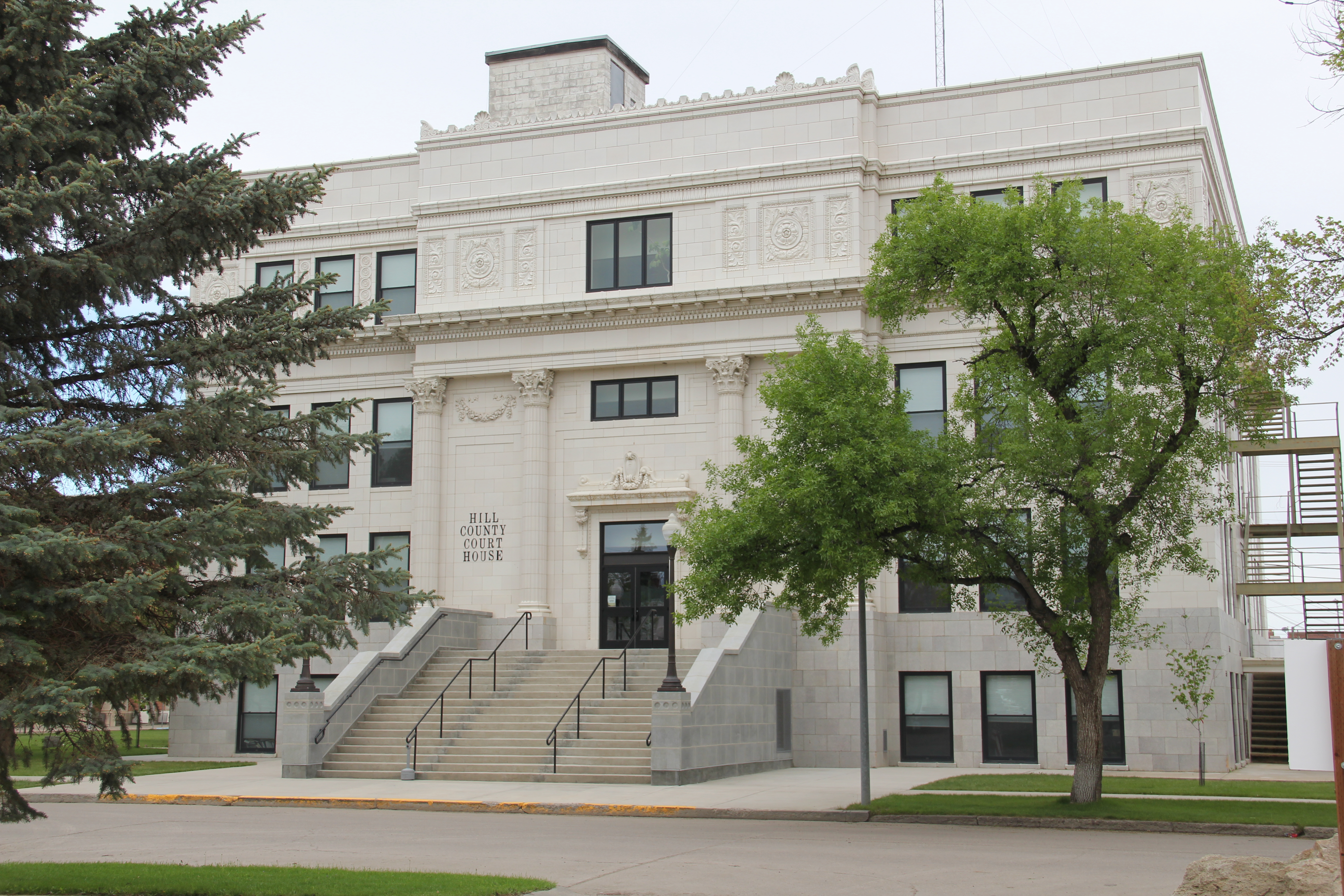
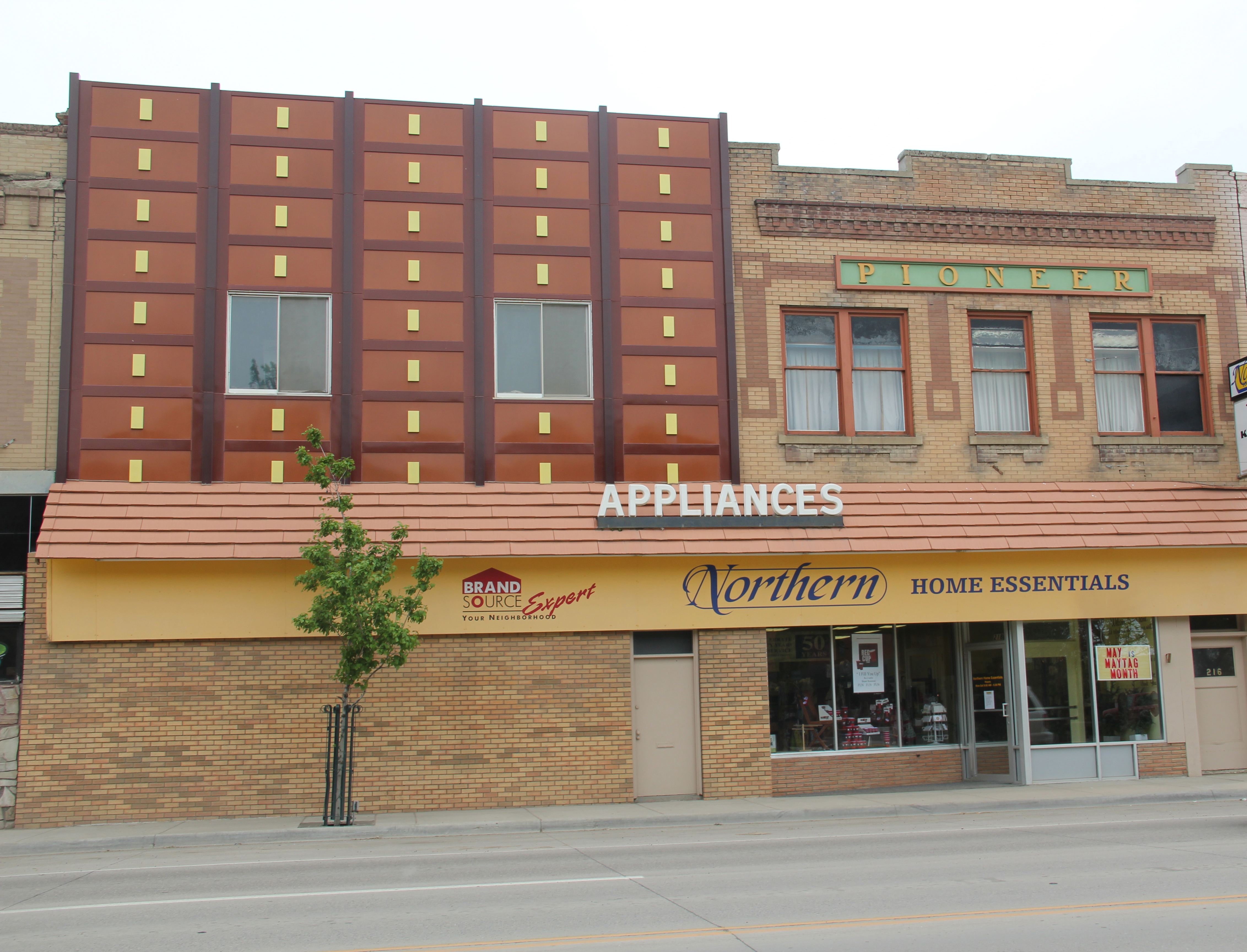
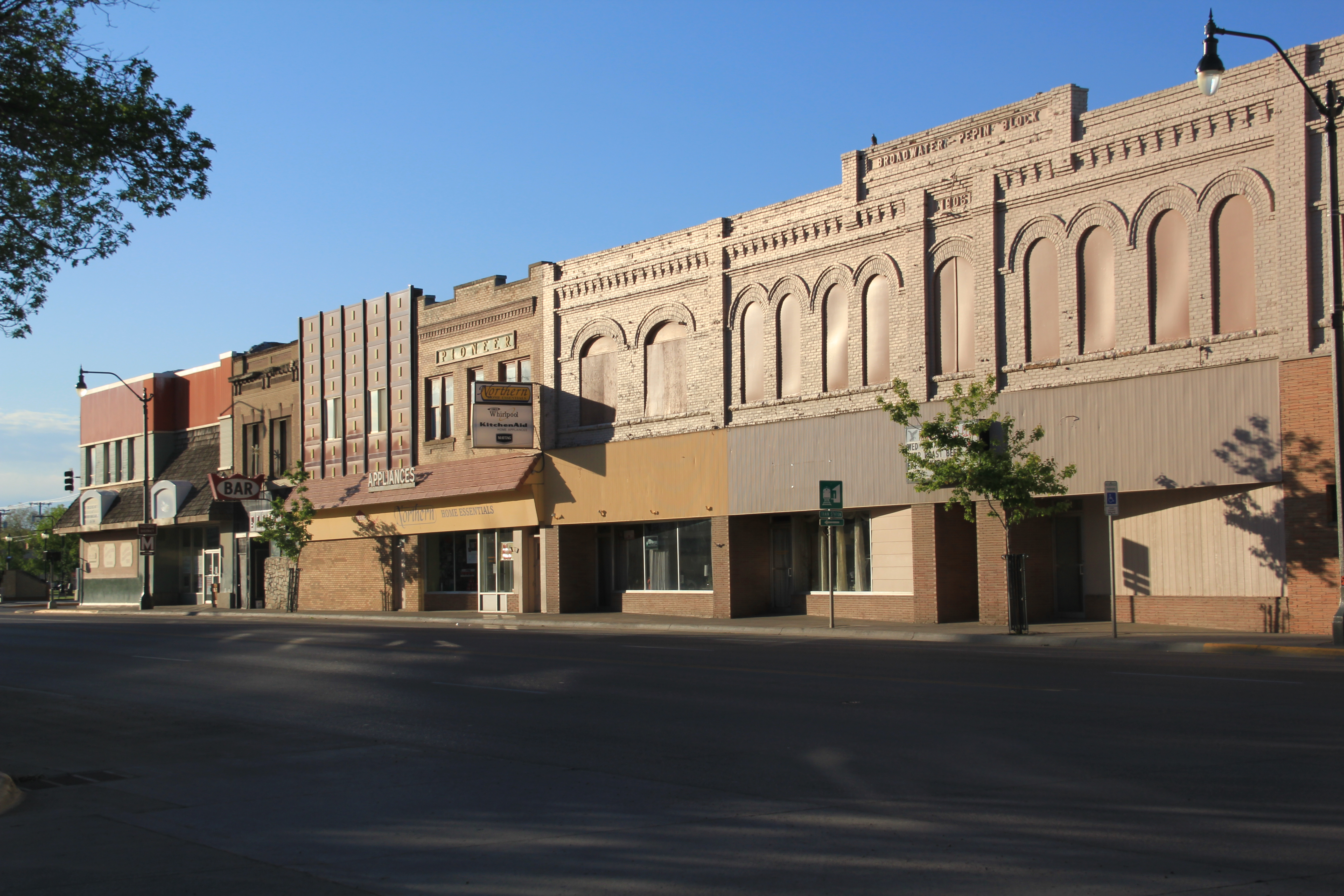
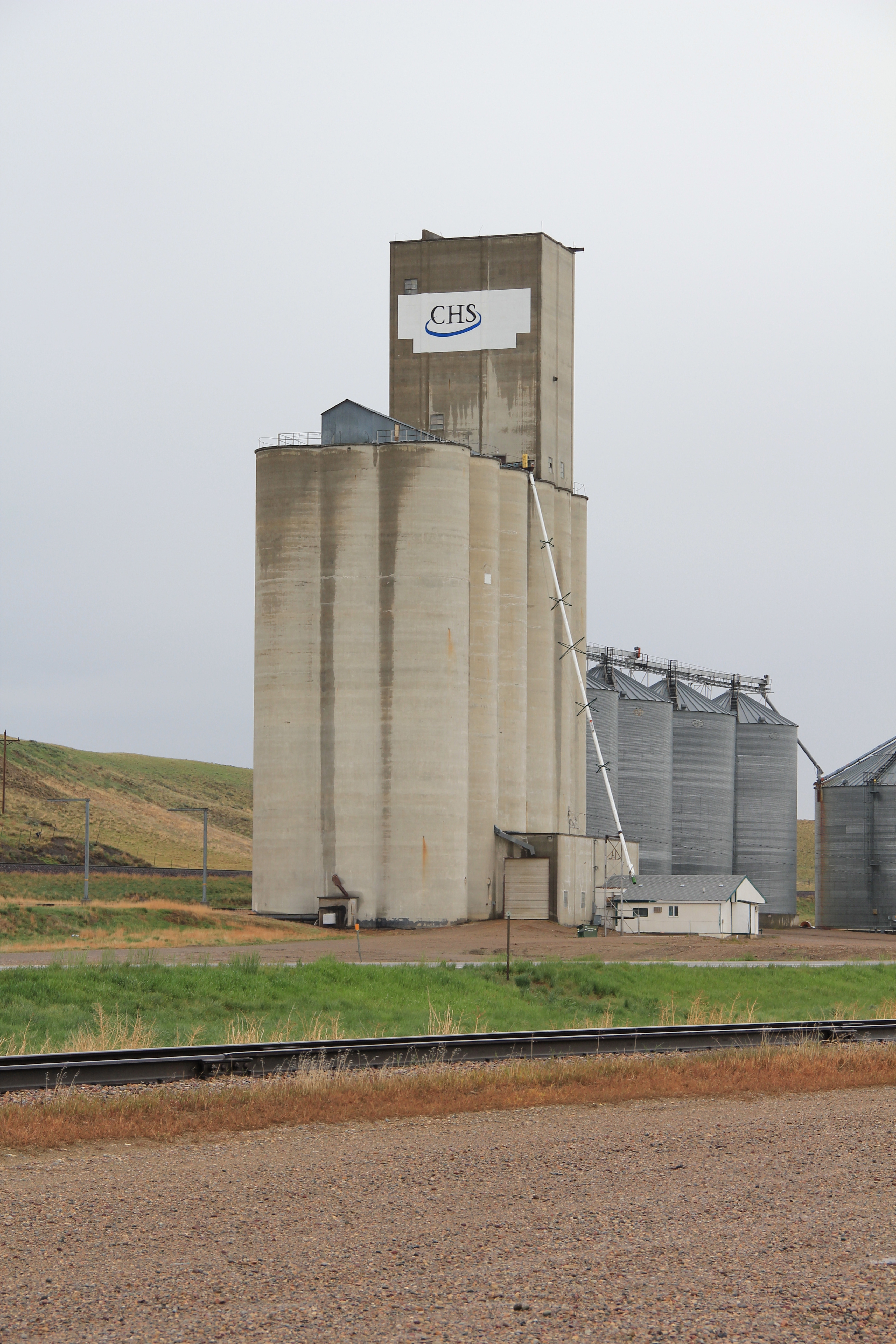
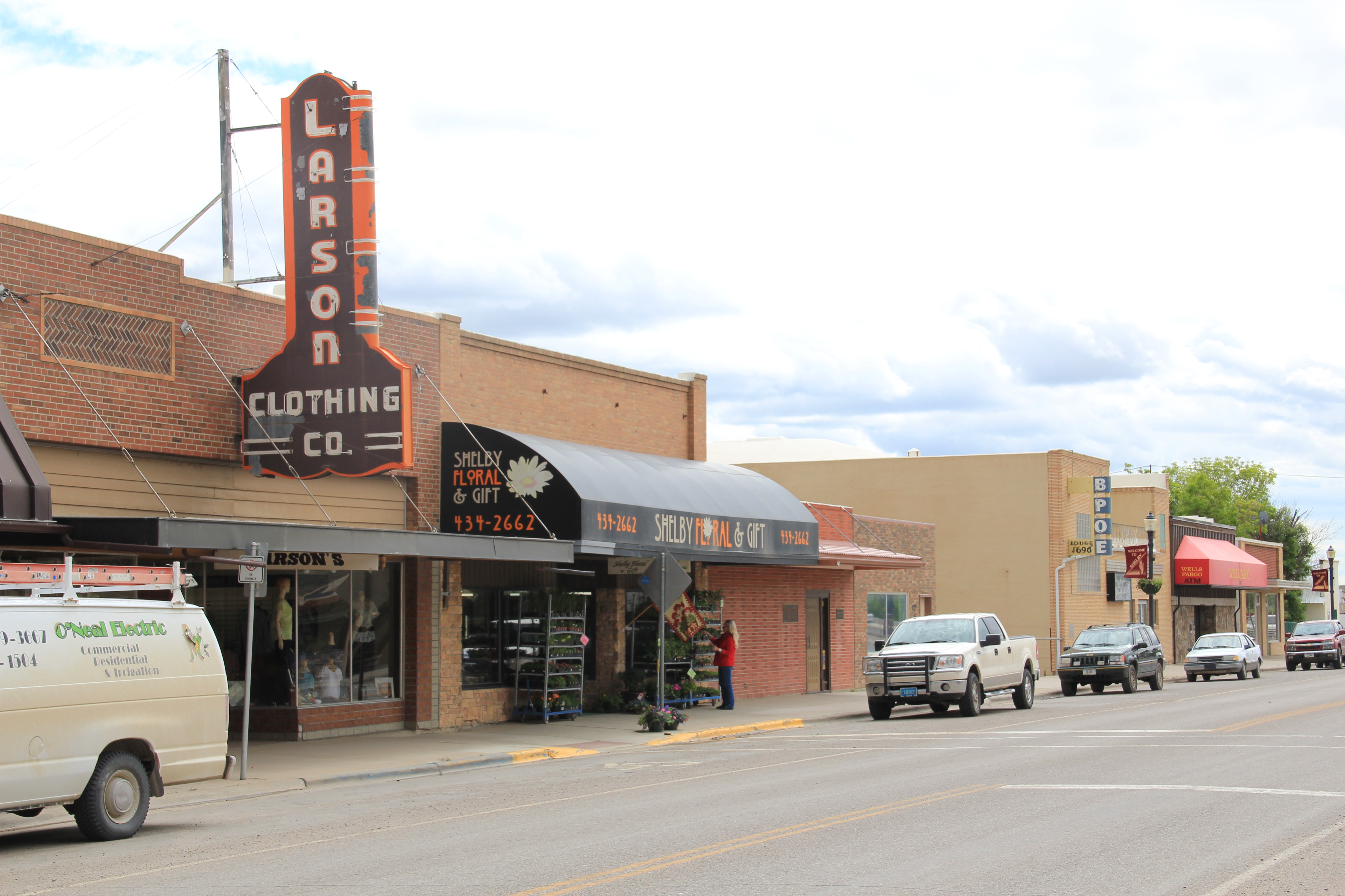
As soon as you move east of the historic Shelby visitor center on U.S. 2, you encounter the landmarks that physically mark the region’s agricultural character.  On the north side of the highway, immediately adjacent to the tracks are complexes of grain elevators. Here at Shelby there is a tall concrete group of elevators run by CHS–the appearance of concrete elevators always mark a town that has experienced economic growth in the second half of the twentieth century.  Many of the smaller Hi-Line towns have the classic frame elevators of the homesteading era.  Grain elevators thus become a physical barometer of a place’s economic prosperity and development.

Image Image

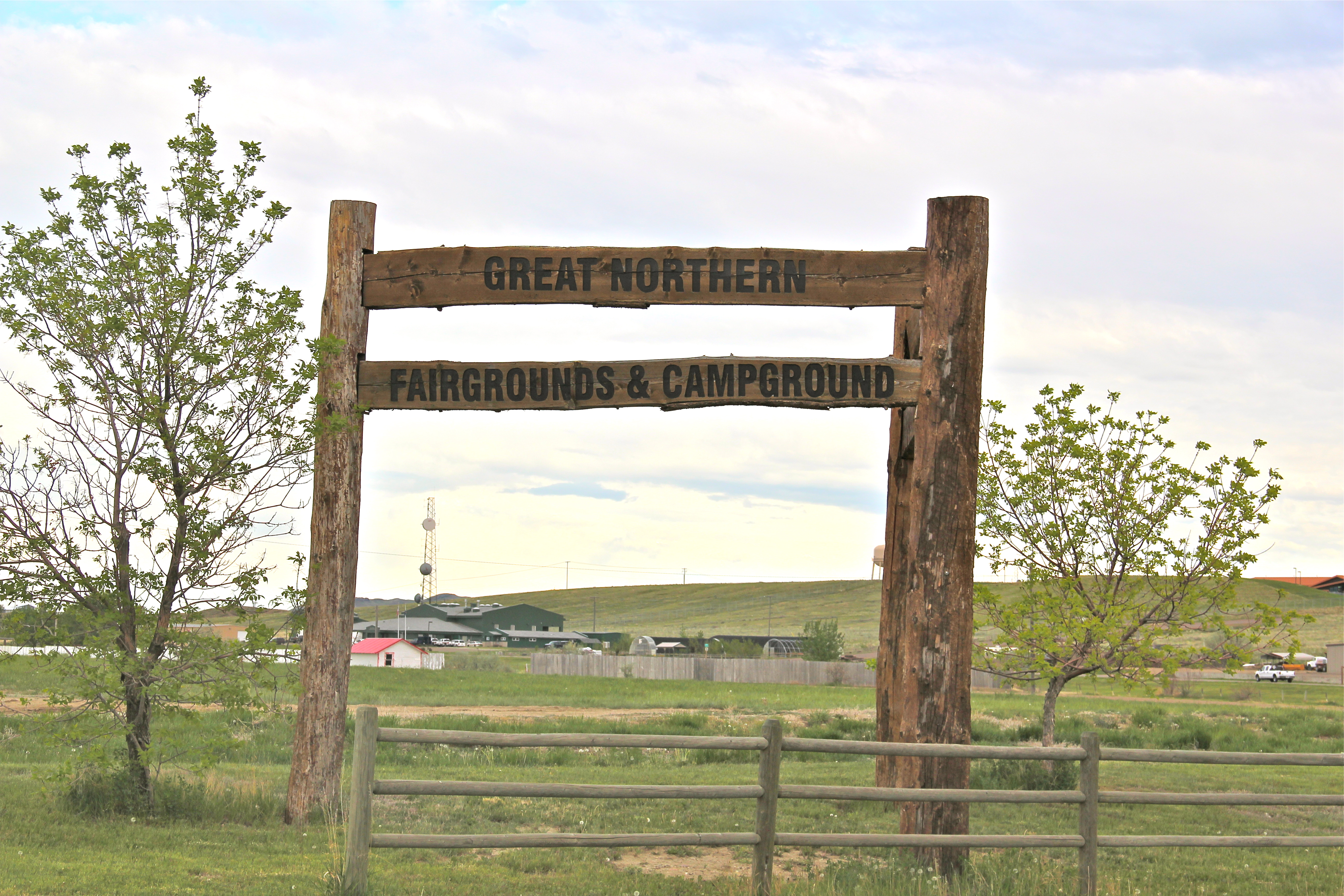
On the south side of the highway in Shelby is the second crucial agricultural institution, the county fairgrounds and rodeo arena.  Livestock is not only important to the economy but maybe even more important to the culture of the region.  The Marias 4 County Fair, held the third week of July, is a regional gathering of no equal.  Thousands attend, and they do so at a fairgrounds with an impressive collection of historic buildings.

Image Image

Image

In 1984, I noted this east side of Shelby as I left the town, but my eyes and camera were focused on the small railroad towns that I would next encounter, along with two important historic sites I wanted to document.

Image

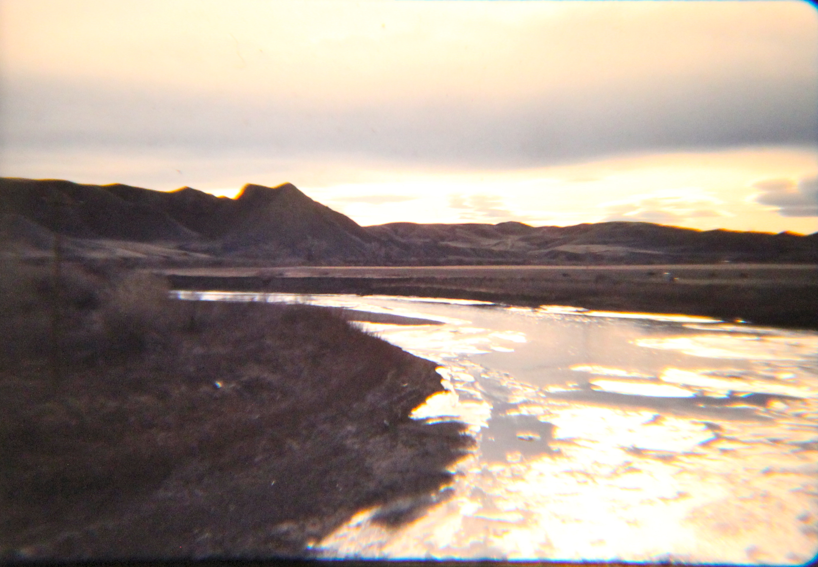
Whoop-Up Trail site, U.S. 2, 1984 

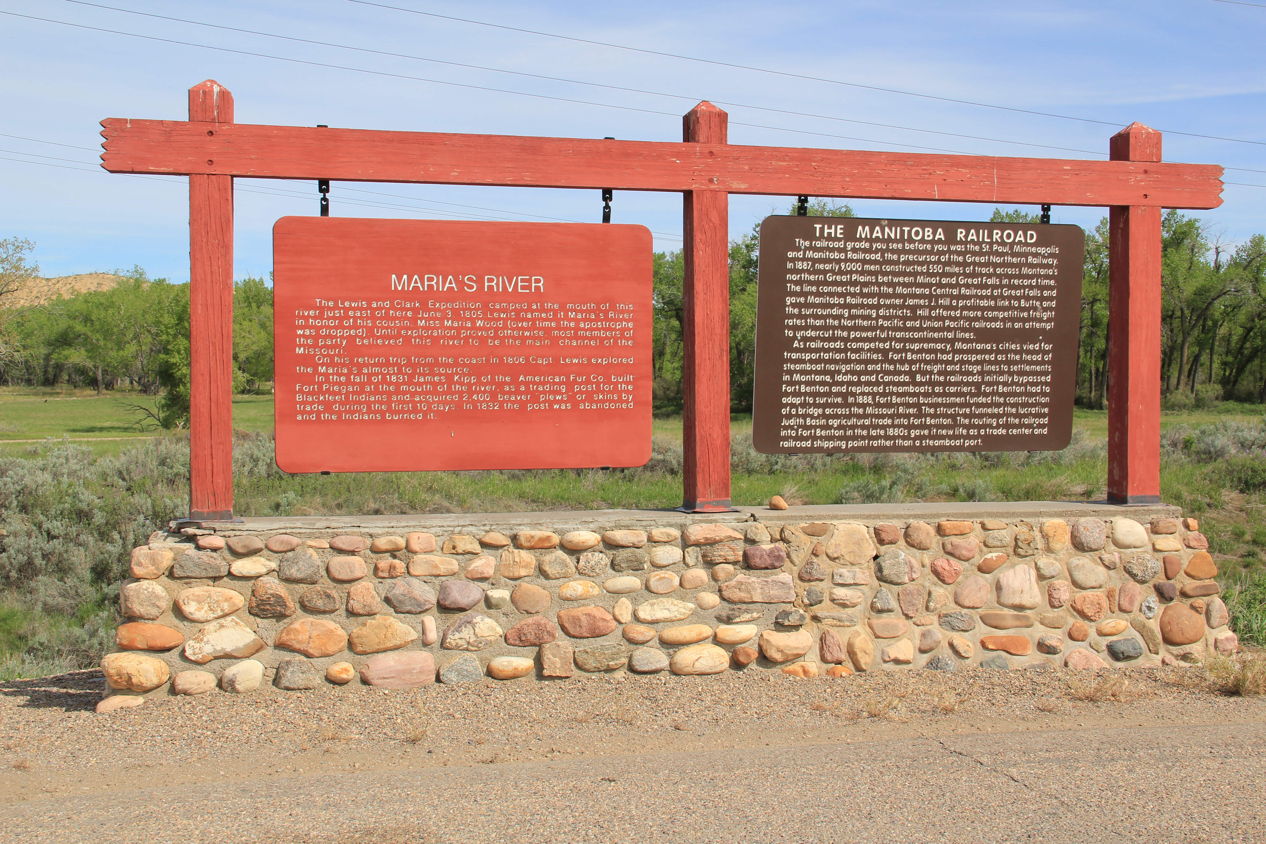
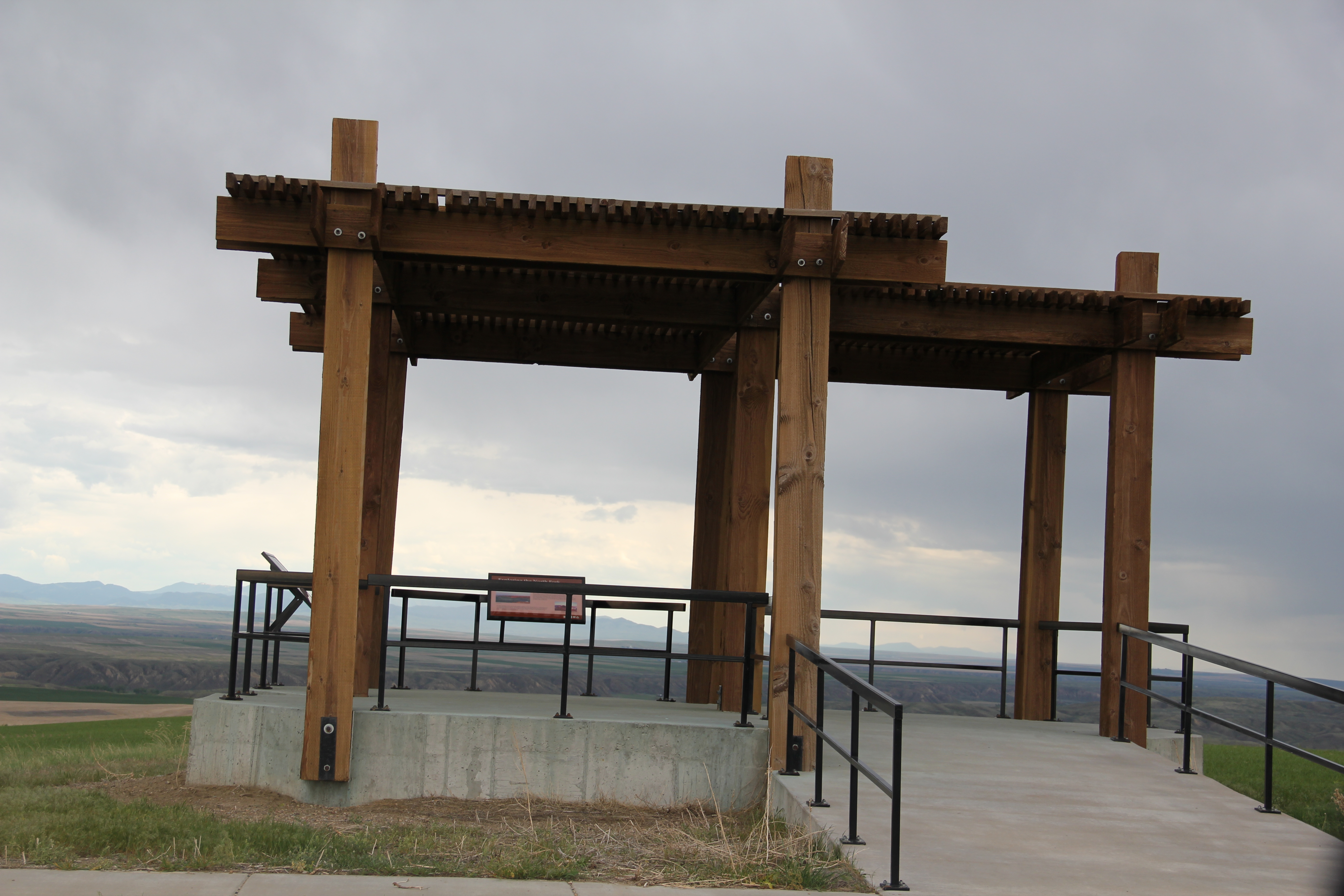
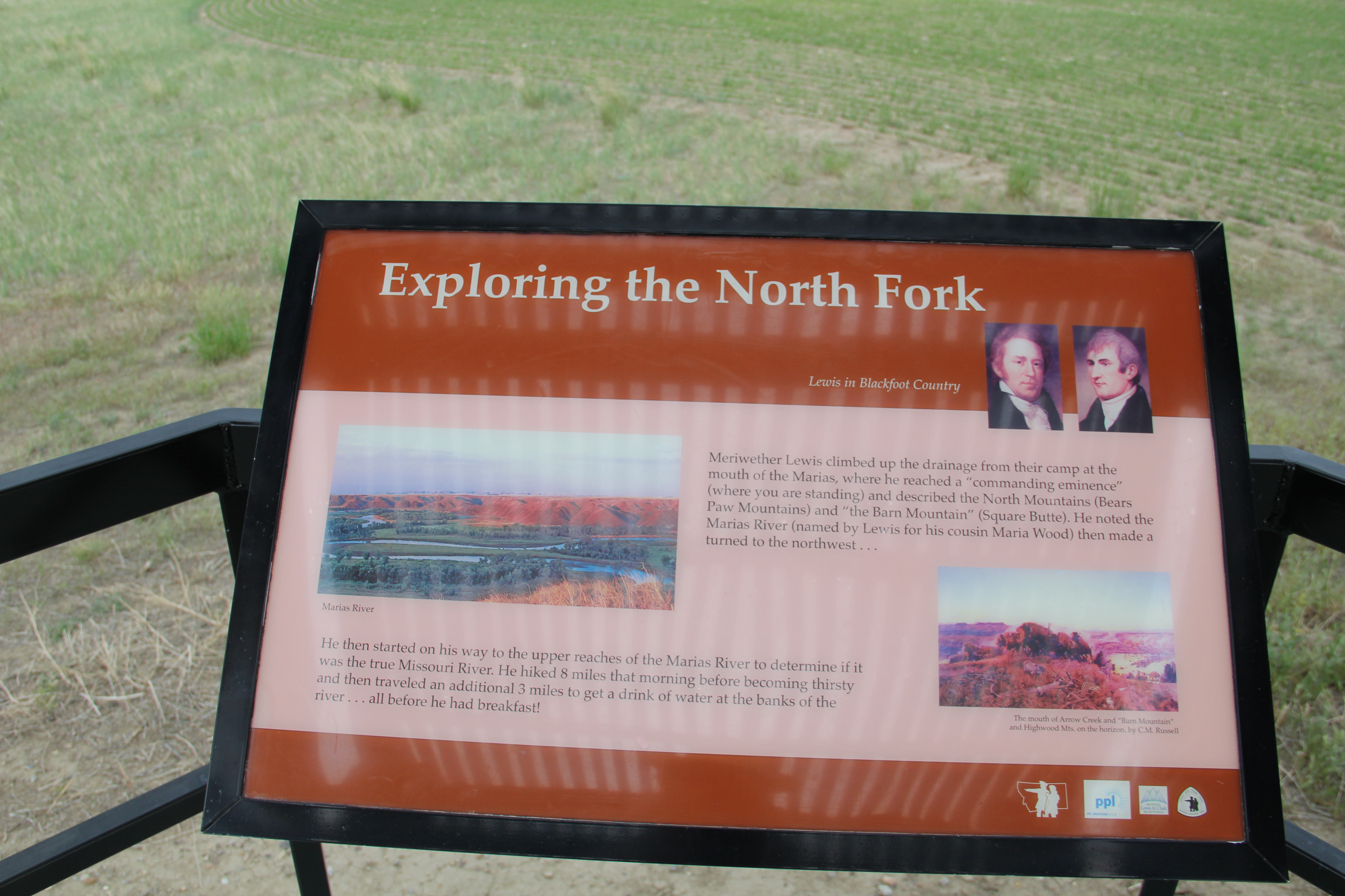
The first was the Whoop-Up Trail remnant, a site first documented by state archaeologists in 1968 and among the handful of historic properties then identified in Toole County (another section of the trail near Kevin is listed in the National Register).  In 1984 the location along the highway was well marked, with a series of stones marking the trail and encouraging visitors to go to the property edge and look into the Marias landscape where this historic route between Fort Benton and Fort Whoop-Up in Canada once passed.  

 Image 
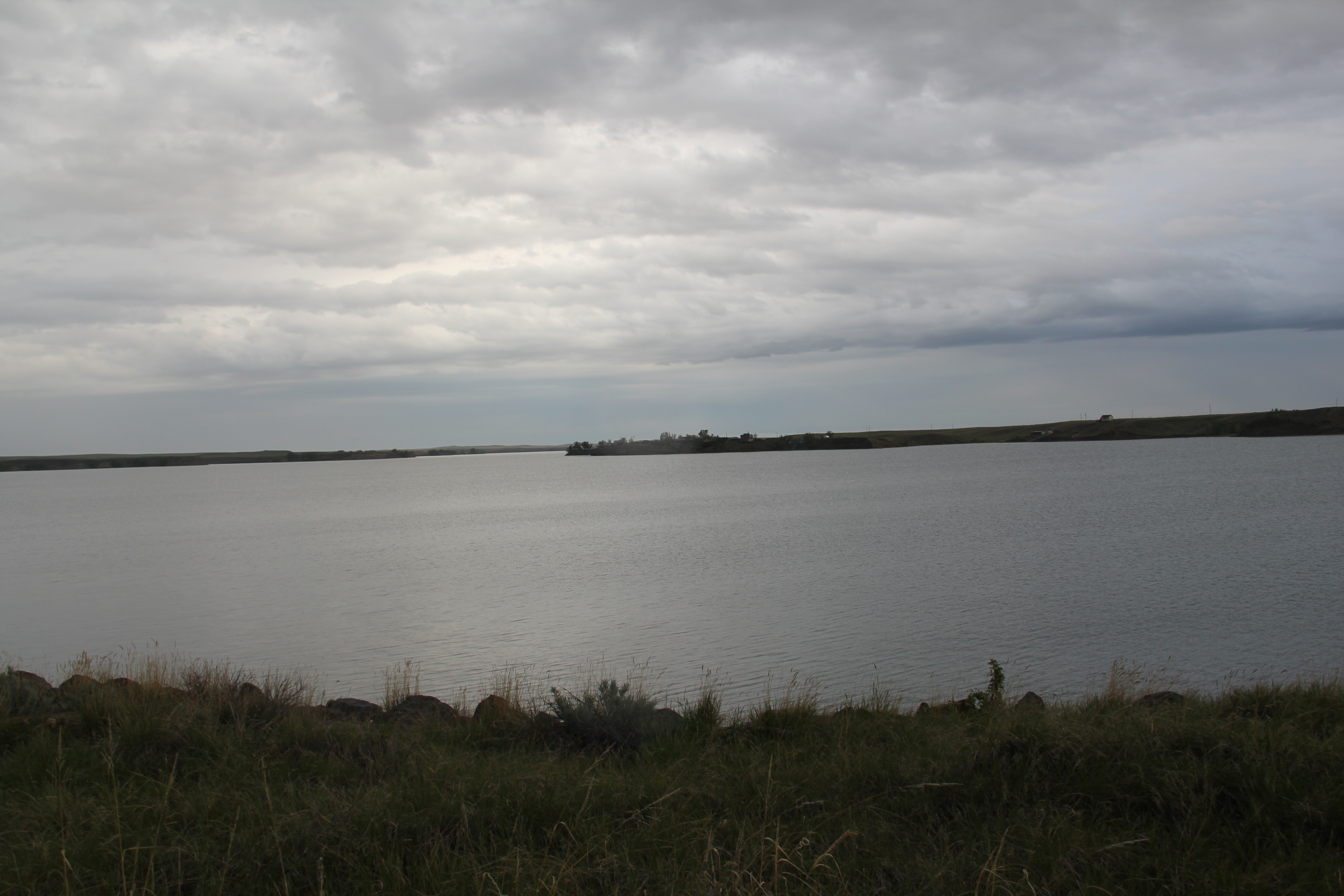
In fact to the south of U.S. 2, a county road still crosses the Marias near the old trail crossing:  it was a somber, beautiful place in 1984. In 2013, the Whoop-Up Trail site is still maintained, put the line of stones to mark the path has either been taken up or covered by growth.  

 Image

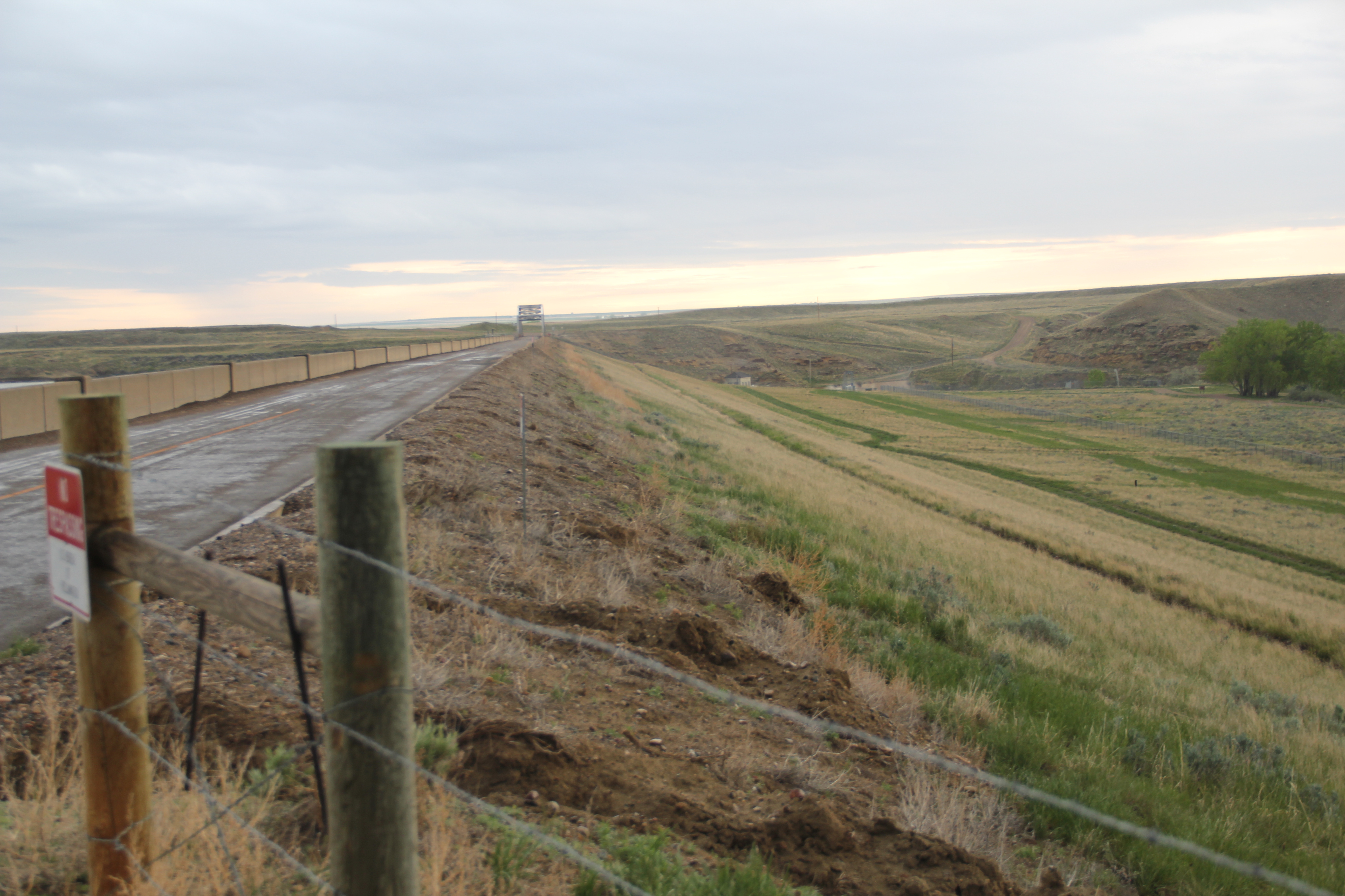
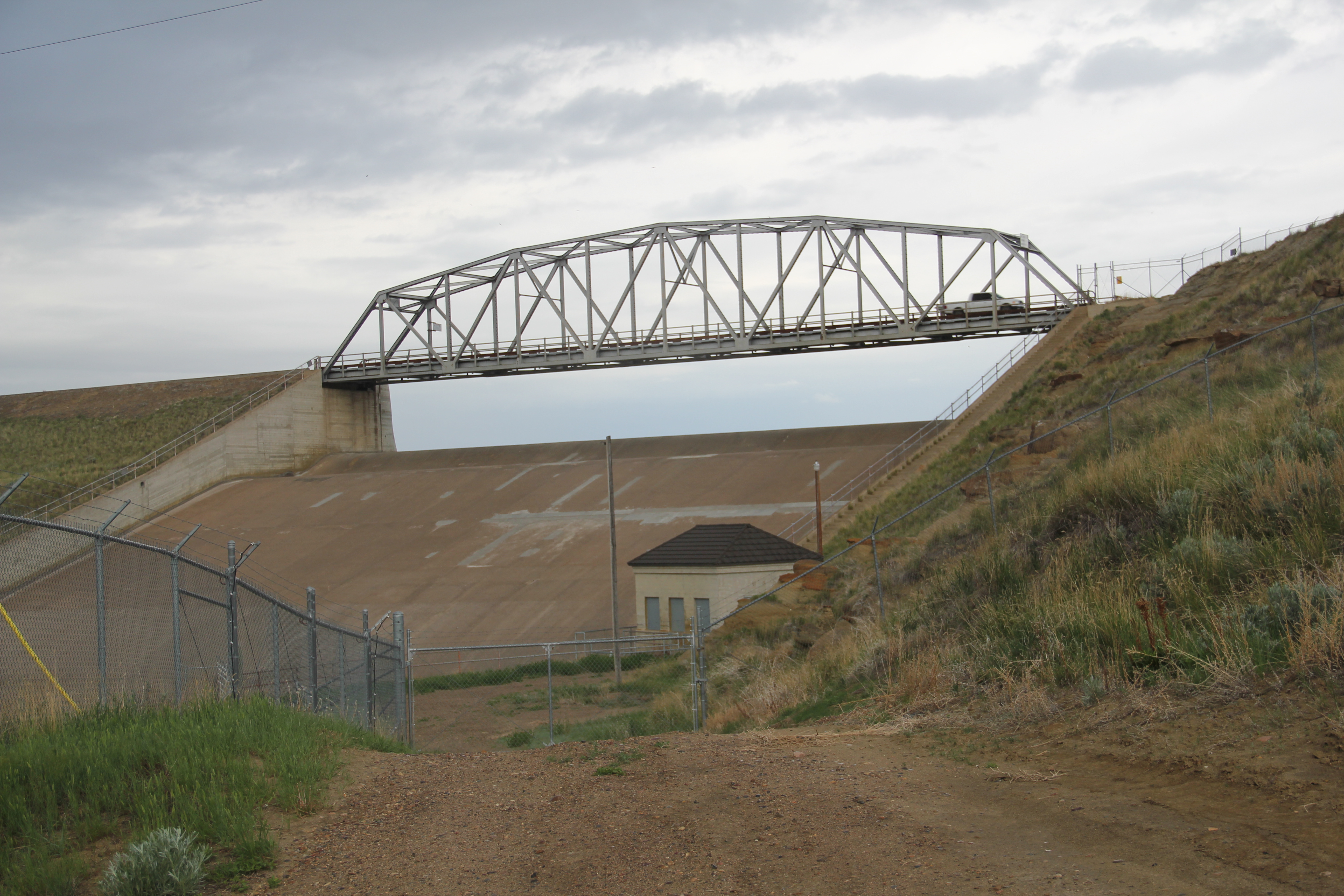
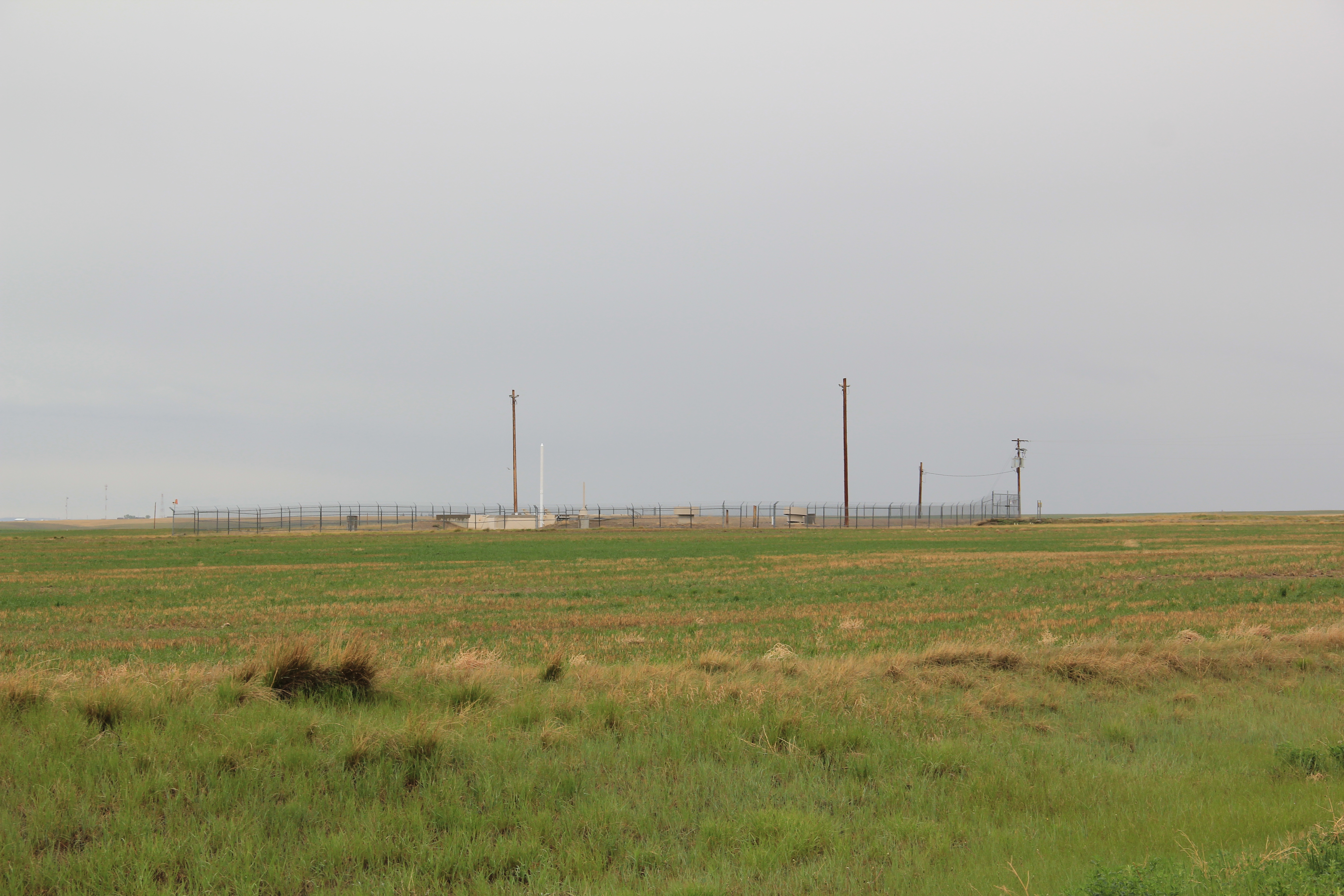
Across the highway remains another key landmark of the Hi-Line and Central Montana region:  a nuclear missile silo. These military bases are everywhere it seems, and sometimes in the most unlikely places.  By 1984 I had become somewhat accustomed to their presence–coming from the South I had no idea of the role Montana played in our nation’s defense.  

 Image

But the missile silo was a surprise:  what I really was seeking was something on the Marias River–or Baker–Massacre, one of the most horrific events of Montana’s early territorial period.  The site is east of Shelby and south of U.S. 2 on private ranch land–and the family has been excellent stewards of this place.  No need for me to tred on such sacred ground, but there is a need to intepret that story, and to tell visitors and residents that here in this seemingly peaceful beautiful countryside a group of territorial citizens murdered Blackfeet women, children, and elderly in some sort of mindless bloody search for revenge.  That story wasn’t told in 1984 but a long text marker does so now. It strikes the right message: that the massacre “profoundly impacted the Blackfeet people and is very much alive in tribal memory.”  A small bouquet of flowers at the marker’s base in 2013 testifies to the truth of this simple memorial.

 Image

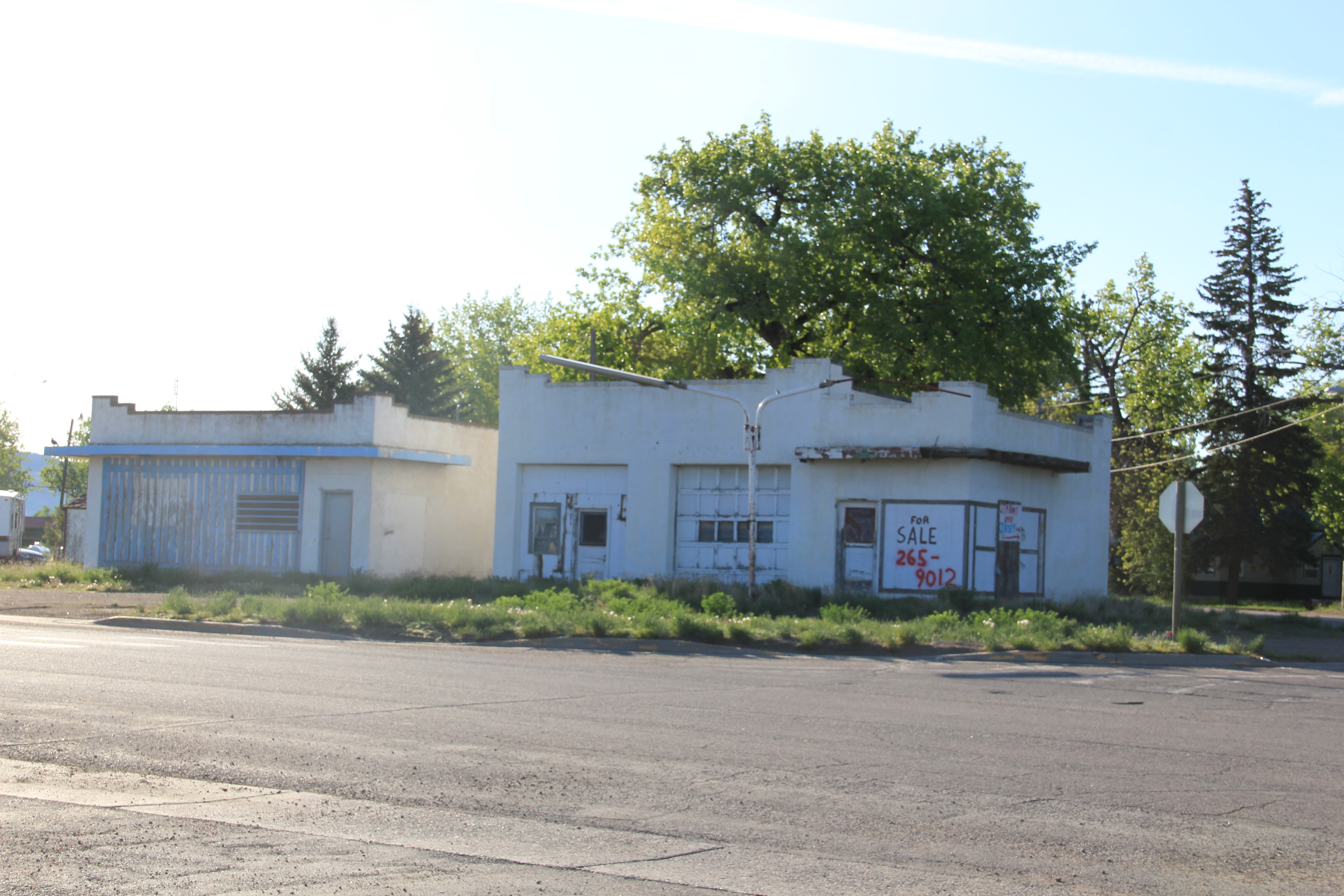
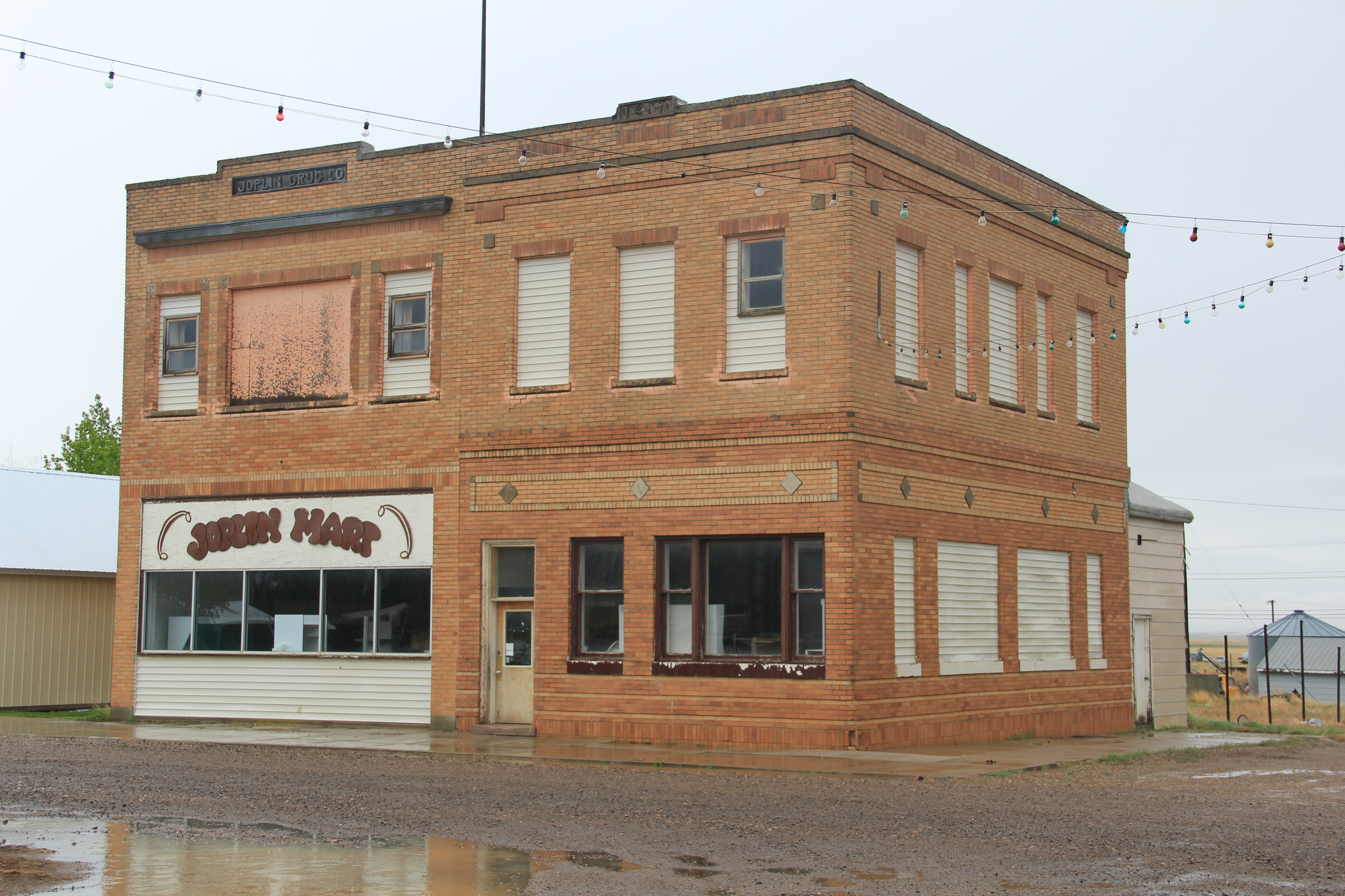
Dunkirk, the first of a trio of Toole County railroad villages east of Shelby, was too close to Shelby itself to ever maintain its own identity for long.  Its Frontier Bar was long a worthy roadside stop for thirsty travelers.  Outside of the Westermark Grain Corporation elevators, the bar was the only reason to even give Dunkirk a glance.

 Image Image

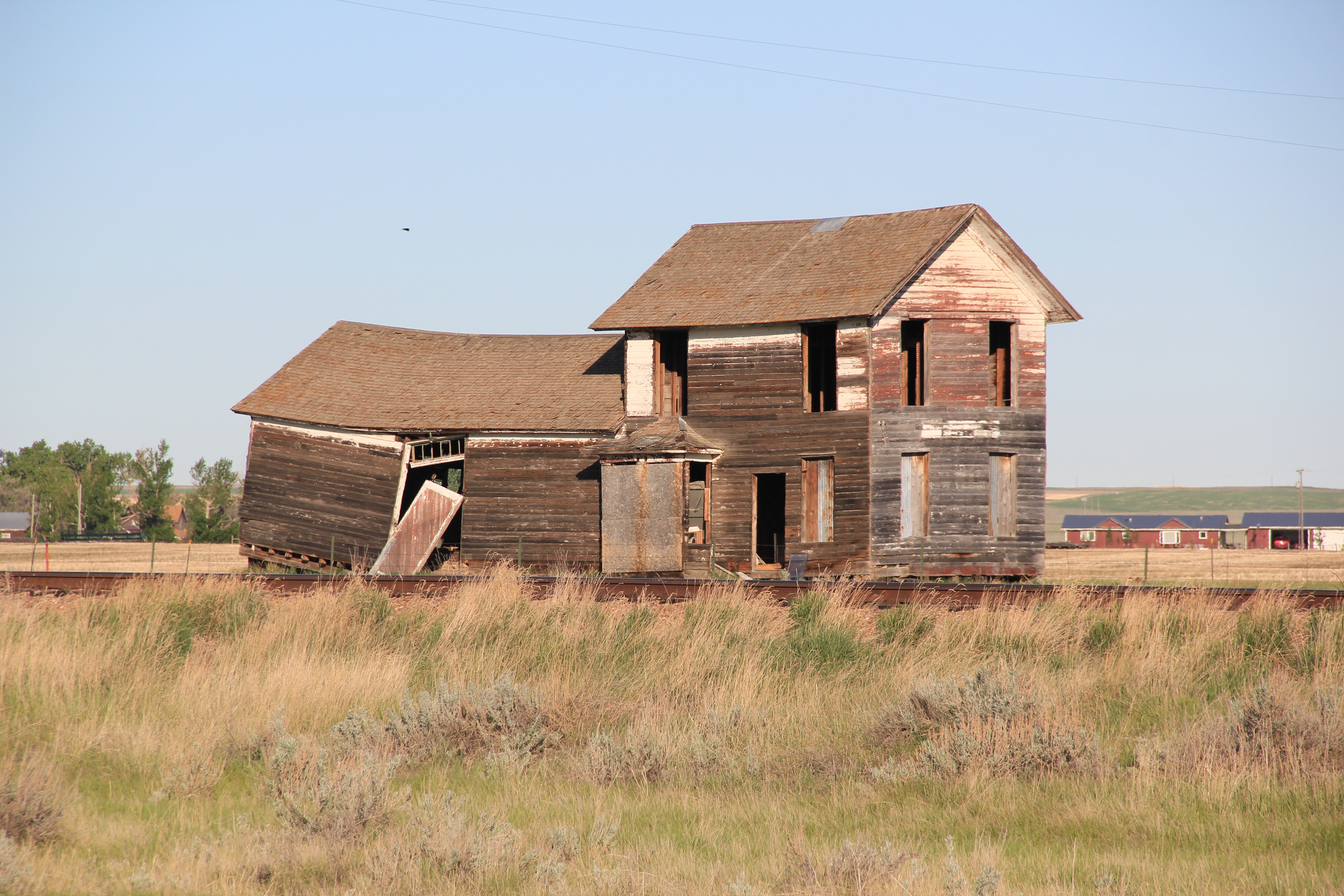
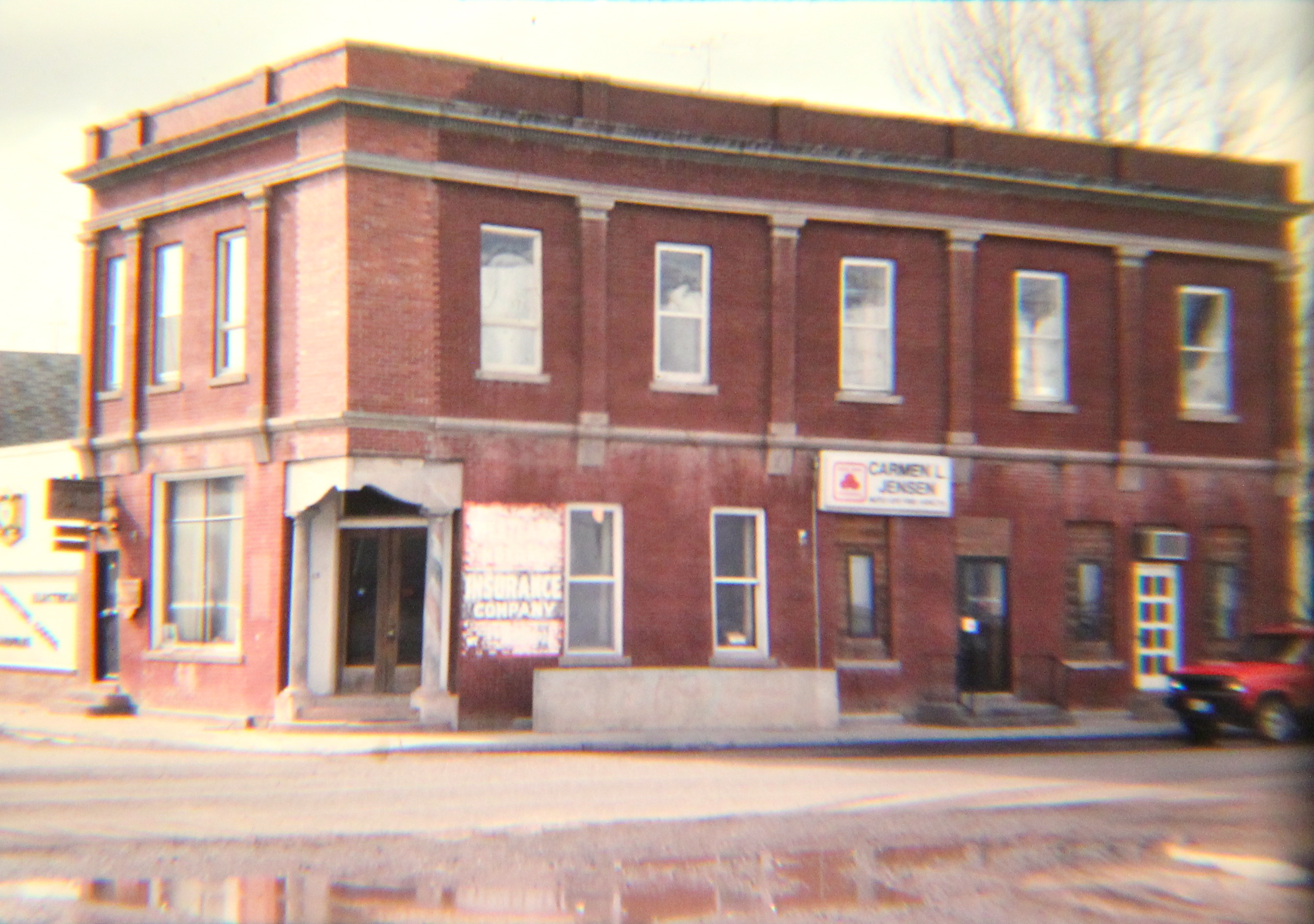
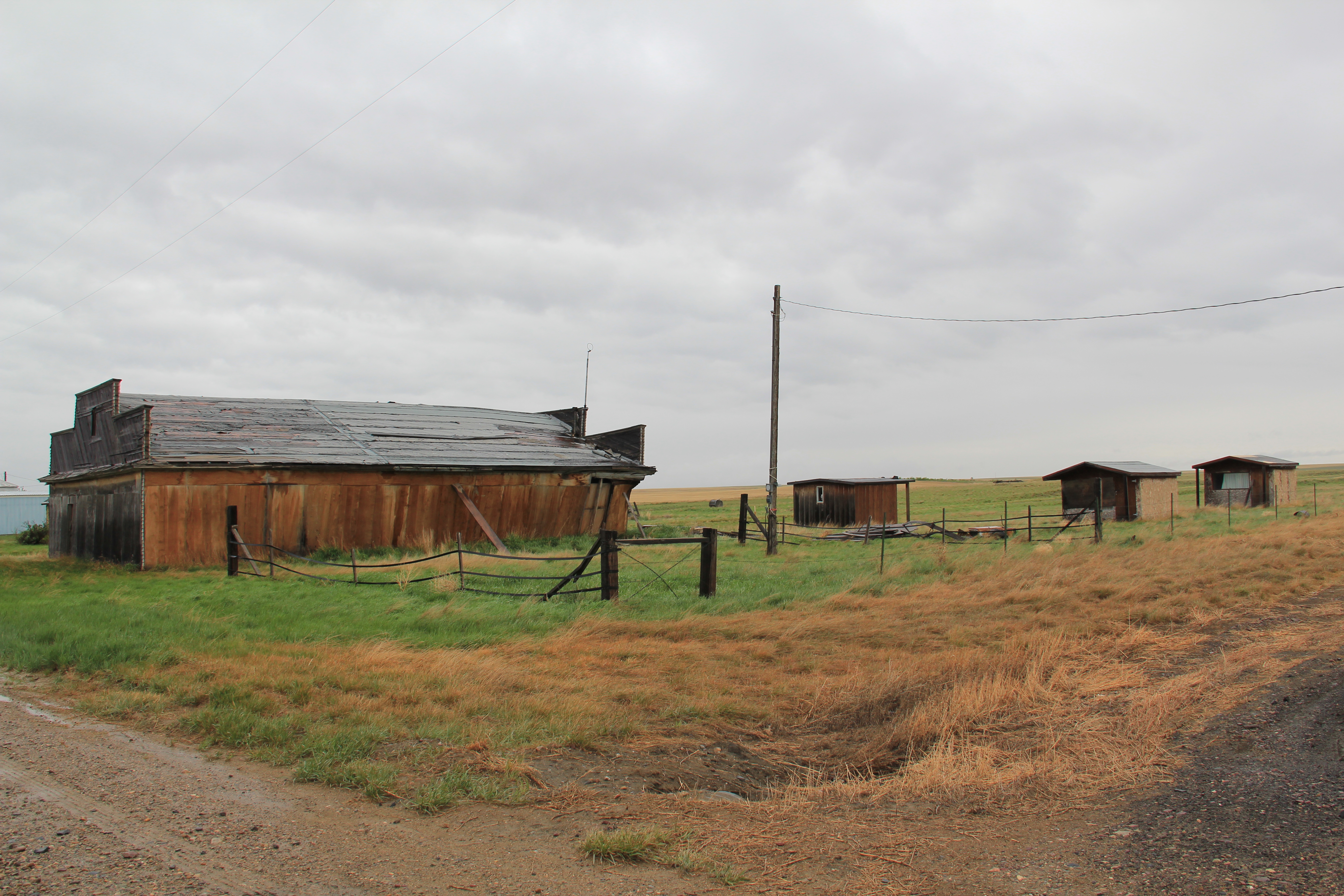
Devon is a plains country town on the Great Northern Railway that was the first “prairie ghost town” of the 1984 survey.  Numerous false-front frame buildings from the 1910s and 1920s existed in 1984:  30 years later several of these were gone. 

Image


Image

Devon streetscape, 1984


Image

Devon, Montana, 1984

Image

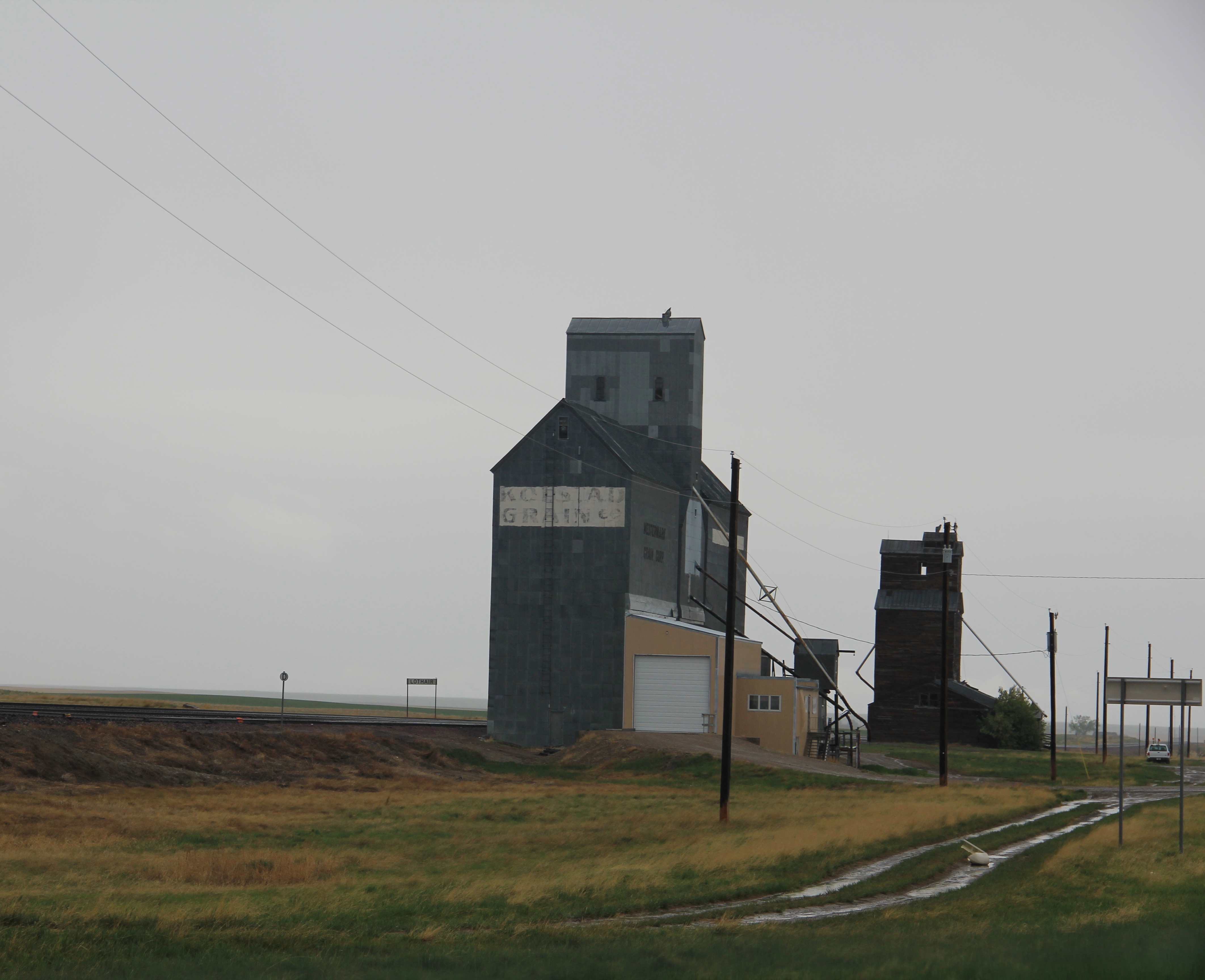
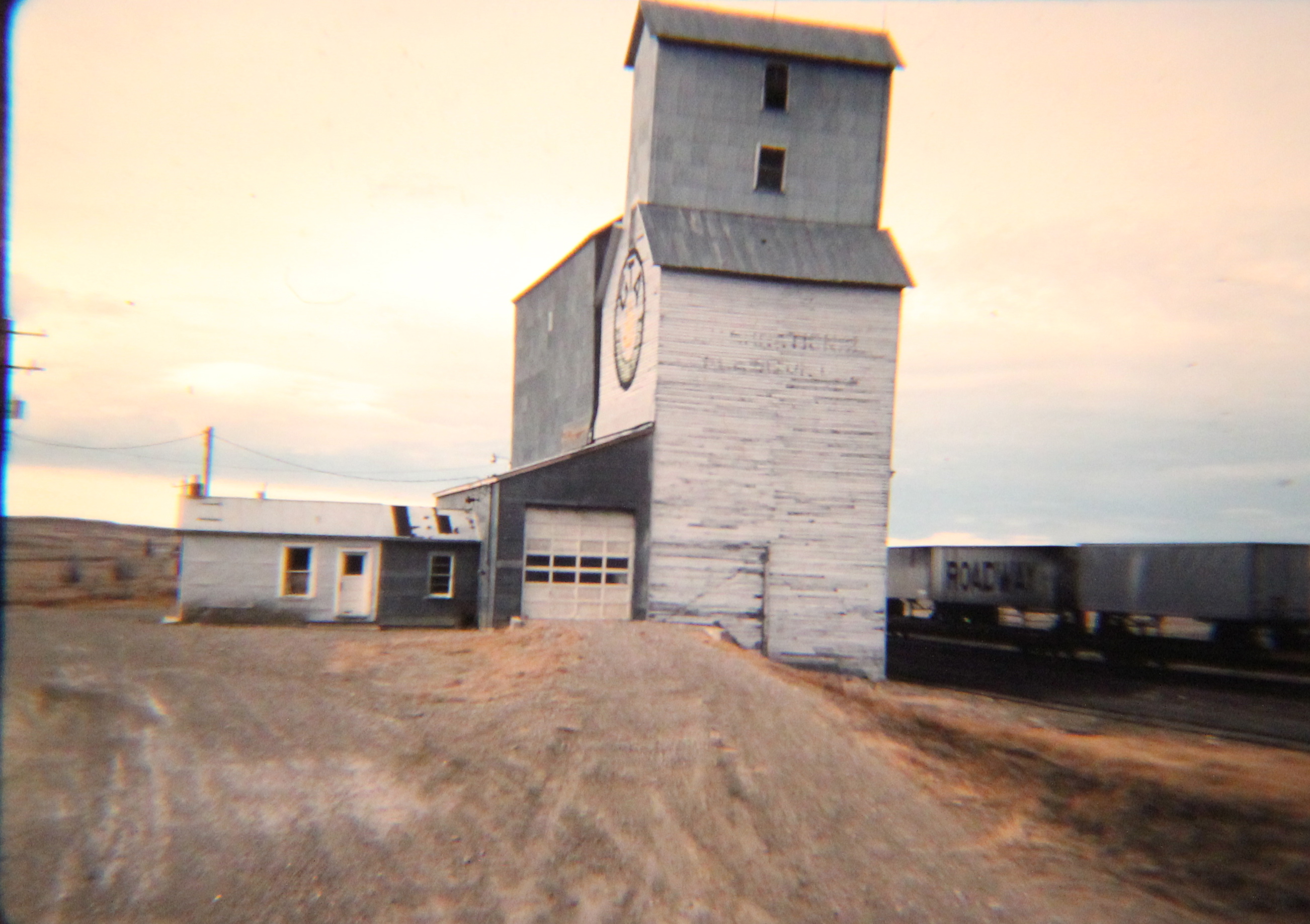
Devon grain elevator, 1984

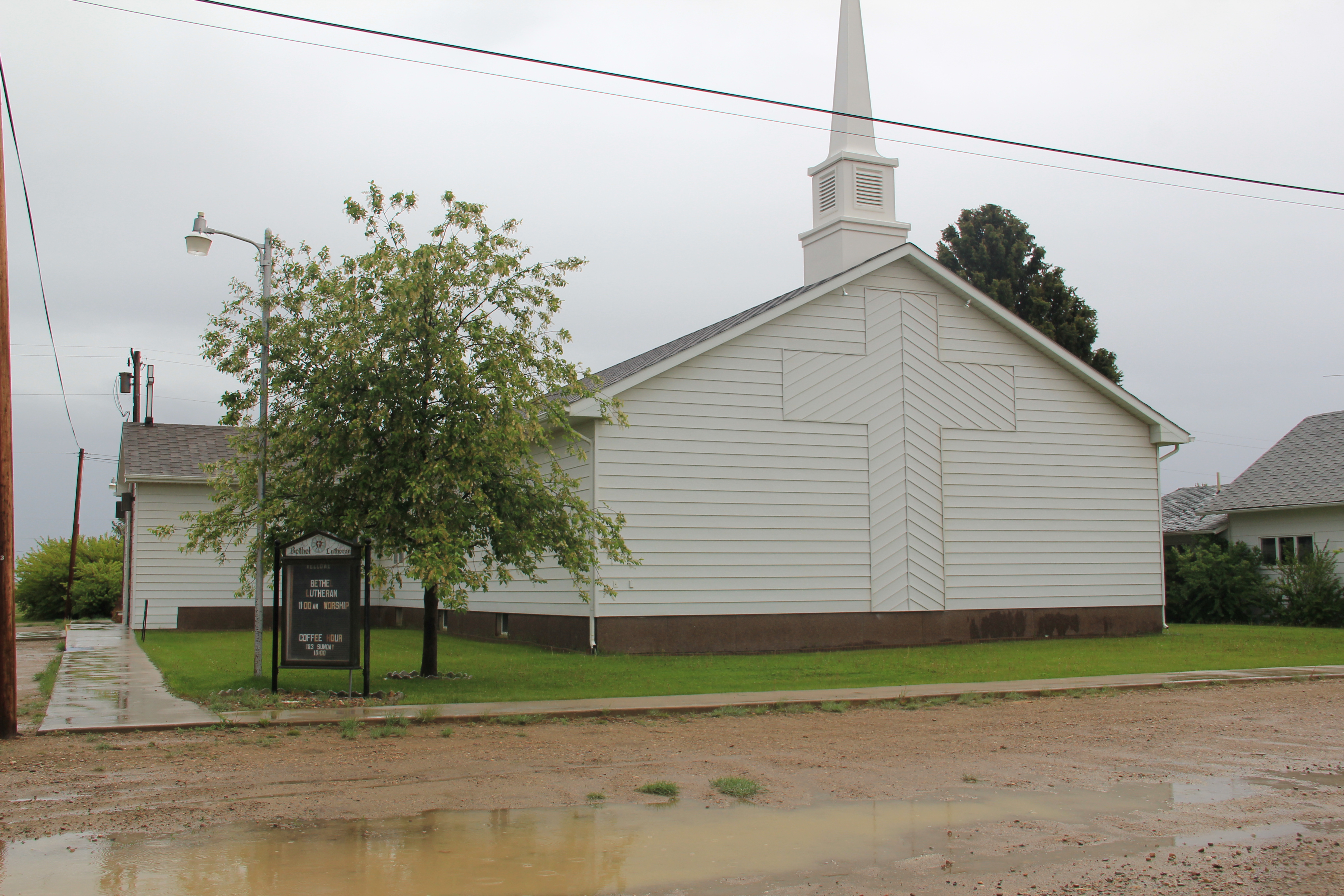
Yet I must admit that Devon now had more to it than what I recalled from 1984.  Certainly the old brick bank building had been abandoned, and the town community hall appeared shuttered, but the contemporary-styled Devon Lutheran Church spoke to persistence, even after decades of economic change. The grain elevators that were prominent in 1984 also had persisted, and stood as three sentinels on the plains.

Image Image

 Image


Image

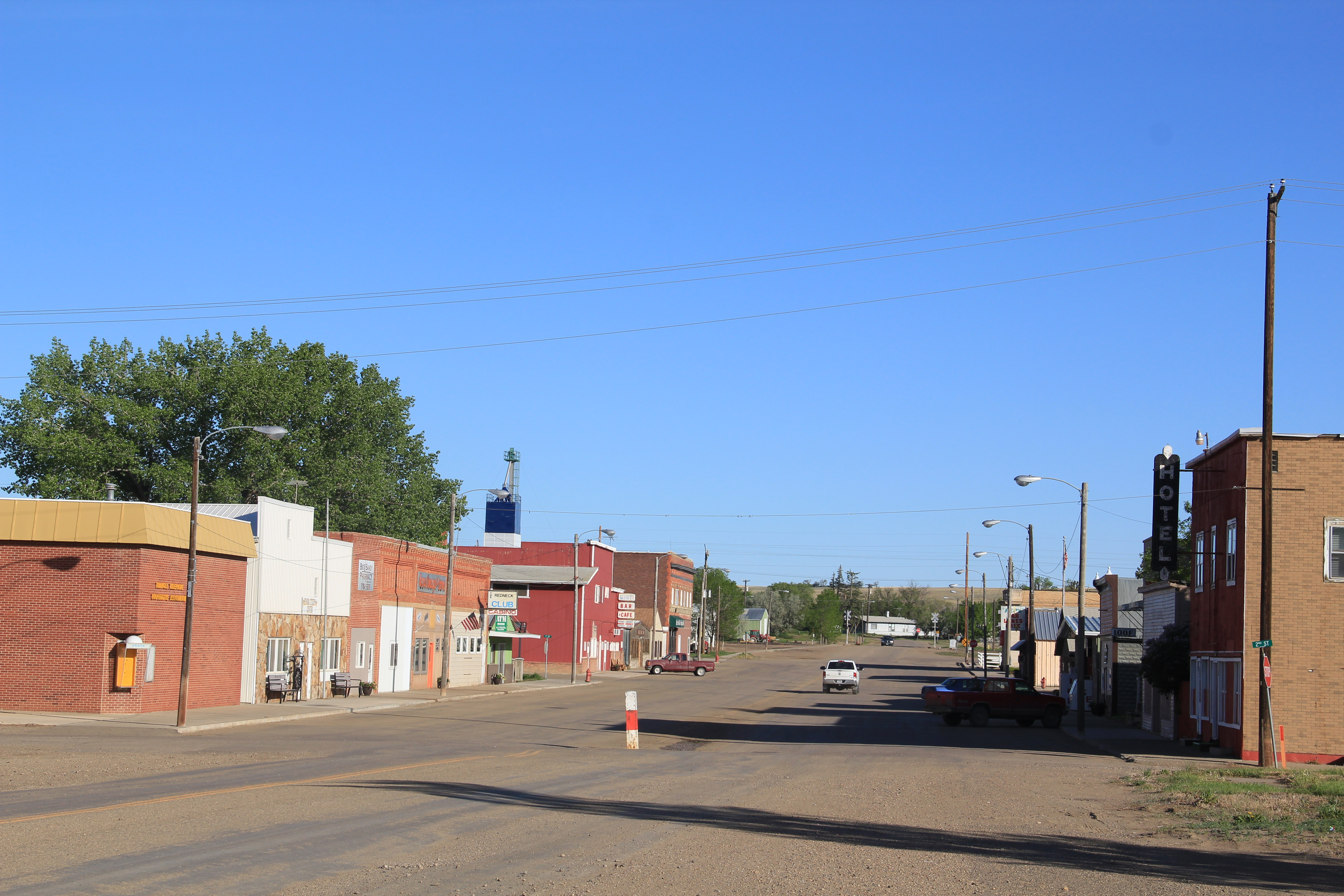
Galata, established in 1901, is another Great Northern Railway stop, with its corridor landscape speaking to its isolation and agricultural dependence.  It is a T-town plan town, where the main street forms the stem of the T while the railroad tracks form the top of the T.Image

 In the latter half of the 20th century, Galata had actually reached beyond its T-town plan and out to the highway.  Its Motel Galata is a classic piece of roadside architecture, and its huge highway sign of a Montana frontiersman with cowboy hat waving his car keys beckoning travelers to stop.

 Image

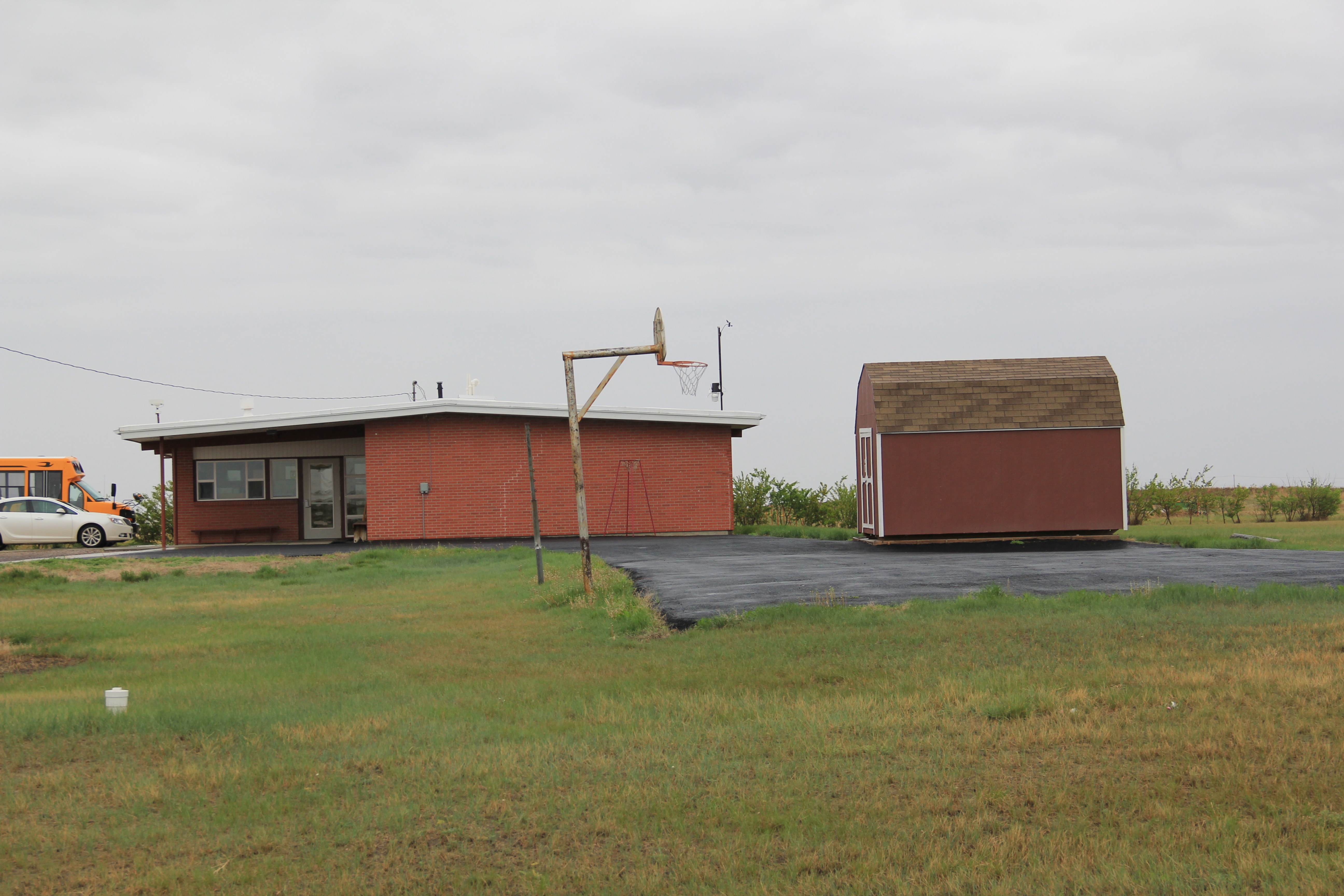
Galata also has kept its post office–a classic 1960s standardized design.  But the real key is the strength of its community institutions, churches, American Legion lodge hall, and especially the

Image Image

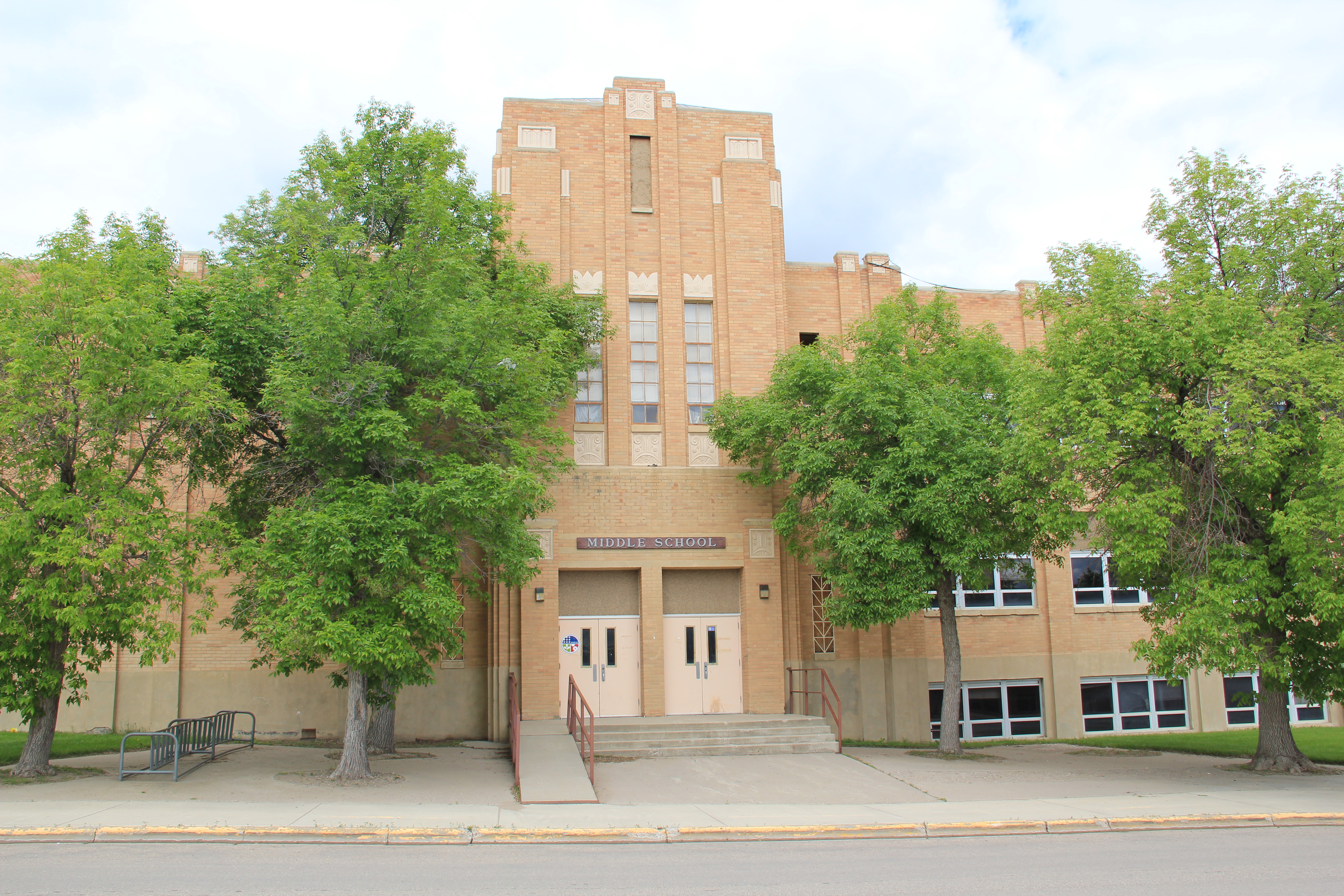
school.  The school campus contains two eras:  the classic frame country school of the homesteading era, with additions, and then the more ranch-styled flat roof school building common in American suburbs in the 1950s and 1960s.

 Image Image

As discussed earlier in this blog, Hi-Line residents also make their presence known by signs, even if they are a little worn or emblematic of the loss of other community buildings.  Galata is no exception.

Image

Image 

Toole county, 1984 and now: Day Two

ImageToole County, second day: As I ventured out from Shelby into Toole County in February 1984 I followed old US Hwy 91 route (surpassed then as now by I-15)  into an early 20th century  oil patch region–the Kevin-Sunburst field–that had been discovered in the 1920s during Montana’s initial oil boom, but had dried up until the 1950s, although limited production remains even today.  In 1984 everyone in Helena thought that I should give the region a look for early resources associated with the oil industry.

Oilmont school had closed already in 1984 but the hipped roof frame building remained as a symbol of the boom days.  Thirty years later, I was surprised to see, the school was still there, barely–the years had not been kind to it. Jerry Funk in his memoir, “Life is an Excellent Adventure,” recalled that “The school plant itself was an ungainly hodge-podge of after-thoughts and additions and mismatched free-standing structures.  Its construction was obviously undertaken, with boom-town gusto and elan, as and when new space was needed, without the constraints of dealing with architects and planners.  The result was perhaps not what one would call pretty, but it was quite serviceable, and certainly memorable.”

ImageBetter stories in 2013 awaited me in Kevin, to the west. Here the historic Kevin depot, which is listed in the National Register, had been moved off the tracks, but it had been converted to a community center and senior citizens center, a very appropriate and successful adaptive reuse.  The town numbers under 200 residents and their commitment to keeping this connection to the town’s railroad roots along this spur line alive and well is commendable.

Image

Image

Image

Image

Also in Kevin in 1984 a circa 1930 service station caught my eye, with especially the period “Firestone” signs. ImageRather amazingly the building still stands at the town’s prominent corner, although the roof is sagging and its original function is more difficult to discern today.

Image

Another favorite building in 1984 was the Derrick Bar, a friendly place where the very name spoke to what was happening in Kevin in the mid-20th century. Its miniature derrick sign, on the top of the building, was a beacon; unlike anything else I would see in Montana.

Image Image

The bar is still there–still friendly too–but the derrick had come off of the top–although it too was preserved on the side of the building.

Kevin-Oilmont was a section of Toole County that had promised untold wealth in the 1920s and 1930s–and the boom at the Kevin-Sunburst field helps to explain the strong imprint of 1930s modernism in Shelby.

The most important Jazz Age building in Shelby is the visitor center, from 1923.  Listed in the National Register, the building served as the local headquarters for the city’s ambitious attempt to host a world’s heavyweight fight between legendary boxer Jack Dempsey and Tommy Gibbons.  Flush with oil money, town boosters thought the fight would put Shelby on the map, but the projected tens of thousands of spectators never materialized–only 7,000 made it to Shelby–and the event bankrupted the town.

Image

At the western end of the historic downtown is another National Register landmark, the Rainbow Service Station.  The development of U.S. 2 as the region’s key east-west automobile/truck corridor happened at the same time as the oil boom, and as auto travel to Glacier National Park also was growing in numbers.

.Image

In between these two landmarks grew an impressive collection of commercial buildings, along with some of the best roadside neon in the state. Modernism isn’t confined to the commercial strip.  There are impressive residential designs of International Style and Art Deco from the 1930s.

Image Image

And both the New Deal Art Deco high school (now middle school) and the contemporary-styled St. William Catholic School make their own statements of mid-century modern architecture.

Image Image

Shelby might be a modern urban oasis on the Hi-Line but as soon as I started to move east of the visitor center along U.S. 2 I discovered that I was entering a very rural, agricultural landscape: more on that later.