

Abandoned homestead in 1984, north of Joplin, Sweetgrass Hills in background
Liberty County, created in 1919 with Chester as county seat, was the next place I visited, and it proved to be one of my favorites along the Hi-Line. Stuck between the larger railroad towns of Shelby, a junction point, to the west and Havre, a division point with Great Northern maintenance yards to the east, the Great Northern never saw a need to invest in or to encourage investment in town development in Liberty County. In the 1910s, hundreds of homesteaders flooded into the area: this 1984 image above of an abandoned homestead with the sacred Sweetgrass Hills in the background is one of my favorities. Today a little over 2000 people live in the county.
Lothair was the first town I encountered in Liberty County. Its grain elevators called me off the highway in 1984; they remain landmarks today.
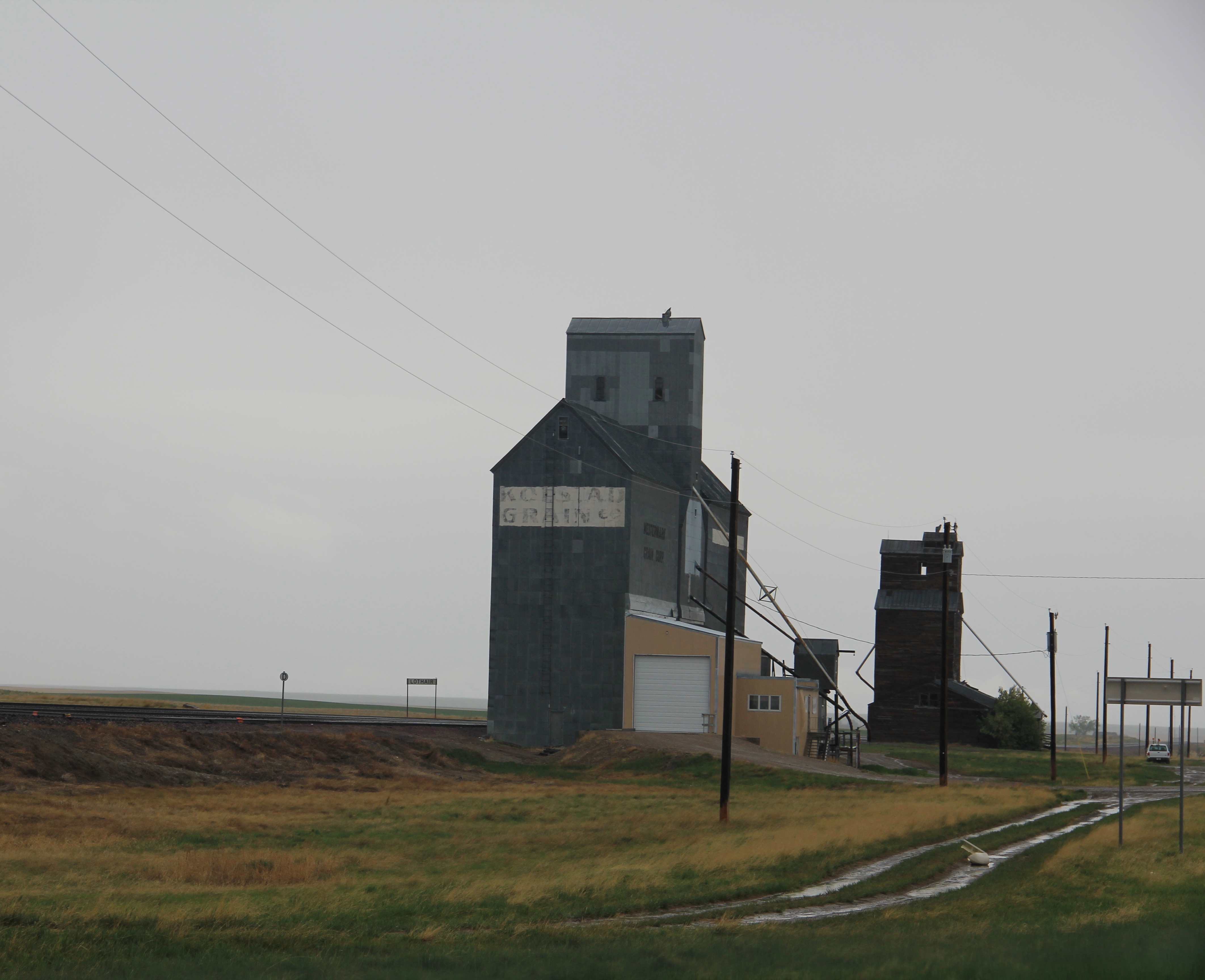
Nothing else much is there, although in the 1910s residents and nearby homesteaders petitioned the state railroad commissioners to force the Great Northern to treat their town more seriously. The 1918 petition, launched by the Lothair Commercial Club and others, called on the railroad to replace a depot that had burned in 1912. The residents complained that “the depot now in use is of the portable style 12×34 feet, which with a box car body for freight, constitutes the facilities for the handling of passengers, freight, baggage, and express, as well as for the housing of the agent and operator. . . . The waiting room is only of sufficient size to accomodate four or five people comfortably.” The petitioners argued that their town was at “the center of a very extensive dry land farming territory, nearly all of which has been filed on, but only about one-third is under active cultivation at the present time.” But the hopes of Lothair never survived the homesteading crash of the 1920s.

mid-1980s town sign of Chester
Chester has fared better. It retains a historic Great Northern depot, from the 1950s, although it was been moved from its earlier prominent location a bit farther to the east along the line.

Chester has a T-town plan, with one attribute that I later found in other turn-of-the-century Montana railroad towns: an architecturally compelling two-story brick building on one corner, situated so its entrance faced both the tracks and the highway that paralleled the railroad.

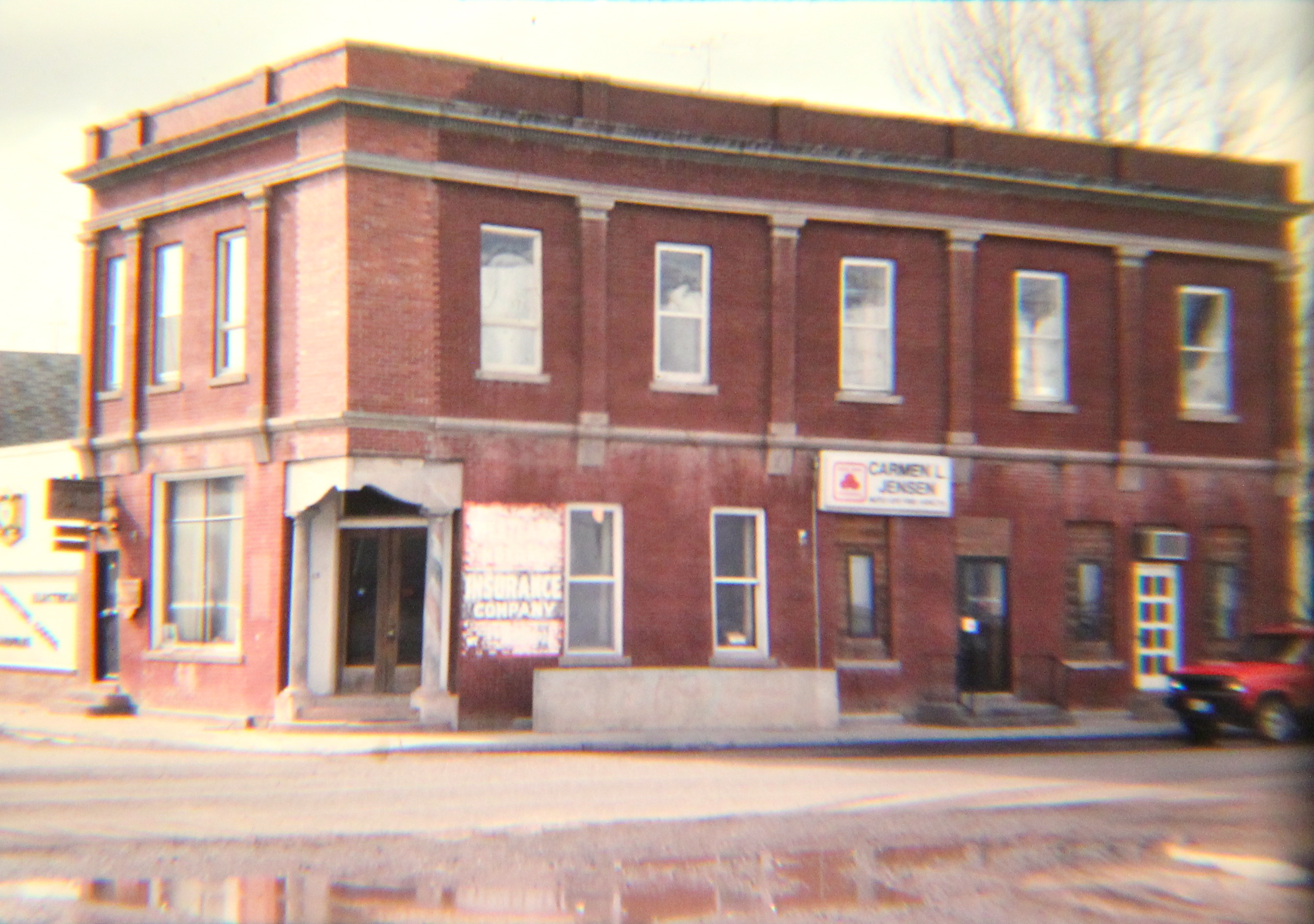
This building is the historic First State Bank of Chester (1910), one of two Liberty County buildings in the National Register of Historic Places. The bank closed in 1920, but the building remained important to the community, serving all sorts of function; a local high school class researched its history for the National Register nomination in 1997.

1st State Bank, Chester, 2013
The organization of space in Chester is interesting. As typical of a T-town plan, the railroad corridor dominates the top of T with the tracks, elevators, warehouses, and railroad buildings.

Chester t-town plan, 2013
The adjacent route of U.S. Highway 2 creates sorta of a “bottom” to the top of the T, where gas stations and other auto- and traveler-focused buildings, including a diner and an automobile museum, stand. One bit of roadside architecture–the MX Motel–really captured my attention in 1984 because only a few years earlier Montana and especially Liberty County eagerly pursued

MX Motel sign, 1984
the Carter administration idea of a defense system where nuclear missiles would be moved on tracks over a huge expanse of land, creating uncertainty for enemy targeting of missile silos. Liberty County had good reason to be excited about the MX–the time Chester had enjoyed sustainable growth was in the 1950s when the Bureau of Reclamation constructed the Tiber Dam/Lake Elwell project in the southern end of the county.
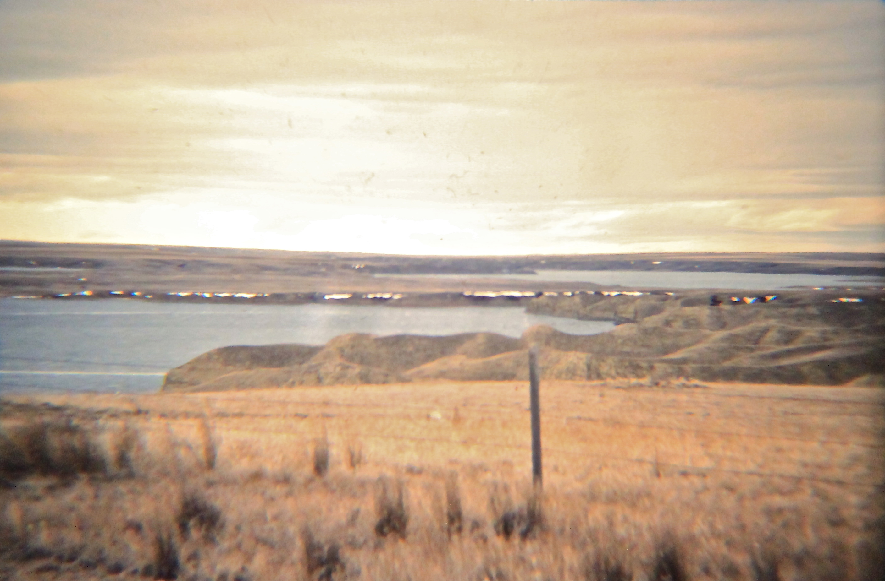
Tiber Dam Reservoir (Lake Elwell), 1984
I stayed at the MX Motel in 1984–and never imagined it would still be there 30 years ago. It remains, but I wonder if anyone recalls why the name MX made sense to Liberty County in the past.

The stem of the T-town plan in Chester is also interesting. The bank is the visually prominent element while the county courthouse is a large two-story brick facade a bit farther down the street. At the base of the T is the school campus, a sprawling group of brick Art Deco-influenced buildings (1935 for the Art Deco elementary school; the high school building dates to 1952) that now serve students with three old railroad towns: Chester, Joplin, and Inverness, and the school nickname is the Hi-Line Hawks.


Located between the commercial district and the school is the National Register-listed First Episcopal Methodist Church (1911-1968); it became the county museum in 1970, and soon will have served that cultural function for longer than it was a church. A much more recent yet still appropriate adaptive reuse is the conversion of another church into a county arts center. This portion of Montana has actively pursued cultural tourism in the 21st century and the arts center plus the earlier museum are parts of that effort.


Next: Joplin, a Liberty County town on the border with Hill County

Another cool thing about Liberty County is that–outside of a county in Wisconsin, according to “They Chose Minnesota”–it had the next highest population of Estonians in the US. I’d hoped to do some fieldwork in the rural parts of the County last year to determine what vernacular architecture might have existed or remains but I ran out of time before I went to another employer.
Here is a photo of the decayed remains of the Estonian Community Hall. Made from mud bricks, i fear I was probably 5 or 10 years late in getting a good photo with the roof still standing. https://photos.app.goo.gl/Veky8H3tDp8rdM1DA
Would it be possible to use this photo in a column I’m writing from Whitlash about a year my wife and I are spending in Liberty County? She is serving as the pastor in residence at the Whitlash Community Presbyterian Church and I am writing a periodic column for the Blaine County Journal in Chinook. We both retired before we took this basically volunteer position.
I am writing about observations in and around the Sweet Grass Hills. I’ve done about 45 columns. The column is titled “South of the Border,” a play on our location so close to the international border.
I am currently visiting with the descendants of the Estonians that settled in Liberty County (Lothair area). I hope to do photos of the old sod brick structures but understand they are quite degraded. Still winter here so have not been out to see them yet.
Would it be possible to use this photo in the column about the Estonian community south of Whitlash? I’ve been told the old community hall was taken in to Chester several years ago and is now used for storage. I’m wondering if this photo is of one of the houses that survived for a long time?
If possible to use the photo, what would be the preferred wording of the photo credit?
Yes you can
Carroll Van West, photographer
montanahistoriclandscape.com