Building Zoos on the Northern Plains

IMG_7666

Building zoos are among the most interesting parts of the western historical landscape. At an isolated outpost on the northern plains like Scobey, Montana, these deliberate creations of history, identity, and memory tell residents, much more so than tourists (who come by in dwindling numbers), that once there were people, vitality, and interest here, and what happened in the past could happen again in the future.

IMG_7659

They also are demonstrations of the challenges of early days when tiny homestead shacks were home, and families stood in stark contrast to the seemingly endless flat prairie. As such building zoos are also marks of achievement, that the settlements of today show that the pioneers’ sacrifice was not in vein.

IMG_7676

The Daniels County Museum in Scobey is one of my favorite building zoos due to its fascinating array of buildings plus the obvious care that the facility has received over the decades. When I encountered it in 1984 frankly I was amazed. Here were large buildings moved to a spot in the middle of nowhere. They did “they” hope to achieve? Of course “they” were what they were doing–and they told their story with the same verve shown by the original owners of the Rex Theater, a false front in log rustic style for a land that had so few trees.

IMG_7663

Then were were the multiple churches marking a diversity of faiths from St. Michaels Ukranian Greek Orthodox Church, St. Thomas Catholic Church, and the more stylish in an Arts and Crafts way All Saints Episcopal Church. All were from the second decade of the 20th century when the homesteading boom across Daniels County was at its height.

IMG_7661

IMG_7673

A building zoo is not really a building zoo unless it has moved mercantile buildings, which, in turn, are full of artifacts of the past. The Daniels County Museum has excellent examples of the early 20th century commercial aesthetic of the northern plains–a look not different than that of any western instant town of the era between the Civil War and World War I.

IMG_7672

IMG_7675

When I visited this place in 1984 the museum proper was in an old quonset hunt, and it was more of a community attic than anything else.

IMG_7658

But in the 21st century, the community has invested in a new museum/community hall where new exhibits were being installed as I visited. The Daniels County Museum is one of the region’s most compelling heritage institutions, and despite the population decline in this corner of Montana, the museum volunteers look forward into the future.
IMG_7679

The high plains of Daniels County, Montana

IMG_7623

The high plains of Daniels County are among the most isolated places in all of Montana.  You may reach this place by heading straight north out of Wolf Point on a state road or you can come from the east on another paved road. Gravel roads are available as well.  Federal highways have never touched this place; railroads came, above is the Soo Line Corridor at Whitetail. They arrived from the east and dead-ended here on the prairie.

IMG_7650

Yet the isolation, the vernacular buildings, the fact that nothing is overtly special here actually makes it a special place. I liked it in 1984, when I made this image of the courthouse in Scobey–certain it would not be there for long.

Scobey MT jpeg

I liked it enough to return in 1988, and couldn’t wait to explore some more in 2013. In this blog, I have already spoken of the some of the remaining rural schools; the fairgrounds; the Soo Line railroad corridor; and, the survival of the Daniels County Courthouse, an old homesteader hotel that was once a bordello and still is used today by the citizens of Daniels County. As we take this detour from U.S. Highway 2 far to the south–the Canadian border is much closer to the north–here’s to Daniels County–the residents’ persistence, sense of community, and dogged determination means there is much to commend here.

IMG_7642

The courthouse proudly displays its National Register of Historic Places marker, although officials admitted that they do not get many “faraway” tourists (I found out Canadians naturally were not faraway-but someone from Tennessee, yes indeed).Dropped ceilings may be about but the courtroom retains its turn of the 20th century feel. The place was in great shape, considering the fact it was never built to be a public building, and its condition speaks to the pride residents have in this old false-front frame building.

IMG_7654

Another favorite haunt was the Scobey school, perhaps, next to the Catholic Church, the most architectural stylish building in the county. Keeping the Scobey in good shape and open is crucial to a town and county that has steadily lost population over the last 50 years. The population had dropped over 300 since the 1980s, and now is just over 1,000 residents.

IMG_7633

The Daniels County Cemetery, just outside of town, tells part of the story of those who came and are no longer here. But in the next post I will look in depth at the place that tells that story of change best–the quite wonderful Daniels County Museum, building zoo without rival in northern Montana.

IMG_7682

Fort Peck Indian Reservation, Poplar, Montana

Grain elevators on Great Northern line, 1984

Grain elevators on Great Northern line, 1984

If you arrived in Poplar, Montana, via train, as tens of thousands did 100 years ago, you saw little that made this place seem different than dozens of other northern plains towns.  Grain elevators dominated the skyline; almost as imposing were multi-story hotels–not luxury lodgings but a place to literally land for newly arrived homesteaders or “drummers,” salesmen traveling the line trying to drum up business for industries located in faraway metropolitan centers.

IMG_7573

Gateway Hotel, Poplar MT

IMG_7571

Poplar Hotel, Poplar MT


But if you move north away from the tracks and toward the modern-day U.S. Highway 2, a different, distinct world is found, in the historic buildings of the Fort Peck Indian Reservation.  Near the Montana Highway Historical Marker telling the reservation’s story is a historic jail building from the late 19th century–the town’s most identifiable historic landmark in my 1984 work and today.

IMG_7562

IMG_7559


Next to the jail was a new arts and crafts shop, aimed at travelers along U.S. Highway 2, part of a significantly expanded presence for the Fort Peck Community College.

IMG_7561

Indeed, the new college buildings are among the most attractive institutional buildings that you can find along the eastern end of U.S. Highway 2 in Montana.  Their bold colors and dramatic placement along the highway demonstrates the importance of education for the future of the Fort Peck Indian Reservation.

IMG_7564

IMG_7558

IMG_7569

IMG_7566
North of the new buildings are many historic buildings associated with the reservation’s development in the early 20th century.  Some are abandoned and in poor repair but most are in use, still serving the tribes in the 21st century.

This building was a museum in 1984; now that activity has moved to the highway, better to attract visitors

IMG_7778


No doubt as to my favorite new building in Poplar in 2013:  The Perculator.  Not only a classing roadside building, but they also made great coffee–perfect for a long day of fieldwork in the Fort Peck Indian Reservation.

Wolf Point on the Hi-Line

Great Northern corridor along U.S. in Roosevelt County

Great Northern Railway corridor along U.S. 2 in Roosevelt County

When I encountered the northern prairie of Roosevelt County in 1984, it was difficult to tear your eyes from the omnipresent tracks of the Great Northern Railway.  The trains roared past regularly, and the tracks defined space and town location throughout this stretch of U.S. Highway 2.  So when I arrived in Wolf Point, the seat of Roosevelt County, I immediately looked for the depot, and came away disappointed.  Here, for northeast Montana, was a large town: certainly I would

Wolf Point depot, Roosevelt  County

Wolf Point depot, Roosevelt County

find more than the standard-issue Great Northern design.  It was different but nothing as I expected.  No grand architectural statement–rather a modernist building with little ornament or aesthetics to it, except here was what the railroad had become in the second half of the 20th century–a functional transportation system not the town builder and landmark of the turn of the century.

IMG_7737 But as I explored the town in 1984, and visited it again in 2013, I found several places worth considering in this small county seat of 2621 in 2010.  First was the impact of the New Deal.  Roosevelt County–named for TR not FDR–received one of the most striking modernist courthouses in the state, courtesy of the Work Projects Administration.

IMG_7743


Encountering such a gleaming landmark of the federal imprint on the region startled me, but also started me looking much more carefully at the impact of federal projects on the region, a research interest that culminated in an essay titled “The New Deal Landscape of the Northern Plains” for the Great Plains Quarterly.

Wolf Point, like almost every Hi-Line town, had suffered from population decline.  The town’s heyday came in 1960 with a population of 3585, which had dropped by 500 by 1980, and another 400 since then.  Yet Main Street was alive, not dead, but dilapidated with later day “improvements” marring historic commercial facades.

IMG_7764

IMG_7752

Yet the town retained its historic movie theater, and had recently expanded a local history museum that has a remarkable array of objects.  Wolf Point in the 2010 census was about 1/2 Native American in population; the most impressive building added to the town since 1984 was the Fort Peck Community College.

IMG_7761

IMG_7751

Wolf Point also had hoped to become the final landing spot for the Montana Cowboy Hall of Fame.  It was a worthy contender not just for its open plains, but the Wolf Point Rodeo is among the state’s oldest, and the historic fairgrounds continue to host the “Wild Horse Stampede” every summer.

IMG_7755

Smack in the middle of U.S. 2 is another monument to the Montana Cowboy, and a symbol of the hopes that the Hall of Fame would land in Wolf Point.  This bronze statue titled Homage was executed by Floyd DeWitt and given to the town by the Fort Peck Assiniboine and Sioux tribes.

IMG_7753

To travelers along U.S. 2 Wolf Point may be considered as one or two blinks and that it is, but the history here is deeper, and strongly felt.  Yes it has the rails and the elevators to define the horizontal and the vertical but its landmarks continue to say:  we’re here and we matter.

IMG_7756

IMG_7756

IMG_7757

Frazer: western gateway to Fort Peck Indian Reservation

IMG_7864The people of the Fort Peck Indian Reservation have shaped the landscape of northeastern Montana for almost 150 years.  Established in 1871 for the Sioux and Assiniboine Indians, the reservation boundary encompasses over 2 million acres, of which less than one-fourth (some 378,000 acres) are tribally owned trust lands.  The Fort Peck Assiniboine and Sioux tribes enroll over 10,000 members, with most living on the reservation.  Assiniboine members tend to live in the western part of the reservation (Oswego, Frazer, Wolf Point as towns) while Sioux members tend to live in the eastern part (Poplar, Brockton, Riverside and Fort Kipp).

We begin with the town of Frazer, initially established as a Manitoba Road stop in 1888-1889.  Due to the oil boom in the Williston Basin to the east, trains still roar through Frazer constantly while grain elevators command the skyline.

IMG_7876

IMG_7863


The community has lost population in the new century.  While the sign on U.S. Highway boasts of 452 residents, the 2010 census counted 362, and the impact is documented by the lack of business, even along the highway.

IMG_7872


The recently constructed Frazer School is the heart of the community.  The modern styling and brick construction gives it a prominence unmatched by any other building in Frazer.

IMG_7869

Adjacent to U.S. 2 is another key community institution, a tribal ceremonial ground.  Looking from the highway right-of-way only (having not been invited to enter this community space), you see the continuation of culture and tradition celebrated in Frazer and the reservation.

IMG_7862

IMG_7859

Nashua, Montana: stories of a railroad and a man

IMG_7881

Nashua is the eastern most town of Valley County, Montana, located where Porcupine Creek empties into the Milk River.  Its history mirrors those of many towns along the Hi-Line:  it too began as a Manitoba Road town in 1888-1889. The tall grain elevators that still dominate the townscape, as they did in 1984, document the days when the rails carried everything as does the moved and repurposed Great Northern Railway depot, not a Senior Citizens Center.

Elevators along Great Northern line, 1984

Elevators along Great Northern line, 1984

IMG_7883

Nashua is also a gateway along U.S. Highway 2 to the region’s New Deal era history, especially the construction of Fort Peck Dam and Reservoir.  As an eastern gateway to the dam, Nashua reached its peak population of over 900 in 1940 as the project neared completion.  Today less than 300 make Nashua home.  One key New Deal survivor–the 1935 school (with later additions)–is home to the Porcupines, and serves still as a community center.

IMG_7878

Another building in Nashua, the Civic Center, also looked New Deal in its origins, indeed similar in shape (but not materials) to the WPA-constructed civic center in Glasgow.  But in finding out the history of this building, I also found the story of a man and family who shaped Nashua in the post-World War II era.

IMG_7882


Victor Dostert (1886-1961) is a Montana small town example of a “civic capitalist,” a topic that I explored at length in my book Capitalism on the Frontier (1993).  He came and homesteaded south of the town along the Milk River during the boom of the 1910s but when the bust came in the 1920s Dostert, his wife Anna, and their three sons stayed, making their mark with construction projects (from a theater to the Catholic Church) and taking advantage of the thousands of construction workers passing through by building and operating Vick’s Bar in 1935.

Vick's Bar and Bowling Lane is at the center of the Nashua business district

Vick’s Bar and Bowling Lane is at the center of the Nashua business district

Then in 1957 the family added a adjacent Bowling Alley–and both institutions were still going when I visited in 2013.  The Civic Center, however, was Dostert’s crowning civic achievement.  He designed the building and had it constructed during his period as Nashua mayor (1945-1951).  It housed a movie theater as well as provided community meeting space. And as a community gathering point it anchors the adjacent Lion’s Park and is busy throughout the year, an anchor of identity for the dwindling population of eastern Valley County.

IMG_7880


Fort Peck Dam and the Transformation of Valley County, part 1

IMG_8000

The southern end of Valley County has forever transformed by the construction of the Fort Peck Dam, Powerhouse, and Reservoir during the New Deal of the late 1930s.  The huge construction project, building an earthen-filled dam across the river near an old fur trading post, employed tens of thousands of Depression-era workers and left a permanent federal imprint in the lake, the huge, iconic concrete spillway, and the village of Fort Peck.

IMG_8115

The massiveness of the project–reflecting the boundless ambition and optimism alike of government planners, engineers, and workmen–is difficult to grasp.  As you drive across

IMG_8005

the top of the dam, the high vantage point of the Montana plains is spectacular, and a reminder of just how radically the dam changed the Missouri River Country.  An interpretive kiosk–in need of repair and refreshening–tells of the Lewis and Clark Expedition and what it found and learned.  But as soon as you turn to the east, it is not a open, wild landscape, but one dominated by the soaring towers of the power plant turbines, two concrete and steel obelisks to the 1930s ability to transform, and that decade’s faith in hydroelectric power.

IMG_7995

The Corps of Engineers has recently opened a full interpretive center, not only about the dam’s construction but of the environment and wildlife of the region.  But the story of the federal imprint is most graphically portrayed in the village of Fort Peck, built for the key administrators and officials of the project as well as important guests in the 1930s. We will look at that story next.


Montana’s Malta: More Travels along the Hi-Line

Phillips County is one of my favorite places along the Hi-Line. The Milk River Valley is beautiful; the high plains at Loring and Whitewater are lonesome yet compelling. Empty I guess is how many would describe the county as just over 4250 people live there–in a county of 5,212 square miles.

Image

Loring Hall in 1984

But the diversity of the landscape is memorable. The southern tip of the county is the gateway to the Charles M. Russell National Monument, truly one of the great national parks that few people know about but home to some of most overwhelming views of the Missouri River. North of the Missouri are the southern end of the Little Rocky Mountains and the old mining towns of Zortman and Sandusky.

Image

Abandoned cabins at Zortman, 2013

I have already written about the two Hi-Line towns on the west end (Dodson) and the east end (Saco). Now it is Malta’s turn. When I visited there in 1984 little did I know that Malta was at its population peak.

Image

The 1980 census counted 2,367 residents–never had the town had that many people, and judging from the last three decades, that number is never returning: the population is now under 2,000. The 1980 as a peak population decade–not common among Hi-Line towns, but that wasn’t all that set Malta apart from what I encountered east or west.

Vibrant community institutions anchored the town. The neoclassical Phillips County Courthouse (1921) served as the foundation for the east end residential neighborhood. Designed by Great Falls architect Frank E. Bossout, the red brick courthouse reflects a more restrained expression of the popular classical revival movement, especially compared to Bossout’s earlier more flamboyant Beaux-Arts design for the Hill County Courthouse (c. 1914) in Havre. (I wish they would remove the vines–not good for the bricks.)

Image

Nearby was the Carnegie Library, which had been recently converted to serve as a county museum. In 1984 the community was quite proud of the place, recently (1980) listed in the National Register of Historic Places.

Image

Now the museum has moved to new quarters, the Phillips County/ Great Plains Dinosaur Museum, on U.S. Highway 2, where dinosaurs are the primary attraction moreso than local history after a major nationally-noted dinosaur discovery happened in the county in 2000. Yet the town has preserved a notable local house, the Victorian-style H.G. Robinson House (1898), nearby the new museum and there in a domestic setting the town’s early history and settlement is interpreted. The new highway historical/cultural institutions are improvements–but have come at a real cost: a crumbling Carnegie Library, the town’s only National Register-listed property that needs help, now.

Image Image

Another community institution was the Woman’s Club of the late 1930s, a Rustic-style building that has been discussed earlier in the blog, as part of the institutions that spoke to women’s history that I missed and could not “see” in 1984. But it was also one of three major New Deal buildings that missed–the others being the two-story brick WPA-constructed City Hall and the massive brick “Old Gym” that once served the high school.

Image

Image

Malta also had its share of schools and churches, although again I did not “see” in 1984 the beauty of the contemporary-styled St. Mary’s Catholic Church from c. 1960.

Image

Malta’s business district is the classic T-town type of design found all along the Great Northern line. It too had its anchors: massive grain elevators and grain storage bins, along with the Arts and Crafts styled Great Northern passenger depot, defined the top of the “T”.

Image Image

Once you took the New Deal-era underpass to go under the tracks, there was the neoclassical First State Bank introducing the “stem” of the T and several blocks of businesses: two movie theaters (both closed now unfortunately) and an Art Deco-styled auto dealership being particularly notable buildings.

Image


Image

Although it was in rough shape Malta also had its railroad/highway park (Trafton Park) on the north side of U.S. 2, where the original U.S. Highway 2 passed using a steel Parker through truss bridge to cross the Milk River.

IMG_8224

Nearby was a railroad bridge allowing Great Northern passenger trains to do the same.

Image

Malta, Great Northern Bridge over Milk River, 1984

The town also had its own rodeo grounds, tucked away next to a historic livery stable at the corner of N 2nd Street and N 2nd Avenue. The Maltana Motel–even in 1984 it struck me as a classic 1950s motor court–was the place to stay then, and now. It is one of the few survivors of the “Mom and Pop” roadside abodes I enjoyed in 1984 along the Hi-Line.

Image

Malta has many potential National Register listings–as the many photos here suggest. And all of these heritage assets could be a valuable foundation for new visions and investment. The community is keeping the buildings in use and in general decent repair. But you worry about the future–if the town’s recent trend of population decline continues.

Great Northern Towns in west Hill County, Montana

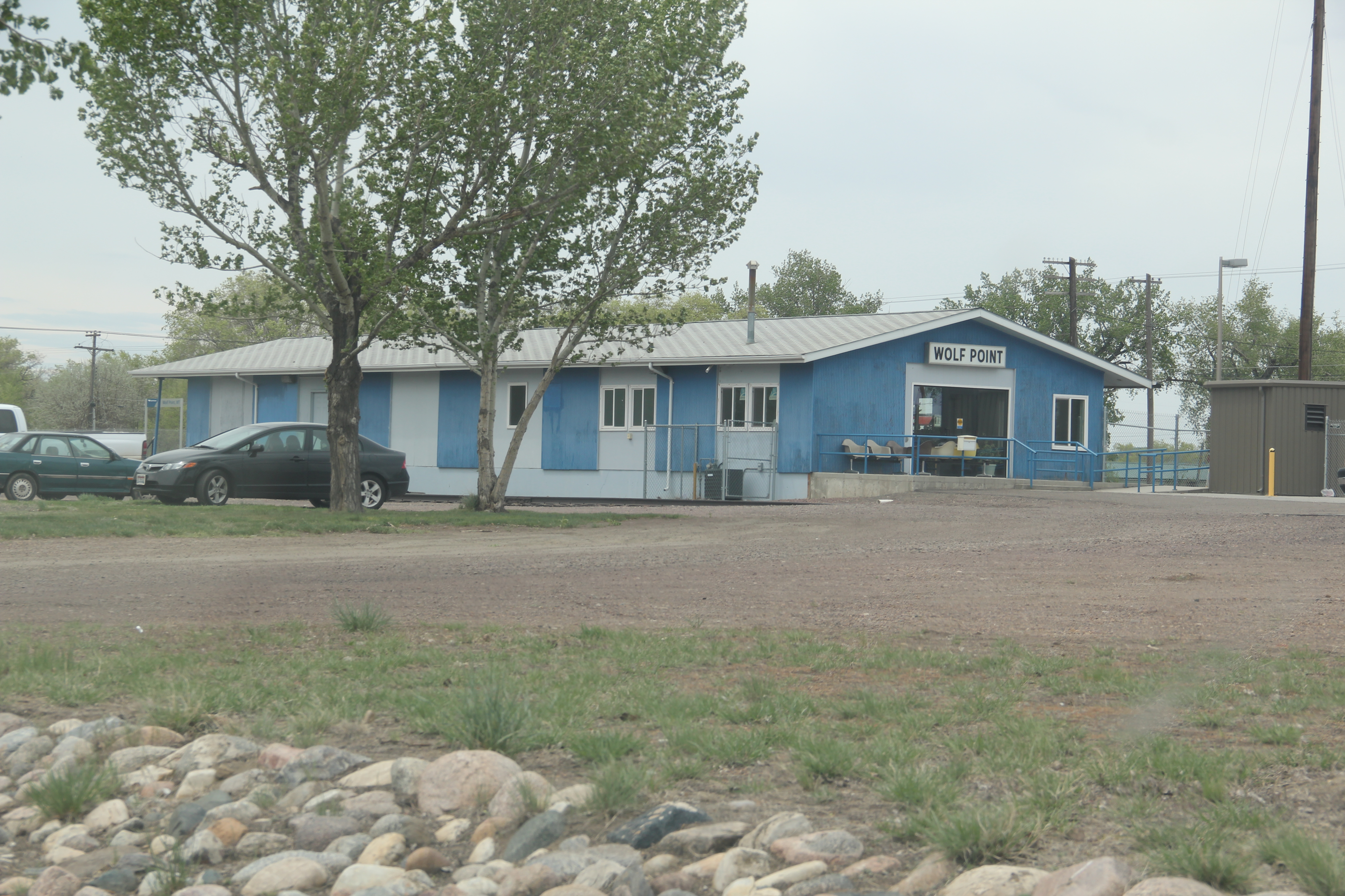
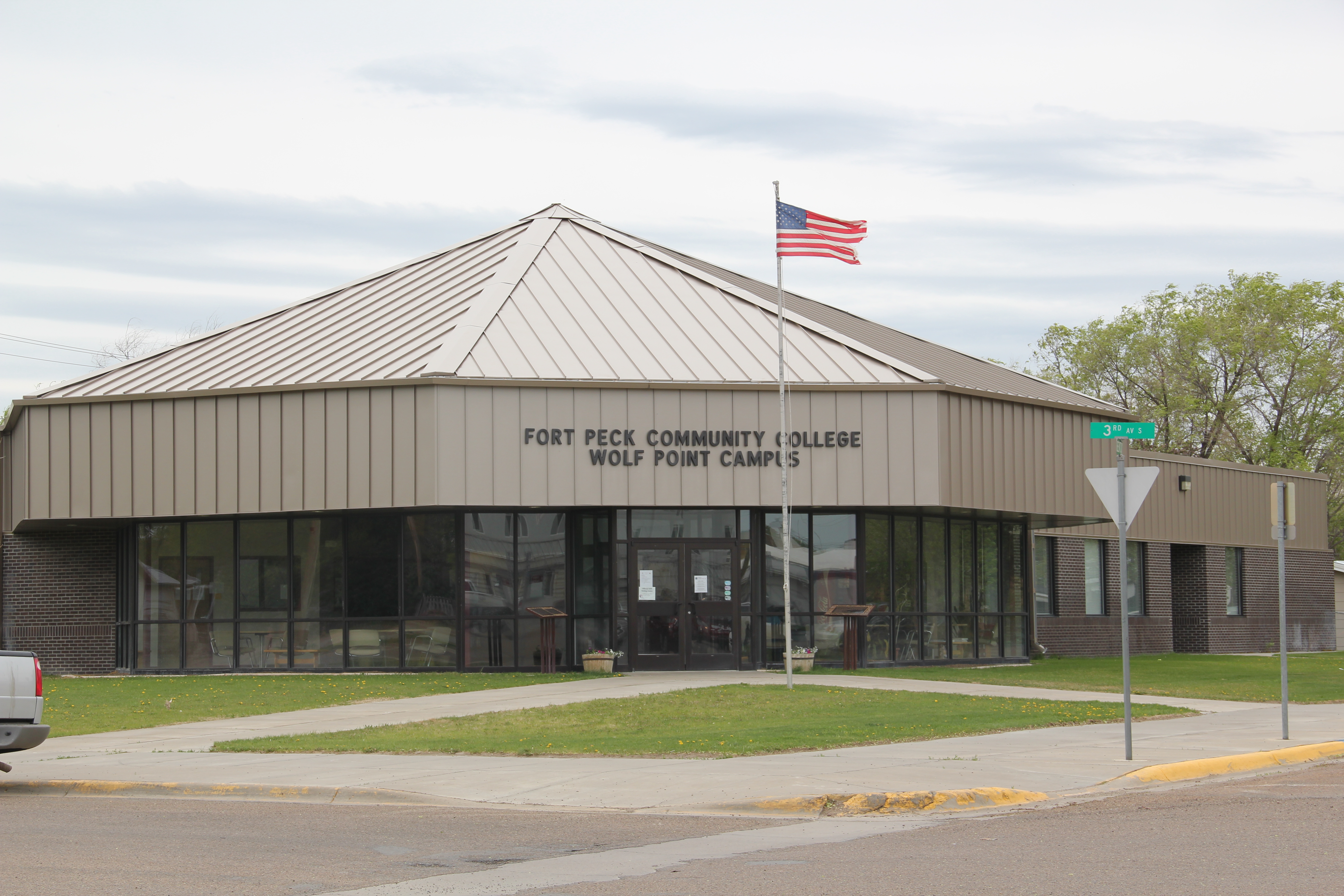
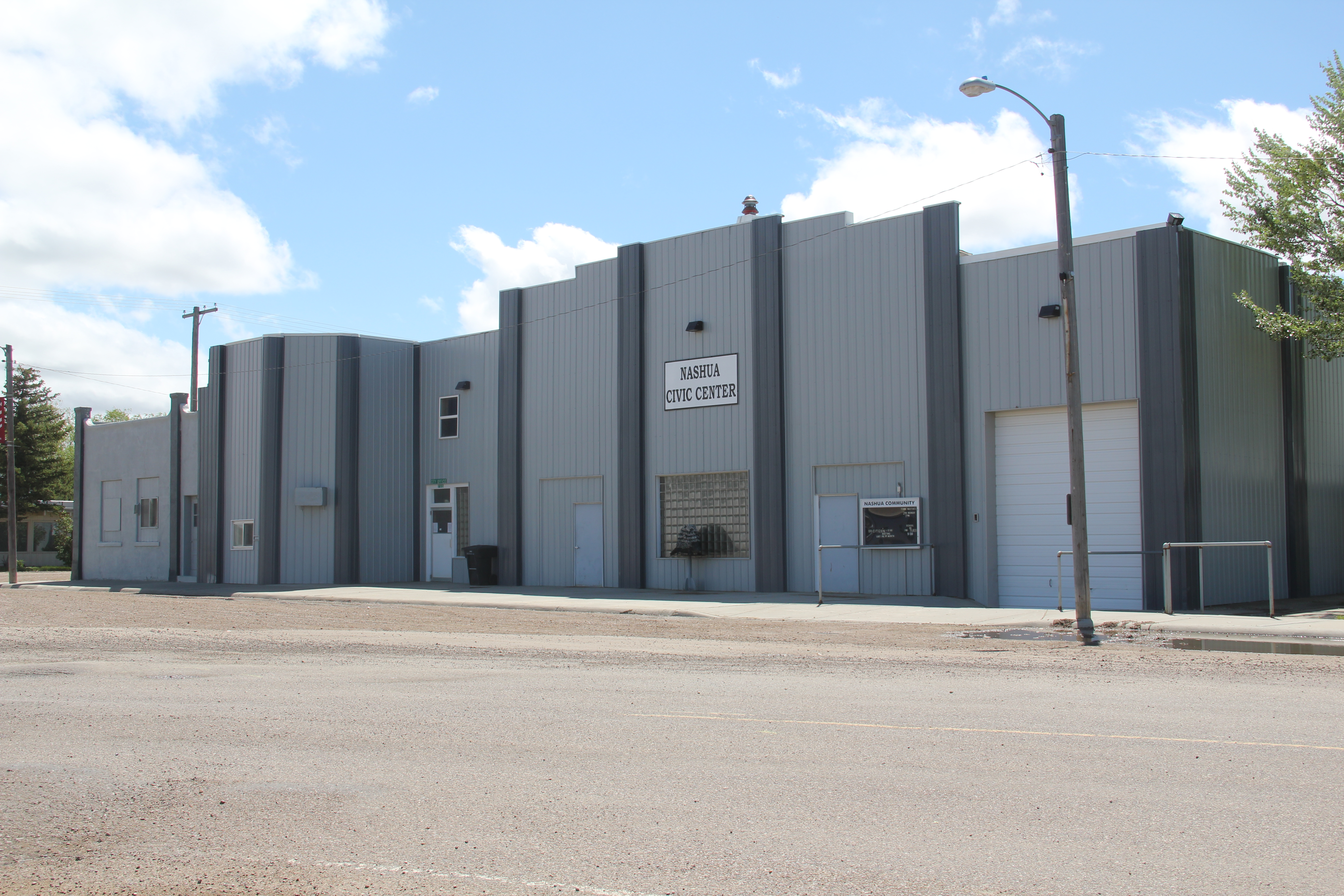
In my 1984 fieldwork, Havre was a base for quite a bit of travel along the Hi-Line.  One of the most compelling landscapes, and among my favorites for the state, were the little towns, regularly spaced about every eight miles, west of Havre.

Image

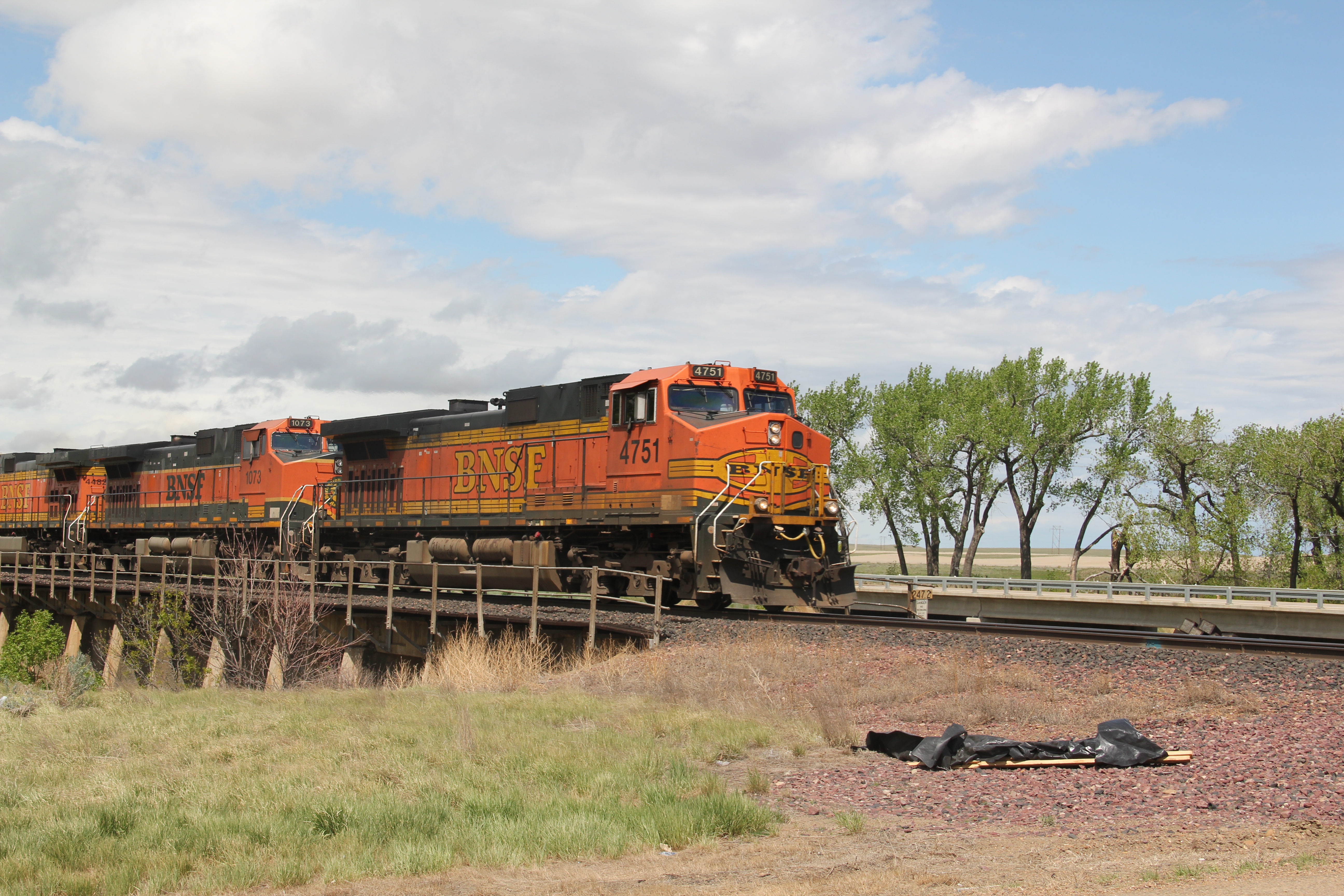
At the time, my understanding of this landscape was heavily influenced by recent works by the American Studies scholar John Stilgoe (Metropolitan Corridor: Railroads and the American Scene) and the historical geographer John Hudson (a series of articles that culminated in the book Plains Country Towns.) Stilgoe reminded me that railroads in the late 19th century not only defined towns and urban design but impacted American culture in how small, tiny spaces became part of urban, metropolitan life through the steel tracks.  Hudson explain why towns existed every six to seven miles or so throughout the plains (these were often single track lines so trains needed places to pull over for passing, and places where water and fuel could be acquired as necessary).  Hudson explained differences between railroad division points, where shops and offices would be located, and “country towns,” where typically a combination depot carried out all of the railroad’s corporate functions.

Image

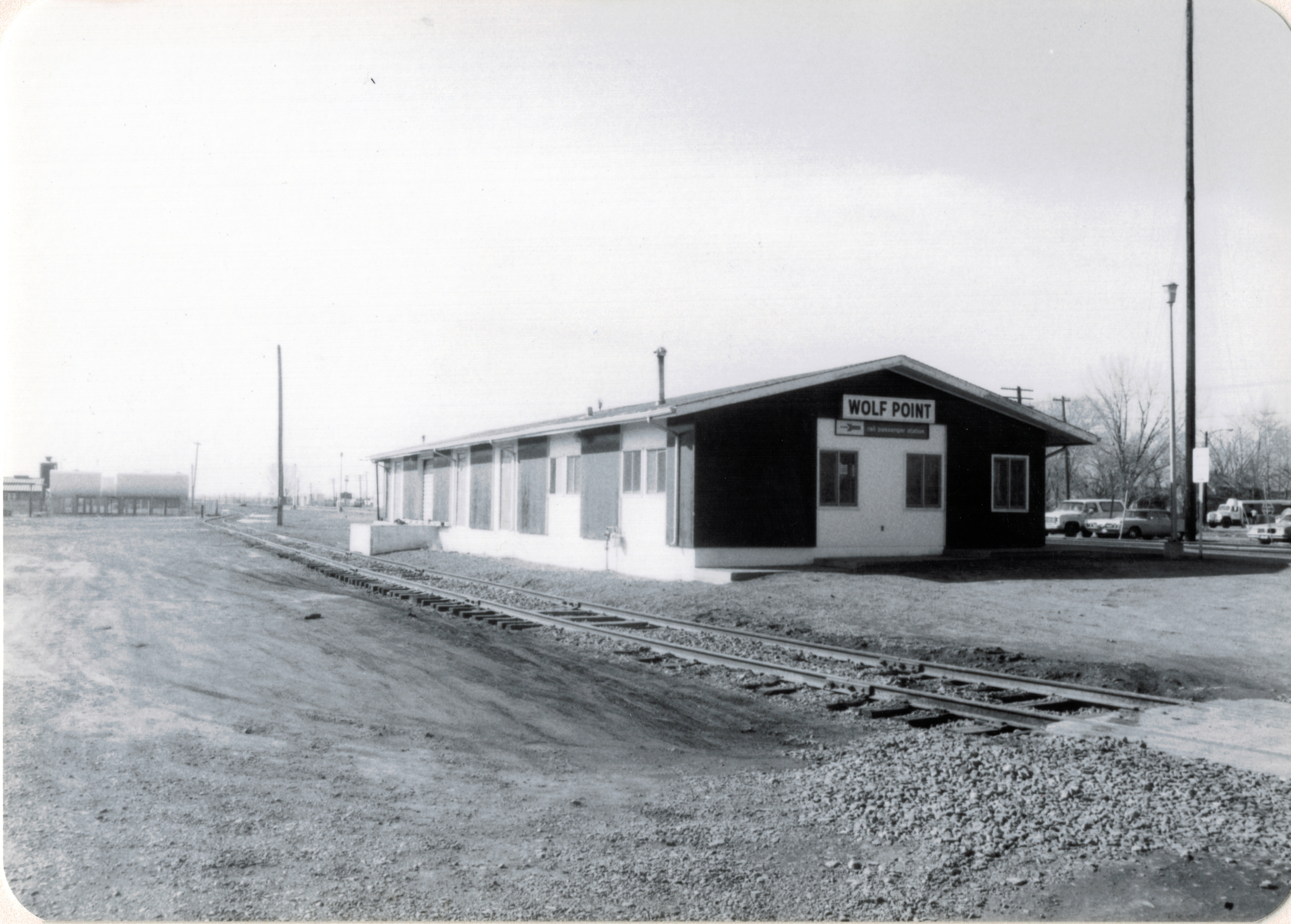
This arrangement of space, and the ennobling of railroad culture in larger towns, was exactly what I saw in Havre and Hill County.  Ever since 1984, this has been among my favorite places in Montana.  In a posting last year I discussed the “disappearing depots” along the Hi-Line, focusing on west Hill County.  I want to revisit those same places today, with a deeper view on what was there in 1984 and what you find today.

Image

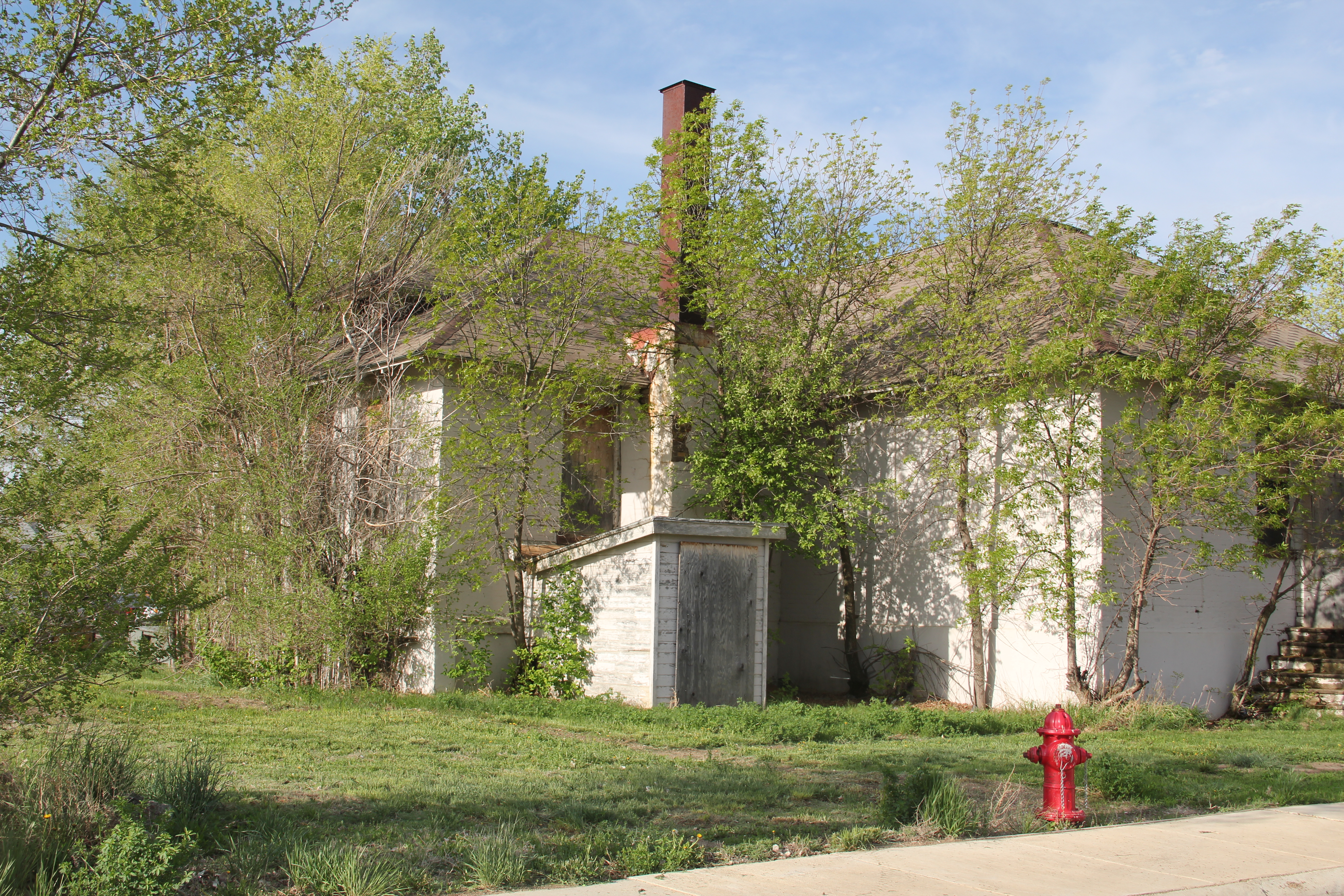
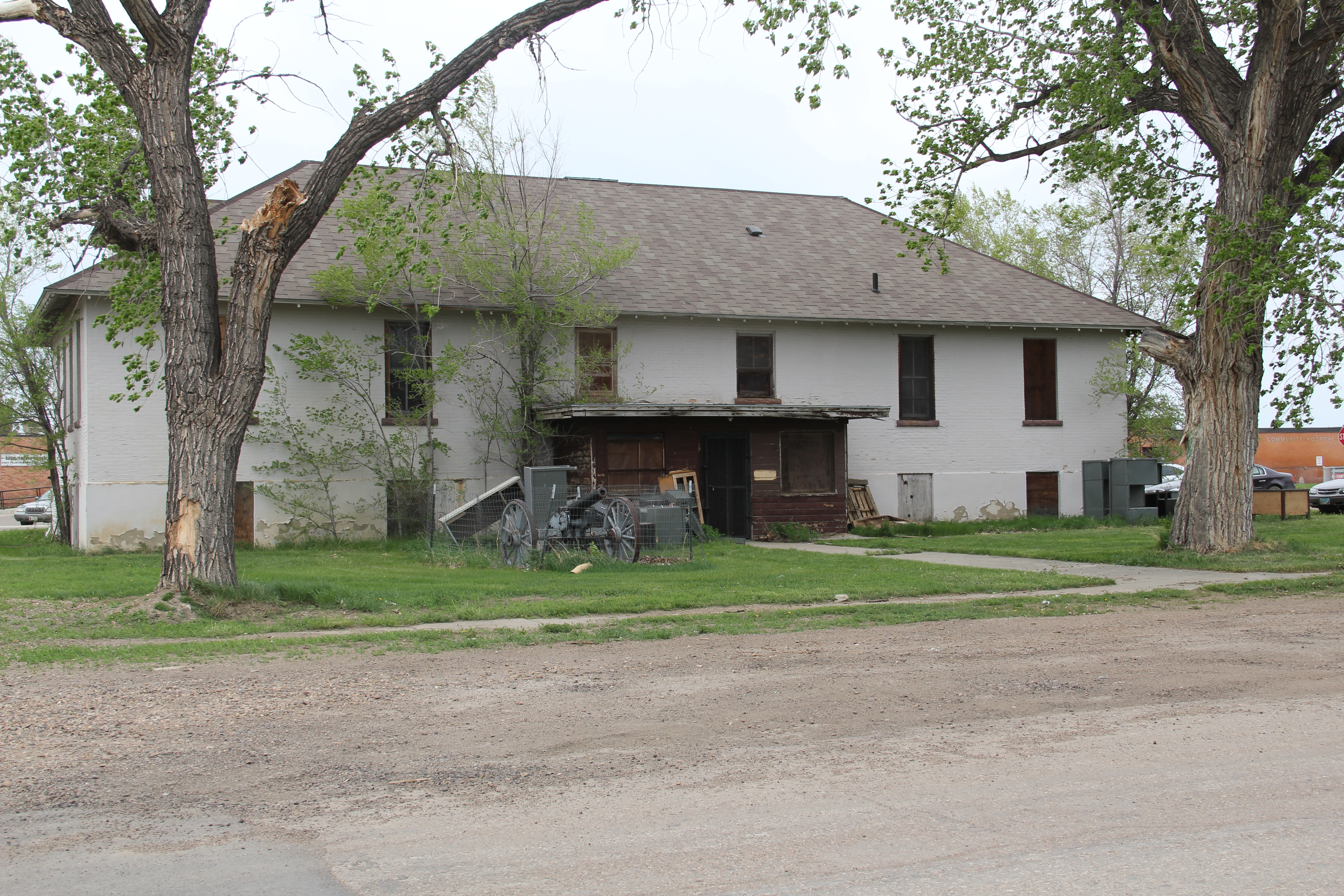
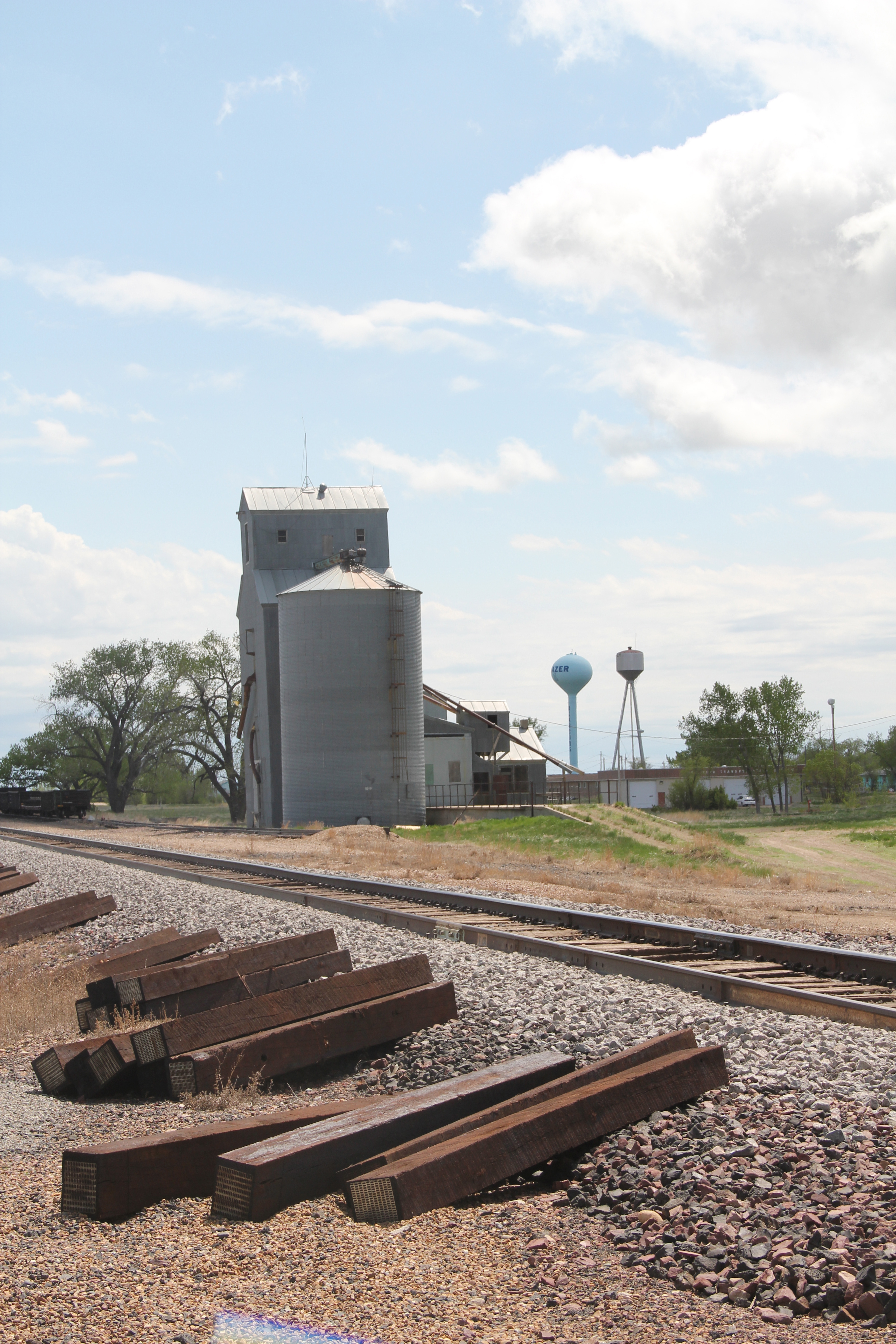
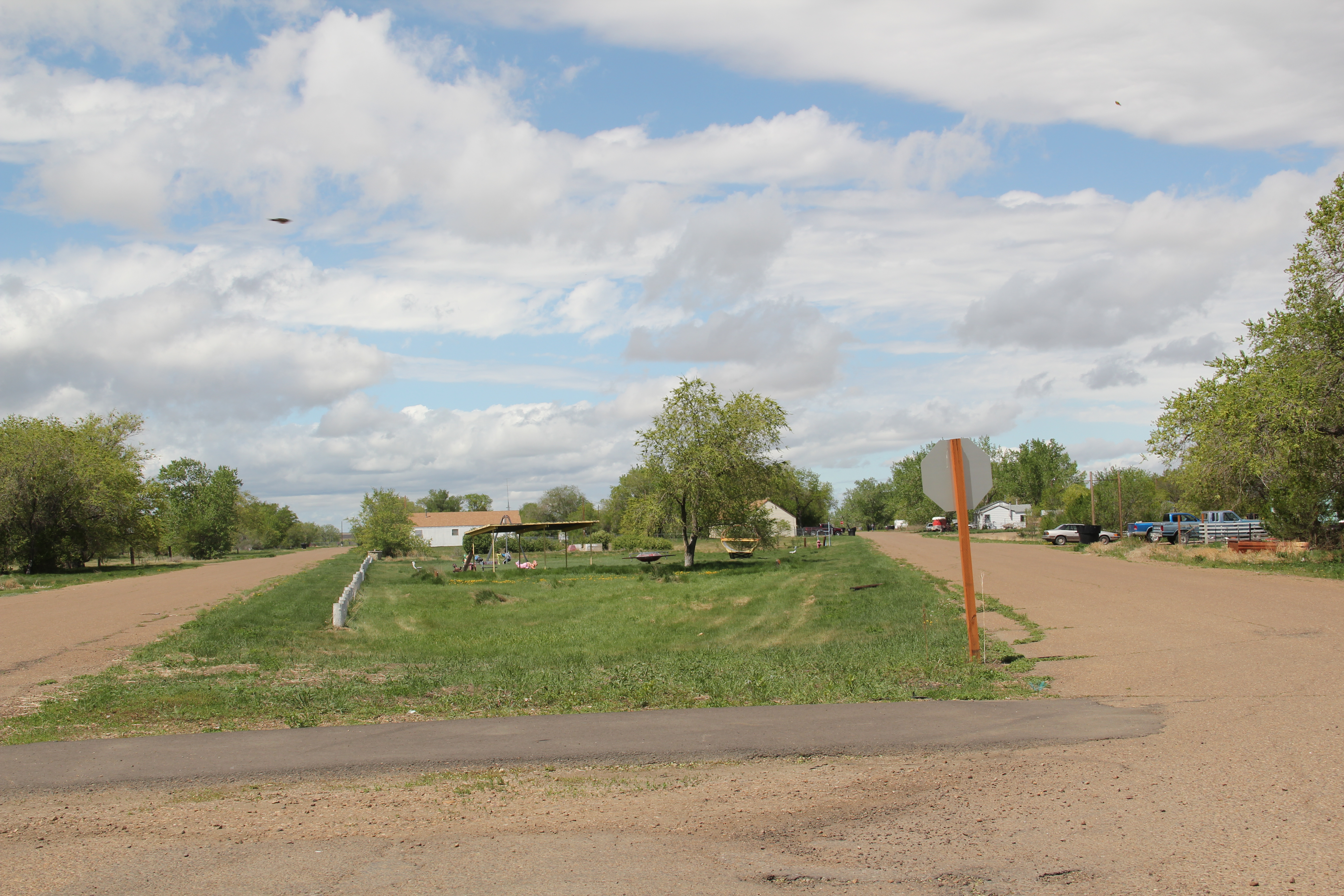
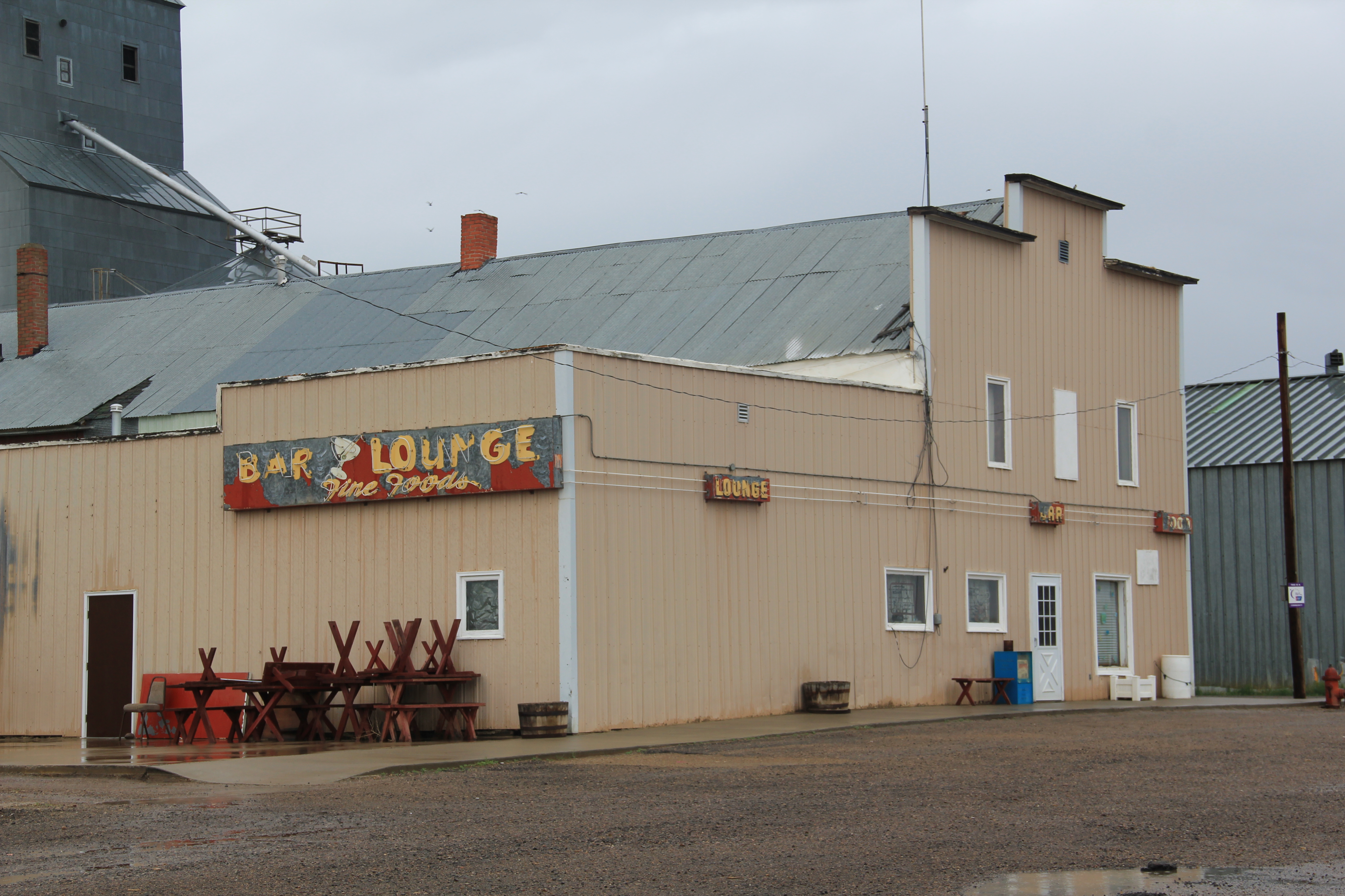
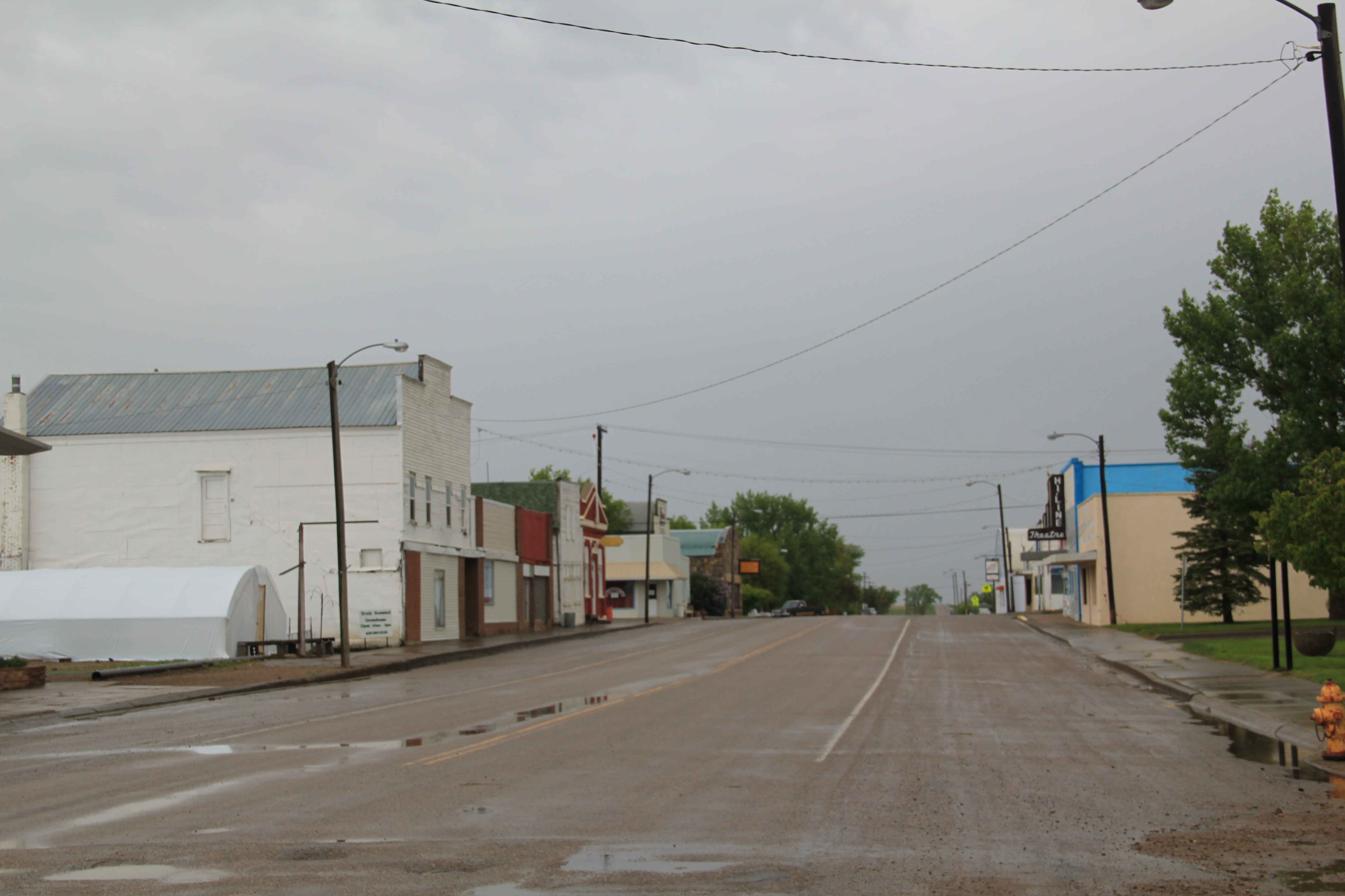
Inverness, established c. 1909, was the first place I stopped but spent little time there because already in 1984 its Great Northern depot was gone.  But in 2013, I was looking for beyond the Stilgoe-Hudson way of understanding plains country towns.  Inverness in 2010 had 55 residents, but still held several early settlement landmarks, such as its early 20th century elevators along the railroad, a National Register-quality c. 1920 store/gas station, and two large two-story frame blocks–the historic Inverness Hotel (most recently Inverness Supper Club) dates to the second decade of the 20th century.

ImageImage

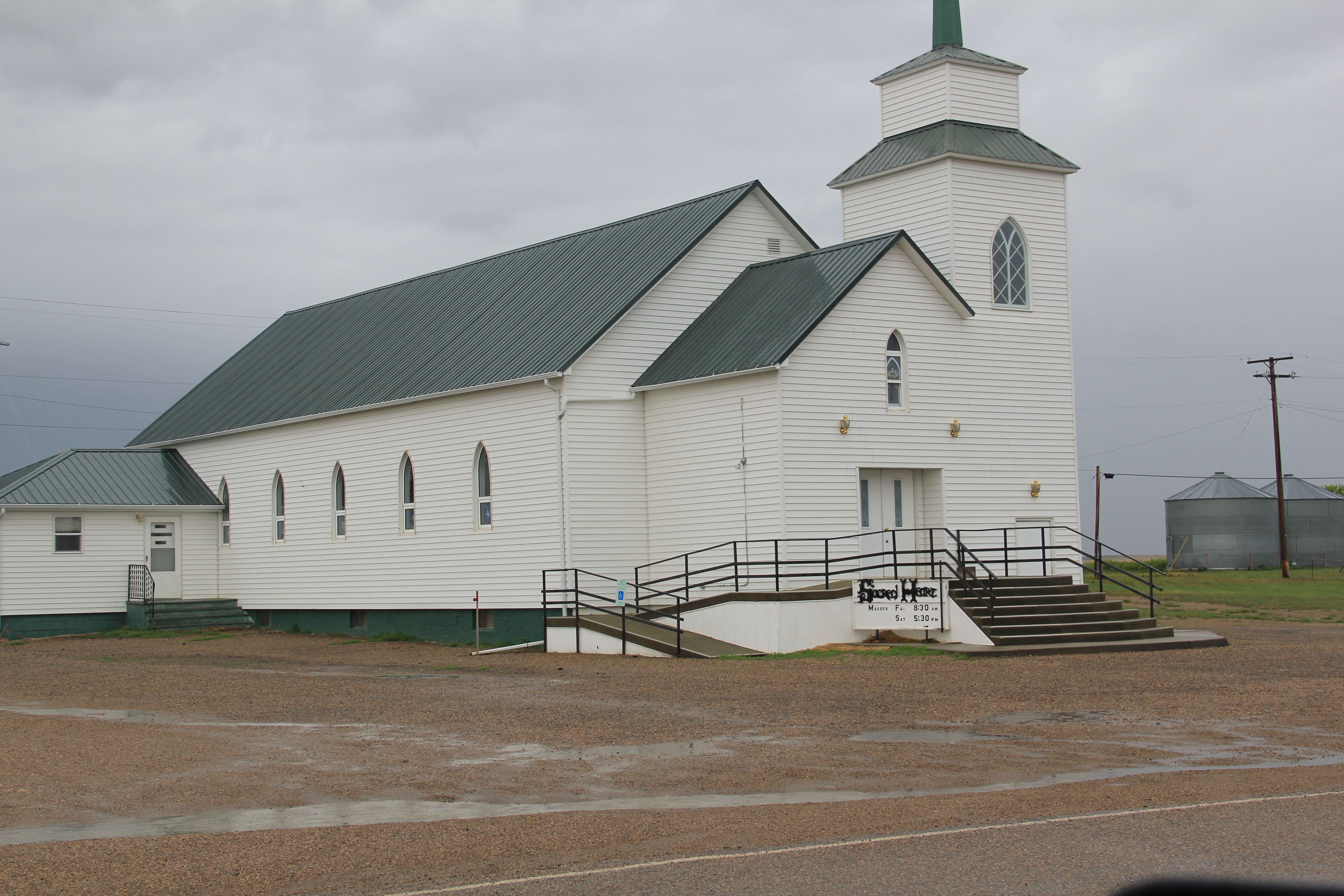
The Sacred Heart Catholic Church dates to the town’s beginnings, but a brick school from 1931 with 1952 additions closed in the early 21st century.

Image

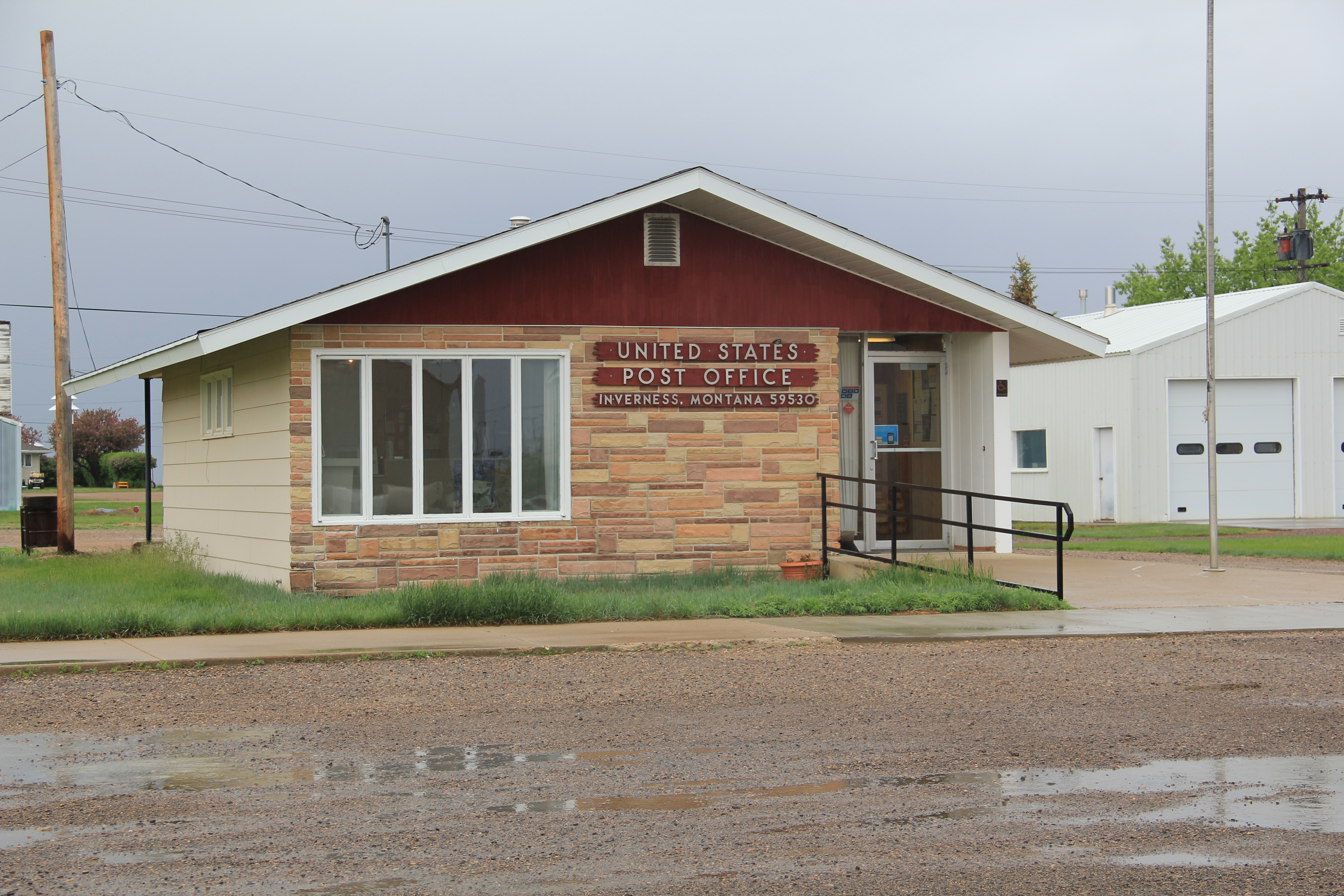
Inverness’s c. 1960 post office is a great example of stone-faced standardized design that the postal service used in small towns across the nation in that decade. It was one of the offices threatened with closure in 2011.

Image

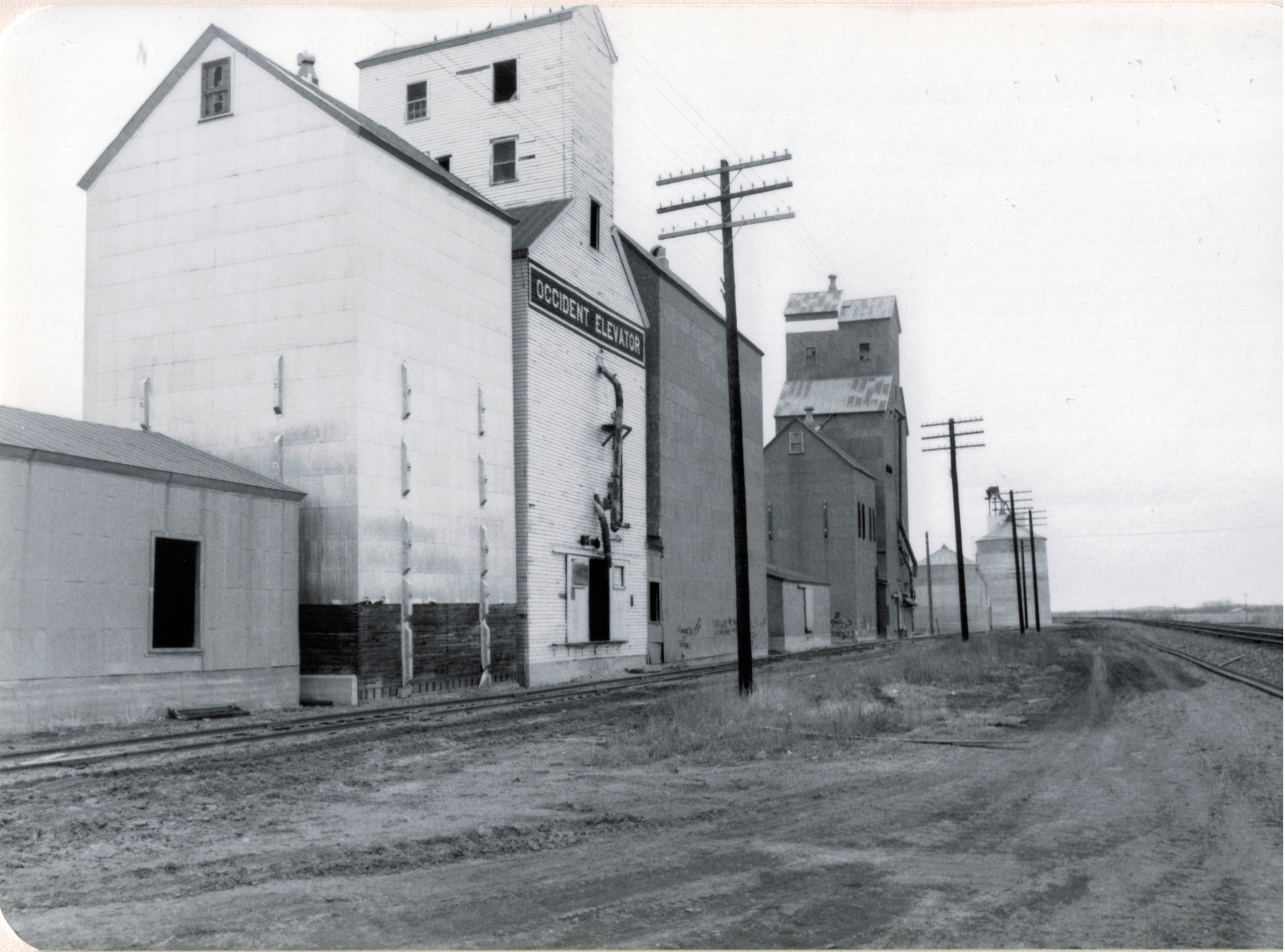
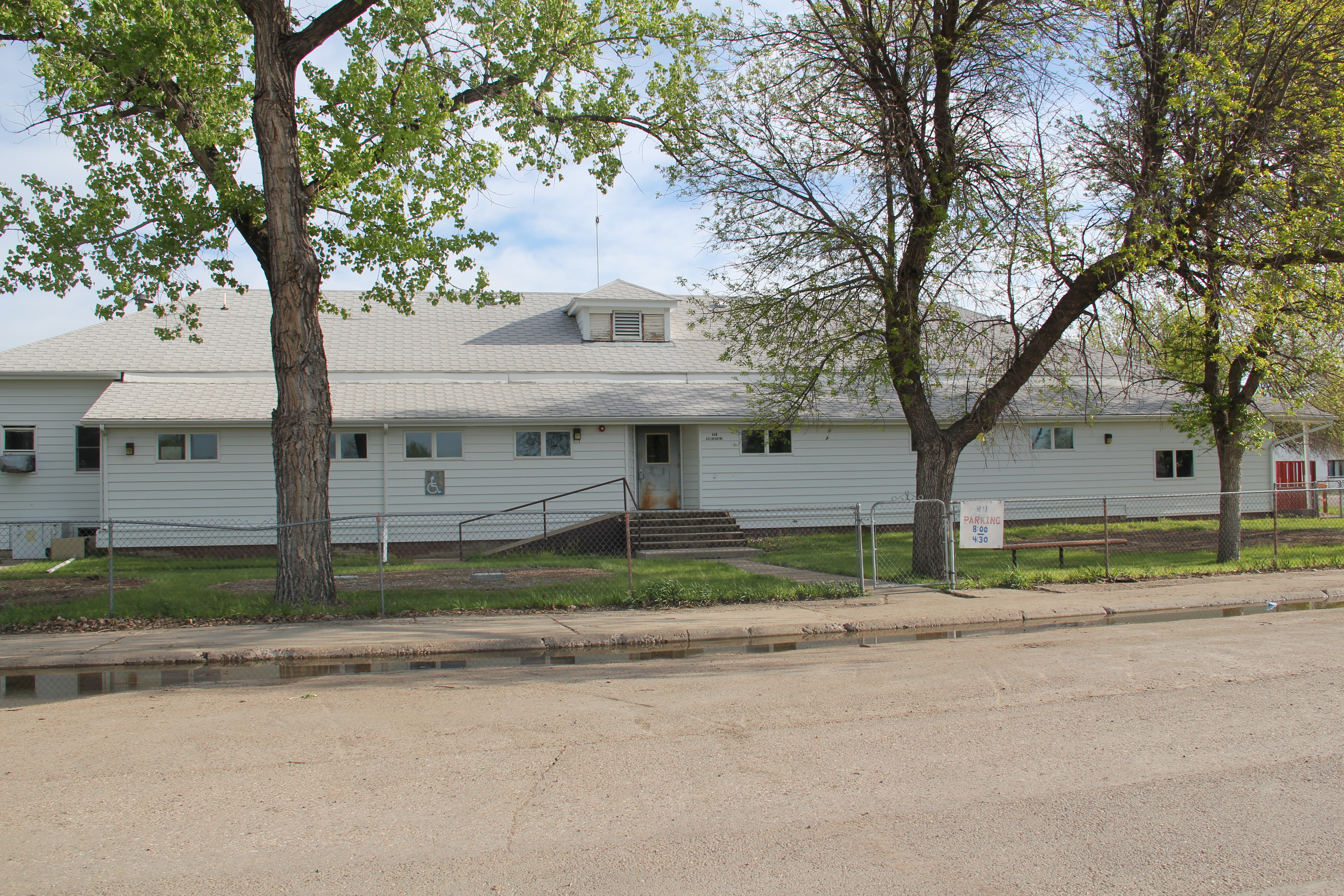
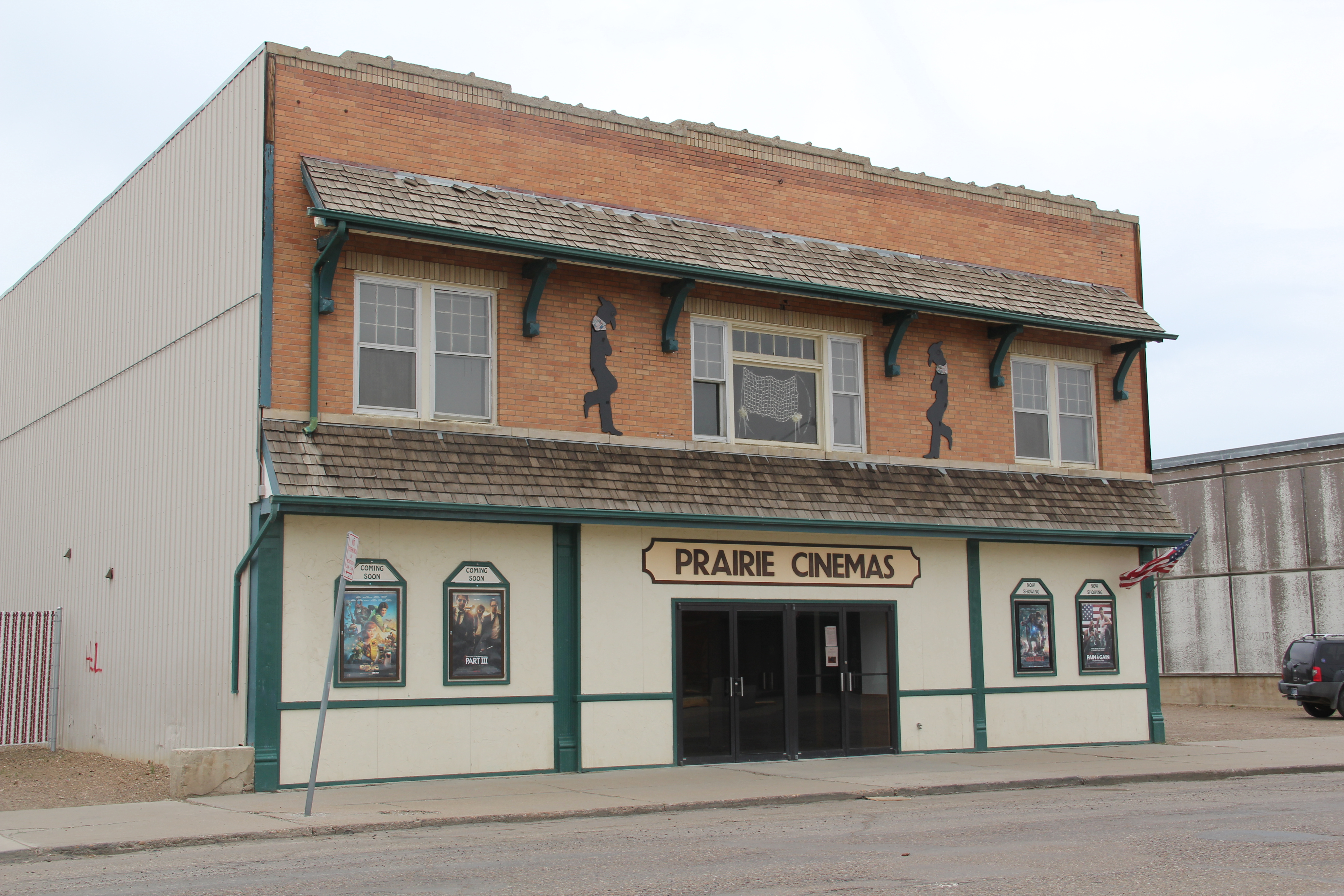
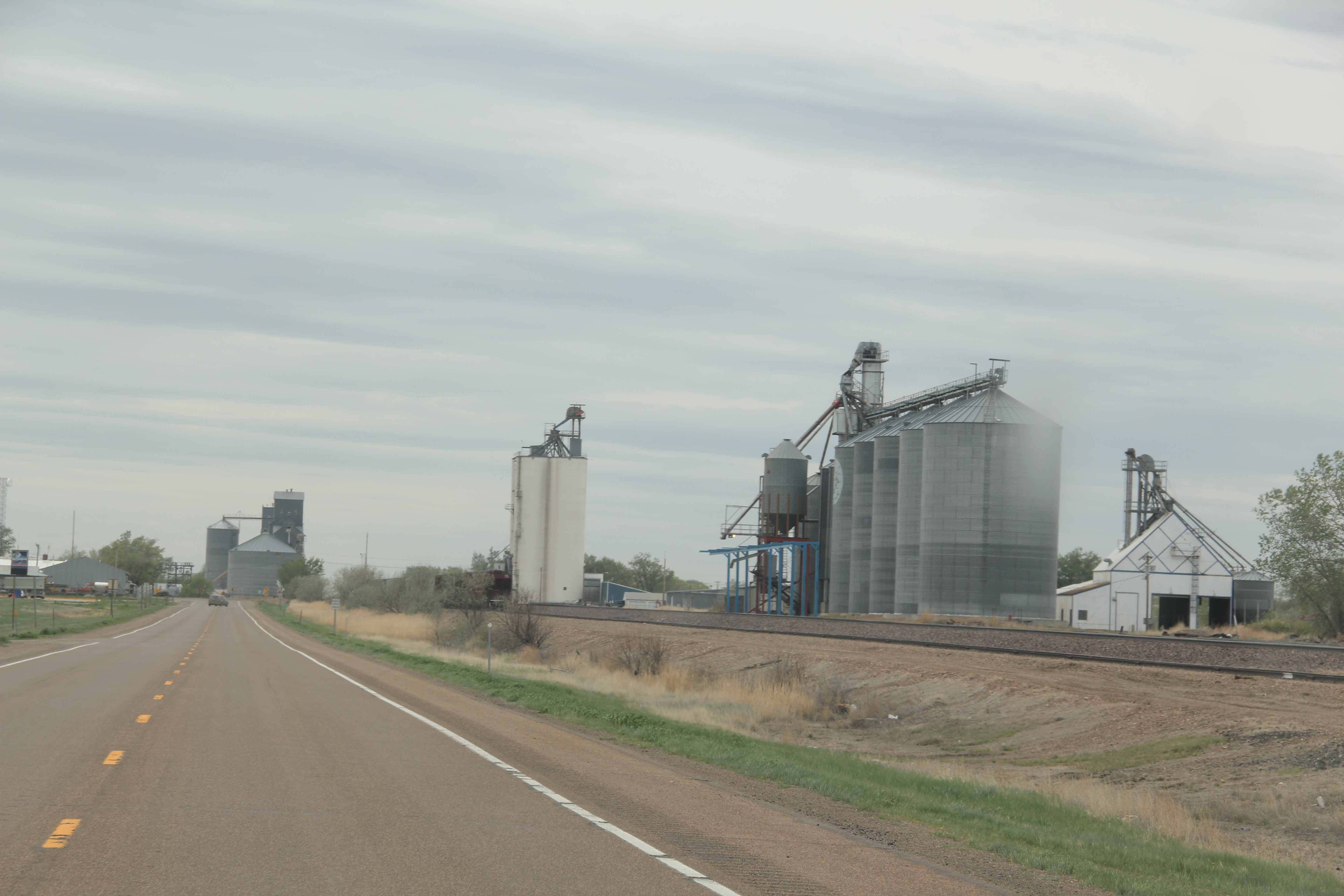
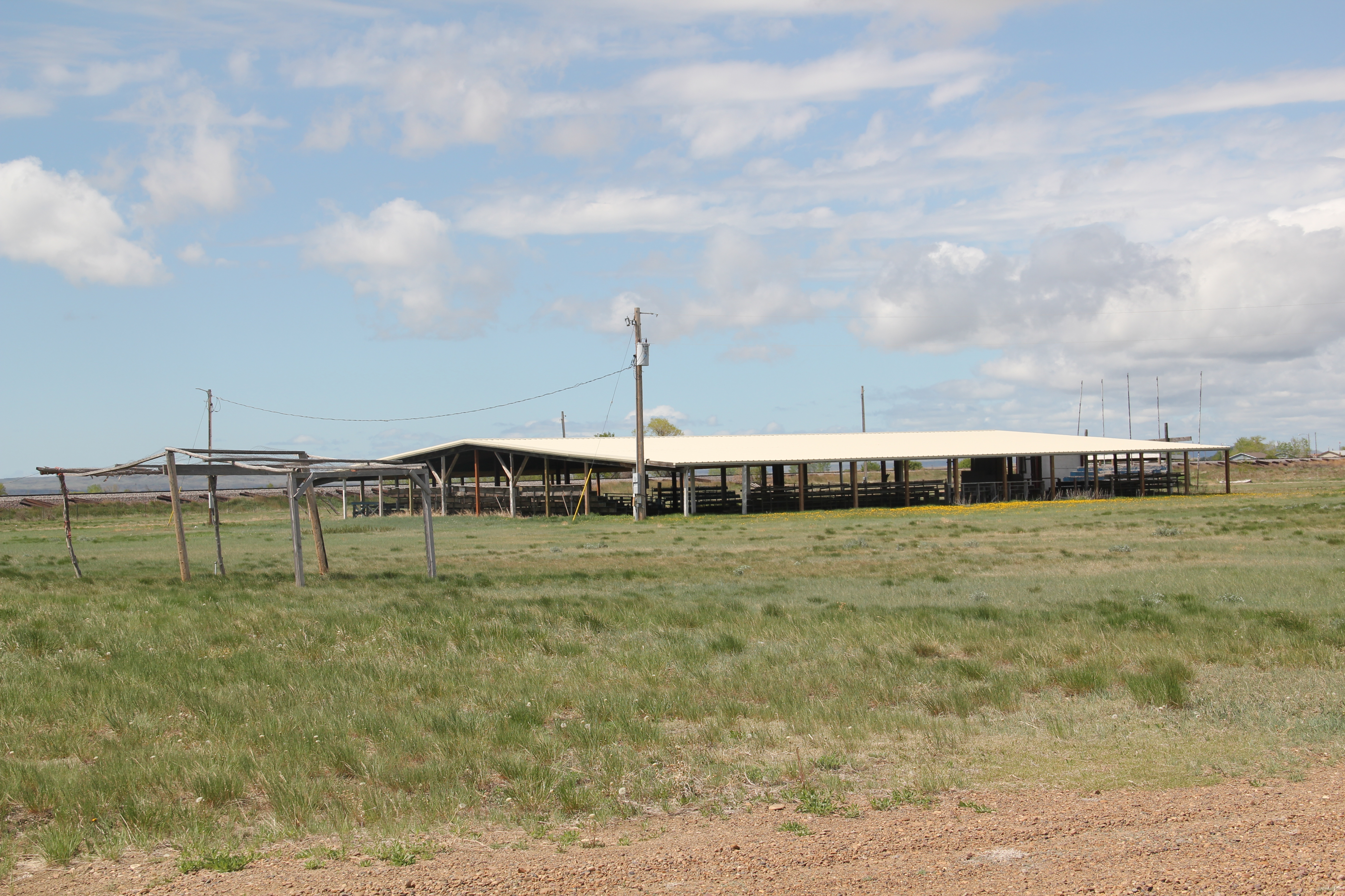
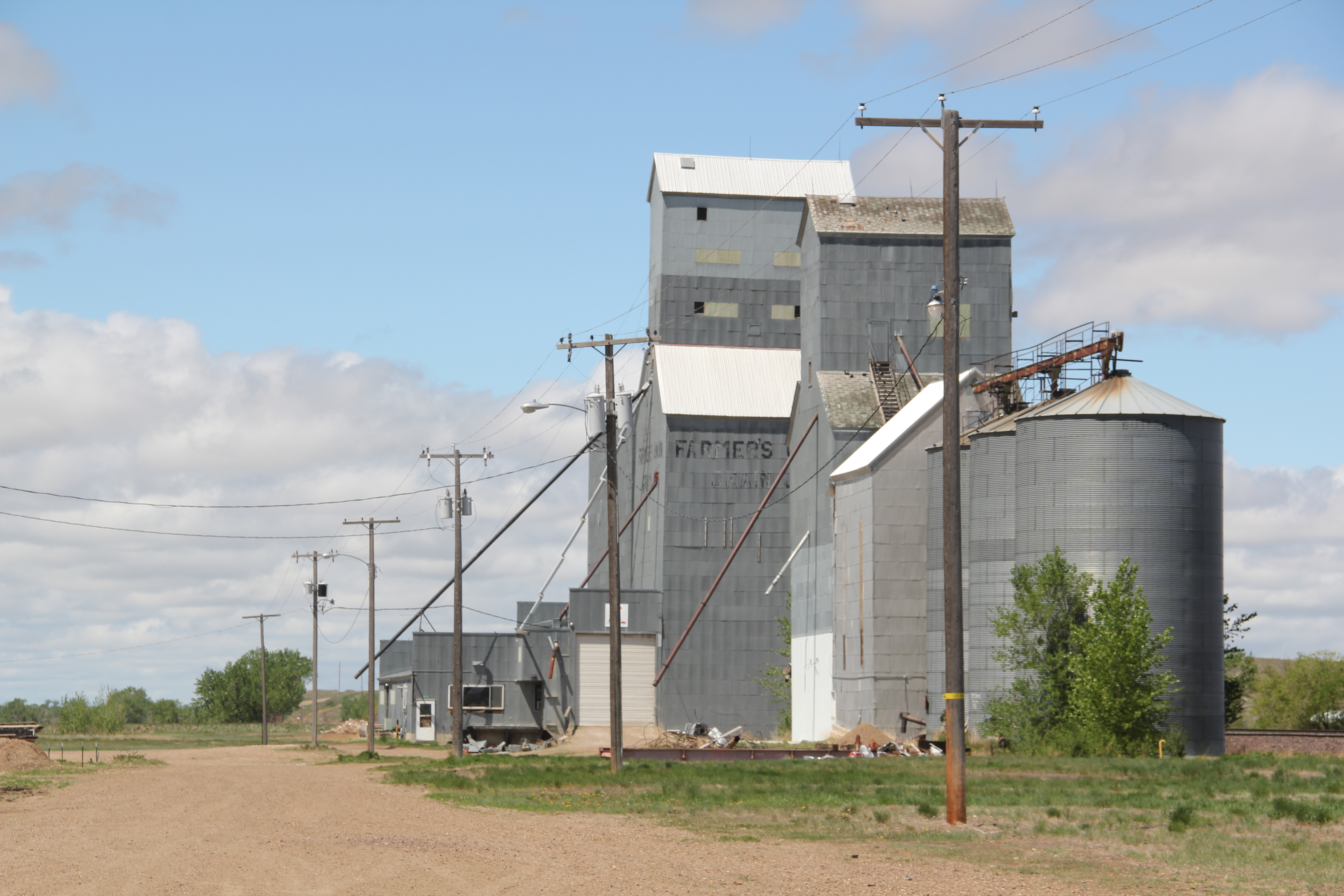
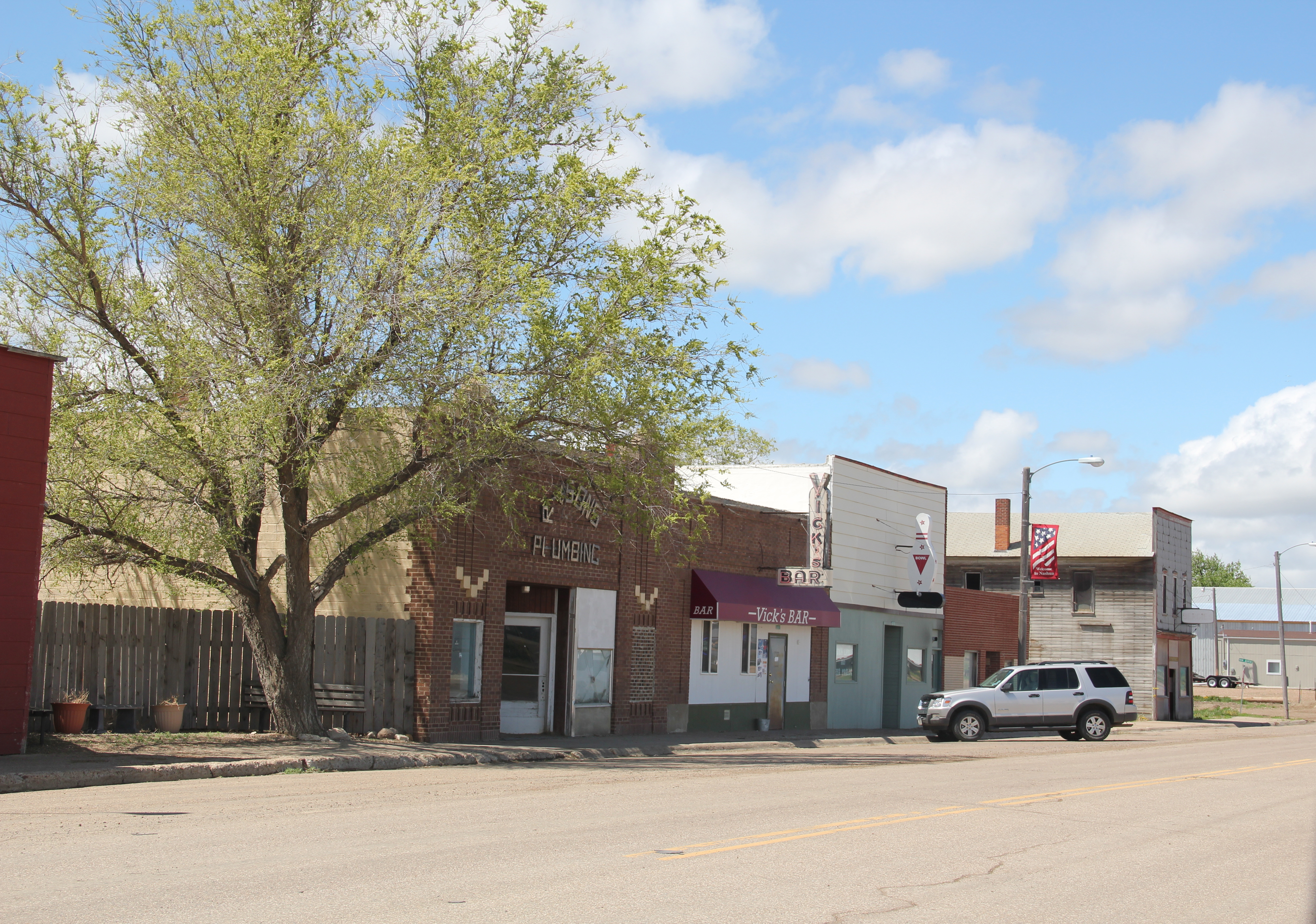
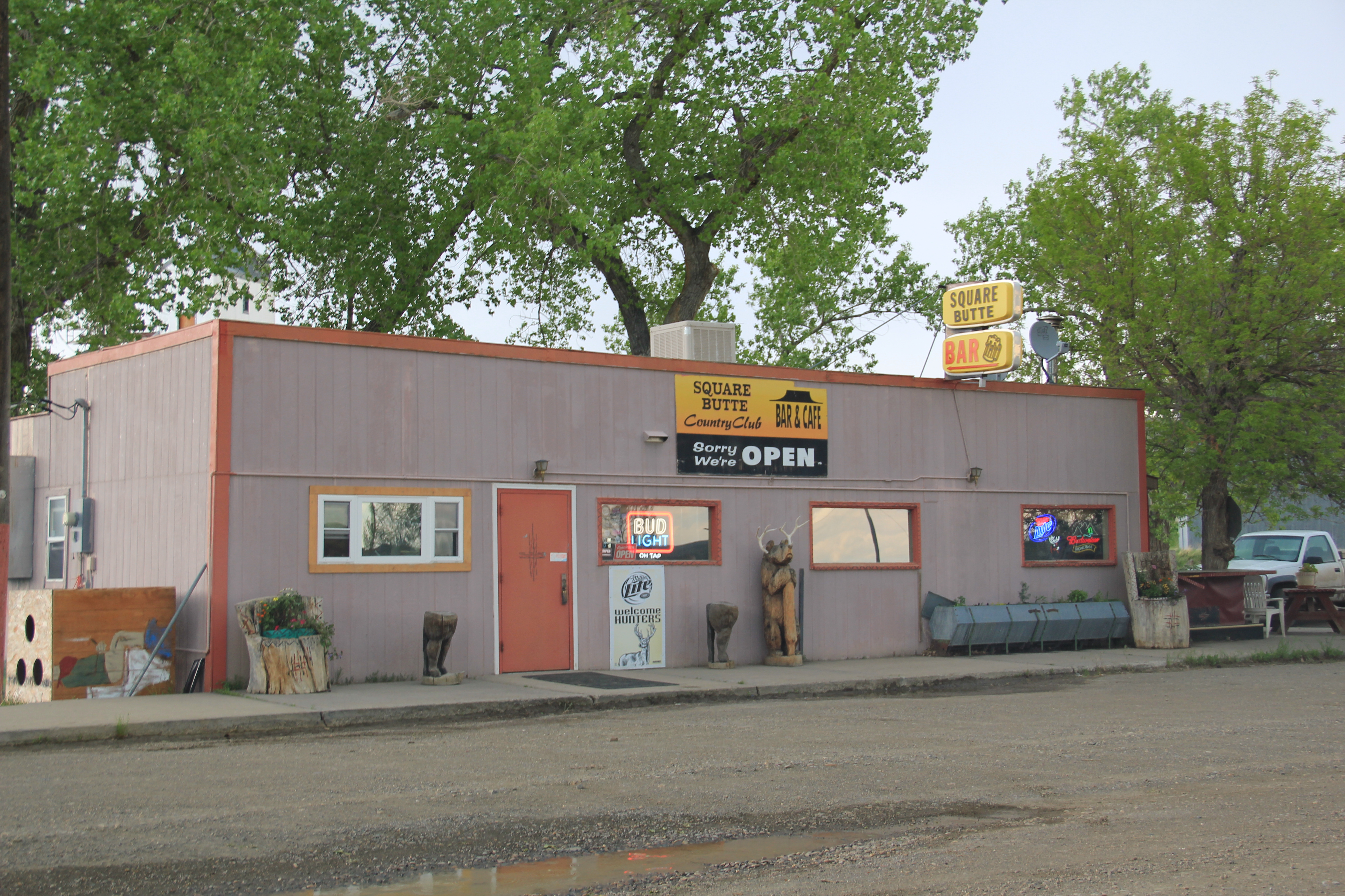
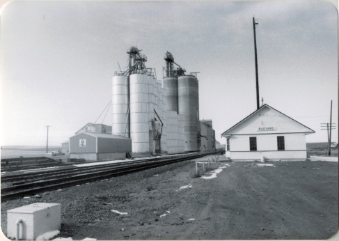
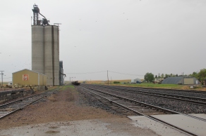
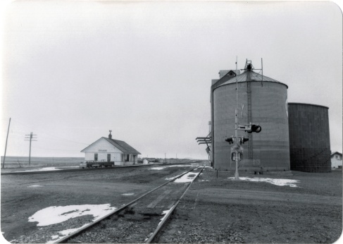
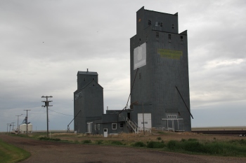
Rudyard, established 1909, was the largest of the west Hill County towns, about 500 people in 1980 but now with only 258 residents according to the 2010 census.  Its prominence in the second half of the 20th century is reflected in two buildings:  the tall concrete grain elevators along the railroad and the contemporary-styled Wells Fargo bank building on the prominent town corner facing the tracks and Reed Street.

Image Image

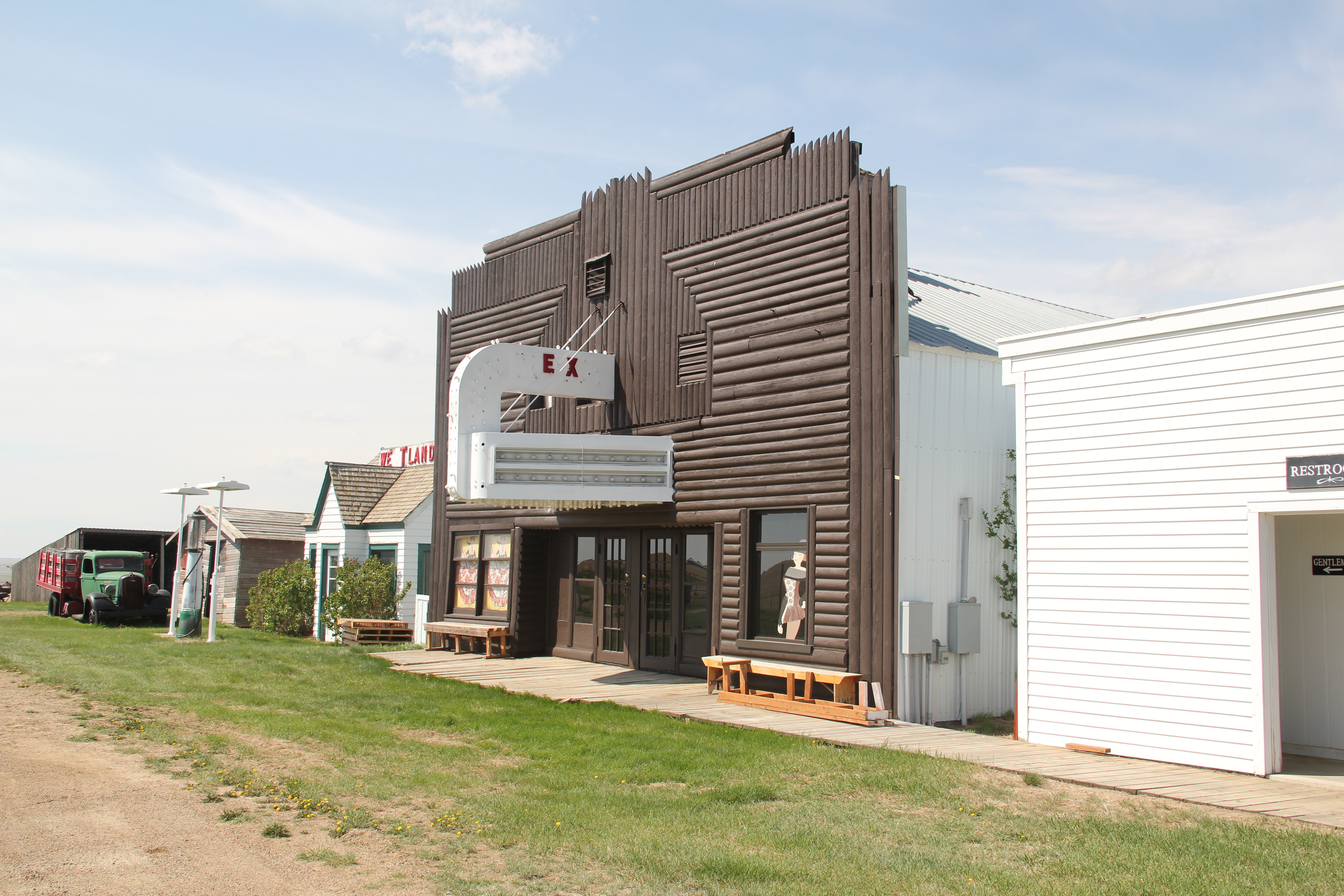
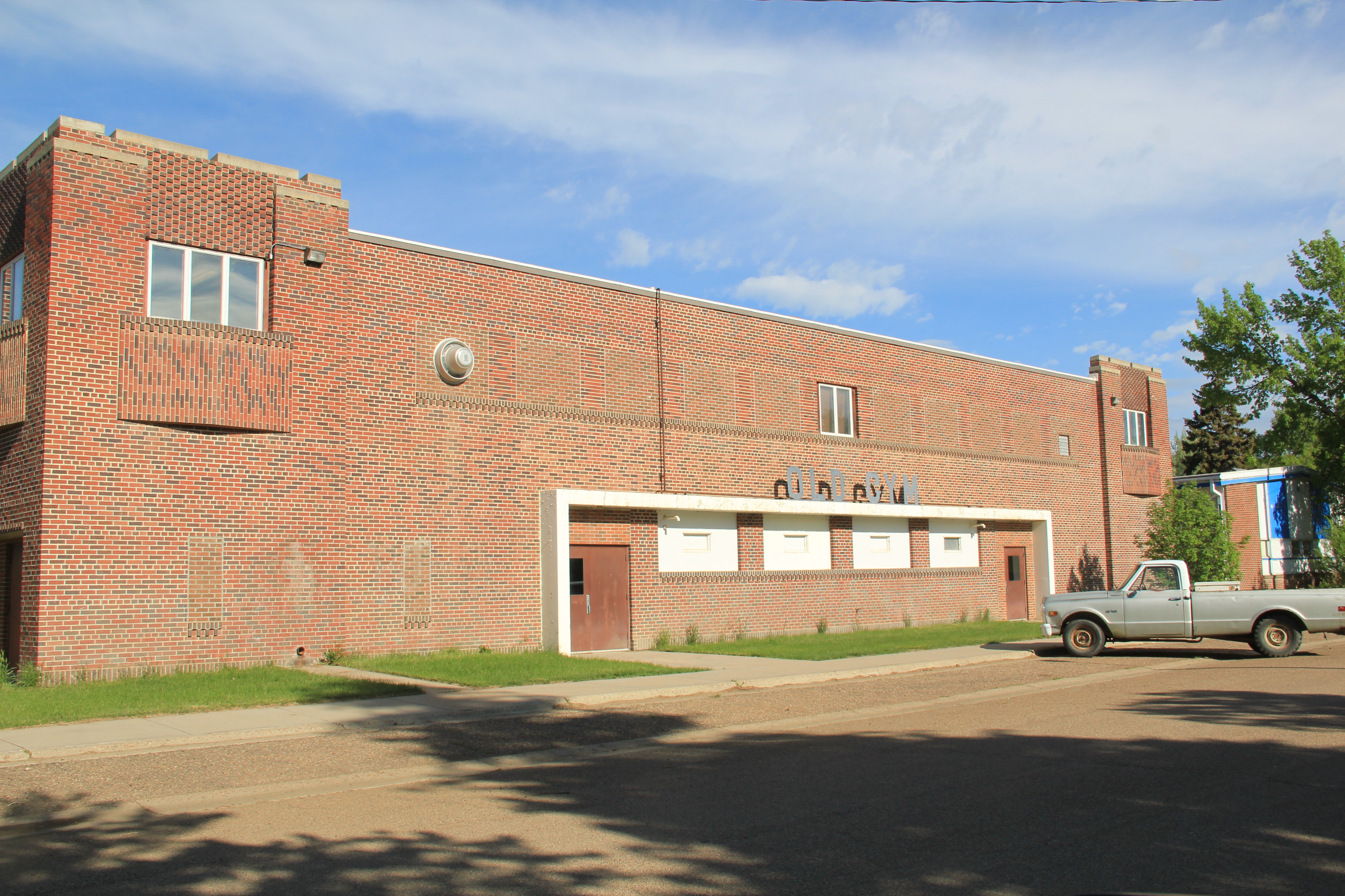
Thirty years ago, as the construction of a modern bank building attests, several stores and the Hi-Line Theater were hubs of activity; today most businesses are closed.

ImageImage

Image

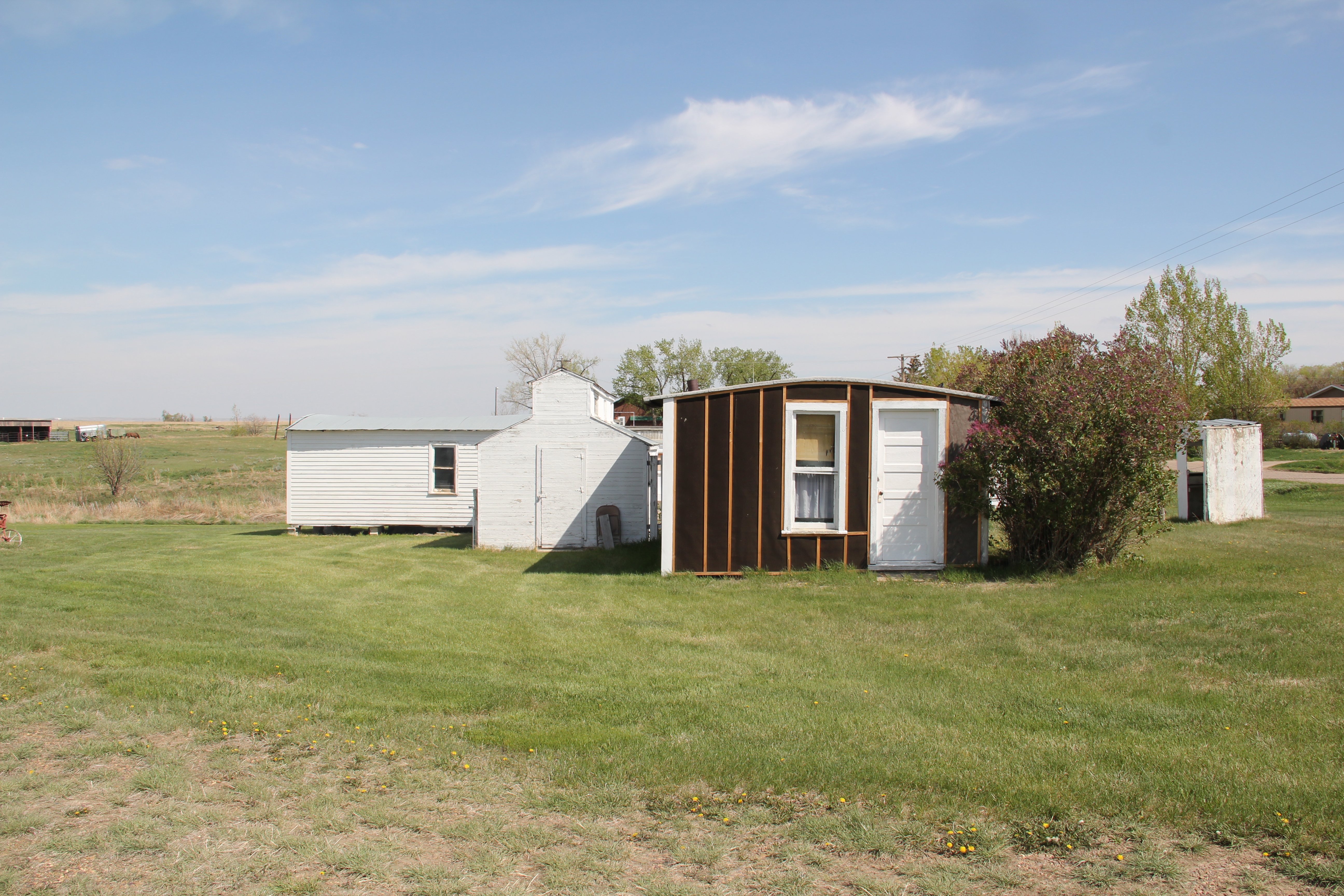
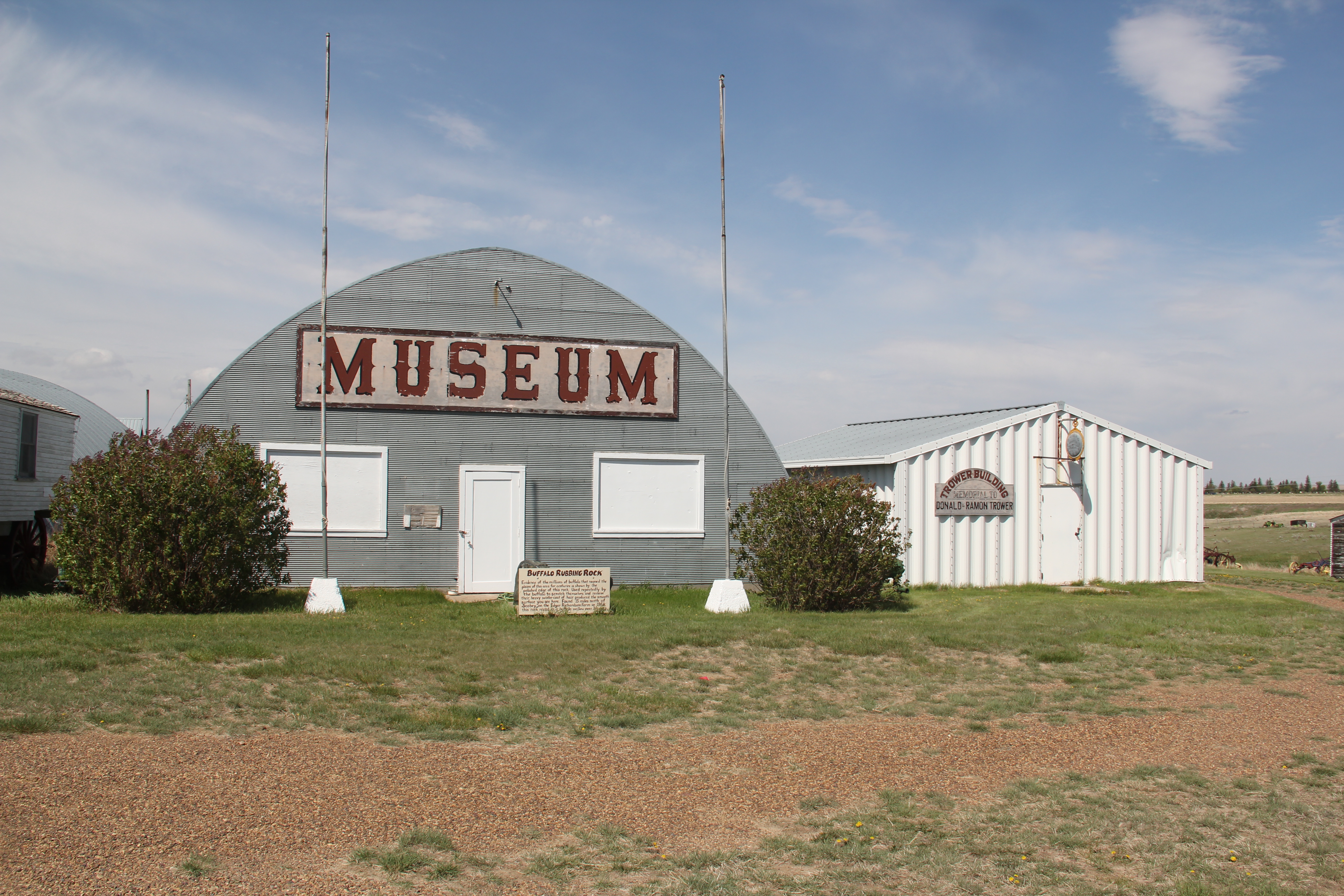
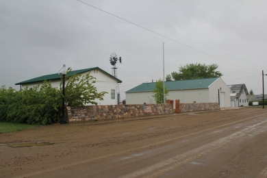
Museums now abound–with the moved depot forming a small building zoo while an early 20th century stone building has become an auto museum.

Image

Image

Rudyard also has one of the highway’s most famous town signs–boasting of a population now greatly diminished but the old sorehead remains–at the Sorehead Cafe in the heart of the four block long commercial district.

Image

Image

One hundred years ago, Hingham (1910) seemed to be the town that would make it. From the railroad corridor several blocks of commercial businesses were filled in the next decade.

Image

There was a town square featuring a city park in the midst of it all.

Image

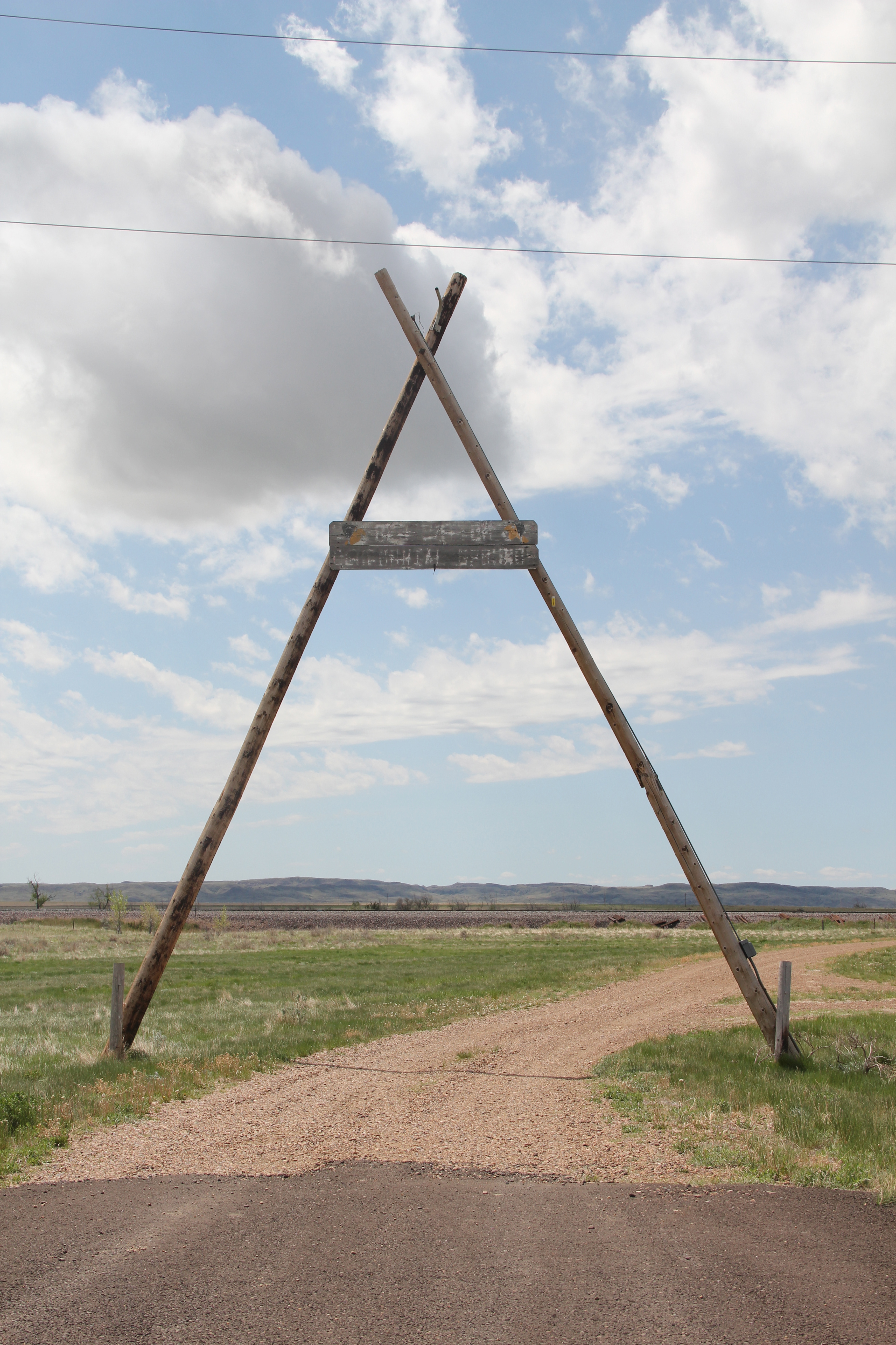
Here the town’s Commercial Club hosted the Hi-Line Fair, which “presented farmers and ranchers with an opportunity to exhibit their grain and livestock and to exchange ideas with people from other points along the Hi-Line.”

Image

While the buildings, outside of the brick neo-classical brick bank (1913-14), were frame, town boosters were confident these were only the initial businesses. But the second decade of the 20th century proved to be the town’s high point, and frame buildings still define local businesses.

Image

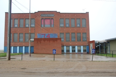
In 1930 they defined the town with a large, handsome two-story brick school at its south end (near U.S. 2, a recognition of the highway’s importance in getting students to and from Hingham).

Image

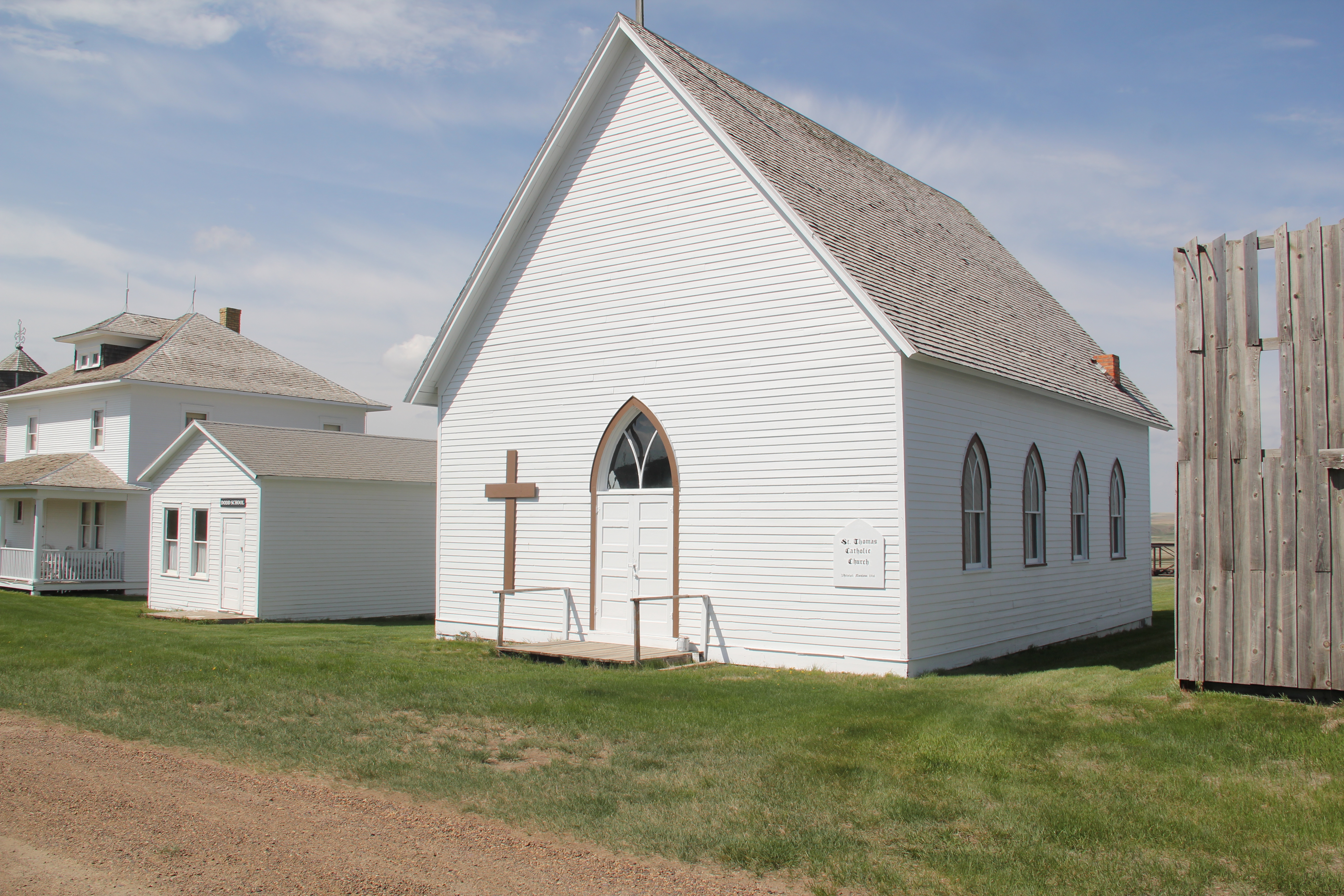
The Our Lady of Ransom Catholic Church is a modernist landmark, and one of the most architecturally important buildings of the Hi-Line, part of the Great Falls diocese effort to improve and modernize its churches in the mid-20th century.  A much earlier frame Methodist Church remains, and has most recently served as a community chapel.

Image Image

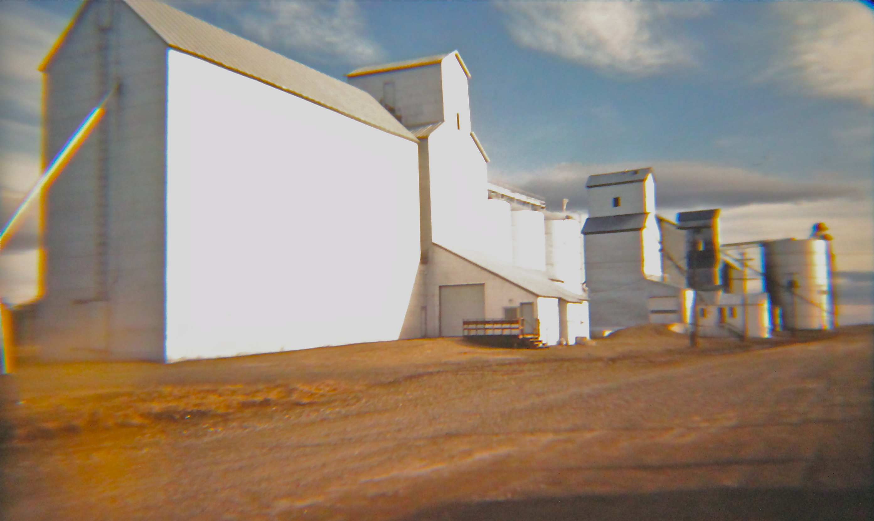
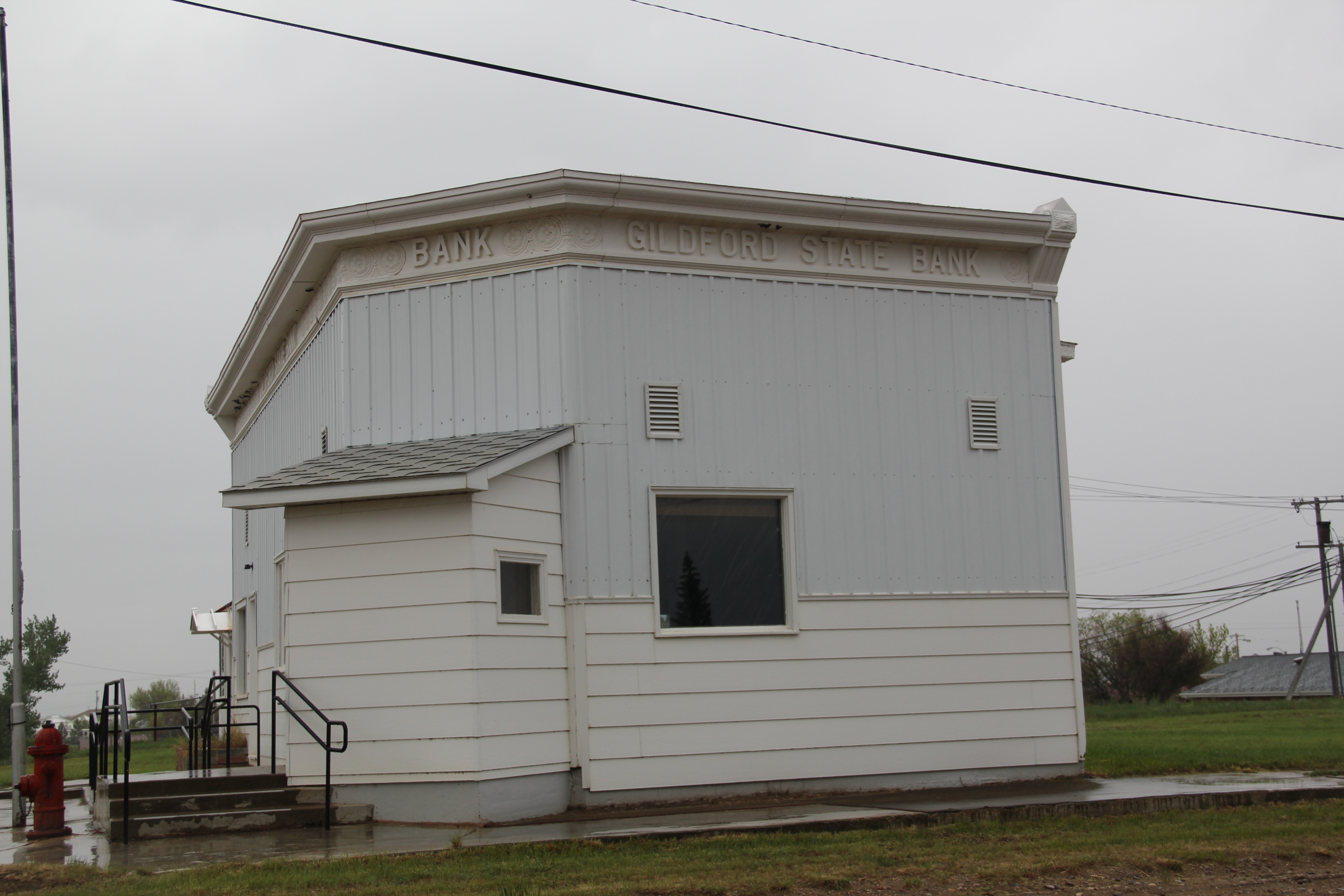
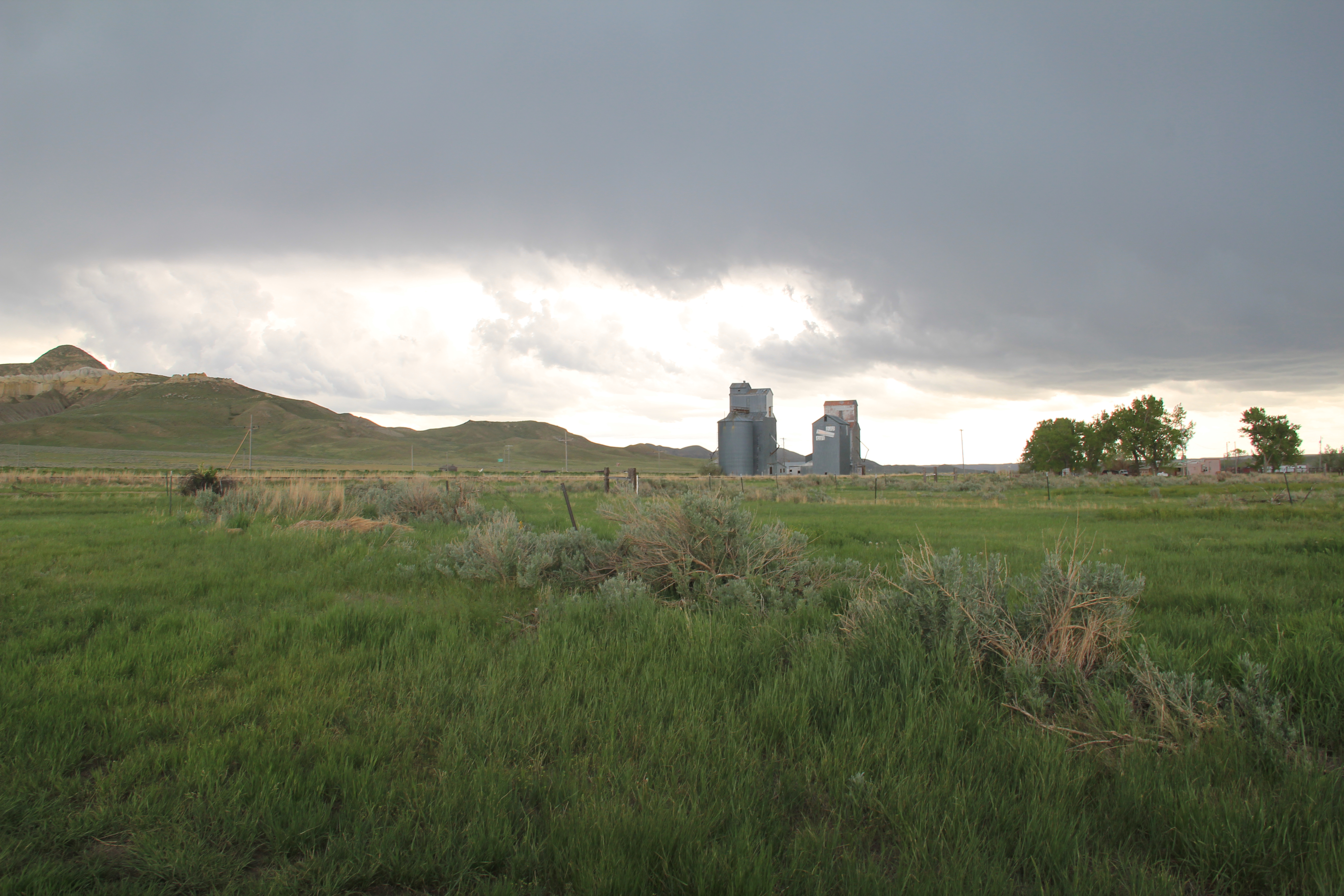
The boosters of Gildford also had high hopes in 1910 and the homesteading boom brought a full fledged town into existence by 1915-16.
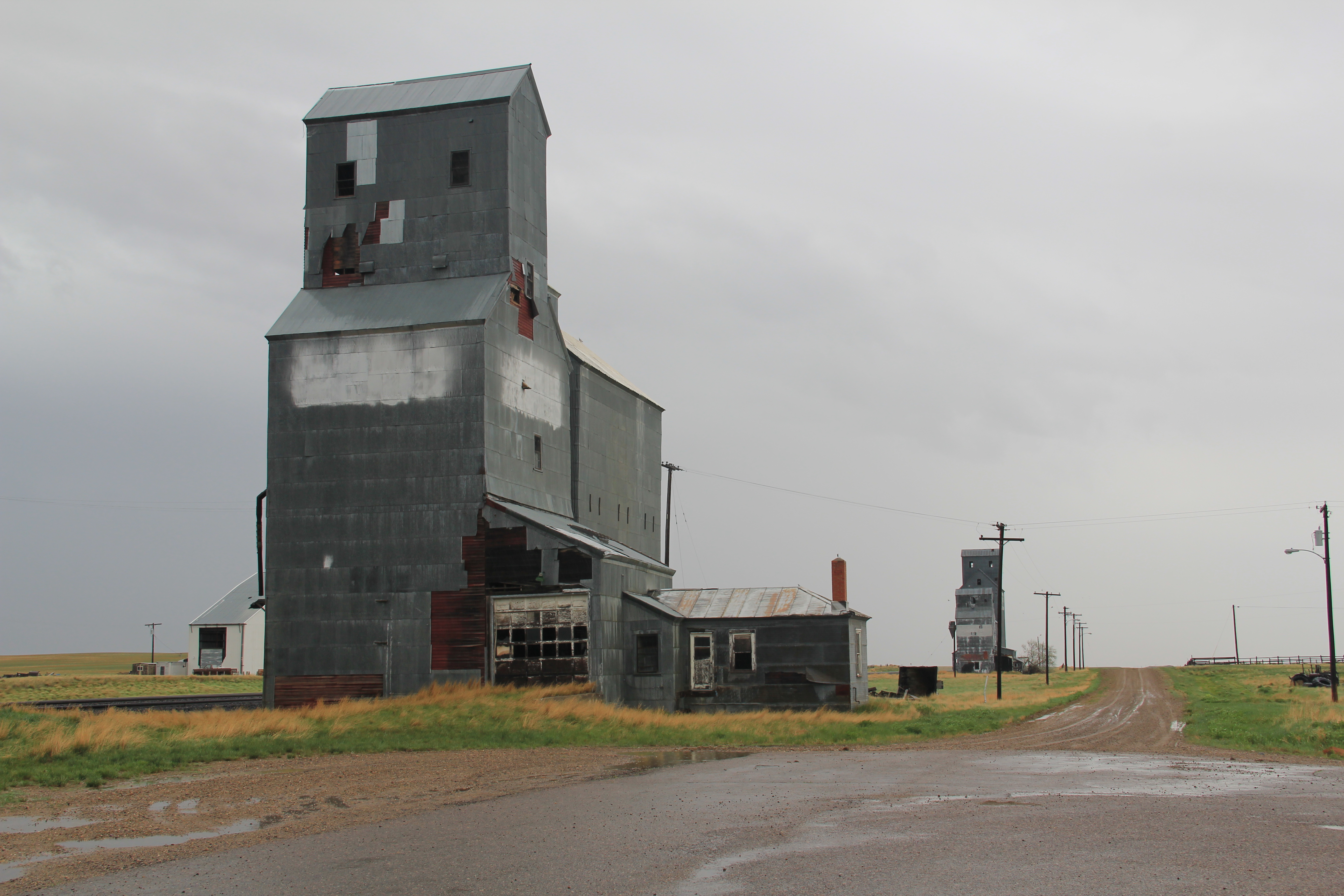
Image

Image

Image Elevators in 1985

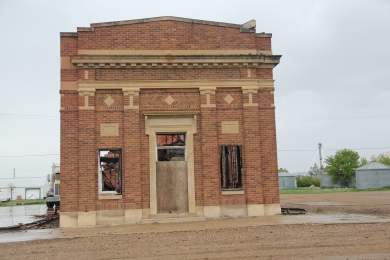
The boom decade is marked by the extant Gildford State Bank (1914), which also served as the town’s post office when I first visited in 1984.  The town also had an early industry, the Mundy Flour Mill.

ImageImage

Kremlin acknowledges its distinct name with its highway town sign.

Image

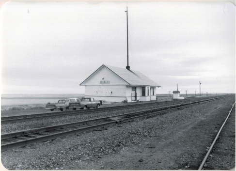
Settlement began in 1909, with a plat from land agent K.C. Farley, focused on the Great Northern section house, later replaced by a standardized depot, all of which is gone from the railroad corridor today.

Image

IMG_8903

The WPA built a new high school in 1938, which remains a central landmark for the community, a symbol of the future, and a good way to end this posting.

IMG_8913 IMG_8912

Square Butte and a spring storm

Image


One of my favorite Central Montana landmarks and small railroad towns is Square Butte.  Once served by the Milwaukee Road, few travelers find the town today.  Yet several key landmarks remain–the historic late 19th century stone jail is listed in the National Register of Historic Places.  

Image


There is a historic brick school building, a bit worse for wear but still a key survivor that marks the height of the homesteading boom in the county.  

Image


But my favorite resources are the elevators along the railroad corridor–still standing tall, although in that stormy day–I made it through a pretty strong hail storm about 10 minutes after the photo–the elevators perhaps look dramatic than normal.

Image

And perhaps most importantly the town still has a local tavern, the appropriately named Square Butte Country Club Bar.  Still an important community center today, as it was in 1984.

Image