Somehow it is most appropriate that my 300th post for Revisiting the Montana Landscape would find me back at Glacier National Park, especially the west side or Flathead County part of the park. From the first visit in 1982, Glacier always intrigued me–at first because of the tie between park creation and railroad development, then the Arts and Crafts/Chalet architecture associated with the park, and then high mountain Alpine environment. In the years since, I have eagerly grabbed a chance to get a cabin by Lake McDonald and just re-charge for a few days.
 For the 1984-1985 state historic preservation plan work, however, I did not visit the west side of the park–the bulk of the travel took place between mid-February to mid-May 1984, meaning only the lower elevations such as Apgar Village were accessible. But already the state historic preservation office was aware that a major effort was underway to identify and nominate key properties within the park to the National Register of Historic Places, and by the end of the decade that process was largely complete. The National Park Service identified a range of historic resources from the turn of the 20th century to the Mission 66 program of the National Park Service during the 1960s–Glacier became one of the best studied historic landscapes in all of Montana.


Going-t0-the-Sun Road is an engineering marvel from the early automobile age in the park, straight and safe in the lower reaches but as you climb into the mountains it is narrow and dangerous–for those who refuse to follow the rules of the road.

View of Lake Shelburne, east side of park, Glacier County, from Going-to-the-Sun Road.
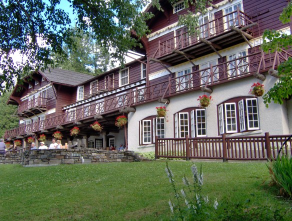
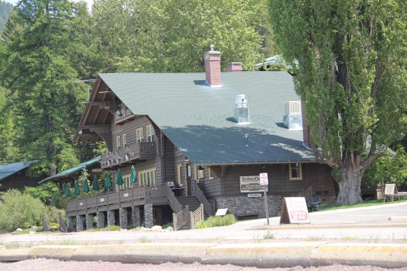
On the west side of the Going-to-the-Sun Road, Lake McDonald Lodge is listed as a National Historic Landmark for its significance in and influence on the Arts and Crafts/Chalet style within the national park.
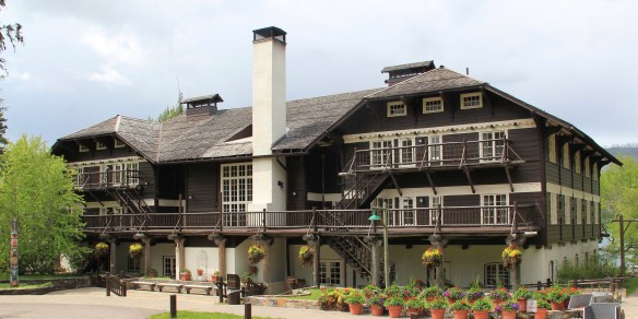
Built initially as the Lewis Glacier Hotel for Great Falls businessman John Lewis in 1913, architect Kirkland Cutter’s design reflected his earlier work at the Belton Chalet, but his interior design was a step above, especially in how he incorporated local materials, the mountain goat symbol of the Great Northern Railway, and Native American motifs to create an environment that was both of the outdoors but also of the deep cultural meaning of the mountains. The hanging lanterns are more recent, being reproductions added in the 1960s from originals at the Prince of Wales Hotel in Canada. Their original designs are attributed to Kanai artists.


In 1957, the property changed its name to the Lake McDonald Lodge and soon various new buildings were added, in part to meet the demand for increased visitation but also to meet the tastes and expectations of suburban Americans who came to park not by train but by automobile. The Lake McDonald Lodge Coffee Shop (1965) has been listed in the National

 Register as an excellent example of Mission 66-associated architecture within the park. Burt L. Gewalt of the Kalispell firm Brinkman and Lenon was the architect.
 Great Northern officials considered the lodge to be the center of the mountain experience on the park’s west side. From there visitors could take overnight hikes to two other facilities, shown below, the Granite Park Chalet to the northeast or the Sperry Chalet to the southeast of Lake McDonald, both of which are also listed in the National Register.


When I knew of my new position at the recently created MTSU Center for Historic Preservation in the summer of 1985, my wife and I made a quick last trip to the chalets, the lodge, and Glacier National Park. Perhaps that decision, moreso than my words, show what the park and its built environment has meant to my understanding of landscape, design, and escape in the Big Sky Country.
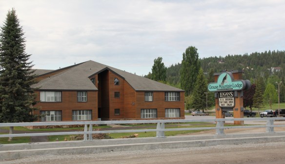
 City as one large tourism funnel. After spending a good part of 2006-2007 working with local residents and the Great Smoky Mountains National Park about the heritage and preservation of Gatlinburg, Tennessee–one of the most notorious gateways into any national park–I learned to look deeper than the highway landscape and find some real jewels in each of these Glacier National Park gateway communities.


 At Hungry Horse, however, I did leave the highway and explored the marvelous landscape created by the Hungry Horse Dam and Reservoir, a mid-20th century project by the U.S. Bureau of Reclamation. The agency justified the dam as a hydroelectric power project for a growing Flathead County and as a boost to local irrigation. The irrigation side of the project–the real reason the agency exists–never happened and Hungry Horse today is an electric power and recreational project.
 I appreciated the vastness of the concrete arch dam–the 11th largest concrete dam in the United States–as well as the beauty of Hungry Horse Reservoir, an under-appreciated tourism asset as anyone in Flathead County will tell you. But again, I let just the size and impact of the dam distract me from some of the details of its construction that, today, are so striking.


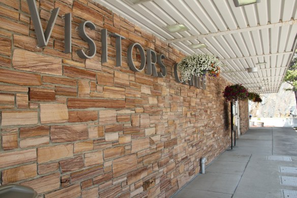

 I am concerned, however, about news in September 2015 that Reclamation has contracted for updates and renovation at the Visitor Center–let’s hope that the classic 1950s look of the property is not sacrificed.


 Architect Kirtland Cutter of Spokane was the architect and the chalet design was actually just a smaller scale and less adorned version of the Idaho State Exhibition Building that he had designed for the 1893 World’s Fair in Chicago. Cutter is one of the major figures of the Arts and Crafts Movement in the American Northwest and we will look at another of his buildings for the railroad and Glacier in the next post about Lake McDonald Lodge.


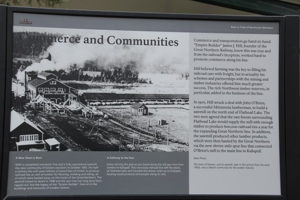
 The answer was yes, to both questions. Here is an early 20th century log building landmark on a highway where the traffic seems to never end. It is also along the corridor of a new recreational system–the Great Northern Rails to Trails linear park that uses an old railroad corridor to connect the city to the country in Flathead County.
 The trail allows bikers to see the rural landscape, still dotted with family farms, of the Smith Valley as it stretches west to Kila, where the old Cottage Inn has been converted in the last few years into the Kila Pub, complete with the Arts and Crafts/Tudor theme associated with the railroad corridor.

 To the north of Kalispell and Whitefish U.S. Highway 93 takes you past the ski developments into a thick forested area, managed in part as the Stillwater State Forest.
 from the 1920s into the 1960s. While several are from the Civilian Conservation Corps during the 1930s, state ranger Pete De Groat built his log residence in 1928 in the Rustic Style. Stillwater was Montana’s first state forest.


 “lone eagles” was local–an attempt to describe those professionals “who fly to work as comfortably as most Americans drive, and whose use of computers in business lets them indulge their preference for life in the great outdoors,” as a June 19, 1994 story in the New York Times explained.
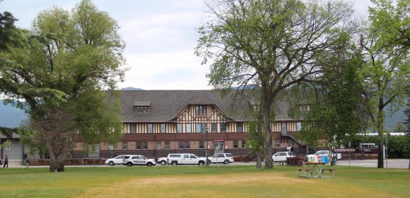

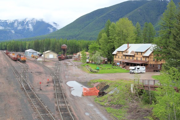
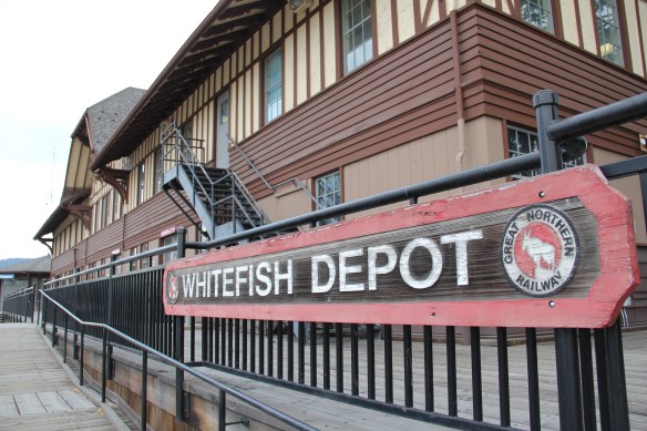
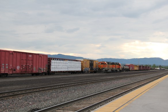 The station along with the railroad tracks defined everything you saw in Whitefish–here in the classic Great Northern T-plan landscape was a classic railroad town–one that old-timers even called the best along the entire line. Whitefish developed and then prospered as a division point on the mainline from 1904 to 1955–and that corporate imprint was still there to be experienced, in 1984.
 Thankfully in 2015, I still found all of my favorite landmarks from 30 years earlier, even though there was little doubt that the business district had been altered, sometimes in ways that left little original fabric in place but still some two-story brick blocks stood.


 A much earlier landmark, the Classical Revival Masonic Temple from the town’s first decade still stood, and it too found a new use through adaptive reuse.
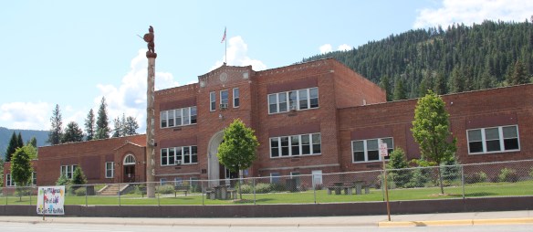
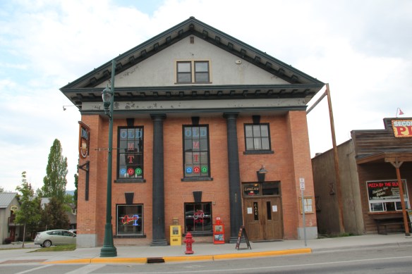 Despite the population boom over the last 30 years, Whitefish still uses its Art Deco-styled school from the New Deal decade of the 1930s, although the auditorium has been restored and updated into a community performing arts center.


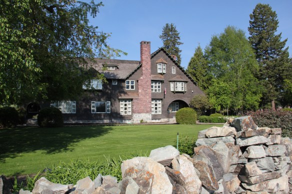


 The images above and those below come from those well maintained neighborhoods, where the sense of place and pride is so strongly stated.


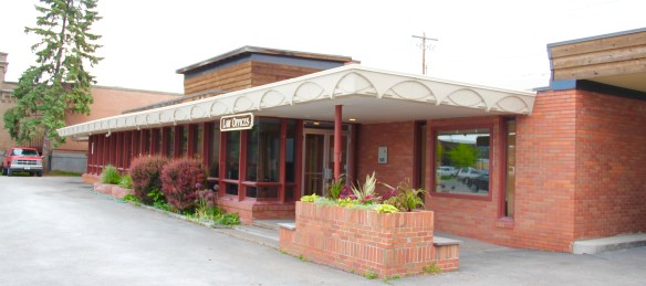
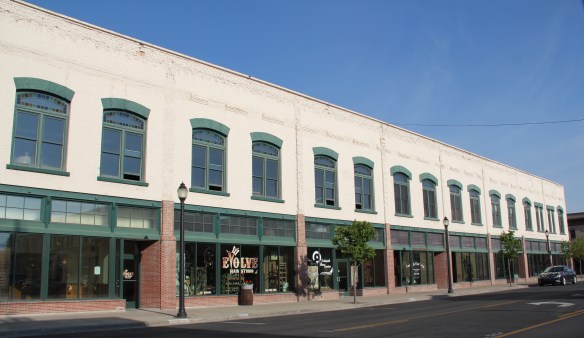
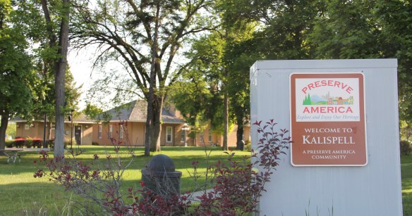
 Kalispell’s Main Street–the stem of the T-plan that dates to the town’s very beginning as a stop on the Great Northern Railway–has a different mix of businesses today than 30 years ago when I visited during my state historic preservation plan survey. It also now is a historic district within National Register of Historic Places, noted for its mix of one-story and two-story Western Commercial style businesses along with large historic hotels and an opera house for entertainment.
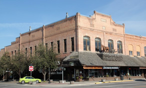 The Opera House, and I’m sorry you have to love the horse and buggy sign added to the front some years ago, dates to 1896 as the dream of merchant John MacIntosh to give the fledging community everything it needed. On the first floor was his store, which over the years sold all sorts of items, from thimbles to Studebakers. The second floor was a community space, for meetings, a gymnasium, and even from a brief period from 1905 to 1906 a skating rink. In this way, MacIntosh followed the ten-year-old model of a much larger building in a much larger city, the famous Auditorium Building in Chicago, providing Kalispell with a major indoor recreation space and landmark. Allegedly over 1000 people attended a performance of Uncle Tom’s Cabin soon after the opening.


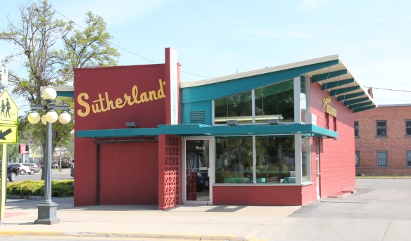
 The Alpine Lighting Center dates to 1929 when local architect Fred Brinkman designed the store for Montgomery Ward, the famous Chicago-based catalog merchant. Its eye-catching facade distinguished it from many of the other more unadorned two-part commercial blocks on Main Street.


 The town’s early religious institutions also built to stay, leaving key landmarks throughout the neighborhoods that serve as historic anchors today. On Main Street alone there is the unique Arts and Crafts styled First Presbyterian Church (1925-26) by architect Fred Brinkman, and the Gothic Revival masonry and tower of Bethlehem Lutheran Church (1932-1937).
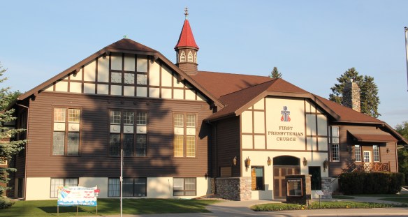


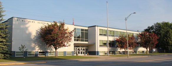
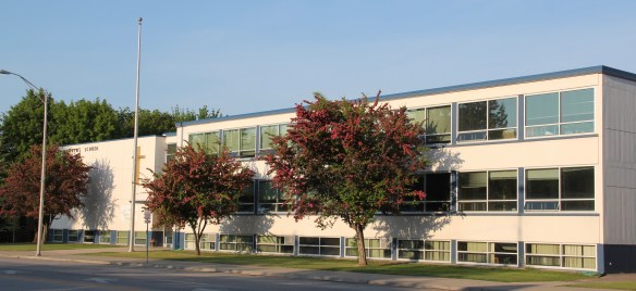 The city’s first Catholic school dated to 1917. The historic St. Matthew’s Catholic Church (1910) by Great Falls architect George Shanley remains the city’s most commanding Gothic landmark.


 By the late 1980s there was little doubt that a substantial development boom was underway in Flathead County. In the town near the Flathead Lake, like Bigfork, above, the boom dramatically altered both the density and look of the town. In the northern half of the county Whitefish suddenly became a sky resort center. In 1988, during a return visit to Montana, I did not like what I encountered in Flathead County–and thus I stayed away for the next 27 years years, until the early summer of 2015.


 I love Montana town signs, and Troy, deep in the state’s logging country, has one of the best. The sign lures to a city park nestled along the Kootenai River. The focus point is a


 the Great Northern’s main line, and I documented the few historic buildings left facing the railroad tracks today. The Home Bar (c. 1914) and the Club Bar were institutions then, and remain so today. The Kootenai State Bank building still stands but has experienced a major change to its facade–made better in part by the American flag painted over some of the frame addition.
 The Troy Jail, above, was listed in the National Register of Historic Places in 2006 and it remains the only building so listed in the town today. D.E. Crissey, a local contractor, built it out of concrete in 1924 during Troy’s boom from 1916 to 1926 when its population jumped from 300 to 1300. The Snowstorm mine, which produced lead, zinc, and silver, started to serve the demand for raw materials during World War I. The mine soon turned what had been a small railroad town into a mining camp best known for its brothels and bars. Then in the early 1920s the Great Northern decided to build a division point here, further booming the town. The Sandpoint Pole and Lumber Company began its logging business in 1923, and Troy suddenly was the largest town in the county