Meagher County: Crossroads between East and West Montana

IMG_1629

Meagher County Courthouse, White Sulphur Springs, 2007. One of the best New Deal era courthouses in the state.

Meagher County has been a place that I drive through rather constantly.  If you take U.S. Highway 12 east/west or U.S. Highway 89 north/south–both are important historic roads–you pass through this county where the central plains meet the mountains of the west.  The county seat of White Sulphur Springs is near the crossroads of the two federal highways, and home to one of the great roadside cafes of the state, what we always called the Eat Cafe, since the only marker it had was a large sign saying “Eat.”

IMG_0081

And the old historic bar, the Bucka-Roo Bar , was not a bad place either to grab a beer on a hot, dry day.  It is not the only commercial building of note.  The town has both the

IMG_1626

classic Victorian era commercial block but also the 1960s modernist 1960s gas station.

2011 MT Meagher County 005

2011 MT Meagher County 009

The Wellman Block, now home to Red Ants Pants, was built in 1911 and is listed in the National Register of Historic Places.  Red Ants Pants is the sponsor of an annual Americana music festival outside of the town that ranks as the highlight of the summer in this part of the state.  Next door to the Wellman Block is the historic Strand Theatre.

IMG_1625

The reason I came to White Sulphur Springs in 1984 was none of these places–it was to visit the local historic house museum, a granite stone Romanesque styled house known as The Castle.  It was rather amazing to everyone in preservation back then that a tiny town

2011 MT Meagher County 010

had tackled the tough task of preserving a historic house as a local museum–especially one so far away from the interstate visitor.  Byron Sherman had the house constructed in 1892, with rock taken from the nearby Castle Mountains.  This stockman wanted to show that livestock could pay, and pay well out in the wilds of central Montana.  It has been a tough go for The Castle over the last 30 years.  The local historical society built a new storage building adjacent to the house but the house itself doesn’t get enough visitors.  The town’s major landmark in 1984, it seems almost an afterthought today.

IMG_1622

IMG_1624

That neglect is really no fault of the house, its story, or its keepers.  It is the reality after a nearby ranch house–famous in 1984 but closed to visitors, even someone as intrepid as me, back then.  Of course I am speaking of the Bair Ranch, east of White Sulphur Springs in Martinsdale.  Its story comes in the next post.

IMG_1606

Harlowton: Lost Landmarks in a Milwaukee Road Town he

IMG_9748Harlowton is my favorite of Montana’s Milwaukee Road towns.  Its roots lay with the vision of Richard Harlow to build an independent central Montana railroad.  When the Milwaukee Road assumed control of Harlow’s mini-empire, it turned Harlowton into one of the line’s key division points, the place where steam engines switched to electric power for the journey up and over the Rocky Mountains.

IMG_1591 copy

Fischer Park with Milwaukee Road electric engine, Harlowton, 2006

When I surveyed the town in 1984, I did so with the blessing and insight of Lon Johnson, then the historic architect of the Montana State Historic Preservation Office.  Harlowton was a special case for Lon, especially the dream of restoring and reopening the magnificent State Theatre (1917), a hallmark of its days when Milwaukee passenger traffic promised so much for this small plains town.

IMG_9739

IMG_9738

Before the restoration could take place, however, the theatre caught fire in 1997 and plans were set aside until 2011 when a new effort to restore the building occurred, but a second fire in 2012 again stopped progress.  The photos above from 2013 show that the hulk of the 1917 theatre remain but with the declining local population, renewal of the theatre will be difficult.

Milwaukee Road depot and offices, Harlowton, 2006

Milwaukee Road depot and offices, Harlowton, 2006

My great interest in Harlowton centered on the Milwaukee Road and its works.  In 1984, the company’s bankruptcy was only a few years old.  Down at the tracks, there was still the railroad line, the depot, the roundhouse, and other buildings.  I considered these remnants, especially in the local context, as extremely significant.  Afterwards, locals and the SHPO agreed and the Milwaukee Road depot historic district was created.  Over the next 25 years, I would stop by Harlowton periodically to monitor the district, and noted with approval how the depot had been repaired.  The roundhouse, unfortunately, was lost.

Harlowton depot and offices in 2013

Harlowton depot and offices in 2013

Looking north from the depot, on the bluffs of the Musselshell River overlooking the railroad tracks, stood a third key landmark, the Graves Hotel.  My colleague Lon Johnson also had

IMG_1594

Harlowton, from the railroad depot, 2006

been a big fan of this Queen Anne-styled stone railroad hotel, with the stone carved from the nearby bluffs.  I too fell in love with the Graves, staying here periodically in the 1980s.

Graves Hotel, Harlowton, MT, 1984

Graves Hotel, Harlowton, MT, 1984

When I visited in 2006, however, the Graves looked good–from a recent repainting of its late Victorian detailing–but it was closed, and so it has remained ever since.  I do not

Graves Hotel harlowton

pretend to have the answers on how do you maintain a large three-story National Register hotel that is miles from an interstate and located instead on a little-used-by-tourists route

Graves Hotel in 2013

Graves Hotel in 2013

(U.S. Highway 12), but even if the hotel can come partially back to life, it would be a real tourism boost to Harlowton.

It’s not like the local residents aren’t in the game and trying.  The county museum, the Upper Musselshell Valley Museum, continues to grow its profile along Central Avenue.  The buildings made of locally quarried stone, with late Victorian cornices, harken to the turn of the 20th century when Harlowton held such promise with the Milwaukee Road’s arrival.

IMG_9719

IMG_9731

The Harlo Theatre remains in business too, and is a throwback to small town theaters, and a rare survivor in today’s home entertainment world.  Plus it is a cool building.

IMG_1592 copyDespite missing out on the interstate, losing a railroad, and dropping a lot of population, there is still something to Harlowton that makes me return, trip after trip.  More on that something in the next blog.

Montana’s Golden Valley–County, that is

MR line in Musselshell Valley (p84 25-30)

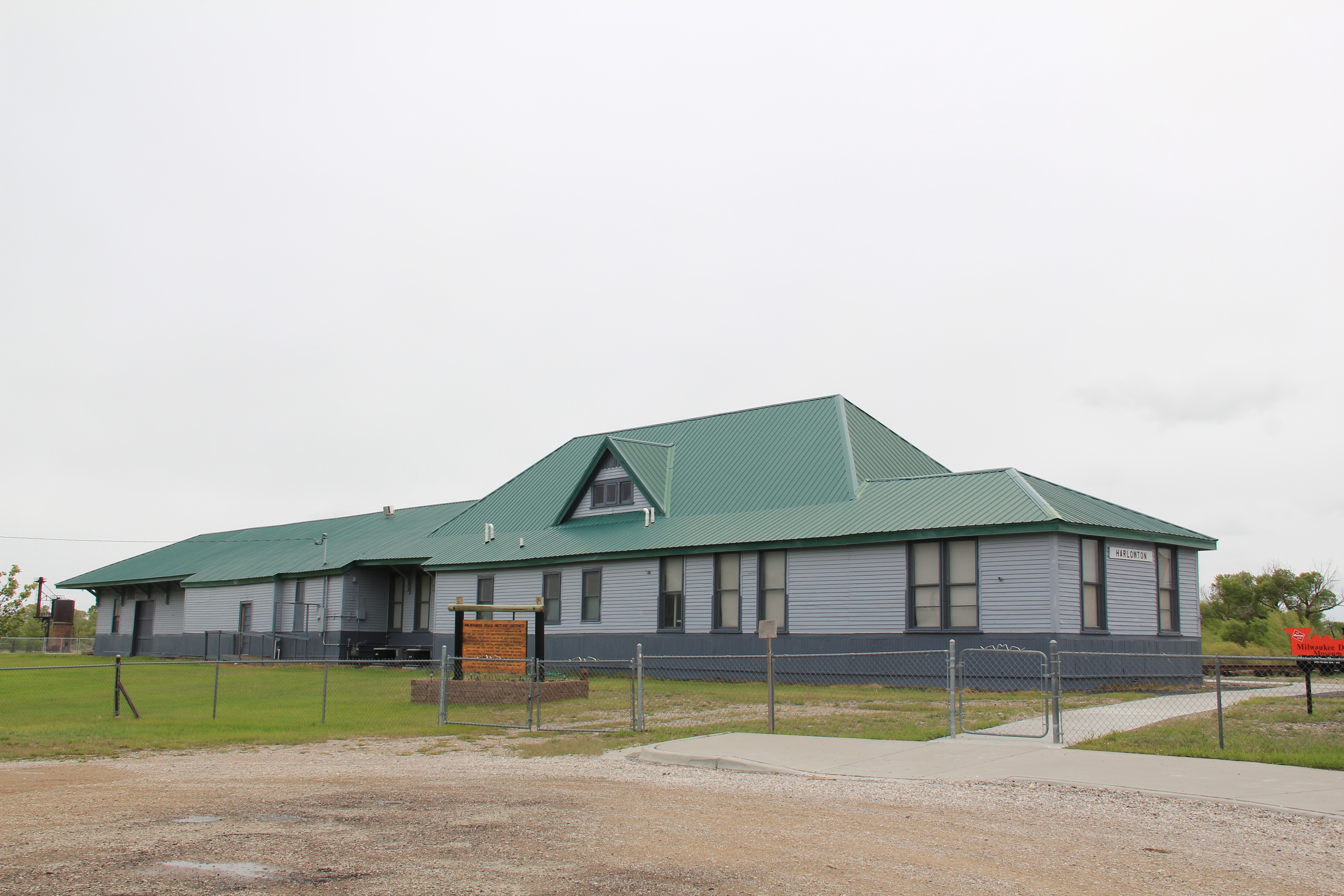
Abandoned Milwaukee Road corridor along U.S. Highway 12, Golden Valley County, MT, 1984

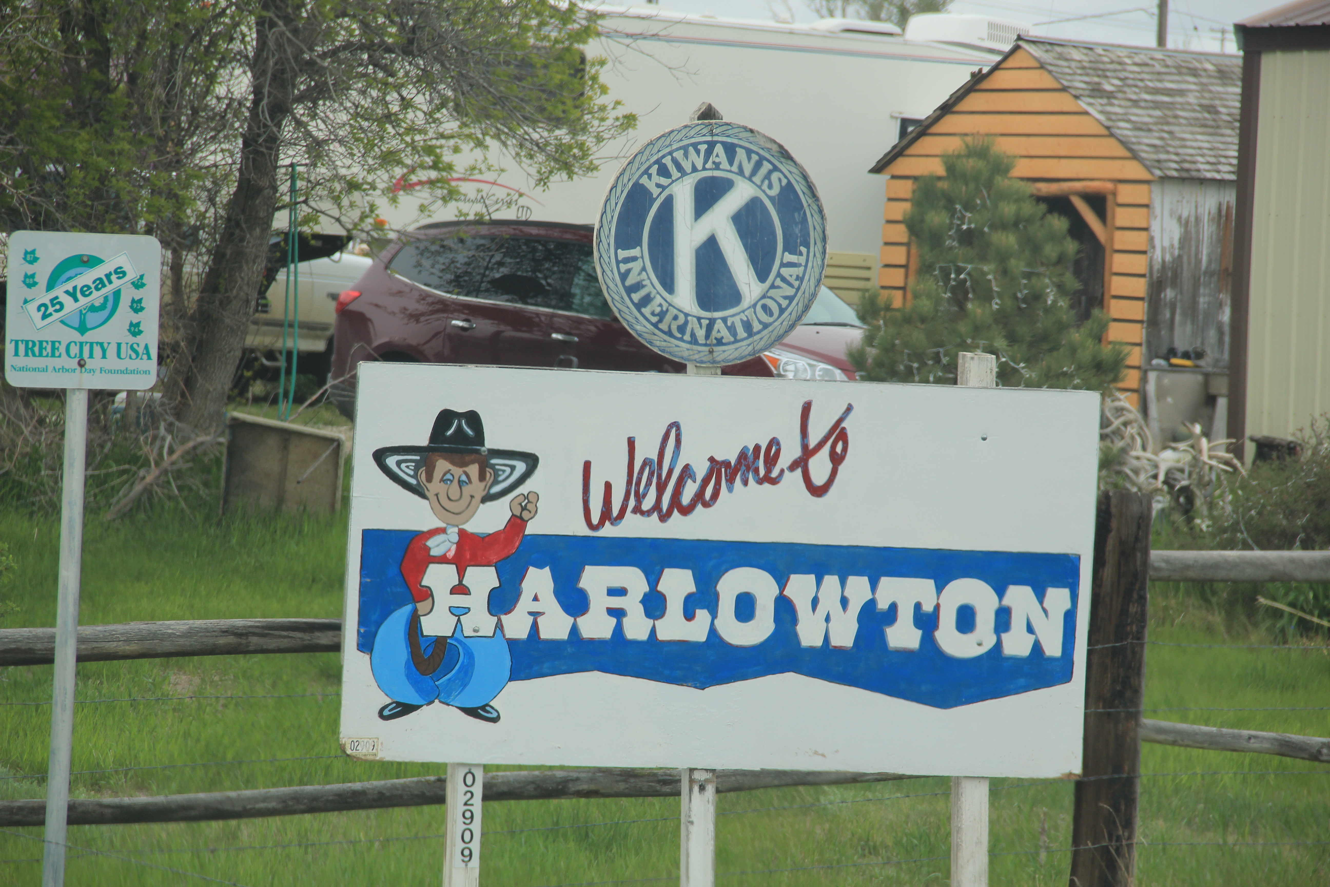
Golden Valley County, Montana, established with much local fanfare and excitement in 1920, was one of the last counties created in Montana.  Today, with just over 1100 residents, it remains one of the county’s smallest in population.  Yet, like other places along U.S. Highway 12, it has been a favorite jaunt of mine since 1982.  The highway connects with Montana 3, which roughly parallels an old stagecoach route, and Highway 3 going south takes you directly to downtown Billings.  Thus, beginning with my many projects with the Western Heritage Center in Billings in 1982, I quickly found out that taking U.S. 12 between Helena and Billings not only cut off miles from the journey but was always more scenic and more interesting due to the remnants of roadside architecture and bits of the Milwaukee Road corridor that followed the Musselshell River in this county.

Golden Valley Co, near Cushman (p84 27-9)

U.S. 12 and Milwaukee Road routes along Musselshell River, Cushman, MT, 1984

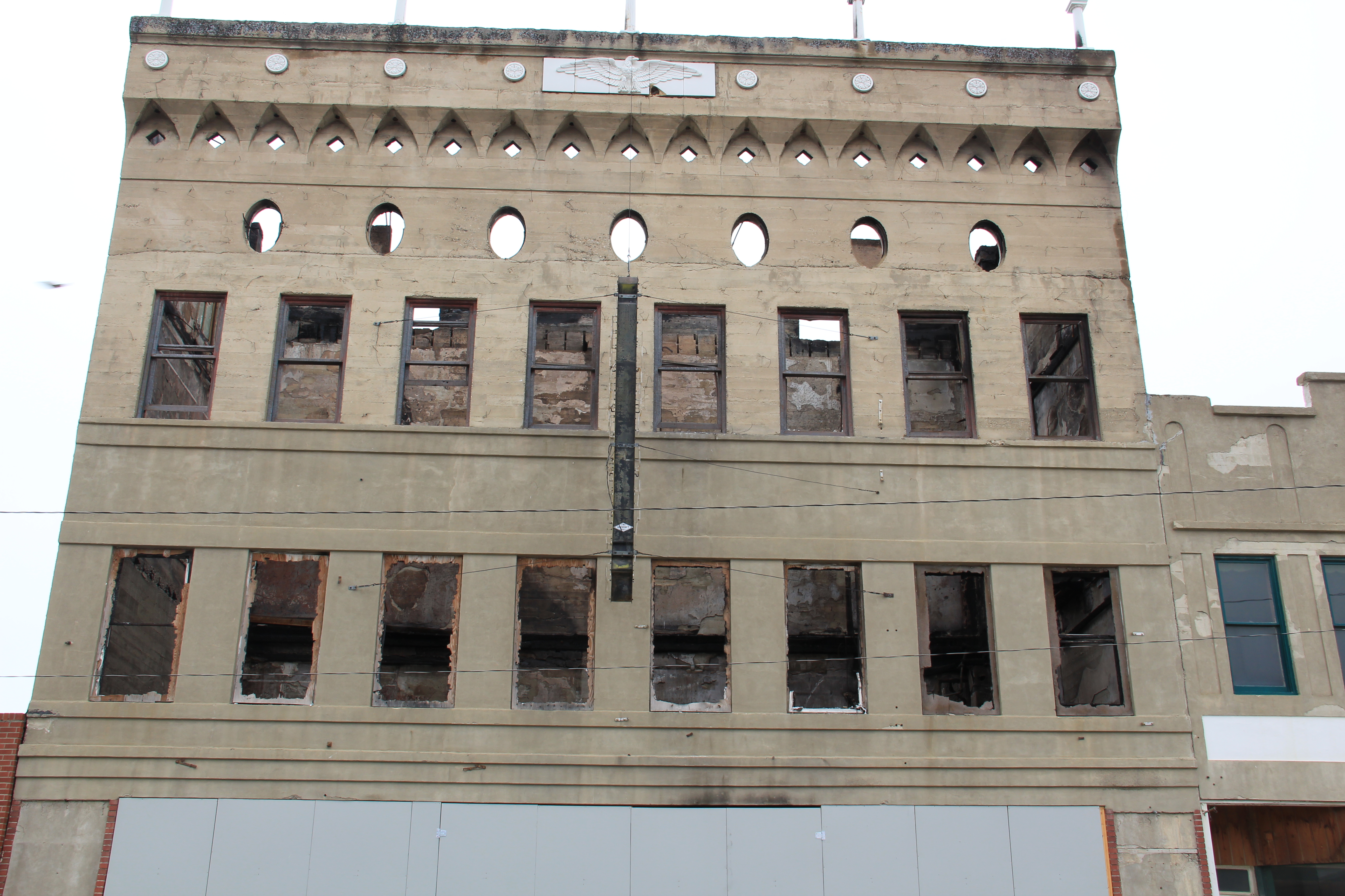
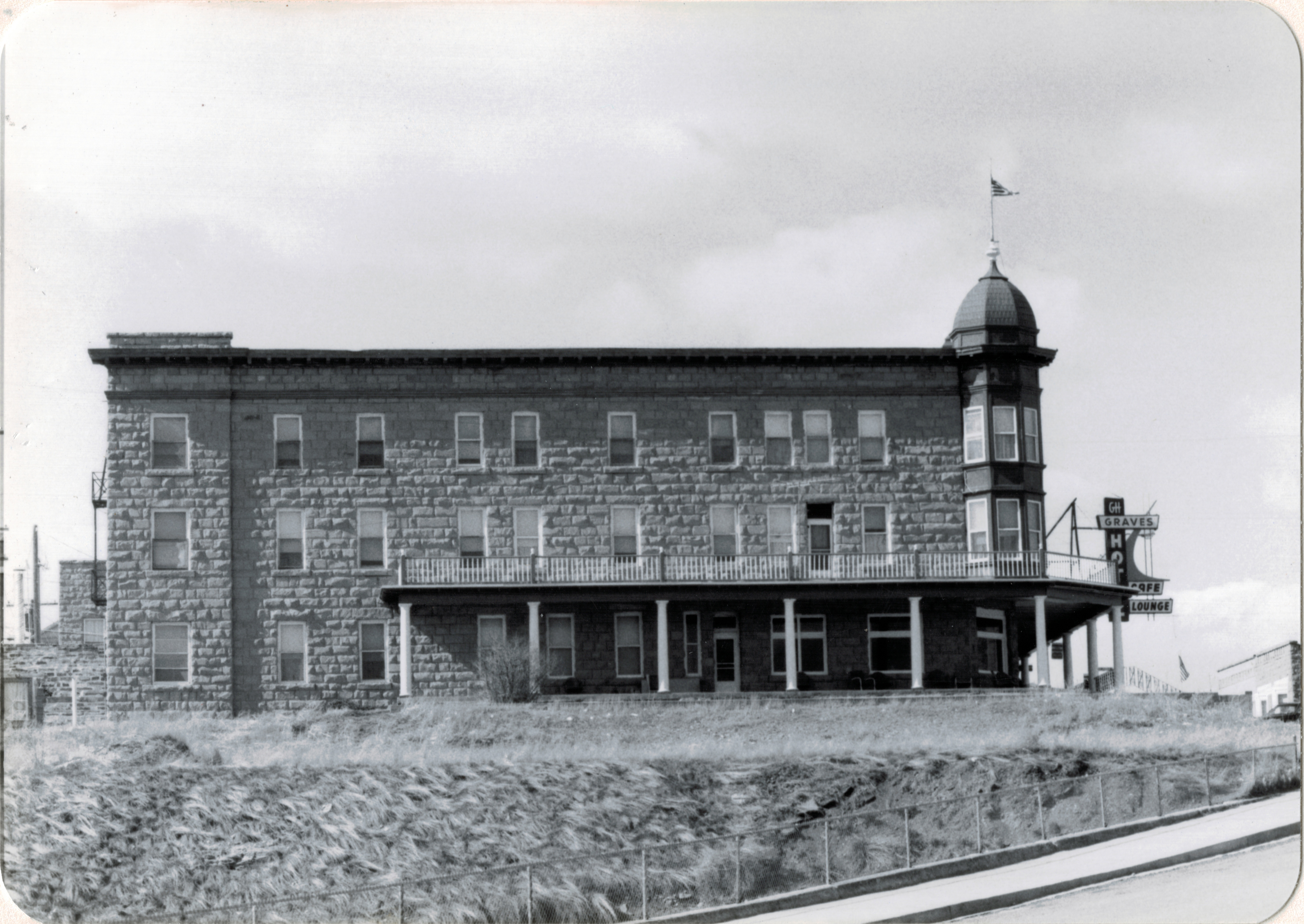
As you leave Billings and head north of Montana 3, this state road intersects with U.S. 12 at Lavina, one of the county’s two incorporated towns, and a place that has held steady in population since 1980 (probably due to its location and proximity to Billings).  The Adams Hotel, built in 1908 with a year of the railroad’s arrival, struck me immediately–a huge two-story Colonial Revival style building–in 1984 in the middle of nowhere.  But the Adams,

Adams Hotel, Lavina, Golden Valley Co (26-26)

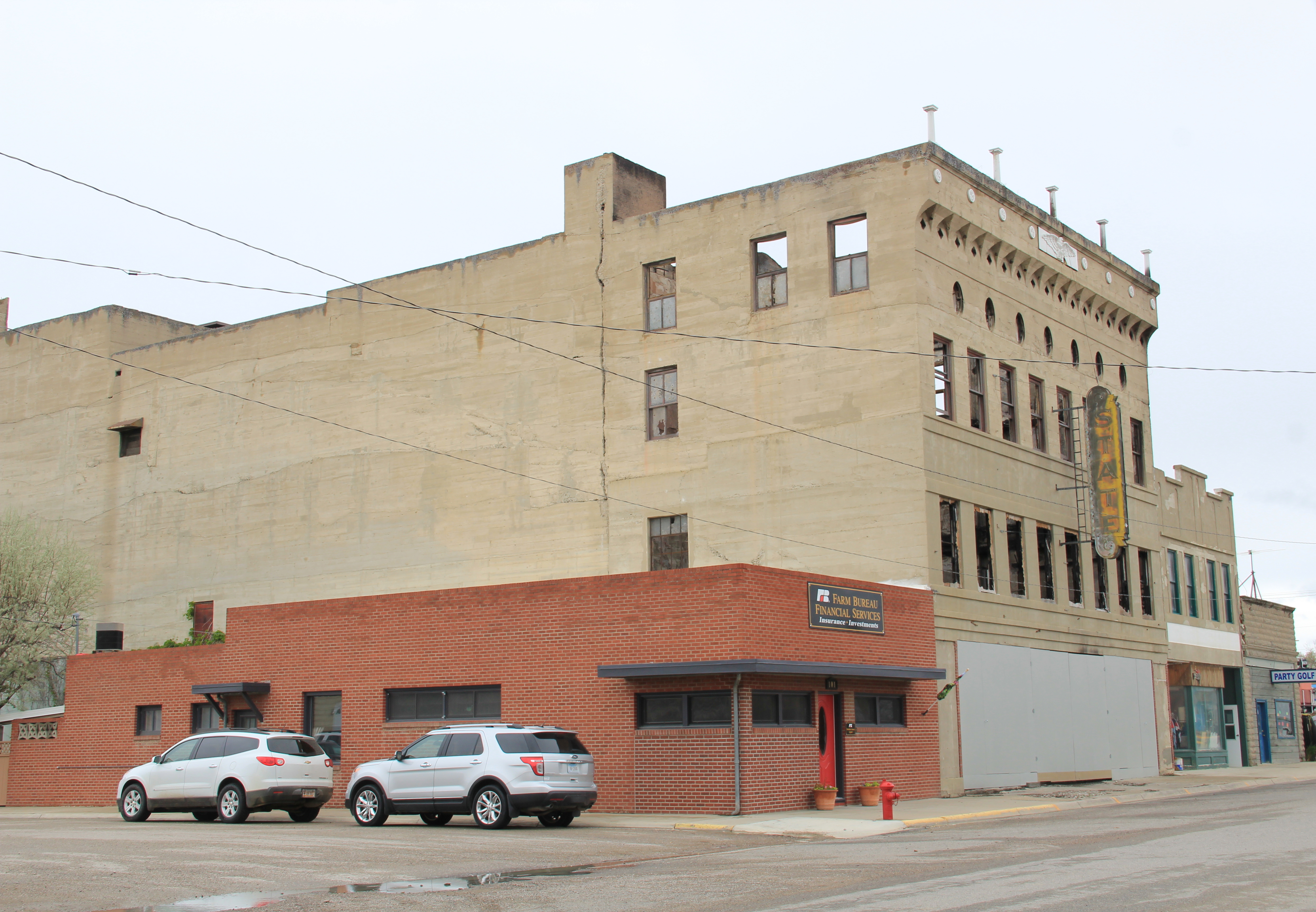
listed in the National Register of Historic Places, spoke to the town founders’ hopes for the future–and the need for a large hotel for all of the traveling businessmen, and homesteaders, the Milwaukee planned to attract to the area.  As the image above shows, in 1984 the Adams needed a friend–someone who would take on a huge frame building and find a new life for it.  In the next decade that friend came and the Adams came back to life, as the 2006 digital image below shows.

Lavina

The next decade has not been so kind.  Owners have placed a clock in the cornice, eliminating the original dating of the building, plus brass lanterns have appeared on the second floor and it needs painting and repairs.  But the building is still open, and in use, and those are huge steps toward compared to 30 years ago.

IMG_0203

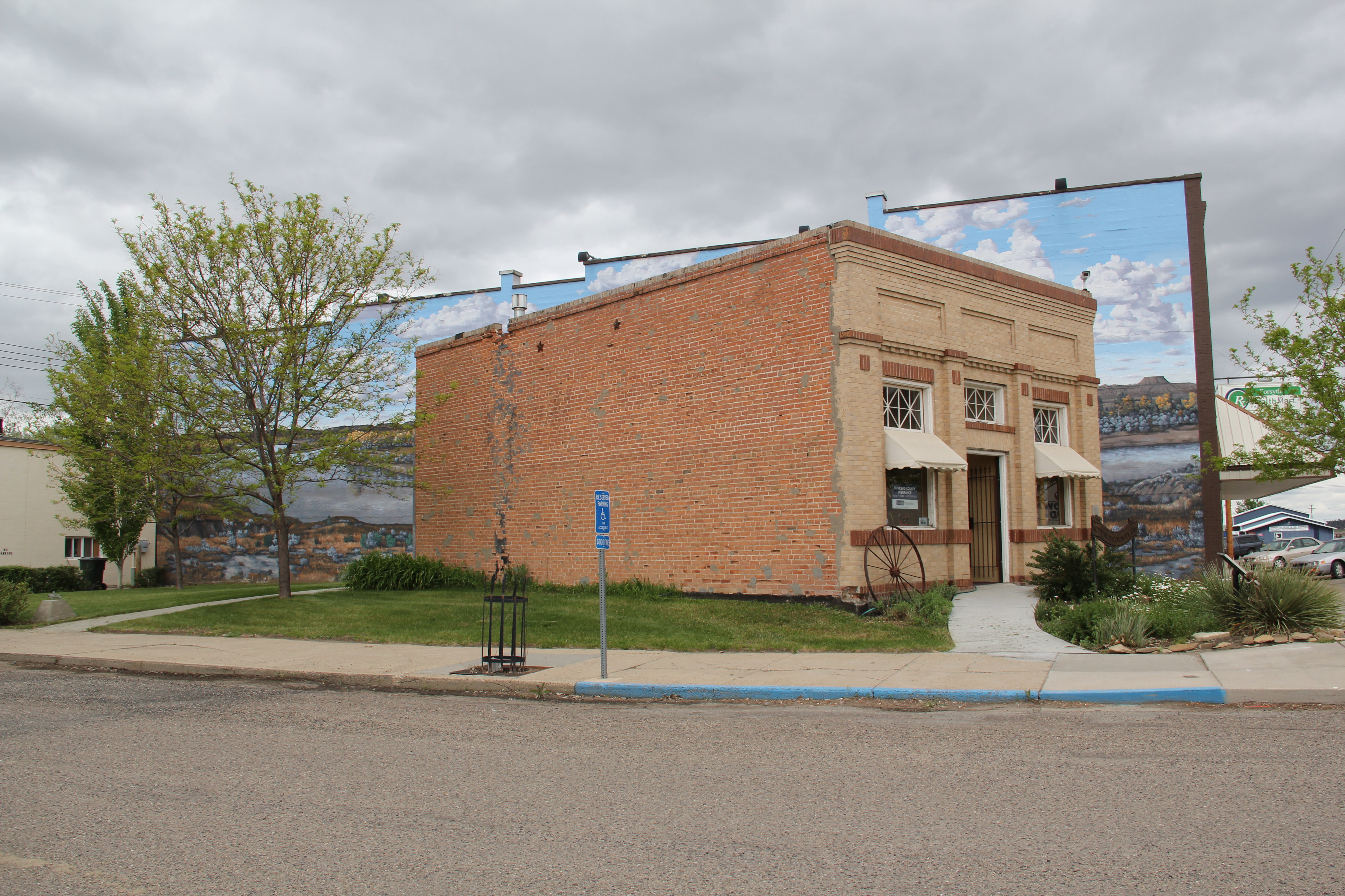
The town’s general store, Slayton Mercantile, which is also on the National Register, is doing better, and has become one of my frequent stops in the region.  This two-story brick commercial building also spoke to town’s hope for a bright future in the second decade of the 20th century.  Travelers along the road, and the town’s steady population, keep it in business today.

Slayton Mercantile, Lavina, MT, 2007

Slayton Mercantile, Lavina, MT, 2007

Slayton Mercantile, Lavina, MT, 2013

Slayton Mercantile, Lavina, MT, 2013

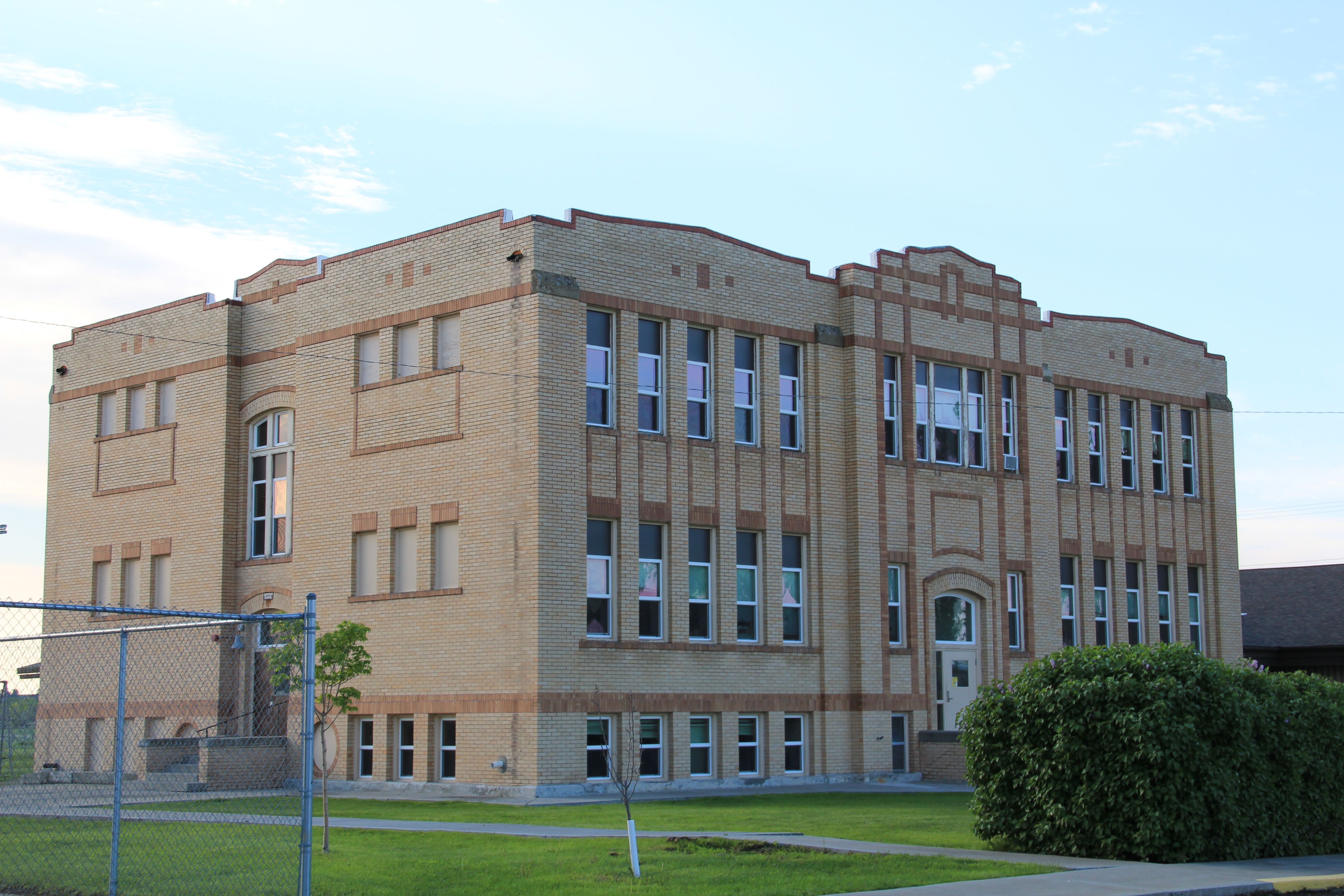
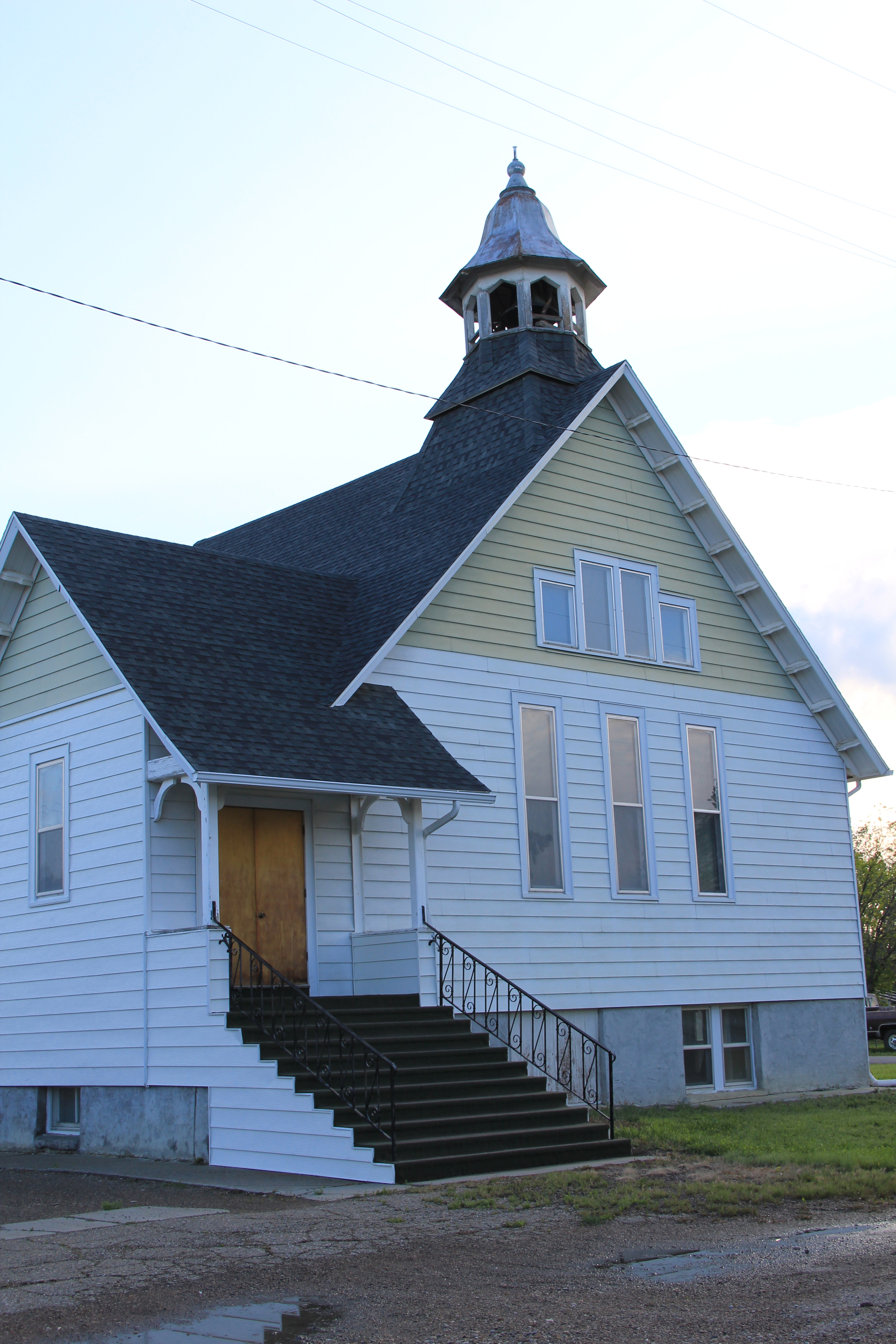
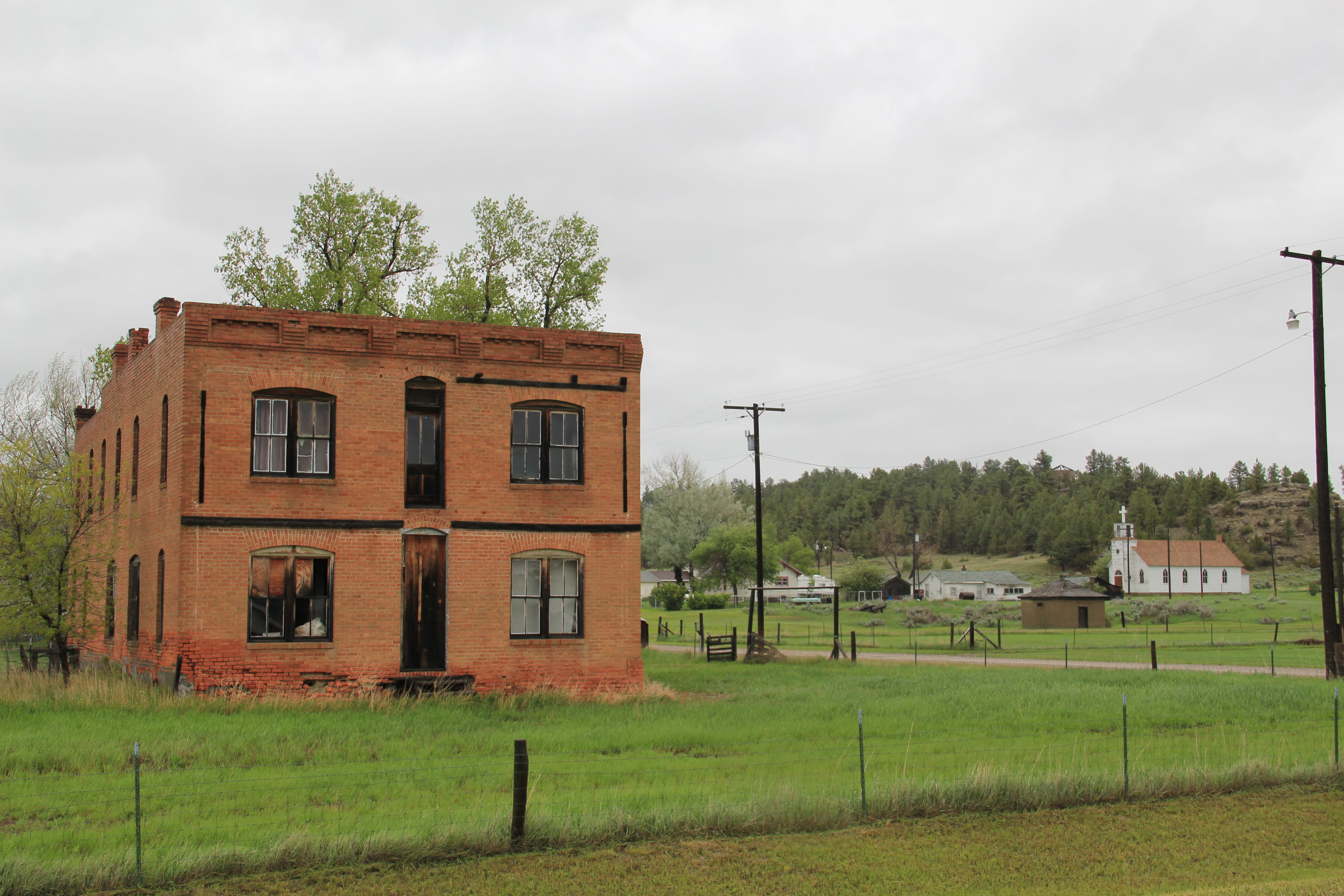
The historic two-story with full basement yellow brick Lavina Public School is not on the National Register but this early 20th century building is another key landmark.  Its exterior architectural features speak to the restrained styles of public architecture often found in the region. Another community landmark is the joint United Methodist and Lutheran church of Lavina–the two congregations share this Gothic-styled early 20th century building to sustain it and themselves as viable congregations.

IMG_0196

IMG_0195

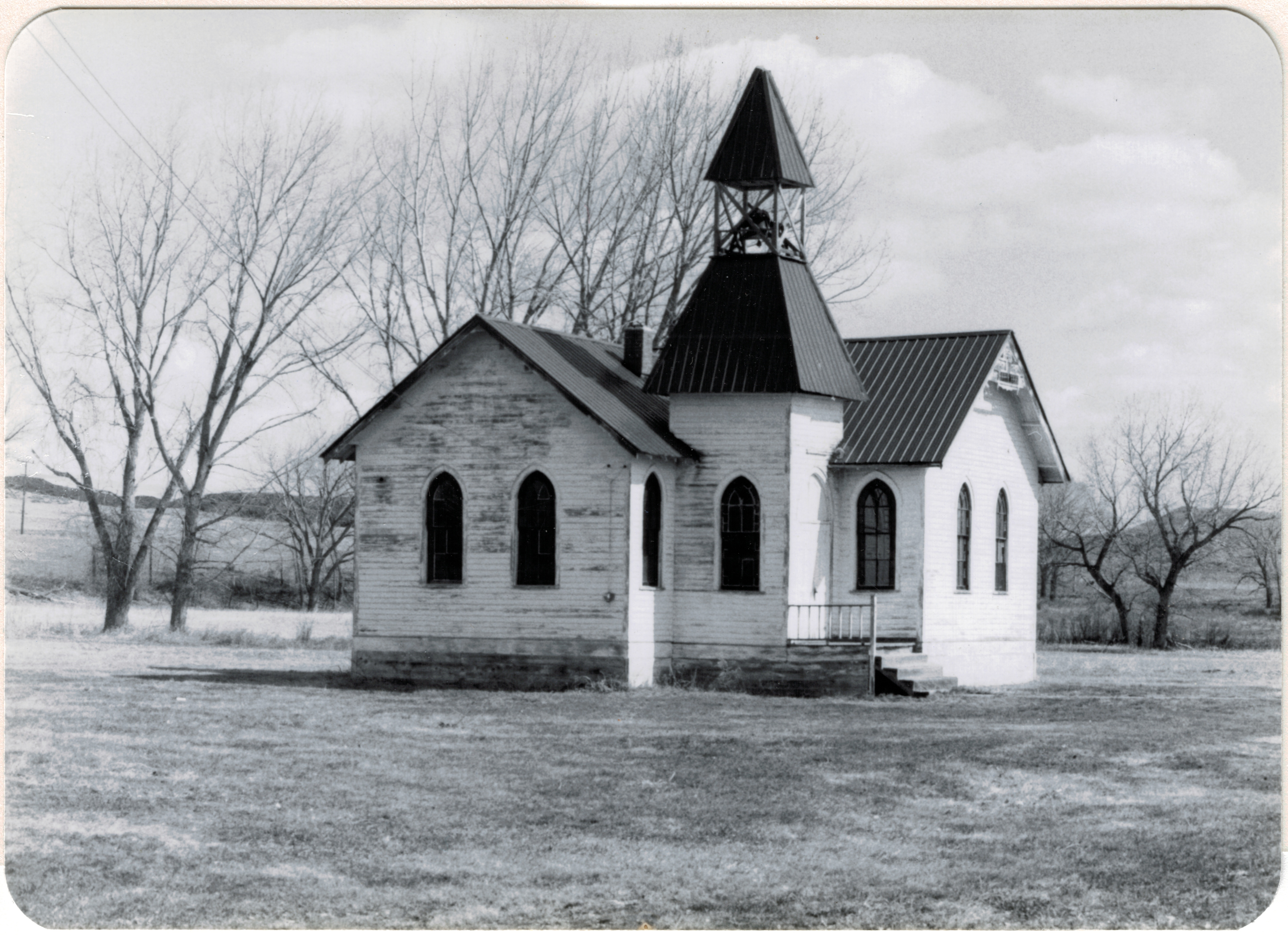
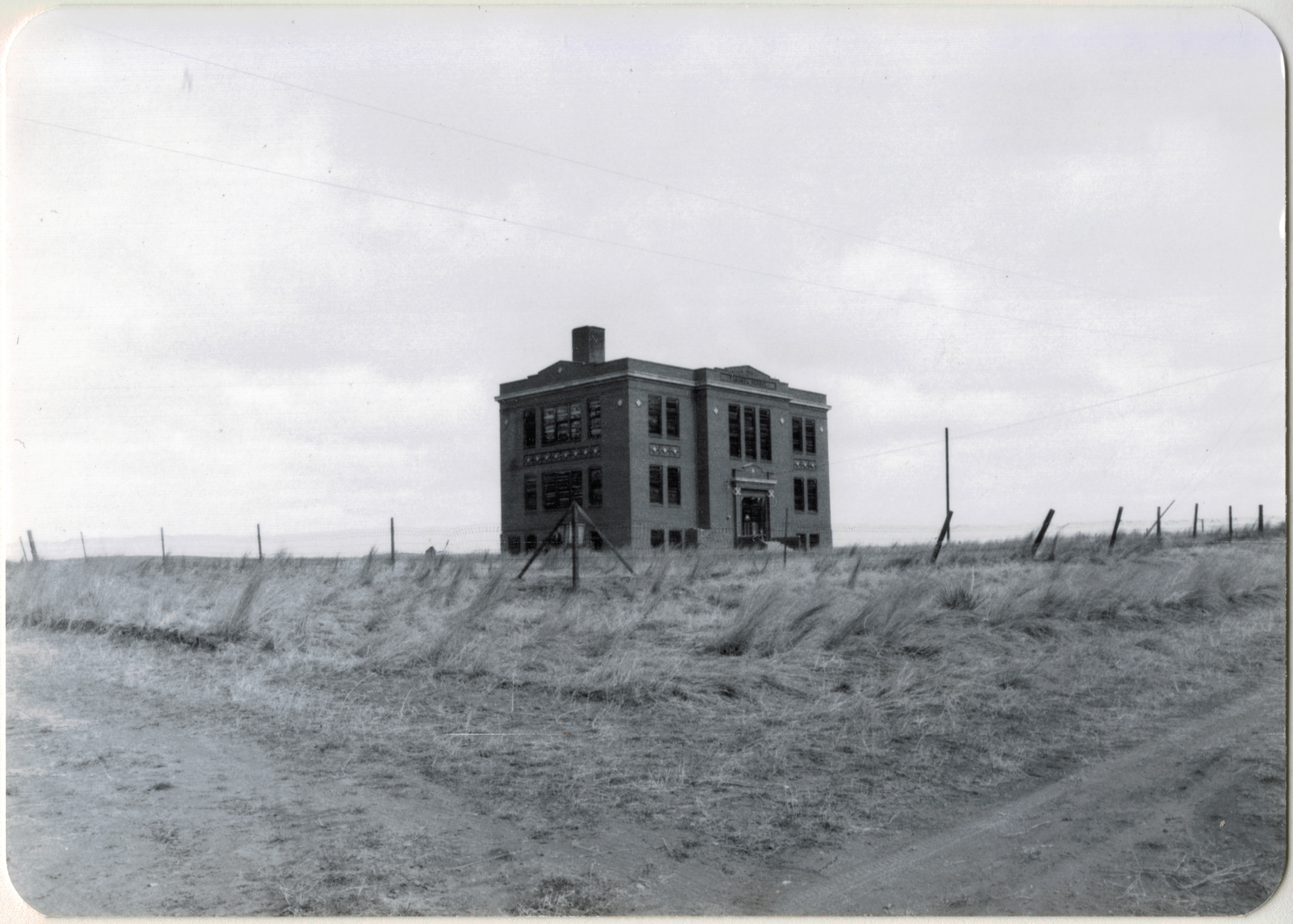
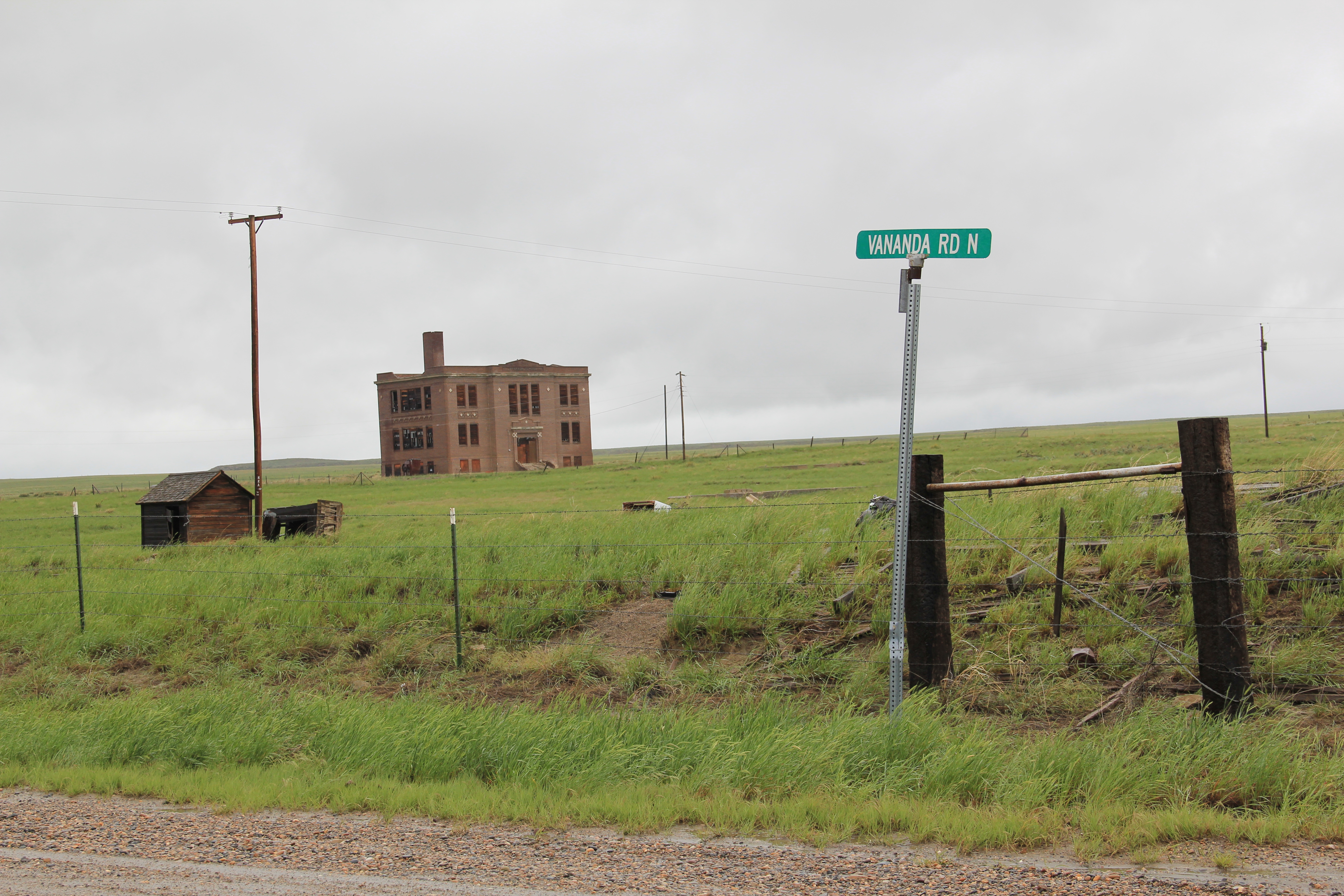
The fate of beautiful rural churches is not a happy story throughout the northern plains, but Golden Valley County has done better than many.  Another of its early 20th century churches, the Lutheran Church at Barber, needed help in the early 1980s when I first surveyed it.  Local residents in the last 30 years restored the building, opening it for services, and listed it in the National Register.  The original open bell tower has been covered and a handicap ramp for attendees have been added–steps that have helped to keep the building part of the county’s otherwise disappearing historic landscape.

Grace Lutheran Church, Barber NR (p84 27-29)

Barber Community Church, Golden Valley County, MT, 1984

Ryegate is the county seat and an important crossroads for ranchers and travelers.  Its population too has remained relatively steady since the end of the Milwaukee Road in 1980–273 then and 245 in 2010.  It was never a big place, with the largest population coming in 1920 when the county began, 405 residents.  The historic grain elevators

IMG_0211

speak to the importance of the railroad, and highway, while the landmark Ryegate Bar has served thirsty locals and travelers for decades.  Today it is most famous for its annual testicle festival–a new tradition launched since the survey of 1984-1985.

IMG_0212

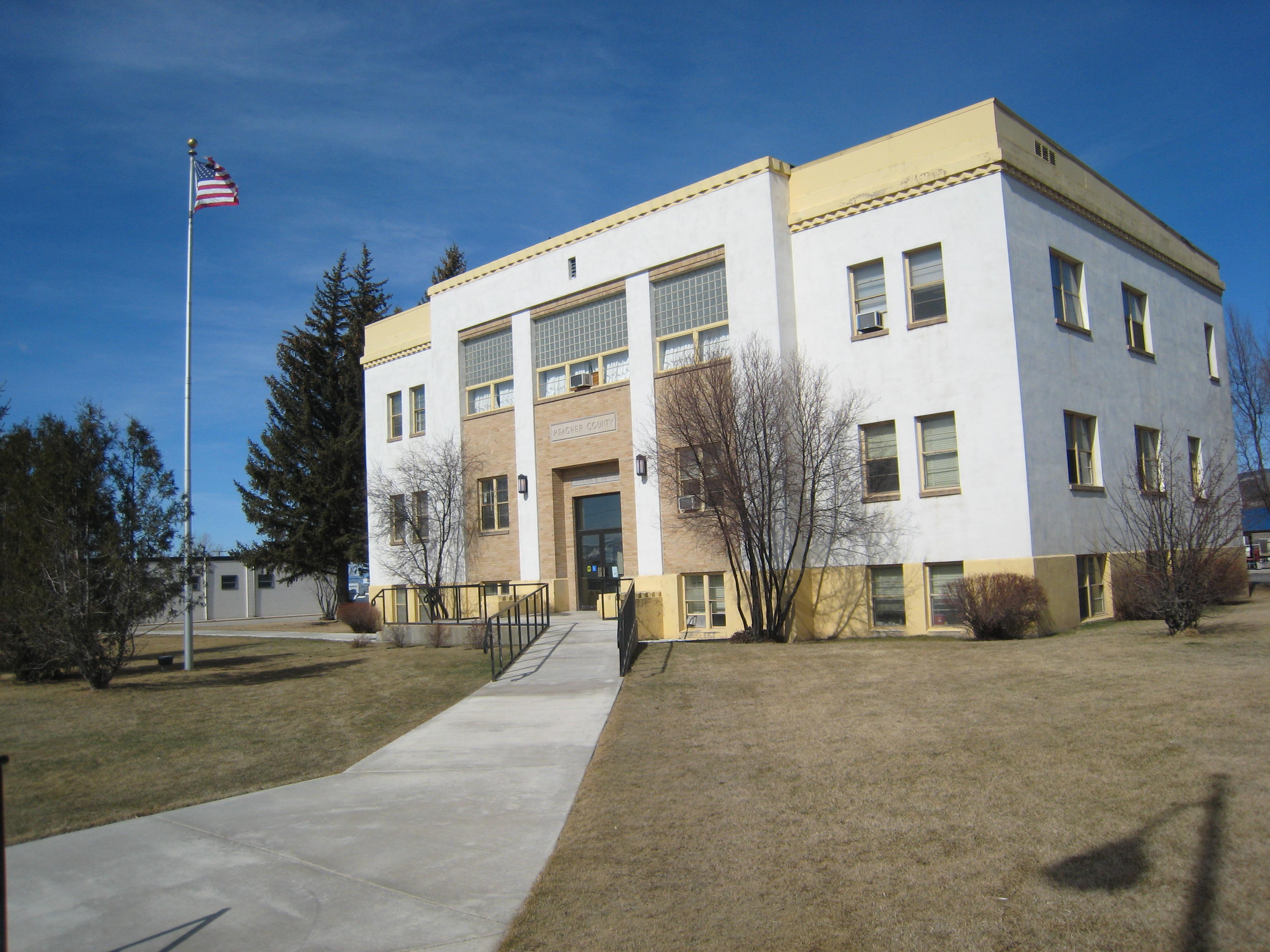
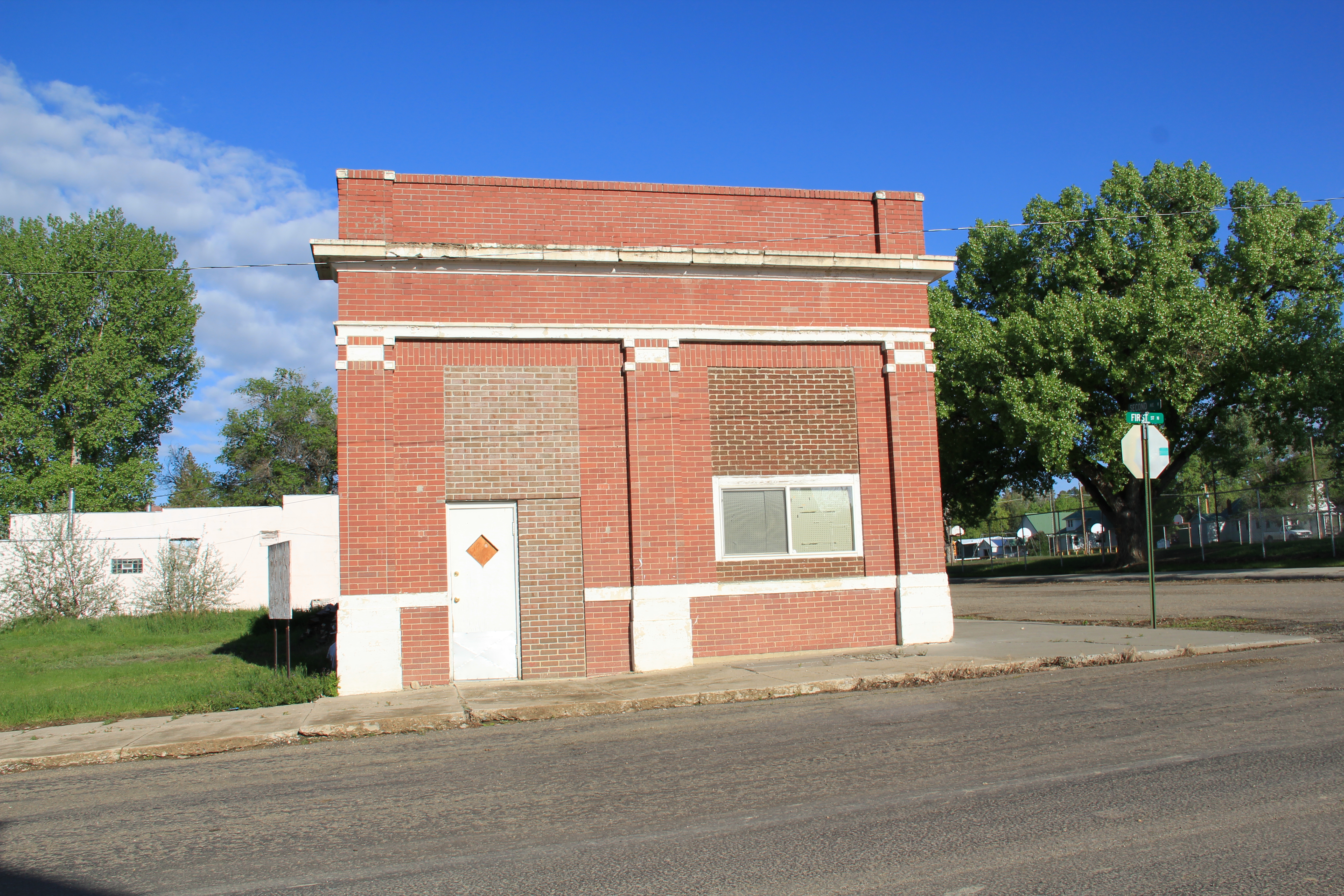
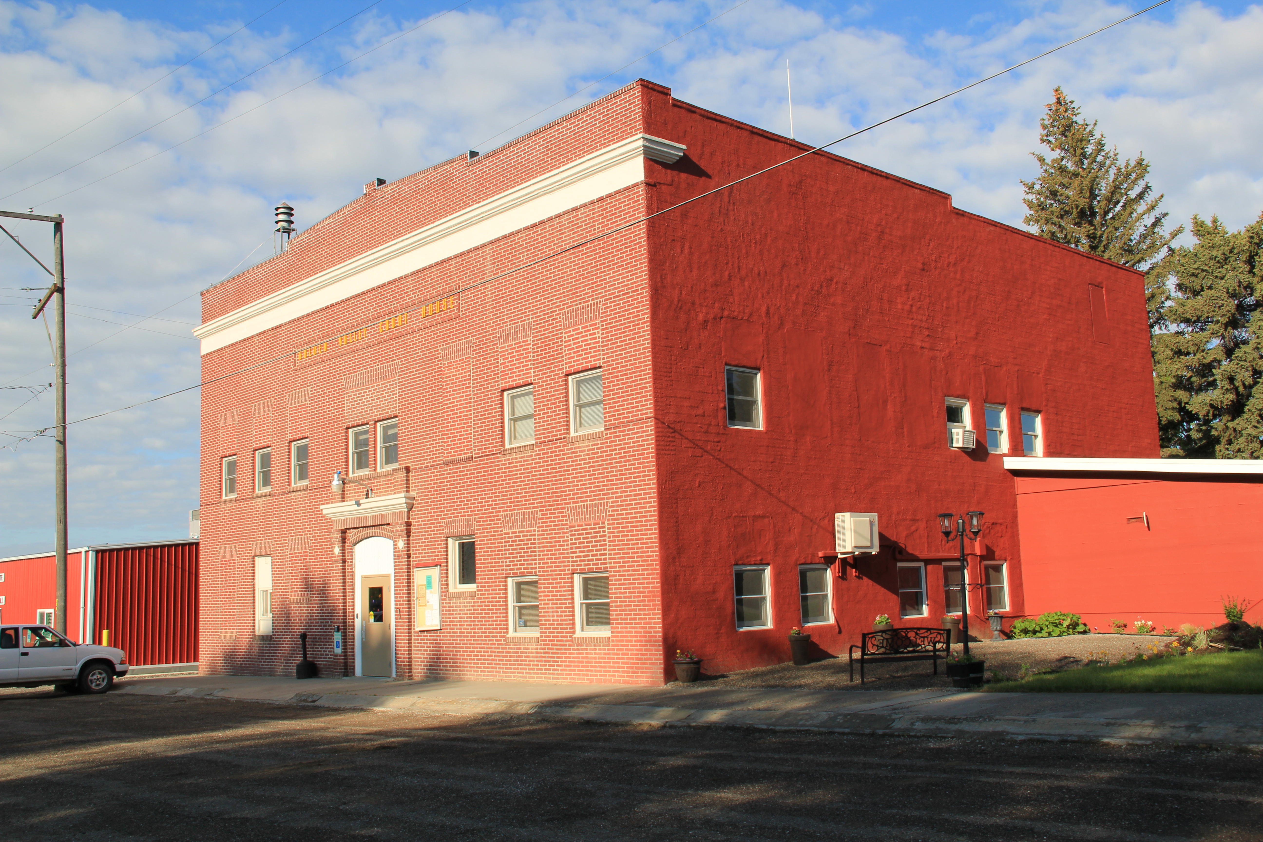
Two buildings from the county’s beginnings are a one-story brick Classical style bank building, which like so many in the region closed its doors during the homesteader bust and the Great Depression, and the Golden Valley County Courthouse, appropriately the town’s most imposing building.

IMG_0214

IMG_0222

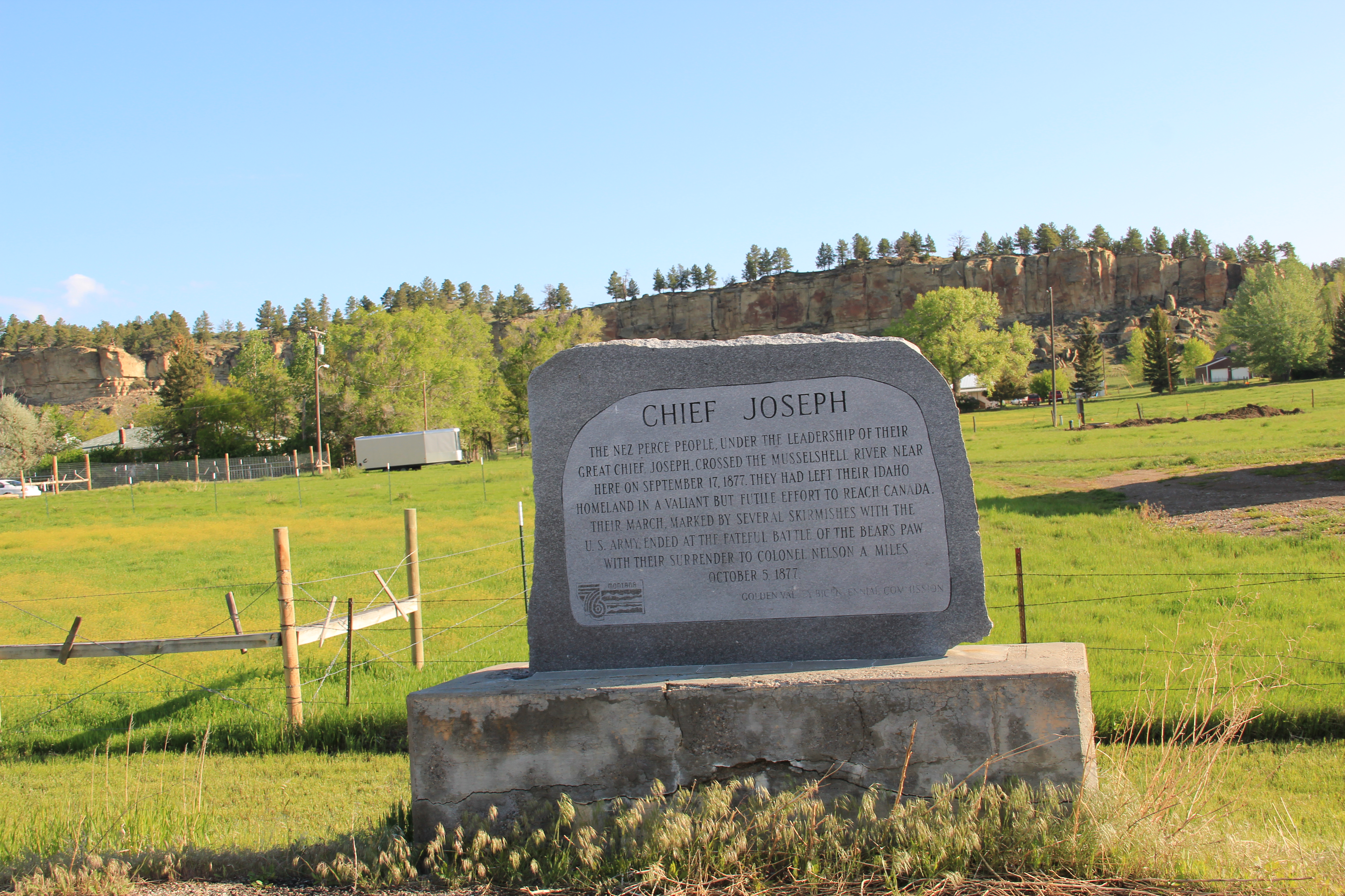
Ryegate also has its acknowledged historic sites:  a town project in 1976 marked the area’s association with Chief Joseph’s 1877 trek across eastern Montana while on the

IMG_0208

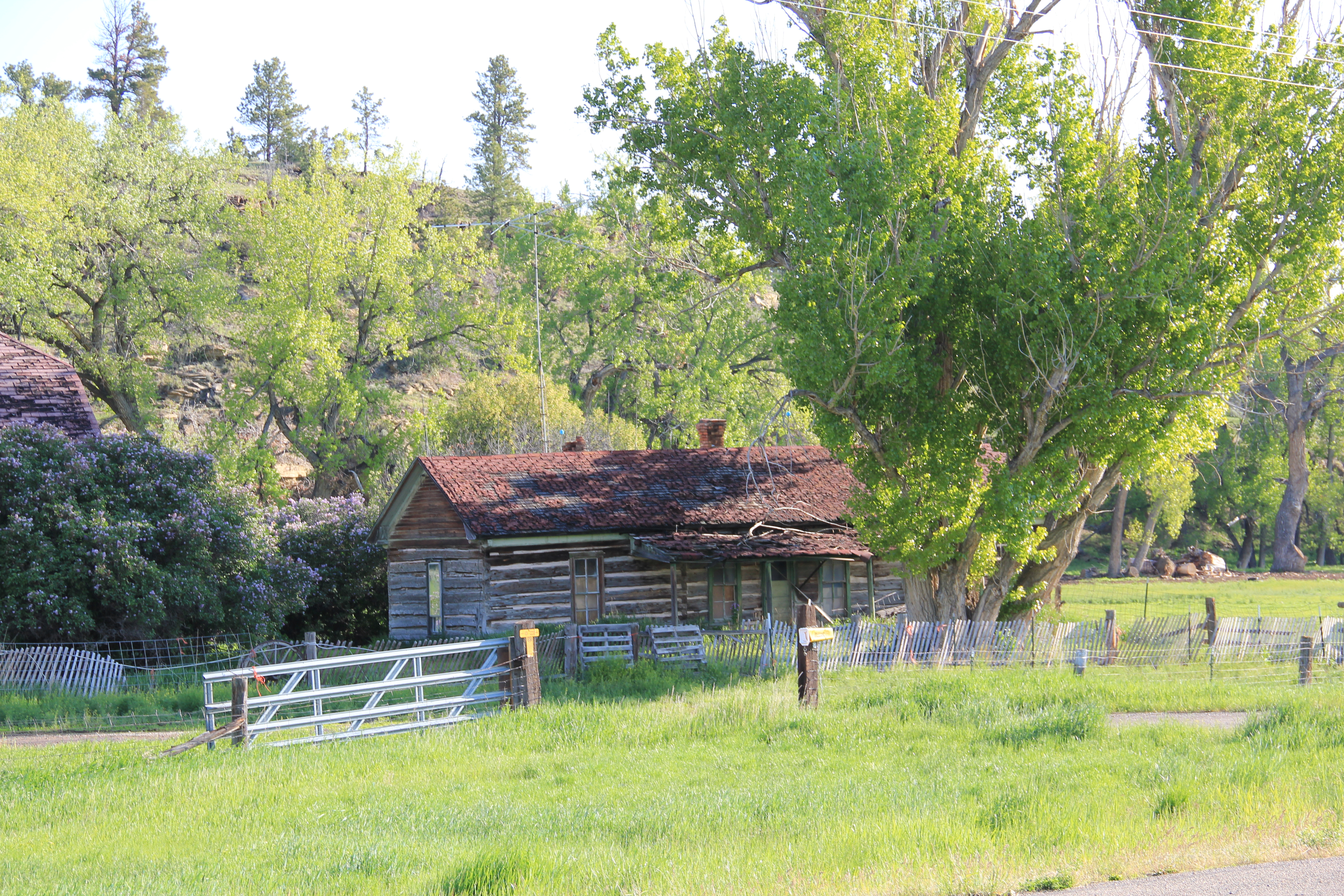
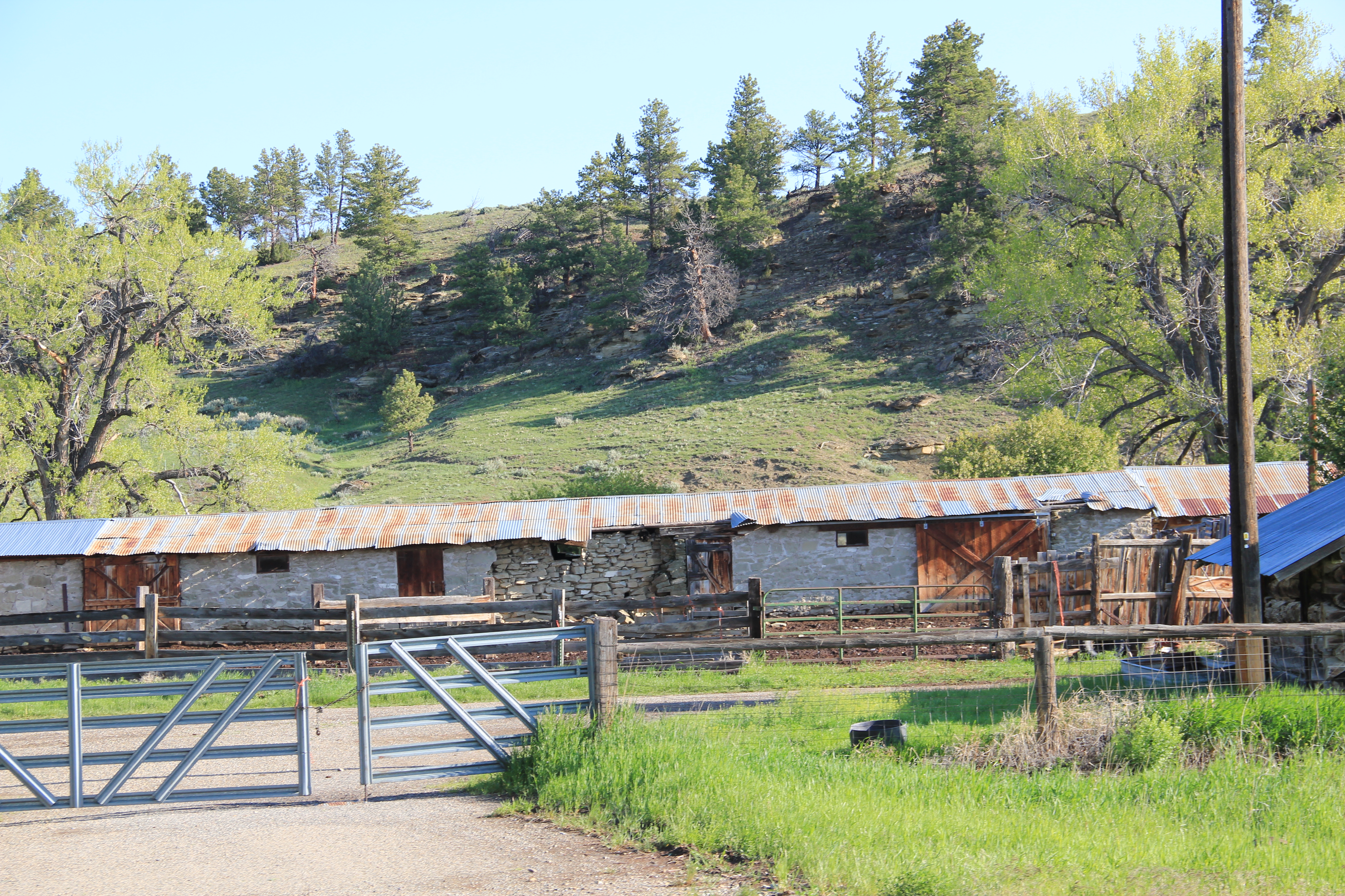
town’s eastern border the Sims-Garfield Ranch, a rambling assortment of vernacular-styled log and stone outbuildings and two vernacular style residences is the only town property listed in the National Register. Nestled between U.S. Highway 12 and the rocky bluffs of the Musselshell River, it is evocative of the county’s roots as a ranching landscape, a place of work and pride that survives today.

IMG_0229

IMG_0228

IMG_0227

IMG_0226

Musselshell school and the Musselshell Valley

IMG_0091

Traveling west of U.S. 12 along the Musselshell River Valley, I eagerly sought out the town of Musselshell, assuming that the 30 years since my last visit had not been kind to the small country town.  I hope that the iconic 1913 school–a gleaming yellow brick landmark–was still there.  It had survived, as the photo above attests, although students no longer attend classes there.  Musselshell School closed as an education institution over 10 years ago, but a group of determined community-minded residents formed the Friends of Musselshell School and saved the building, turning it into community center for the western end of the county.  When I visited in 2013–new work to the building was evident, including newly installed windows, courtesy of a $10,000 grant from PPL Montana Community Fund.

Handel store, c. 1912, and Musselshell overview

Handel store, c. 1912, and Musselshell overview

Musselshell prospered in its first decade of existence, after the arrival of the Milwaukee Road, and has been in decline, really, ever since.  But it retains both the historic high school and elementary school (which is now headquarters for the volunteer fire department), along with early 20th century churches, community institutions for a vanishing population.

IMG_0093

IMG_0094

Community Bible Church, Musselshell

Vanishing as well is the story told by the area’s mid-20th century irrigation project, the Delphia-Melstone Canals, built in 1950 and 1953 by the State of Montana.  The diversion dam at Musselshell was the project’s largest at 182 feet.

IMG_0098

Somehow Musselshell has been able to hang on to its tiny false-front post office, a reminder of the community’s persistence along a railroad that has disappeared and a highway that receives so few travelers today.

IMG_0095

Moving and Saving Historic Buildings in the Montana Plains

Created with GIMP

Vananda School, northern Rosebud County. I took this image during the preservation work of 1984.

When I met with residents in Rosebud County in 1984, few places in the county captivated me more than Vananda, one of the county’s Milwaukee Road towns along U.S. Highway 12.  Vananda in 1984 had a few scattered buildings and structures, but two landmarks, a small one-story Classical Revival bank, and the three-story Vananda school. The school in particular spoke to the hopes of the settlers who flooded into the region after the Milwaukee came through in 1907-1908.  In 1917, when Louis Wahl, a Forsyth contractor, built the bank, Vananda like many other homestead towns thought a bright future awaited.  But when the bust came in the 1920s, followed by the Great Depression in the 1930s, people disappeared from here even quicker than they had arrived.

In the years since, I have stopped at Vananda several times, seeing if the buildings still stood as silent sentinels to the homesteading past. The school and the bank survived

Vananda Bank-School Rosebud Co. MT

My favorite image of Vananda, taken in 1998.

the 1990s.  In fact, the Montana State Historic Preservation Office had listed the Vananda historic district in the National Register of Historic Places in 1990, part of a countywide effort to designate local landmarks at that time.

IMG_0130

Vananda historic district, 2013

When I next visited Vananda in 2013, fifteen years had passed.  Imagine my disappointment in finding only the school, and it was looking even more worse for the wear.  This was the same year that the National Trust for Historic Preservation listed Montana’s rural schools as one of its most threatened properties in the nation.  One can hope that that designation will eventually bring help and preservation to the school.

IMG_0128

What had happened to the bank?  I found out about 17 miles later when I came into Forsyth, and stopped at something new, at the town’s most prominent crossroads, at Main and 10th Avenue.  It was the Vananda State Bank, moved to that location in 2002-2003.

IMG_6984

The abandoned building was now an insurance building, and an important contributor to town’s historic environment, especially since its corner lot was further enlivened by a mural of the Yellowstone River, “Autumn on the Yellowstone,” by local artist Bob Watts, who has several different murals located throughout town. No. moving the bank to Forsyth and restoring it there, rather than Vananda, is not historic preservation in its purest form.  But it is preservation nonetheless in my opinion.  The historic marker in front of the building tells its story, and there is an active heritage tourism infrastructure in Forsyth, with multiple historic districts, a recently expanded county museum, and a Historic Forsyth walking/driving tour you can download from the Internet.  The bank and the story of Vananda remain active contributors to Rosebud County, fulfilling some of that promise first proclaimed in 1917.