Sheridan County: a forgotten railroad landscape

IMG_7450
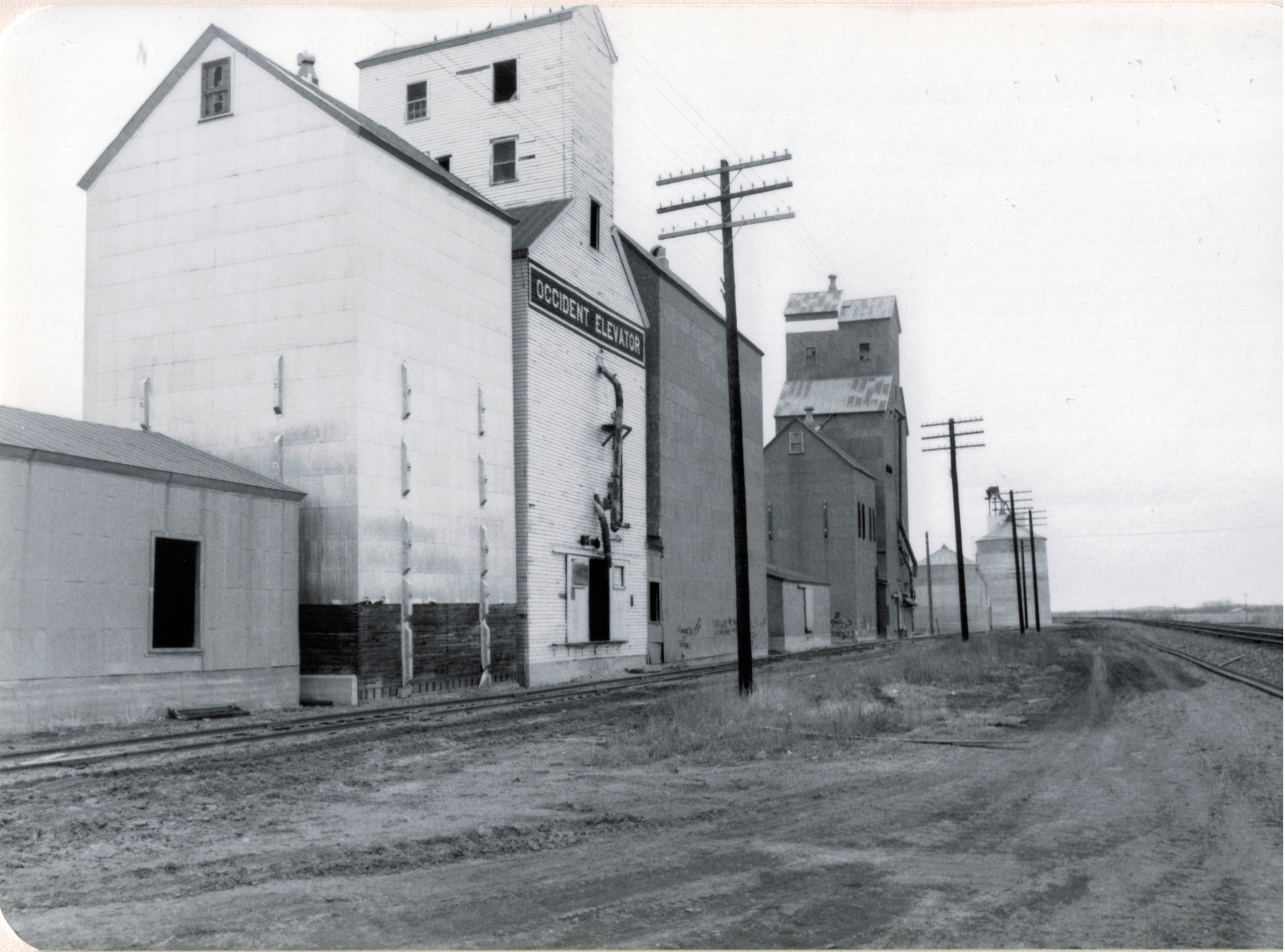
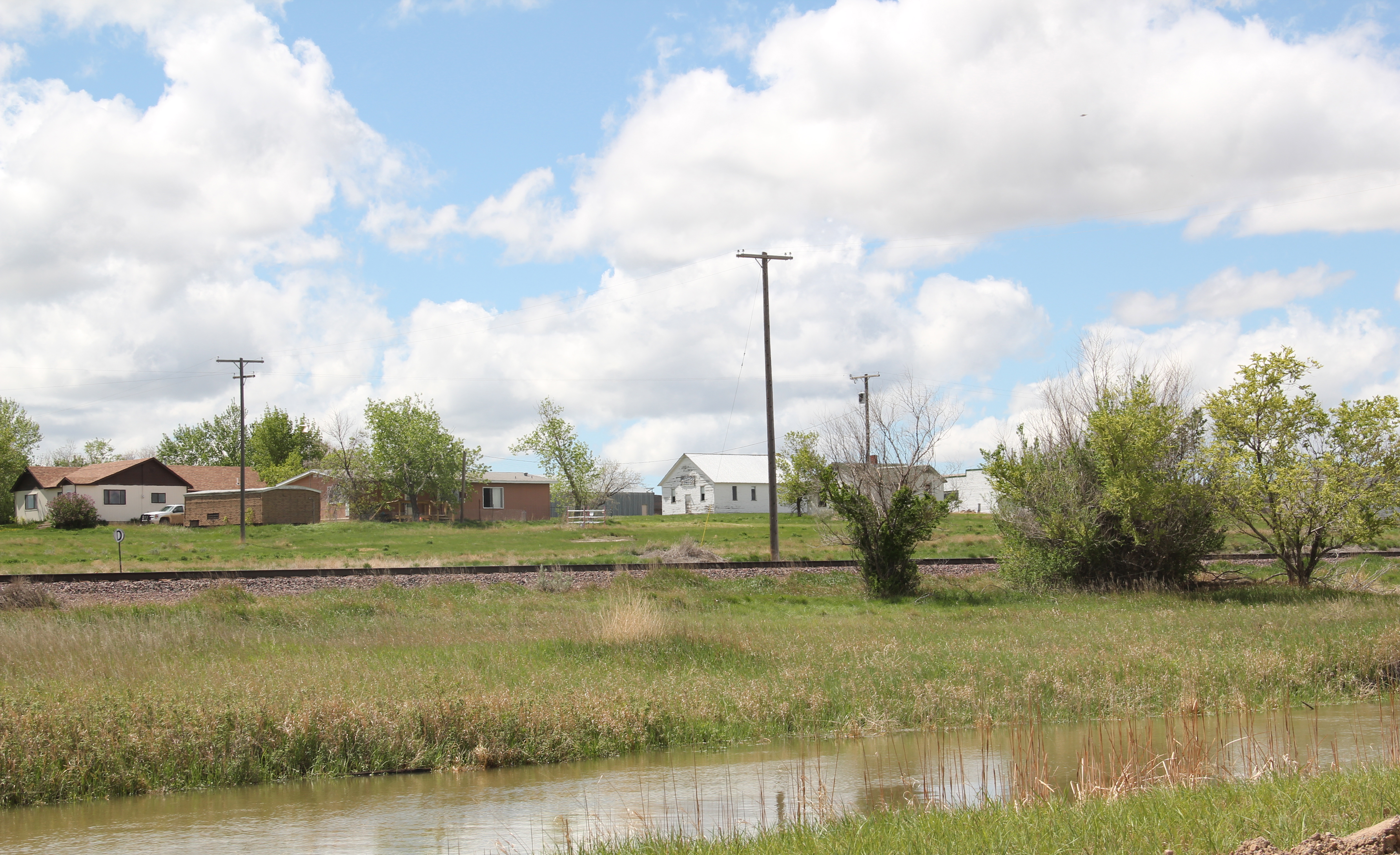
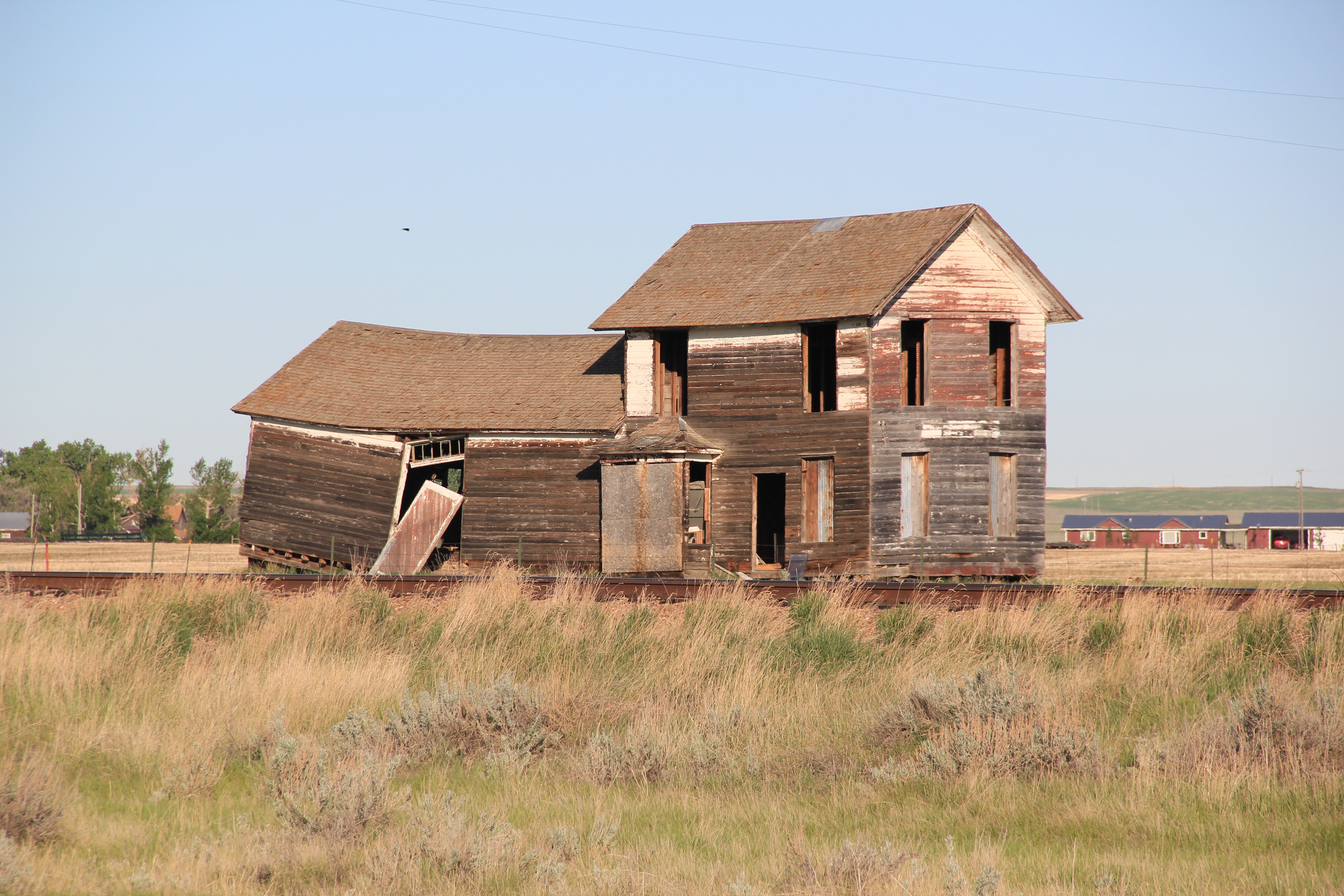
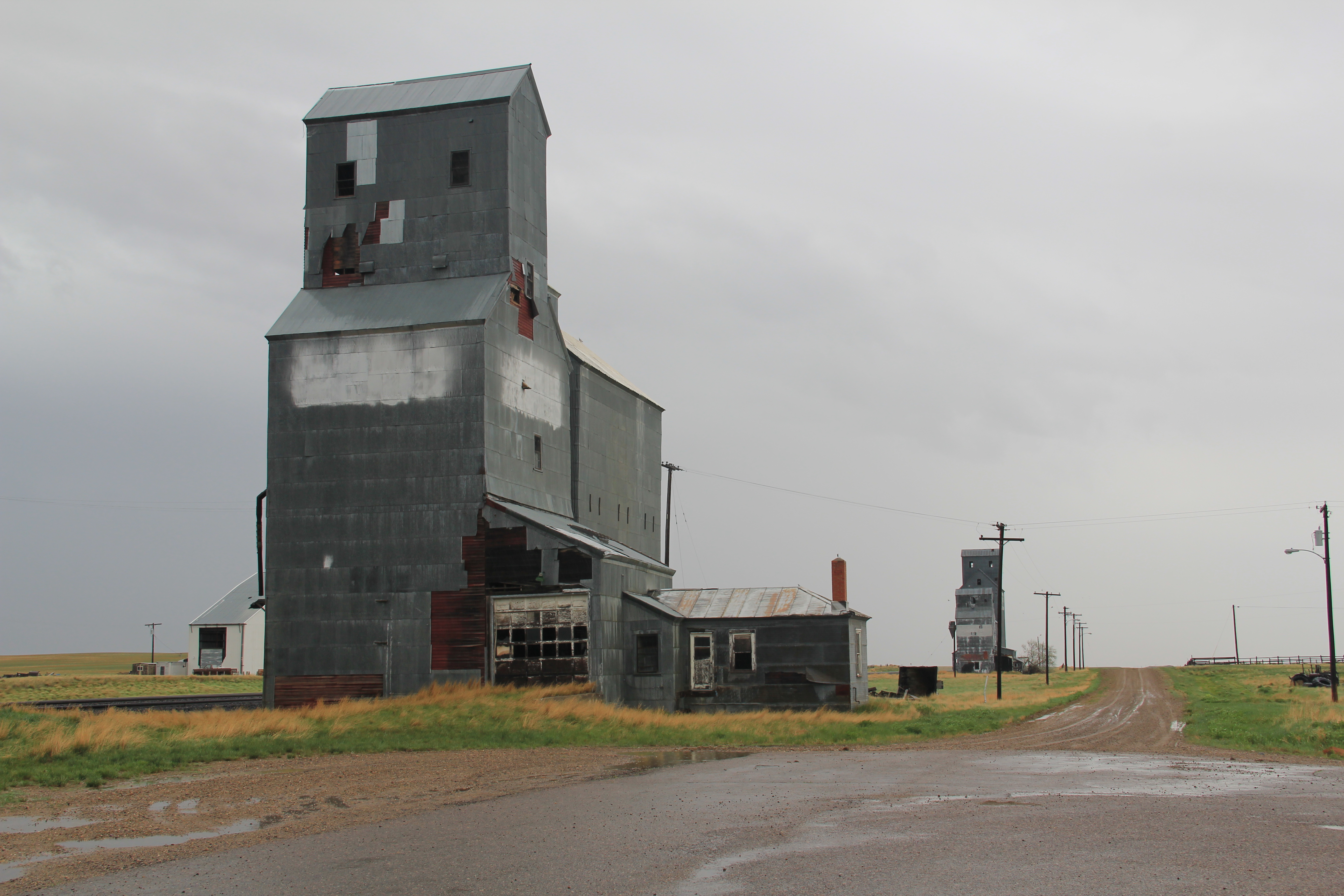
In the past posts I revisited the two Daniels County towns at the “end of the line” of a spur line constructed by the Great Northern Railway in the early 1910s as a way of countering the push into northeastern Montana by the Soo Line at the same time. These attempts at railroad expansion and town building took root during the homesteading boom of that decade. Now with depots gone and residents drifting away, the old railroad corridor as it stretches from Opheim on the west end to its junction with the main line at Bainville, takes on the appearance of a ghost line, attested by the image above from Homestead and the one below from Reserve,both in Sheridan County.
IMG_7473
At the rough mid-point of this spur line lies Plentywood–rather forsaken spot I thought in 1984 but a town now actually facing too much growth, too fast as the need for residences and space for the thousands of Bakken oil field workers seeps into northeast Montana. In 2013, the impact on Plentywood and Medicine Lake to the south was apparent as this just opened man camp at Medicine Lake shows.
IMG_7458
Plentywood was of considerable interest to me because once the initial homestead boom turned to disaster in Sheridan County by the time of the Great Depression, there was a local movement to create a communist party. This story was known in 1984 but now we have full accounting due to the research of Sheridan County native Verlaine Stoner McDonald in her book The Red Corner (2010).
IMG_7492
IMG_7491
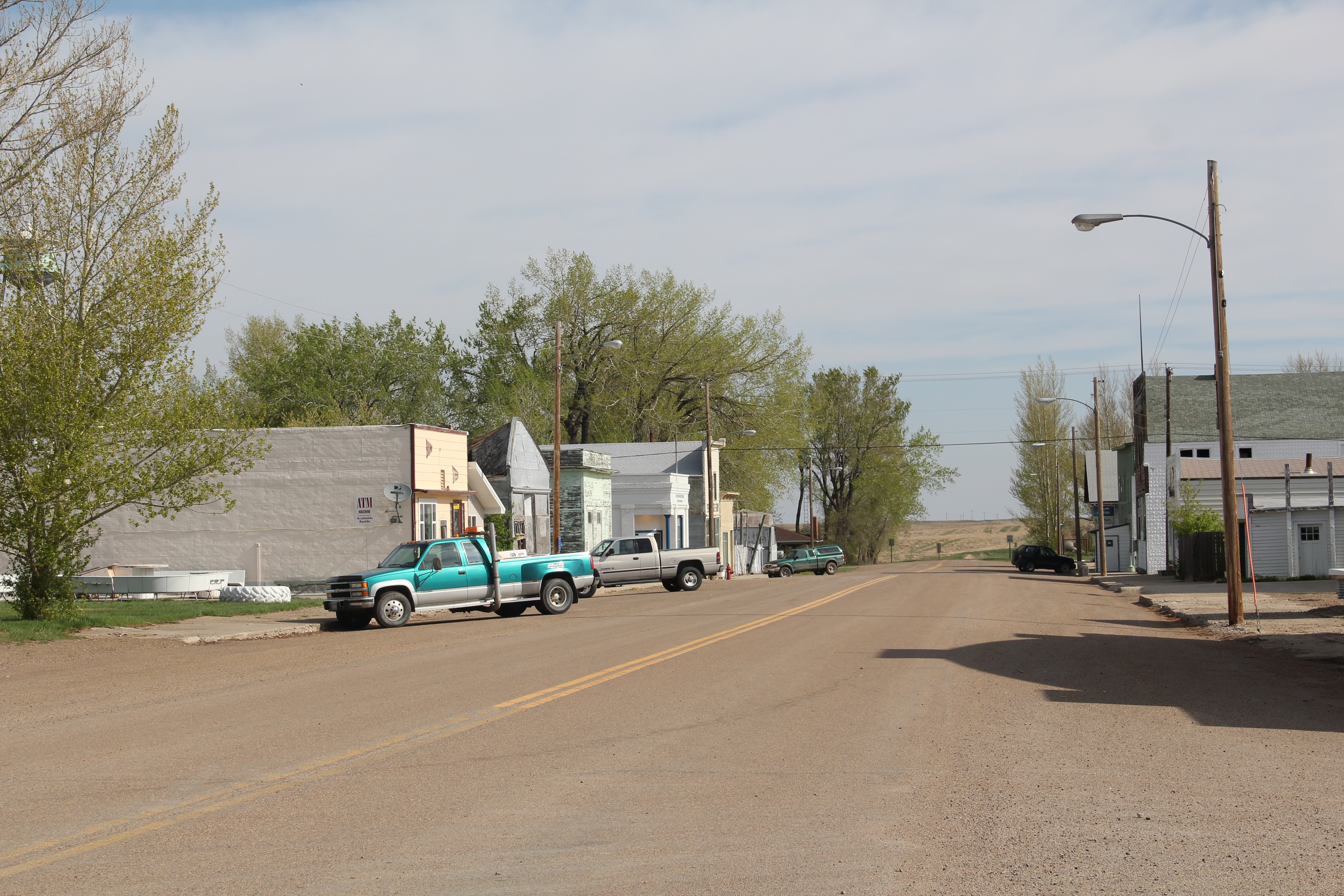
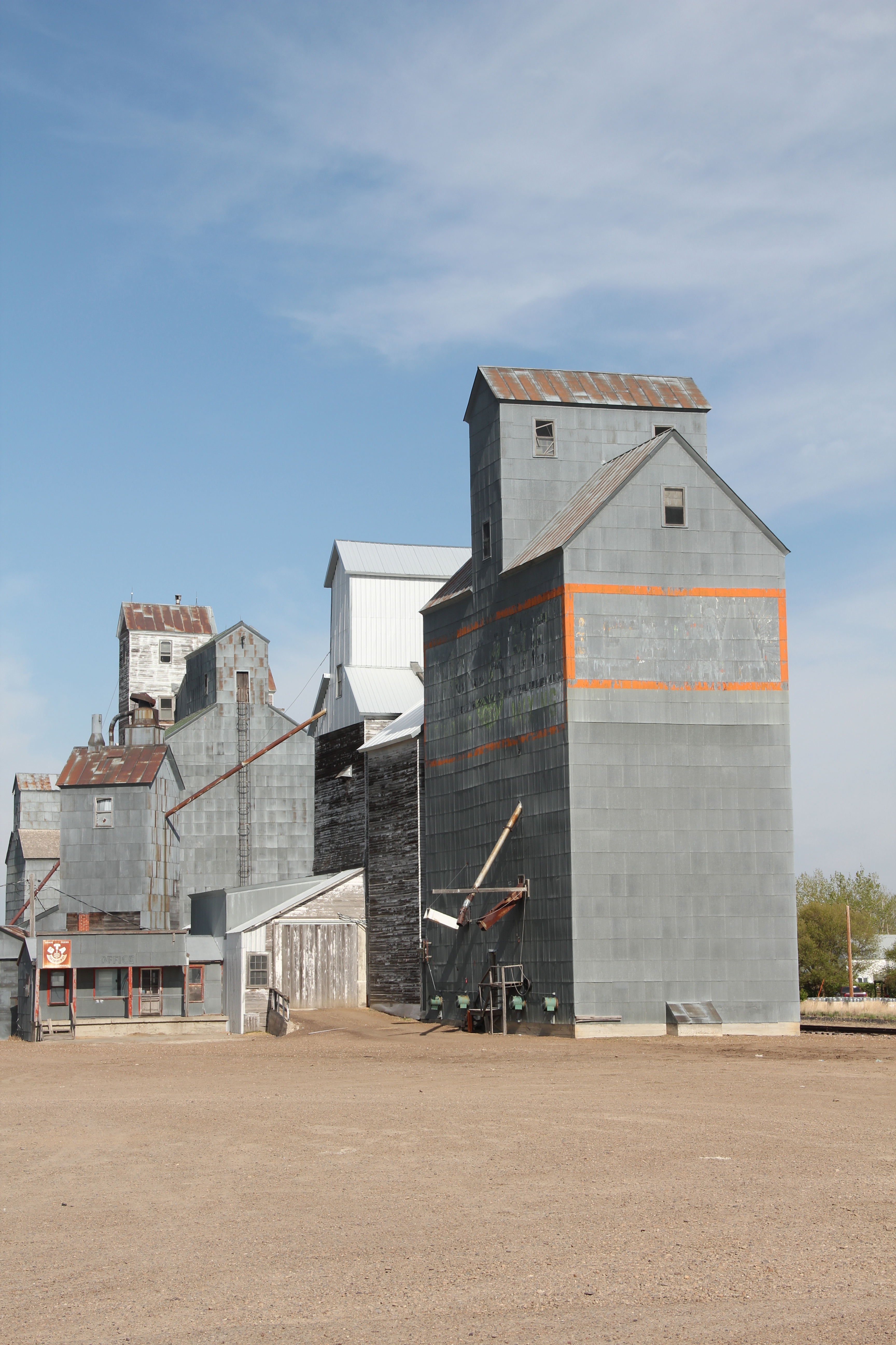
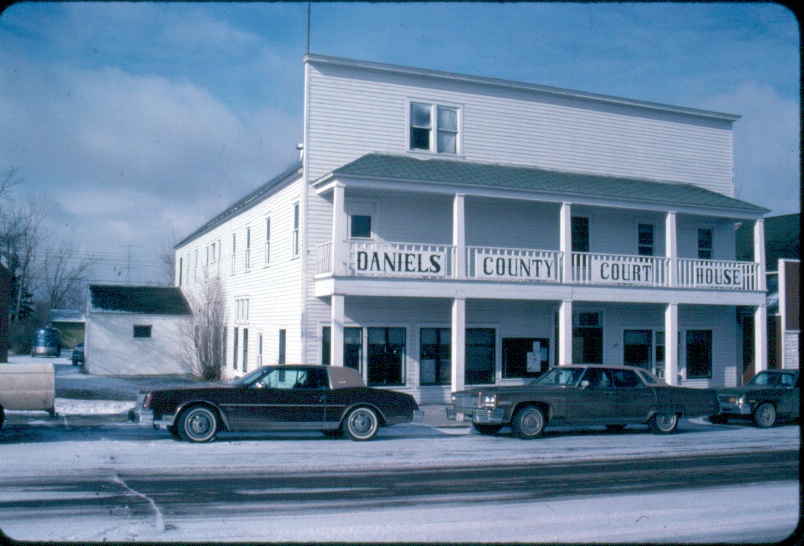
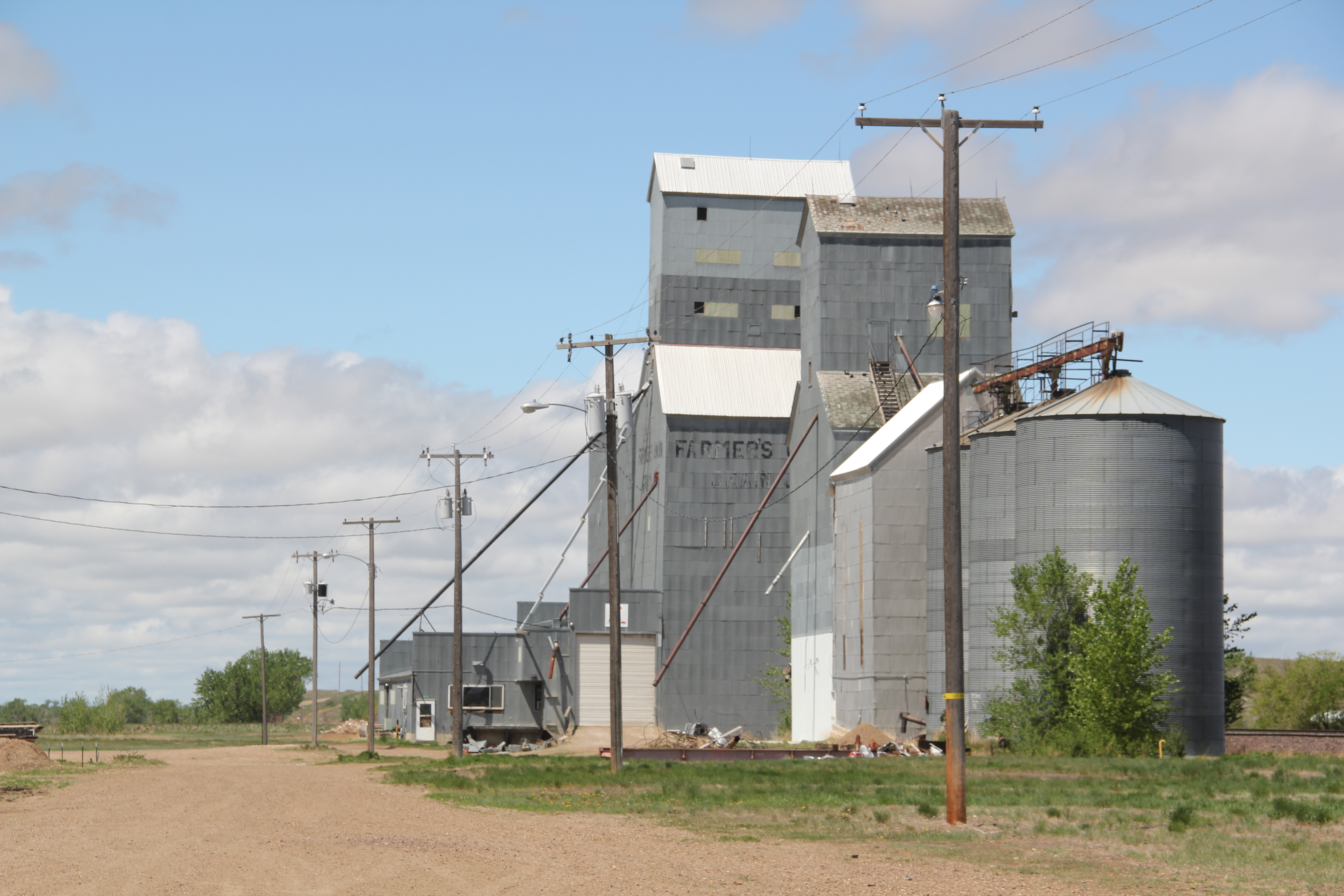
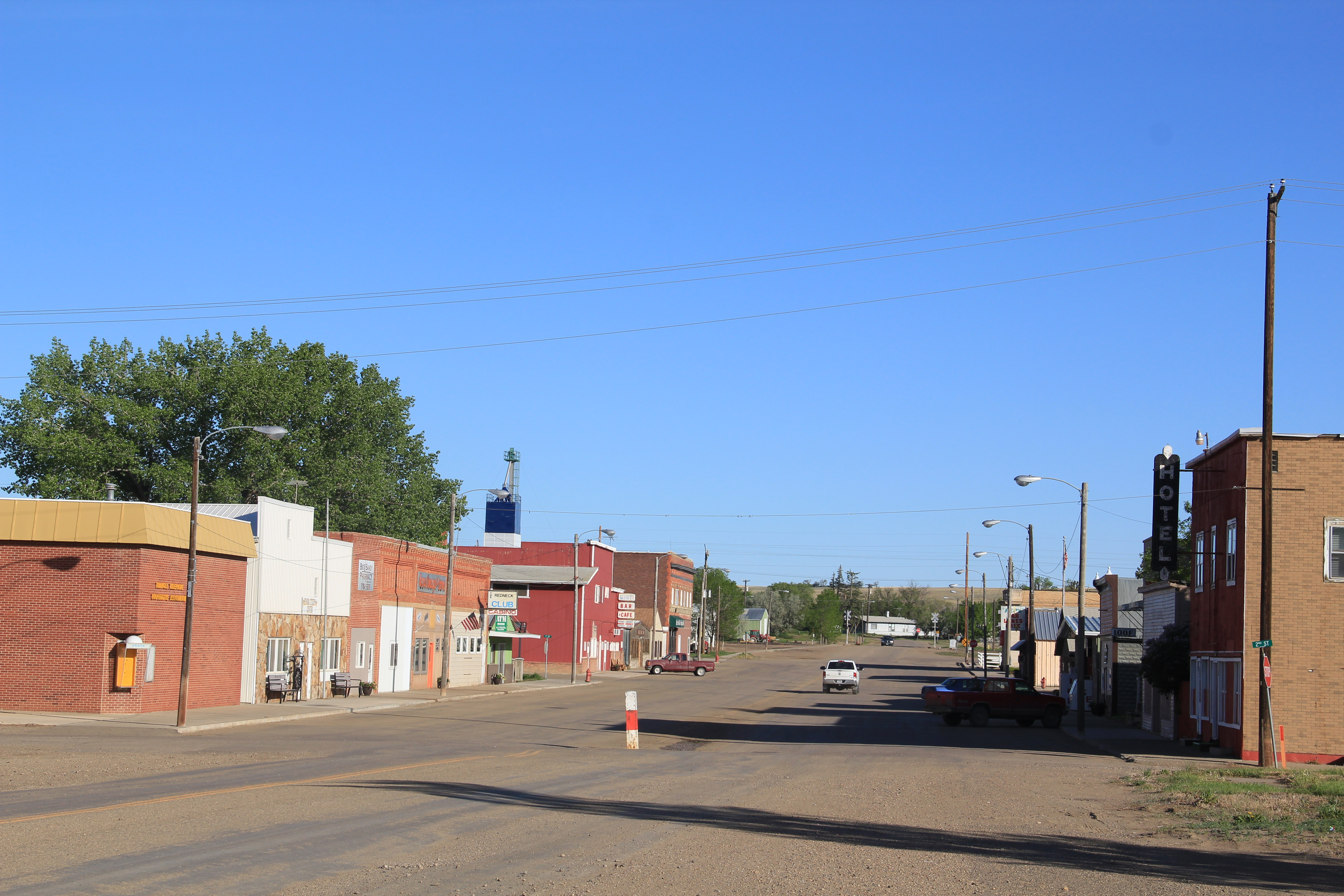
Plentywood has a classic T-plan town, with its depot and huge grain elevators defining what was the head of the town–and then a long “stem” of the T, where first came the commercial district, then a residential district, and finally at the “bottom” of the T: the county courthouse.

Plentywood's T-town plan, looking from the courthouse

Plentywood’s T-town plan, looking from the courthouse


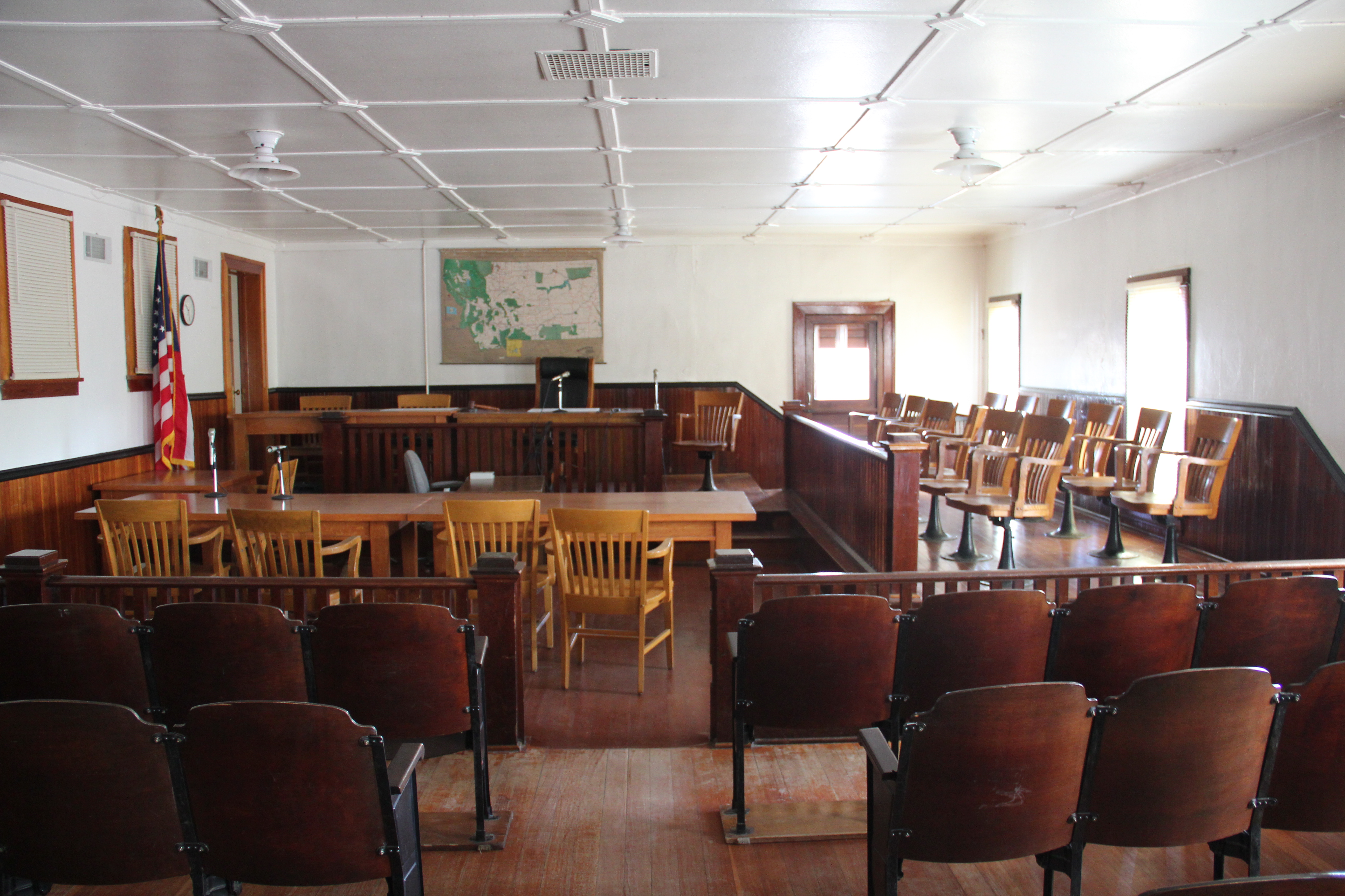
This arrangement of space spoke to the railroad’s concern for safety and efficiency: T-plans moved traffic and pedestrians off of the tracks. But when the Works Progress Administration built the understated WPA Modern-styled courthouse in 1937, placing it at the end of the town, you also had a classic statement of where power lay in these plains country towns. The railroad stood at the head; at the end of the town was the seat for local politics.
IMG_7497
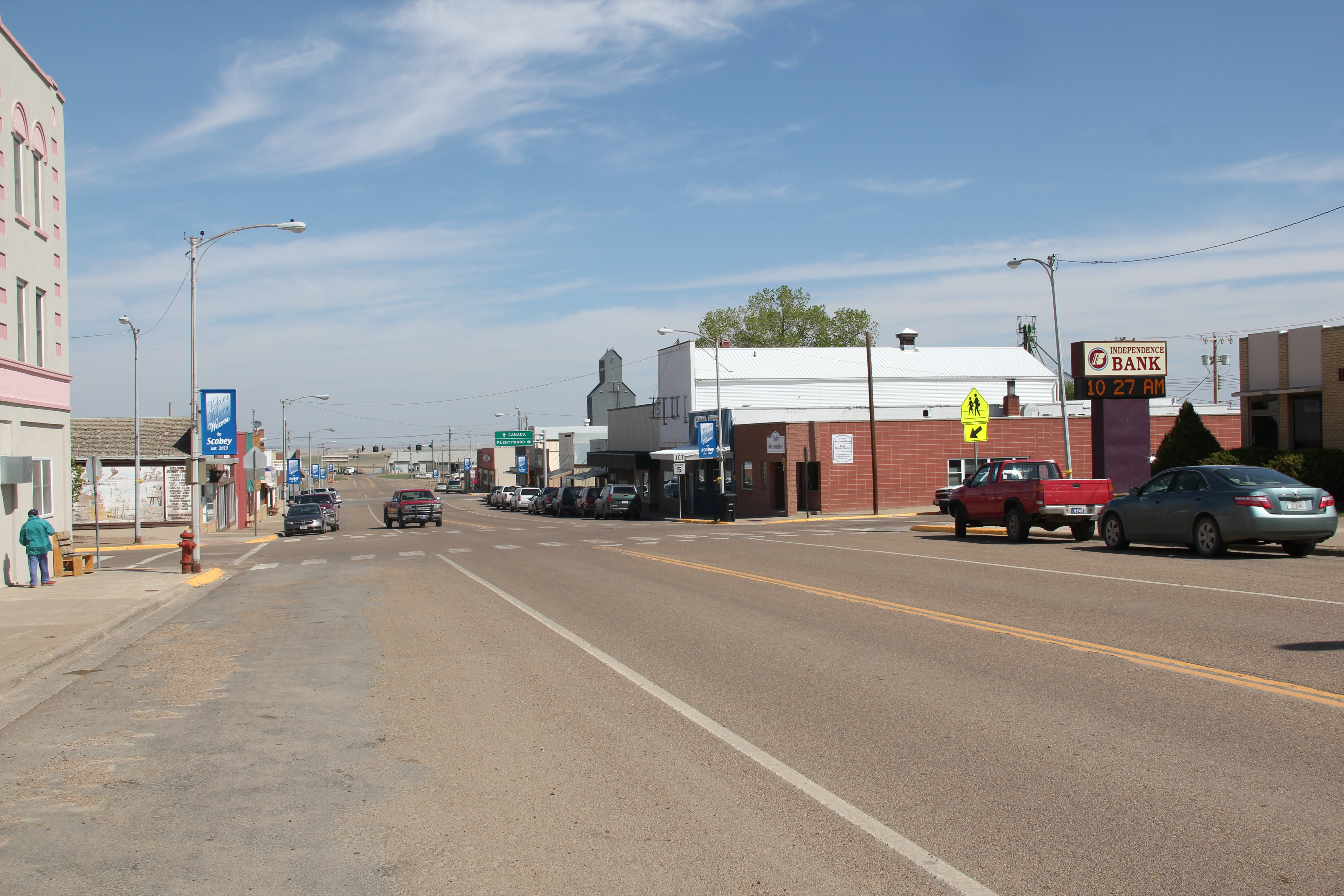
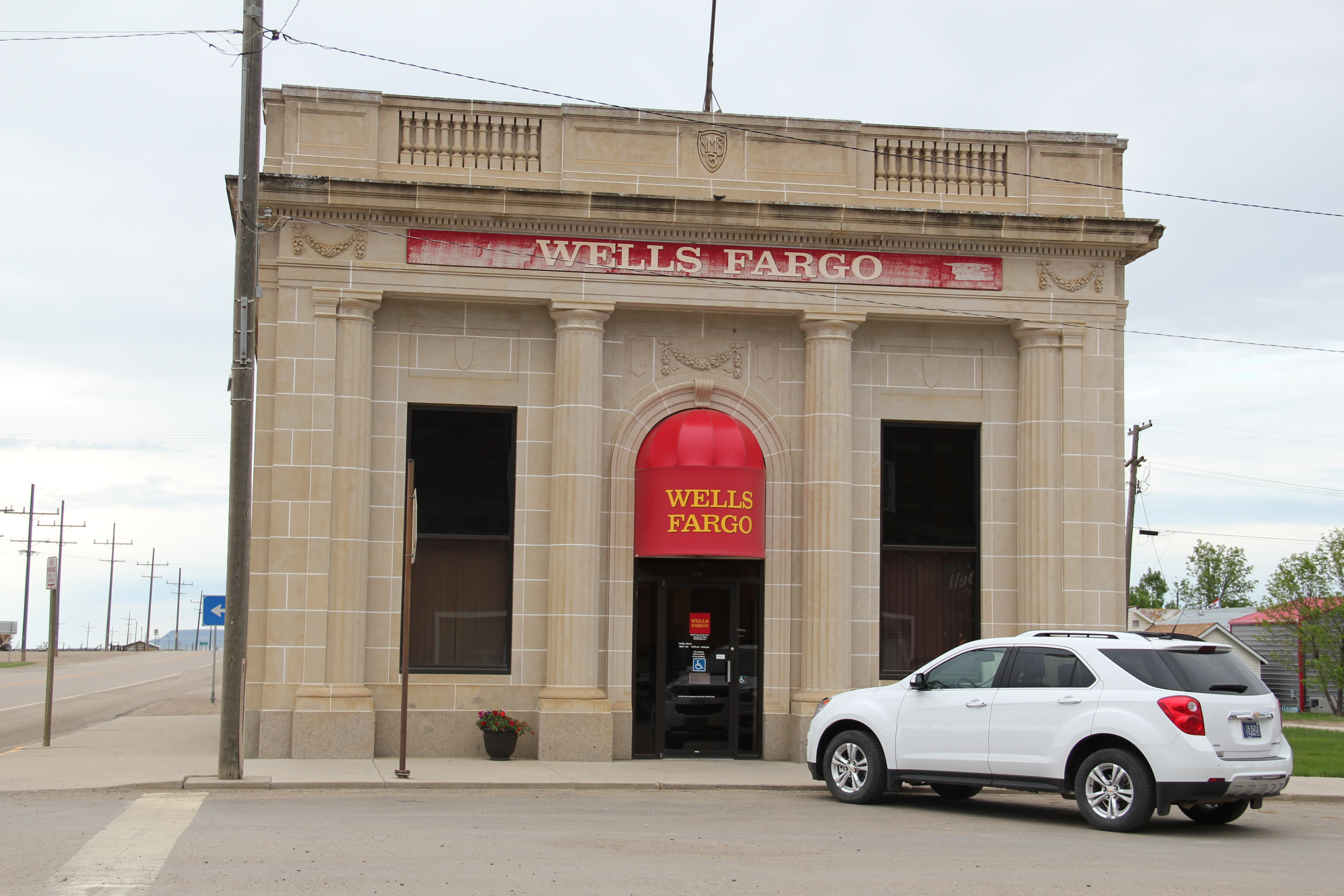
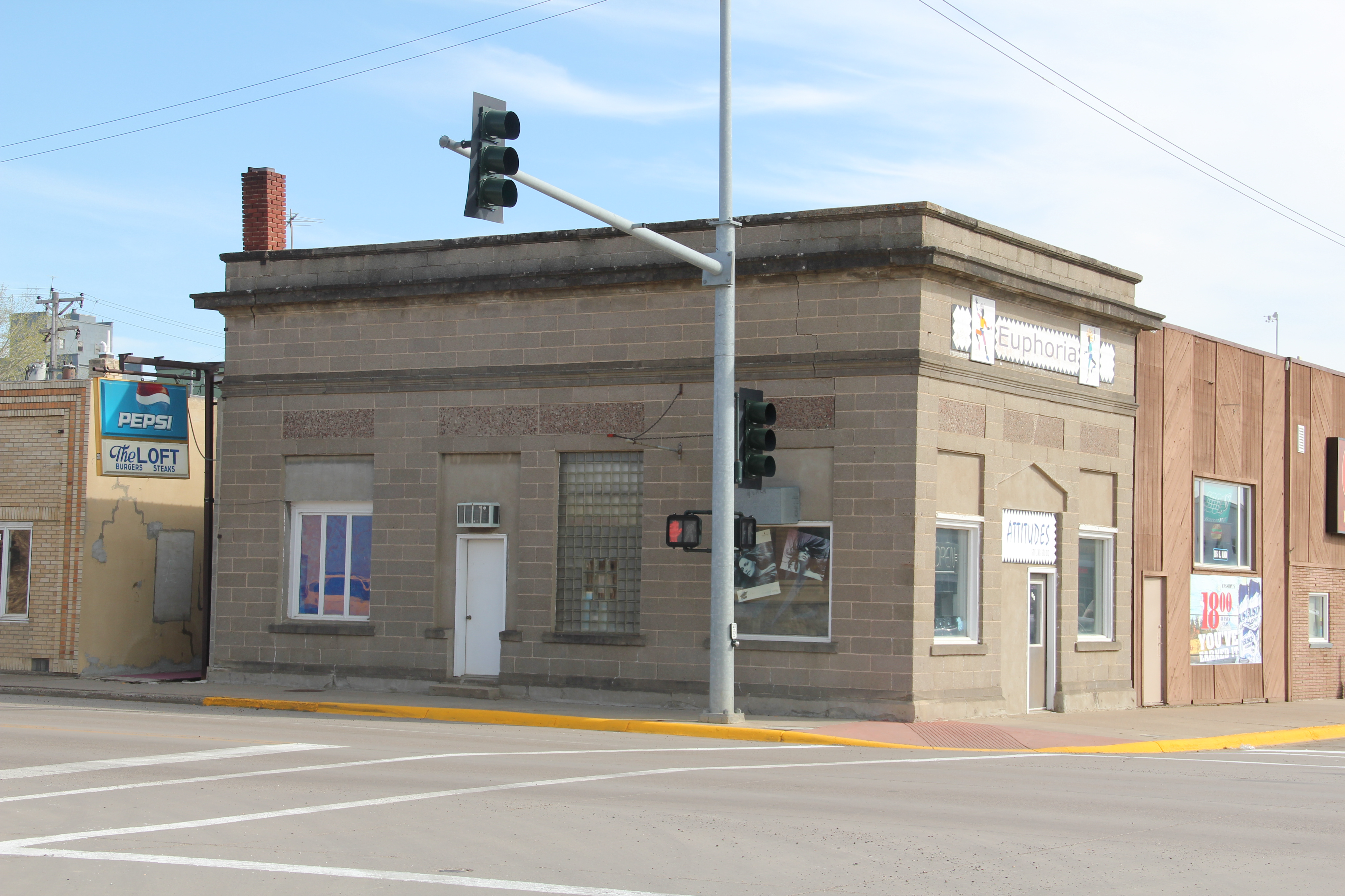
In 1984 another interesting arrangement of space I noted in Plentywood was how three different banks stood on three of the four corners of the town’s most prominent crossroads, where Montana Highway 16 crossed the main street. The banks are still there with the stone-work of the historic Adolph Riba bank (built by Henry and John Hill from the village of Raymond to the north), making it a prominent landmark.
IMG_7509
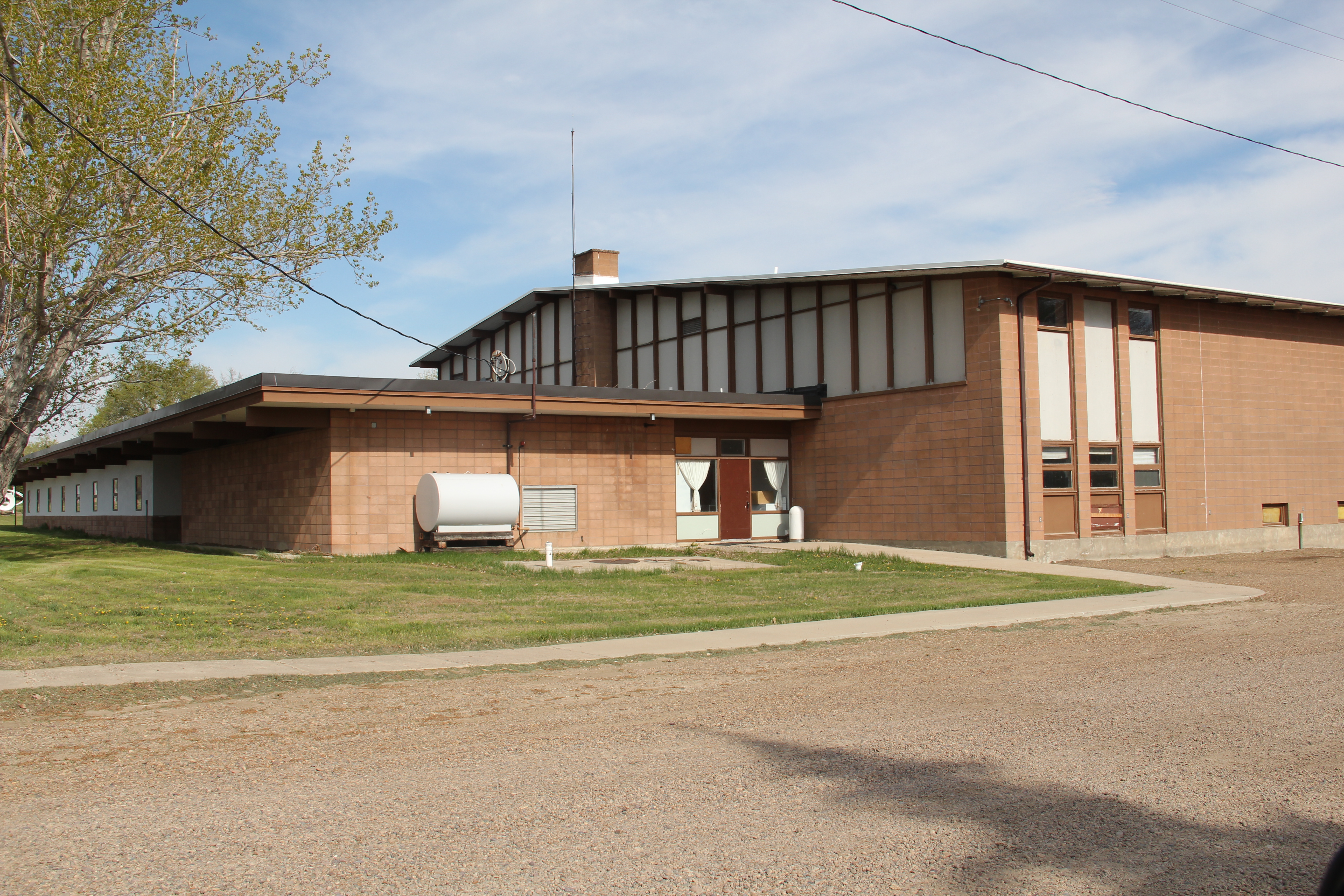
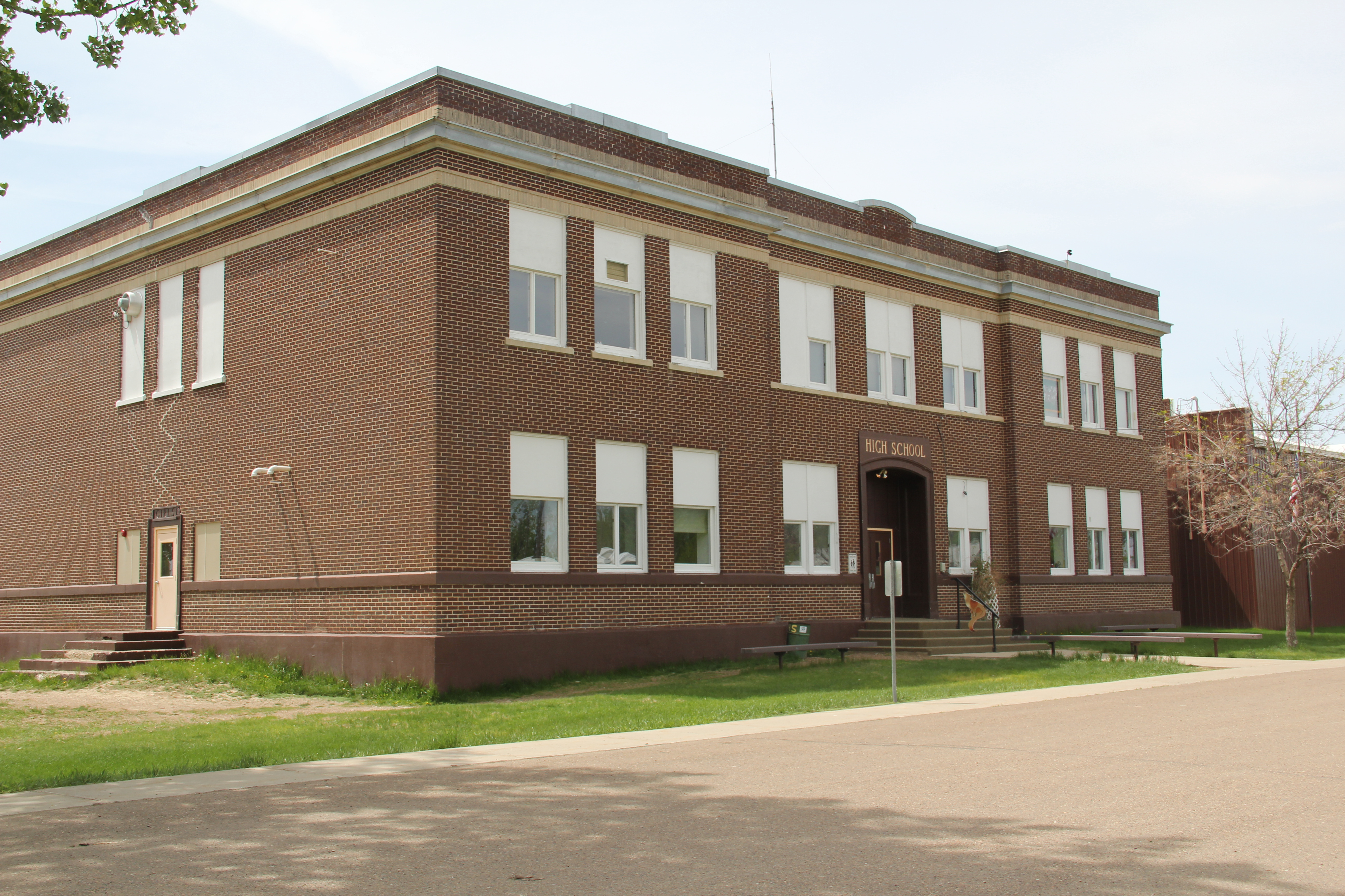
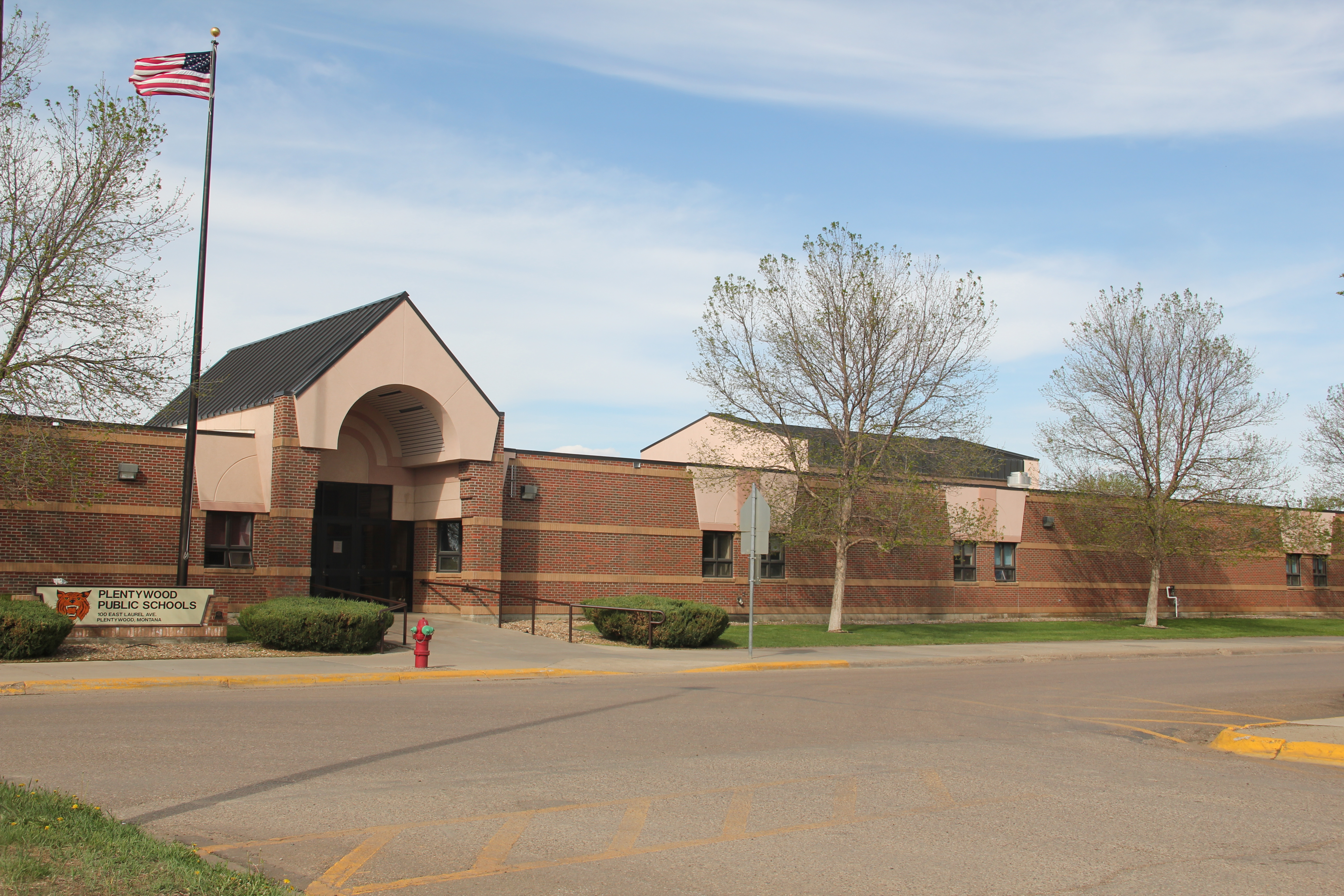
The impact of the regional oil boom on the public landscape is most evident in new schools and the new library, attached to the historic courthouse, changes I didn’t expect to find in a town that had lost 700 residents from the 2400 or so who lived there in 1984.
IMG_7500
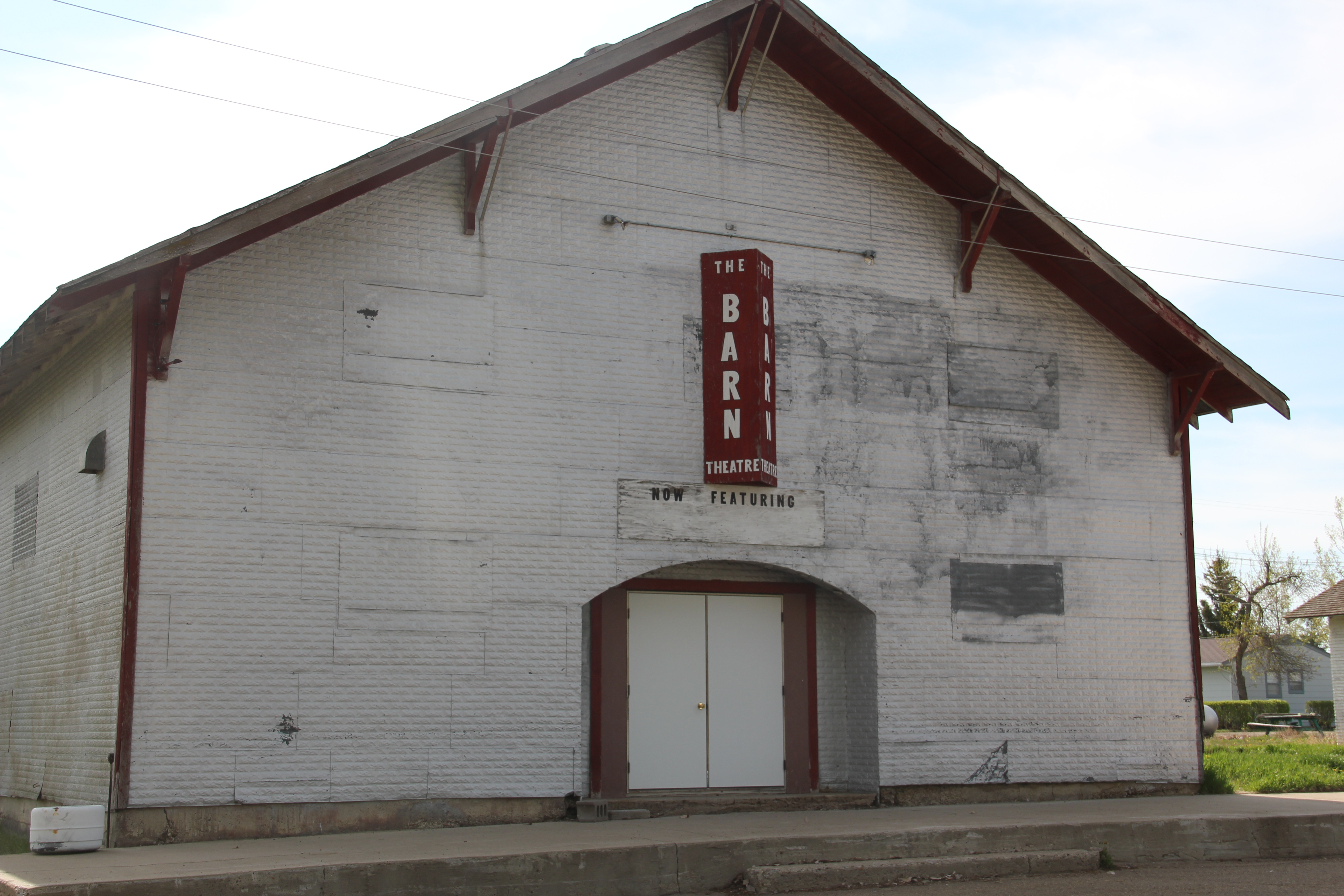
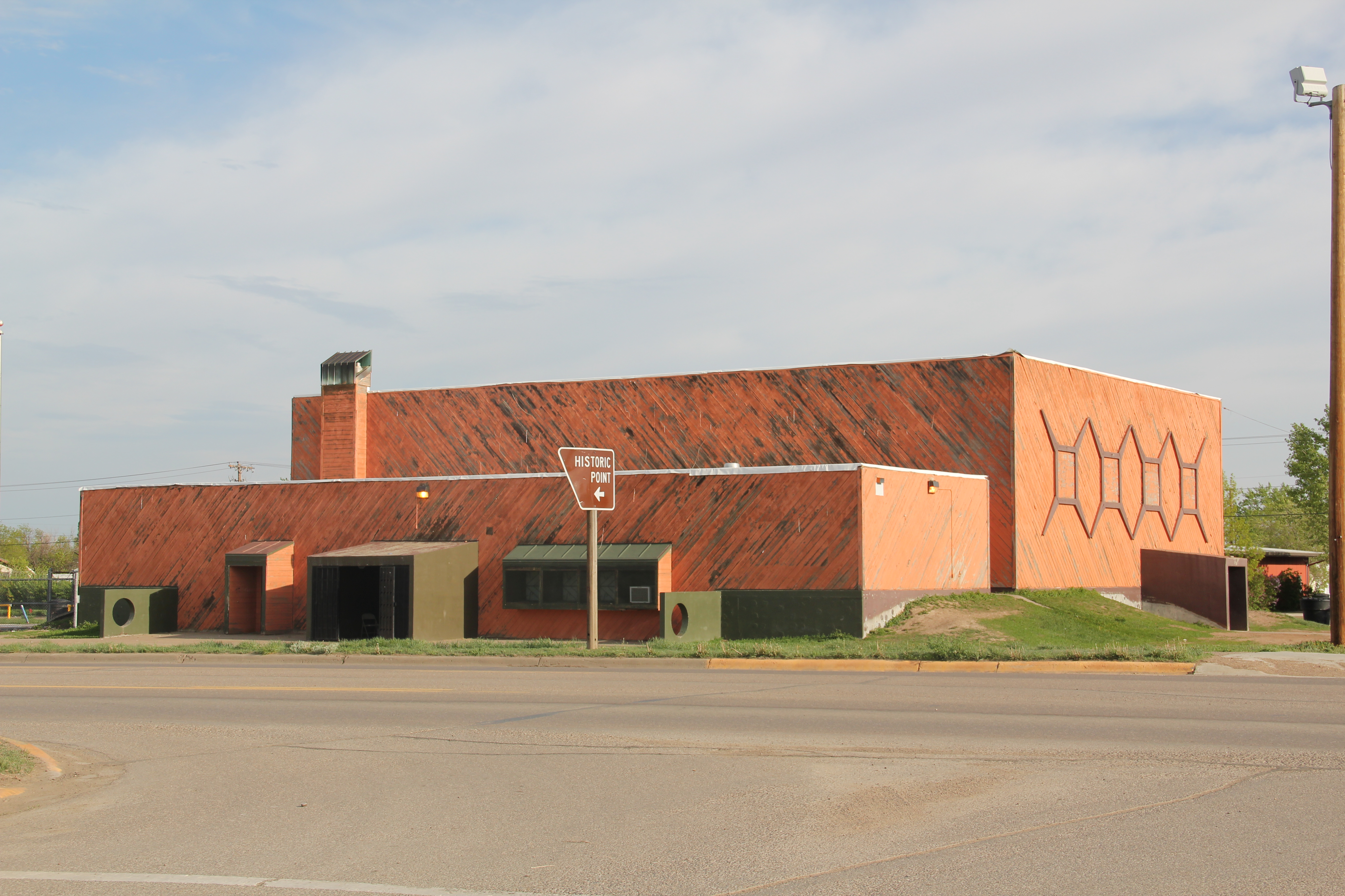
I was especially pleased to see the town’s historic movie theater, the Orpheum, which stands adjacent to the “top” of the T, still doing well. It was rare to find a small town movie theater in 1984, even less common today. Plentywood today is more than the historic center point of a neglected railroad corridor; it lies in the center of the changes coming to the region out of the 21st century oil boom of the northern plains.
IMG_1680
IMG_7520

Flaxville’s disappearing act

IMG_7593
A generation after its first settlement in 1913-1914, over 500 people lived in Flaxville, a Great Northern spur line town in Daniels County. When I visited in 1984, I found a declining railroad town, very common in the region, but I also liked how an old one-story brick bank still served the town’s 142 residents as a post office. Adaptive reuse at its best.
IMG_7595
Almost 30 years later the post office remained but one-half of the residents had gone. The census taker in 2010 counted 71 people in Flaxville. Despite the disappearing numbers, Flaxville has many worthy landmarks beyond the historic bank. Let’s start with the R-Y Bar, one of the few reminders in all of Montana of a historic trail that once connected Regina, Saskatchewan, to Miles City, far to the south.
IMG_7600
Then there is the Flaxville school, actually a marvel of contemporary design that you would never expect to find in such an out-of-the-way place. Once again we find Montana modernism is not just in the cities.
IMG_7604
IMG_7605
IMG_7602
The Barn, once a movie theater now a community theater and center, is a true rarity–a vernacular design for a popular culture purpose that seems almost crazily out of place. Its size speaks to time when whole towns gathered in one place for the movies. Its empty marquee today records a much more unpleasant truth: the
IMG_7598
reality of what happens when everyone begins to leave: the lights do go out. Yet the remaining local Catholic and Lutheran churches also speak loudly, to the quiet determination of those who remain here in Daniels County.
IMG_7603
IMG_7601
Naturally the grain elevators remain as sentinels overlooking Flaxville but few other commercial enterprises are open. The starkness of the town’s cemetery records both the past and future of this tiny place in Montana’s northern plains.
IMG_7592
IMG_7624

The high plains of Daniels County, Montana

IMG_7623

The high plains of Daniels County are among the most isolated places in all of Montana.  You may reach this place by heading straight north out of Wolf Point on a state road or you can come from the east on another paved road. Gravel roads are available as well.  Federal highways have never touched this place; railroads came, above is the Soo Line Corridor at Whitetail. They arrived from the east and dead-ended here on the prairie.

IMG_7650

Yet the isolation, the vernacular buildings, the fact that nothing is overtly special here actually makes it a special place. I liked it in 1984, when I made this image of the courthouse in Scobey–certain it would not be there for long.

Scobey MT jpeg

I liked it enough to return in 1988, and couldn’t wait to explore some more in 2013. In this blog, I have already spoken of the some of the remaining rural schools; the fairgrounds; the Soo Line railroad corridor; and, the survival of the Daniels County Courthouse, an old homesteader hotel that was once a bordello and still is used today by the citizens of Daniels County. As we take this detour from U.S. Highway 2 far to the south–the Canadian border is much closer to the north–here’s to Daniels County–the residents’ persistence, sense of community, and dogged determination means there is much to commend here.

IMG_7642

The courthouse proudly displays its National Register of Historic Places marker, although officials admitted that they do not get many “faraway” tourists (I found out Canadians naturally were not faraway-but someone from Tennessee, yes indeed).Dropped ceilings may be about but the courtroom retains its turn of the 20th century feel. The place was in great shape, considering the fact it was never built to be a public building, and its condition speaks to the pride residents have in this old false-front frame building.

IMG_7654

Another favorite haunt was the Scobey school, perhaps, next to the Catholic Church, the most architectural stylish building in the county. Keeping the Scobey in good shape and open is crucial to a town and county that has steadily lost population over the last 50 years. The population had dropped over 300 since the 1980s, and now is just over 1,000 residents.

IMG_7633

The Daniels County Cemetery, just outside of town, tells part of the story of those who came and are no longer here. But in the next post I will look in depth at the place that tells that story of change best–the quite wonderful Daniels County Museum, building zoo without rival in northern Montana.

IMG_7682

Fort Peck Indian Reservation, Poplar, Montana

Grain elevators on Great Northern line, 1984

Grain elevators on Great Northern line, 1984

If you arrived in Poplar, Montana, via train, as tens of thousands did 100 years ago, you saw little that made this place seem different than dozens of other northern plains towns.  Grain elevators dominated the skyline; almost as imposing were multi-story hotels–not luxury lodgings but a place to literally land for newly arrived homesteaders or “drummers,” salesmen traveling the line trying to drum up business for industries located in faraway metropolitan centers.

IMG_7573

Gateway Hotel, Poplar MT

IMG_7571

Poplar Hotel, Poplar MT


But if you move north away from the tracks and toward the modern-day U.S. Highway 2, a different, distinct world is found, in the historic buildings of the Fort Peck Indian Reservation.  Near the Montana Highway Historical Marker telling the reservation’s story is a historic jail building from the late 19th century–the town’s most identifiable historic landmark in my 1984 work and today.

IMG_7562

IMG_7559


Next to the jail was a new arts and crafts shop, aimed at travelers along U.S. Highway 2, part of a significantly expanded presence for the Fort Peck Community College.

IMG_7561

Indeed, the new college buildings are among the most attractive institutional buildings that you can find along the eastern end of U.S. Highway 2 in Montana.  Their bold colors and dramatic placement along the highway demonstrates the importance of education for the future of the Fort Peck Indian Reservation.

IMG_7564

IMG_7558

IMG_7569

IMG_7566
North of the new buildings are many historic buildings associated with the reservation’s development in the early 20th century.  Some are abandoned and in poor repair but most are in use, still serving the tribes in the 21st century.

This building was a museum in 1984; now that activity has moved to the highway, better to attract visitors

IMG_7778


No doubt as to my favorite new building in Poplar in 2013:  The Perculator.  Not only a classing roadside building, but they also made great coffee–perfect for a long day of fieldwork in the Fort Peck Indian Reservation.

Nashua, Montana: stories of a railroad and a man

IMG_7881

Nashua is the eastern most town of Valley County, Montana, located where Porcupine Creek empties into the Milk River.  Its history mirrors those of many towns along the Hi-Line:  it too began as a Manitoba Road town in 1888-1889. The tall grain elevators that still dominate the townscape, as they did in 1984, document the days when the rails carried everything as does the moved and repurposed Great Northern Railway depot, not a Senior Citizens Center.

Elevators along Great Northern line, 1984

Elevators along Great Northern line, 1984

IMG_7883

Nashua is also a gateway along U.S. Highway 2 to the region’s New Deal era history, especially the construction of Fort Peck Dam and Reservoir.  As an eastern gateway to the dam, Nashua reached its peak population of over 900 in 1940 as the project neared completion.  Today less than 300 make Nashua home.  One key New Deal survivor–the 1935 school (with later additions)–is home to the Porcupines, and serves still as a community center.

IMG_7878

Another building in Nashua, the Civic Center, also looked New Deal in its origins, indeed similar in shape (but not materials) to the WPA-constructed civic center in Glasgow.  But in finding out the history of this building, I also found the story of a man and family who shaped Nashua in the post-World War II era.

IMG_7882


Victor Dostert (1886-1961) is a Montana small town example of a “civic capitalist,” a topic that I explored at length in my book Capitalism on the Frontier (1993).  He came and homesteaded south of the town along the Milk River during the boom of the 1910s but when the bust came in the 1920s Dostert, his wife Anna, and their three sons stayed, making their mark with construction projects (from a theater to the Catholic Church) and taking advantage of the thousands of construction workers passing through by building and operating Vick’s Bar in 1935.

Vick's Bar and Bowling Lane is at the center of the Nashua business district

Vick’s Bar and Bowling Lane is at the center of the Nashua business district

Then in 1957 the family added a adjacent Bowling Alley–and both institutions were still going when I visited in 2013.  The Civic Center, however, was Dostert’s crowning civic achievement.  He designed the building and had it constructed during his period as Nashua mayor (1945-1951).  It housed a movie theater as well as provided community meeting space. And as a community gathering point it anchors the adjacent Lion’s Park and is busy throughout the year, an anchor of identity for the dwindling population of eastern Valley County.

IMG_7880


Valley County’s Farming Outposts, and some Lefse

Valley County–another huge Hi-Line county stretching from the border with Canada to the Missouri River–became one of my favorite places to explore in 1984, and then again in 1988. Fort Peck Dam made it a targeted area because I was interested in the New Deal agencies as back then an under-studied part of the national built environment, and because I came from Tennessee. Nowhere else did the New Deal leave such a heavy hand as the series of dams and lakes of the Tennessee Valley Authority. But in its massiveness–Fort Peck on the Missouri River came damn close.

Image

But let’s start considering Valley County not from its most visited landscape–Fort Peck Dam and Lake–but from its least visited the northern third of the county, where once thousands of homesteaders tried to make their mark but today only hundreds remain to help tell that story still documented by abandoned schools, scarely populated towns, and miles of open prairie. But some places from 1984 were so powerful that linger today, and Glentana School is one of those.

Image

It was abandoned but had hope in 1984–today it is 30 years into becoming a ruin, perhaps a majestic one at that, of the hopes and dreams of homesteaders at the end of the Great Northern spur line almost 100 years ago.

Image

Glentana had lost its post office–replaced by a plexiglass and metal postal delivery system one may guess it is called, a sure sign of being forgotten. Not so for its neighbor Richland, where the post office remains open (let’s hope it stays that way).

Image Image

But schools turned into homes and community halls are always signs of withering communities–indeed almost every business Richland had in 1984 was now closed.

Image


Image

Opheim, established in 1911, is the biggest place by far in the northern reaches of Valley County.  It had 85 residents in 2010, down from about 210 in 1984 and more than double that number in 1960, during the years that it served as federal radar base during the Cold War.

Image Image

Its population loss is documented not only in the historic town cemetery but also in its abandoned buildings. Yet, compared to other towns, Opheim had more than a sense of life about it, it had a strong sense of place and self, starting with the 1927 school remained vibrant, with a recent addition in place.

Image

The Mint Bar and Outpost were still in service, and the flag flew proudly over the town, and post office.

Image  Image

Most importantly, well at least after the school, is Granrud’s Lefse, once a family business that was fairly new in 1984 but that is now a regional institution for its traditional Norwegian lefse–a rolled potato snack that is fairly tremendous, and can be ordered online.

Image Opheim in 2013 is what it was, for so many years now: an outpost of America’s agricultural economy. Ignored and usually forgotten by most–true enough. But to those I have met there over 30 years, it is a place that helps to center life and community in the far northern reaches of Montana. And don’t forget the lefse.

Image

Milk River Project Towns: Dodson, Vandalia, and Tampico Jo

Image

The U.S. Bureau of Reclamation’s Milk River Project is one of its largest and most significant in Montana; it was one of the agency’s first five projects carried out under the Newlands Reclamation Act of 1902. I have already briefly mentioned the project in regards to Fresno Dam outside of Havre. Now let’s consider the project and its impact on three much smaller villages: Dodson in Phillips County and Vandalia and Tampico in Valley County. All three were once major stops along U.S. 2, but a later re-routing of the highway bypassed Tampico and Vandalia, and not much is left decades later but the canals and ditches of this massive irrigation system.

Image 

Original U.S. 2 route between Vandalia and Tampico (to right is Great Northern roadbed)

The Bureau launched the Milk River Project in the first decade of the 20th century but due to disputes over who controlled the water (the Winters case) along with international negotiations with Canada since the Milk River basin passes through both nations, serious construction did not begin until the century’s second decade. The project area encompassed 120,000 acres, with 219 miles of canals, and hundreds more of secondary laterals and ditches. The water begins at Lake Shelburne at Glacier National Park, flows through the St. Mary Canal to the Milk River where then water is stored at Fresno Reservoir outside of Havre and then at the Nelson Reservoir between Malta and Saco.

Image

Dodson developed as a major base for the Bureau. Nearby here was a major diversion dam, and bureau officials established a regional headquarters at Dodson in the 1910s.

Image

This impact of the federal agency is still reflected in the impressive two-story brick high school, the magnificent Phillips County Fairgrounds (discussed earlier in this blog), and the fact that such a small town has impressed contemporary styled churches from the 1950s. I was very impressed with the quality of the town’s built environment, considering its size, when I visited here in 1984.

Image Image


But in the mid-1990s the Bureau left Dodson for a more centralized regional office in Billings, hundreds of miles to the south. Dobson’s emptiness was shocking in 2013–even the iconic (and once very good) Cowboy Bar had shuttered its doors.

Image  Image

Dodson now is entering the same fate suffered by its neighbors to the east, Vandalia and Tampico. Although trains still rumble by on the former Great Northern route, these two towns lost their highway connection when U.S. was re-routed to the north. Ever since they are slowly ebbing away. Vandalia was another location of a Bureau diversion dam on the river along with a historic steel bridge from 1911. The dam remains but the bridge is gone.

Image Image

In 1984 I loved the historic Vandalia school (1912) and had a good conversation with folks there–the school was closed but now it was a post office and still very much a community center, competing with the bar next door. Now both businesses are closed.

Image Image

Tampico lays just south of both a major canal and the railroad tracks. A scattering of buildings marks its existence.

Image

The water still flows through the Milk River project but the towns it once nurtured are becoming fainter with each passing year. But it is not without promise:  later we will visit the Nelson Reservoir and what is happening at Sleeping Buffalo Hot Springs.  Next is Malta, the seat of Phillips County.

Chinook and the Sugar Refinery

The last post ended with a rather pastoral image of the Utah-Idaho sugar refinery in Chinook with promises to add a few comments on how the town changed after the refinery.  Let’s begin with a dose of reality–the image of a stack looming over the prairie is compelling but misleading.  The WPA Guide to Montana tells us that the factory began in 1925, was the state’s fourth largest by the late 1930s, and that the “shacks” of Mexican and Filipino workers crowded around the factory.  Other sources record how at this same time

Image

other communities down river complained of the foul discharge of the company directly into the Milk River.  The lesson here:  later day architectural photos can sometimes obscure rather reflect historical reality.

Within Chinook, there are many reminders of the prosperity brought by beet farming and the refinery.  The town has an interesting array of 1920s and 1930s domestic architecture, from the revival craze to the modernism of the International style.

Image


Image


Business owners also took the new styles of the Jazz Age–like Art Deco–and added facades that gave a new look to their stores.

Image


After the impact of New Deal modern design in the new Chinook High School in the 1930s, Chinook embraced post-World War II modernism, such as the expansion of the high school in the 1950s, a dazzling International style National Guard facility out near the Image 

Image

sugar refinery, and a new International Harvester dealership, part of the architectural legacy of industrial designer Raymond Loewy.

Image

The sugar refinery brought a new era to Blaine County and it gave Chinook a two-sided look:  one, a railroad town along U.S. 2, and two, a modern plains town that emerged agriculture and industry in the mid-20th century.

Traveling the historic Manitoba Line, from Havre to Big Sandy

Image

The impact of the Great Northern Railway on the settlement of northern Montana really can never be over-emphasized–its mark on the settlement landscape and later transportation routes is that important.  Most travelers, and many residents, do not realize that the railroad, then named the St. Paul, Minneapolis & Manitoba, did not initially strike straight across the plains to Glacier National Park.  In 1887 it turned at Havre and headed southwest towards Great Falls, creating a distinct modern landscape along Big Sandy Creek that you may still follow today.

Image 

The first important stop was Fort Assinniboine, a U.S. army base established in 1879, before the first settlers arrived. The army maintained this major base until the 1910s and later in that decade its land and buildings became the Northern Montana demonstration farm, allowing state and federally supported agricultural reformers learn and demonstrate best practices in farming techniques and crops for the region.  Today it remains part of the state’s extension service, which has adapted some buildings for new uses while keeping others preserved as part of the nationally significant story of the U.S. military and its occupation of the northern plains.  

Image Image 

When I visited the fort site in 1984, the highway marker was the primary interpretation.  The farm’s administrators have since worked with the Montana State Historic Preservation office to locate interpretive markers outside of several buildings.  Tours of the complex are also available by reservations.

Image

Image Image

 As part of the federal process of transforming the landscape of Big Sandy Creek, the homesteading boom left its mark everywhere in the 1910s.  But also in 1916 the federal government established the Rocky Boy Indian Reservation for the Chippewa Cree.  The Manitoba Road’s intersection with the reservation came at Box Elder, at the border between Hill and Chouteau counties.  In 1984 one of the early Great Northern-era combination depot still stood at the town, although it seemed destined for destruction. Imagine my surprise in 2013 when the depot still remained, but barely so. 

Image Image

The gas station’s roadside architecture also faces an uncertain future.  But St. Anthony’s Catholic Church remained a key landmark and along U.S. 87 in the reservation stood a new architecturally distinctive building:  the Northern Wing Casino.  

 ImageImage


Image

Big Sandy is easily the largest town of northern Chouteau County, a place that abounds in surprises.  In 1984 the town’s old homesteader hotel remained, and so many other Montana towns had lost these artifacts of the early 20th century settlement. 

Image


Image

Thirty years later, the hotel remains in place, as do several other architecturally important buildings, from the Northern Monana State Bank, a vault-like neo-classical style building to the modern contemporary styling of St. Margaret Mary’s Catholic Church.

Image

Image

 Impressive adaptive reuse projects also had taken place, with the community turning the historic Great Northern depot into a center for its historical society and museum.  Big Sandy has a t-town plan, with its stem lined by businesses and other ventures, such as the false front Odd-Fellows Lodge or the recently established coffee shop.

Image


Image

The town’s New Deal era school remained, although the building’s original International Style design was somewhat muted by a new roof and other cosmetic changes. Yet, here was the school that nurtured Jeff Ament, who moved to Seattle and gained fame as part of the internationally significant band, Pearl Jam.  

Image

Big Sandy has steadily lost population since 1984–600 people remained in the 2010 census–but key landmarks remain standing and in use.  Impressive.  The days of the Manitoba Road are long gone but this early railroad town still makes a powerful historical statement.

Great Northern Towns in west Hill County, Montana

In my 1984 fieldwork, Havre was a base for quite a bit of travel along the Hi-Line.  One of the most compelling landscapes, and among my favorites for the state, were the little towns, regularly spaced about every eight miles, west of Havre.

Image

At the time, my understanding of this landscape was heavily influenced by recent works by the American Studies scholar John Stilgoe (Metropolitan Corridor: Railroads and the American Scene) and the historical geographer John Hudson (a series of articles that culminated in the book Plains Country Towns.) Stilgoe reminded me that railroads in the late 19th century not only defined towns and urban design but impacted American culture in how small, tiny spaces became part of urban, metropolitan life through the steel tracks.  Hudson explain why towns existed every six to seven miles or so throughout the plains (these were often single track lines so trains needed places to pull over for passing, and places where water and fuel could be acquired as necessary).  Hudson explained differences between railroad division points, where shops and offices would be located, and “country towns,” where typically a combination depot carried out all of the railroad’s corporate functions.

Image

This arrangement of space, and the ennobling of railroad culture in larger towns, was exactly what I saw in Havre and Hill County.  Ever since 1984, this has been among my favorite places in Montana.  In a posting last year I discussed the “disappearing depots” along the Hi-Line, focusing on west Hill County.  I want to revisit those same places today, with a deeper view on what was there in 1984 and what you find today.

Image

Inverness, established c. 1909, was the first place I stopped but spent little time there because already in 1984 its Great Northern depot was gone.  But in 2013, I was looking for beyond the Stilgoe-Hudson way of understanding plains country towns.  Inverness in 2010 had 55 residents, but still held several early settlement landmarks, such as its early 20th century elevators along the railroad, a National Register-quality c. 1920 store/gas station, and two large two-story frame blocks–the historic Inverness Hotel (most recently Inverness Supper Club) dates to the second decade of the 20th century.

ImageImage

The Sacred Heart Catholic Church dates to the town’s beginnings, but a brick school from 1931 with 1952 additions closed in the early 21st century.

Image

Inverness’s c. 1960 post office is a great example of stone-faced standardized design that the postal service used in small towns across the nation in that decade. It was one of the offices threatened with closure in 2011.

Image

Rudyard, established 1909, was the largest of the west Hill County towns, about 500 people in 1980 but now with only 258 residents according to the 2010 census.  Its prominence in the second half of the 20th century is reflected in two buildings:  the tall concrete grain elevators along the railroad and the contemporary-styled Wells Fargo bank building on the prominent town corner facing the tracks and Reed Street.

Image Image

Thirty years ago, as the construction of a modern bank building attests, several stores and the Hi-Line Theater were hubs of activity; today most businesses are closed.

ImageImage

Image

Museums now abound–with the moved depot forming a small building zoo while an early 20th century stone building has become an auto museum.

Image

Image

Rudyard also has one of the highway’s most famous town signs–boasting of a population now greatly diminished but the old sorehead remains–at the Sorehead Cafe in the heart of the four block long commercial district.

Image

Image

One hundred years ago, Hingham (1910) seemed to be the town that would make it. From the railroad corridor several blocks of commercial businesses were filled in the next decade.

Image

There was a town square featuring a city park in the midst of it all.

Image

Here the town’s Commercial Club hosted the Hi-Line Fair, which “presented farmers and ranchers with an opportunity to exhibit their grain and livestock and to exchange ideas with people from other points along the Hi-Line.”

Image

While the buildings, outside of the brick neo-classical brick bank (1913-14), were frame, town boosters were confident these were only the initial businesses. But the second decade of the 20th century proved to be the town’s high point, and frame buildings still define local businesses.

Image

In 1930 they defined the town with a large, handsome two-story brick school at its south end (near U.S. 2, a recognition of the highway’s importance in getting students to and from Hingham).

Image

The Our Lady of Ransom Catholic Church is a modernist landmark, and one of the most architecturally important buildings of the Hi-Line, part of the Great Falls diocese effort to improve and modernize its churches in the mid-20th century.  A much earlier frame Methodist Church remains, and has most recently served as a community chapel.

Image Image

The boosters of Gildford also had high hopes in 1910 and the homesteading boom brought a full fledged town into existence by 1915-16.

Image

Image

Image Elevators in 1985

The boom decade is marked by the extant Gildford State Bank (1914), which also served as the town’s post office when I first visited in 1984.  The town also had an early industry, the Mundy Flour Mill.

ImageImage

Kremlin acknowledges its distinct name with its highway town sign.

Image

Settlement began in 1909, with a plat from land agent K.C. Farley, focused on the Great Northern section house, later replaced by a standardized depot, all of which is gone from the railroad corridor today.

Image

IMG_8903

The WPA built a new high school in 1938, which remains a central landmark for the community, a symbol of the future, and a good way to end this posting.

IMG_8913 IMG_8912