Milk River Project Towns: Dodson, Vandalia, and Tampico Jo

Image

The U.S. Bureau of Reclamation’s Milk River Project is one of its largest and most significant in Montana; it was one of the agency’s first five projects carried out under the Newlands Reclamation Act of 1902. I have already briefly mentioned the project in regards to Fresno Dam outside of Havre. Now let’s consider the project and its impact on three much smaller villages: Dodson in Phillips County and Vandalia and Tampico in Valley County. All three were once major stops along U.S. 2, but a later re-routing of the highway bypassed Tampico and Vandalia, and not much is left decades later but the canals and ditches of this massive irrigation system.

Image 

Original U.S. 2 route between Vandalia and Tampico (to right is Great Northern roadbed)

The Bureau launched the Milk River Project in the first decade of the 20th century but due to disputes over who controlled the water (the Winters case) along with international negotiations with Canada since the Milk River basin passes through both nations, serious construction did not begin until the century’s second decade. The project area encompassed 120,000 acres, with 219 miles of canals, and hundreds more of secondary laterals and ditches. The water begins at Lake Shelburne at Glacier National Park, flows through the St. Mary Canal to the Milk River where then water is stored at Fresno Reservoir outside of Havre and then at the Nelson Reservoir between Malta and Saco.

Image

Dodson developed as a major base for the Bureau. Nearby here was a major diversion dam, and bureau officials established a regional headquarters at Dodson in the 1910s.

Image

This impact of the federal agency is still reflected in the impressive two-story brick high school, the magnificent Phillips County Fairgrounds (discussed earlier in this blog), and the fact that such a small town has impressed contemporary styled churches from the 1950s. I was very impressed with the quality of the town’s built environment, considering its size, when I visited here in 1984.

Image Image


But in the mid-1990s the Bureau left Dodson for a more centralized regional office in Billings, hundreds of miles to the south. Dobson’s emptiness was shocking in 2013–even the iconic (and once very good) Cowboy Bar had shuttered its doors.

Image  Image

Dodson now is entering the same fate suffered by its neighbors to the east, Vandalia and Tampico. Although trains still rumble by on the former Great Northern route, these two towns lost their highway connection when U.S. was re-routed to the north. Ever since they are slowly ebbing away. Vandalia was another location of a Bureau diversion dam on the river along with a historic steel bridge from 1911. The dam remains but the bridge is gone.

Image Image

In 1984 I loved the historic Vandalia school (1912) and had a good conversation with folks there–the school was closed but now it was a post office and still very much a community center, competing with the bar next door. Now both businesses are closed.

Image Image

Tampico lays just south of both a major canal and the railroad tracks. A scattering of buildings marks its existence.

Image

The water still flows through the Milk River project but the towns it once nurtured are becoming fainter with each passing year. But it is not without promise:  later we will visit the Nelson Reservoir and what is happening at Sleeping Buffalo Hot Springs.  Next is Malta, the seat of Phillips County.

Harlem on the Hi-Line


Image

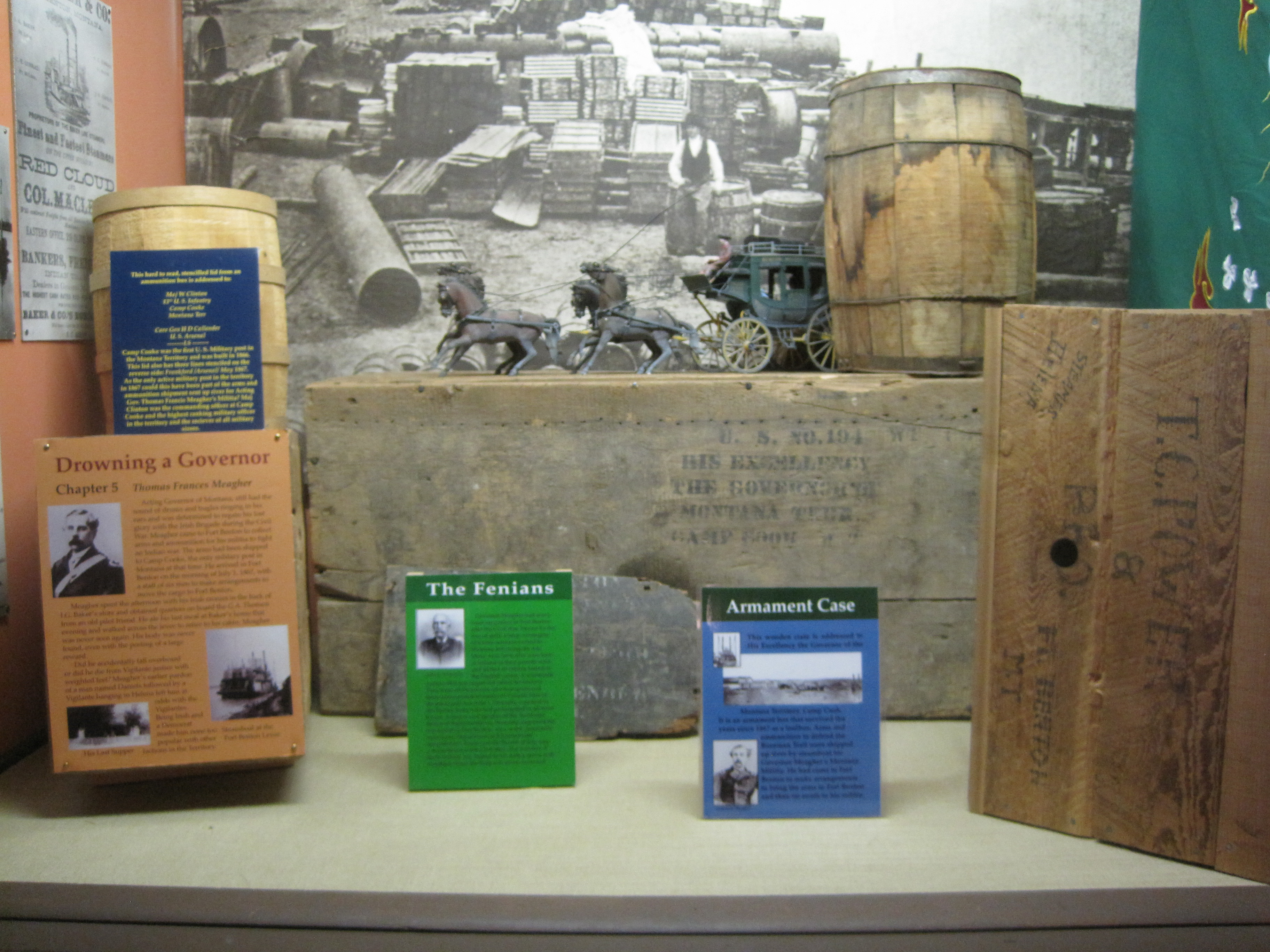
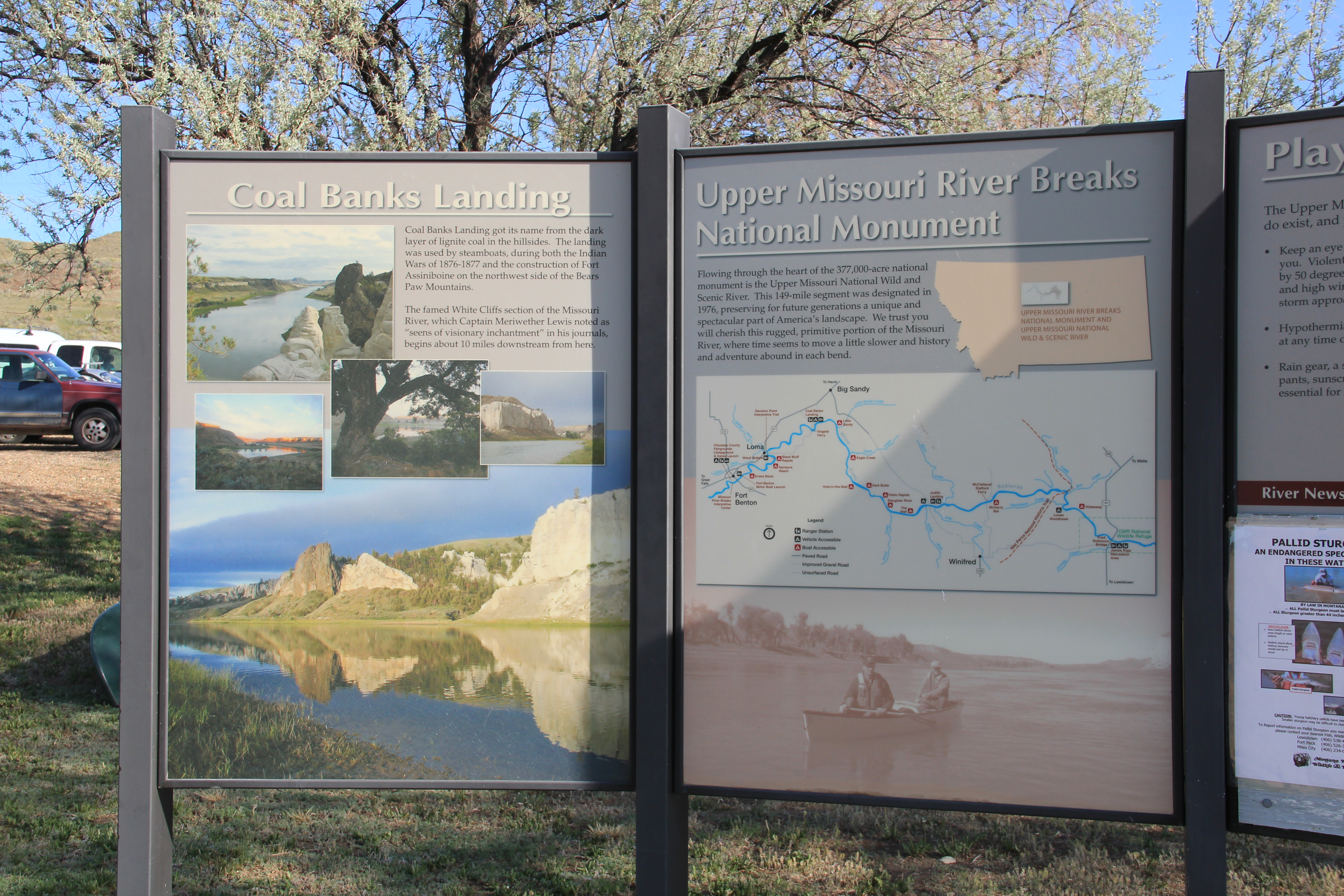
Whenever travelers or residents for that matter talk about Hi-Line towns, Havre, Shelby, Glasgow, Wolf Point always enter the conversation. Some places, inexplicably to my mind, never do: Harlem is a case in point.

Image

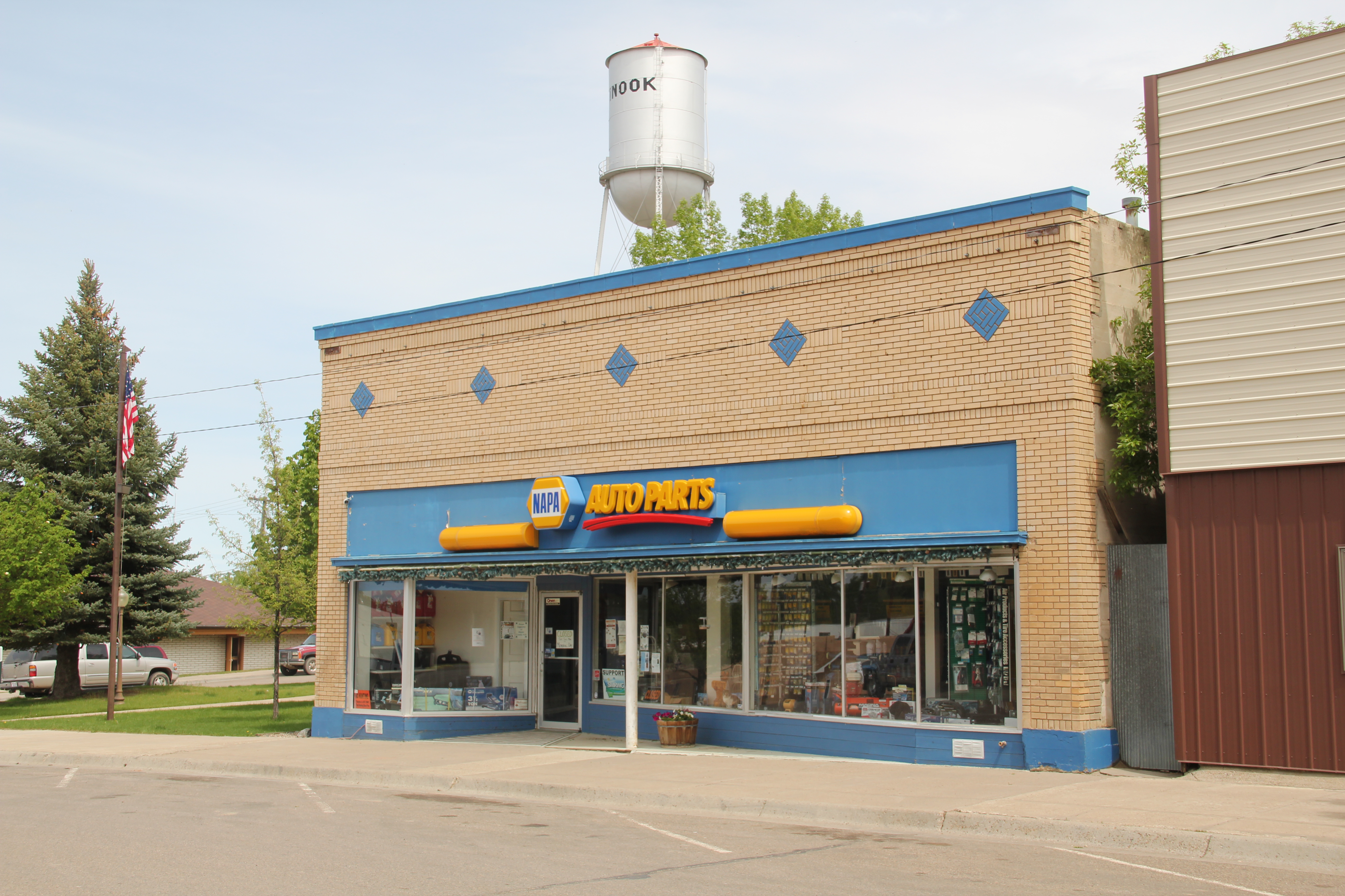
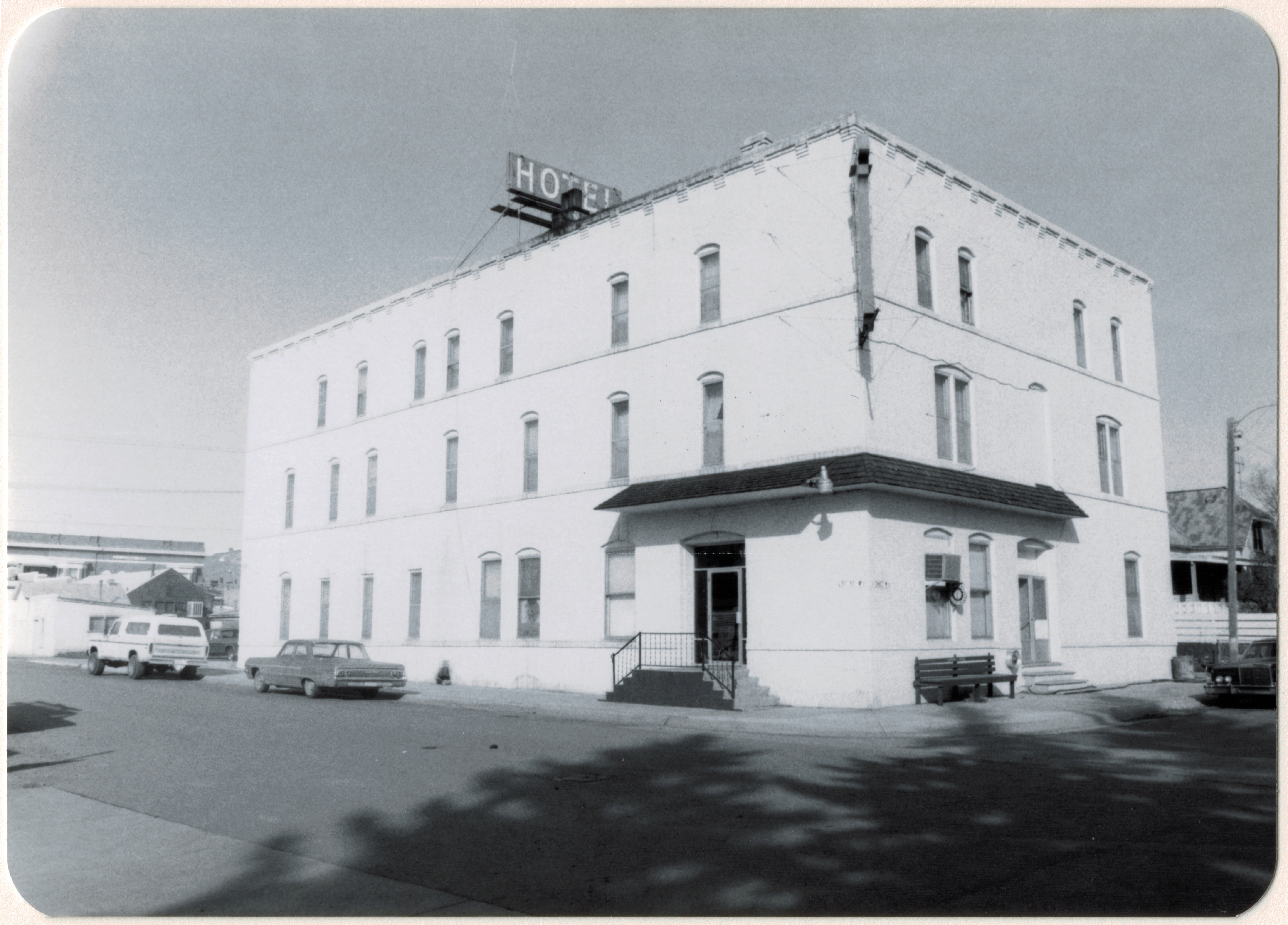
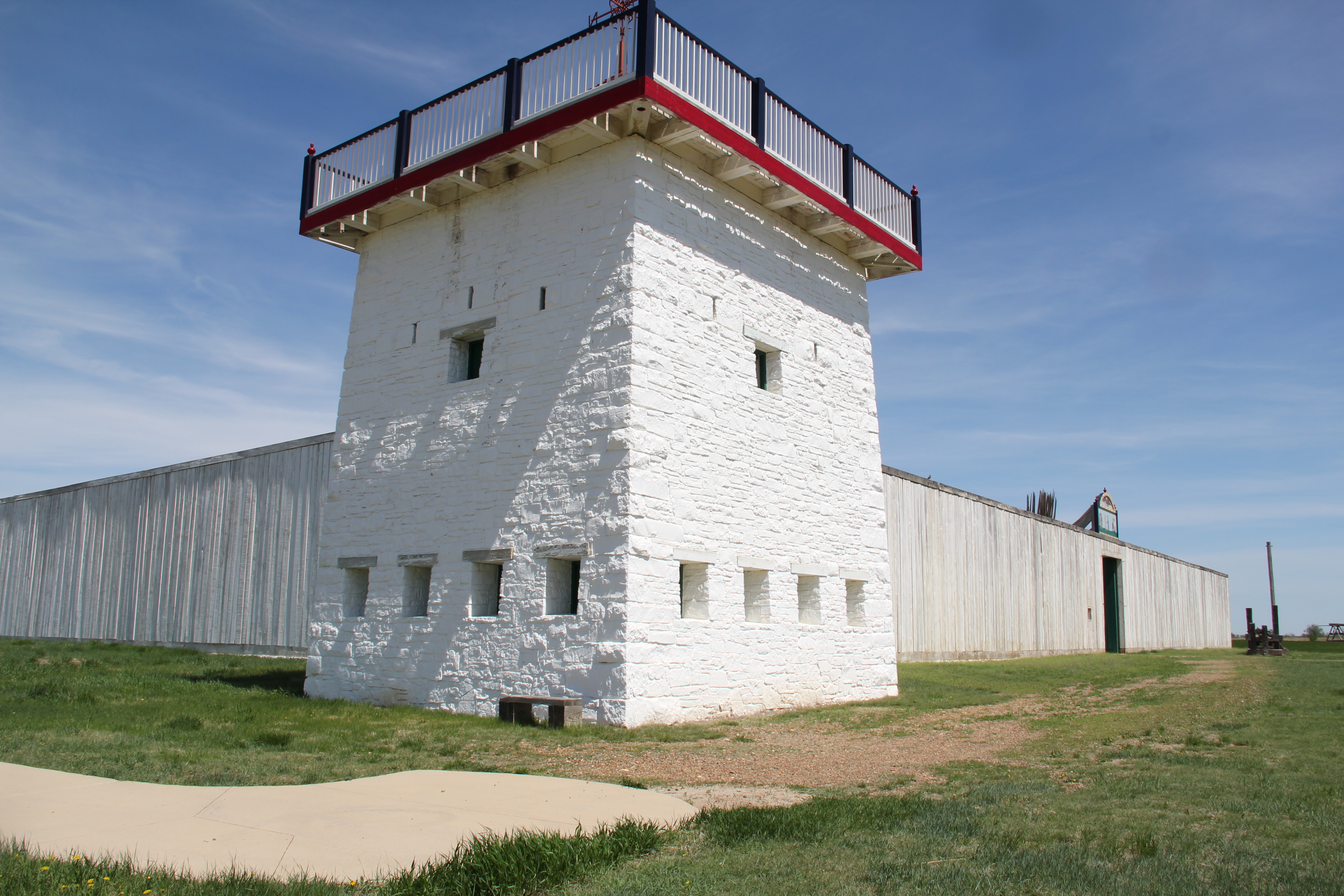
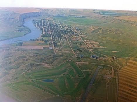
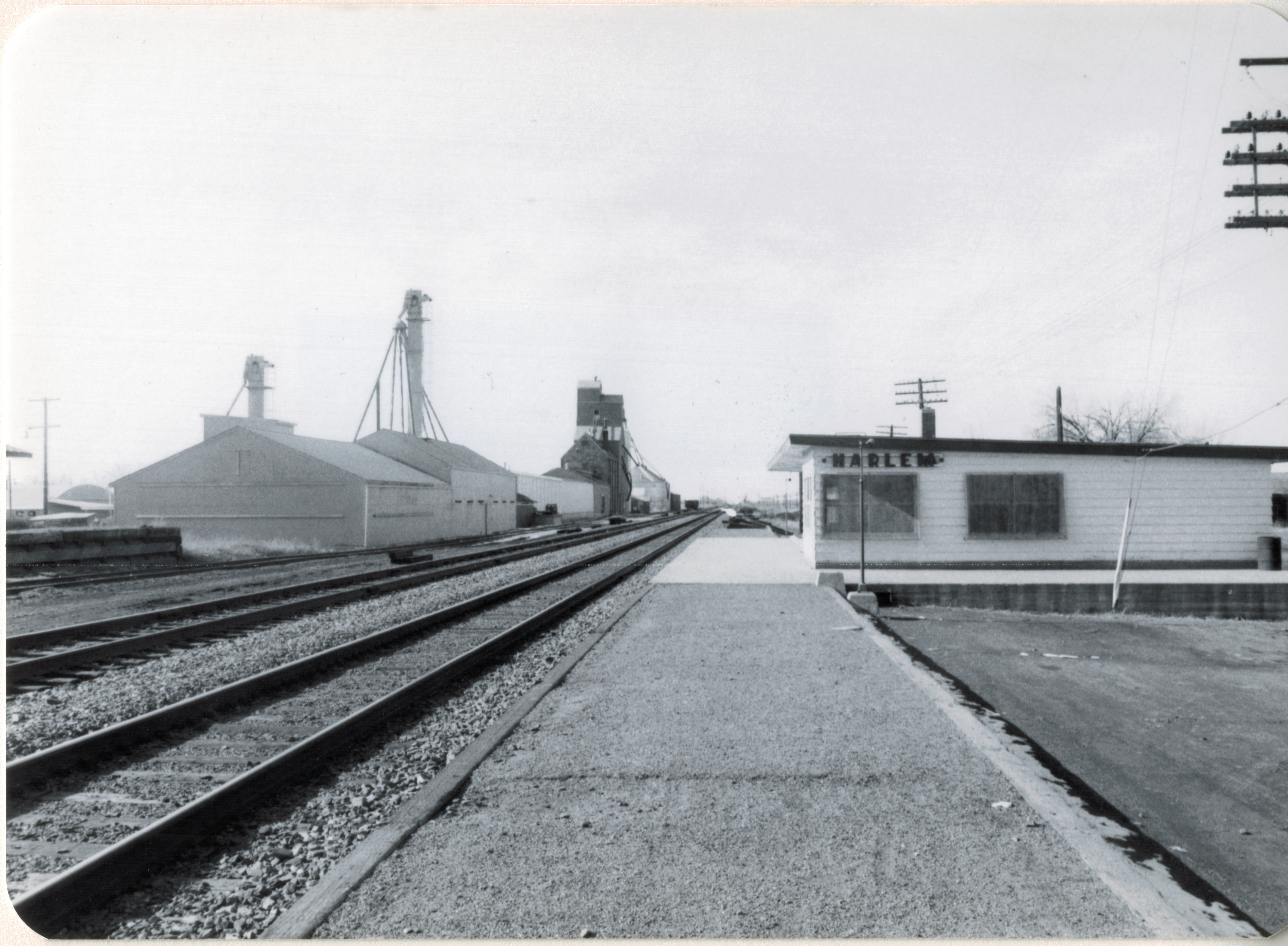
A gateway to the Fort Belknap Reservation, Harlem is one of the early Great Northern Railway towns, dating to 1889, and was established to serve as a commercial center on the northern border of the reservation.When the homesteading boom swept through the Hi-Line during the early 20th century, Harlem quickly expanded and most of the historic buildings found there today date between 1910 and 1940.

Image


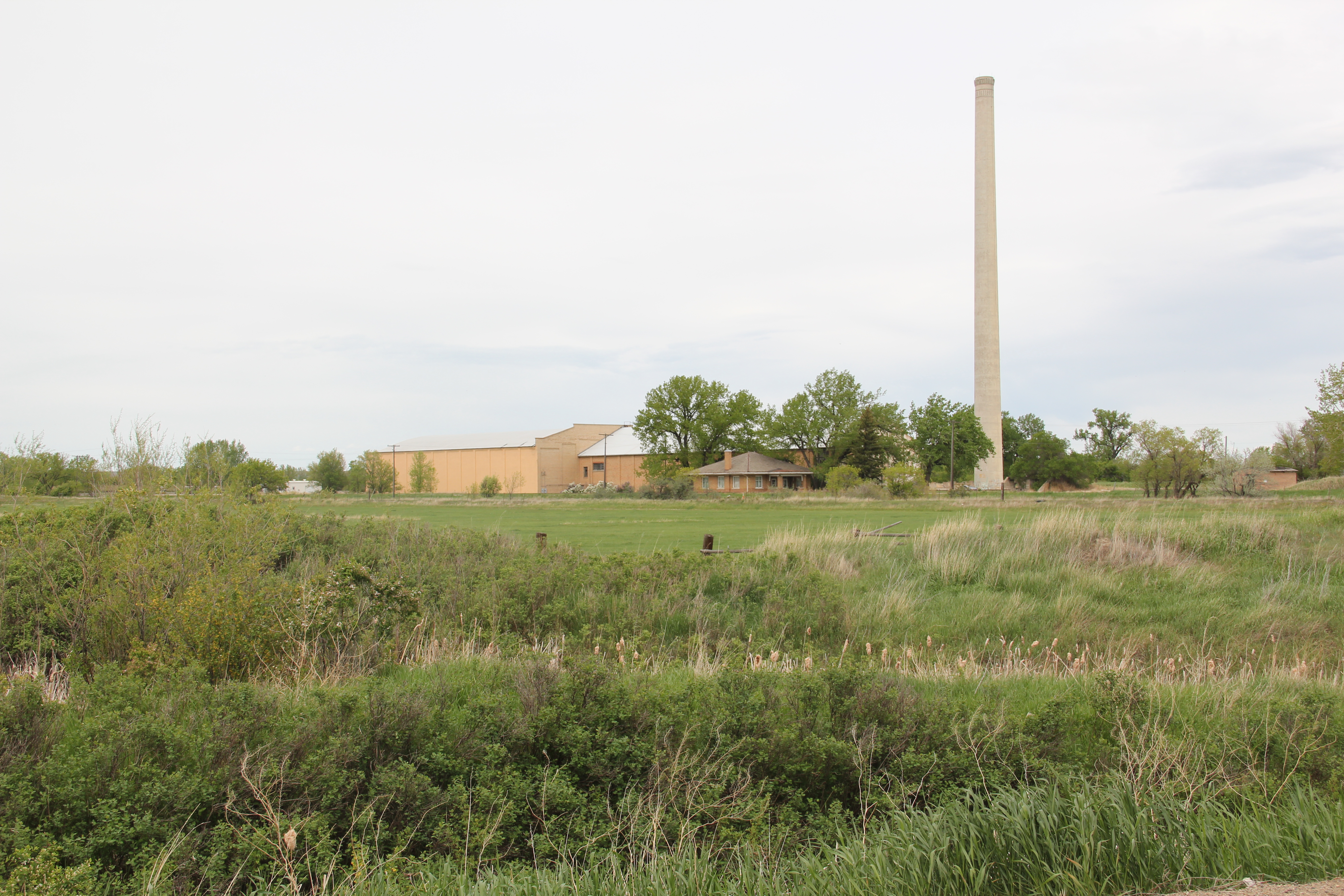
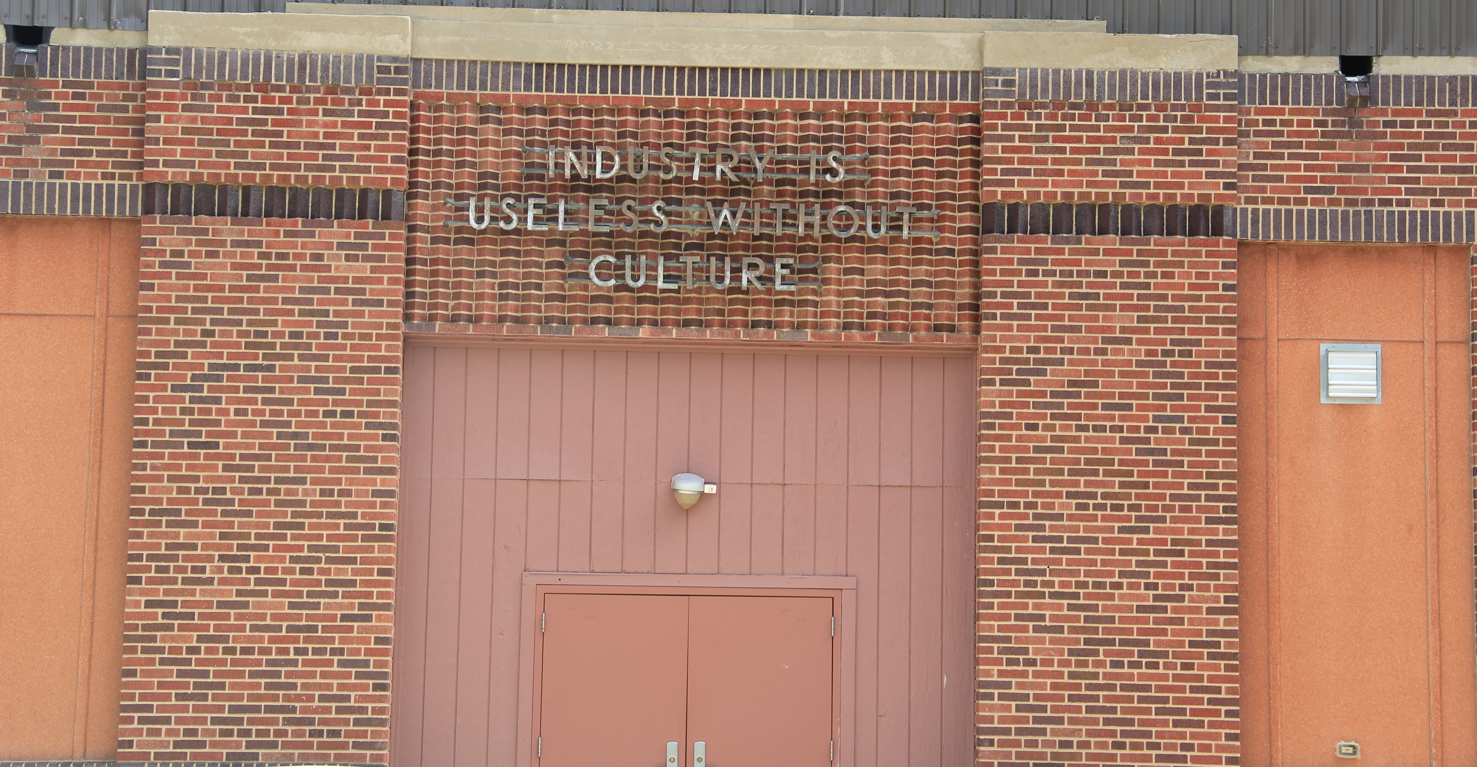
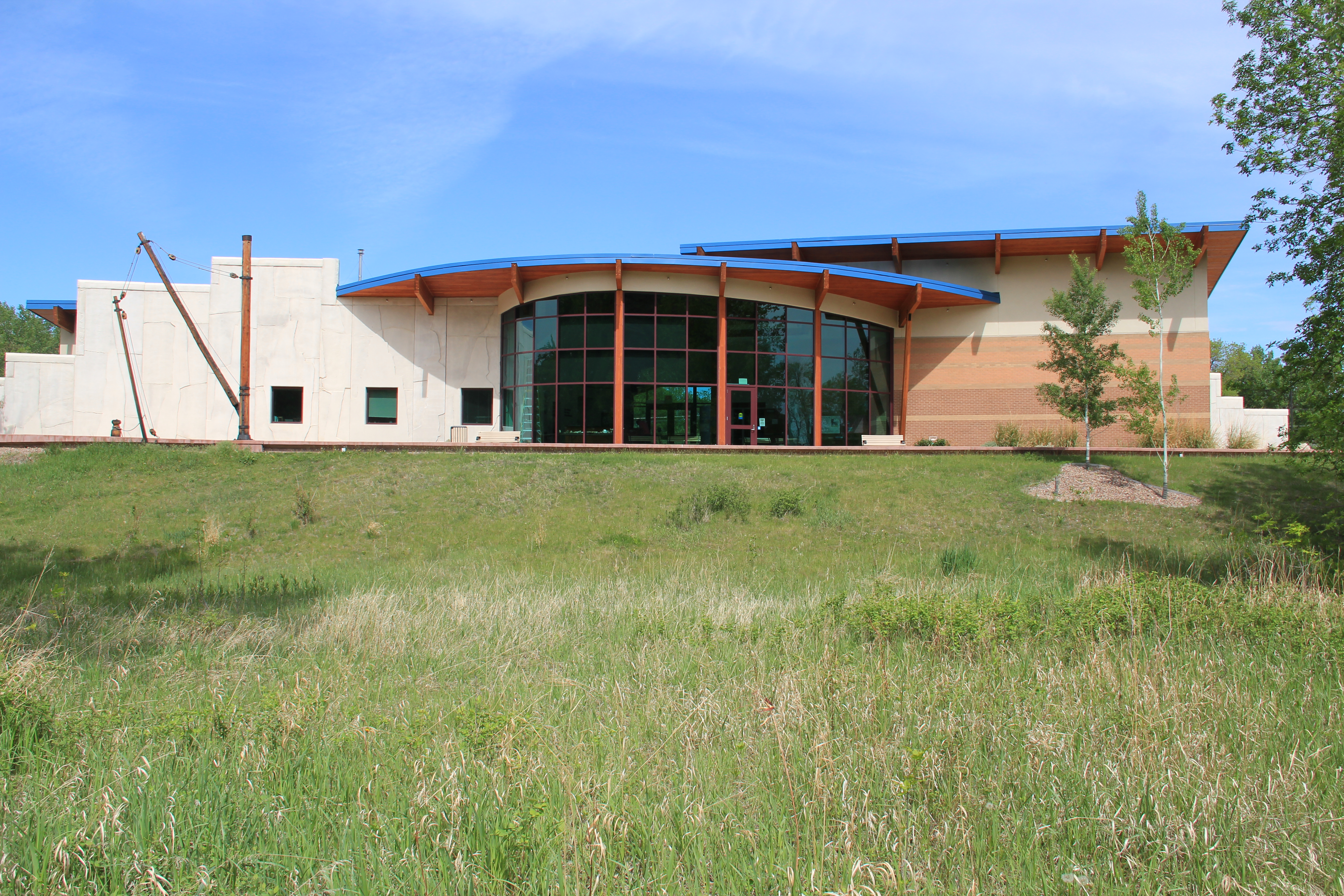
What struck me powerfully when I visited in 2013, compared to my last visit in 1984, was dual themes of growth and decline. The Aaniiih Nadoka College, established in 1884, had left its initial spartan quarters on the edge of the reservation into new modern-styled buildings, that still reflected the spirit of earlier vernacular styled buildings.

Image Image

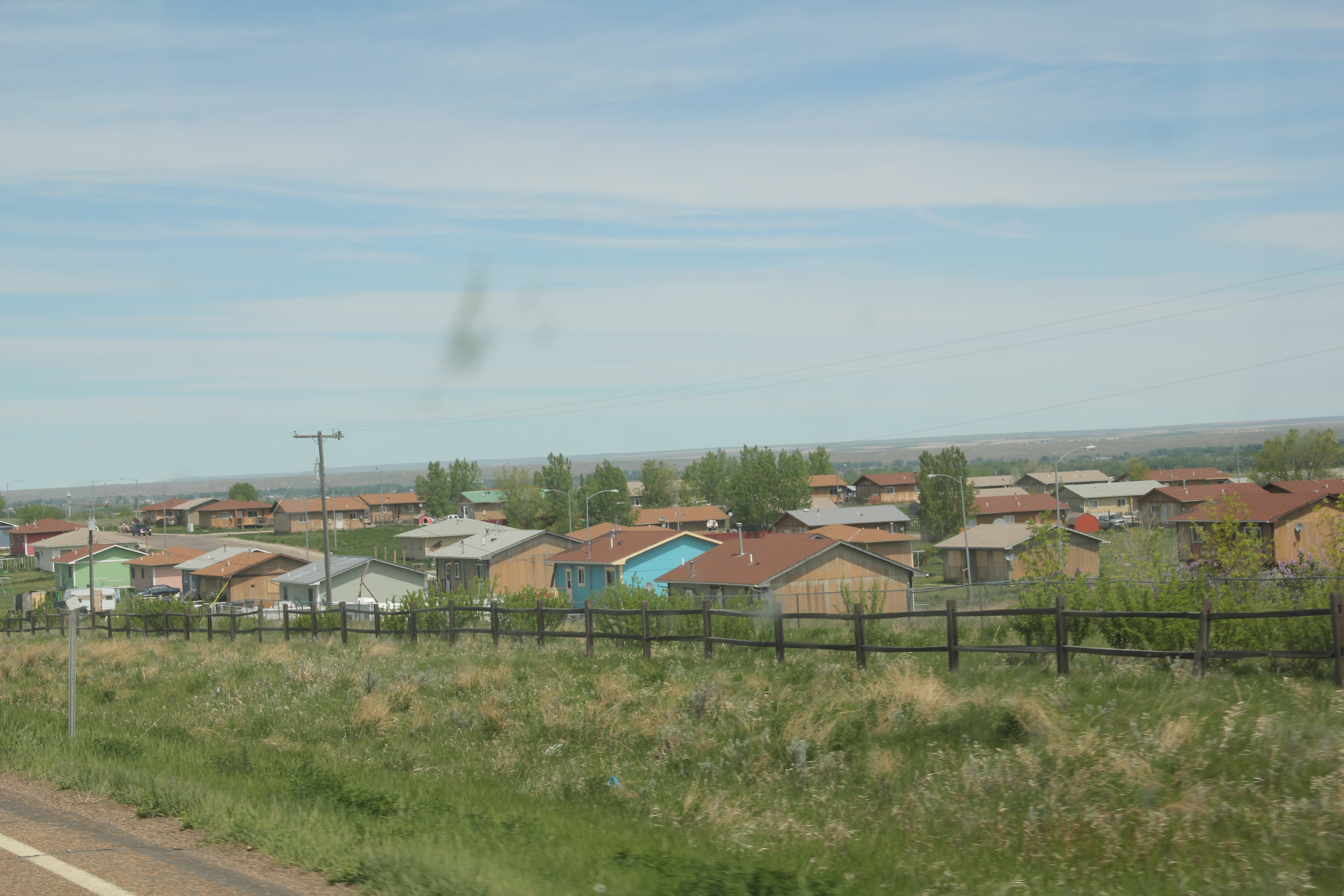
The 30-year growth of the college certainly underscored new opportunities as the flashy facade of the Ft Belknap Casino, facing U.S. Highway 2, showed a new revenue source. Standardized designs for federal housing also indicated the growth of a large neighborhood just south of the U.S. 2 and Montana 66 junction.

Image Image


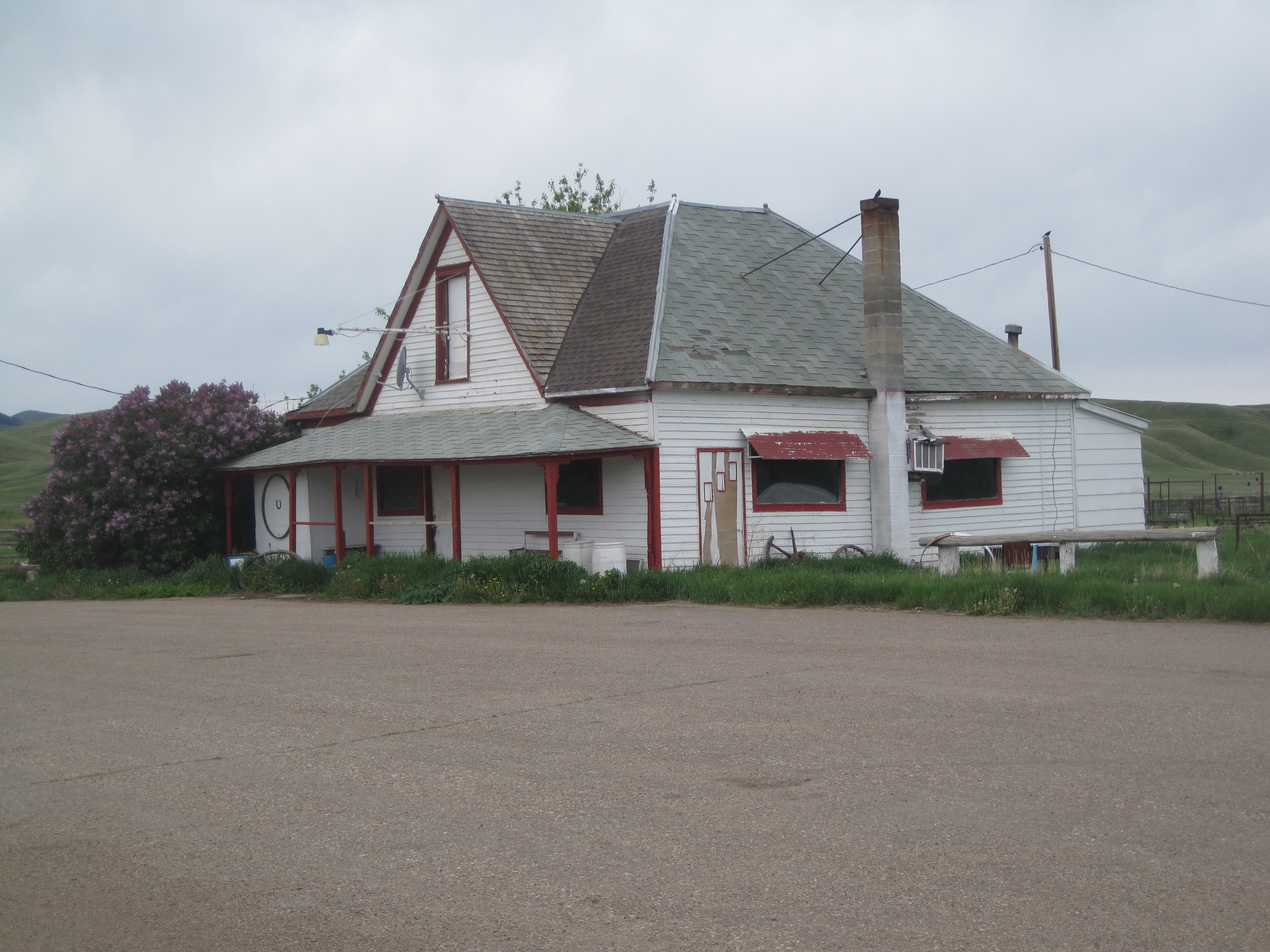
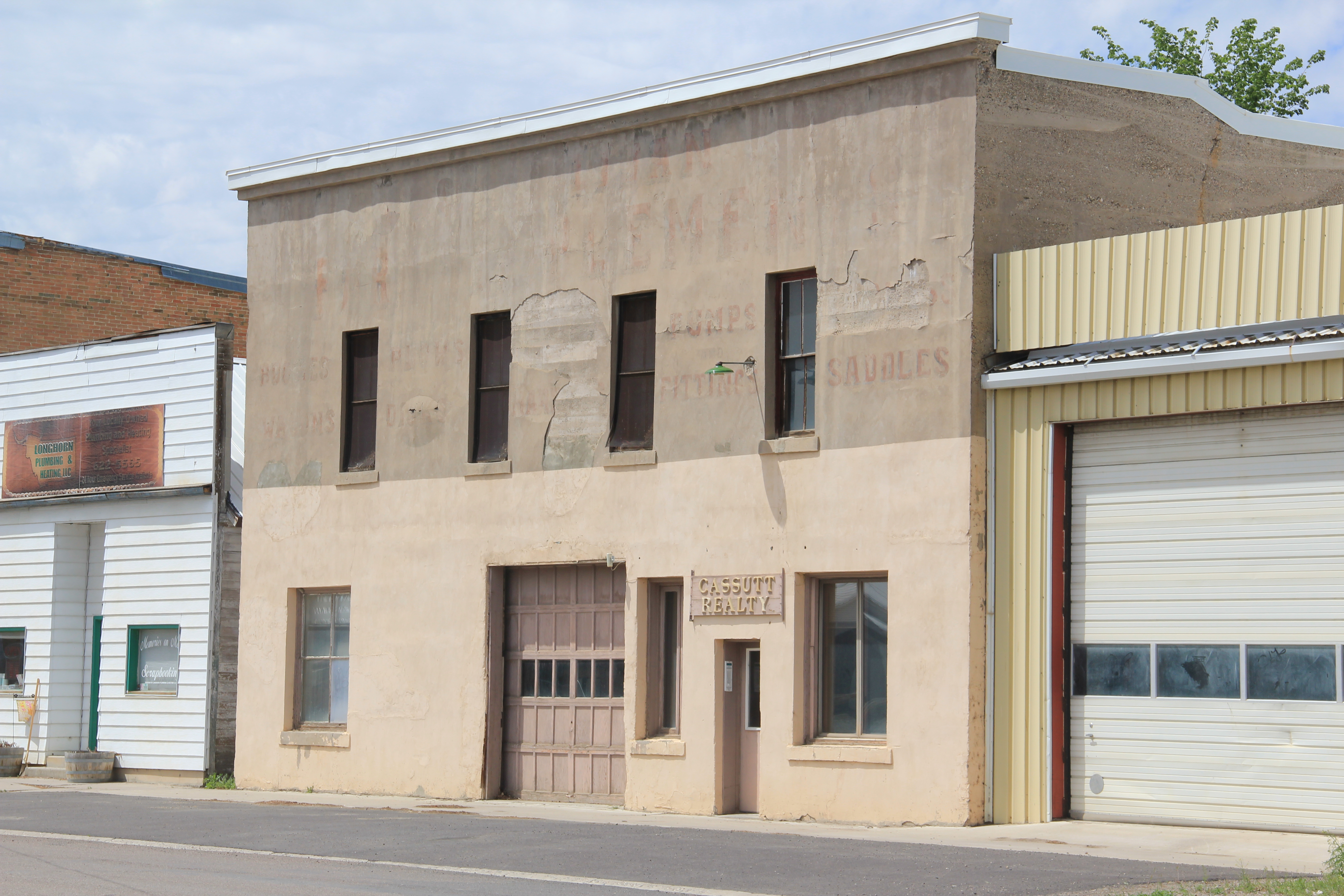
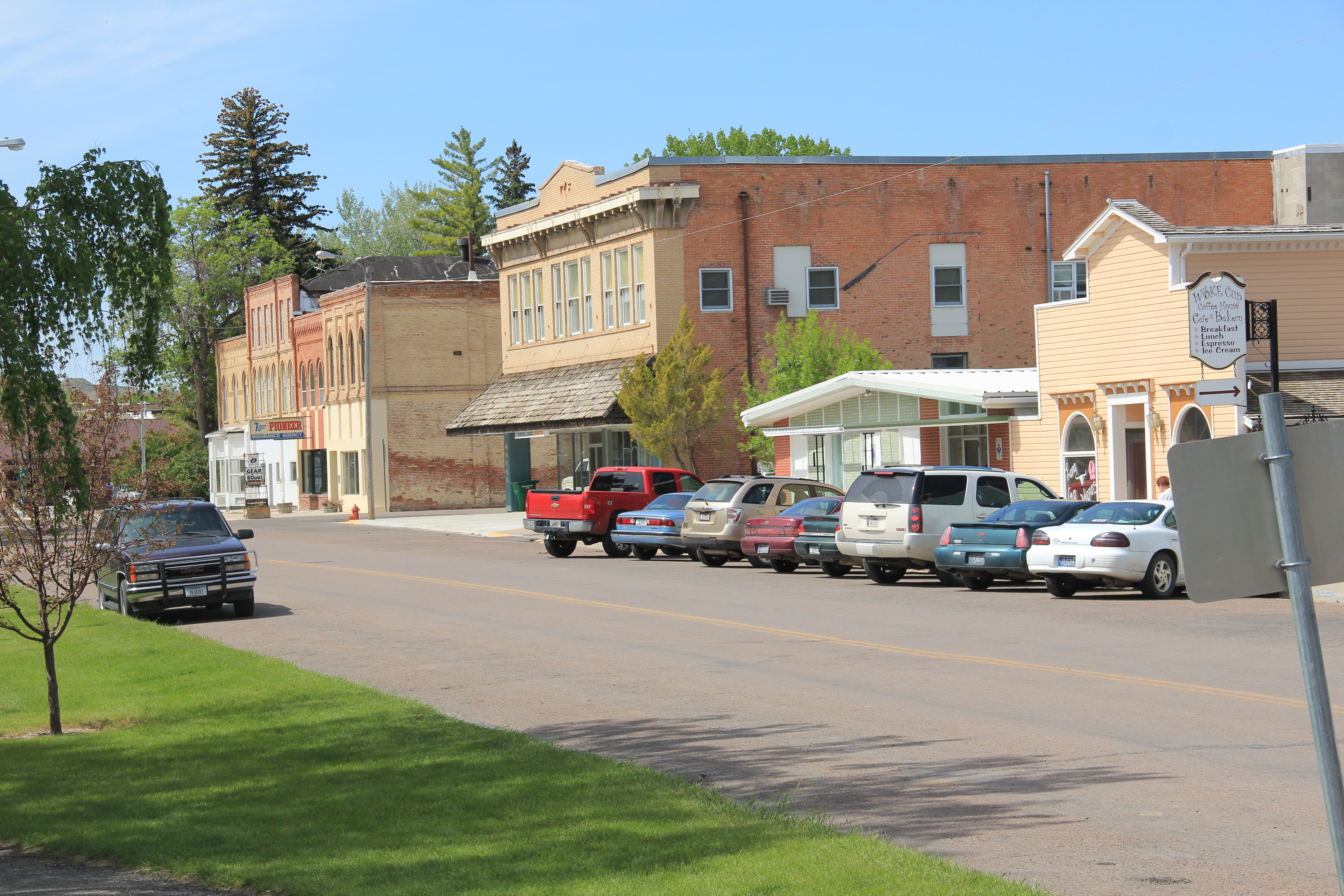
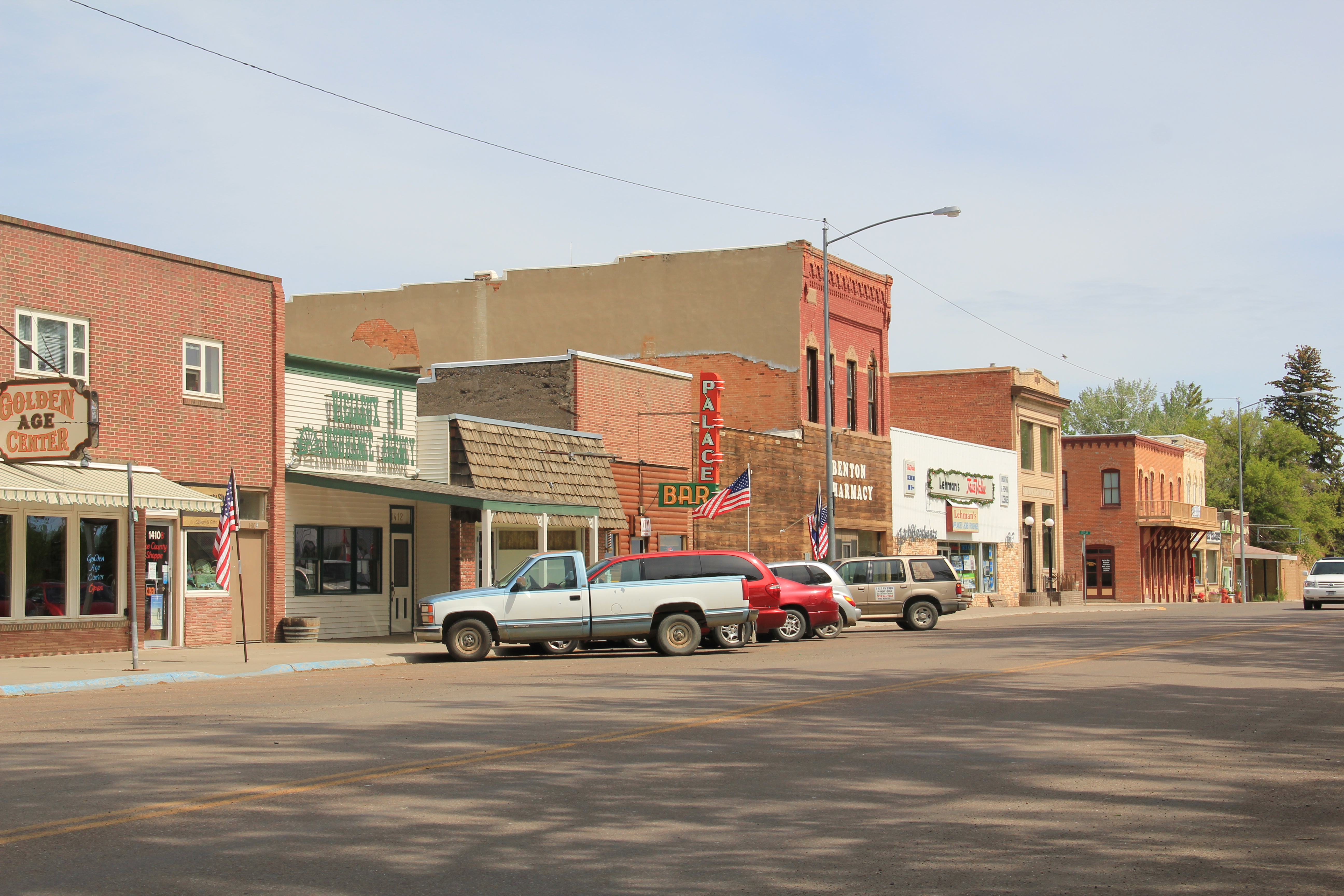
The theme of decline, however, marked the historic business district of Harlem. When I visited in 1984, Harlem had over 1000 residents–now that number is close to 800. Classic roadside gas stations, even at prominent corners, had closed.

Image Image

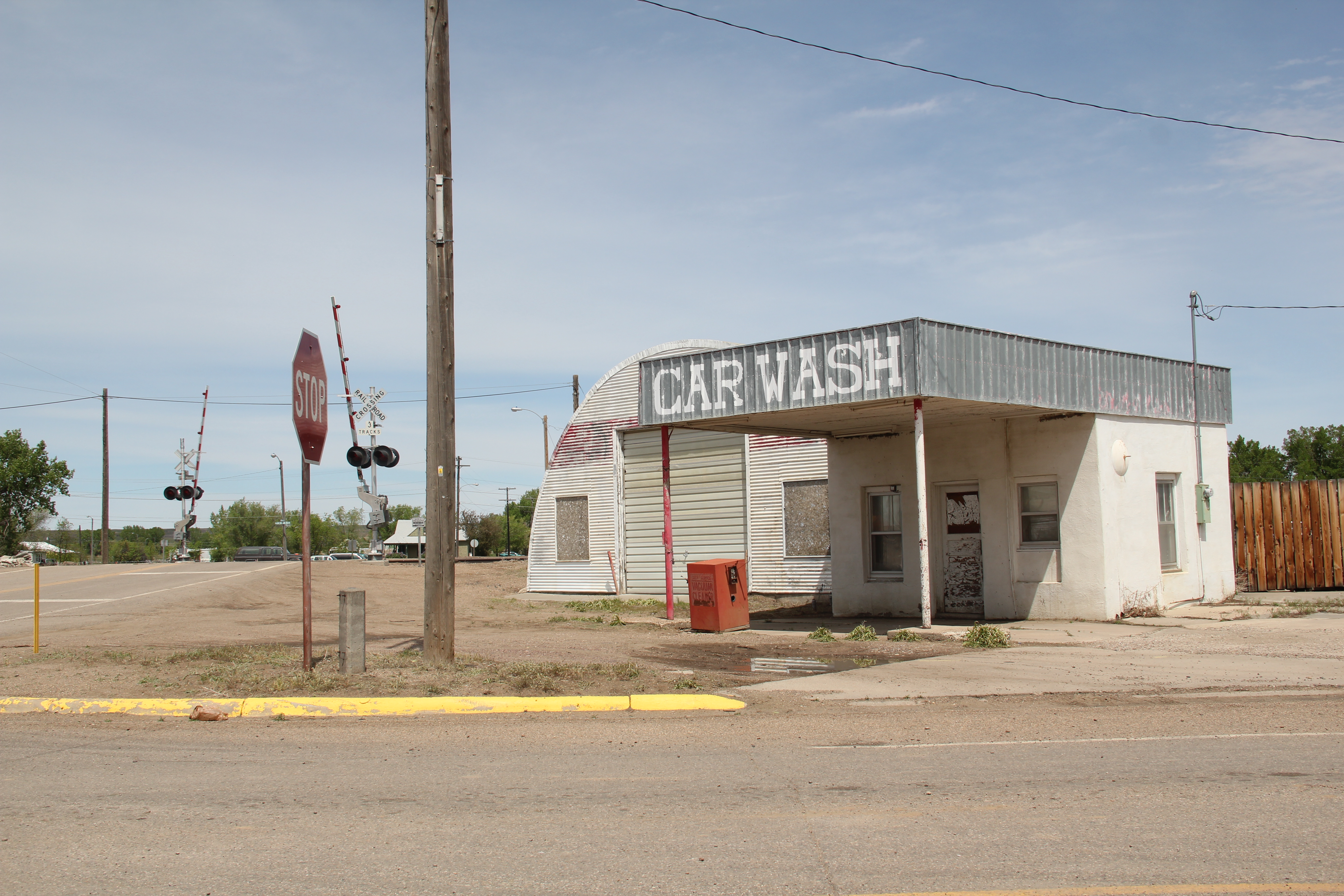
The Art Deco-ish Brekke Block (1941) only had a few going businesses; the early 20th century commercial block at Central and Main streets had even fewer signs of life. The Grand Theatre no longer showed movies. The imposing classical facade of the old state bank had broken windows and decaying architectural details.  These historic buildings retain their potential to impress, and could be heritage assets in multiple ways.  They need attention before it is too late.

Image  Image

While life and commerce enlivened the railroad and highway corridor, the downtown had a shuttered, tired look. But pride was there too. The Harlem Centennial Park, established in 1987, featured an memorial to the thirteen airmen who lost their lives when Air Force cargo planes collided north of town in 1992. The dedication and commitment to raise the funds and build such an appropriate monument impresses–and for travelers like me, I had no idea that this terrible air accident took place, and was glad that Harlem understood its obligation to the airmen and to history to record the event, permanently, with the memorial.  It was one of several surprises I encountered during my visit to Blaine County in 2013.

Image

St Paul’s Catholic Mission, Hays, MT

Image

St. Paul’s Mission, Hays, March 1984

A basic goal of the 1984 survey of Montana was to have a greater understanding of the built environment of Montana’s Indian Reservations, especially those in northern central and eastern Montana, which had little acknowledgement from historic preservationists and architectural historians.  For me in 1984, that trek began when I came to Hays, in the Fort Belknap Reservation,  south and east of Chinook.  As the photo above suggests, I arrived on a cold winter afternoon, and was immediately awed by the simple yet direct beauty of the stone St. Paul’s Mission.  Built in 1898, this Gothic style building replaced earlier log buildings used by the Jesuits as they worked with Gros Ventre and Assinniboine Indians, who owned the reservation, to establish the community of Hays.

Image

St. Paul’s Mission, summer 1988

When the Jesuits arrived in this country they were struck by its beauty.  Father Frederick Eberschweiler said in 1886:

“The cattle country with grazing land: the best I ever saw. Timber: that whole mountain range is thickly covered from the bottom to the top of the mountains. Water: seven beautiful creeks, running into the Milk River, clear as crystal, sweet as honey. Cultivating land: at all the creeks, but especially at “Peoples Creek”; at least 15 miles long remaining near the mountains is a deep, wide valley of the best garden-land, enough to make the whole tribe here very rich and happy.”

Image

Image

Peoples Creek is at the heart of Hays, and this land remains cattle country as the two overviews above suggest.  Hays is small but tight-knit, proud of its school (and its basketball), and friendly.  When I first visited in 1984, Fr. McMeel visited with me for a long time.  

Image Image

He considered himself a newcomer too (he arrived in 1978 from Alaska and became pastor in 1979) so we shared a bit about how a southerner and a westerner could meet at such a sacred place. He insisted that I call him Father Barney. He was clearly devoted to the mission, and its community.    

His devotion is memorialized in a historical marker on the drive to the mission church, which is still in great shape, obviously benefiting from careful stewardship over the decades.  I visited on Memorial Day weekend, where the church was the backdrop for a ceremony in honor of the generations of Ft Belknap residents who had served their people and their country.

Image


 Image

Another architectural beauty at Hays is the shrine, Our Lady of the Rockies, built in 1931 by Father Feusi and Tom Flack, a German stonecarver.  Another Gothic style building, reflecting a church from Feusi’s native Switzerland, the chapel is used for memorial services every May.

Hays is only a small yet significant part of the Ft Belknap Reservation–next we move north to Harlem and return to our explorations along the Montana Hi-Line.


The Chief Joseph Battleground in Blaine County


Image


In 1984 I was very eager to see the Chief Joseph Battleground, as many historians and residents called it 30 years ago.  Here in 1877 Chief Joseph of the Nez Perce surrendered to the U.S. Army, which had pursued Joseph and his followers across most of Montana, starting in Beaverhead County in the southeast corner, extending as far east along the Yellowstone as present-day Laurel, and then striking north for the Canadian border.  They made it as far as this wind-swept prairie 15 miles south of Chinook.

In 1984, on a cold winter morning, the site was spectacular and I gave a tip of my hat to the local residents who had made the effort to preserve the site–and acquire enough land that you could gain a strong sense of place, and of destiny.  The level of interpretation at the battleground was disappointing.  There was a mounted bust of Chief Joseph (not full-sized; it looked lost on the vastness of the space) which has since been moved.  There were metal plaques noting Chief Joseph’s surrender to Gen. Nelson Miles, erected by the DAR and the citizens of Blaine County in 1929 and by Congress in 1930. And most recently, a 1966 marker to C. R. Noyes, the local 


Image    Image

rancher who had played the key role in saving the battleground.  There was not much else to explain the significance of the Nez Perce campaign nor what happened there in the fall of 1877.  When I next visited in 1988, the story was the same.

In 1989 the National Park Service designated the Chief Joseph Battleground as a National Historic Landmark–the first step in a new future for the park.  Then it became a key property in the Nez Perce Historical Park, which has units from Idaho to Montana.  New interpretive trails and interpretive markers are the most recent additions, telling a much broader story than the old metal markers were capable of doing.  

Image


The experience today is far different than 1984.  There is still no visitor center–the new one at Big Hole Battlefield in Beaverhead County is superb however–and the Blaine County Museum in Chinook still carries that burden of interpreting the story.  But there is truth in the landscape now, as never before.  The trails, markers, and landscape combine to create a deeper understanding of why the Nez Perce stopped here, why it was difficult to escape the U.S. army, and what that trek and all of those stories might mean today.

ImageImage


The two layers of interpretation–that of the early 20th century and that of the 21st century–co-exist within a special place.  Here is one preservation success in the last 30 years that deserves to be better known.

A bit farther down the road is Cleveland.  In my time in Montana, it hosted one of the most famous (or was it infamous) local rodeos around.  Its bar/cafe/post office spoke still to the first part of the 20th century.  People there in 1984 were friendly, and it was a good place that I looked forward to revisiting.  But the doors were shuttered in Cleveland.  The corrals were still there, sorta.   And there was no Cleveland Bar.  Wish I could have been here one more time before it went away.

Image

Image

Image

Image


Chinook and the Sugar Refinery

The last post ended with a rather pastoral image of the Utah-Idaho sugar refinery in Chinook with promises to add a few comments on how the town changed after the refinery.  Let’s begin with a dose of reality–the image of a stack looming over the prairie is compelling but misleading.  The WPA Guide to Montana tells us that the factory began in 1925, was the state’s fourth largest by the late 1930s, and that the “shacks” of Mexican and Filipino workers crowded around the factory.  Other sources record how at this same time

Image

other communities down river complained of the foul discharge of the company directly into the Milk River.  The lesson here:  later day architectural photos can sometimes obscure rather reflect historical reality.

Within Chinook, there are many reminders of the prosperity brought by beet farming and the refinery.  The town has an interesting array of 1920s and 1930s domestic architecture, from the revival craze to the modernism of the International style.

Image


Image


Business owners also took the new styles of the Jazz Age–like Art Deco–and added facades that gave a new look to their stores.

Image


After the impact of New Deal modern design in the new Chinook High School in the 1930s, Chinook embraced post-World War II modernism, such as the expansion of the high school in the 1950s, a dazzling International style National Guard facility out near the Image 

Image

sugar refinery, and a new International Harvester dealership, part of the architectural legacy of industrial designer Raymond Loewy.

Image

The sugar refinery brought a new era to Blaine County and it gave Chinook a two-sided look:  one, a railroad town along U.S. 2, and two, a modern plains town that emerged agriculture and industry in the mid-20th century.

Back on the Hi-Line at Chinook: a town that got it

Image

Chinook, the seat of Blaine County, has long been among my favorite Hi-Line towns.  Certainly there is the Elk Bar, with its cowgirl in the champagne glass neon sign,–is there a better bar sign in the Big Sky Country?  But then Chinook is most definitely a railroad town of Great Northern vintage.  Then it is part of U.S. highway corridor, and I loved staying at what was then a Mom and Pop Bear’s Paw motor lodge on the west side of town in 1984.  And it is irrigation country, and the impact of the federal Milk River Project in the early 20th century.  Railroads, highways, irrigation, bars–throw in that the town is also the gateway to the Bear’s Paw National Battlefield and the end of the Nez Perce National Historic Trail:  little wonder I stayed there for 3 days in 1984 exploring a wide swath of the region.

Image

This post is subtitled “a town that got it” for the simple reason that when I visited in 1984, outside of the battlefield (which was little more than preserved ground with a few early 20th century markers not the more fully interpreted landscape you find today) and the local museum (which was since grown considerably) the words “historic preservation” were new, and somewhat foreign.  Nothing was happening–30 years later however you can see a range of preservation work, along with some exciting adaptive reuse projects.  Chinook treasures its past and sees it as an asset for the present, and future.

Image

A U.S. 2 service station converted into a great ice cream stop in Chinook

What didn’t I “see” in 1984:  the New Deal imprint on the town.  Frankly put, the Chinook High School is one of my favorite New Deal buildings in the state–perhaps its slick International modernism made it hard to grasp 30 years ago but today its powerful statement of 1930s aesthetics can’t be missed.

Image Image

Image

That’s not all the New Deal left the town–it also energized public buildings with a new City Hall and an annex to the county courthouse, both somewhat subdued architectural statements.

Image Image

I did a better job of understanding the transportation corridors and how they impacted Chinook.  Most prominent to my mind was a three-story brick hotel, serving both railroad passengers and newly arriving homesteaders.  In 1984 it looked as if only minor changes had occurred since first construction-it still looks that way 30 years later with a few more windows filled-in, and general hard times apparent.

Image


Image

The Great Northern depot was another focus of my work but somehow I missed a great 1920s gas station that has been restored and converted into new uses by a local financial institution–it is now on the National Register of Historic Places and good example of how the roadside architecture of the 1920s can find new uses in the 21st century.

Image Image

Another big miss was the Sugar Refinery–especially considering the role that Chinook played in the Milk River project, both in its origins, the nationally significant case of Winters v. United States at the turn of the century (see Beth LaDow’s epic study The Medicine Line (2001), and then the impact of this major federal project from 1911 to the present.  Not to mention that the high school nicknameImage

was the Sugarbeaters, surely one of the GREAT names in high school sports.

You cross a major ditch on the way to the refinery, on the outskirts of town.  A good bit of the property remains, with the tall stack speaking strongly to the merger of homestead and factory on the northern plains.  The refinery began an new era in the town’s history–a theme worth exploring in the next post.

IMG_8358


Fort Benton, final thoughts

IMG_8624

In considering Fort Benton from 1984 to today, I have compared the early efforts to preserve the town’s nationally significant mid-19th century history in the latter part of the twentieth century to the massive effort to re-interpret the place in the 21st century.  I am not the first writer to do so, but we all then leave out the history of the town from the end of the Victorian period to the 1960s.  And Fort Benton has something to say there as well.

There is the county fairgrounds and its early 20th century landscape and buildings–here is the community center for the entire county during the summer.  And a reminder of how the county’s and town’s economy became so dependent on agriculture from the 1880s to the present.

IMG_8645


IMG_8651

Let’s look at the New Deal era school–a huge sprawling brick complex, full of encouraging words for a time when agricultural hopes and dreams for Chouteau County had been dashed.  “Industry is worthless without culture”–words that almost perfectly sum  up the community’s efforts in the second half of the 20th century to celebrate its past.

IMG_8794


Then let’s shift to the town’s prosperity and hopes as expressed in contemporary design from the 1960s.  Two compelling modernist statements continue to serve–the Catholic Church and Lutheran Church, anchoring the west end of town.

IMG_8616

IMG_8638


Fort Benton has much to say about the 20th century too–just walk away from the riverfront and find it.


Fort Benton’s Heritage Development: 3 Museums, 3 Messages

Image


Fort Benton in 1984 had one dominant interpretive place:  The Museum of the Upper Missouri in the local city park facing the Missouri River.  The museum is still there and thriving–on an early Sunday afternoon in May 2013 it had plenty of visitors.  Still the same too were the exhibits–dioramas told much of the story, a reflection of the long, deep influence of the dioramas prepared for the Montana Historical Society’s museum installation almost 30 years earlier.  At MHS, as it installed a new exhibit in the late 1980s, dioramas and recreated villages disappeared in favor of more artifact-driven exhibits but at the local levels many museums still feature dioramas.  And to my mind, they are almost like bits of culture-laden folk art.

Image

The Museum of the Upper Missouri focused not just on Native American-white relations, the trade, and the creation of Fort Benton.  It spent just as much space exploring the post-gold rush steamboat era, the development of Fort Benton as an urban center, and the general frontier to settlement thesis that still dominates the narrative of northern plains history.  After all the museum was “the place” so naturally it captured all of the areas of possible historical interest, even extending into the region’s early ranching history.

Image


As the “place” it was also the logical location for federal trail programs to hand their hats, or at least trail markers, from displays about the Indian Wars to Lewis and Clark and to the Nez Perce Trail.

Image

The museum, outside of ranching, did not serve the region’s 20th century history that was tied much less to the river (except as a source of water to be dammed for irrigation) but to the land and its transformation through massive federal funded irrigation projects and the homesteading boom into the agricultural landscape that you immediately encounter in Chouteau County once you climb out of the Missouri River bottomlands and up to the plains landscape to the north.  Thus, at the north end of town, and actually closer for tourists exiting U.S. 87, came the Museum of the Northern Great Plains.

Image


Here is the typical 20th century technology museum, first depicted at the Greenfield Village Museum of Henry Ford in Dearborn, Michigan, and copied by literally hundreds of midwestern and western institutions.  A large building encloses a progression of agricultural technology from plows and tractors to automobiles and combines and onto the household.Image

And then outside of the museum doors are representative buildings–artifacts themselves of rural life, ethnic diversity, and corporate standardization, especially in the mini-gas station.  These museums are more like large-scale community attics–almost anything

Image


and everything is here, except for central unifying themes.  I arrived, somewhat excitedly, hoping that finally someone had the space and the wherewithal to tackle such major themes as the U.S. Reclamation Bureau and projects like the Milk River Project.  After all, the place markets itself as Montana’s agricultural history museum. Rather I found a celebration of the individual, those who stayed and made it– which then made sense when you stop and consider the isolation, the demanding climate, the difficulty of making an arid landscape bloom.  

Image


The latest addition to the museum landscape of Fort Benton comes courtesy of the federal government and the Bureau of Land Management–the Upper Missouri Breaks National Monument interpretive center for all things federal in this part of the Missouri River country.  The building attempts to compete with the White Cliffs of the Missouri itself, and it is a modernist architectural wonder, reflecting region, topography, materials, and culture.  

Image

As a homage to the river itself, the building may work, but it is difficult to compete with the beauty of the Missouri at Fort Benton, even if you are on the west end of town by the old public water works.

Image Image


The Upper Missouri museum, as you would expect from a 21st century installation, tells a big story, from natural resources to prehistory to Lewis and Clark, the Nez Perce, and large-scale recreations of steamboats.  And of the three museums it has the great, decisive advantage to my mind, of actually touching the Missouri.  It is the river at this location that made Fort Benton and here the river dominates the experience.

Image


All three museums reflect their time of creation and target specific audiences.  But you still end with the reality of three museums for just one place–the story is told loudly and often in Fort Benton, from three different vantage points and from multiple types of historical markers scattered across the town, especially at the riverfront.  Discerning heritage tourists will take it all in and get it.  But you wonder about those who stop by, in a rush to get to Great Falls, to Glacier, or heading home to some place back east.  Fort Benton in its historic riverfront buildings looks old but tired, and rather than constructing yet more new buildings to contain the history, one thinks–why not adapt the historic buildings–and tell the history in the actual places that it happened.  There is more to Fort Benton than meets the eye but how come a visit here makes you feel still like you are on the outside looking in, that just underneath the renovated surface may be a reality worth exploring.

Image


Image


Fort Benton’s heritage development, part 2

Image

Lobby, Grand Union Hotel, 2013

In 1984, when John Lepley took me through Fort Benton and spoke of the community’s dreams for both preservation and heritage tourism, the vision was compelling but at the same time you had to wonder whether it was feasible.  One morning was spent at the Grand Union Hotel, a marvelous Victorian-era building, right on the river front.  It was then under restoration yet I had spent a night there and the future seemed bright.  But managing heritage assets is challenging and the hotel has passed through several approaches until its most recent owners seem got it right.  In the summer season and on weekend the hotel is a busy place.

IMG_8787

Next Lepley took me to the ruins of Fort Benton and spoke of the pending reconstruction of the fort.  The notion of reconstructing the nationally significant fur trade posts of the mid-19th century was an idea I had heard elsewhere, especially at Fort Union, at the confluence of the Yellowstone and Missouri rivers on the Montana-North Dakota border.

IMG_7404

But Ft Union would be a National Park Service project, with all of that agency prestige and federal funding behind it.  Fort Benton too was nationally significant but the property was not owned by the federal government–a complete reconstruction struck me as ambitious if not fantasy in 1984.  Well, I was wrong:  Fort Benton, mid-19th century, has been reconstructed, and serves as a centerpiece of the town’s public interpretation.

IMG_8719

The fort is not only rebuilt in its exterior–a reconstruction that you can find elsewhere in the West–but it has a completed interior, divided into period rooms and modern exhibit spaces.  Finally there is a property in central Montana that conveys visually and physically what a mid-1800s trading post was like, and just how crucial this mix of private enterprise and Native American relations was to the region’s history.

IMG_8741

IMG_8721

The reconstruction also preserves and interprets the few bits of original fort wall that exist–and that were slowly ebbing away back in 1984.

IMG_8726


No doubt the reconstruction of Fort Benton, and the preservation of the remaining fort site, are major achievements for anyone, especially a town and county that are relatively isolated from large population areas like this one.  In 1984, John Lepley shared with me one last set of resources–the riverfront buildings.  There the story still needs to grow.  The recent success of the hotel should spur even more investment into the adaptive reuse of these buildings. Splendid properties they are, and still a potential backbone for the revitalization of the local economy.

IMG_8709

IMG_8687

The 1984 story ends here–and I must admit that the progress in heritage development is impressive.  But there is still the more recent history to digest, and that will be the next blog from Fort Benton.

Transformations in Fort Benton, part 1

Image


In the spring of 1984, there was no doubt that I would spend considerable time looking at the historic preservation issues at Fort Benton, a small county seat today but one of the most important places in all of the northern plains before the age of the railroad.  Here at this bend in the river, shown in a postcard I bought there in 1984, was basically the last stop for Missouri River boat traffic heading west.  The fort dated to the late fur trade era and as the rush for precious metals overtook Montana Territory in the 1860s and 1870s here developed a major trade and outfitting post, with roads running from Fort Benton in all directions.  But the place was a sleepy, almost forgotten town, as the railroads changed routes and the interstates bypassed it by miles and miles.  Landmarks too were there but the old fort had been slowly coming apart, only a recent determined effort by save what remained and then, ambitiously I thought 30 years ago, to rebuild the lost fort and tell fully the story of the fur trade and the significance of the Upper Missouri.

Image  Image


My guide was John Lepley, who was spearheading the local efforts and a member of the SHPO board.  Another key leader was Joel Overholser. And no doubt, there was some heritage tourism and historic interpretation infrastructure in place.  The Chouteau House, a classic river hotel, was still open, rough on the edges but the place where I stayed and took meals. (It was closed when I visited last in 2013).

Image


Nearby was the home of I. G. Baker, a pivotal figure in the region’s history.  It was open, and paneled interpretation in place but certainly a property that could “say” more.

Image


Various monuments and markers could be found throughout the riverfront:  the Mullan Road, the Whoop-Up Trail, and especially the recently installed (1976) State of Montana Lewis and Clark Memorial, a monument piece of public art, sculpted by Bob Scriver with the base by Shorty Shope, another well regarded Montana artist.  The memorial was an American bicentennial project led by the Fort Benton Improvement Association, which Lepley and Overholser served on as commissioners.  Indeed, the state also had donated one of the keelboats used in the film “Far Horizons,” a Hollywood take on the Lewis and Clark expedition.  The waterfront told a story, one dominated by Lewis and Clark.

Image  

Image

postcard of Far Horizons boat, c. 1984

Image


The amount and quality of the public art along the riverfront was impressive, but what struck me as speaking most strongly to the town’s future were two completed projects (the Museum of the Upper Missouri and the Missouri River Bridge) and the almost completed restoration of the Grand Hotel, a remarkable Victorian building that spoke to the town’s hopes in the late 19th century.

Image Image


Image


I left Fort Benton convinced of two things:  the town had clear preservation needs, not just the fort site but buildings from the Victorian era were decaying too.  But compared to other places that I would visit in 1984, I thought Fort Benton had the one key trait for success–vision, the realization that the steps of the 1970s were just first steps, and many more needed to be taken in the years to come.  Let’s next come back to Fort Benton 30 years later and see how far that vision has reached.

ImageWho