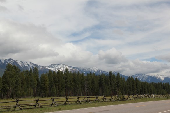
 Missoula County has grown, a lot, since my state historic preservation plan work in 1984-1985, especially in the county seat of Missoula and surrounding suburbs. Yet Missoula County still has several spectacular rural drives, like Montana Highway 83 above at Condon, along with distinctive country towns. This post will share some of my favorites.


Let’s just stay at Condon. The Swan Valley Centre–it was just a general store back in the day–still operates, providing for locals and in the summer the tourists who are flocking to Seeley Lake or passing through on the way to Glacier National Park or Flathead Lake.

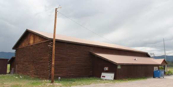
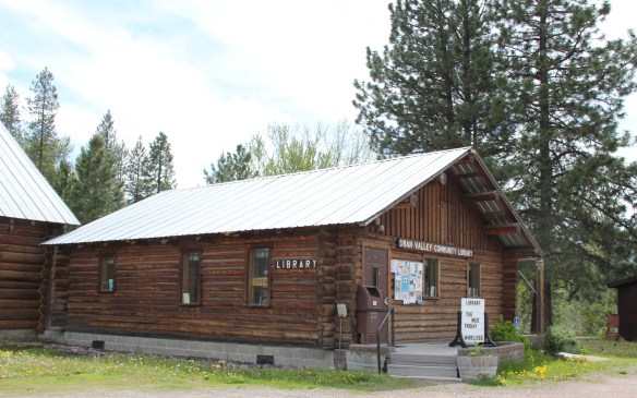 The Condon Community Center and adjacent Swan Valley Community Library serve as additional hubs for those living along the lakes and mountains of northeast Missoula County. Both buildings are excellent examples of mid-20th century Rustic style–a look that, in different variations, dominates the Highway 35 corridor.
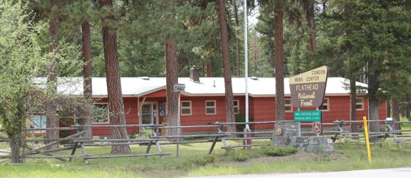
 Condon is also the base for the Condon Work Center, home to the Great Northern Fire Crew, of the Flathead National Forest. Here you can take a mile-long Swan Ecosystem Trail and learn of the diversity of life in this national forest region.
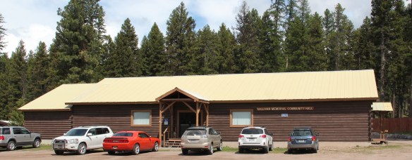
 South of Condon on Montana Highway 83 is Seeley Lake–a place that certainly has boomed in the last 30 years–witness the improved highway, new businesses, and population that has increased over 60 percent since my last visit in 1992. Yet it still had places rooted in the community’s earlier history such as the Sullivan Memorial Community Hall–a good example of mid-20th century Rustic style.
 And it had added one of my favorite bits of roadside architecture in this part of Montana: the Chicken Coop Restaurant as well as opening a new Seeley Lake Historical Museum and Chamber of Commerce office at a spectacular highway location just outside of town.
Let’s stay in the mountains but go northwest of Missoula to the historic Ninemile Remount Depot of the U.S. Forest Service. In earlier posts I have praised the historic preservation work of the Forest Service at various places across Montana–30 years ago it might have been like pulling teeth to have forest service managers to recognize the many heritage assets under their jurisdiction but no more. The Forest Service has done right by many of its National Register historic places, with Ninemile Depot being a particularly good example. It is listed in the National Register of Historic Places.
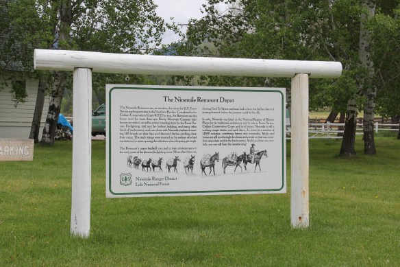
In 1984 too few of us were focused on resources coming from the New Deal era. When I was at Ninemile in 1984 I was looking for the historic school house–and was pleased 30 years later to find that it stood, and had been converted into a residence.
 I don’t recall even thinking about the forest service facility, but here was an entire complex devoted to the forest service’s use of mules and horses before the days of the ATV that was built by the Civilian Conservation Corps. The remount depot is an interesting
mix of restrained Colonial Revival styled offices and residences combined with a early 20th century functional aesthetic for the various barns and work buildings, which could have come straight from the USDA’s standardized plans for farm buildings of that time.
If you want to explore how the New Deal transformed the Montana landscape, the Ninemile Remount Depot is a must stop. It has a museum about what has and still happens here and campgrounds are located nearby in the national forest.
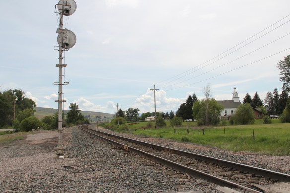
Frenchtown is a Milwaukee Road railroad town closer to Missoula and the city’s sprawl to the northwest has impacted the town, as evident from the new school complex. When I visited in 1984 the town was a paper mill town. Waldorf Paper Products Company opened the mill in 1957, but a successor company, Smurfit-Stone, closed the mill in 2010. At that time the town had experienced a significant population boom, having grown from 883 in 2000 to over 1800 in 2010.
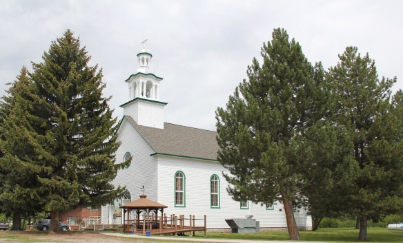
 The name Frenchtown dates to 1868 and is a reference to a number of French Canadians who moved here in the early settlement period. A National Register-listed church, the St. John the Baptist Catholic Church (1884) marks that first generation of settlers. Its classical-tinged cupola has long been the town’s most famous landmark.
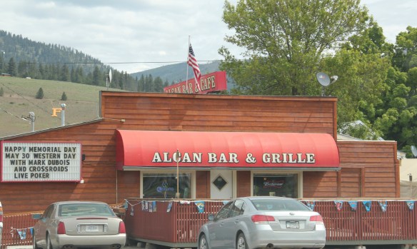
 The Milwaukee Road built through here in 1907-1908 and there remains a handful of historic business buildings from the time of the Milwaukee boom. There is one landmark

from the paper mill days that I recall from my work in 1984–because I stopped here for a break back then: the Alcan Bar–and note the “F” for Frenchtown on the hill behind it.
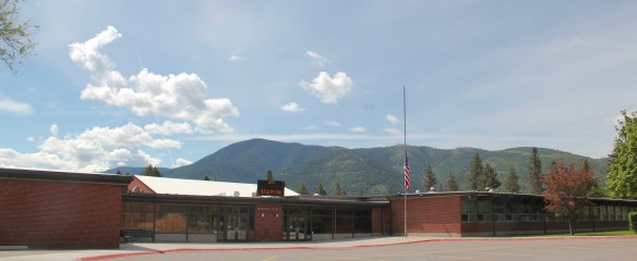
Evaro is also northwest of Missoula, more north than west along U.S. Highway 93. The highway’s four-lane expansion has changed so much of the roadside landscape between this place and Hamilton far to the south. Yet Evaro still has its c. 1930 one-room school, which is now the community center, helping to preserve this historic building. And its has
 another roadside landmark–the Bucksnort Bar, just further evidence to add to the Chicken Coop and the Alcan that you won’t go hungry if you explore the small towns of Missoula County.


 The Silver Dollar, like the Double Front, were meccas not just for railroad workers but also travelers weary of life on the rails and looking for a bit of liquid refreshment. It remains a drinkers’ bar today.
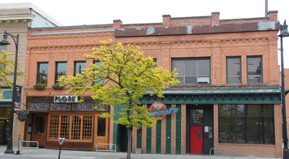 I realize that Missoula now has a wide range of downtown establishments–even a wine bar for a good measure–and I wish them well. But give me the Ox, the Double Front, or the Club any day, any time.
 The Clark’s Fork River and transportation through the valleys and over the Rocky Mountains lie at the core of Missoula’s early history. Captain John Mullan blazed his road through here immediately before the Civil War, and a Mullan Road marker is downtown.
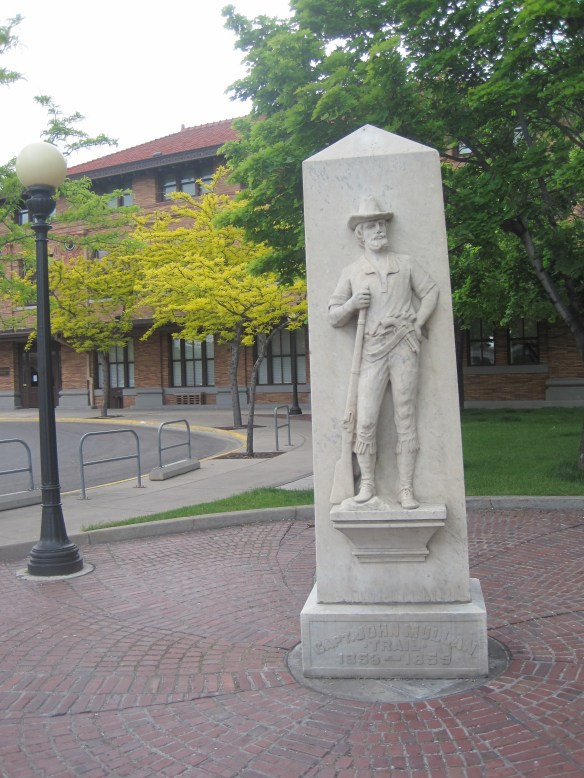 White settlement first arrived in the initial territorial years and a sawmill was the first major business. As a river crossroads town, Missoula grew, and then became a permanent dot on the federal map with the arrival of Fort Missoula, established in 1877. The fort, largely neglected when I conducted my work for the state historic preservation plan in 1984, is now a regional heritage center.

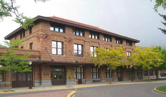 Built in 1901, the Northern Pacific passenger station is an impressive example of Renaissance Revival style, designed by the architectural firm of Reed and Stem, and symbolized the turn of the century dominance of the railroad over the region’s transportation and the importance of Missoula to the railroad as a major train yard. The station, listed in the National Register of Historic Places in 1985, stands at the historic “top” of downtown Missoula, which at its bare bones has the classic T-plan of a railroad hub of the late 19th century. The Northern Pacific tracks and related railroad warehouses are the top of the “T” stretching in both directions with Interstate I-90 crossing the river bluffs to the northeast. Two reminders of the historic railroad traffic are adjacent to the station–a steam Northern Pacific engine and a diesel Burlington Northern engine.


 The Milwaukee was not to be out-done by the Northern Pacific when it arrived in Missoula in 1908. Railroad architect J. J. Lindstrand gave the line a fashionable Misson-style passenger station and offices, which opened in 1910. It too is listed in the National Register. Like the company’s stations in Great Falls and Butte, built approximately at the same time, the station has a tall tower that commanded the city’s early 20th century skyline, and made the depot easy to find. Located dramatically along the Clark’s Fork River, the arrival of the railroad and the construction of the depot led to a new frenzy of building on South Higgins Street, and a good many of those one-story and two-story buildings remain in use today.
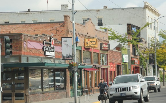


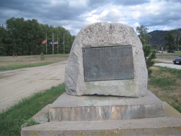


 Since I last visited in 2012 efforts have been underway to secure additional acres and to preserve a buffer around the property since growth and highway expansion between Missoula and Stevensville has engulfed Lolo. The park now has 51 acres and represents quite an achievement by the non-profit Travelers Rest Preservation and Heritage Association, local government, and Montana State Parks.
 It is a land watered by the river, framed by the mountains, and famous for its beef–which they even brag about at the crossroads of Montana Highways 200 and 83.
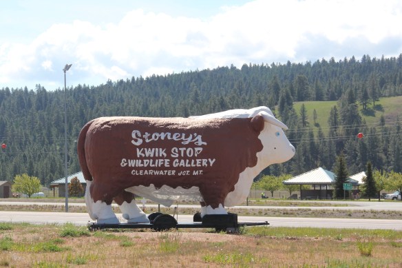 But soon after passing the junction, you enter a much different landscape, particularly at the point where the Blackfoot River meets the Clark’s Fork River. This is an industrial world, defined by the company town design of Bonner and the active transportation crossroads at Milltown. Suddenly you shift from an agricultural landscape into the timber industry, which has long played a major role in the history of Missoula and northwest Montana.
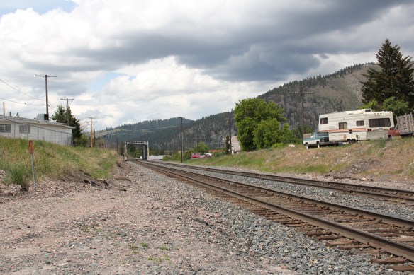 In 1881 the Northern Pacific Railroad was approaching the river confluence. It contracted with a company led by E. L. Bonner, Andrew Hammond, and Richard Eddy to supply everything the railroad needed but steel as it passed through the region. Two years later the railroad provided the capital for Bonner, Hammond, Eddy, and M.J. Connell to establish the Montana Improvement Company. In c. 1886 the improvement company dammed the rivers and built a permanent sawmill–the largest in the northern Rockies, and created the town of Bonner. The sawmill works and town would later become the Blackfoot Milling and Manufacturing Company and eventually by the late 1890s it was under the control of Marcus Daly and his Anaconda Copper Company. Anaconda ran Bonner as a company town until the 1970s.
 Although buildings have been lost in the last 30 years, especially at the sawmill complex which had a disastrous fire in 2008 and a heavy snow damaged another historic structure in 2011, I found Bonner in 2014 to remain a captivating place, and one of the best extant company towns left in Montana.
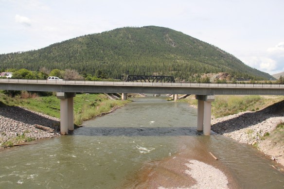 Montana Highway 200 passes through the heart of Bonner while Interstate I-90 took a good bit of Milltown when it was constructed in the 1970s. Both Bonner and Milltown are heavily influenced by transportation and bridges needed to cross the Blackfoot and Clark’s Fork rivers.
 The Milltown Bridge has been restored as a pedestrian walkway over the Blackfoot River. It is the best place to survey the Blackfoot Valley and the old sawmill complex.
 The pedestrian bridge and heritage trail serve as a focal point for public interpretation, for the Lewis and Clark Expedition, the Mullan Road, and then the lumber industry, which all passed this way over time, a conjunction of rivers and history that lie at the heart of the local and state (Milltown State Park) effort to interpret this important place.


 At this time, my entry on Flaxville, the tiny place above in Daniels County, has received the most views. Perhaps that changes as I continue to move into the northwest portion of the state, starting with one of the most rapidly changing places in the last 30 years, Missoula County.
 I am on the back end of my trek across the Big Sky Country, with probably 50 entries to go–see you soon!