

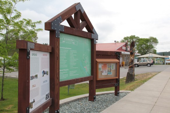
Nestled within the Tobacco Valley of northern Lincoln County is the town of Eureka, which serves as a northern gateway into Montana along U.S. Highway 93. I first encountered the town in 1982, as I returned from a jaunt into Alberta, and immediately thought here is a classic linear town plan, a landscape created by a spur line of the Great Northern Railway.
 As I would come to find out, on two return trips here in 1984, the town was much more than that, it was a true bordertown between two nations and two cultures. The two trips came about from, first, a question about a public building’s eligibility for the National Register, and, second, the fieldwork for the state historic preservation plan, where such obvious landmarks as the National Hotel and Eureka passenger depot were noted. Thirty

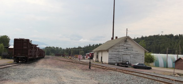 years later I was pleased to see the National Hotel in much better condition but dismayed to see the Great Northern passenger station–a classic example of its early 20th century standardized designs–is far worse condition that it had been in 1984.
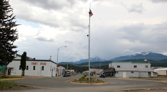
 Otherwise, Eureka has done an impressive job of holding together its historic core of downtown one and two-story commercial buildings. In 1995, owners had the Farmers and Merchants State Bank, built in 1907, placed in the National Register. Walking the town, however, you see the potential of a historic district of this turn of the 20th century place.


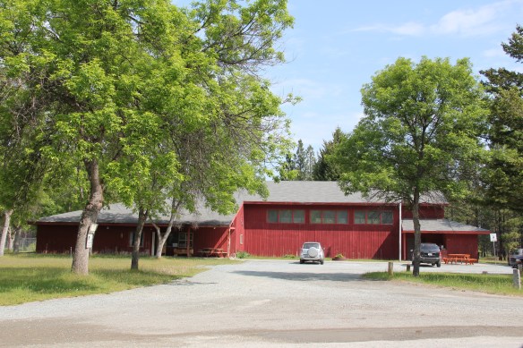
Oh yeah, what about that second reason for two trips in 1984? That would be the Eureka Community Hall, one of the last public buildings constructed by the Works Progress Administration in Montana in 1942.
 Located on a hill perched over the town, the building was obviously a landmark–but in 1984 it also was just 42 years old, and that meant it needed to have exceptional significance to the local community to merit listing in the National Register of Historic Places. Eureka had been a logging community, and the depression hit hard. The new building not only reflected community pride but also local craftsmanship, and it became a
 foundation for community resurgence in the decades to come. The building was listed in 1985, and was the first to have my name attached to it, working with Sally Steward of the local historical society. But credit has to go to Pat Bick and especially Marcella Sherfy of the State Historic Preservation Office for urging me to take it on, and to guide me through the maze of the National Register process. Today, it has experienced an adaptive reuse and serves as a rustic log furniture store.
 During those visits in 1984 I also held a public meeting in Eureka for the state historic preservation plan, where I learned about the Tobacco Valley Historical Society and its efforts to preserve buildings destined for the chopping block through its museum village on the southern edge of town. Here the community gathered the Great Northern depot (1903) of Rexford, the same town’s 1926 Catholic Church, the Mt. Roberts lookout tower, the Fewkes Store, and a U.S. Forest Service big Creek Cabin from 1926.


But thirty years later I found new public interpretation not just in the museum village but in the town itself, as Eureka introduced visitors to its history and setting and also told its
border story of such fascinating people as Joseph Peltier, who built the first dwelling at the town site in 1891, and especially the cross-border entrepreneur Sophie Morigeau, who was trading in the area as early as 1863.


The Peltier log dwellings came within a year of each other, 1891 and 1892, and their size, finish, and log notching speak to the region’s rapid development. His 1891 low pitched roof, v-notched cabin is typical, throughout the mountain west, of first homes–quickly constructed shelter. The second house, with its hewn log exterior and crafted corner notching speaks to permanence. The settler was here to stay in 1892.


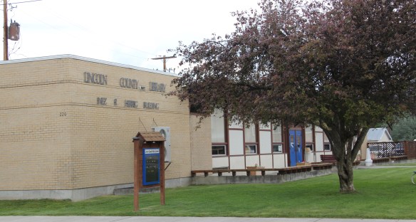
Eureka has held its population steady over 30 years, just a few families over 1,000 residents, a sizable achievement considering the change in both railroading and logging over that time. I think community pride and identity has to be contributors, because you see it everywhere, and I will close with two last examples. The town’s library and nearby veterans park, and then the magnificent Art Deco-influenced high school–yet another New Deal era contribution to this special gateway town.


 Libby is the seat of Lincoln County, a typical railroad town along the historic Great Northern Railway corridor. The image above is from the town’s railroad depot, the symbolic beginning of town, from which runs a long main street of businesses, reflecting the T-plan town design, where the long railroad corridor defines the top of the T and the main street forms the stem of the T.


 courthouse received a totally new front, in a contemporary style, in the 1970s as the town and county expanded in the wake of the federal spending in constructing Libby Dam. The rectangular blockiness, flat roof, and band of windows set within a symmetrical facade makes the courthouse one of the state’s best designs for a rural public building in the late 20th century.
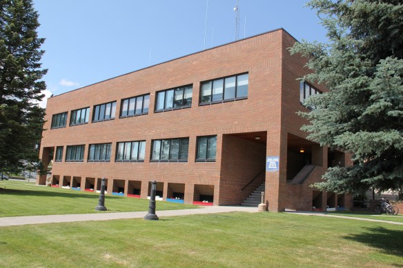 I liked all of those things about Libby in 1984. Imagine my shock and disappointment to learn, as everyone else did, that Libby was one of the poisoned places in the west. In 1919, vermiculite, a natural material that contains asbestos, had been discovered outside of town, and the mines were still operating, producing 80 percent of the vermiculite in the world, under the control of the W.R. Grace company. Residue from the mines had been used in local yards and buildings for decades, a fact that was not known when I visited the town for the state historic preservation plan. When the discovery of the danger became public, and the federal Environmental Protection Agency entered into the fray in 1999, it was already too late for many residents. A federal Superfund project began, and did not conclude its work until 2015, spending some $425 million. Then in 2009 the Environmental Protection Agency announced a public health emergency, spending another $130 million to help residents and to leave a new health infrastructure in place. In a generation, Libby had been turned inside out. EPA announced in 2016 that the cleanup would continue to 2018, and that the project was the longest in the agency’s history.
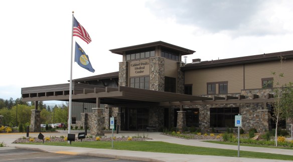
 Despite the disaster, I saw many signs that Libby residents were determined to remain and rebuild their community. One of the most powerful examples is the conversion of one of the town’s historic schools into a new community arts center as well as school administration offices.


 The asbestos crisis was a terrible disaster for Libby–yet residents refused to let it define their future. There are past accomplishments to acknowledge, an active railroad depot to cherish, a beautiful river and lake, the mountains all around, as celebrated in this public art mural on a downtown building. This place is here to stay, and the historic built environment is a large part of it.
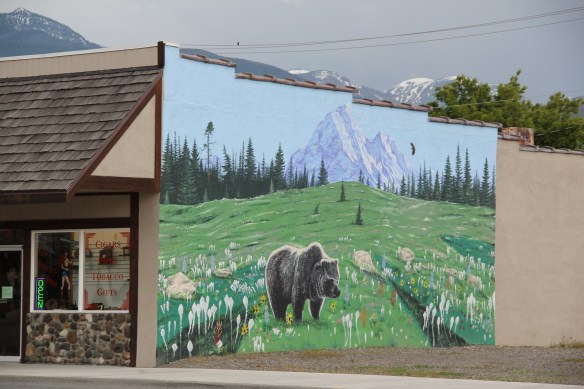
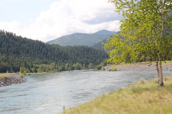
 The dam is 422 feet tall and stretches across the river for 3,055 feet–well over a 1/2 mile. It creates a huge reservoir, extending 90 miles to the north and into British Columbia, among the ten largest reservoirs in the nation. And like that, a historic river valley became a recreational lake in a joint project between the United States and Canada.


 The Lake Koocanusa Bridge, which provides access to a Mennonite community and a backroad way to Yaak, is the state’s longest, and in many ways, its most spectacular multi-truss bridge. The bridge is 2,437 feet long, and stands, depending on water level, some 270 feet above the lake.
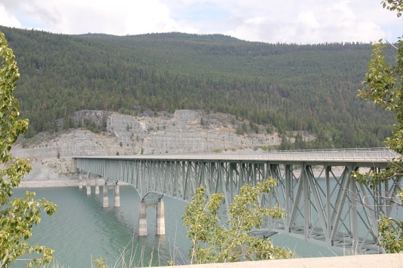


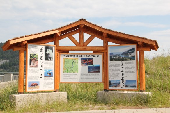 There was no interpretation at this bridge in 1984, but the scenic highway designation has led to the placement of overlooks and interpretive markers at some places along the lake. One wishes for the same at the Montana town that the lake displaced, Rexford. This once
 small river town had to move, or be inundated. And since the move took place in the mid to late 1960s, the town embodies the mid-century modern aesthetic, both in the design of many buildings but also in the town plan itself as the federal government finished relocating Rexford in the early 1970s.


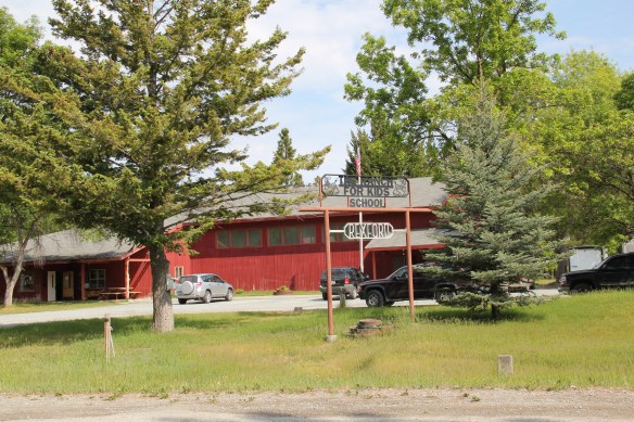
 school by itself is a fascinating statement of both design but also a community’s determination to stay, no matter what the federal government threw their way. Needless to say, in 1984 I paid Rexford no attention–nothing historic was there, it was all new. But now it is clear what a important place in Lincoln County’s 20th century history Rexford came to be.
 U.S. Highway 2 enters northwest Montana in Lincoln County and from there the federal highway stretches eastward through the towns of Troy and Libby with vast rural stretches along the way to Kalispell. Paralleling the highway is the historic route of the Great Northern Railway, which brought timber and mining industries to this corner of Montana.
 Before you encounter the towns, however, there is a spot that is among my favorite in the state, and a place that I discussed in some depth in the book A Traveler’s Companion to Montana History: Kootenai Falls.


 The falls is spectacular, no matter what time of the year you visit. But do stop and consider the mountains and bluffs that surround it. The entire landscape is what mattered to the Native Americans as they navigated through the area, or took vision quests at isolated places, or stopped to fish along the banks or hunt the wild game who also came to the falls for nourishment.
 There are few less untouched places than Kootenai Falls. The county park provides access and information. It is then up to you to explore, stop, and think about how humans have interacted with this places, taking aways thoughts and messages that we can only guess at, for thousands of years.