Tower Rock State Park

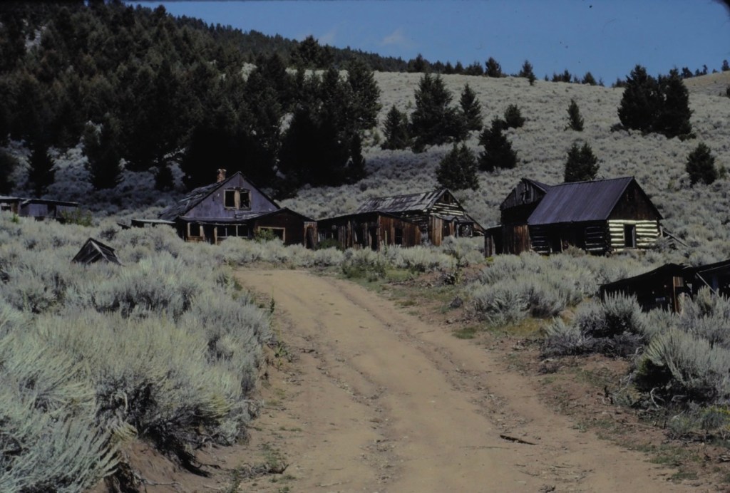
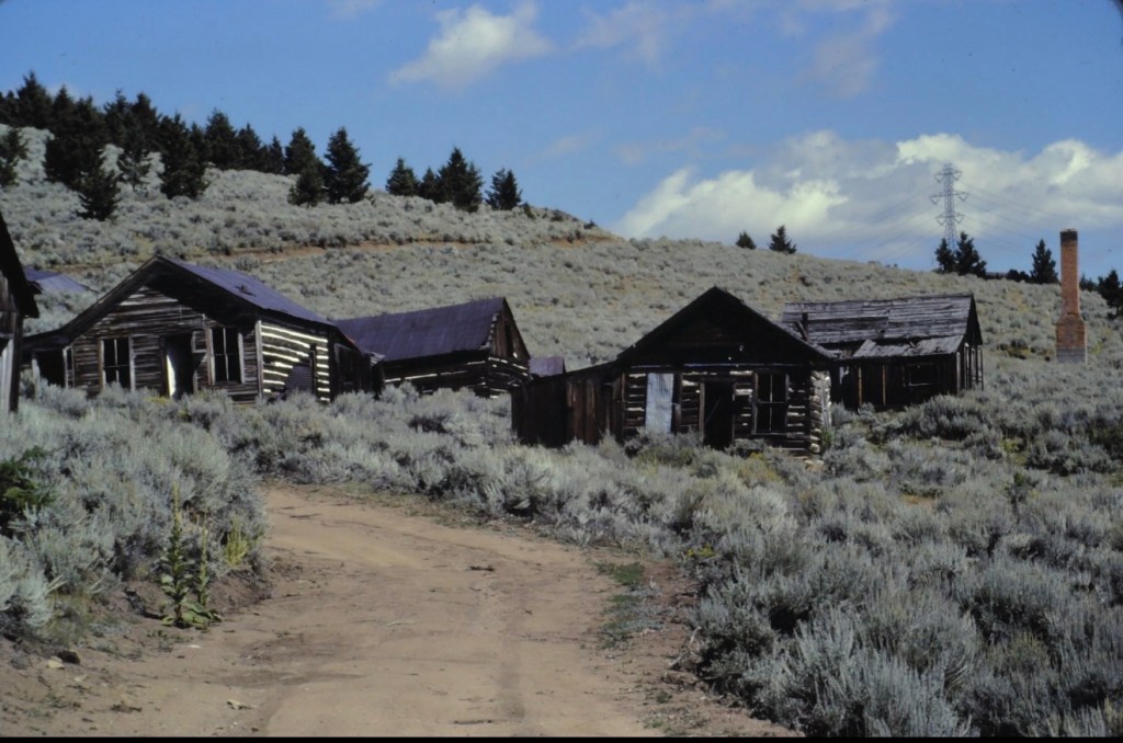
Since my initial survey of Montana historic places in 1984-1985, Montana state parks has established several small but significant historic parks. One of these, Tower Rock State Park, is viewed by hundreds of drivers daily, as it is located directly on Interstate I-15 along the Missouri River Canyon in southern Cascade County.

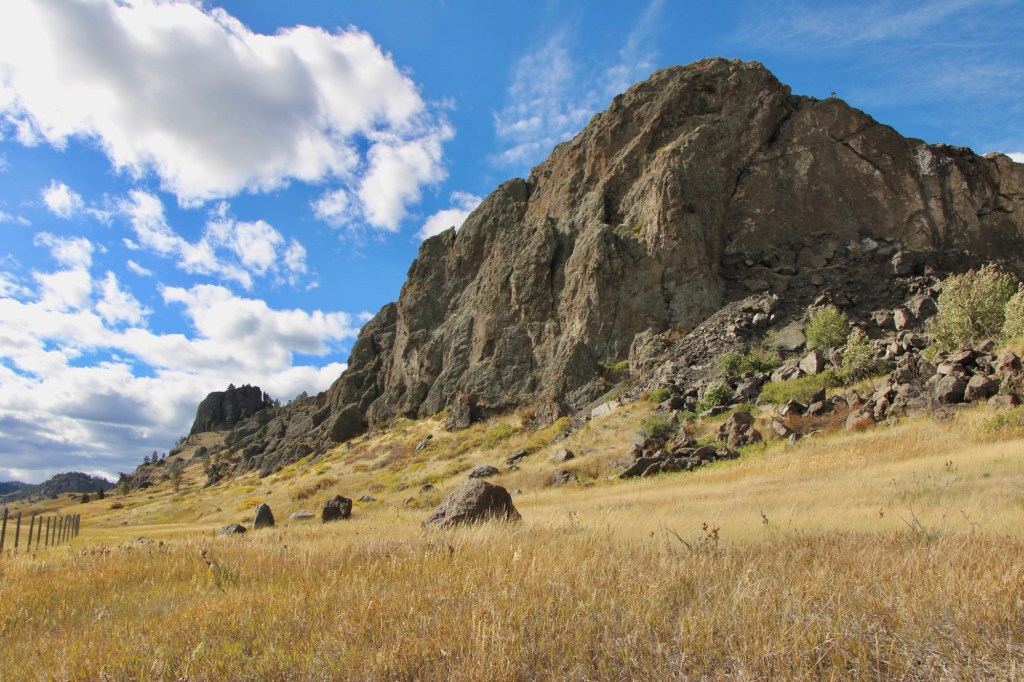
Native Americans traveling from their Rocky Mountain homelands into the game-rich high plains, used the rock formation, over 400 feet high, as a landmark between the two regions. The Bitterroot Salish, Lower Kootenay, and the Piegan Blackfeet are all associated with the place. For the Piegan Blackfeet it was and is a sacred place. Groups camped in the vicinity between the Rock and Missouri River.

When on July 16, 1805 Capt. Meriwether Lewis of the famous Corps of Discovery encountered the Rock on his journey west, he noted the presence of what he called an “Indian road” around the Rock. He then decided to name the place and wrote in his journal: “this rock I called the tower. it may be ascended with some difficulty nearly to its summit, and from it there is a most pleasing view of the country we are now about to leave. from it I saw this evening immence herds of buffaloe in the plains below.

The surrounding region’s development took place in the late 19th century, accelerated by the decision of the Manitoba Road to built through the canyon a rail link connecting Great Falls, Helena and Butte. This line became known as the Montana Central Railroad.

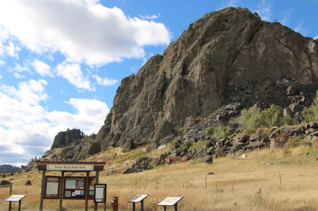
In the early 20th century came an automobile route, U.S. Highway 91, and then the interstate highway in 1968. Interestingly, the property’s official designation as a historic site came much later. Tower Rock was listed in the National Register of Historic Places in 2002. Two years later, it became a state park of about 140 acres.

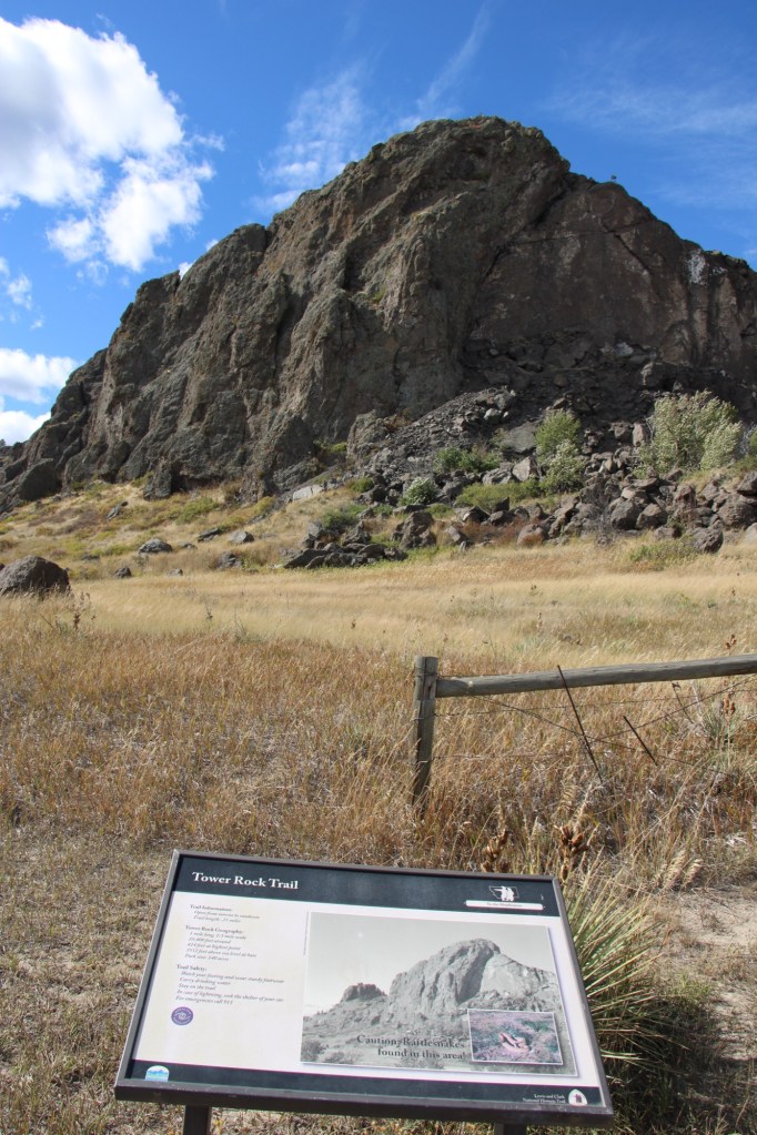
The park is day-use only but there is adequate public interpretation. There is also a maintained trail to the Rock’s base, allowing for a more direct experience with landscape and some mitigation of the noise from the highway. The importance of the place deserves a more robust treatment but perhaps more can come in the future ( and the adjacent disposal center can be moved to a more appropriate location).

Big Timber and suburban aesthetics

Readers of this blog on Montana’s historic places will see that, clearly, Big Timber is one of my favorite railroad towns of the Yellowstone Valley. Its classic T-plan is one reason why. The top of the “T” runs roughly along the river and railroad tracks, facing the Crazy Mountains, while the stem of the “T” becomes the town’s Main Street, as you can see above.

Big Timber school in 2014

Distinguished one and two-story historic buildings along Main Street and scattered throughout the town are among the other reasons I enjoy Big Timber. The fate of of one of those places is the theme of today’s post.

I have earlier talked about the town’s three primary public spaces (the courthouse, the school/library, and the Sweet Grass Mill park at the south end of Main Street.) The second oldest space is defined by its historic school and the adjacent Civic Center (which also served as the school’s gym) and the Carnegie Library, which was expanded last decade.

Civic Center in 2014. Note the rear of the school in the far right side of the image
Expanded Carnegie Library, 2021
School after fire, taken in 2018

After the disastrous fire of 2017 that destroyed the school, the future of this public space was left in doubt. Here at the end of 2025 an answer has been presented—a new outdoor space called Sheepherder Square, designed by a Bozeman-based architectural firm. A foundation has been established to support the project and fundraising is underway.

The square will be an open space with an amphitheater and other amenities that link the library and civic center. The rendering above, from the Helena Independent Record website, shows a lot of concrete walkways, perhaps too much of a suburban aesthetic for a western railroad town. Will it compete with/ replace the Sweet Grass mill park? How will it blend with pedestrian traffic at the library and the Main Street business district?

This envisioned transformation of an empty lot will be interesting to monitor over the next year or two. Is the look and feel of Big Timber headed in the right direction?

Revisiting Nashua in Valley County in 2025

It had been over a decade since I last stopped in late September 2025 at the tiny railroad town of Nashua in Valley County. Recently in the state and regional press, there have been stories about the uptick in tourism in northern Montana. It’s about time, especially for intrepid heritage tourists. As my posts from over ten years ago emphasized, an amazing array of stories and places await those who venture beyond Havre on U.S. Highway 2.

Even tiny Nashua (probably less than 300 residents today) reflects virtues worth exploring—community pride especially as reflected at the recently renovated Nashua High School, above. Since the town had lost population since my last visit, I had wondered if the school was still there as an anchor. Indeed it was, and looked almost modern as its 1935 core from the New Deal had been layered over with a new facade.

The railroad was the dominant influence in the town’s history—save for the 1930s boom during the construction of nearby Fort Peck Dam—and the town’s rail corridor is still defined by its grain elevators.

Queen of Angels Catholic Church

Competing for the Big Sky line of Nashua is the tall Gothic style bell tower of the Catholic Church. Established in 1917, Queen of Angeles Catholic Church began as a mission church. The Sisters of Charity worked with the diocese to establish an adjacent one-room school, below, as a way of growing and maintaining the congregation after the end of the Fort Peck Dam boom.

Then in 1953 Rev A. J. Schuh wrote an appeal to The Catholic Worker, a major newspaper, asking for the support for the construction of a rectory so that a more permanent foundation for the church’s work in Nashua could be laid. I had no idea if the appeal worked or not—but something happened. Queen of Angels Catholic Church was in great condition, and a major town landmark.

Front Street, Nashua

Along the old highway route was another landmark, of a quite different purpose: Vic’s Bar and Bowling Alley. Here is the private social center for the town. Great rural Montana towns always have at least one traditional watering hole. Vic’s is that place in Nashua.

Victor Dostert (1886-1961) homesteaded south of the town along the Milk River during the boom of the 1910s but when the bust came in the 1920s Dostert, his wife Anna, and their three sons stayed, making their mark with construction projects (from a theater to the Catholic Church) and taking advantage of the thousands of construction workers passing through by building and operating Vick’s Bar in 1935. He added the bowling alley in the 1950s—a decade when the bowling craze as a community institution reached its peak across the nation.

Dostert as Nashua’s town official had already been instrumental a few years earlier in the creation of the Nashua Civic Center, the public community center for this part of Valley County still today.

These places and brief stories hint at the richness of heritage experiences in Valley County. I’m glad I stopped at Nashua again (just too bad that it was early in the morning and Vic’s Bar was not yet opened). But give the residents much credit—they hung through another tough decade through commitment, community spirit, determination and faith.

Greenwood Cemetery in Wolf Point

Municipal cemeteries are key public spaces in the Hi-Line towns of Montana. As they mostly date from the 1890s to 1910s, the cemeteries are part of the region’s progressive-era history. New settlers sought to replicate their prior homes—building permanent schools, new churches, town blocks, and homes while also establishing cemeteries.

In 1915 settlers formally incorporated Wolf Point as a municipality. A year later, mortician L.M. Clayton opened a funeral business, which would operate until 2005. On a hill several blocks north of the town’s railroad tracks, Clayton established Greenwood Cemetery by 1917. The name came from his wife, Nora May Greenwood. The Greenwood Cemetery Association was organized to administer the property, and its beautification was ensured by the town’s Woman’s Club when it worked with Wolf Point leaders and the cemetery association to extend water to the place. It became a green oasis of rest and tranquility within the often brown, water starved landscape. It remains an impressive landmark of civic pride today.

There are two ceremonial areas that immediately capture your attention. Two veterans circles have been installed to honor the many from Roosevelt County who have served the nation from World War I forward.

Scattered through the cemetery are other veteran burials, including ones from the Civil War and the Spanish-American War.

Civil War veteran
Spanish-American war veteran

The second ceremonial area is more subtle in appearance but unique in its own way.

Seehaler Chapel

Father Benedict Seehaler established and led Wolf Point’s Immaculate Conception Catholic Church from 1917 to 1931. After his death, parishioners built a tiny memorial chapel in his memory. It was built over his grave.

The chapel has an altar and a carved depiction of Christ. The church on Memorial Day holds a memorial mass is held (weather permitting) at the Father Benedict Seehaler Memorial Chapel in Greenwood Cemetery.

There are many impressive grave markers at the cemetery, whether they are unadorned crosses of early settlers to ones that through the materials used help to tell a story.

Gabriel Beauchman (d. 1940)
Jesse W. Baker, Sr (d. 1994)

Two of the most unique, however, are pedestal sculptures in memory of a husband and wife, Floyd and Bea Dewitt. Floyd passed away in 1980, Bea followed three years later. Floyd’s sculpture is a likeness while Bea’s pedestal sculpture is more symbolic, with the interpretation left to the visitor, until you learn she was a beloved nurse.

Historian Patty Dean found the DeWitt’s obituaries published in the Billings Gazette, see below, and graciously shared them:

There are many more observations you can make about Greenwood Cemetery but this is enough for the posting (I reserve the right to revisit this place in the future. It is simply one of the most significant municipal cemeteries of northern Montana.

Comet, Montana: A 1985 Flashback

As I wrapped up the 1984-85 survey of Montana, I made a few specific visits to classic Montana ghost towns. Comet in Jefferson County was one of those stops and here I share for the first time the images from 1985.

In 1883, the Helena and Livingston Smelting and Reduction Company established the Comet mine, around which the town of Comet developed. Like many of the late 19th century mining towns, Comet boomed briefly until the economic crash of the 1890s.

But Comet had a second life in the 20th century. In 1900, interest in reopening the mine for copper and other base metals led to the establishment of the Montana Consolidated Copper Company. This company managed the property for a generation until 1927 when the Basin Montana Tunnel Company acquired the property.

Note the lone brick chimney to the right

The new operators built a processing center, and the town’s population reached new highs, although always remaining in the low hundreds.

Large scale operations at Comet ended in 1941 but scattered work remained for years—there was still activity at the site in 1985.

I found Comet to be an interesting combination of log buildings and balloon-frame one story buildings. So it spoke to me as both a historical place but also a surviving laboratory for studying the vernacular architecture of 20th mining camps.

I need to revisit Comet and see what’s left after 40 years. Perhaps in the new year!