Judith Landing over 40 years

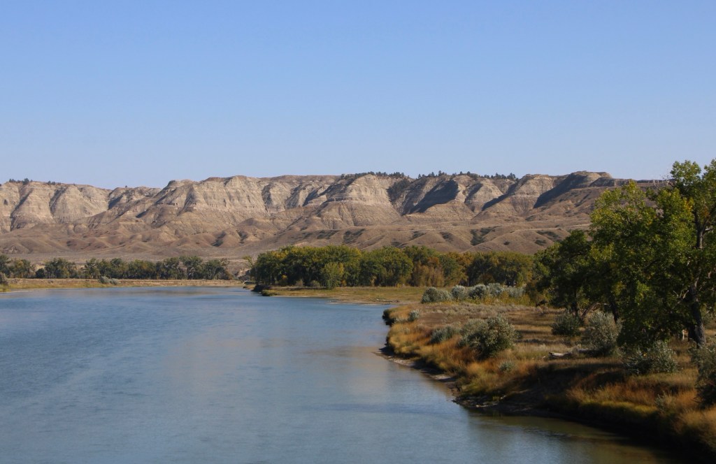
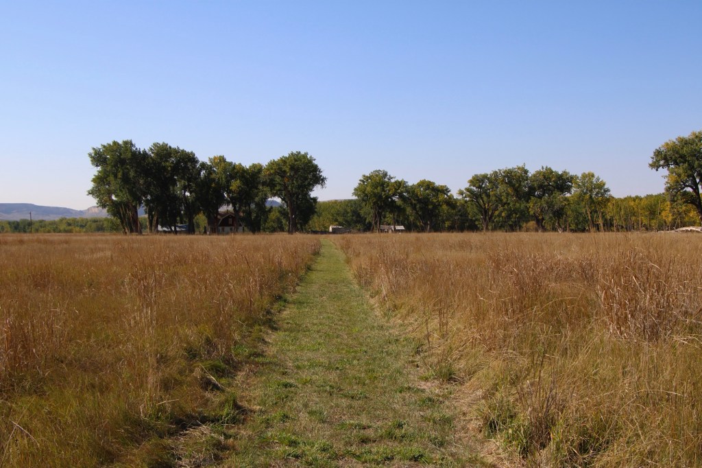
There are few places in the nation more important than the broad river valley at the confluence of the Judith and Missouri rivers in central Montana, a place only accessible by historic gravel roads. When I first visited in 1984, I came from the Fergus County side through Winifred.

View from MT 236 north of Winifred, 1984

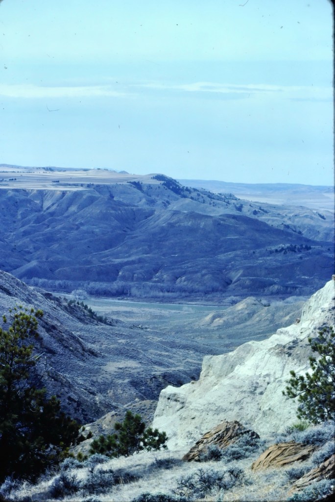
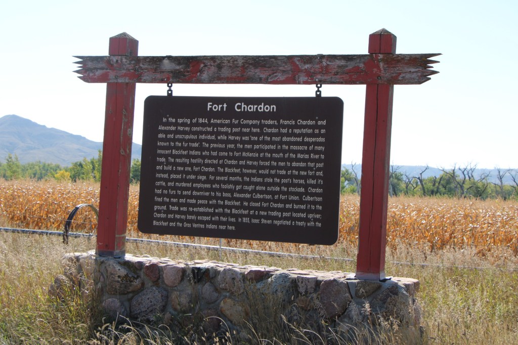
Why is Judith Landing so important? It was a vital and frequently used crossroads for Northern Plains tribes for centuries. Then in 1805 as Lewis and Clark traveled on the Missouri, they camped at the confluence (private property today). In 1844, The American Fur Company established Fort Chardonnay, a short-lived trading post.

In 1846 Indigenous leaders of several tribes met at Council Island to discuss relations between the Blackfeet and other northwest tribes. In 1855 leaders from the Blackfeet, Salish, Pend d’Oreille, and Nez Perce returned to Council Island to negotiate the Lame Bull treaty, which established communal hunting areas and paved the way for white settlement in the late 1860s and early 1870s.

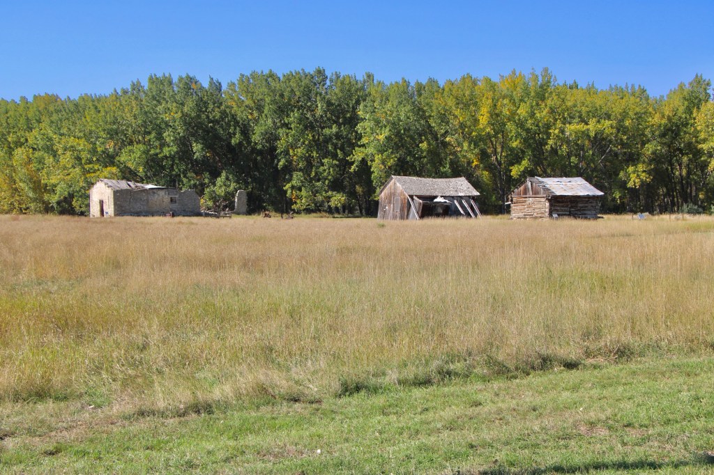
Settlement first came with trading posts, serving a nearby army base, Camp Cooke (1866-1870) and connecting steamboat traffic on the Missouri to nearly mining camps (like Maiden). When the U.S. government moved the base, Fort Benton merchant T.C. Power developed his own businesses and post at Judith Landing and established “Fort Clagett” to the immediate west. In the 1880s he partnered with Gilman Norris to create the famous PN Ranch from the remnants of these early settlement efforts.

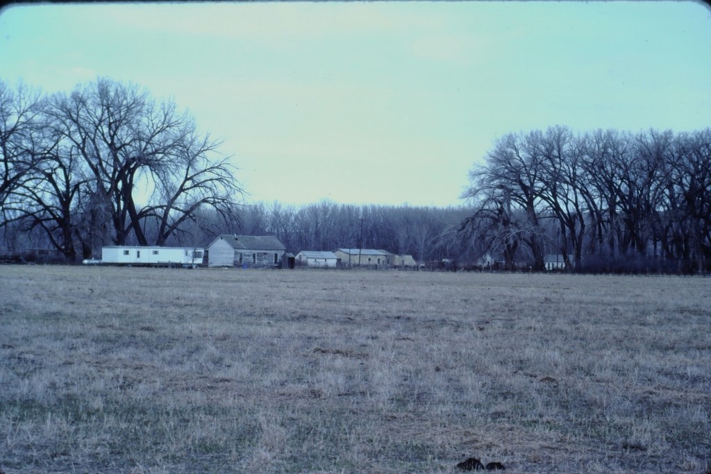
Visiting this place was a major goal of the 1984 historic preservation plan survey. At that time the ranch was still operating as a ranch and the one slide that I took show several of the historic and new ranch buildings, yes from a distance because in the work I always respected private property boundaries.

Over the next 40 years I worked in Montana many times but never made a return to Judith Landing. I knew that the historic buildings of the PN ranch were there and that a National Register district existed affording some protection. Then in late 2024 came the news that Montana State Parks was acquiring 109 acres of the historic property and would create the Judith Landing State Park. I couldn’t wait to return and visited in late September 2025.

Interpretation and maps at the parking area
Path to the park buildings

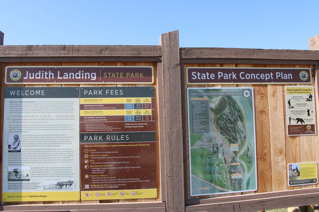
At that time there had been little in the way of “park development.” I hope it largely stays that way because the sense of time and place conveyed by the rustic, rugged surroundings is overwhelming. You can be lost in history.

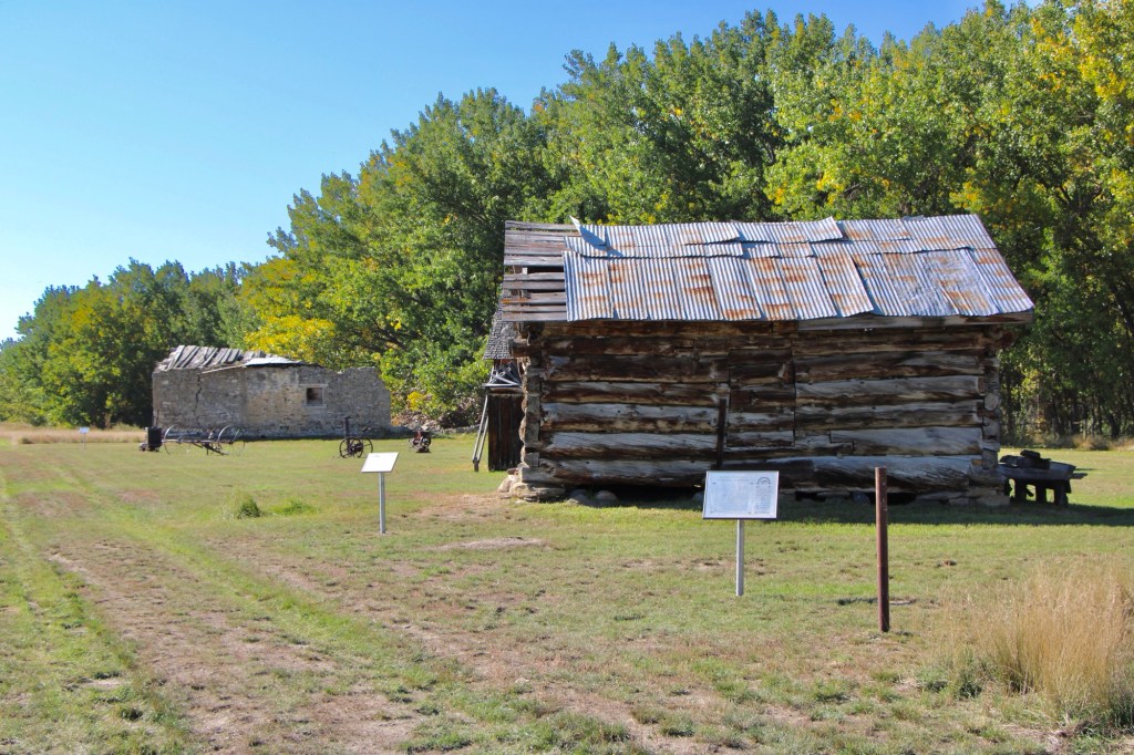
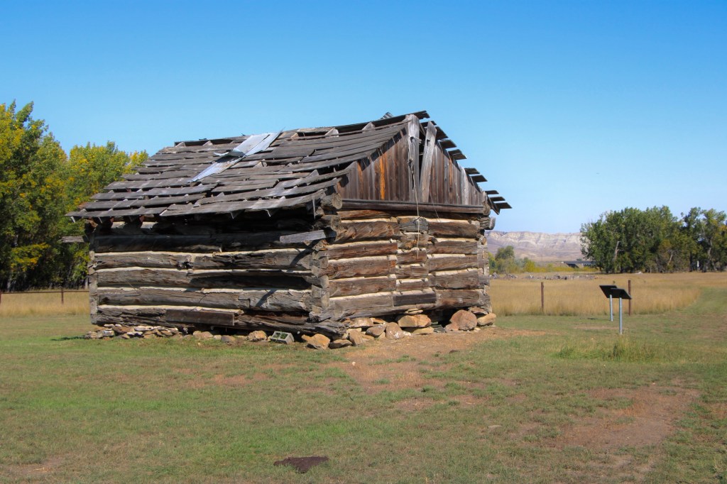
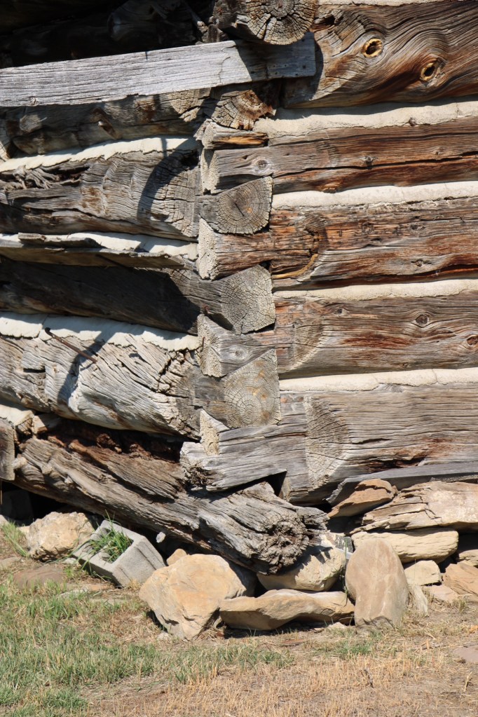
The half-dovetail “mail barn” was moved to its location on the ranch about 1980. It continued to serve as a post office until 1919.

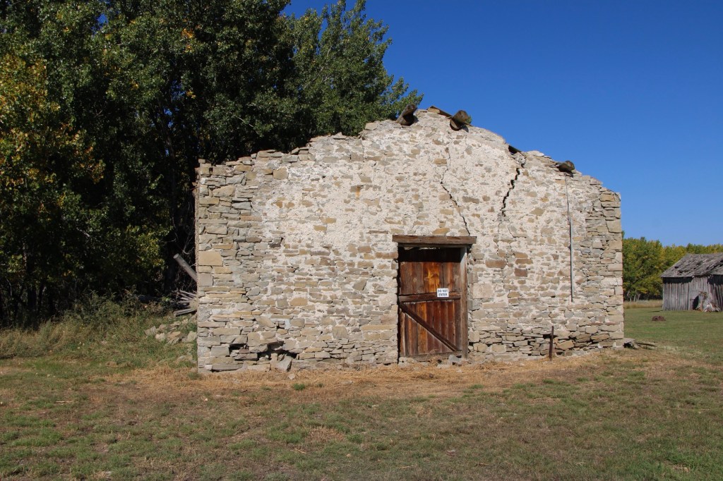
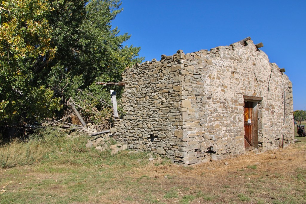
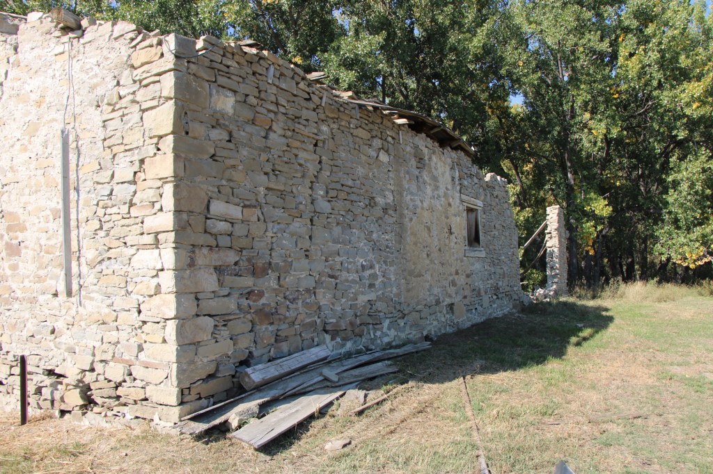
The stone warehouse was severely damaged in a flood 50 years ago—but it is hanging on, and indicates how important trade and commodities were here 150 years ago. It operated as a store until 1934 and then became a barn for the next 40 years until the flood of 1975.

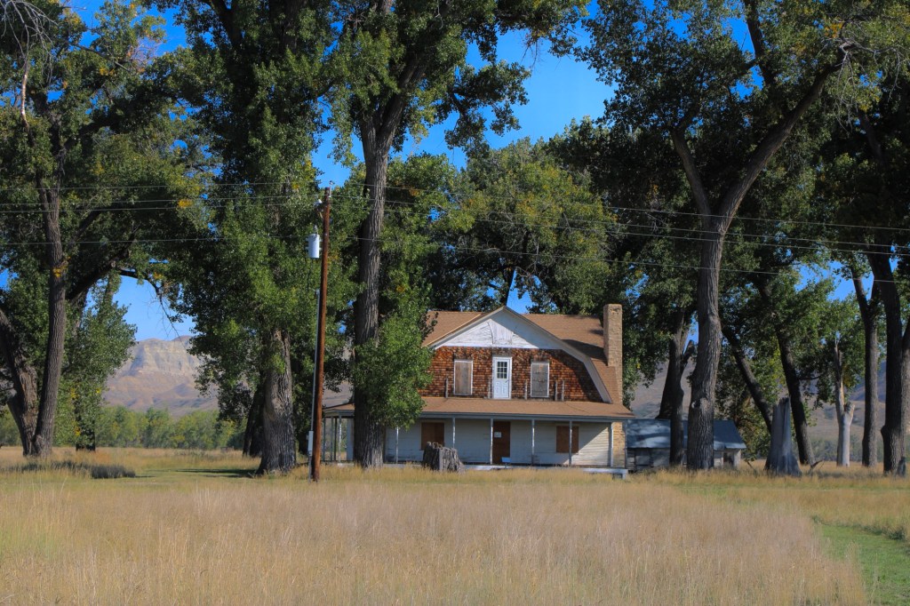
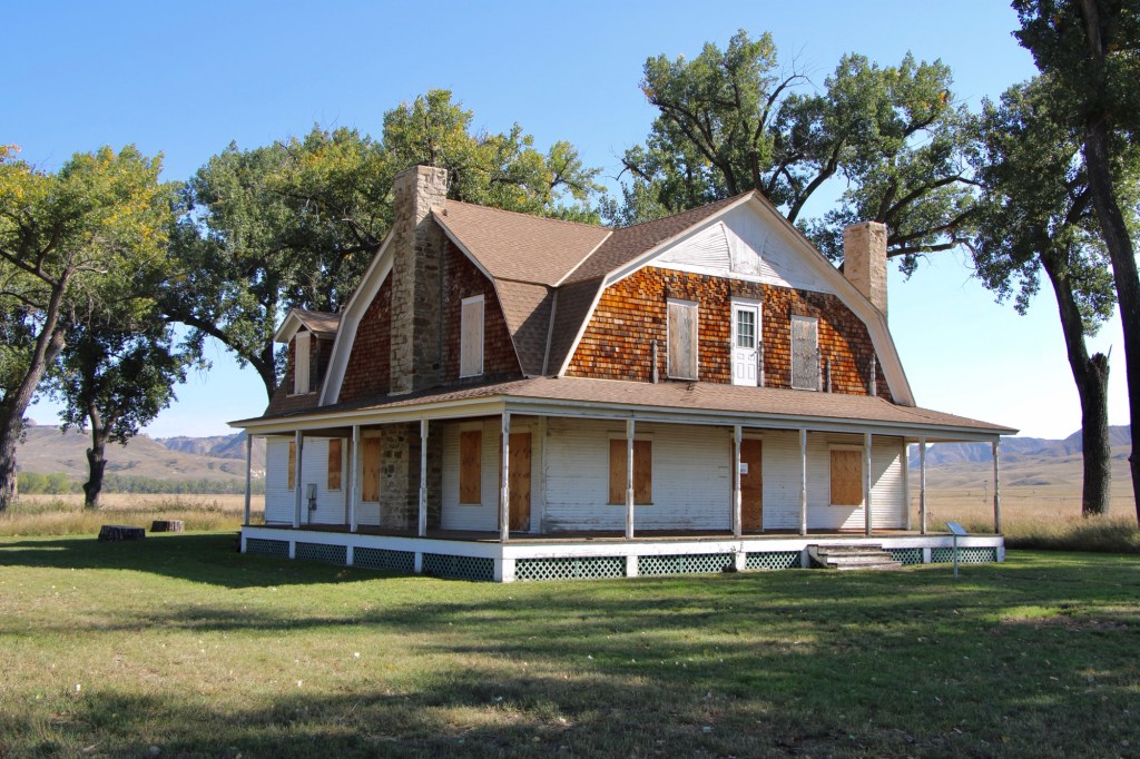
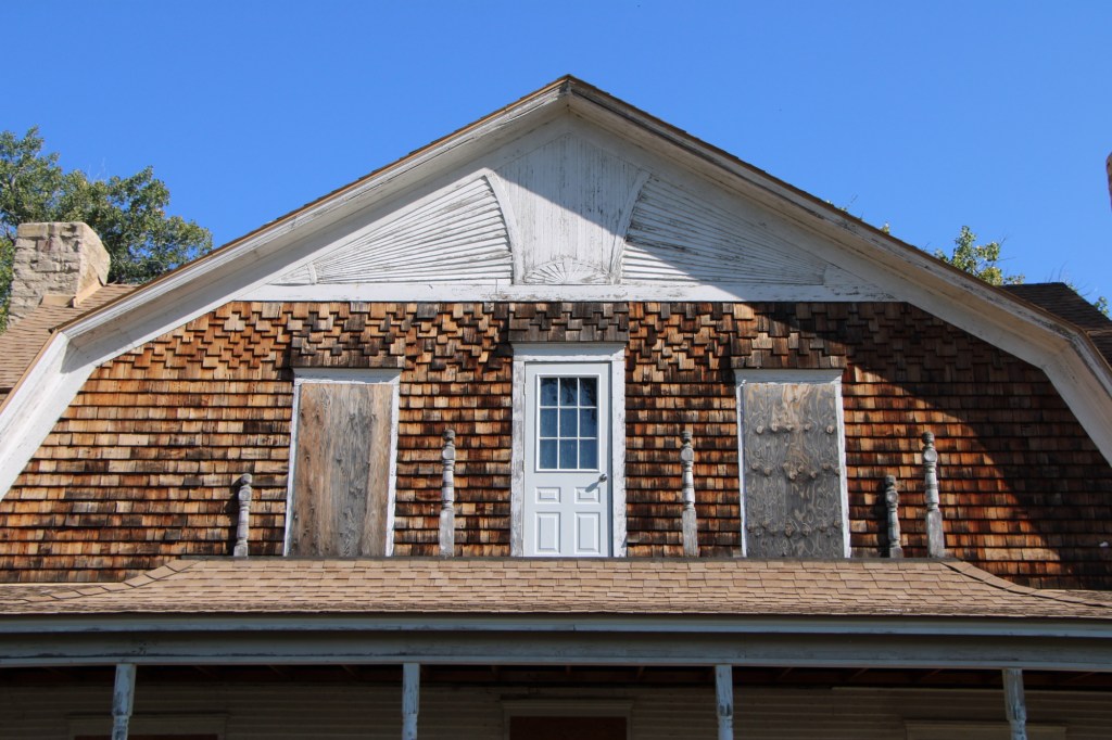
Gilman and Pauline Norris’s own ranch house, a turn of the twentieth century Shingle-style beauty, speaks to the ranch’s success. perhaps it can be restored as a future park interpretive center, open in the summer.

Historic path/road down to the river landing from the front of the ranch house.

The important point is that, now, finally, Judith Landing is a state park, conserving one of the most remarkable places of the northern plains.

Huntley School, U.S. Highway 2 Landmark

One of the oldest historic preservation projects along Montana’s U.S. Highway 2 route is at Saco. In 1961, the Saco Garden Club moved, restored, and interpreted the 1916 Huntley school, which once served homesteaders in Phillips County. Their efforts came five years before the landmark National Historic Preservation Act and the creation of the National Register of Historic Places.

Why this school and why in 1961? The answer lay with one of the school’s primary students, Chet Huntley. His father had earlier donated the land for the school, thus it was given the name of Huntley. In 1961, however, Chet Huntley was a national news icon, part of NBC Network’s Huntley-Brinkley Report.

Tiny Saco had a direct connection to one of the most famous newscasters in America. The show, with Huntley reporting from New York City and David Brinkley reporting from D.C., began in 1956 and continued on air until 1970.

Sometime between 1988 and 2013, the Saco Garden Club added another historic building to their site. 1n 1988, the Immanuel Lutheran Church stood to the east, outside of Sleeping Buffalo Hot Springs (below).

By my next visit to this corner of the state, the building had been added to the Huntley site.

Like the school, the church is well preserved and maintained, particularly its compelling and beautiful interior.

When I visited Saco again in the fall of 2025 I found a third historic building, the first Saco Jail, added to the site.

Plus the Garden Club had installed new landscaping and a sidewalk tying together the properties by the Saco Pioneer Garden.

The efforts made by tiny rural communities across Montana to preserve their history and to share their stories never ceases to amaze. The Huntley School is one of the most impressive landmarks along the Hi-Line, and a reminder of the role of women in the state’s historic preservation traditions.

Malta Cemetery, a Hi-Line Landmark

When the state government in 2014 identified 18 businesses that had been operating in Montana for at least 100 years, the Malta Cemetery was one of those 18. The Manitoba Road, the precursor to the Great Northern Railroad, established a siding here in 1887. Three years later, a post office named Malta was established and settlement followed.

Then came the homesteading boom of the early 1900s. The town of Malta was formally established in 1909. The cemetery association—still a private corporation headed by three trustees today—came soon thereafter.

The cemetery is north of the town center at a place where first burials date to 1894. The cemetery design centers on a tree-lined road that reaches the top of a slight rise, with different roads radiating on either side of the main artery. It is not an elaborate design but the many trees planted in its early years give the place a calm, serene feel.

Several large, expressive stone markers identify town founders and the first generation of leaders. the Malta Enterprise of March 30, 1916, recorded the passing of Benjamin W. “Brock” Brockway, who was the town mayor, and a cemetery trustee. The newspaper emphasized that Mayor Brockway “grew to be an intregal part of the growth and development of the city of Malta. His fathful [sic] services in the various city and county organizations and his long and intimate association with the affairs of the country’s complex life made him a valuable leader, a sate adviser and a most efficient officer. He was justice of the peace in Malta for a long time, secretary of the Milk River Valley Water Users’ Association for the success of which he worked with an unusual degree. He held the secretaryship of the Malta Cemetery association, and his never ceasing interest in and devotion to the improvement as a more fit sleeping. place for the dead were deeply appreciated everywhere.”

When Brockway first came to Malta, he worked for the town’s leader merchant, Robert M. Trafton, whose similar beautiful stone marker is nearby. Trafton is considered one of the town’s founders. He came in 1886 as the Manitoba Road was being completed. He traded extensively with Native Americans, paying $4 a ton for buffalo bones (according to the Billings Gazette of March 16, 1933). He made $30,000 by selling the tons of bones to fertilizer companies in the east. Later he was a founder of the First State Bank of Malta; its classical Revival building remains a town landmark.

Trafton died in Long Beach, CA, but wanted to be buried in Malta.

Brockway’s predecessor as Malta mayor was Arthur Cavanaugh, also a prominent businessman. He has a stone marker to the west of the Brockway and Trafton graves centered in a large concrete lined family plot.

William McClellan (d. 1916) was another important early Malta merchant. He and Lee Edwards built a two-story business block prominently facing the railroad tracks in 1910. It is listed in the National Register of Historic Places.

Edward’s-McClellan Block, built in 1910

Isolated in a northwest corner is the monumental Phillips family plot that honors the county’s first family. The county was named for Benjamin D. Phillips, a rancher and miner and he is buried at Highland Cemetery in Havre. The Malta marker honors his son Benjamin M. Phillips, who ran his father’s interests in Malta, but especially Ben’s first wife Bessie Keller Phillips, who died in 1918 in a tragic fire at their home. She tried to repair a gas stove, but it exploded and Bessie died from the burns she suffered in the explosion.

Another noted Victorian style marker is for Timothy Whitcomb who was the brother of Zortman mine owner Charley Whitcomb. Timothy worked the properties at Zortman but contracted liver disease and died in Malta in early 1910. the Whitcomb plot also includes the burial of his wife Katie McGuire Phillips who died in 1937.

John Survant, a native of Missouri, was a State Senator, first elected in 1910. He also was a prominent businessman in both Malta and Hinsdale. Survant began as a partner of Edwards and McClellan but later bought out their interests. He owned a large ranch along the Milk River Project as well.

As the Survant markers indicate, at some point in the second half of the 20th century the cemetery association undertook a major renovation of the property, uprooting both gravestones and foot markers and installing them in long concrete rows.

The renovation perhaps made mowing and irrigation more efficient. It certainly gave the cemetery a unique look, one that I have not found in other early northern Montana cemeteries.

The Malta Cemetery also has several expressive grave markers placed over the last thirty years, such as the colorful river scene of Robert M. Ostlund’s marker (above) and the metal sculptures of a cattleman (Allan Oxarart) and a golfer (Jack D. Brogan), as shown below.

The Malta Cemetery is a fascinating blend of the old and new, and one of the oldest community institutions of the Hi-Line.

Glasgow’s Highland Cemetery

Glasgow, the seat of Valley County, dates to the late 1880s when the Manitoba Railroad (later named the Great Northern Railroad) entered the northeast corner of Montana Territory on its way west to its initial terminus in Great Falls. The first burials at what later became Highland Cemetery on a bluff northeast of the town center date to those years. The images above and below are of that first burial ground, known as Potter’s field, and part of what is designated at the first addition.

The next two images are of the cemetery’s second addition .

The section designated as Glasgow original cemetery also marks the beginning of the Highland Cemetery period. The Glasgow Montana Citizen reported on November 13, 1897: “Owing to the utter lack of system in locating the graves on the hill it was impossible to lay it [a city cemetery] out in lots so the county fathers located a strip of five acres of land adjoining the old burrying [sic] ground and laid it out into lots for future use. The cemetery is named Highland.” A couple of weeks later, the Glasgow Montana Citizen clarified the situation on December 11, 1897: The opinion prevails that the old cemetery is not a portion of the new one. This is wrong. The plat of Highland Cemetery includes a strip sixty feet wide of the old graveyard which takes in all the graves.”

Within the boundaries of the original Highland are several remarkable gravestones, many of which have fascinating stories.

For instance, Harry Wright, according to the Glasgow Record of October 15, 1896, “was one of the best known ranchers around Saco and was a prosperous young man. He had quite a nice little bunch of cattle, a comfortable ranch and was always considered one of the most promising young men of Saco.” He was returning to England for a visit when he took ill in Buffalo, New York. He had kidney surgery which “proved most successful” but before resuming his travel Wright took a “Turkish bath” [a type of steam bath] and “death came a short while afterwards.” His sister lived in Hinsdale and had the body shipped to Glasgow to be buried in the cemetery in 1897.

The tall obelisk marker for Lynn Benton Cook, who died at the age of 34 in 1905, has an unusually long dedication, beginning “Farewell Husband” composed by his wife Edith May.

Fredrick Whitbread has a beautiful carved marker with a Richardsonian Romanesque arch framing a depiction of salvation. He was an Englishman who came to the USA in 1881. He worked as a locomotive fireman before becoming a Great Northern engineer. He left the railroad in 1897 and established a cattle ranch near Hinsdale. However in 1907 he reversed course to become the night foreman at the Great Northern’s roundhouse in Glasgow. He was a loyal member of the Odd Fellow lodge and his funeral “was the largest in the history of this city,” according to the Glasgow Montana Citizen of April 25, 1908.

Another prominent citizen was Father James Molyneux, an Irish Catholic priest who pastored St RaphaelCatholic Church in Glasgow from 1912-1917 during the height of the county’s homesteading boom.

Perhaps the most compelling marker in the early history of Highland Cemetery is that of Mary Fitzpatrick Roach. She first came to Glasgow by 1890 when she worked as a cook at a local hotel before opening her own restaurant. During the railroad strike of 1895, she “became famous all along the Hi Line, by carrying her customers along whether they could pay or not.” (Glasgow Courier, June 5, 1931)

Her empathy and charity earned her the nickname “Mother of Glasgow,” which is carved in her gravestone. After the strike, her business grew and she owned a boarding house, a meat market, a large herd of cattle, and a lodging house. She married Porter Roach in 1907 and died two years later.

Highland Cemetery, like several other municipal cemeteries along the Hi Line, maintains an impressive Veterans section, with the four section arranged around a central flagpole.

Residents of Valley County are no doubt proud of what Highland Cemetery says about their respect for the past and those who came before. This post only begins to share the impressive grave markers and stories of this public space.

Craig, from railroad stop to Fish Town

As the Missouri River winds its way into the mountains of Montana, one of my favorite stops for 40 years is the town of Craig. Ben Stickney was the first to farm here in the 1870s. He and Frank Wagner also established a ferry crossing. Other early settlers were Warren and Eliza Craig who platted a townsite named Craig once the construction of the Montana Central Railroad between Great Falls and Helena was finished in late 1887. By 1890, the town had 77 residents.

The story of Craig in its early years was all about the railroad corridor, with houses and businesses arranged on either side of the tracks.

The Missouri River defined the east side of town as it closely paralleled the tracks. Then in 1902-1904 came the construction of a steel bridge, which replaced the ferry.

The Craig Bridge, c. 2002. Photo by Jon Axline, Montana Department of Transportation. The bridge was demolished c. 2004.

The bridge made Craig a crossroad town but it never grew that much in the next decades.

When in the 1930s the state constructed its section of U.S. Highway 91, the improved transportation led to the growth of the local school, which closed in the 21st century and now serves as a community building.

Residents also established a volunteer fire hall next to the school.

At the time historian Jon Axline documented the steel bridge c. 2002, he noted that Craig had only a bar and a fishing shop. There was not much else left. The Craig Bar is still there if you want a throwback small town bar experience.

Craig Bar on a busy day in 2015

An almost totally different Craig has emerged since the construction of the concrete bridge 20 years ago. New businesses that cater to the ever-growing fly fishing industry are everywhere it seems. Floaters and fisherman crowd the landing on weekends and in the summer.

Izaak’s is a popular bar and grille
The new taphouse caters to a different clientele than the older Craig Bar

Big Sky Journal has nicknamed Craig as Fish Town, a “quintessential fishing village” on the Missouri River. Fishing and recreation now have replaced its earlier reputation as a transportation crossroads in the Missouri River Canyon. And the concrete bridge is like a slash across the river compared to the beautiful steel trusses of the first bridge.

Kalispell’s modernist traditions

Kalispell is the seat of Flathead County, established on the Great Northern Railroad line in the 1890s. Today the city is the hub for commerce, transportation and medical care in northwest Montana. The Advisory Council on Historic Preservation designated it as a Preserve America community in recognition of its historic downtown and multiple National Register of Historic Places properties.

Certainly the town has many impressive late Victorian era buildings, like the County Courthouse, but this post focuses on a part of Kalispell’s historic built environment that doesn’t get enough attention—its buildings of modern 20th century styles.

The key town founder was C. E. Conrad and similar to how he started the town, you could also say he started the modernist traditions by commissioning his grand Shingle-style mansion from architect A.J.Gibson in 1895. Architectural historians consider the Shingle style, introduced by major American architects Henry Hobson Richardson and the New York Firm McKim, Mead, and White, to be an important precursor to the modernist buildings that would flourish in Kalispell during the 1930s.

Another important example of early modernist style is this local adaptation of Prairie house style, a form introduced and popularized by the designs of American master Frank Lloyd Wright.

Kalispell’s best modernist examples come from the 1930s to 1960s. In 1931 Brinkman designed the KCFW-TV building in a striking Art Deco style. It was originally a gas station but has been restored as an office building with its landmark tower intact.

The Strand Theatre closed as a movie house in 2007 but its colorful Art Deco marquee and facade remain, another landmark across the street from the History Museum which is housed in the old high school.

The Eagles Lodge (1948-1949) is an impressive example of late Art Deco style, especially influenced by the federal “WPA Moderne” buildings from the New Deal. G.D. Weed was the architect.

Then the town opened Elrod School in 1951. It is a good example of mid-century International style in a public building.

The 1950s decade witnessed new modern style religious buildings. The Central Bible Church (1953) evolved from a merger of Central Bible and the West Side Norwegian Methodist Church. Harry Schmautz was the architect.

That same year, the Lutheran church added a new wing for its youth ministry, the Hjortland Memorial, which is one of Kalispell’s most impressive 1950s design. Ray Thone was the architect.

In 1958 Central Christian Church completely remodeled its earlier 1908 building to a striking modern design.

That same year came the opening of St. Matthew Catholic School, an impressive two-story example of International style in an institutional building. the architect was the firm of Brinkman and Lenon.

Architectural rendering published in Flathead News and Farm journal, May 16, 1957

Kalispell also has two excellent examples of commercial buildings in the mid-century contemporary style. Below is the stone veneer and window wall of the McGarvey and Townsend building.

But my favorite, until a recent “remuddling,” is the Sutherland Dry Cleaners, now a golf supply shop.

The Sutherland business in 2015
The same building in 2023

Kalispell has several good examples of mid-century domestic design. My favorite is this Ranch-style residence near the Conrad Mandion.

This post doesn’t include all of Kalispell’s modernist designs but hopefully I have included enough to demonstrate that the town has a significant modernist architecture tradition.