Hot Springs, off from Montana Highway 28 on the eastern edge of Sanders County, was a place that received little attention in the survey work of 1984-1985. Everyone knew it was there, and that hot springs had been in operation trying to lure automobile travelers since the 1920s–but at that time, that was too new. The focus was elsewhere, especially on the late 19th century resorts like Chico Hot Springs (believe or not, Chico was not on the National Register of Historic Places in 1984). This section of what is now the reservation of the Consolidated Salish and Kootenai Tribes was opened to homesteaders in 1910 and first settlement came soon thereafter. The development of the hot springs as an attraction began within a generation.
 Due to the 21st century fascination from historic preservationists for the modern movement of the mid-20th century, however, Hot Springs is now squarely on the map as a fascinating example of a tourist destination at the height of the automobile age from the 1930s to 1960s.

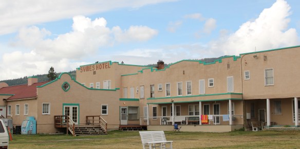
Listed in the National Register of Historic Places, Symes Hotel and hot springs takes you back to the era of the Great Depression. Fred Symes acquired the family property and opened the Mission-style hotel in 1930. It has changed somewhat over the decades, but not much. The narrow hallways of the baths, with their single tubs ready for a soak, are still in operation.


What the Symes did for Hot Springs was to make it a destination, and to give a vernacular Mission-style look to other buildings from that decade such as the old Mission style building below and other storefronts on the town’s main street.


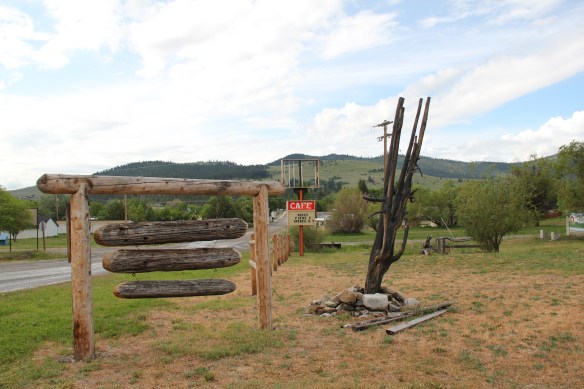
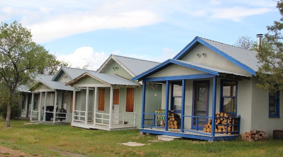
 Not everything fit into this mold, naturally. There remains a representative set of gable-front shotgun-form “cabins” that housed visitors staying for several days and various one-story buildings served both visitors and year-round residents.


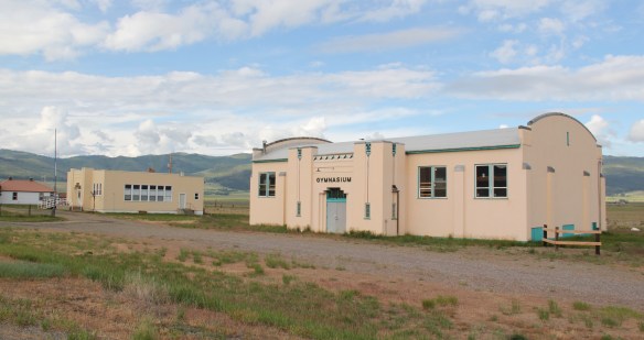
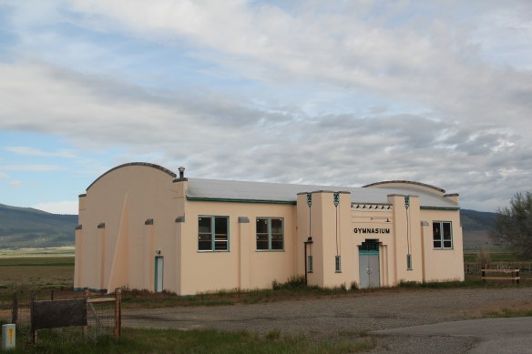
Then a few years after World War II the tribe decided to invest in the town through the creation of the modernist landmark known as the Camas Hot Springs, truly a bit of the International style on the high prairie of western Montana.

From a photo in the lobby of the Symes Hotel.
This venture initially was successful and led to a population boom in the 1950s and 1960s but then as the interstates were built and the 1970s recession impacted travel choices, the Camas struggled and closed c. 1980. For the last 30 years this grand modernist design has been slowly melting away.


 The loss would be significant because few mid-20th century buildings in Montana, especially rural Montana, are so expressive of the modernist ethos, with the flat roofs, the long, low wings and the prominent chimney as a design element. Then there are the round steel stilts on which the building rests.
 As this mural suggests, today Hot Springs embraces its deep past as a place of sacred meaning to the Confederated Salish and Kootenai. And it continues to try to find a way to attract visitors as a 21st century, non-traditional hot springs resort.
 Sanders County, like many of the places that are on the western side of the Rocky Mountains, has boomed in the last 25 years, from a population over 8,000 to the current estimated population of 11,300. It is close to Missoula, the eastern side is not far from Flathead Lake, Montana Highway 200 runs from Dixon to the end of the county at Heron. With wide valleys and narrow gorges created by both the Flathead and Clark’s Fork Rivers, which meet outside the town of Paradise, Sanders County is frankly a spectacular landscape, with dramatic mountain views framing open plains, such as the image above and the awesome gorge of Clark’s Fork River, below at Thompson Falls.
 The eastern side of the county is just as dramatic just in a far different way. For centuries First Peoples hunted game and dug the camas root in the broad upland prairie that became known as Camas Prairie, crossed now by Montana Highway 28.
 Then, leading from the county’s southeastern edge there is the beautiful Flathead River Valley, followed by Montana Highway 200, from Dixon to Paradise, and most importantly,
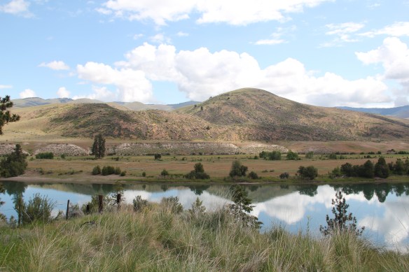 a transportation route initially carved as a trail by the First Peoples who became the nucleus of today’s Confederated Salish and Kootenai Tribe and much later engineered into a major corridor by the tracks of the Northern Pacific Railroad, as it stretched westward from Missoula to the west coast.
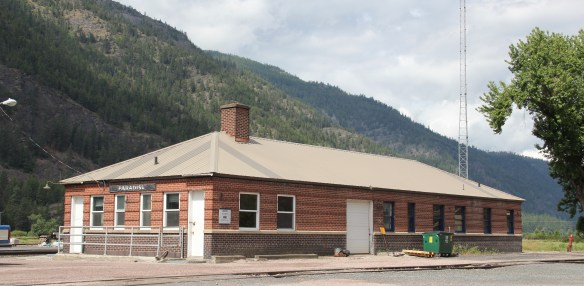
 In its wake, the Northern Pacific created most of the county’s townsites by locating sidings along the track. Substantial settlement arrived once the federal government opened lands for the homesteading boom in the early 20th century.
 Dixon, named for the former Montana governor Joseph Dixon, is one of the remaining railroad/homesteading towns along the Flathead River. The fate of the community bar, above, is symbolic of the recent history of the town, one of population decline.


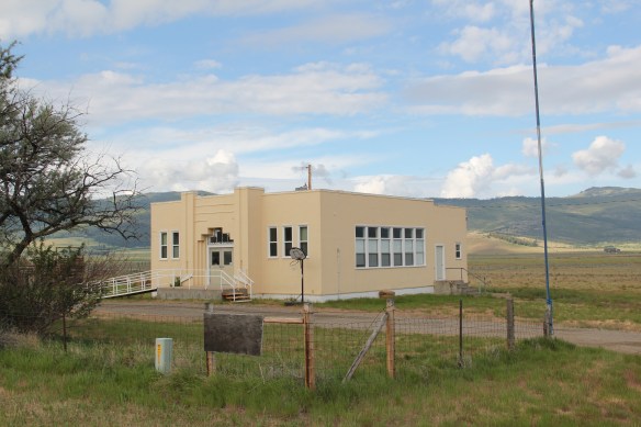 Local residents are being excellent stewards of this captivating property–certainly one of my favorite spots in the state combining landscape with architecture with history. The architect was the Missoula designer H. E. Kirkemo, and the school was completed in 1940, near the end of the New Deal school building programs.
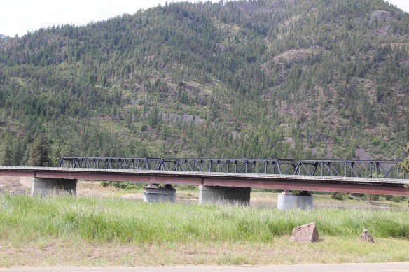


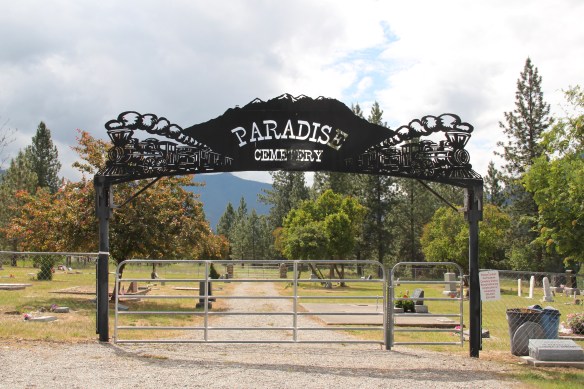
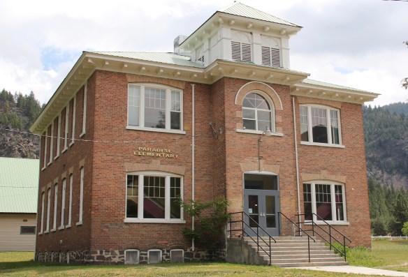 The school had just closed its doors for good when I lasted visited but the restoration planning has been underway ever since. I look forward to my next visit to Paradise to experience the final results. Near the school is another historic community property, the Paradise Cemetery, where tombstones mark the names of those who worked so long for the railroad and for the creation of this place within the Clark’s Fork River Valley.