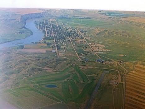
In the spring of 1984, there was no doubt that I would spend considerable time looking at the historic preservation issues at Fort Benton, a small county seat today but one of the most important places in all of the northern plains before the age of the railroad. Here at this bend in the river, shown in a postcard I bought there in 1984, was basically the last stop for Missouri River boat traffic heading west. The fort dated to the late fur trade era and as the rush for precious metals overtook Montana Territory in the 1860s and 1870s here developed a major trade and outfitting post, with roads running from Fort Benton in all directions. But the place was a sleepy, almost forgotten town, as the railroads changed routes and the interstates bypassed it by miles and miles. Landmarks too were there but the old fort had been slowly coming apart, only a recent determined effort by save what remained and then, ambitiously I thought 30 years ago, to rebuild the lost fort and tell fully the story of the fur trade and the significance of the Upper Missouri.


My guide was John Lepley, who was spearheading the local efforts and a member of the SHPO board. Another key leader was Joel Overholser. And no doubt, there was some heritage tourism and historic interpretation infrastructure in place. The Chouteau House, a classic river hotel, was still open, rough on the edges but the place where I stayed and took meals. (It was closed when I visited last in 2013).

Nearby was the home of I. G. Baker, a pivotal figure in the region’s history. It was open, and paneled interpretation in place but certainly a property that could “say” more.

Various monuments and markers could be found throughout the riverfront: the Mullan Road, the Whoop-Up Trail, and especially the recently installed (1976) State of Montana Lewis and Clark Memorial, a monument piece of public art, sculpted by Bob Scriver with the base by Shorty Shope, another well regarded Montana artist. The memorial was an American bicentennial project led by the Fort Benton Improvement Association, which Lepley and Overholser served on as commissioners. Indeed, the state also had donated one of the keelboats used in the film “Far Horizons,” a Hollywood take on the Lewis and Clark expedition. The waterfront told a story, one dominated by Lewis and Clark.

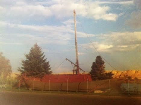
postcard of Far Horizons boat, c. 1984

The amount and quality of the public art along the riverfront was impressive, but what struck me as speaking most strongly to the town’s future were two completed projects (the Museum of the Upper Missouri and the Missouri River Bridge) and the almost completed restoration of the Grand Hotel, a remarkable Victorian building that spoke to the town’s hopes in the late 19th century.


I left Fort Benton convinced of two things: the town had clear preservation needs, not just the fort site but buildings from the Victorian era were decaying too. But compared to other places that I would visit in 1984, I thought Fort Benton had the one key trait for success–vision, the realization that the steps of the 1970s were just first steps, and many more needed to be taken in the years to come. Let’s next come back to Fort Benton 30 years later and see how far that vision has reached.
 Who
Who