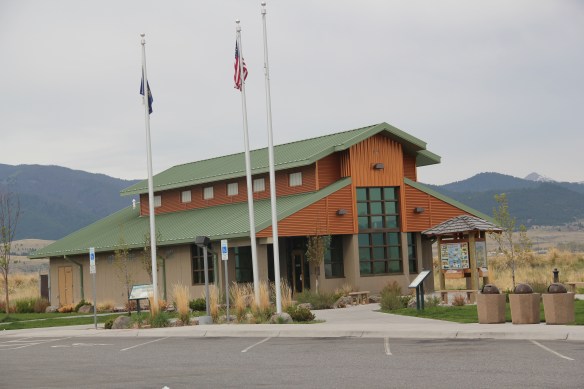
Montana Highway 1, designated the Pintler Scenic Route, has long been one of my favorite roads. It was the first Montana road to be paved in its entirety. During the state historic preservation plan work of 1984-1985, I documented the route as U.S. 10A, but once government officials decided to decommission the U.S. 10 designation in 1986, the name U.S. 10A also went away. t. In its early decades the route had passed through Opportunity to Anonconda onto Phillipsburg and then Drummond, but for all of my time in Montana, the highway has gone from Interstate I-90, Anaconda/Opportunity exit to the west and then north to the Drummond exit on the same interstate. There is a new 21st century rest stop center at the Anaconda I-90 exit that has a Montana Department of Transportation marker about the mountain ranges and the Pintler route.

 The town of Opportunity was not a priority for my travels in 1984-1985 but recent scholarship on how local residents have fought back against the decades of pollution from Anaconda’s Washoe Stack led me to give this small town of 500 a new look. The book is Brad Tyer’s Opportunity, Montana: Big Copper, Bad Water, and the Burial of an American Landscape (2014). Tyler details how the success of Anaconda also meant the sacrifice of thousands of surrounding acres to the pollution belching daily from the Washoe Stack until it closed in 1981. He then reviews in detail how in the 21st century, EPA heaped a new disaster on the town by moving Milltown wastes from the Clark’s Fork River near Missoula to Opportunity, telling locals that the Milltown soil would be new top soil for Opportunity. The environmental solution didn’t work, leaving the town in worse shape than before.
 Opportunity residents got a small fraction of SuperFund monies for the environmental cleanup in the form of Beaver Creek park. But the centerpiece of the park, the Opportunity School built for residents in 1914 by the Anaconda Company, has been mothballed for now. It operated from 1914 until the smelter ceased operations in 1981 and
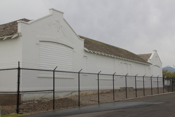 served as the community’s focal point. Restoration of the school is problematic due to the prior use of asbestos, meaning the federally funded park is only partially finished since the SuperFund support is now gone.


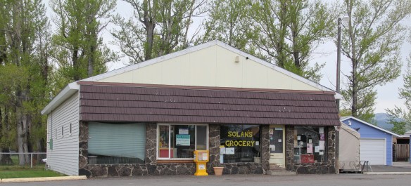
The park’s sharp landscaping, with well-manicured green space, walking/jogging track, playground and picnic shelter is in stark contrast to other places merely hanging on. The town’s Community Hall remains in use but the local store has shuttered its doors.

This blog has already looked at Stack and the town of Anaconda, so let’s continue north on the Pintler route to Georgetown Lake and surviving ghost towns.

 Sitting at 6,425 feet in elevation Georgetown Lake covers over 3700 acres. Today it is very much a recreational landscape but when it was created in 1885 its job was to generate electrical power for the nearby mines since it stood roughly equal distance between


Anaconda (14 miles away) and Phillipsburg (10 miles away). Taverns, motel, and rustic-style log buildings, both old and new, mark the lakeside today.
 As the state highway historical marker above documents, this high country area was another mining region. With an vantage point above the lake, Southern Cross is a significant remnant of the mining activities from the early 20th century. The mines here
 began operation in the mid-1860s and production continued for until World War II. The settlement was largely Finnish and Swedish in the early 20th century when most of the remaining buildings were constructed.


Existing foundations, rubble heaps, and other archaeological remnants help to document the historic community and its activities.These sites are not open to the public but they are fascinating to explore from the existing roads. One place that welcomes the public is St. Timothy’s Catholic Chapel, a wonderful example of Montana Modernism that I discussed in an earlier post.

With Southern Cross–over 7,000 feet in elevation, representing the end of the Deer Lodge County section of the Pintler Route, I will stop now, and in the next post begin the exploration into the Granite County portion of the highway.
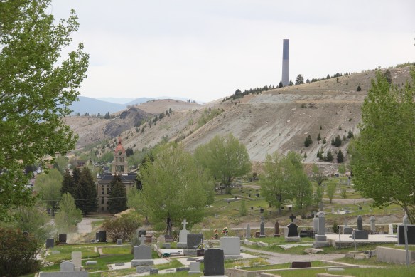
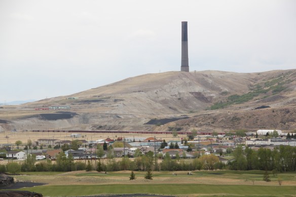
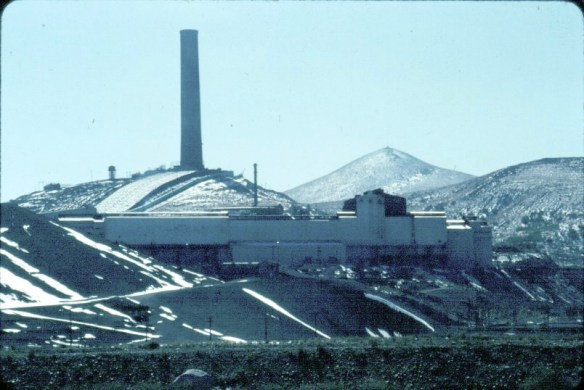 In my work across Montana in 1984-85 there was no more imposing structure than the smelter stack and works at Anaconda, in Deer Lodge County. The image above was one I used in the 20 plus listening sessions I had across the state in 1984, gathering perspectives and recommended properties for the state historic preservation plan. I used the stack because the smelter had just closed–and how this chapter in the state’s mining history could be preserved was on many minds.
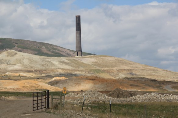 The Washoe Stack is one of the state’s most dominant man-made environments. For like the massive dams and reservoirs at Hungry Horse, Canyon Creek, and Fort Peck, there is the massiveness of the structure itself, and the thousands of surrounding acres impacted by the property. Unlike the lakes created by the dams of the first half of the 20th century, however, the stack left devastation in its wake, not recreation, not rebirth.
 The old gateway to the smelter introduces you to one lasting legacy of the stack–the tons of slag located along the highway leading in and out of Anaconda. The huge pile of
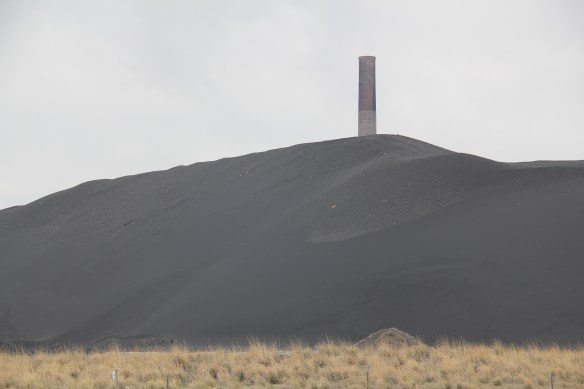 seems like some sort of black sand that has washed up on a beach rather the environmental spoils left by 100 years or production.
 In the 1980s, the Atlantic Richfield Corporation, a later owner of the Washoe works, announced the stack’s closing and possible demolition. A community-wide effort to save the stack was launched because, in the poetic words of local union activist Tom Dickson:


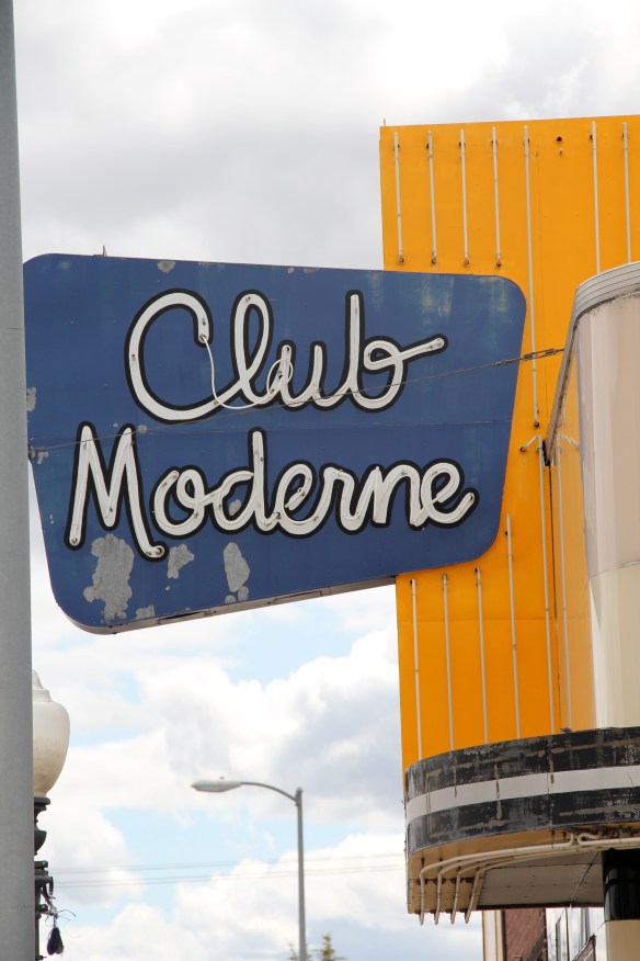
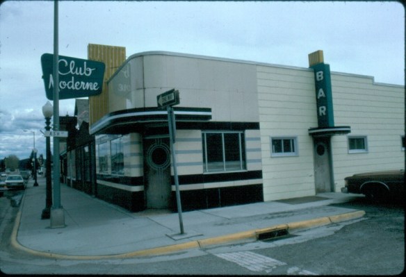
 That the place remained so intact in the early 1980s was impressive to me–that it remains that way 30 years later is a testament to local stewardship, and continued good times. The interior design of Art Deco details also remain to treat the eye and tempt